


 GPS & GNSS
 Lidar scanning
 Total Station

Office software
Office software






3D scanning and lidar software

3D scanning and lidar software


3D scanning and lidar software
Software
Office Software for Surveying and Engineering
Surveying office software is used after field data has been collected to process measurements, calculate coordinates, create drawings and prepare final project deliverables. It forms the connection between instruments such as RTK GNSS receivers, total stations and laser scanners and the CAD, GIS or engineering information required in the office.
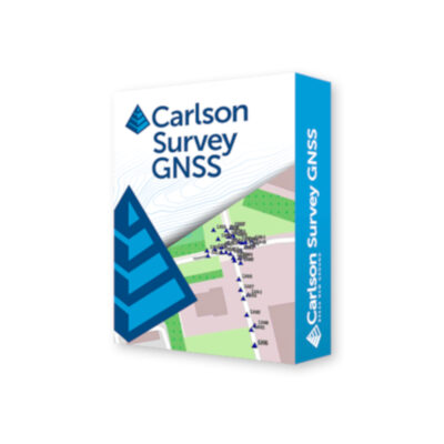
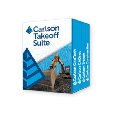
At Global GPS Systems you can find professional office software for surveying, construction, civil engineering, GIS and geospatial data processing. The range includes solutions such as Aplitop Tcp MDT, Aplitop Tcp Tunnel CAD, Carlson CADnet, Carlson Civil, Carlson Civil Suite, Carlson GIS, Carlson Hydrology, Carlson iCAD, Carlson Point Cloud, Carlson Survey, Carlson SurveyGNSS, Carlson Takeoff Suite, eOffice and other specialist packages. Because these programs serve different purposes, choosing the right software starts with understanding what you need to do with your field data.
What is surveying office software used for?
Field crews collect coordinates, observations, codes, point clouds and other measurements. Office software helps convert those measurements into useful information. A surveyor may use it to calculate and adjust survey data before producing a CAD drawing, while a construction company may use office software to prepare design information for stakeout or calculate quantities from surfaces.
Depending on the software, typical tasks include survey data processing, coordinate calculations, GNSS post-processing, CAD drafting, digital terrain modelling, contour generation, point cloud processing, GIS analysis, hydrology calculations, earthwork quantities and preparation of data for field crews.
Common office software functions
- Import and process measurements from GNSS receivers and total stations.
- Create and edit survey drawings in a CAD environment.
- Generate terrain models, contours, profiles and cross-sections.
- Process and analyse point clouds from 3D scanning equipment.
- Perform coordinate, civil engineering and survey calculations.
- Prepare data for construction stakeout and other field operations.
Survey data processing software
Survey data usually needs to be checked and processed before it becomes a final drawing or coordinate file. Office surveying software can help users organise measured points, review observations, work with coordinate systems and perform calculations required to turn raw field information into a finished survey.
This type of workflow is particularly useful when projects combine measurements from different instruments. GNSS coordinates, total station observations and other survey information can often be brought together in the office so that the complete project is managed within one coordinate framework.
CAD software for land surveying
CAD is an important part of many professional surveying workflows. Once points have been measured in the field, surveyors often need to convert them into linework, plans, contours, surfaces and other drawing elements. Specialist survey CAD software adds tools that are directly relevant to geospatial and engineering work rather than relying only on standard drawing functions.
Products such as Aplitop Tcp MDT, Carlson Survey and Carlson iCAD can support office workflows where measured survey data needs to become a practical CAD deliverable. Depending on the package, users may be able to work with points, surfaces, alignments, profiles, coordinate geometry and other survey information inside the drawing environment.
GNSS post-processing software
Not every GNSS project is completed using real-time RTK corrections. In some workflows, satellite observations are recorded in the field and processed later in the office. Post-processing software uses those observations together with reference data to calculate accurate positions after the survey has been completed.
This approach can be useful when mobile data coverage is unavailable, a real-time correction service cannot be used or the project requires observations to be reviewed and processed after collection. When choosing GNSS office software, check compatibility with the receiver data formats and the processing method used by your equipment.
Civil engineering and infrastructure software
Survey information often forms the basis of civil engineering work. Office packages such as Carlson Civil and Carlson Civil Suite provide tools for workflows involving surfaces, roads, site design, grading and other infrastructure projects. This allows measured terrain and design information to be used within the same broader project workflow.
For engineers and construction professionals, the practical value is the ability to move from existing ground measurements to a design and then prepare that design for field stakeout. This reduces unnecessary conversions between unrelated systems and helps keep field and office data consistent.
Terrain models, contours and earthworks
A set of measured points can be converted into a digital representation of the ground surface. Surveying office software can use these points to create terrain models, contours, profiles and cross-sections. These outputs are commonly required for construction sites, roads, drainage, landscaping, mining and other earthwork projects.
Surface models can also be used for volume calculations. By comparing existing and proposed surfaces, users can estimate cut and fill quantities or calculate stockpile volumes. Software such as Carlson Takeoff Suite is aimed at workflows where quantities and construction data need to be derived from digital plans and terrain information.
Point cloud office software
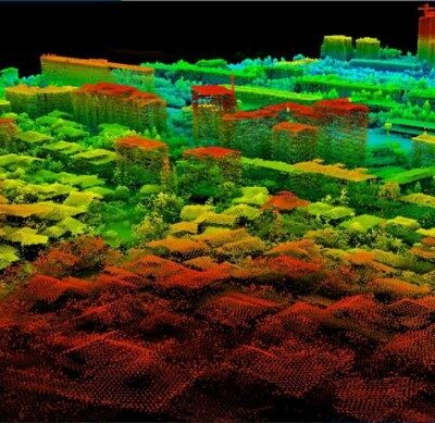
Laser scanners and LiDAR systems create dense three-dimensional point clouds. These datasets often need considerably more processing than conventional survey points. Point cloud software such as Carlson Point Cloud provides tools for viewing, processing and extracting useful information from 3D scan data.
Depending on the workflow, users may need to clean the point cloud, identify surfaces, calculate measurements or convert scanned information into CAD-ready data. For larger datasets, computer performance and file compatibility are important considerations when selecting office software.
GIS office software
GIS workflows combine coordinates with descriptive information about objects and assets. A measured point may represent a utility cover, tree, sign, pipeline or other feature, while its associated attributes describe what that object is. GIS software helps organise, analyse and present this type of spatial information.
Software such as Carlson GIS can be useful for surveyors and mapping professionals who need to combine field measurements with geographic databases and mapping information. When selecting GIS software, consider both the spatial data formats used by your organisation and how information needs to move between field collection and office processing.
Hydrology and drainage calculations
Surveyed terrain data is also used for drainage and hydrological analysis. Specialist applications such as Carlson Hydrology can support engineering workflows where terrain models and design information are used to evaluate water movement and drainage systems.
This type of software is typically more relevant to civil engineers and infrastructure professionals than to straightforward boundary or topographic surveying. It is therefore important to select software based on the actual calculations and project outputs required rather than choosing the package with the longest feature list.
Tunnel and specialist CAD software
Some surveying projects require specialised office tools. Tunnel work, for example, involves alignments, profiles and sections that differ from normal land surveying. Software such as Aplitop Tcp Tunnel CAD is designed to support these types of specialist engineering and tunnel workflows.
Dedicated software can make repeated specialist tasks more efficient because the relevant calculations and drawing tools are built around the application. For companies that regularly work on tunnels, roads or other infrastructure projects, this can be more practical than adapting general-purpose CAD software for every job.
Choosing the right surveying office software
Start with the type of data your field crews collect. If most work is performed with GNSS equipment, check whether you need simple coordinate processing or full GNSS post-processing. Total station users may place greater importance on survey calculations and CAD drafting, while laser scanning companies may require point cloud processing.
The required final deliverable is just as important. A land surveyor producing CAD plans has different requirements from a contractor calculating earthwork quantities or a GIS team maintaining an asset database. Choosing software around the final output usually results in a more practical workflow than selecting a product solely because it has a large number of functions.
Important factors to compare
- Compatibility with your GNSS, total station or scanner data.
- Supported survey, CAD, GIS and engineering file formats.
- Required coordinate and survey calculation tools.
- Terrain, contour, volume and civil engineering functions.
- GNSS post-processing or point cloud capabilities when required.
- Compatibility with your existing office and field workflow.
Moving data between field and office
An efficient surveying workflow should allow information to move in both directions. Measurements collected in the field need to be transferred into office software for processing, while design coordinates, alignments, surfaces and other information may need to be prepared in the office and sent back to field controllers for stakeout.
File compatibility can therefore have a major effect on day-to-day efficiency. Before choosing a package, consider the formats generated by your existing field software and the formats required by clients, CAD departments or GIS systems.
Office software for complete surveying workflows
Many survey companies use several technologies within the same project. RTK GNSS can be used for open-site measurements, total stations for precise work around structures and laser scanners for dense 3D capture. Suitable office software helps combine these different sources into usable project information.
At Global GPS Systems, buyers can compare office software for survey processing, CAD, civil engineering, GIS, GNSS post-processing and point cloud applications. Matching the software to your instruments, field applications and required deliverables helps create a practical workflow from initial measurement through to the finished project.
Office Software FAQ
Surveying Office Software Basics
What is surveying office software?
Surveying office software is used to process measurements collected with GNSS receivers, total stations, scanners and other surveying equipment. Depending on the package, it can be used for coordinate calculations, CAD drafting, terrain modelling, post-processing, GIS work and preparation of field data.
What is the difference between field software and office software?
Field software is mainly used while measuring or staking out on site, while office software is used to process, analyse and present the collected information. Data commonly moves between both systems during a surveying or construction project.
Do I need office software if my field controller already calculates coordinates?
For simple coordinate work, the controller may provide much of what you need in the field. Office software becomes important when measurements need further checking, CAD drafting, surface creation, post-processing, quantity calculations or preparation as professional project deliverables.
CAD and Survey Processing
Can surveying office software create CAD drawings?
Yes. Many specialist survey packages include CAD functions or work within a CAD environment. They can help turn measured points into linework, surfaces, contours, profiles and finished survey drawings.
Can I create contours and terrain models from surveyed points?
Yes. Suitable software can use measured elevations to create digital terrain models and generate contours, profiles and cross-sections. The accuracy of the result depends on the quality and coverage of the original survey data.
Can office software calculate earthwork volumes?
Many civil and surveying applications can calculate volumes from terrain or design surfaces. This can be used for cut and fill calculations, stockpiles, excavation quantities and other earthwork applications.
GNSS, Point Clouds and GIS
What is GNSS post-processing software?
GNSS post-processing software calculates accurate positions from satellite observations recorded in the field together with suitable reference data. It is useful when measurements are not corrected in real time or when observations need to be processed after the survey.
Can office software process LiDAR and 3D scan data?
Specialist point cloud applications can process data captured with terrestrial scanners, mobile mapping systems and other LiDAR equipment. Available tools may include point cloud viewing, cleaning, measurement, surface extraction and conversion to CAD-ready information.
Can surveying office software be used for GIS work?
Yes. GIS-oriented software can combine survey coordinates with attribute information and geographic datasets. This is useful for asset mapping, utilities, infrastructure management and other applications where objects need both a position and descriptive data.
Choosing Office Software
How do I choose the right surveying office software?
Start with the data you collect and the final result you need to produce. Check compatibility with your field equipment and file formats, then compare the required functions such as CAD, survey calculations, GNSS post-processing, point cloud processing, GIS, civil design or quantity calculations.
Which office software is suitable for land surveyors?
Land surveyors commonly need coordinate processing, CAD drafting, surface modelling and survey calculations. Packages such as Carlson Survey, Carlson iCAD and Aplitop Tcp MDT are examples of software aimed at these types of workflows, depending on the specific requirements and existing software environment.
Can one software package handle surveying, civil engineering and GIS?
Some software suites combine several disciplines. Carlson Civil Suite, for example, groups tools for civil engineering, surveying, hydrology and GIS. Whether an integrated suite or separate specialist applications are more practical depends on the type and variety of projects your organisation handles.
 GPS & GNSS
 Total Stations
 Data collectors
 Software
 Correction services
 Machine control
 External radio
 Marine
 Accessories