


Aplitop Tcp MDT
This product is Available
Contact our experts for the best possible price and configuration.
This application is ideal for all types of surveying projects, modelling the terrain, drawing profiles, calculating volumes and visualising the terrain in 3D. Its main users are government agencies, construction companies, engineering firms, architecture firms, urban planning studies and companies involved in earthworks, quarrying, mining, environment, etc. and freelance professionals.
MDT is an application that installs as a plugin to AutoCAD, BricsCAD or ZWCAD. It offers a powerful set of tools that are easy to learn and has a modular structure.
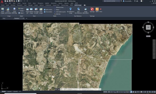
It shows great versatility by importing and exporting files in the most common formats, such as LandXML, DWG and many more. In addition, APLITOP is a pioneer in the integration of topographical and road data into OpenBIM workflows, via the IFC format and the IFC Alignment and IFC Road extensions.
You may also like…
Software
CAD software
3D scanning and lidar software
Data collection
Data collection
Valued customers:


Find RTK Networks
Search NTRIP providers and connect to reliable RTK correction services.
Description
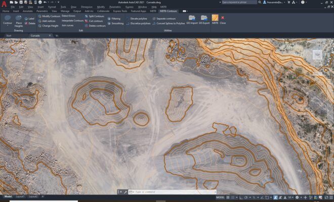
MDT is an application running on AutoCAD, BricsCAD, GstarCAD or ZWCAD, and has a wide range of easy-to-use tools. Its modular structure allows users to choose the most suitable options for their work.
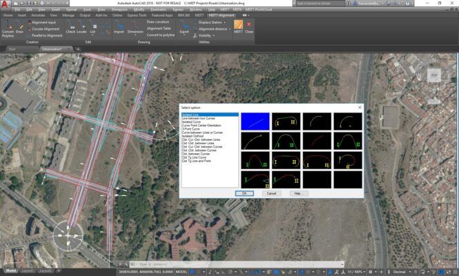
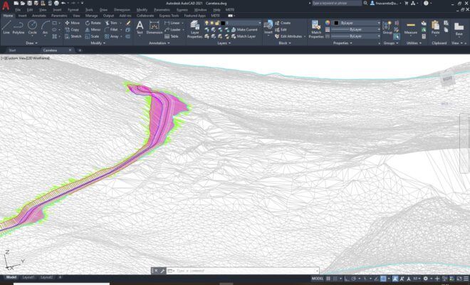
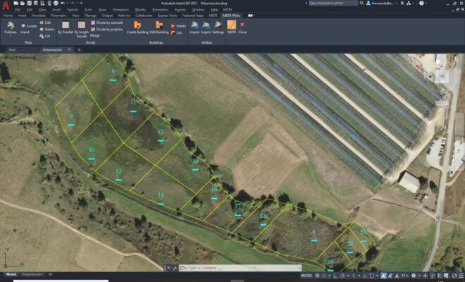
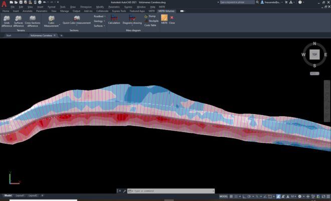
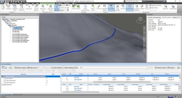
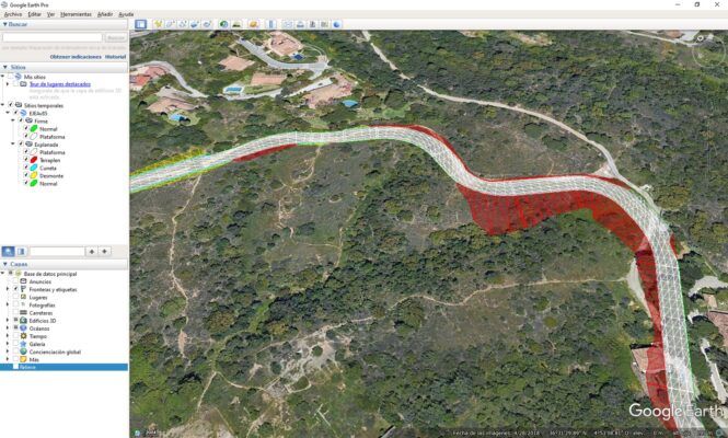
It includes all features of standard version and provides tools for designing horizontal and vertical alignments, drawing the project templates, area and volume reports, setting-out, virtual tour, measurements and quotations, water, sewerage and rainwater networks, etc. This software is suitable for all kind of surveying projects for roads, urbanizations, quarries… It is easily integrated into OpenBIM workflows, through exchange of IFC and LandXML files.
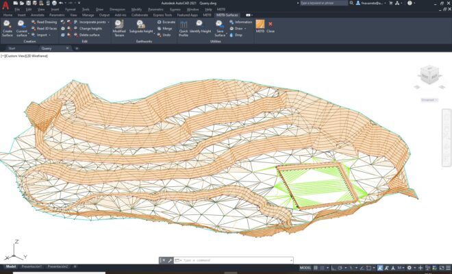
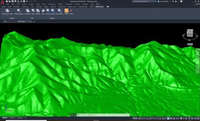
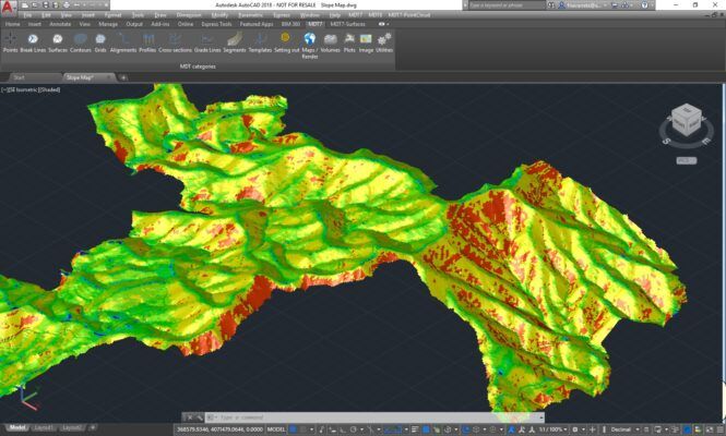
The standard version allows you to model a terrain using points measured by any total station or GPS, generate contours, derive longitudinal and transversal profiles, calculate volumes and visualise the terrain in 3D. It also has functions to work with plots and multiple additional utilities.
The Professional Version is designed to assist the user at all stages of developing a project in the context of Topography and Civil Engineering, including all the functionality of the Standard Version. Its main users are public administrations, construction companies, engineering, architecture and town planning studies and companies involved in earthworks, running quarries, mining, the environment etc. as well as free-lance professionals
MDT is an application that is installed as a plugin on AutoCAD, BricsCAD, GstarCAD or ZWCAD. It offers a powerful set of tools for easy learning and has a modular structure. It shows great versatility through the import and export of files in the most common formats, such as LandXML, DWG and many more. In addition, APLITOP is a pioneer in the integration of topographic and road data in OpenBIM workflows, through the IFC format and the extensions IFC Alignment and IFC Road.
How to work with TcpMDT for GstarCAD


Datasheets & Manuals
Datasheets and manuals
Additional information
| Brand | Aplitop |
|---|
Reviews (0)
Only logged in customers who have purchased this product may leave a review.
Reviews
There are no reviews yet