

 GPS & GNSS
 Lidar scanning
 Total Station

Carlson Civil Road Site and Land Development Design Software
Get the best price for your setup
Contact our experts for the best possible price and configuration.
- Fast response
- Expert configuration advice
- No overpaying for features you do not need
Carlson Civil is CAD-based civil engineering software for road design, site development, grading, subdivisions and earthwork. It gives civil engineers, designers, survey engineering firms and construction professionals practical tools for turning terrain and survey information into roads, building pads, finished surfaces, profiles, sections and construction-ready design data.
Road Network handles connected roads, intersections and cul-de-sacs, while LotNET supports subdivision and parcel layout. SiteNET and grading tools help build proposed surfaces, calculate earthwork and prepare designs that can continue into construction staking or machine-control workflows.
- Design roads, intersections, sites, subdivisions and finished grading surfaces.
- Create and compare terrain models with profiles, cross-sections and cut/fill calculations.
- Work with standard CAD and civil data including DWG, DXF, DGN and LandXML.
Carlson Civil Highlights
| Road design | Road Network for roads, intersections, cul-de-sacs, profiles, templates and 3D design surfaces |
|---|---|
| Site grading | SiteNET, Design Pad Template and tools for pads, parking areas, basins and complex grading |
| Subdivision design | LotNET for parcel layout, setbacks, rights-of-way and subdivision planning |
| Surface and earthwork | TIN surface modelling, contours, cut/fill volumes, balancing, profiles and cross-sections |
| CAD platform | Included IntelliCAD or supported AutoCAD installation |
You may also like…


Valued customers:










Find RTK Networks
Search NTRIP providers and connect to reliable RTK correction services.
Description
Carlson Civil for road site and land development design
Carlson Civil is professional CAD-based civil engineering software for designing roads, sites, subdivisions, grading and other land-development projects. It combines terrain modelling with road geometry, profiles, cross-sections, lot design, earthwork and site-grading tools so engineers can move from existing survey information to a complete proposed design within one CAD environment.
The software is designed for civil engineers, engineering technicians, survey engineering firms, land developers and construction professionals who need to create buildable site geometry rather than simply draft lines on a plan. Design information can remain connected through surfaces, alignments and grading workflows, making it easier to evaluate how a change to one part of the project affects the surrounding site.
Design complete road networks
Road design is one of the main applications of Carlson Civil. Road Network allows engineers to combine alignments, vertical profiles and road templates into connected street and highway designs that can include intersections, cul-de-sacs and other roadway geometry.
Instead of treating every road as an isolated corridor, roads can be processed as part of a wider network. This is particularly useful for subdivisions, residential developments, industrial sites and business parks where several roads and intersections need to work together.
The resulting design can be represented in plan, profile, cross-section and 3D form. Surface information created from the road design can then be used for quantities, grading coordination, construction data preparation and further civil engineering work.
Work with horizontal alignments profiles and templates
A road is defined by more than its position on a plan. Carlson Civil provides tools for creating and managing horizontal alignments, vertical profiles and road templates so that the complete three-dimensional geometry can be developed from the centreline outward.
Existing-ground profiles can be extracted from terrain models and compared with proposed vertical designs. Templates define the road cross-section, including the geometry needed to represent lanes, kerbs, shoulders, sidewalks, ditches and other design components.
These elements can then be processed together to build the final road surface and cross-sections. For engineering teams, this provides a direct connection between the design geometry and the drawings or models used later in the project.
Design intersections cul-de-sacs and complex road layouts
Carlson Civil is built for road networks rather than only simple single alignments. Intersections can be incorporated into Road Network and coordinated with the connected roads, helping designers manage transitions between different alignments and templates.
Cul-de-sacs, traffic circles and other roadway arrangements can also form part of the design. Current Carlson 2026 tools extend Road Network with functions for designing and grading median traffic islands and for generating coloured TIN surfaces from the resulting road design.
These capabilities are particularly relevant to residential subdivisions, commercial developments and larger infrastructure projects where the road geometry needs to respond to several connected site features.
Quick driveway grading from roads to building pads
Current Carlson Civil tools include a driveway routine that grades a connection from a road to an elevated building pad. This addresses a common land-development task where individual properties, buildings or parking areas need practical access to the surrounding road network.
Rather than designing every driveway as an unrelated grading exercise, the road and pad elevations can form the basis of the connection. This can speed up preliminary site design and helps designers see how access requirements interact with the surrounding grading.
Create and manage terrain surfaces
Surface modelling is central to Carlson Civil. Existing survey points and 3D drawing information can be used to create triangulated terrain models, while proposed roads, pads and grading can form new design surfaces.
Contours can be generated from the surface, and the model can be inspected or edited before it is used for design calculations. Breaklines allow important terrain features such as kerbs, ridges, ditches and slope changes to be represented more accurately than a surface built from random points alone.
For engineers working from GNSS, total station, drone or LiDAR-derived survey information, this makes the surface model the connection between measured existing conditions and the proposed design.
Analyse existing and proposed ground
Once existing and proposed surfaces are available, Carlson Civil can compare them to determine where material needs to be excavated or filled. Cut and fill information can be calculated for complete sites or selected design areas.
This is useful during both design and construction planning. An engineer can use the information to assess whether a grading concept is practical, while a contractor or estimator can use the resulting terrain data as part of an earthwork workflow.
Cut and fill visualisation also makes it easier to identify areas where the proposed design creates excessive excavation or fill. The grading can then be adjusted before the project progresses further.
Balance earthwork across a site
Earthwork balance can have a major effect on the cost and logistics of a development. Carlson Civil includes tools for calculating and adjusting cut and fill so designers can assess whether material excavated on one part of a site can be reused elsewhere.
Site-volume balancing and cut/fill centroid tools can help evaluate the relationship between excavation and fill areas. In practical terms, this can support grading decisions intended to reduce unnecessary material import, export or movement around the site.
The final construction strategy still depends on soil conditions and project requirements, but having quantities available during the design stage gives engineers a better basis for evaluating different grading options.
SiteNET for grading quantities and site modelling
SiteNET is Carlson Civil’s layer-based workflow for site modelling and quantity calculations. It can automate parts of surface generation, subgrade design, material takeoff and earthwork analysis using drawing information organised according to the project setup.
This makes SiteNET useful for projects such as car parks, residential developments, commercial sites and industrial areas where several types of proposed features contribute to the finished terrain model.
The same site model can also support construction data preparation. Carlson specifically positions SiteNET as a route from civil design and quantity work into GNSS-assisted machine-control workflows, allowing finished design surfaces to continue toward the construction stage rather than being recreated from scratch.
Grade building pads parking areas and drainage basins
The Design Pad Template tools provide another practical grading workflow within Carlson Civil. They can be used for features such as building pads, parking areas, drainage basins and other defined site features that need to tie into surrounding terrain at controlled slopes.
For a building project, an engineer can establish the required pad elevation and then calculate the slopes needed to connect it to the existing or proposed ground. Similar methods can be used around parking areas, ponds and other site features.
This is useful where simple contour editing would not provide enough control over slope geometry, tie-ins and earthwork quantities.
Design residential and commercial subdivisions with LotNET
LotNET is Carlson’s subdivision and parcel-layout workflow. It can generate lots using an outer boundary, rights-of-way or centre lines together with design rules defined for the project.
This allows planners and engineers to test different subdivision layouts without manually redrawing every parcel after a road or boundary changes. Building footprints and setback requirements can also form part of the planning process.
Current Carlson 2026 improvements add custom setbacks for situations such as unusual setback requirements and corner lots, along with additional control over parcel edges. This gives land-development professionals more flexibility when a development does not fit a simple repeated lot pattern.
Link road lot and site design
The value of Carlson Civil becomes clearer when Road Network, LotNET and SiteNET are used together. A subdivision layout can define parcels and road rights-of-way, the road network can provide design elevations, and the surrounding site grading can then respond to those roads and development areas.
If a road alignment or elevation changes, related parts of the design can be updated rather than every drawing element being reconstructed manually. Carlson’s Civil workflow is designed around this type of dynamic relationship while continuing to use standard CAD entities rather than proprietary custom drawing objects.
For projects that go through many design revisions, this can make it easier to explore alternatives while still producing ordinary CAD-based deliverables.
Create profiles and cross-sections
Profiles and cross-sections provide the vertical information needed to check roads, terrain and other linear design features. Carlson Civil includes tools for creating and managing profiles from terrain surfaces and proposed geometry as well as producing cross-sections along alignments.
Existing and proposed ground can be compared to understand how the design changes along a road or corridor. Cross-sections can also support earthwork quantities and show how the proposed template relates to surrounding ground.
These outputs are useful both during design and when preparing drawings for review, tendering or construction.
Prepare civil designs for field layout and machine control
Civil engineering designs eventually need to leave the office. Surfaces, alignments, points and other construction information created in Carlson Civil can form part of the data-preparation workflow for field staking and GNSS-assisted construction systems.
This is useful for contractors and surveyors who need to transfer road and site designs into field software or machine-control workflows. By starting with the actual civil design model, the construction team can avoid rebuilding the same proposed terrain from printed drawings.
As with any machine-control or stakeout project, the final data should be checked against the approved construction drawings, coordinate system and project control before use in the field.
Useful for road and highway projects
For road designers, Carlson Civil combines horizontal geometry, vertical profiles, templates, intersections, cross-sections, surfaces and quantities in one environment. It can be used for local streets, subdivision roads, access roads and larger roadway design tasks.
The ability to model both the proposed roadway and the surrounding terrain also helps users evaluate cut and fill, side slopes, intersections and other transitions rather than concentrating only on the centreline.
Useful for site and commercial development
Commercial and industrial sites often combine roads, parking areas, building pads, access routes and complex grading in a relatively small area. Carlson Civil provides several tools for handling these different features within the same design model.
SiteNET and Design Pad Template can help develop the finished terrain, while Road Network can handle access roads and connected roadway geometry. Surface comparison then provides earthwork information for the overall site.
This makes the software useful for office parks, industrial developments, retail sites, warehouses, residential developments and other projects where finished grading needs to coordinate with buildings and access infrastructure.
Support for DWG DXF DGN and LandXML
Carlson Civil works with common engineering and CAD data formats including DWG, DXF, DGN and LandXML. This is important on multidisciplinary projects where surveyors, engineers, architects and contractors may not all use the same design software.
LandXML is especially useful for transferring civil information such as surfaces, alignments and related design data between compatible applications. Standard CAD formats provide additional flexibility when only drawing geometry needs to be exchanged.
Keeping project information in established industry formats can also make it easier to hand design data to survey and construction teams after the engineering work is complete.
IntelliCAD or AutoCAD working environment
Carlson Civil can run using the CAD platform supplied with Carlson or with a supported AutoCAD installation. The current Carlson 2026 installer includes IntelliCAD 12.1 and 13.1 and supports AutoCAD, AutoCAD Map and Civil 3D versions from 2019 through 2026.
Companies that do not already maintain an AutoCAD installation can therefore use the included IntelliCAD environment. Engineering offices that already standardise on a supported AutoCAD product can instead use Carlson Civil within that existing CAD environment.
Available individually or as part of Carlson Civil Suite
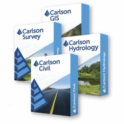
Carlson Civil can be purchased as an individual design module. It is also one of the four modules in Carlson Civil Suite together with Carlson Survey, Carlson Hydrology and Carlson GIS.
The suite is useful for organisations handling a wider project cycle. Carlson Survey provides survey-processing functions, Carlson Civil handles roads, sites and grading, Carlson Hydrology adds stormwater and drainage design, and Carlson GIS manages geospatial attributes and GIS exchange.
Because these modules operate within the same Carlson CAD environment, data can move between surveying, design, drainage and GIS work without every department rebuilding the project in a different software structure.
Who is Carlson Civil for?
Carlson Civil is primarily intended for civil engineers, civil engineering technicians, land-development consultants, road designers, survey engineering companies, construction data-preparation specialists and other professionals responsible for turning survey and terrain information into buildable infrastructure.
It is particularly suitable for companies working on roads, subdivisions, commercial developments, industrial sites, earthworks and other projects where surfaces, grading and quantities need to remain connected to the CAD design.
Carlson Civil from Global GPS Systems
Global GPS Systems can help determine whether Carlson Civil on its own provides the functionality required for your projects or whether Carlson Civil Suite is a better fit when survey processing, hydrology or GIS functions are also needed.
For businesses that collect existing-ground information with RTK GNSS, total stations, drones or LiDAR and then prepare design data for construction layout or machine control, Global GPS Systems can also help connect the field hardware and Carlson office software into a practical end-to-end workflow.
Datasheets & Manuals
Specifications
Carlson Civil 2026 Specifications
Software Overview
| Product name | Carlson Civil |
|---|---|
| Current release researched | Carlson Civil 2026 |
| Product type | Professional CAD-based civil engineering, road design, site design, grading, subdivision and land development software |
| Primary applications | Road and highway design, site development, grading, subdivision design, lot layout, surface modeling, earthwork calculations, profiles, cross sections and construction model preparation |
| Typical users | Civil engineers, land development professionals, road designers, surveyors, site designers, contractors and infrastructure consultants |
| Design environment | CAD-based 2D and 3D civil design environment |
| Dynamic design updates | Road, lot, site and surface workflows support dynamic design updating without relying on proprietary custom drawing objects |
| Standalone module | Yes |
| Civil Suite | Also available as part of Carlson Civil Suite with Carlson Survey, Hydrology and GIS |
| Application architecture | 64-bit |
Major Civil Design Systems
| Design System | Primary Function |
|---|---|
| RoadNET | Road, highway, intersection, cul-de-sac, roundabout, ramp and roadway network design |
| LotNET | Subdivision, parcel and lot layout using user-defined development rules |
| SiteNET | Site grading, surface modeling, subgrade/material definition, quantities and earthwork calculations |
| Design Pad Template | Building pads, basins, parking areas, embankments, ditches and other cut/fill grading designs |
CAD Platform Compatibility
| CAD Platform | Carlson Civil 2026 Support | License Requirement |
|---|---|---|
| IntelliCAD 13.1 | Supported | Included with applicable Carlson configuration |
| IntelliCAD 12.1 | Supported | Included with applicable Carlson configuration |
| AutoCAD 2019–2026 | Supported | Separate Autodesk license required |
| AutoCAD Map 2019–2026 | Supported | Separate Autodesk license required |
| Civil 3D 2019–2026 | Supported | Separate Autodesk license required |
| 32-bit Windows | Not supported by Carlson 2026 | 64-bit operating system required |
Drawing and Data Compatibility
| DWG | Native CAD workflow |
|---|---|
| DXF | Supported |
| DGN | Supported; IntelliCAD 13.1 includes enhanced DGN import capabilities |
| LandXML | Import and export supported |
| ASCII point files | Supported with user-definable point formats |
| Carlson CRD / CRDB | Supported for coordinate database workflows |
| Carlson TIN | Native triangulated surface workflow |
| Carlson GRD | Rectangular grid surface workflow supported |
| External references | XREF workflows supported through the CAD platform |
| Civil 3D drawing units | Carlson 2026 adds automatic unit detection from Civil 3D drawings |
| Civil 3D point conversion | Improved in Carlson 2026 |
Project and CAD Standards Management
| Project Setup | Flexible project data and settings storage |
|---|---|
| Project subfolders | Custom project data folders can be assigned by data type |
| Settings Explorer | Central interface for managing Carlson program settings |
| Settings Libraries | Supports reusable symbols, layers, road templates and other standards |
| Data Depot | Project document management and workgroup archiving functionality |
| Draw Standard Items | Creates common CAD entities with predefined properties |
| Drawing Cleanup | Tools for correcting common drawing-data problems |
| Join Nearest | Supported |
| Shrinkwrap | Supported for applicable drawing geometry |
| Remove Proxy Objects | Added in Carlson 2026 to assist with drawing compatibility and copy/paste issues |
Point Functions
| Point import | Supported |
|---|---|
| Point export | Supported |
| User-defined point formats | Supported |
| Draw Points | Points can be drawn with configurable symbols, layers and styles |
| Point label editing | Supported |
| Point symbol editing | Supported |
| Point rotation and sizing | Supported |
| Point Group Manager | Supported |
| Draw 3D polyline from point groups | Added / enhanced in Carlson 2026 |
| Non-surface point tagging | Supported through current point attribute and Point Group Manager workflows |
Surface Modeling
| TIN surface creation | Supported |
|---|---|
| Rectangular grid surface creation | Supported using Carlson GRD files |
| Surface from points | Supported |
| Surface from 3D entities | Supported |
| Breaklines | Supported |
| Surface boundaries | Supported |
| Surface Manager | Integrated surface display and editing interface |
| Add surface points | Supported |
| Remove surface points | Supported |
| Edit breaklines | Supported |
| Swap TIN edges | Supported |
| Merge TIN surfaces | Supported |
| Combine adjacent grids | Supported by Carlson 2026 Grid File Utilities |
| TIN transformation | Carlson 2026 includes TINUTIL for TIN transformation |
Contours and Surface Inspection
| Automatic triangulate and contour | Supported |
|---|---|
| Contours from surface files | Supported |
| Contours from 3D drawing entities | Supported |
| Contour interval | User configurable |
| Contour labeling | Supported |
| Adjust contours from coordinate points | Added in Carlson 2026 |
| Surface Inspector | Interactive surface elevation and design inspection tool |
| Station / offset in Surface Inspector | Display and labeling supported in Carlson 2026 |
Earthwork and Volume Calculations
| TIN-to-TIN volumes | Supported |
|---|---|
| Grid-based volumes | Supported |
| Layer-based volumes | Supported |
| Cut volume | Calculated |
| Fill volume | Calculated |
| Shrink factor | Supported |
| Swell factor | Supported |
| Site volume balancing | Supported |
| Cut / Fill Centroids | Supported for earthwork optimization |
| Deep cut / deep fill analysis | Supported by applicable surface-volume workflows |
| Mass Haul | Mass haul diagram and analysis supported for roadway projects |
| End-area volumes | Supported from cross-section data |
Design Pad Template and Grading
| Design Pad Template | Integrated grading tool |
|---|---|
| Building pads | Supported |
| Drainage basins | Supported |
| Parking lot grading | Supported |
| Road / ditch grading | Supported |
| Embankments / stockpiles | Supported |
| Cut slope | User definable |
| Fill slope | User definable |
| Slope format | Ratio, percent or design template |
| Slope direction | Inside or outside for applicable closed grading perimeters |
| Daylight calculation | Automatically creates cut/fill daylight intersections with the target surface |
| 3D daylight polylines | Supported |
| Multiple grading surfaces | Supported in applicable pad-design workflows |
| Retaining wall grading | Supported in applicable Design Pad Template workflows |
| Volume calculation from grading design | Supported |
SiteNET
| Primary purpose | Automated site surface creation, grading and earthwork quantity analysis |
|---|---|
| Existing surface layers | Supported |
| Proposed surface layers | Supported |
| Material layers | Supported |
| Subgrade layers | Supported |
| Inclusion areas | Supported |
| Exclusion areas | Supported |
| Areas of interest | Supported |
| Subgrade areas | Supported |
| Topsoil depth | Can be defined |
| Topsoil removal | Supported |
| Topsoil replacement | Supported |
| Material quantity calculations | Supported |
| Total volume calculation | Supported |
| Site volume balancing | Supported |
| 3D drive simulation | Supported for applicable site models |
| Custom material reports | Supported |
Centerline and Alignment Design
| Horizontal alignment creation | Supported |
|---|---|
| Horizontal alignment editing | Supported |
| Graphical alignment design | Supported |
| Parameter-based alignment design | Supported |
| Lines and curves | Supported |
| Spiral curves | Supported |
| Station labeling | Supported |
| Station / offset labeling | Supported |
| Station / offset reports | Supported |
| Centerline Editor | Integrated |
| Centerline Report | Added to the Centerline Editor in Carlson 2026 |
Profiles
| Existing-ground profile | Supported |
|---|---|
| Design profile | Supported |
| Profile from surface | Supported |
| Profile from drawing entities | Supported |
| Profile from alignment points | Supported |
| Graphical profile editing | Supported |
| Spreadsheet profile editing | Supported |
| Vertical curves | Supported |
| Quick Profile | Interactive profile creation and review supported |
| Draw Profile | Produces profile grids and engineering plan/profile output |
| Profile to 3D Polyline | Supported |
| Vertical curve density | Configurable when converting profiles to 3D polylines in Carlson 2026 |
| Profile Capture | Supported for extracting profile information from drawings |
| Civil 3D Profile View grid extraction | Supported in Carlson 2026 Profile Capture |
| Minor station labels | Supported in Carlson 2026 Draw Profile |
| Save profile data from drawing | Added in Carlson 2026 |
Cross Sections
| Cross sections from surfaces | Supported |
|---|---|
| Cross sections from drawing entities | Supported |
| Cross sections along alignment | Supported |
| Cross-section editing | Spreadsheet and graphical editing supported |
| Quick Sections | Supported |
| Draw Sections | Creates section grids and sheet output |
| Sections to 3D polylines | Supported |
| End-area volumes | Supported |
| Mass haul analysis | Supported |
| Large section file performance | Improved in Carlson 2026 |
| Section labeling | Expanded in Carlson 2026 |
| Save section data from drawing | Added in Carlson 2026 |
RoadNET Road Design
| Road network design | Supported |
|---|---|
| Single road design | Supported |
| Multiple road design | Supported |
| Intersecting roadways | Supported |
| T-intersections | Supported |
| Cross intersections | Supported |
| Cul-de-sacs | Supported |
| Roundabouts / traffic circles | Supported |
| Knuckles | Supported |
| Traffic islands | Supported in applicable roadway template and intersection workflows |
| Roadway ramps | Supported in current-generation RoadNET |
| Bridge-related roadway design | Supported in current-generation RoadNET workflows |
| Sidewalk design | Supported in current-generation RoadNET workflows |
| Horizontal alignment changes | Road design can be reprocessed after alignment edits |
| Vertical alignment changes | Road design can be reprocessed after profile edits |
| Dynamic road model updates | Profiles, sections, surfaces and volumes can be regenerated after design changes |
Road Templates and Subgrades
| Template Editor | Integrated |
|---|---|
| Road templates | User definable |
| Template grade points | Supported |
| Curbs | Supported |
| Ditches | Supported |
| Shoulders | Supported |
| Subgrades | Supported |
| Template transitions | Supported |
| Superelevation | Supported |
| Template Grade Tables | Supported for varying roadway widths and cross slopes |
| Template Series Editor | Supported |
| Edit template from Template Series Editor | Added / enhanced in Carlson 2026 |
| Smooth template transitions | Option added in Carlson 2026 |
| Island-to-standard template transitions | Improved in Carlson 2026 |
RoadNET Output
| Road surface model | Generated |
|---|---|
| Road contours | Supported |
| Cross sections | Generated |
| Profiles | Generated |
| Road quantities | Supported |
| Cut / fill volumes | Supported |
| Right-of-way linework | Supported |
| Draw ROW Polylines control | Added to Road Network settings in Carlson 2026 |
| Road intersection indicator | Added in Carlson 2026 |
| Road Network file management | Improved in Carlson 2026 |
| Road output processing | Improved in Carlson 2026 |
Stream and Reclamation Road Tools
| Stream bank profile creation | Carlson 2026 adds the BANKPRO command |
|---|---|
| BANKPRO application | Creates stream-bank profiles for stream reclamation workflows |
| 3D profile conversion | Profile information can be converted into 3D polyline geometry |
| Surface-based 3D offsets | Offset 3D Polyline includes surface offset options in Carlson 2026 |
LotNET Subdivision Design
| Subdivision layout | Supported |
|---|---|
| Automatic lot generation | Supported |
| Target lot area | User definable |
| Minimum frontage | User definable |
| Lot depth | User definable |
| Outer subdivision boundary | Supported |
| Internal ROW / centerlines | Supported |
| Lot Types | Supported |
| Blocks | Supported in current-generation LotNET |
| Building pads in lots | Supported |
| Lot editing | Lot boundaries can be interactively adjusted after generation |
| Automatic lot labels | Supported |
| Area updates after edits | Supported |
| Bearing / distance table updates | Automatically updated in applicable LotNET workflows |
| Lot reports | Supported |
LotNET 2026 Enhancements
| Custom Setbacks | Added for atypical setback requirements and corner lots |
|---|---|
| Clear Custom Setbacks | Custom setbacks can be cleared from selected polylines |
| Isolated parcels | Can create parcels with no road frontage |
| Lot Closure Tolerance | User configurable |
| Load Lot Types | Lot types can be loaded from an existing LTN file |
| Remove ROW lines from processing | Supported |
| Clear selected Lot Network entities | Supported |
| Highlight current ROW | Supported |
| Highlight lot edges | Supported |
3D Data Tools
| 3D polylines | Create and edit |
|---|---|
| Assign polyline elevations | Supported |
| 3D entity from surface model | Supported |
| 3D polyline offset | Supported |
| Offset to surface | Added / enhanced in Carlson 2026 |
| Merge crossing 3D polylines | Supported |
| Snap contours to 3D polylines | Supported |
| 3D polyline by slope on surface | Supported |
| Minimum / maximum slope analysis | Supported for 3D polylines |
| Follow TIN edges | Supported |
| Extend to elevation | Supported |
| Break 3D polyline by surface | Supported |
Road and Site Visualization
| 3D surface viewing | Supported |
|---|---|
| 3D road models | Supported |
| 3D site models | Supported |
| 3D Drive Simulation | Supported |
| Surface visualization | Supported for existing and proposed models |
| Cut / fill visualization | Supported through applicable surface and SiteNET workflows |
| Material / subgrade visualization | Supported |
Construction and Machine Control Preparation
| Construction surface models | Supported |
|---|---|
| 3D grading models | Supported |
| Road surface models | Supported |
| Machine-control data preparation | Applicable Carlson Civil and SiteNET models can be prepared for GPS-assisted machine-control workflows |
| Carlson Grade integration | Supported through compatible Carlson surface/model workflows |
| Construction staking preparation | Design points, alignments, profiles, surfaces and road models can be prepared for compatible Carlson field software |
Civil 3D Interoperability
| Civil 3D point conversion | Supported and improved in Carlson 2026 |
|---|---|
| Civil 3D drawing unit detection | Supported in Carlson 2026 |
| Civil 3D Profile View | Profile Capture can extract applicable grid settings in Carlson 2026 |
| Civil 3D surfaces | Applicable conversion and interoperability tools are available |
| Civil 3D alignments | Applicable conversion workflows supported |
| Civil 3D custom objects | Applicable Carlson conversion tools can convert supported custom objects to standard CAD / Carlson data |
Plan, Profile and Section Production
| Plan sheets | Supported |
|---|---|
| Profile sheets | Supported |
| Cross-section sheets | Supported |
| Profile grids | Supported |
| Section grids | Supported |
| Automatic profile updates | Supported in applicable design workflows |
| Automatic section updates | Supported in applicable road-design workflows |
| Profile labels | Configurable |
| Section labels | Configurable |
| Report Formatter | Integrated Carlson report formatting tools |
| Report Formatter Title Editor | Available directly from the main dialog in Carlson 2026 |
Vehicle and Road Analysis
| Vehicle Path Tracking | Supported |
|---|---|
| Roadway geometry review | Supported using horizontal, vertical and section design tools |
| Sight-distance-oriented profile design | Supported through applicable road/profile workflows |
| Road quantity analysis | Supported |
| Mass haul | Supported for earthwork planning along roadway projects |
Carlson 2026 Civil Enhancements
| LotNET Custom Setbacks | Added |
|---|---|
| Isolated parcels without frontage | Added |
| Lot Closure Tolerance | Added |
| Lot Type loading from LTN | Added |
| ROW / lot-edge highlighting | Added |
| Road Network file management | Improved |
| Road Network intersection indicator | Added |
| Road Network ROW drawing control | Added |
| Road template editing | Improved within Template Series Editor |
| Smooth template transitions | Added |
| Road template island transitions | Improved |
| Building-pad elevation rounding | Added to applicable Road Network workflows |
| Stream bank profile command | BANKPRO added |
| Profile Capture | Expanded with additional grid, labeling, Twist Screen and Civil 3D support |
| Minor profile station labels | Added |
| Save profile data from drawings | Added |
| Draw Sections interface | Updated |
| Large section file performance | Improved |
| Save section data from drawings | Added |
| Offset 3D Polyline to surface | Added / enhanced |
| Vertical curve density | Added to Profile to 3D Polyline |
| Station / offset Surface Inspector labels | Added |
| Adjacent grid combination | Added |
| Contour adjustment by coordinate points | Added |
| TIN transformation | TINUTIL command added |
Current Carlson 2026 Installation
| Current installer researched | Carlson 2026 64-bit CAD products installer |
|---|---|
| Installer date researched | July 30, 2026 |
| Full installer size | Approximately 3.01 GB |
| Civil module included in installer | Yes |
| Runtime module access | Controlled by the purchased Carlson license |
| Included CAD engines | IntelliCAD 12.1 and IntelliCAD 13.1 |
| AutoCAD compatibility | AutoCAD / Map / Civil 3D 2019–2026 |
| 32-bit operating systems | Not supported |
| Windows 8 and older | Not supported by the current Carlson 2026 installer; Windows 8.1 remains supported with IntelliCAD 13.1 |
System Requirements – Carlson 2026 with IntelliCAD 13.1
| Component | Minimum / Supported | Recommended |
|---|---|---|
| Operating system | 64-bit Windows 8.1, Windows 10 or Windows 11 | Current supported 64-bit Windows 10 or Windows 11 environment |
| Processor | Intel Core i5, AMD equivalent or better | Intel Core i7 / i9, AMD Ryzen 7 / 9 or comparable processor with strong single-thread performance |
| RAM | 8 GB | 16 GB or more |
| Large raster / aerial imagery projects | Additional RAM beneficial | 32 GB can be beneficial for large image-heavy projects |
| Graphics API | OpenGL 1.4 or higher compatible graphics hardware | Desktop-class discrete graphics card |
| Graphics hardware | Compatible integrated or discrete GPU | Discrete NVIDIA GPU preferred by Carlson for consistent driver support; compatible discrete AMD graphics also supported |
| Carlson application disk allowance | Approximately 750 MB additional space above the requirements of the selected CAD platform | SSD with additional free capacity for drawings, surfaces and project files |
| Input device | Keyboard and mouse or compatible pointing device | Standard CAD mouse / pointing device |
AutoCAD-Based Installation Requirements
| Autodesk CAD license | Required separately when Carlson Civil is installed on AutoCAD, AutoCAD Map or Civil 3D instead of using included IntelliCAD |
|---|---|
| Supported Carlson 2026 Autodesk versions | 2019–2026 |
| System requirements | The workstation must meet the system requirements of the installed Autodesk CAD version in addition to Carlson requirements |
| Additional Carlson disk allowance | Approximately 750 MB above the requirements of the Autodesk CAD platform |
| Architecture | 64-bit |
Civil Suite Integration
| Module | Integration with Carlson Civil |
|---|---|
| Carlson Survey | Survey points, surfaces, alignments, coordinate data, subdivision and field-to-office workflows |
| Carlson Hydrology | Road, lot and site surfaces can feed directly into runoff, drainage and storm sewer design |
| Carlson GIS | GIS, aerial imagery, mapping and spatial data can be incorporated into civil design projects |
| Carlson Civil | Road, subdivision, site, grading, surface, profile and cross-section design |
Typical Engineering Workflows
| Workflow | Support | Primary Function |
|---|---|---|
| Road design | Yes | Horizontal and vertical alignment, templates, intersections, surfaces, sections and quantities |
| Subdivision design | Yes | Automatic lot generation, editing, setbacks and parcel reporting |
| Commercial site design | Yes | Building pads, parking areas, grading, surfaces and earthwork |
| Residential development | Yes | LotNET, RoadNET and SiteNET combined subdivision workflow |
| Surface modeling | Yes | Create and edit existing and proposed terrain models |
| Earthwork estimating | Yes | Cut/fill, subgrade, material, centroid and site-balance calculations |
| Grading design | Yes | Create pads, slopes, daylight lines and design surfaces |
| Road plan/profile production | Yes | Create engineering plan, profile and cross-section deliverables |
| Machine-control model preparation | Yes | Create compatible 3D grading and roadway surfaces |
| Hydrology integration | Yes | Pass road and site design surfaces into Carlson Hydrology workflows |
Version and Configuration Notes
| Current specification basis | Carlson Civil 2026 platform specifications combined with current Carlson Civil functionality and official Civil documentation |
|---|---|
| Feature availability | Available commands can vary by Carlson release, CAD engine and purchased module configuration |
| IntelliCAD configuration | Does not require a separate AutoCAD license |
| AutoCAD configuration | Requires a separately licensed compatible Autodesk CAD product |
| Civil Suite configuration | Adds Carlson Survey, Hydrology and GIS to the Civil design module |
Specifications and package contents may vary by configuration, region or manufacturer update. Always check the current configuration before ordering.
Reviews (0)
Only logged in customers who have purchased this product may leave a review.
FAQ
Carlson Civil FAQ
Carlson Civil & Civil Engineering Applications
What is Carlson Civil?
Carlson Civil is professional CAD-based civil engineering design software for road and highway design, site development, subdivision design, grading, terrain modelling and earthwork calculations. It combines civil design tools with a DWG-based CAD environment and is designed to take projects from existing terrain through proposed design and construction data preparation.
Who is Carlson Civil designed for?
Carlson Civil is designed for civil engineers, land development consultants, surveyors, road and infrastructure designers, site-development professionals, municipalities, contractors and other users who need to create and manage civil engineering designs in a CAD environment.
What types of projects can Carlson Civil be used for?
Typical applications include residential subdivisions, commercial developments, industrial sites, roads and highways, intersections, parking areas, building pads, site grading, earthworks and other land-development and infrastructure projects.
Is Carlson Civil included in Carlson Civil Suite?
Yes. Carlson Civil is one of the four main applications included in Carlson Civil Suite, together with Carlson Survey, Carlson Hydrology and Carlson GIS. Carlson Civil can also be licensed as an individual module when the complete suite is not required.
Does Carlson Civil require AutoCAD?
No. Carlson Civil can run with the IntelliCAD platform included with Carlson software, so a separate AutoCAD licence is not required. It can also be installed on a compatible separately licensed version of full AutoCAD when an AutoCAD-based workflow is preferred.
What is the difference between Carlson Civil and Carlson Survey?
Carlson Civil focuses on engineering design, including roads, subdivisions, grading, site design and proposed surfaces. Carlson Survey focuses on processing survey measurements, COGO, Field-to-Finish, traverse adjustment and survey drafting. The programs are designed to work together when survey data is used as the starting point for a civil engineering design.
Road, Subdivision & Site Design
What is RoadNET in Carlson Civil?
RoadNET is Carlson Civil's road-network design system. It can be used to design individual roads or connected road networks containing intersections, cul-de-sacs, traffic circles and other roadway features. Horizontal alignments, vertical profiles and road templates work together to create the proposed roadway model.
Can Carlson Civil design road intersections and cul-de-sacs?
Yes. RoadNET is designed to process connected roads and automatically develop features such as intersections and cul-de-sacs. It can also be used for more involved road geometry including roundabouts, knuckles, widening, traffic islands and other roadway configurations.
Can Carlson Civil create road profiles and cross-sections?
Yes. Carlson Civil includes tools for horizontal alignments, vertical profiles, road templates and cross-sections. Changes to road design information can be processed through the model so profiles, sections, surfaces and quantities can be updated as the design develops.
Does Carlson Civil support road superelevation and subgrades?
Yes. Road design tools support superelevation and detailed road templates containing pavement, shoulders, subgrade layers and daylight conditions. Template controls can be used to change widths, slopes and other roadway geometry along an alignment.
What is LotNET in Carlson Civil?
LotNET is a subdivision and parcel-layout tool that helps automate the creation of lots from user-defined design requirements. Parameters can include target lot area, minimum frontage and depth, helping designers quickly develop and modify residential, commercial or other parcel layouts.
Can Carlson Civil apply setbacks when designing lots?
Yes. LotNET includes tools for managing lot-design requirements and setbacks. Current Carlson Civil versions also support custom setback conditions, giving designers additional control for irregular lots, corner lots and projects where standard setback rules do not apply uniformly.
Can Carlson Civil design building pads, parking areas and other graded sites?
Yes. Carlson Civil includes site-grading tools and Design Pad Template functions for projects such as building pads, parking areas, drainage basins and other graded features. Proposed elevations, slopes and daylight conditions can be used to build a complete design surface.
Surfaces, Grading & Earthwork Quantities
Can Carlson Civil create terrain surfaces?
Yes. Carlson Civil can create triangulated TIN surfaces and grid-based terrain models from survey points, contours, breaklines and other 3D information. Existing and proposed surfaces can then be used throughout the road, grading and site-design workflow.
Can Carlson Civil generate contour lines?
Yes. Terrain models can be used to generate contours for existing or proposed surfaces. Surface editing tools allow points, breaklines and triangle edges to be adjusted so the terrain model accurately represents the intended design.
What is SiteNET in Carlson Civil?
SiteNET is Carlson's site-modelling and quantity workflow for creating proposed surfaces from design information. It can organise surface, material and subgrade information by drawing layer, calculate earthwork and material quantities and help prepare 3D project data for construction and machine-control workflows.
Can Carlson Civil calculate cut and fill volumes?
Yes. Existing and proposed surfaces can be compared to calculate cut and fill quantities. Volume calculations can be used during grading design, project evaluation and construction planning to determine how much material must be excavated, filled or redistributed.
Can Carlson Civil calculate material and subgrade quantities?
Yes. SiteNET can define different materials and subgrade conditions so quantities can be calculated for more than just total cut and fill. This can be useful for pavement sections, topsoil, replacement material, building areas and other construction layers.
Can Carlson Civil show a proposed site in 3D?
Yes. Carlson Civil provides 3D surface and design visualisation tools that help users inspect roads, grading, pads and terrain before finalising the project. Three-dimensional review can make incorrect elevations, slopes, intersections and surface transitions easier to identify.
CAD Compatibility, Data Exchange & Field Workflow
Can Carlson Civil open and edit DWG drawings?
Yes. Carlson Civil operates in a DWG-based CAD environment using either the included IntelliCAD platform or a supported AutoCAD installation. This allows engineering drawings to be created and edited using familiar CAD entities without requiring proprietary civil objects for the core Carlson design workflow.
Does Carlson Civil support LandXML?
Yes. Carlson Civil supports LandXML for exchanging engineering information with other compatible civil design and surveying applications. Depending on the source data, LandXML can be used to transfer information such as surfaces, alignments, profiles and other project geometry.
Can Carlson Civil work with designs created in Civil 3D?
Yes. Carlson Civil can work with standard DWG geometry and supports data-exchange workflows for Civil 3D projects. Carlson also provides conversion tools for certain Civil 3D objects and supports LandXML as a common method for transferring civil design information between software platforms.
Can Carlson Civil designs be transferred to field surveying software?
Yes. Design information such as points, alignments, surfaces and CAD drawings can be prepared for use with Carlson field software including SurvPC. This creates a design-to-field workflow in which information developed in Carlson Civil can be used for construction stakeout and field verification.
Can Carlson Civil prepare models for machine control?
Yes. Carlson Civil can create 3D surfaces and design linework suitable for construction data preparation. SiteNET is specifically designed to help move surface and grading information into GPS-assisted machine-control workflows, including Carlson machine-control products and compatible construction systems.
Does Carlson Civil update designs when geometry changes?
Yes. Carlson Civil provides dynamic design workflows without requiring proprietary custom CAD objects. For example, changes to road alignments, profiles or other design information can be reprocessed so related surfaces, cross-sections and quantities reflect the revised design.
What computer and CAD versions are supported by Carlson Civil?
Current Carlson Civil releases are designed for 64-bit Windows computers. Carlson 2026 can be installed with the included IntelliCAD 12.1 or 13.1 platform and supports AutoCAD, AutoCAD Map and Civil 3D versions from 2019 through 2026. A modern 64-bit processor, adequate RAM, SSD storage and suitable graphics hardware are recommended for larger terrain and road-design projects.


 GPS & GNSS
 Total Stations
 Data collectors
 Software
 Correction services
 Machine control
 External radio
 Marine
 Accessories
Reviews
There are no reviews yet