


 GPS & GNSS
 Lidar scanning
 Total Station
Marine
Marine
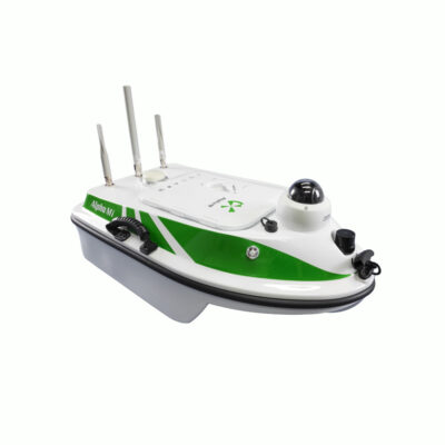
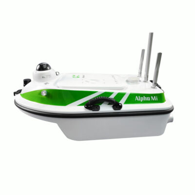
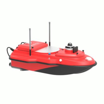
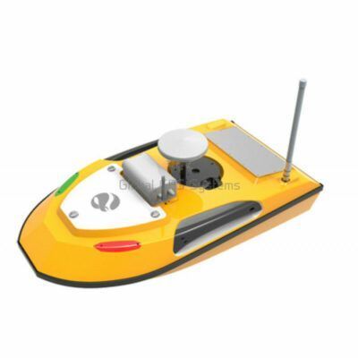
USV Survey Boats for Hydrographic and Bathymetric Surveying
A USV, or Unmanned Surface Vehicle, is a survey vessel that operates without a crew onboard. The vessel can be remotely controlled or follow planned survey routes while carrying instruments such as GNSS receivers and echo sounders. This allows survey teams to collect position and water-depth information from the shore while the USV travels across the survey area.
USV survey boats are particularly useful for bathymetric surveying, hydrographic mapping, dredging surveys, reservoir measurements, river surveys, canal surveys and construction projects. They provide a practical alternative to putting a conventional survey boat on the water, especially on smaller, shallow or difficult-to-access sites.
How Does a USV Survey Work?
During a typical USV survey, the vessel travels along predefined lines across the water. An onboard GNSS system determines the position of the boat while an echo sounder or another hydrographic sensor measures conditions underneath the vessel. Position and depth information can then be combined to create a geographically referenced representation of the underwater surface.
Depending on the equipment configuration, survey missions can be controlled manually from shore or performed using an autopilot and planned routes. Automated survey lines are useful for maintaining consistent spacing between measurements and for covering larger areas systematically.
RTK GNSS Positioning on a USV
Positioning is a fundamental part of professional bathymetric surveying. A depth measurement has limited mapping value unless the surveyor also knows exactly where it was collected. For this reason, professional USVs are often combined with RTK GNSS.
Under suitable conditions and with an appropriate correction source, RTK GNSS can provide centimetre-level positioning. This helps surveyors accurately locate depth observations, navigate along planned survey lines and repeat a survey later when monitoring changes such as dredging progress, sediment movement or reservoir conditions.
When comparing USVs, buyers should consider how GNSS corrections are received, which coordinate systems are supported and how positioning information is combined with the hydrographic sensor data.
USV with Echo Sounder
An echo sounder USV combines positioning and depth measurement in one mobile surveying platform. The echo sounder transmits an acoustic signal toward the underwater surface and measures the returning signal to determine depth. As the vessel moves, a sequence of positioned depth measurements can be collected across the survey area.
Different projects can require different hydrographic payloads. Some surveys only require straightforward single-beam depth measurement, while more specialised work may use other sensors or instruments. Certain USV platforms are therefore designed with payload areas that make it possible to configure the vessel for different measurement requirements.
Common Applications for Unmanned Survey Vessels
USVs can support surveying and engineering teams across many inland and marine environments. They are especially practical on sites where launching a conventional manned vessel would require considerable additional equipment or where water conditions make shore-based operation preferable.
- Bathymetric surveys: Mapping the shape and depth of riverbeds, lakebeds, reservoirs and other underwater surfaces.
- Dredging projects: Measuring conditions before, during and after dredging work to monitor changes in depth.
- Reservoir surveys: Collecting depth information that can be processed for terrain modelling and volume analysis.
- River and canal surveys: Recording underwater profiles for engineering, maintenance and environmental projects.
- Harbour and infrastructure surveys: Measuring underwater areas around ports, quays, bridges and other structures.
Advantages of Using a USV for Surveying
One practical advantage of an unmanned survey vessel is that survey personnel can operate from shore instead of travelling onboard the measurement platform. This can be useful in shallow water, restricted areas and locations where deploying a larger boat is inconvenient.
Automated route planning can also improve the consistency of data collection. Instead of manually attempting to follow each survey line, the USV can navigate according to a prepared mission. This helps produce regular survey patterns and can make repeated surveys easier to compare.
The compact size of many survey USVs can also simplify transportation between projects. For survey companies covering numerous reservoirs, rivers, ponds or construction sites, practical deployment and transport can be just as important as the measurement specifications.
How to Choose the Right USV
The best USV depends on the environment and the measurements required. Start by considering the size of the survey area, expected water conditions, required depth measurement technology and positioning accuracy. Also consider whether you need a complete integrated hydrographic system or a platform capable of carrying different sensors.
Payload compatibility is especially important. Check whether the USV supports the echo sounder, ADCP or other hydrographic instruments required for your work. A flexible payload configuration can be useful for organisations that perform several types of water survey with the same vessel.
Battery capacity and practical operating endurance should be compared with the size of your normal projects. Communication range, propulsion, vessel stability and obstacle awareness are also relevant when working on larger or more challenging sites. For automated surveys, look closely at the mission-planning workflow and how easily survey lines can be prepared and transferred to the vessel.
USV Stability and Water Conditions
A stable survey platform helps the onboard equipment collect consistent measurements. Hull design, vessel dimensions and propulsion therefore matter when selecting a USV. For example, a multi-hull design can provide a broad and stable working platform for carrying survey sensors.
No USV is appropriate for every water condition. Survey teams should match the vessel to the expected current, waves, depth and obstacles at their sites. A system intended mainly for calm reservoirs and canals can have different requirements from equipment regularly used around harbours or wider waterways.
USV Payloads and Sensor Integration
USVs can be used as platforms for more than one type of sensor. Depending on the vessel and project requirements, payloads can include echo sounders, GNSS equipment, cameras and other hydrographic instruments. Some professional platforms also provide dedicated areas for installing additional sensors.
This flexibility is useful for survey companies that want one vessel to support different field applications. Before choosing a system, check the physical payload capacity, interfaces, power requirements and software compatibility of the instruments you intend to use.
Choosing a USV from Global GPS Systems
Global GPS Systems supplies professional USV equipment for surveyors, hydrographic teams, engineers and construction professionals. The available category includes different unmanned survey vessel configurations, including solutions designed for RTK positioning, automated navigation and integration with hydrographic sensors.
When comparing a USV, consider the complete workflow rather than only the vessel itself. GNSS positioning, echo sounding, correction data, mission planning, communications and data processing all need to work together in the field. Selecting a system around your actual survey environment and required deliverables makes it easier to build an efficient marine surveying setup.
USV Survey Boat FAQ
USV Surveying Basics
What is a USV survey boat?
A USV, or Unmanned Surface Vehicle, is a vessel that operates without a crew onboard. Survey USVs can carry equipment such as GNSS receivers and echo sounders and can be remotely controlled or navigate along planned survey routes.
What is a USV used for in surveying?
USVs are commonly used for bathymetric surveys, hydrographic mapping, reservoir measurements, dredging surveys, river and canal surveys, harbour projects and other jobs where accurate position and water-depth information is required.
Can a USV operate autonomously?
Many professional USVs support automated missions using predefined survey routes. The available autonomous functions depend on the particular vessel and control system, so mission-planning capabilities should be compared when choosing a USV.
GNSS and Depth Measurement
Why does a survey USV need RTK GNSS?
RTK GNSS provides accurate positioning for the vessel and its measurements. This makes it possible to associate individual depth observations with precise coordinates and to navigate along predefined survey lines.
Can a USV measure water depth?
Yes, when equipped with an echo sounder. The echo sounder measures the distance between its transducer and the underwater surface while the GNSS system records where the measurement was taken.
What is an echo sounder USV?
An echo sounder USV is an unmanned survey vessel equipped with an acoustic depth measurement instrument. Combining echo sounding with GNSS positioning allows surveyors to collect geographically referenced depth measurements for bathymetric mapping.
Applications and Operation
Can a USV be used for reservoir surveying?
Yes. Reservoirs are a common application for unmanned surface surveying. A USV can follow systematic survey lines while collecting positioned depth observations that can later be processed into bathymetric models or used for further analysis.
Can a USV be used for dredging surveys?
USVs can be used to collect depth information before, during and after dredging projects. Repeated surveys can help engineering and hydrographic teams document changes in the underwater surface and monitor project progress.
Can a USV survey shallow water?
USVs are often useful for shallow-water projects where operating a conventional survey boat can be inconvenient. The practical minimum operating depth depends on the vessel, propulsion arrangement and installed hydrographic sensor.
Choosing a USV
What should I look for when buying a USV?
Consider the required positioning accuracy, survey area, water conditions, operating endurance, communication range, hull stability, propulsion, mission-planning functions and compatibility with the hydrographic sensors you need.
Which sensors can be installed on a survey USV?
Depending on the USV, survey payloads can include echo sounders, GNSS receivers, cameras and other hydrographic instruments. Always check payload capacity, mounting options, communications and power requirements before selecting a configuration.
Can Global GPS Systems help me select a USV?
Yes. Global GPS Systems can help compare USV configurations according to your survey environment, required depth measurements, GNSS positioning requirements, intended payload and field workflow.
 GPS & GNSS
 Total Stations
 Data collectors
 Software
 Correction services
 Machine control
 External radio
 Marine
 Accessories