


 GPS & GNSS
 Lidar scanning
 Total Station

3D scanning and lidar software

Software

3D scanning and lidar software
Software

Software
3D scanning and lidar software

3D scanning and lidar software


3D scanning and lidar software
3D Scanning and LiDAR Software
3D scanning and LiDAR software turns raw laser scanning data into useful information for surveying, engineering, construction, mapping and asset management. A LiDAR scanner can capture millions of accurately positioned points, but dedicated software is needed to clean, organise, classify, measure and convert those points into practical deliverables such as terrain models, profiles, drawings and classified point clouds.
At Global GPS Systems you can find professional point cloud and LiDAR processing software for a range of workflows. The category includes solutions such as Aplitop TcpScancyr, Carlson Point Cloud, Geosun Point Cloud Automata, GreenValley LiDAR360 Professional, GreenValley LiDAR360, GreenValley LiPowerline and GreenValley LiStreet. These packages serve different applications, so the right choice depends on the type of LiDAR data you collect and the results you need to produce.
What is LiDAR processing software used for?
LiDAR systems measure the position of surfaces and objects by collecting large numbers of three-dimensional points. The resulting point cloud can represent terrain, buildings, vegetation, roads, utilities and other features in considerable detail. Processing software helps turn this raw dataset into information that can be interpreted, measured and transferred into CAD, GIS or other engineering systems.
Typical applications include topographic surveying, digital terrain modelling, construction documentation, stockpile measurement, road and railway mapping, forestry analysis, powerline inspection, urban mapping, mining, infrastructure surveys and 3D modelling. Some software is designed as a general-purpose point cloud package, while other applications focus on specialist industries.
Common LiDAR software functions
- Import, view and manage large 3D point clouds.
- Clean unwanted or incorrect points from scan data.
- Classify ground, vegetation, buildings and other objects.
- Create terrain models, contours, profiles and cross-sections.
- Measure distances, heights, areas and volumes from point clouds.
- Export processed data for CAD, GIS and engineering workflows.
Point cloud processing and classification
Raw point clouds often contain much more information than is required for the final deliverable. There may be vegetation above the terrain, vehicles on a road, temporary objects around a construction site or other points that need to be separated from the features being analysed. Point cloud processing software provides tools for filtering and classifying these datasets.
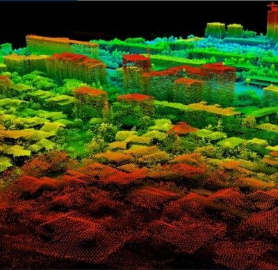
Classification is particularly important when a project requires a bare-earth terrain model. The software needs to distinguish ground points from vegetation, buildings and other objects. Depending on the package and workflow, this process may be manual, automatic or a combination of both. Automated classification can save considerable processing time on larger LiDAR projects, while manual editing remains useful for checking complex areas.
Creating terrain models from LiDAR data
One of the most common uses of LiDAR is creating an accurate representation of the ground surface. Once suitable ground points have been identified, software can use them to generate digital terrain models, contours, elevations and profiles.
These outputs can support surveying, earthworks, drainage design, road engineering, mining and construction planning. Because LiDAR captures a dense set of measurements, it can provide much more surface information than a limited number of individually surveyed points. The processing software determines how that information is filtered and converted into a useful model.
LiDAR software for surveying and construction
Surveyors use point cloud software to process data collected by terrestrial scanners, handheld SLAM scanners, mobile mapping systems and UAV LiDAR equipment. Typical outputs include measured coordinates, sections, surfaces, volumes and CAD-ready information.
Construction professionals can use 3D scan data to document existing conditions, compare completed work with a design, calculate volumes or capture complex structures without measuring every object individually. For renovation and engineering work, point clouds can also provide a detailed digital record of areas that would be difficult or time-consuming to survey using conventional methods alone.
Software for forestry and vegetation analysis
LiDAR is widely used where both terrain and vegetation need to be understood. Laser pulses can capture points at different levels within vegetation, allowing suitable processing software to separate the ground surface from trees and other vegetation.
Specialised LiDAR applications can support forestry workflows such as analysing vegetation structure, terrain below tree cover and other spatial characteristics. When choosing software for forestry, consider whether the available classification and analysis tools match the specific information required for the project rather than choosing solely on general point cloud capabilities.
Powerline LiDAR processing software
Powerline surveys involve specialised requirements because the point cloud may contain conductors, towers, vegetation, terrain and surrounding infrastructure. Software such as GreenValley LiPowerline is designed specifically for these types of datasets.
Specialist processing tools can help identify relevant powerline features and support clearance or vegetation analysis. This can make large corridor surveys easier to process than using a general-purpose point cloud package that requires more manual classification. The exact workflow should still be matched to the required inspection or mapping deliverables.
LiDAR software for roads and urban mapping
Mobile LiDAR systems can rapidly collect dense point clouds along roads and through urban environments. These datasets may contain road surfaces, kerbs, signs, poles, buildings, vegetation and other street assets. Dedicated software can help classify and extract these features from the scan data.
Solutions such as GreenValley LiStreet are intended for street and corridor-related processing. This type of software is useful when the purpose of the survey is not simply to view a point cloud but to identify and organise infrastructure features that can be transferred into mapping or asset management systems.
Working with terrestrial and mobile 3D scanners
Different scanners produce different types of datasets. A stationary terrestrial scanner typically captures high-density scans from several fixed positions, while a handheld or backpack SLAM scanner collects data continuously as the operator moves through an environment. Mobile mapping and UAV systems add further positioning and trajectory information.
The processing requirements can therefore differ substantially. Before choosing software, check which scanner formats and point cloud types are supported. Also consider whether additional processing such as trajectory adjustment, point cloud registration or georeferencing takes place in the scanner manufacturer's software before the data is imported into the main analysis package.
Choosing the right 3D scanning and LiDAR software
Start by considering the type of data you work with. General-purpose point cloud software can be suitable when you need to view, clean, measure and export scan data. More specialised applications may be preferable for forestry, road mapping, powerline inspection or automated LiDAR classification.
Dataset size is another important factor. LiDAR surveys can contain millions or even billions of points, so efficient handling of large files can have a significant effect on day-to-day productivity. Computer hardware requirements should also be considered, particularly for large projects and demanding 3D visualisation tasks.
Important factors to compare
- Compatibility with the point cloud formats produced by your equipment.
- Maximum practical dataset size and computer requirements.
- Manual and automatic point cloud classification tools.
- Terrain, contour, profile and volume calculation functions.
- Support for CAD, GIS and common point cloud export formats.
- Specialist functions for forestry, roads, powerlines or other applications.
Point cloud software for CAD and GIS workflows
Processed LiDAR data often needs to continue into other software. Surveyors may need point clouds, surfaces or linework in CAD, while GIS professionals may require georeferenced terrain and classified spatial information. Suitable export options are therefore an important part of choosing the right package.
Consider the final deliverable before selecting software. If the objective is a CAD drawing, terrain surface, GIS dataset, classified LAS file or 3D model, the software should provide a practical route from the original scan to that required output. A good data workflow can reduce unnecessary conversions and manual processing.
Using LiDAR software with GNSS and surveying equipment
LiDAR is often used together with GNSS, total stations and other surveying instruments. GNSS can provide georeferenced positions, while total stations may be used for control points or checks where very specific survey references are required. Combining these technologies can help place a dense 3D point cloud accurately within the project coordinate system.
For mobile, UAV and SLAM scanning systems, positioning can also form an important part of the scanning workflow. The appropriate software setup therefore depends not only on the scanner itself but also on how the data is positioned, processed and delivered.
Selecting a complete LiDAR workflow
The best software is the package that matches both your equipment and the final result required by your client or project. A land surveyor creating terrain models has different needs from a utility company analysing powerlines or a mapping team extracting road assets.
Before choosing, identify your scanner, point cloud format, typical project size and required outputs. Also consider whether you need automated classification or specialist extraction tools. Global GPS Systems can help buyers match suitable 3D scanning and LiDAR software with compatible scanning and positioning equipment for their intended field and office workflow.
3D Scanning and LiDAR Software FAQ
LiDAR Software Basics
What is 3D scanning and LiDAR software?
3D scanning and LiDAR software is used to view, process, classify and analyse point clouds captured by laser scanners. It can turn raw scanning data into useful outputs such as terrain models, contours, profiles, measurements and classified point clouds.
What is a point cloud?
A point cloud is a collection of three-dimensional measured points representing surfaces and objects in the real world. Depending on the scanner and project, a point cloud may contain millions or billions of points representing terrain, buildings, roads, vegetation and other features.
Do I need special software to process LiDAR data?
Yes, professional LiDAR projects normally require point cloud processing software. The scanner captures the data, while software is used to clean, classify, measure, analyse and export that information into formats suitable for surveying, CAD, GIS or engineering work.
Processing and Outputs
Can LiDAR software create terrain models and contours?
Yes. Suitable LiDAR software can classify ground points and use them to generate digital terrain models, contours, profiles and other surface information. Available functions vary between software packages.
Can I calculate volumes from a point cloud?
Many professional point cloud packages provide volume measurement tools. These can be useful for stockpiles, earthworks, excavation and other applications where the shape of a surface has been captured with sufficient accuracy and coverage.
Can LiDAR data be exported to CAD or GIS software?
Yes. Professional point cloud software commonly supports formats that can be transferred into CAD, GIS and other surveying or engineering applications. The exact supported file formats should be checked against your existing workflow.
Applications and Equipment
Can the same software process data from every LiDAR scanner?
No. Supported file formats and workflows vary between software packages and scanner manufacturers. Check that the software can import the output from your terrestrial, handheld, mobile or UAV LiDAR system before choosing a licence.
Can LiDAR software be used for forestry?
Yes. LiDAR software can be used to separate terrain from vegetation and analyse three-dimensional forest data. Specialist packages may provide additional functions designed specifically for forestry and vegetation workflows.
Is there specialist software for powerlines and road mapping?
Yes. Some LiDAR applications are designed for particular industries. GreenValley LiPowerline focuses on powerline and corridor data, while GreenValley LiStreet is intended for street and urban mapping workflows.
Choosing LiDAR Software
How do I choose the right LiDAR processing software?
Start with compatibility with your scanner and point cloud formats. Then compare the processing tools you need, such as classification, terrain modelling, measurements, CAD or GIS export and specialist analysis for your industry.
What computer specifications are important for LiDAR processing?
Point clouds can be very large, so processing generally benefits from sufficient RAM, a capable processor, fast storage and suitable graphics hardware. Exact requirements depend on the software, dataset size and type of processing being performed.
Should I choose general point cloud software or specialist LiDAR software?
General point cloud software is suitable for many surveying, measurement and modelling jobs. Specialist software can be more efficient when you repeatedly process a particular type of data, such as forestry, powerlines or roads, because it may include dedicated classification and extraction tools for that workflow.
 GPS & GNSS
 Total Stations
 Data collectors
 Software
 Correction services
 Machine control
 External radio
 Marine
 Accessories