


Greenvalley LiStreet Software
This product is available
Get the best price for your setup
Contact our experts for the best possible price and configuration.
HD-Road Mapping Processing Software
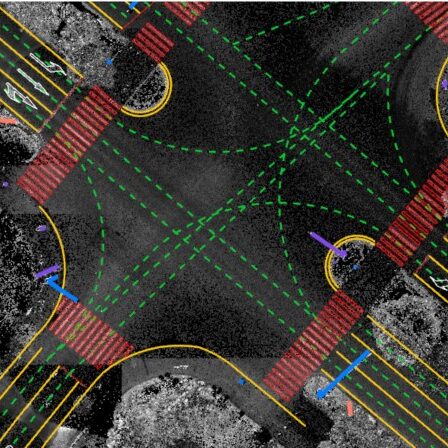
LiStreet is a street and street-side feature extraction and thematic map
production software. Adopting an automated and semi-automated approach
to the vectorization of urban areas, LiStreet is the most proficient software
intended for 3D mapping and municipal management.
Valued customers:


Find RTK Networks
Search NTRIP providers and connect to reliable RTK correction services.
Description
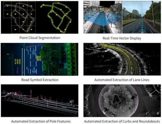
As a feature extraction software for 3D mapping developed by GreenValley International, LiStreet adopts an automated and semi-automated approach to vectorize urban areas, supporting a variety of GIS platforms. The software can be applied to a wide range of fields including municipal management, municipal infrastructure survey, high-definition map generation, highway inspection and expansion, digital city construction, digital garden investigation, etc., elevating the level of informatization and urban management.
Advantages
Automatic extraction of lane line, light pole and road edges – Generate tiles from cutting block tool – Panoramic measurement – Extraction of road marks
Datasheets & Manuals
Datasheets and manuals
Datasheet
Reviews (0)
Only logged in customers who have purchased this product may leave a review.


Reviews
There are no reviews yet