


 GPS & GNSS
 Lidar scanning
 Total Station
Machine control
Machine control
Machine control
Machine control
Machine Control Systems with GNSS
GNSS machine control brings accurate positioning directly into the cab of construction and agricultural machinery. Instead of relying only on physical stakes, string lines or repeated manual checks, the operator can use a display and positioning system to see where the machine is in relation to the required design or guidance line.
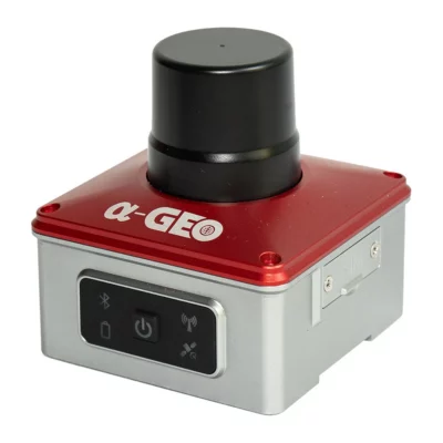
At Global GPS Systems you can find machine control solutions for different types of fieldwork, including the AlphaGeo ALPHA DG1 GNSS Excavator Guidance System, SOUTH EGS01 Intelligent 3D Excavator Guidance System, EFIX eSteer 10 Auto Steering System and EFIX eSteer 20 Auto Steering System. The right solution depends first on the machine you are equipping and whether the goal is excavation guidance, agricultural steering or another machine positioning workflow.
What is GNSS machine control?
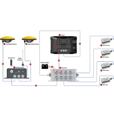
GNSS machine control combines satellite positioning with machine-mounted hardware and software. Depending on the system, this may include GNSS antennas, sensors, a control unit and an in-cab display. The system continuously determines the position and orientation of the machine and presents useful guidance to the operator.
In construction, this information can help an excavator operator work towards a required depth, slope or surface. In agriculture, a GNSS auto-steering system can help the vehicle follow planned guidance lines accurately across a field. The practical result is that the operator receives positioning information while working instead of repeatedly stopping to check the machine position manually.
3D excavator guidance systems
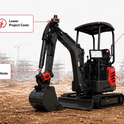
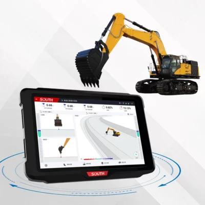
3D excavator guidance is designed to show the position of the excavator bucket relative to a digital design or required surface. A typical system uses GNSS positioning together with machine sensors to calculate where the bucket is and how much material still needs to be removed or added.
Systems such as the AlphaGeo ALPHA DG1 and SOUTH EGS01 are intended for this type of excavator workflow. They can support earthmoving projects where operators need clear information about depth, height and slope while working.
Common excavator machine control applications
- Excavating foundations and building pads.
- Creating trenches for utilities and drainage.
- Working to specified depths and elevations.
- Forming slopes and embankments.
- Road construction and site preparation.
- General earthworks and grading operations.
How excavator guidance works in practice
Once a compatible machine control system has been installed and calibrated, the in-cab display provides the operator with information about the machine position. Rather than repeatedly leaving the cab to measure the excavation, the operator can use the guidance information to work towards the target surface.
This does not remove the need for correct survey control, machine calibration or sensible field checks. It does, however, give the operator much more positioning information during the excavation itself. On suitable projects, this can reduce dependence on stakes and repeated grade checking and make it easier to follow complex surfaces.
GNSS auto steering for agricultural machinery
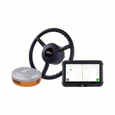
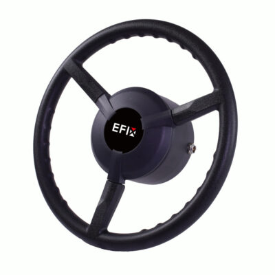
Machine control is also widely used in agriculture. GNSS auto-steering systems such as the EFIX eSteer 10 and EFIX eSteer 20 are designed to guide compatible agricultural vehicles along predefined lines in the field.
Accurate steering can help operators maintain consistent passes during operations such as seeding, spraying, fertilising and cultivation. Instead of concentrating continuously on manually following the previous pass, the operator can use the steering system to maintain the selected guidance path.
Machine guidance versus automatic machine control
It is important to understand whether a system provides guidance or directly controls part of the machine. A guidance system tells the operator where to move or how far the bucket is from the required design. The operator still controls the machine manually.
An automatic control or steering system goes a step further and actively controls a machine function, such as steering the vehicle along a guidance line. The exact level of automation varies between products, so buyers should check what the selected system actually controls rather than assuming that every machine control package provides the same functionality.
Why RTK GNSS is used for machine control
Standard standalone GNSS positioning is normally not accurate enough for precise construction or machine guidance. Professional systems therefore often use RTK GNSS corrections to achieve the level of positioning needed for practical field operations.
RTK corrections can come from a suitable correction network or from a local GNSS base station. The best choice depends on the work area, available mobile connectivity, existing equipment and how the machine will be used. Reliable corrections are an important part of the complete machine control setup.
Machine control for construction and earthworks
Construction crews can use machine guidance to connect digital design information with the equipment carrying out the work. This is useful on projects where elevations, slopes and surfaces need to be reproduced accurately across a site.
For an excavator operator, the most valuable information is often simple: where the bucket is, how far it is from the design and whether more material needs to be removed. Clear in-cab guidance can therefore be useful not only for experienced surveyors but also for operators who need accurate positioning as part of their everyday machine work.
Reducing repeated manual grade checks
Traditional earthworks often require workers to establish levels using stakes, lasers or surveying equipment and then repeatedly check the excavation as work progresses. Machine guidance brings part of this information into the cab so that the operator can monitor progress while digging.
Survey checks and site control are still important, particularly for critical construction work. The benefit of machine control is that the operator has continuous guidance between those checks, which can make the working process more efficient and reduce unnecessary interruptions.
Machine control for agricultural fieldwork
In agriculture, accurate vehicle guidance helps maintain consistent spacing between passes. This can be useful across large fields where small steering errors can accumulate and create overlaps or gaps.
The required system depends on the tractor or machine, steering configuration and desired workflow. Some users need straightforward line guidance, while others want an integrated auto-steering solution capable of maintaining the vehicle's path automatically.
Choosing the right machine control system
The first question is which machine needs to be equipped. An excavator guidance system and a tractor auto-steering system perform very different jobs even though both use GNSS positioning. Always start with the vehicle type and intended application.
Next, consider the required accuracy and correction source. Construction work involving design elevations generally requires precise RTK positioning, while agricultural applications should be matched to the accuracy required for the specific operation. Compatibility with correction services, base stations and existing GNSS equipment should therefore be considered before purchase.
Important factors to compare
- Machine type and supported installation.
- Guidance-only operation or automatic steering/control.
- GNSS and RTK correction requirements.
- Number and placement of antennas and machine sensors.
- In-cab display and operator interface.
- Support for the design or guidance data used in your workflow.
Installation and calibration
Machine control is not simply a GNSS receiver placed on a vehicle. The position of antennas and sensors relative to the machine needs to be known so the system can correctly calculate where the working point, bucket or vehicle is located.
Proper installation and calibration are therefore essential. For excavators, the geometry of the boom, stick and bucket must be represented correctly within the system. Auto-steering systems also need to be configured for the vehicle on which they are installed. A technically capable system can only provide useful guidance when these setup values are correct.
Digital designs and machine control data
Some construction machine control workflows use digital terrain or design models. These models represent the surface the operator is expected to create. The machine control display then compares the actual machine position with that design.
Before selecting a system, consider how project data will be prepared and transferred to the machine. Contractors already working with survey or civil engineering software should make sure the selected machine control solution fits their existing data workflow.
Machine control, GNSS and surveying equipment
Machine control often works alongside conventional surveying equipment rather than replacing it. Surveyors may establish site control with RTK GNSS receivers or total stations, while the machine operator uses the machine control system to carry out the earthworks. Periodic survey checks can then be used to verify progress and final results.
This makes compatibility across the wider positioning workflow important. Global GPS Systems can help buyers compare machine control equipment alongside GNSS receivers, RTK correction solutions and other positioning equipment used on construction or agricultural projects.
Finding the right GNSS machine control solution
The best system depends on what the machine needs to do. Excavator operators should focus on suitable 3D guidance, machine geometry support and practical in-cab information. Agricultural users should focus on steering compatibility, guidance accuracy and how the system fits their tractor and field operations.
Start with your machine type, required accuracy and correction source, then consider installation, calibration and data requirements. Matching these parts as one complete system makes machine control much more useful in everyday fieldwork.
Machine Control FAQ
Machine Control Basics
What is a GNSS machine control system?
A GNSS machine control system uses satellite positioning, sensors and software to determine the position of a machine and provide guidance or automatic control. It is commonly used with excavators, tractors and other construction or agricultural equipment.
What is the difference between machine guidance and machine control?
Machine guidance shows the operator where the machine or working tool is in relation to the required position. Automatic machine control can actively control a machine function, such as steering. The exact level of automation depends on the system.
Does machine control replace a surveyor?
No. Machine control can reduce repeated manual checking during earthworks, but accurate site control, design preparation, calibration and verification remain important. Surveying equipment and machine control are often used together on the same project.
Excavator Guidance
How does a 3D excavator guidance system work?
A 3D excavator guidance system combines GNSS positioning with sensors that determine the geometry and movement of the excavator. The system calculates the bucket position and shows the operator how it relates to the required depth, slope or digital design.
What jobs can excavator machine control be used for?
It can be used for foundations, trenches, utilities, drainage, road works, grading, slopes, site preparation and general earthworks where the operator needs accurate information about excavation depth or elevation.
Does an excavator guidance system control the hydraulics automatically?
Not necessarily. Many systems provide guidance to the operator while the excavator remains manually controlled. Always check the specific product to determine whether it is a guidance system or includes any automatic machine control functions.
RTK and Positioning
Does machine control need RTK GNSS?
Precise construction and agricultural machine control commonly uses RTK GNSS because ordinary standalone satellite positioning is generally not accurate enough for demanding guidance tasks. The required correction method depends on the application and system.
Where do RTK corrections for machine control come from?
Corrections can typically come from an RTK correction network or a compatible local GNSS base station. The most suitable option depends on network availability, mobile coverage, working area and existing equipment.
Can machine control work together with surveying GNSS equipment?
Yes. Survey GNSS equipment can be used to establish site control, measure reference points and verify finished work, while the machine control system guides the equipment during construction or field operations.
Choosing a Machine Control System
How do I choose the right machine control system?
Start with the type of machine and the work it needs to perform. Then consider whether you need operator guidance or automatic control, the required positioning accuracy, RTK correction source, installation requirements and compatibility with your existing workflow.
What machine control systems are available for excavators?
The machine control range includes excavator guidance solutions such as the AlphaGeo ALPHA DG1 GNSS Excavator Guidance System and SOUTH EGS01 Intelligent 3D Excavator Guidance System. Suitability depends on the excavator, installation requirements and intended construction workflow.
What machine control systems are available for agricultural steering?
GNSS auto-steering solutions such as the EFIX eSteer 10 and EFIX eSteer 20 are intended for agricultural vehicle guidance. The correct choice depends on vehicle compatibility, required accuracy and the type of field operations being carried out.
 GPS & GNSS
 Total Stations
 Data collectors
 Software
 Correction services
 Machine control
 External radio
 Marine
 Accessories