


 GPS & GNSS
 Lidar scanning
 Total Station


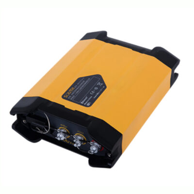
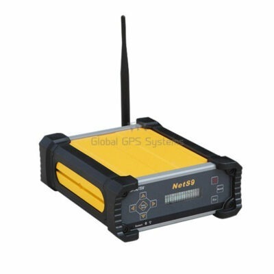
GNSS Receivers for Reference Stations
A GNSS reference station is a receiver installed at a precisely known location to monitor satellite signals continuously. By comparing its measured position with its established coordinates, the station calculates corrections that help compatible RTK rovers achieve centimetre-level positioning. These corrections can be transmitted through the internet, a local network or a radio connection.
Reference-station GNSS receivers are used to create individual RTK base stations and wider Continuously Operating Reference Station networks. They are suitable for survey companies, construction sites, mines, infrastructure projects, GIS organisations, agricultural operations and drone teams that need dependable correction coverage over an extended period.
Applications of a GNSS Reference Station
A permanent reference station can support multiple users and projects within its coverage area. Surveyors can connect their RTK rovers for topographic surveys, setting out and control work, while construction teams can use the same correction source for site positioning and machine guidance. Drone pilots can record accurate ground-control coordinates or use compatible RTK and PPK workflows for aerial mapping.
Reference stations are particularly valuable in remote locations where no public CORS network is available or where access to an existing correction service is unreliable. They can also give organisations greater control over station coordinates, data availability, communication settings and user access.
Important Features for Reliable Correction Data
Modern reference-station receivers generally track several satellite constellations and frequencies. Multi-constellation tracking improves satellite availability, while multi-frequency observations help the system model atmospheric effects and resolve ambiguities more effectively. This supports faster RTK initialisation and more stable results for connected field receivers.
Communication options are equally important. NTRIP allows correction data to be distributed through an internet connection, making it practical to serve rovers across a project area or network. Depending on the receiver and installation, corrections may also be sent through Ethernet, mobile data, serial connections or an external UHF radio. Support for standard RTCM messages helps the reference station work with a wide range of professional GNSS equipment.
Raw observation logging is useful when measurements need to be checked or processed after fieldwork. Support for formats such as RINEX enables static processing, monitoring and archiving. Storage capacity, configurable logging intervals and automated file management should therefore be considered when long-term data collection is required.
External GNSS Antennas and Installation
A reference-station receiver normally works with a separate survey-grade GNSS antenna. The antenna should have a stable phase centre, strong multipath rejection and support for the required satellite frequencies. Choke-ring antennas are often selected for permanent stations because their design helps reduce signals reflected from surrounding surfaces.
The antenna must be mounted on a structurally stable point with a clear view of the sky. Movement in the monument, roof or mast can affect every rover using the station. Nearby walls, metal structures, trees, transmitters and electrical equipment may also reduce observation quality. Accurate antenna-height measurement, suitable surge protection, weatherproof cabling and dependable power are essential parts of a professional installation.
How to Choose the Right Reference-Station Receiver
Start by deciding whether the receiver will serve one local project or form part of a larger CORS network. A single-site installation may only require one correction stream, while a network application can benefit from multiple data outputs, remote administration and compatibility with network RTK software.
- Satellite tracking: Select support for the constellations and frequencies used by your rover fleet.
- Correction formats: Check compatibility with the RTCM messages and NTRIP configuration required by connected equipment.
- Data logging: Choose raw-data and RINEX capabilities when post-processing or long-term archiving is needed.
- Connectivity: Consider Ethernet, cellular, serial and radio interfaces according to the installation location.
- Power and protection: Plan for continuous power, backup power, grounding, surge protection and an appropriate enclosure.
Compatibility should be assessed across the complete setup rather than the receiver alone. The antenna, cable, communication link, caster software, rover equipment and coordinate system must work together. Global GPS Systems can help buyers compare these elements and select a practical reference-station configuration for surveying, construction, GIS, drone mapping or remote-site operations.
Related GNSS Equipment
A complete system may also require a survey-grade GNSS antenna, low-loss antenna cable, mounting hardware, an external radio, an internet connection and suitable software for managing correction streams. RTK GNSS receivers and rover sets can then connect to the reference station for centimetre-level field measurements. For projects that do not require an organisation-owned station, an RTK correction service may be a more practical alternative.
Building a Dependable CORS Installation
The performance of a reference station depends on more than the receiver specification. A stable monument, accurately determined coordinates, clear satellite visibility and reliable communications are fundamental. Regular checks of the antenna position, correction stream, power supply and logged data help identify problems before they affect field crews.
With the correct equipment and installation, a GNSS reference station becomes a consistent positioning resource for multiple teams. It can reduce dependence on temporary base setups, simplify repeated work in the same area and provide a controlled correction source for accurate day-to-day operations.
GNSS for Reference Stations FAQ
Reference-Station Basics
What is a GNSS reference station?
A GNSS reference station is a receiver installed at a known, stable position. It continuously observes satellite signals and calculates correction data that compatible RTK rovers can use for more accurate positioning.
What is the difference between a reference station and an RTK rover?
The reference station remains at a known coordinate and generates corrections. An RTK rover moves between measurement points and applies those corrections to determine its position with centimetre-level accuracy under suitable conditions.
What does CORS mean?
CORS stands for Continuously Operating Reference Station. A CORS operates for long periods and can distribute GNSS observations or RTK corrections to one or more users through a network connection.
Corrections and Communication
How are RTK corrections sent to field receivers?
Corrections are commonly sent through NTRIP over the internet. Depending on the equipment and project, they may also be transmitted through an external UHF radio, mobile network, Ethernet or another data connection.
What is NTRIP?
NTRIP is a method for streaming GNSS correction data over the internet. A reference station sends data to a caster, and authorised rovers connect to the appropriate stream using mobile data or another internet connection.
Can one reference station serve multiple rovers?
Yes. When the communication system and server configuration support multiple users, several rovers can receive corrections from the same station. Performance also depends on bandwidth, licensing and the selected network setup.
Antennas and Installation
Does a reference-station receiver need an external antenna?
Most dedicated reference-station receivers use an external survey-grade GNSS antenna. The antenna provides the satellite observations, while the receiver processes, stores and distributes the resulting data.
Why are choke-ring antennas used for permanent stations?
Choke-ring antennas are designed to reduce multipath, which occurs when satellite signals reflect from nearby surfaces before reaching the antenna. Reducing these reflections helps improve the consistency of reference-station observations.
Where should the GNSS antenna be installed?
The antenna should be mounted on a stable point with a wide, unobstructed view of the sky. Avoid nearby trees, walls, reflective metal surfaces, powerful transmitters and structures that may move over time.
Selection and Operation
Which correction formats should a reference station support?
RTCM 3 is widely used with modern RTK equipment, although some workflows require other RTCM versions or manufacturer-specific formats. Select a receiver that provides the messages required by your rover fleet and network software.
Why is RINEX logging useful?
RINEX files contain raw GNSS observations that can be archived or processed after fieldwork. They are useful for static surveys, coordinate determination, quality checks, monitoring and PPK workflows.
What should I check before choosing a reference-station receiver?
Check constellation and frequency support, RTCM output, NTRIP functionality, raw-data logging, storage, communication ports, remote management and compatibility with the selected antenna, rovers and processing software.
 GPS & GNSS
 Total Stations
 Data collectors
 Software
 Correction services
 Machine control
 External radio
 Marine
 Accessories