


 GPS & GNSS
 Lidar scanning
 Total Station




FJD Trion V4e Pro Mini RTK GNSS Receiver with Laser
Get the best price for your setup
Contact our experts for the best possible price and configuration.
- Fast response
- Expert configuration advice
- No overpaying for features you do not need
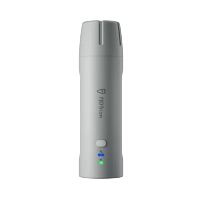
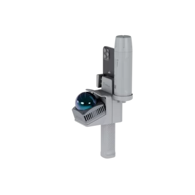
The FJD Trion V4e Pro is a compact RTK GNSS receiver developed for fast surveying, mapping and stakeout work. Its integrated green laser allows users to measure points without placing the receiver directly on the target, making it practical for inaccessible corners, trenches, façades, road edges and other difficult locations.
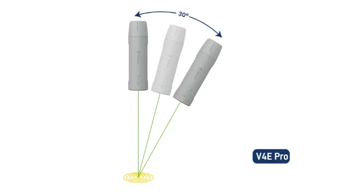
At only 320 g, the V4e Pro is easy to carry throughout the working day. It tracks all major satellite constellations across 1,408 channels and delivers centimetre-level RTK positioning when connected to a suitable correction service or base station. The built-in IMU supports tilted measurements, while the laser extends the working angle to as much as 60° for flexible pole-free data collection.
FJD Trion V4e Pro Highlights
| Laser measurement | Integrated visible green laser for remote measurement and stakeout |
|---|---|
| Laser tilt accuracy | 3D error ≤2.5 cm at up to 30° and ≤3.5 cm at up to 60° |
| RTK accuracy | Horizontal ≤0.8 cm + 1 ppm and vertical ≤1.5 cm + 1 ppm |
| GNSS tracking | 1,408 channels with GPS, GLONASS, Galileo, BeiDou, QZSS and SBAS |
| Weight and protection | 320 g, IP67 rated and tested for drops from 1.2 metres |
| Battery life | At least 12 hours with USB-C charging in 3 hours or less |

Valued customers:










Find RTK Networks
Search NTRIP providers and connect to reliable RTK correction services.
Description
Compact laser RTK surveying with the FJD Trion V4e Pro
The FJD Trion V4e Pro combines a multi-constellation RTK GNSS receiver, an IMU and an integrated green laser in a lightweight handheld instrument. It is designed for professionals who need to collect or stake out accurate coordinates quickly without carrying a conventional full-size GNSS receiver for every job.
The laser is the main difference between the V4e Pro and a standard compact GNSS rover. Instead of placing the receiver directly above every point, the operator can aim at the required location from a convenient position. This is useful when measuring building corners, trench bottoms, road edges, utility features, embankments, stockpiles and other points that are unsafe, obstructed or difficult to reach.
Measure points from where you can safely stand
For laser measurements, the V4e Pro supports angles of up to 60°. Its specified three-dimensional error is no more than 2.5 cm at angles up to 30° and no more than 3.5 cm at angles up to 60°. At a distance of 3 metres and an angle of up to 30°, the specified laser tilt measurement error is no more than 3 cm.
In practical fieldwork, this means surveyors and construction teams can record points without leaning over excavations, climbing onto objects or repeatedly repositioning a survey pole. The visible green beam also helps the operator confirm exactly which feature is being measured. During stakeout, it can be used to guide the user towards the required point and confirm the target location.
Centimetre-level RTK GNSS positioning
The receiver tracks 1,408 channels and supports GPS, GLONASS, Galileo, BeiDou, QZSS and SBAS signals. Tracking several constellations gives the receiver access to more satellites, supporting faster and more stable positioning when working around buildings, trees or machinery where part of the sky may be obstructed.
With RTK corrections, the specified positioning accuracy is up to 0.8 cm + 1 ppm horizontally and 1.5 cm + 1 ppm vertically. The V4e Pro supports RTCM 2.3, RTCM 3.x and CMR differential data formats and outputs standard NMEA-0183 data. It can therefore be used with compatible NTRIP correction services and established GNSS workflows.
RTK initialization takes less than five seconds under suitable conditions. A cold start takes up to 30 seconds, while a hot start takes up to five seconds. These fast startup times are helpful for short site visits, repeated point collection and jobs where crews regularly move between work areas.
Built-in IMU for flexible point collection
The integrated IMU allows the receiver to compensate for tilt instead of requiring the instrument to be held perfectly level. This makes it easier to measure beside walls, fences, vegetation, parked equipment and other obstacles that prevent a pole from being positioned vertically.
For conventional tilted measurement at angles up to 30°, the specified three-dimensional error is no more than 2.5 cm. The laser function provides additional flexibility for points that cannot be occupied directly, extending the usable measurement angle to as much as 60°.
Designed for surveying construction GIS and agriculture
The FJD Trion V4e Pro can support a wide range of field tasks. Land surveyors can use it for topographical surveys, detail collection, boundary-related fieldwork and quick verification measurements. Construction teams can measure site features, check positions and stake out design points without bringing a large receiver to every task.
GIS and utility teams can record assets such as inspection covers, valves, poles, cabinets and roadside features. The laser is particularly valuable where the required point is behind a barrier, below the operator or close to traffic. Forestry and agricultural users can collect field boundaries, reference points and infrastructure locations, while drone operators can use accurately measured ground points as part of suitable control and verification workflows.
- Topographical and detail surveying
- Construction layout and position checks
- Road, utility and public-works surveys
- GIS asset and infrastructure collection
- Forestry and agricultural mapping
Lightweight equipment for a full working day
The receiver weighs only 320 g and measures 182 × 53 × 53 mm. Its narrow handheld body reduces the amount of equipment crews need to carry and makes it suitable for high-frequency point collection across larger sites.
The internal battery provides at least 12 hours of operation and can be charged in three hours or less through its USB-C connection. Its low power consumption also makes it practical for long field sessions. The unit can be powered from a compatible external power source when longer operating periods are required.
Built for demanding outdoor sites
An IP67-rated enclosure protects the V4e Pro against dust and temporary water exposure. The housing is also designed to withstand a drop from 1.2 metres. Its specified operating temperature range of −20°C to 60°C supports use across construction sites, roads, farms and other outdoor working environments.
Bluetooth provides communication with a compatible phone or controller, while 2.4 GHz Wi-Fi is available for supported base-station functions. Status indicators show power, charging and positioning conditions, helping users confirm whether the receiver is connected and whether an RTK fixed solution has been achieved.
Connected field workflows
The V4e Pro works with FJD field software for measurement, stakeout and project data collection. GNSS data collected in the field can also be used within the wider FJD technology ecosystem, including supported agricultural autosteering systems, robotic mowers and automation devices. This can reduce unnecessary file conversion when organisations already use compatible FJD equipment.
Choosing and supporting your FJD Trion V4e Pro
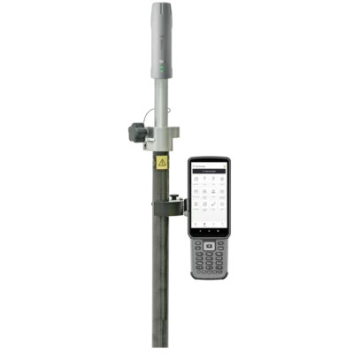
The V4e Pro is a practical choice for professionals who value portability and need to measure points that cannot always be reached with a survey pole. Buyers should confirm the required field controller, software, NTRIP correction service, coordinate systems and mounting accessories for their intended workflow.
Global GPS Systems can help configure the FJD Trion V4e Pro for surveying, construction, GIS, agriculture or related positioning work. This includes advice on compatible controllers, RTK correction access, poles, mounts and the most suitable setup for the required accuracy and field process.
Specifications
FJD Trion V4e Pro Mini RTK Receiver Specifications
Product Overview
| Product Name | FJD Trion V4e Pro Mini RTK Receiver |
|---|---|
| Product Type | Compact multi-constellation RTK GNSS receiver with integrated IMU and laser point measurement |
| Model Version | V4e Pro |
| Primary Functions | Centimetre-level RTK positioning, tilt-compensated surveying, laser-assisted point measurement and handheld coordinate collection |
| Typical Applications | Land surveying, construction, topographic mapping, road surveying, BIM, forestry, agriculture, utilities, public works and geospatial data collection |
GNSS Receiver
| GNSS Channels | 1408 parallel channels |
|---|---|
| Supported Constellations | GPS, BeiDou, GLONASS, Galileo, QZSS and SBAS |
| Supported Frequencies | Up to 19 frequencies |
| GPS Signals | L1 C/A, L2P and L5 |
| BeiDou Signals | B1I, B2I, B3I, B1C, B2a and B2b |
| GLONASS Signals | G1 and G2 |
| Galileo Signals | E1, E5a, E5b and E6 |
| QZSS Signals | L1, L2 and L5 |
| SBAS Signals | L1 C/A |
| Correction Connection | NTRIP compatible |
| Correction Formats | RTCM 2.3, RTCM 3.x and CMR |
| Positioning Data Format | NMEA 0183 |
| Integrated UHF Radio | No |
| Integrated Cellular Modem | No; an internet-connected controller or mobile device is required for NTRIP corrections |
Positioning Accuracy
| RTK Horizontal Accuracy | ≤0.8 cm + 1 ppm RMS |
|---|---|
| RTK Vertical Accuracy | ≤1.5 cm + 1 ppm RMS |
| Single-Point Horizontal Accuracy | ≤1.5 m RMS |
| Single-Point Vertical Accuracy | ≤2.5 m RMS |
| DGPS Horizontal Accuracy | ≤0.4 m RMS |
| DGPS Vertical Accuracy | ≤0.8 m RMS |
| Time Accuracy | 20 ns RMS |
| Speed Accuracy | 0.03 m/s RMS |
Initialization and Update Performance
| Signal Reacquisition | ≤1 second |
|---|---|
| Cold-Start Time to First Fix | ≤30 seconds |
| Hot-Start Time to First Fix | ≤5 seconds |
| RTK Initialization Time | <5 seconds |
| Initialization Reliability | Up to 99.9% under suitable operating conditions |
| Data Update Rates | 1 Hz, 2 Hz, 5 Hz, 10 Hz, 15 Hz and 20 Hz |
IMU and Tilt Compensation
| Integrated IMU | Yes |
|---|---|
| Maximum Advertised IMU Tilt | Up to ±60° |
| Specified Precision Tilt Range | Up to 30° |
| Tilt-Compensated Surveying | Supported |
| Pole-Free Measurement | Supported through integrated IMU and laser targeting |
| Levelling Requirement | Manual pole levelling is not required for supported tilt-compensated workflows |
Laser Measurement
| Integrated Laser | Yes |
|---|---|
| Laser Function | Laser-assisted point targeting and coordinate measurement |
| Laser Rangefinder Precision | ±3 mm at 10 m under specified conditions |
| Laser Tilt Measurement Accuracy | 3D measurement error ≤3 cm at 3 m with tilt angle ≤30° |
| Target Types | Suitable for inaccessible, obstructed or difficult-to-reach survey points |
Wireless Communication
| Bluetooth | Bluetooth 4.0 dual-mode |
|---|---|
| Bluetooth Working Distance | Approximately 5 m |
| Wi-Fi | 2.4 GHz Wi-Fi |
| Wi-Fi Operating Mode | Base-station mode supported |
| Wi-Fi Working Distance | Up to 300 m under suitable conditions |
| Controller Connectivity | Compatible with supported mobile devices and survey controllers |
Battery and Power
| Battery Operating Time | ≥12 hours |
|---|---|
| Charging Time | ≤3 hours |
| Charging Input | 5 V / 2 A |
| Power Consumption | ≤1.5 W |
| Charging Interface | USB Type-C |
| USB Standard | USB 2.0 |
| Operation While Charging | Supported |
| External Power Bank Support | Supported |
| Charging Temperature | 0°C to 45°C |
Physical Specifications
| Dimensions | 182 × 53 × 53 mm |
|---|---|
| Weight | 320 g |
| Housing Material | PC + ABS |
| Mounting Interface | Internal 1/4-inch thread |
| Form Factor | Compact handheld receiver |
| Controls | Power button |
| Status Indicators | Integrated device and positioning indicator lights |
Environmental Specifications
| Ingress Protection | IP67 |
|---|---|
| Dust Protection | Dust-tight |
| Water Protection | Protected against temporary water immersion under IP67 test conditions |
| Drop Resistance | Up to 1.2 m |
| Operating Temperature | -20°C to 60°C |
Software and Data Compatibility
| Survey Software | Compatible with the FJD Trion Survey application |
|---|---|
| NTRIP Support | Yes |
| NMEA Output | NMEA 0183 |
| FJD Ecosystem Compatibility | Compatible with selected FJD surveying, agriculture, robotic and smart-device workflows |
| Custom Integration | Supports selected customised workflows and system integration |
Key V4e Pro Features
| Laser-Assisted Surveying | Measures points that are difficult or unsafe to access directly |
|---|---|
| Tilt Compensation | Allows measurements without holding the receiver perfectly level |
| Handheld Operation | Compact 320 g design for portable point collection |
| Multi-Constellation Tracking | Tracks six GNSS constellations with 1408 channels |
| Centimetre-Level RTK | Provides centimetre-level horizontal and vertical positioning when suitable RTK corrections are available |
| Field Runtime | At least 12 hours of rated operation |
Specifications and package contents may vary by configuration, region or manufacturer update. Always check the current configuration before ordering.
Reviews (0)
Only logged in customers who have purchased this product may leave a review.
FAQ
FJD Trion V4e Pro FAQ
Product Overview and Applications
What is the FJD Trion V4e Pro?
The FJD Trion V4e Pro is a compact RTK GNSS receiver for professional centimetre-level positioning, surveying, mapping and stakeout. It combines multi-constellation GNSS, an integrated IMU and laser point targeting in a lightweight handheld receiver.
What is the difference between the FJD Trion V4e and V4e Pro?
The V4e Pro is designed specifically for advanced pole-free coordinate collection with laser point targeting. Its enhanced IMU supports measurements at angles of up to approximately ±60°, allowing users to capture points that would be awkward, unsafe or impossible to occupy with a conventional survey pole.
Who is the FJD Trion V4e Pro intended for?
It is intended for surveyors, construction professionals, engineers, GIS teams, utility contractors, agricultural users, forestry professionals and other field teams that need portable, high-accuracy coordinate collection.
Which applications is the V4e Pro suitable for?
Typical applications include topographic surveying, road surveys, construction measurements, utility mapping, asset collection, agricultural boundary mapping, forestry work, civil engineering, GIS data collection and integration with compatible FJD automation systems.
Can the V4e Pro replace a traditional GNSS rover?
For many routine RTK measurements, mapping tasks and stakeout workflows, the V4e Pro can perform the role of a conventional rover in a smaller handheld format. A survey pole can still be preferable where a precisely defined antenna height, maximum repeatability or a specific regulated surveying procedure is required.
Can the V4e Pro replace a total station?
It can reduce the need for a total station in many open-sky coordinate collection tasks, particularly when measuring inaccessible points with the laser. It does not replace every total-station workflow, especially where satellite reception is unavailable, very high angular precision is required or observations must be made indoors.
Laser Measurement and RTK Accuracy
How does pole-free laser measurement work?
The operator aims the visible laser at the required point. The receiver combines its GNSS position, IMU orientation and laser measurement to calculate the target coordinate without requiring the GNSS antenna to be placed directly above the point.
What is the maximum measurement angle of the V4e Pro?
The V4e Pro is designed to support pole-free laser measurements at angles of up to approximately ±60°. Actual performance depends on correct operation, target visibility, satellite reception, RTK correction quality and the surrounding environment.
How accurate is the V4e Pro?
Under suitable RTK conditions, its specified GNSS accuracy is up to 0.8 cm + 1 ppm horizontally and 1.5 cm + 1 ppm vertically. Pole-free laser point accuracy can be approximately ±3.5 cm under the manufacturer’s stated conditions. Results may vary with distance, angle, satellite geometry, corrections and target quality.
Does the V4e Pro require an RTK correction service?
Yes, an RTK correction source is normally required to achieve centimetre-level positioning. Corrections may be received from a compatible NTRIP network or another supported correction source. Without RTK corrections, standalone GNSS accuracy will be lower.
Does the V4e Pro contain a cellular modem or UHF radio?
The receiver does not have an integrated internet modem or internal UHF radio. Internet-based RTK corrections are normally supplied through the connected phone or field controller. Confirm the intended correction workflow and required accessories before deployment.
Which satellite constellations does it support?
The V4e Pro has 1,408 tracking channels and supports signals from major GNSS constellations, including GPS, GLONASS, Galileo, BeiDou, QZSS and SBAS. Multi-constellation tracking improves satellite availability and positioning reliability in many field environments.
Can it measure inaccessible points?
Yes. Laser point targeting is useful for features such as walls, building corners, trench edges, embankments, fences and other points where placing a survey pole is difficult or unsafe. The laser still requires a clear line of sight to a suitable target surface.
Operation, Software and Data
What is the built-in IMU used for?
The IMU detects the receiver’s orientation and enables compensated measurements when the unit is tilted. In the V4e Pro, it also contributes to the calculation of coordinates captured with the pole-free laser measurement function.
How quickly can the V4e Pro start surveying?
The specified startup time is up to 30 seconds from a cold start and up to five seconds from a hot start. RTK initialization may take less than five seconds when satellite visibility, correction data and communication conditions are suitable.
Can the V4e Pro perform stakeout?
Yes. It can be used to navigate to and mark predefined coordinates. Its visible laser can assist the operator in identifying the target location during supported stakeout workflows.
Can data be exported to CAD or GIS software?
Survey data can be transferred into compatible office, CAD, GIS and construction workflows using the export options available in the associated field software. Available formats and functions can depend on the software version and project configuration.
Can V4e Pro data be used with other FJD equipment?
Yes. FJD describes a connected ecosystem in which compatible GNSS data can be used with FJD agricultural autosteering systems, robotic mowers and other smart equipment without unnecessary data conversion.
Can it be used close to buildings or under trees?
It can operate in many partially obstructed environments, but accuracy and RTK reliability may decrease when buildings, trees or machinery block satellites or reflect GNSS signals. Measurements should be checked carefully where the sky view is restricted.
Battery, Durability and Troubleshooting
How long does the V4e Pro battery last?
The specified battery life is at least 12 hours, depending on operating conditions, wireless communication, laser use, temperature and battery condition.
How long does it take to charge?
The specified charging time is no more than approximately three hours when a suitable charger and cable are used. The receiver can also be powered from a compatible power bank during longer field sessions.
Is the FJD Trion V4e Pro waterproof?
It has an IP67-rated enclosure, providing protection against dust and temporary water immersion under the conditions defined by the IP67 standard. Covers and connections must be closed correctly, and the receiver should not be treated as suitable for prolonged underwater use.
Can the receiver withstand a fall?
The V4e Pro is designed to withstand drops of up to approximately 1.2 metres under specified test conditions. A protective case and careful handling are still recommended because impacts can affect the housing, laser alignment or internal sensors.
Why does the receiver remain in float mode?
A float solution can result from poor satellite visibility, interrupted correction data, excessive distance from the correction source, multipath reflections or an incorrect RTK configuration. Move to a clearer location, check the NTRIP or correction connection and wait for the solution to return to fixed before recording critical points.
Why might a laser measurement be inaccurate?
Possible causes include an unstable RTK solution, an unsuitable or reflective target, excessive distance or angle, an obstructed laser path, poor IMU initialization or movement during capture. Verify the receiver status and test the result against a known point when accuracy is critical.


 GPS & GNSS
 Total Stations
 Data collectors
 Software
 Correction services
 Machine control
 External radio
 Marine
 Accessories
Reviews
There are no reviews yet