

 GPS & GNSS
 Lidar scanning
 Total Station
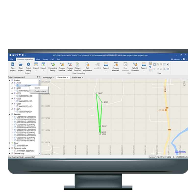
South Geomatics Office
Get the best price for your setup
Contact our experts for the best possible price and configuration.
- Fast response
- Expert configuration advice
- No overpaying for features you do not need
South Geomatics Office Software combines high-speed processing, advanced post-processing, and cloud connectivity to revolutionize land surveying. From accurate PPK calculations to seamless CAD integration, it’s the go-to software for post-processing in the geomatics industry.
Valued customers:










Find RTK Networks
Search NTRIP providers and connect to reliable RTK correction services.
Description
Optimize Land Surveying with South Geomatics Office (SGO) Software
The South Geomatics Office (SGO) software is a powerful solution designed to enhance the accuracy and efficiency of land surveying. Featuring a high-speed processing engine, advanced post-processing capabilities, and intelligent algorithms, it simplifies complex surveying tasks while delivering precise results.
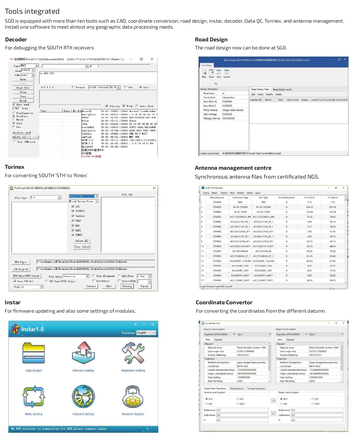
Key Features
- High-Speed Data Processing: Process static and dynamic baselines up to three times faster.
- PPK Processing: Accurately calculate azimuth coordinates and export tracks in multiple formats.
- Data Quality Control (QC): Analyze raw data with features like satellite sky plots and clock jump detection.
- Multi-Format Support: Import/export in multiple formats and download IGS data online.
- Intelligent Algorithms: Improve accuracy with multi-constellation solutions and advanced error elimination.
- Cloud Connectivity: Sync field and office data in real-time for efficient workflows.
- CAD Integration: Support DXF formats, terrain simulation, and automatic CAD output.
- Base Map Integration: Visualize control networks via Google Maps for better data editing.
- Net Adjustment: Ensure precise standards with GNSS and total station data integration.
Reviews (1)
1 review for South Geomatics Office
Only logged in customers who have purchased this product may leave a review.


 GPS & GNSS
 Total Stations
 Data collectors
 Software
 Correction services
 Machine control
 External radio
 Marine
 Accessories
Thomas Sacher (verified owner) –
Grundsätzlich ok, macht was es soll, leider nur englisch und chinesisch .