


 GPS & GNSS
 Lidar scanning
 Total Station
Data collectors
Data collectors
Rugged Survey Tablets for GNSS and Field Data Collection
Survey tablets are rugged portable computers designed for professional data collection and equipment control in the field. Compared with compact handheld controllers, a tablet provides significantly more screen space for maps, drawings, point information and graphical stakeout. This makes rugged tablets particularly useful for construction professionals, surveyors, engineers and GIS teams who regularly work with detailed visual information on site.
A professional survey tablet can be paired with compatible RTK GNSS receivers, total stations and other field equipment. With suitable data collection software installed, the tablet becomes the main interface for configuring instruments, recording measurements, performing stakeout and organising project information.
Why Use a Tablet for RTK GNSS Surveying?
During an RTK GNSS survey, the tablet allows the operator to see measured coordinates, point numbers, satellite and RTK status, background maps and project information in one interface. The larger display can make it easier to understand the relationship between measured points and the surrounding project, especially when working with complex site plans.
The tablet normally communicates with a compatible GNSS receiver through Bluetooth, Wi-Fi or another supported connection. Depending on the hardware and field software, mobile connectivity can also be used to receive NTRIP correction data from an RTK correction network. This creates a practical rover setup without requiring a separate GNSS base station where suitable network coverage is available.
Survey Tablets for Construction Stakeout
Construction is one of the applications where a larger display can provide a clear advantage. Digital design coordinates, site plans and other project information can be loaded into compatible field software and displayed directly on the tablet while working with an RTK rover or total station.
During stakeout, the software can guide the operator towards the required design location while showing distances, directions and surrounding geometry. Being able to see more of the drawing at once helps provide context, which can be particularly useful when setting out foundations, roads, utilities, drainage systems and other construction elements.
Tablets for GIS and Asset Mapping
GIS work frequently involves recording more than a coordinate. Field teams may need to complete forms, identify assets on a map, enter attributes, take photographs or check previously collected information. A rugged survey tablet provides enough screen space to handle these tasks comfortably while connected to a high-accuracy GNSS receiver.
This type of workflow is useful for utility mapping, environmental surveys, infrastructure inventories and asset management. Accurate GNSS coordinates can be combined with descriptive information while the operator is still at the measured location, reducing the amount of information that needs to be processed separately later.
Rugged Tablets Versus Standard Consumer Tablets
A normal consumer tablet can be useful in controlled environments, but professional fieldwork introduces additional requirements. Surveying and construction equipment is regularly exposed to dust, moisture, transport between job sites and changing temperatures. Rugged tablets are designed with these conditions in mind.
Depending on the model, professional tablets can provide reinforced housings, environmental protection, field-oriented batteries and connectivity options intended for external instruments. Their displays and physical design are also developed around outdoor use rather than office or home use.
Important Features When Choosing a Survey Tablet
The best tablet depends on the equipment, software and type of work you already use. Screen size is important, but it should not be the only specification considered. Instrument compatibility and software support are normally more important than raw processing specifications.
- Screen size: a larger display makes maps, CAD drawings and graphical stakeout easier to view.
- Operating system: confirm that the tablet supports the surveying, construction or GIS software required for your workflow.
- GNSS compatibility: check that the tablet and field software can communicate with your RTK receiver.
- Connectivity: Bluetooth, Wi-Fi and mobile-data support can be important for instruments, cloud workflows and NTRIP corrections.
- Rugged construction: consider resistance to water, dust, drops and the environmental conditions found on your normal job sites.
- Battery performance: field equipment should be able to support long working sessions without frequent charging.
Choosing the Right Screen Size
A larger tablet is useful when you regularly inspect detailed drawings, aerial imagery or large maps. Construction crews and GIS professionals often benefit from this extra workspace because they can view more project information without repeatedly zooming or switching between screens.
The trade-off is portability. A compact handheld survey controller is easier to mount on a GNSS pole and carry throughout a full day. A tablet is larger and may require a suitable holder or separate carrying method. Surveyors who mainly collect individual points may therefore prefer a traditional controller, while users working extensively with visual plans can benefit more from a tablet.
Survey Tablet Options
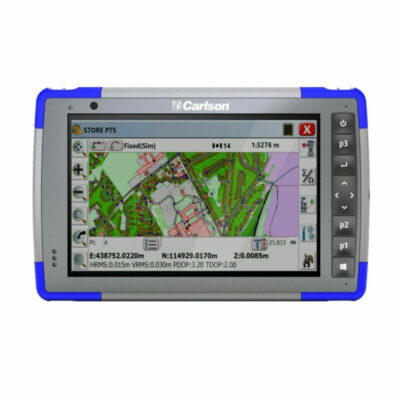
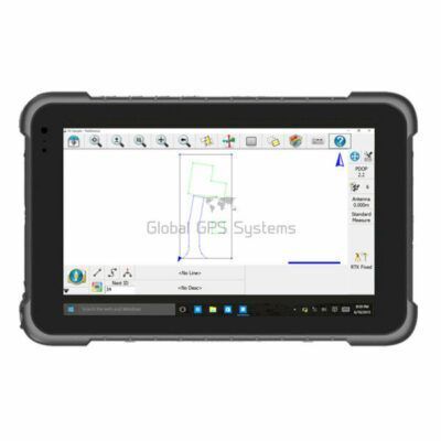
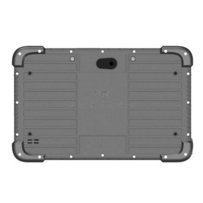
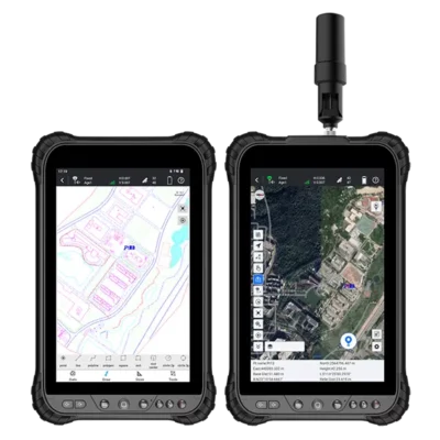
The tablet category at Global GPS Systems includes professional field devices such as the Carlson RT4, SOUTH HR842 and SOUTH N80 Rugged Android 8-inch Survey Data Collector Tablet. These models represent different approaches to field data collection, so the right choice depends on your preferred software, instrument compatibility and working environment.
For users who prefer Android-based workflows, a rugged Android tablet such as the SOUTH N80 provides a larger touchscreen environment for compatible surveying and data collection applications. Other professional tablet platforms may be better suited to specific software ecosystems or existing survey equipment.
Using a Tablet with a Total Station
A rugged tablet can also be used as a field computer for compatible manual or robotic total stations. With the appropriate software, operators can measure points, perform stakeout, manage coordinates and work with digital project files from the same device used for GNSS.
This is useful on projects where several measurement technologies are combined. GNSS can handle open areas efficiently, while a total station can be used near structures or in locations with restricted satellite visibility. Keeping both workflows on one field device can simplify project organisation.
Which Survey Tablet Should You Choose?
Start by checking which tablet operating systems and applications are supported by your GNSS receiver, total station or other equipment. Next, consider how much graphical information you need to see in the field. Users working mainly with points and simple stakeout may not require a large tablet, while operators using detailed drawings, maps and GIS forms often benefit from the additional screen space.
Global GPS Systems can help match a rugged survey tablet to your GNSS equipment, field software and normal working conditions. Related categories include handheld survey controllers, RTK GNSS receivers and data collection software, allowing a complete field setup to be selected around the way your team actually works.
Survey Tablets FAQ
Survey Tablet Basics
What is a survey tablet?
A survey tablet is a rugged portable computer used with professional field equipment such as RTK GNSS receivers and total stations. With compatible software, it can be used to collect points, perform stakeout, display maps and drawings and manage project information in the field.
Who uses rugged survey tablets?
Survey tablets are used by surveyors, construction crews, civil engineers, GIS teams and other professionals who need a durable mobile device for measurement, mapping or site data collection.
Why use a rugged tablet instead of a normal tablet?
A rugged field tablet is designed for demanding outdoor conditions. Depending on the model, it can provide greater protection against dust, water and impacts together with field-oriented connectivity and battery performance.
GNSS and RTK Surveying
Can I connect a rugged tablet to an RTK GNSS receiver?
Yes, provided the tablet, receiver and field software are compatible. The connection is commonly made using Bluetooth, Wi-Fi or another supported wireless method.
Can a survey tablet receive NTRIP corrections?
Many professional tablets can use an internet connection with compatible field software to support NTRIP correction data for network RTK. The exact setup depends on the tablet, GNSS receiver and software.
Does a survey tablet contain an RTK GNSS receiver?
Not necessarily. A tablet is normally used as the field computer and is connected to a separate professional RTK GNSS receiver for centimetre-level surveying. Any integrated positioning hardware and accuracy depend on the individual tablet model.
Choosing a Survey Tablet
Is a tablet better than a handheld survey controller?
Neither format is always better. A tablet provides more screen space for maps, drawings and forms, while a handheld controller is smaller and easier to carry or mount on a survey pole. The best choice depends on your daily workflow.
What screen size is best for surveying?
Larger displays are useful for detailed site plans, GIS maps and graphical stakeout. If portability is more important and you mainly collect points, a smaller handheld controller may be more convenient.
What should I check before buying a rugged survey tablet?
Check compatibility with your field software and instruments first. You should also compare operating system, display size, Bluetooth and Wi-Fi support, mobile connectivity, battery performance and environmental protection.
Field Software and Applications
Can a survey tablet be used for construction stakeout?
Yes. With suitable software and a compatible GNSS receiver or total station, a rugged tablet can display design information and guide operators towards points, lines and other elements that need to be set out on site.
Are survey tablets suitable for GIS data collection?
Yes. Their larger displays are particularly useful for maps, forms and asset information. When connected to a suitable high-accuracy GNSS receiver, they can support precise GIS mapping and attribute collection in one field workflow.
How do I choose the right tablet for my surveying equipment?
Begin with the GNSS receiver or total station you intend to use and identify which field software supports it. Then choose a compatible tablet based on screen size, operating system, connectivity and ruggedness. Global GPS Systems can help match a suitable tablet to your equipment and workflow.
 GPS & GNSS
 Total Stations
 Data collectors
 Software
 Correction services
 Machine control
 External radio
 Marine
 Accessories