

 GPS & GNSS
 Lidar scanning
 Total Station

Carlson Hydrology Stormwater Drainage and Hydraulic Design Software
Get the best price for your setup
Contact our experts for the best possible price and configuration.
- Fast response
- Expert configuration advice
- No overpaying for features you do not need
Carlson Hydrology is CAD-based stormwater, drainage and hydraulic design software for civil engineers, drainage designers, land-development professionals and survey engineering teams. It connects terrain and site design data with watershed analysis, runoff calculations and drainage-network design, helping users move from an existing or proposed surface to practical stormwater calculations and construction drawings.
Use Carlson Hydrology to calculate watershed areas, time of concentration and peak flows, design storm-drain networks, analyse inlets and pipes, size ponds and model culverts, channels and outlet structures. Terrain-based flow tools and HydroNET help keep hydrologic calculations connected to the actual site geometry rather than treating drainage design as a separate spreadsheet workflow.
- Analyse runoff using Rational or SCS based workflows and terrain-derived watershed information.
- Design storm sewers, ponds, culverts, channels, inlets and outlet structures.
- Calculate pipe hydraulics, gutter spread, bypass flow and hydraulic and energy grade lines.
Carlson Hydrology Highlights
| Runoff analysis | Watershed area, time of concentration, peak flow and Rational or SCS based workflows |
|---|---|
| Drainage networks | Storm drains, inlets, manholes, pipes and dynamic plan, profile and 3D drafting |
| Hydraulic calculations | Pipe depth and velocity, inlet interception and bypass, gutter spread, HGL and EGL |
| Hydraulic structures | Ponds, culverts, channels, orifices, weirs and outlet control structures |
| CAD platform | Included IntelliCAD or supported AutoCAD installation |
You may also like…




Valued customers:










Find RTK Networks
Search NTRIP providers and connect to reliable RTK correction services.
Description
Carlson Hydrology for stormwater drainage and hydraulic design
Carlson Hydrology is professional CAD-based software for analysing surface runoff and designing drainage systems for land-development and civil engineering projects. It brings watershed calculations, storm-sewer design, ponds, channels, culverts and hydraulic structures into the same drawing environment used for site and terrain design.
The software is primarily intended for civil engineers, drainage designers, land-development professionals and survey engineering companies that need to understand where water will flow across a site and then design infrastructure to manage that flow. Because the hydrology tools work with CAD geometry and digital terrain information, changes to a site can be evaluated in relation to the actual project layout rather than through disconnected calculations alone.
Turn terrain models into watershed information
One of the main advantages of Carlson Hydrology is its connection with the site surface. A digital terrain model can be used to determine drainage areas, flow directions and runoff paths across the project.
Watershed analysis tools can identify drainage boundaries and determine the watershed contributing to a selected location such as an inlet or catch basin. This is especially useful during early drainage design because engineers can see how grading and terrain direct water before deciding where structures and pipe networks should be placed.
The software can also determine maximum runoff paths from the terrain model and use this information as part of time-of-concentration calculations. For a designer, this reduces the amount of manually measuring and recreating watershed geometry outside the CAD drawing.
Calculate runoff for existing and proposed conditions
Carlson Hydrology supports site-drainage calculations using established Rational and SCS based methods. Users can calculate watershed area, time of concentration and peak flow rates for the areas being analysed.
Hydrologic Soil Groups, ground-cover areas and watershed boundaries can be represented with normal CAD geometry and layers. Carlson can analyse how these areas overlap and use the resulting information in the runoff workflow.
This is particularly useful when comparing existing and proposed site conditions. Changes in grading, paving, buildings or other ground cover can change the amount and speed of runoff. The software provides a practical way to incorporate these design changes into the hydrology model and produce supporting reports.
Design complete storm drain networks
After runoff has been determined, Carlson Hydrology provides tools for designing the storm-drain system that carries the water through the site. Inlets, structures and pipe connections can be created and managed as a network within the CAD drawing.
The software includes libraries for rainfall information, inlets, manholes, outlets and pipe-related design data. This helps engineers apply repeatable design information across the project rather than entering every parameter from the beginning for each structure.
Pipe networks can be drafted in plan view, profiles and 3D. Keeping the network connected to the CAD drawing makes it easier to review how drainage pipes interact with roads, finished levels and other underground infrastructure.
Calculate pipe flow and hydraulic grade lines
Carlson Hydrology provides the hydraulic calculations required to check how the drainage network will perform. Users can calculate pipe flow depth and velocity together with hydraulic grade line and energy grade line information.
These calculations help an engineer determine whether the selected pipe sizes, slopes and elevations can carry the design flow through the network. HGL and EGL information can also be reviewed in relation to structures and surface elevations to identify areas where the proposed system needs to be adjusted.
Because the network geometry and calculations are connected, changes to pipe sizes, invert elevations or other design parameters can be incorporated into the drainage model without rebuilding the complete layout manually.
Analyse inlets gutter flow and bypass water
For road and urban drainage projects, getting water into the pipe network is just as important as sizing the pipe itself. Carlson Hydrology provides tools for analysing inlet interception, bypass flows, gutter spread and gutter flow depth.
This allows designers to check whether an inlet captures the required flow and how much water continues to the next structure. Gutter spread information can also help evaluate how stormwater interacts with the usable width of a roadway or paved area.
These functions are useful for residential developments, commercial sites, roads, car parks and other projects where surface flow needs to be transferred efficiently into an underground stormwater system.
Automatic drainage network checks
A drainage network contains many relationships that can be difficult to review manually. Carlson Hydrology provides warnings for conditions such as pipe collisions, excessive pipe lengths, insufficient cover, insufficient slope and excessive flow rates.
These checks give the engineer another way to identify potential problems while the system is being designed. For example, a pipe crossing may work hydraulically but conflict with another utility, while an acceptable plan alignment may create inadequate cover when compared with the finished surface.
The warnings do not replace engineering review, but they can make it easier to find areas requiring attention before drawings and calculations are finalised.
Design ponds and detention storage
Carlson Hydrology includes tools for pond design and sizing, allowing stormwater storage to be developed alongside the rest of the drainage system. Stage-storage and stage-discharge information can be created for detention and other storage structures.
This is particularly valuable when a development increases runoff and requires storage to manage the difference between pre-development and post-development conditions. Pond geometry can be related to the terrain model, making it easier to understand how the proposed basin fits within the available site.
Hydrograph and runoff information can then support evaluation of the storage and outlet arrangement under the required design conditions.
Design culverts channels and outlet structures
Not every drainage system consists entirely of underground pipes. Carlson Hydrology also includes tools for culverts, open channels and outlet-control structures, allowing these elements to be incorporated into the wider stormwater design.
Channel tools can be used where runoff follows an open drainage route, while culvert design supports crossings beneath roads, access routes and other infrastructure. Outlet structures can include hydraulic controls such as orifices, weirs and other discharge components used to manage water leaving a pond or storage area.
Having these different structure types available within the same hydrology environment is useful on land-development projects where surface drainage, storm sewers and detention systems must operate together.
HydroNET for connected stormwater modelling
HydroNET provides a network-based approach to organising hydrology information. Subcatchments, ponds, reaches and links can be assembled into a connected model so that the engineer can understand how runoff moves through the complete drainage system.
HydroNET can automatically extract information from the CAD drawing and surface model, reducing repetitive data entry between terrain analysis and stormwater calculations. This is particularly useful on larger developments where several watersheds, ponds and drainage routes interact with one another.
Reporting tools also help document the resulting network and calculations for design review and project records.
HydroCAD integration
Carlson Hydrology can also form part of a workflow with HydroCAD. Carlson can extract project information such as subcatchment areas, soil groups, ground-cover information and watershed geometry and transfer the relevant data into a HydroCAD project for additional stormwater modelling.
This connection is useful for engineers who prefer to prepare and maintain the physical site geometry inside CAD while using HydroCAD for parts of the hydrologic routing and analysis workflow. Changes to the site information can then be reflected in the data used for further modelling instead of manually recreating every subcatchment.
Keep drainage design connected with civil site design
Drainage design rarely happens independently from the rest of a civil project. Roads, lots, finished surfaces, walls and grading all influence how water travels through a site. Carlson Hydrology is designed around this relationship.
Full 3D road, lot and site information can feed into flow and drainage calculations. When a surface changes, the designer can re-evaluate the watershed and drainage system rather than treating the original calculation as fixed.
This is particularly helpful during design development, when grading and drainage often need to be adjusted together until both the site geometry and stormwater solution work properly.
Dynamic plan profile and 3D drafting
Drainage information needs to become part of the construction drawing, not remain only in calculation reports. Carlson Hydrology can draw sewer and drainage information dynamically in plan, profile and 3D views.
Plan views show the relationship between structures and the rest of the site, while profiles make it easier to review pipe slopes, inverts, cover and crossings. A 3D representation provides another useful check where several networks or site features occupy the same area.
For engineering offices, creating calculations and drawing information within the same CAD environment can reduce duplicate drafting and improve consistency between the model and the final plans.
Useful for land development and civil engineering
Carlson Hydrology is particularly well suited to residential and commercial land development, road drainage, industrial sites, car parks, subdivisions and other civil engineering projects where changing the ground surface also changes the way stormwater behaves.
A civil engineer can begin with an existing terrain model, define the proposed development, calculate runoff, locate drainage structures and then design the pipe and storage network. The resulting information can remain within the project drawing for profiles, plans and construction documentation.
Works alongside survey and terrain data
Accurate drainage design starts with reliable terrain information. Survey data collected using GNSS, total stations, LiDAR or other methods can be converted into a surface model and used as the basis for watershed and flow analysis.
This makes Carlson Hydrology relevant to survey and engineering companies that manage both the initial site survey and the subsequent design work. Existing-ground measurements can feed directly into the terrain model, while proposed surfaces from the civil design provide the basis for analysing future drainage conditions.
Part of Carlson Civil Suite
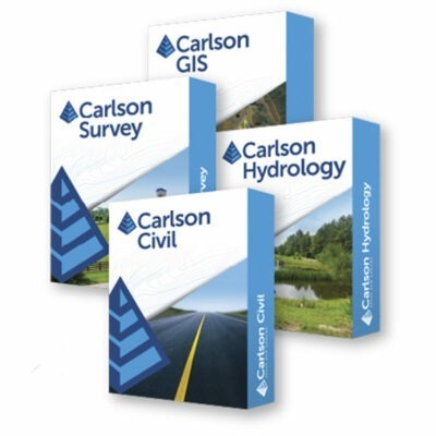
Carlson Hydrology is available as an individual module and is also included in Carlson Civil Suite together with Carlson Civil, Carlson Survey and Carlson GIS. The suite configuration is useful for organisations that handle the complete survey and civil-design workflow rather than drainage alone.
Carlson Survey can process the field survey, Carlson Civil can create roads, sites and grading, Carlson Hydrology can analyse and design the drainage system, and Carlson GIS can manage geospatial attribute information. Because the modules share a CAD-based environment, the same project geometry can continue through several stages of the job.
IntelliCAD and AutoCAD workflow
Carlson Hydrology can run with the IntelliCAD environment supplied with Carlson or on a supported full AutoCAD installation. This gives engineering companies flexibility in how the software is deployed.
Businesses that do not already use AutoCAD can work with the included CAD platform, while companies with an established supported AutoCAD workflow can add Carlson’s hydrology and drainage functions to their existing CAD environment.
Who is Carlson Hydrology for?
Carlson Hydrology is intended primarily for civil engineers, stormwater engineers, drainage designers, land-development consultants and survey engineering companies. It is especially relevant to professionals who already work with terrain models and CAD drawings and want the hydrologic and hydraulic calculations to remain closely connected to that design information.
For smaller engineering offices it can provide a combined CAD and drainage workflow without requiring a separate application for every stage.
Specifications
Carlson Hydrology 2026 Specifications
Software Overview
| Product name | Carlson Hydrology |
|---|---|
| Current release researched | Carlson Hydrology 2026 |
| Product type | Professional hydrologic and hydraulic analysis, drainage design and stormwater network design software |
| Primary applications | Watershed analysis, runoff calculations, storm sewer design, sanitary sewer modeling, detention pond design, culvert design, channel analysis, outlet design and hydraulic network drafting |
| Typical users | Civil engineers, drainage engineers, land development professionals, surveyors, site designers, infrastructure engineers and stormwater professionals |
| Design environment | CAD-based environment using standard polylines, text and layers |
| 3D design integration | Full 3D road, lot and surface designs can feed directly into flow calculations and drainage design |
| Application architecture | 64-bit |
| Standalone module | Yes |
| Civil Suite | Included in Carlson Civil Suite together with Carlson Survey, Civil and GIS |
| Select Suite eligibility | Available as an eligible Carlson Select Suite module |
Primary Hydrology Capabilities
| Site drainage analysis | Supported |
|---|---|
| Watershed analysis | Supported |
| Runoff analysis | Supported |
| Time of concentration | Calculated using multiple supported methods |
| Peak flow calculation | Supported |
| Storm drain design | Supported |
| Storm drain drafting | Supported |
| Detention pond design | Supported |
| Culvert design | Supported |
| Channel analysis | Supported |
| Outlet structure design | Supported |
| Hydrograph routing | Supported |
| Pipe network hydraulic analysis | Supported |
| Multiple rain events | Multiple storm events can be analyzed and reported within applicable workflows |
Runoff Calculation Methods
| Method | Support | Typical Use |
|---|---|---|
| Rational Method | Yes | Peak runoff calculation for drainage and storm sewer design |
| SCS / NRCS Method | Yes | Runoff and hydrograph analysis using curve-number-based hydrology |
| Modified Rational Method | Supported in applicable regional workflows | Peak flow / detention analysis |
| Regional peak-flow methods | Supported where included by Carlson | Region-specific hydrologic calculations |
Rainfall and Storm Events
| Rainfall libraries | Integrated |
|---|---|
| Custom rainfall events | Supported through the Rain Lookup Table |
| NOAA Atlas 14 | Rainfall lookup supported for applicable United States regions |
| SCS rainfall events | Supported |
| SCS triangular storm | Supported |
| Delmarva storm type | Supported |
| Rational rainfall libraries | Supported |
| IDF table import | Rational rainfall IDF data can be imported from comma-separated files |
| User-defined recurrence intervals | Supported in applicable Rational Method workflows |
| Multiple storm-event analysis | Supported |
| Rainfall data validation | Improved rainfall-data checks are included in Carlson 2026 sewer project setup |
Watershed Analysis
| Watershed delineation | Supported from terrain / surface data |
|---|---|
| Watershed area calculation | Supported |
| Watershed Above Points | Calculates drainage areas above selected locations using a grid model |
| Watershed Grid Area | Creates a grid model containing drainage area above each grid node |
| Merge Watersheds | Combines adjacent watershed perimeter polylines |
| Runoff Tracking | Calculates flow paths using terrain / grid models |
| Large watershed optimization | Carlson 2026 can reduce polyline vertices for large watershed areas |
| Surface-based slope | Supported for applicable flow-path calculations |
| 3D flow-line slope | HydroNET can use a 3D flow-line slope without requiring a separate surface prompt |
| USGS soil-area data | Documented tools can download soil-type polygon boundaries for applicable workflows |
Runoff Coefficients and Soil Groups
| Layer-based runoff coefficients | Supported |
|---|---|
| Composite runoff coefficients | Supported |
| SCS Curve Numbers | Supported |
| Hydrologic Soil Group (HSG) | Supported in Carlson 2026 runoff coefficient libraries |
| HSG in time-of-concentration workflow | Supported in applicable Carlson 2026 calculations |
| HSG in peak-flow calculations | Supported |
| HSG in pond design | Supported |
| HSG in HydroNET | Supported |
| Ground-cover / land-use analysis | Supported through runoff coefficient and curve-number workflows |
Time of Concentration
| Time of concentration calculation | Supported |
|---|---|
| SCS TR-55 method | Supported |
| FHWA Kinematic Wave method | Supported |
| Kerby-Kirpich method | Supported |
| Shallow concentrated flow | Supported through applicable SCS TR-55 settings |
| 3D flow-path selection | Flow segments can be generated from a selected 3D polyline |
| Variable flow segments | Flow segments can be created according to user-defined slope-change tolerance |
| Regional methods | Additional documented methods include regional procedures such as LA County and Maricopa County methods |
Hydrograph and Routing Functions
| Runoff hydrograph generation | Supported |
|---|---|
| Hydrograph Editor | Spreadsheet-style editing of time and flow data |
| Hydrograph routing | Supported |
| Channel routing | Supported |
| Pipe routing | Supported |
| Reservoir routing | Supported |
| Muskingum-Cunge | Supported for applicable channel / culvert routing workflows |
| Modified Puls | Supported |
| Clark method | Supported in applicable SCS hydrograph workflows |
| Snyder method | Supported in applicable SCS hydrograph workflows |
| Multiple pipe barrels | Supported in applicable pipe-routing workflows |
| Subtract Hydrograph | Supported |
| Formatted routing reports | Available for applicable hydrograph, pipe, channel and reservoir calculations |
SewerNET and Storm Sewer Design
| SewerNET | Integrated storm / sewer network design environment |
|---|---|
| Storm sewer network modeling | Supported |
| Dynamic pipe / structure network | Supported |
| Network startup wizard | Carlson 2026 includes a startup dialog for initial network settings |
| Design direction | Configurable |
| Automatic pipe connections | Configurable |
| Existing and final surfaces | Carlson 2026 supports two surfaces for sewer design |
| Insert structure onto pipe | Supported |
| Station-based structure insertion | Structures can be inserted by station referenced from upstream or downstream manholes |
| Direct invert entry | Supported in Carlson 2026 SewerNET |
| Pipe line names | Supported |
| Network reset | Remove ALL function can clear / reset a sewer project |
| Erase Network | Supports SewerNET network files |
Sewer Structures
| Manholes | Supported |
|---|---|
| Inlets | Supported |
| Circular inlets | Supported |
| On-grade inlets | Supported |
| Sag inlets | Supported |
| Automatic on-grade / sag determination | Can be determined from the surface in applicable sewer-network workflows |
| Junction structures | Supported |
| Outfalls | Supported |
| Headwalls | Supported |
| Funnel headwall / inlet type | Supported in documented network workflows |
| Inlet control devices | Supported for limiting intercepted flow |
| Underdrain structures | Supported |
| Structure height | Included in Carlson 2026 sewer tables |
Sewer Pipe and Hydraulic Calculations
| Pipe sizing | Supported |
|---|---|
| Pipe material libraries | Integrated |
| Pipe geometry | Stored as part of the sewer network model |
| Hydraulic Grade Line (HGL) | Calculated and reportable |
| Normal depth | Can be displayed in sewer profile workflows |
| Critical depth | Can be displayed in sewer profile workflows |
| Tailwater | Supported; editable from the sewer dock editor for Rational Method calculations in Carlson 2026 |
| Junction losses | Supported |
| Standard junction loss method | Added in Carlson 2026 |
| AASHTO junction loss method | Added in Carlson 2026 |
| HEC-22 energy losses | Supported in documented sewer network calculations |
| Known flows | Can be entered in applicable sanitary / utility network workflows |
Sewer Laterals
| Lateral design | Supported |
|---|---|
| Multiple lateral connections | Supported at applicable manhole structures |
| Lateral cleanouts | Supported |
| T-style cleanout symbol | Added / enhanced in Carlson 2026 |
| Cleanout station | Calculated, stored and reportable |
| Cleanout offset | Calculated, stored and reportable |
| Cleanout depth | Reportable |
| Lateral attribute block labels | Supported at cleanout locations in Carlson 2026 |
| Symbol preview | Available in Carlson 2026 lateral settings |
| Trunk pipe station reference | Downstream structure station and measured distance supported in Carlson 2026 |
| Lateral workflow | Enhanced in Carlson 2026 |
Sewer Plan View and Drafting
| Automatic plan-view drawing | Supported |
|---|---|
| Pipe labels | Supported |
| Structure labels | Supported |
| Flow arrows | Supported |
| Flow-arrow position | Carlson 2026 can position flow arrows above or below pipes |
| Trailing zero control | Available for plan-view labels in Carlson 2026 |
| Pipe dash linetype | User controllable in Carlson 2026 |
| MText labels | Supported |
| MText border offset | Supported in Carlson 2026 |
| Leader tick style | User controllable |
| Pipe line name in layer names | Supported in Carlson 2026 |
| Drainage area labels | Supported |
| Pipe stationing labels | Supported |
Sewer Profiles
| Sewer profile drawing | Supported |
|---|---|
| Sewer Profile Inspector | Added in Carlson 2026 |
| Profile inspector station | Displayed at the cursor |
| Profile inspector elevation | Displayed at the cursor |
| Profile inspector slope | Displayed at the cursor |
| Profile editing | Sewer network geometry can be edited from applicable profile-view workflows |
| Selective profile redraw | Carlson 2026 redraws only profiles affected by modified sewer structures |
| Collision clearance labels | Supported |
| Pipe material labels | Supported |
| Pipe size labels | Supported |
| Inlet type labels | Supported in applicable sewer profile workflows |
Collision and Design Checks
| Pipe collision detection | Supported |
|---|---|
| Horizontal clearance | Checked and reportable |
| Vertical clearance | Checked and reportable |
| Surface collision checking | Supported |
| Multiple network checking | Supported |
| Same-network pipe checking | Supported |
| 3D collision visualization | Conflicts can be represented graphically in 3D |
| Plan-view collision symbols | Supported |
| Collision station / offset | Can be reported relative to a reference centerline |
| Excessive pipe length warning | Supported |
| Insufficient cover warning | Supported |
| Insufficient slope warning | Supported |
| Excessive flow-rate warning | Supported |
Pond Design
| Detention pond design | Supported |
|---|---|
| Bench pond design | Supported |
| Valley pond design | Supported |
| Dynamic pond sizing | Supported |
| Multiple rain events | Supported in detention pond design |
| Existing-condition runoff | Supported |
| Proposed-condition runoff | Supported |
| Required storage | Calculated and reportable |
| Provided storage | Calculated and reportable |
| Target storage at elevation | Supported for applicable bench-pond workflows |
| Pond perimeter editing | Vertices can be added or removed in applicable pond workflows |
| Sloped pond bottom | Supported in applicable bench-pond design workflows |
| Pond exfiltration | Supported |
Stage-Storage and Stage-Discharge
| Stage-storage calculation | Supported |
|---|---|
| Stage-storage curves | Supported |
| Stage-discharge curves | Supported |
| Stage-discharge editing | Integrated with applicable detention pond workflows |
| Stage-storage / discharge editor | Supported |
| Spillway data | Can be included in applicable stage-storage curve workflows |
| Cleanout data | Can be included in applicable stage-storage workflows |
| Report Formatter | Supported for applicable stage-storage / discharge reports |
| Excel output | Supported for applicable stage-storage / discharge data |
Outlet Structure Design
| Orifice design | Supported |
|---|---|
| Horizontal orifice | Added / enhanced in Carlson 2026 |
| Headwater from flow | Can be calculated in applicable orifice workflows |
| Advanced weir design | Supported |
| Weir graphical preview | Supported |
| Drop pipe spillway | Supported |
| Multiple drop pipes | Added / enhanced in Carlson 2026 |
| Rectangular risers | Supported |
| Entrance-loss coefficient library | Supported for applicable drop-pipe spillway calculations |
| Multiple outlet design | Supported |
| Outlet stage-discharge graph | Supported |
| Outlet PDF report | Supported for applicable design routines |
Culvert Design
| Pipe culvert design | Supported |
|---|---|
| HY-8 method | Supported |
| Nominal HW/D design method | Supported |
| Inlet control | Supported |
| Outlet control | Supported |
| Gradually varied flow outlet control | Supported |
| Tailwater by channel | Supported |
| Tailwater by discharge rating | Supported |
| Overtopping analysis | Supported |
| Multiple barrels | Supported in applicable culvert / routing workflows |
| HGL graph | Supported |
| Stage-discharge graph | Supported |
| HY-8 PDF report | Supported |
Channel Design and Analysis
| Open-channel analysis | Supported |
|---|---|
| Channel flow calculations | Supported |
| Channel flow depth | Calculated from channel and liner parameters |
| Channel Lining Analysis | Supported |
| Channel routing | Supported |
| Manning parameters | Supported |
| Overland sheet-flow Manning's n library | Supported |
| 3D channel / surface integration | Compatible terrain and design geometry can be used in hydraulic workflows |
HydroNET
| HydroNET | Integrated hydrologic / hydraulic network analysis environment |
|---|---|
| Watershed integration | Supported |
| Structure and pipe network integration | Supported |
| Multiple rain-event reporting | Supported |
| Circular pipe reach | Supported |
| Culvert links | Supported |
| Clark hydrograph | Supported in applicable HydroNET workflows |
| Snyder hydrograph | Supported in applicable HydroNET workflows |
| Rational Method | Supported |
| Hydrologic Soil Group | Supported in Carlson 2026 calculations |
| 3D flow-line slopes | Supported |
HydroCAD Integration
| HydroCAD integration | Supported |
|---|---|
| Primary integration purpose | Transfer CAD-derived hydrology and stormwater data between Carlson Hydrology and HydroCAD workflows |
| HydroNET exchange | Import / export integration with HydroCAD is documented |
| Runoff data preparation | DTM- and layer-based Carlson calculations can be used to reduce manual HydroCAD data entry |
| Rainfall libraries | HydroCAD rainfall resources can be used through an applicable HydroCAD workflow |
| Stormwater chamber data | Applicable HydroCAD chamber specifications can be used in integrated workflows |
| HydroCAD license | HydroCAD is a separate third-party application and is not included with Carlson Hydrology unless specifically supplied separately |
EPA SWMM Integration
| EPA SWMM support | Supported |
|---|---|
| SWMM project creation | A Carlson sewer network can be used to create an EPA SWMM project |
| SWMM processing | Supported through applicable Carlson Hydrology workflows |
| HydroNET SWMM engine | EPA SWMM processing is supported in applicable HydroNET workflows |
| Subcatchment / drainage modeling | Compatible sewer and watershed information can be transferred for SWMM analysis |
HEC-RAS Integration
| HEC-RAS integration | Supported |
|---|---|
| Cross-section input | Supported |
| HEC-RAS processing workflow | Integrated command supports preparing, processing and returning applicable information to the Carlson drawing |
| Multiple cross-section skews | Supported in documented Carlson Hydrology workflows |
| HEC-RAS software | External HEC-RAS components / installation may be required according to the workflow used |
Sanitary and Utility Networks
| Sanitary sewer networks | Supported |
|---|---|
| Known sanitary flows | Can be entered and labeled |
| Utility network definition | Supported |
| Utility types | Can be included in applicable collision reports |
| Utility ordering rules | Supported in applicable collision / network workflows |
| Pipe data on 3D polylines | Supported |
| Import network from 3D polylines | Supported |
| Network-wide parameter assignment | Supported |
| Network elevation transformation | Supported |
Sewer Network Libraries
| Rainfall libraries | Integrated |
|---|---|
| Pipe libraries | Integrated |
| Structure libraries | Integrated |
| Inlet libraries | Integrated |
| Manhole libraries | Integrated |
| Outlet libraries | Integrated |
| Custom library fields | User-defined fields can be added to applicable pipe, structure and inlet libraries |
| Custom fields in reports | Supported in applicable sewer-network reports |
| Regional library data | Some Carlson installations include regional pipe / rainfall library data; exact libraries depend on software release and region |
Reports and Tables
| Sewer network reports | Supported |
|---|---|
| Sewer data tables | Supported |
| Drainage area fields | Supported in applicable network tables |
| Gutter spread fields | Supported |
| Bypass flow fields | Supported |
| Multiple invert-in reporting | Supported |
| HGL report | Supported |
| Junction loss information | Included in Carlson 2026 HGL reports |
| Lateral report | Supported |
| Cleanout station / offset / depth | Reportable in Carlson 2026 |
| PDF reports | Supported by applicable Hydrology routines |
| PDF report templates | Supported for applicable sewer reports |
| Report Formatter | Supported by applicable hydrologic and hydraulic routines |
| Excel output | Supported by applicable commands |
CAD and Surface Integration
| CAD entities | Uses conventional polylines, text, layers and other standard CAD objects |
|---|---|
| TIN surfaces | Supported in applicable terrain and drainage workflows |
| Grid surfaces | Supported in watershed and runoff workflows |
| 3D polylines | Supported for flow paths, pipe data and terrain interaction |
| Road design integration | Compatible Carlson road surfaces can feed drainage calculations |
| Lot design integration | Compatible Carlson lot / site data can feed drainage calculations |
| Existing ground surface | Supported |
| Final design surface | Supported simultaneously in Carlson 2026 sewer design |
Data and Model Files
| Sewer network model | SEW file |
|---|---|
| Network model data | Applicable sewer-network data is stored within the SEW model |
| Stage-storage file | CAP format supported |
| Carlson stage-storage format | Supported |
| SEDCAD stage-storage formats | SEDCAD 3 and SEDCAD 4 formats documented as supported options |
| Pond exfiltration settings | Can be saved / loaded through applicable PDX files |
| Drop pipe settings | Can be saved / loaded through applicable DROP files |
| Weir settings | Can be saved / loaded through applicable WEIR files |
| Outlet settings | Can be saved / loaded through applicable outlet parameter files |
External Sewer Model Interoperability
| HydroCAD | Integrated import / export workflow |
|---|---|
| EPA SWMM | Project creation and processing supported |
| HEC-RAS | Integrated cross-section and processing workflow |
| Bentley sewer models | Import from applicable SDB files is documented |
| 3D polyline network import | Supported |
| Text-based sewer import | Supports multiple documented input fields |
Current Carlson 2026 Enhancements
| SewerNET startup dialog | Added for initial new-network settings |
|---|---|
| SewerNET settings interface | Reorganized for easier access to design direction and automatic pipe connection options |
| Insert structure onto pipe | Added / enhanced |
| Dual-surface sewer design | Existing and final surfaces supported |
| Sewer Profile Inspector | New command |
| Junction loss methods | Standard Loss and AASHTO methods added |
| Lateral design workflow | Enhanced |
| Lateral cleanout data | Station, offset and depth processing / reporting enhanced |
| Attribute block lateral labels | Added |
| Rainfall data checks | Improved |
| Sewer profile drawing / labeling | Improved |
| Tailwater editing | Added to the Rational Method sewer dock editor |
| HGL reporting | Updated for new junction-loss data |
| Horizontal orifice design | Added / enhanced |
| Multiple drop pipe design | Added / enhanced |
| Pond design | Updated |
| HydroNET | Updated |
| Hydrologic Soil Group support | Added to runoff coefficient library and applicable Tc, peak flow, pond and HydroNET calculations |
Current CAD Platform Compatibility
| CAD Platform | Carlson Hydrology 2026 Compatibility | License Requirement |
|---|---|---|
| IntelliCAD 13.1 | Supported | Included with applicable Carlson Hydrology configuration |
| IntelliCAD 12.1 | Supported | Included with applicable Carlson Hydrology configuration |
| AutoCAD 2019–2026 | Supported | Separate compatible Autodesk license required |
| AutoCAD Map 2019–2026 | Supported | Separate compatible Autodesk license required |
| Civil 3D 2019–2026 | Supported | Separate compatible Autodesk license required |
System Requirements – Carlson 2026 with IntelliCAD 13.1
| Component | Minimum / Supported | Recommended |
|---|---|---|
| Operating system | 64-bit Windows 8.1, Windows 10 or Windows 11 | Current supported 64-bit Windows 10 or Windows 11 environment |
| Processor | Intel Core i5, AMD equivalent or better | Intel Core i7 / i9, AMD Ryzen 7 / 9 or comparable processor with strong single-thread performance |
| RAM | 8 GB | 16 GB or more |
| Graphics API | OpenGL 1.4 or higher compatible graphics hardware | Desktop-class discrete graphics card |
| Graphics hardware | Compatible integrated or discrete GPU | Discrete NVIDIA graphics preferred by Carlson for consistent driver support; compatible discrete AMD graphics also supported |
| Additional Carlson disk space | Allow approximately 750 MB above the requirements of the selected CAD platform | SSD with sufficient additional space for drawings, surface models and project data |
| Application architecture | 64-bit | 64-bit |
Current Carlson 2026 Installation
| Current full installer researched | Carlson 2026 64-bit CAD products installer |
|---|---|
| Installer date researched | July 30, 2026 |
| Full installer size | Approximately 3.01 GB |
| Hydrology module included in installer | Yes |
| Runtime availability | Hydrology functionality is controlled by the Carlson license purchased |
| 32-bit Windows | Not supported |
| Windows 8 and older | Not supported by the current Carlson 2026 installer; Windows 8.1 remains listed as supported for IntelliCAD 13.1 |
Carlson Civil Suite Integration
| Module | Integration with Carlson Hydrology |
|---|---|
| Carlson Civil | Road, site, lot and surface designs can feed directly into drainage and stormwater calculations |
| Carlson Survey | Survey and terrain data can provide existing ground information for hydrologic and hydraulic design |
| Carlson GIS | GIS, imagery, terrain and soil information can support preliminary drainage and watershed workflows |
| Carlson Hydrology | Provides the dedicated runoff, pond, channel, culvert and pipe-network analysis functions within Civil Suite |
Typical Engineering Workflows
| Workflow | Support | Primary Function |
|---|---|---|
| Site drainage design | Yes | Calculate runoff and create drainage infrastructure for site-development projects |
| Watershed delineation | Yes | Determine drainage areas and flow paths from terrain data |
| Storm sewer design | Yes | Design and hydraulically analyze structures, pipes and outlets |
| Sanitary sewer layout | Yes | Create and document applicable sanitary sewer networks |
| Detention pond sizing | Yes | Compare pre- and post-development runoff and calculate required storage |
| Culvert design | Yes | Evaluate headwater, tailwater, inlet / outlet control and overtopping |
| Open-channel analysis | Yes | Calculate flow, depth, routing and channel lining requirements |
| Pipe conflict analysis | Yes | Detect horizontal and vertical clearance problems |
| HydroCAD workflow | Yes | Exchange stormwater data with HydroCAD |
| EPA SWMM workflow | Yes | Create and process applicable SWMM network projects |
| HEC-RAS workflow | Yes | Prepare and process applicable hydraulic cross-section data |
| Plan and profile production | Yes | Create conventional CAD deliverables for drainage and sewer systems |
Carlson Hydrology vs. Carlson P3D Hydro
| Specification | Carlson Hydrology | Carlson P3D Hydro |
|---|---|---|
| Primary environment | Traditional CAD environment | Interactive dedicated 3D engineering environment |
| Primary focus | Hydrologic / hydraulic calculation, sewer network design, plan/profile drafting and reporting | Visual 3D drainage, culvert, channel and storm sewer design |
| Storm sewer design | Yes | Yes |
| Pond / runoff calculations | Extensive | Surface-driven 3D hydrology workflow |
| CAD deliverables | Native CAD plan, profile, labels and reports | Can transfer designs to CAD using compatible workflows |
| Product relationship | Dedicated Carlson CAD-based Hydrology module | Separate Carlson Precision 3D Hydro product |
Specifications and package contents may vary by configuration, region or manufacturer update. Always check the current configuration before ordering.
Reviews (0)
Only logged in customers who have purchased this product may leave a review.
FAQ
Carlson Hydrology FAQ
Carlson Hydrology & Applications
What is Carlson Hydrology?
Carlson Hydrology is CAD-based hydrologic and hydraulic design software for analysing stormwater runoff and designing drainage systems. It provides tools for watershed analysis, runoff calculations, storm sewer networks, detention ponds, culverts, channels, outlets and related hydraulic structures within a familiar CAD environment.
Who is Carlson Hydrology designed for?
Carlson Hydrology is designed for civil engineers, drainage engineers, land development professionals, municipalities, consultants, contractors and other professionals responsible for stormwater analysis, site drainage and hydraulic infrastructure design.
What types of projects can Carlson Hydrology be used for?
Typical applications include residential and commercial site drainage, subdivisions, roads, parking areas, industrial sites, storm sewer systems, detention and retention facilities, culvert crossings, open channels and other land-development projects where stormwater must be calculated, collected, conveyed or detained.
Is Carlson Hydrology hydrology software, hydraulic design software or both?
It provides both hydrologic and hydraulic capabilities. Hydrologic tools calculate rainfall runoff, watershed characteristics, time of concentration and peak flows, while hydraulic tools are used to design and analyse infrastructure such as storm sewer pipes, inlets, manholes, channels, culverts, ponds and outlets.
Is Carlson Hydrology included in Carlson Civil Suite?
Yes. Carlson Hydrology is one of the four main modules in Carlson Civil Suite together with Carlson Civil, Carlson Survey and Carlson GIS. It can also be licensed as an individual Carlson module when the complete Civil Suite is not required.
Does Carlson Hydrology require AutoCAD?
No. Carlson Hydrology can run with the IntelliCAD platform included with Carlson's CAD-based software, so a separate AutoCAD licence is not required. It can also be installed on a compatible separately licensed version of full AutoCAD when an AutoCAD-based workflow is preferred.
Watersheds, Runoff & Rainfall Analysis
Which runoff calculation methods does Carlson Hydrology support?
Carlson Hydrology supports site drainage calculations using methods including the Rational Method and SCS methodology. This allows engineers to select an approach appropriate for the watershed, project requirements and applicable design standards.
Can Carlson Hydrology automatically calculate watershed areas?
Yes. Watersheds can be delineated using terrain and surface information so drainage areas can be determined from the site's topography. The resulting watershed boundaries can then be used in runoff and drainage calculations.
Can Carlson Hydrology calculate time of concentration and peak flow?
Yes. Runoff analysis tools can determine watershed area, time of concentration and peak flow rates. These calculated flows can then be used when sizing downstream drainage structures such as inlets, storm sewers, culverts, channels and detention facilities.
Can runoff coefficients be calculated from land-use information?
Yes. Carlson Hydrology can use CAD layers representing different land-use or ground-cover areas to help calculate composite runoff values. This can automate the calculation of Rational Method C values or SCS Curve Numbers within a watershed containing several surface types.
Can Carlson Hydrology analyse different storm events?
Yes. Different rainfall events can be defined and analysed so designers can evaluate how a drainage system performs under varying storm conditions. Carlson also provides functionality for running multiple rainfall events through a drainage system, which helps compare performance across different design storms.
Does Carlson Hydrology include rainfall and drainage libraries?
Yes. Carlson Hydrology includes libraries for hydrologic and hydraulic design information such as rainfall data, inlets, manholes and outlet structures. Library items can help standardise commonly used design components and reduce repetitive data entry across projects.
Storm Sewers, Culverts, Channels & Ponds
Can Carlson Hydrology design storm sewer systems?
Yes. Storm sewer design and drafting are core Carlson Hydrology functions. Users can create networks containing structures and pipes, calculate flows through the network, size components and produce plan and profile information for the proposed drainage system.
What is HydroNet in Carlson Hydrology?
HydroNet is Carlson's network-based environment for working with connected drainage structures and pipes. It allows components of a stormwater system to be organised and analysed as a connected network so changes in flows, structures or pipe properties can be evaluated throughout the system.
Can Carlson Hydrology automatically size storm sewer pipes?
Yes. Carlson Hydrology includes automated pipe-sizing tools as well as options for testing alternative designs. Engineers can evaluate different pipe sizes and system configurations while considering calculated flows and hydraulic requirements.
Can Carlson Hydrology detect problems in a drainage design?
Yes. The software can provide warnings for potential design problems including pipe or structure collisions, excessive pipe lengths, insufficient cover, inadequate slope and excessive flow rates. These checks help identify issues before the drainage design is finalised.
Can Carlson Hydrology design culverts and open channels?
Yes. Carlson Hydrology includes tools for culvert, channel and outlet design and sizing. These features can be combined with watershed and runoff calculations so the structures are designed using the flows generated by the surrounding drainage area.
Can Carlson Hydrology design detention ponds?
Yes. Carlson Hydrology provides pond design and sizing tools for controlling stormwater runoff. Pond design can use terrain models and calculated inflow, and Carlson workflows support analysis of stage-storage relationships, hydrographs, outlet structures and spillways.
Can Carlson Hydrology compare pre-development and post-development runoff?
Yes. Existing and proposed site conditions can be analysed separately so engineers can compare runoff before and after development. The results can then be used when designing detention facilities and outlet structures intended to control post-development discharge.
CAD, HydroCAD, 3D Design & Workflow
Does Carlson Hydrology integrate with HydroCAD?
Yes. Carlson Hydrology is designed to work closely with HydroCAD. Carlson can use CAD-based terrain, watershed, soil and ground-cover information to prepare hydrologic data, while HydroCAD can provide additional stormwater modelling and routing capabilities. HydroNet workflows also support data exchange with HydroCAD.
Why use Carlson Hydrology together with HydroCAD?
Carlson Hydrology is particularly useful for extracting design information directly from CAD drawings and terrain models, including watershed geometry and land-cover information. HydroCAD can then be used for additional hydrologic modelling and specialised stormwater analysis, reducing the need to manually re-enter project data between CAD and hydrology workflows.
Can Carlson Hydrology work directly with terrain surfaces?
Yes. Terrain models can be used for watershed delineation, drainage analysis and the design of structures that interact with the site's topography. When Carlson Hydrology is used with Carlson Civil, proposed roads, lots and site grading can also feed directly into runoff and drainage design workflows.
Can drainage systems be viewed in 3D?
Yes. Carlson Hydrology supports 3D drainage workflows so pipes, structures and other system components can be reviewed relative to the terrain and surrounding design. Three-dimensional inspection can help identify conflicts, insufficient cover and other spatial problems that may be less obvious in plan view.
Can Carlson Hydrology create storm sewer plan and profile drawings?
Yes. Storm sewer networks can be represented in conventional CAD plan and profile drawings in addition to 3D views. This allows hydraulic design information to be incorporated into engineering drawings and construction documentation without rebuilding the drainage system in separate drafting software.
Can Carlson Hydrology be used together with Carlson Civil, Survey and GIS?
Yes. Carlson Hydrology shares the same CAD-based project environment as Carlson Civil, Survey and GIS. Surveyed terrain can be used to establish existing conditions, Carlson Civil designs can provide proposed grading and road information, GIS data can supply land-use or soil information, and Hydrology can then use these inputs for drainage analysis and stormwater design.
What computer and CAD platform are required for Carlson Hydrology?
Current Carlson Hydrology releases are designed for 64-bit Windows computers. The software can run with the included IntelliCAD platform or on supported versions of full AutoCAD. The Carlson 2026 release supports AutoCAD 2019 through 2026 and Windows 11. A modern 64-bit processor, sufficient RAM and suitable graphics hardware are recommended, particularly when working with large terrain models and complex drainage networks.

 GPS & GNSS
 Total Stations
 Data collectors
 Software
 Correction services
 Machine control
 External radio
 Marine
 Accessories
Reviews
There are no reviews yet