


 GPS & GNSS
 Lidar scanning
 Total Station

South NS30 Robotic Total Station for Surveying and Layout
Get the best price for your setup
Contact our experts for the best possible price and configuration.
- Fast response
- Expert configuration advice
- No overpaying for features you do not need
The South NS30 is a robotic total station built for one-person surveying, construction layout, engineering set-out, topographic work, and site monitoring. Its 1″ angular accuracy, long-range EDM, reflectorless measurement, and motorized operation support precise fieldwork across building sites, roads, bridges, utilities, and civil projects. Prism Search, Auto Prism Recognition, and LocknTRack help the operator locate, aim at, and follow a prism from a compatible controller, reducing the need for a second person at the instrument. With Android 11, onboard Survey Star software, touchscreen controls, and multiple data-transfer options, the South NS30 fits professional workflows and can complement RTK GNSS equipment where line-of-sight measurements are required.
South NS30 Highlights
| Angular accuracy | 1″ |
|---|---|
| Distance range | 3,500 m with prism; 1,000 m reflectorless |
| Robotic functions | Prism Search, Auto Prism Recognition, LocknTRack |
| Field software | Android 11 with onboard Survey Star |
| Environmental protection | IP55; operating range -20°C to +50°C |
Valued customers:










Find RTK Networks
Search NTRIP providers and connect to reliable RTK correction services.
Description
South NS30 Robotic Total Station for One-Person Surveying
The South NS30 is a robotic total station designed for surveyors, construction crews, engineers, GIS professionals, and field teams that need accurate angle and distance measurements with less dependence on a second operator. It combines a high-precision total station, motorized positioning, prism search, automatic prism recognition, target tracking, onboard Android software, and remote controller operation in one field-ready instrument.
For construction layout, topographic surveying, engineering measurement, monitoring, road and rail work, bridge and tunnel projects, and CAD-based stakeout, the NS30 gives crews a practical way to measure and set out points while moving efficiently around the jobsite. Its robotic workflow allows the instrument to be controlled remotely from a compatible controller, helping one person complete tasks that traditionally required an instrument operator and a rod person working together.
Accurate angle and distance measurement for demanding fieldwork
The South NS30 is available with high angular accuracy, including a 1-second configuration and optional higher-accuracy versions depending on the selected instrument package. In practical terms, this level of angular precision helps surveyors maintain reliable control when setting building corners, checking structural positions, measuring alignments, establishing centerlines, or monitoring movement over time.
Its electronic distance measurement system can measure to a standard prism over distances of up to 3,500 meters under suitable conditions. Reflectorless measurement is available for targets up to 1,000 meters in favorable conditions, although practical range depends on the surface, weather, visibility, angle of incidence, and atmospheric conditions. Reflectorless capability is useful when a prism cannot be safely or conveniently placed, such as when checking walls, façades, inaccessible structures, stockpiles, rock faces, or other fixed surfaces.
Prism measurements are specified with accuracy of approximately ±(1 mm + 1 ppm), while reflectorless accuracy varies by distance and measurement conditions. These figures are useful for professional surveying and construction work, but field teams should always consider setup quality, prism constant, instrument calibration, atmospheric corrections, line-of-sight conditions, and site procedures when evaluating achievable results.
Robotic operation that supports one-person surveying
The main advantage of the NS30 is its robotic workflow. Instead of requiring one person to remain at the instrument while another carries the prism, a compatible remote controller can be used to operate the total station from the prism pole. The operator can move around the site while controlling the instrument, starting measurements, recording points, checking results, and performing stakeout operations from the working position.
The NS30 uses motorized positioning with a direct worm-and-gear drive system. The motorization is designed to provide controlled instrument movement for automated prism search, target recognition, tracking, and remote operation. The instrument can rotate quickly between points, which helps reduce time spent manually turning and sighting the telescope during repetitive layout or data collection work.
For crews working on active construction sites, one-person operation can make it easier to measure more points in a day, reduce coordination between crew members, and keep the surveyor closer to the work area. It can also be useful when site access is limited, when the instrument must remain positioned over a known control point, or when the rod person needs to work independently around structures, forms, foundations, roads, and utilities.
Prism search, automatic recognition, and LocknTRack tracking
The NS30 includes several automated target functions intended to reduce the time required to find and follow a prism. Its prism search system can scan for a target within a working range of approximately 3 to 300 meters, depending on site conditions and configuration. Once the prism is found, the instrument can aim toward it and continue with the measurement workflow.
Automatic prism recognition can identify a compatible prism at longer distances, with a stated recognition range of up to 1,200 meters in suitable line-of-sight conditions. This is particularly useful on large sites, open earthwork projects, road corridors, industrial facilities, and structural projects where the prism may be located far from the instrument.
LocknTRack is designed to keep the total station locked onto a moving prism so the operator can continue collecting or setting out points without repeatedly stopping to re-sight the target. In construction layout, this can help when moving between multiple design points. In surveying, it can support more efficient detail collection and control checks. Tracking performance can be affected by obstructions, passing equipment, reflective surfaces, severe weather, crowded jobsites, and the way the prism is held or moved.
Built for construction layout, stakeout, and engineering measurement
The South NS30 is well suited to construction professionals who need to transfer design information from plans or CAD files into the field. It can support the layout of building corners, grid lines, anchor bolts, foundations, columns, walls, piles, roads, curbs, utilities, machine bases, and other project elements that require precise positioning.
CAD stakeout tools help the operator work from digital design information rather than relying only on handwritten point lists. Depending on the field software and project workflow, crews can work with points, lines, surfaces, layers, and drawing information to identify where a feature belongs and guide the rod person to the correct position. This is useful when working with detailed building plans, roadway alignments, site grading information, structural drawings, and infrastructure designs.
For engineering teams, the NS30 can be used to check as-built conditions, verify construction tolerances, measure elevations and offsets, inspect façades, confirm alignment, and document installed features. It can also support deformation and displacement monitoring applications where repeated measurements are required and stable observation procedures are followed.
Survey Star software and a map-driven field workflow
The NS30 includes onboard field software built around common total station tasks such as job creation, station setup, known-point orientation, resection, backsight checks, data collection, prism search, automatic prism recognition, LocknTRack operation, point stakeout, and CAD stakeout.
The map-driven workflow is intended to make field decisions easier to visualize. Instead of working only from numerical readings, the operator can use a graphical map view to review points, codes, layers, and drawing information while moving through the job. This can be helpful for new field staff, mixed-experience crews, and projects where the relationship between measured points and the surrounding site is important.
The software also supports point coding and data organization for mapping and survey work. Proper coding can make it easier to separate features such as curbs, buildings, utilities, fences, drainage structures, road edges, trees, and control points during collection and later office processing. The exact data formats and compatibility should be confirmed against the software used by your organization before purchasing.
Android interface with practical field connectivity
The NS30 uses an Android operating system with a color touchscreen and physical shortcut keys. The touchscreen provides access to menus, maps, measurement settings, job files, and field applications, while the numeric keypad and dedicated keys can be useful when working with gloves or when a fast, tactile input method is preferred.
With internal memory, removable storage support, USB Type-C connectivity, RS-232, Bluetooth, wireless networking, and cellular connectivity on applicable configurations, the instrument is designed to work as part of a broader digital surveying workflow. Data can be transferred using wired connections, removable media, or wireless communication depending on the jobsite and office requirements.
The Android platform also gives the NS30 a more familiar interface for users who already work with mobile field controllers and Android-based survey applications. It can be used with compatible external devices such as controllers, tablets, smartphones, and other field equipment. Connectivity range and supported functions depend on the communication mode, local interference, physical obstructions, software compatibility, and the selected system configuration.
Useful alongside RTK GNSS equipment
The South NS30 is a total station, not an RTK GNSS receiver. It measures angles and distances using a telescope, electronic angle encoders, and an EDM system, so it does not require satellite visibility for every measurement. This makes it valuable in locations where GNSS signals are obstructed or unreliable, including building interiors, urban canyons, beneath structures, near dense tree cover, around bridges, and close to tall equipment or walls.
For many modern survey and construction teams, the most efficient workflow is not choosing between a total station and RTK GNSS, but using both technologies where each performs best. RTK GNSS can quickly establish control, collect open-site points, and provide coordinate positioning over broad areas. The NS30 can then be used for precise layout, line-of-sight measurements, indoor work, structural positioning, and areas where satellite reception is limited.
The NS30 can also be used in workflows that combine total station and RTK equipment through compatible South software and field controllers. A crew may use GNSS to establish or check the station position, then switch to robotic total station measurements when the work moves under cover or into an obstructed area. This combination can be particularly useful for contractors, survey companies, drone mapping teams, and GIS crews that need both wide-area positioning and precise site-level layout.
Applications across surveying and construction industries
The NS30 can serve a wide range of field applications. Land surveyors can use it for boundary support, topographic detail, control surveys, construction surveys, and data collection. Construction crews can use it for building layout, foundation work, structural positioning, elevation transfer, and as-built verification. Civil engineering teams can apply it to road, rail, bridge, tunnel, drainage, earthwork, and utility projects.
GIS and mapping professionals may use the instrument when line-of-sight measurements are needed to supplement GNSS data or when collecting detailed features in areas with limited satellite visibility. Drone pilots and photogrammetry teams can use a robotic total station to establish ground control, check targets, verify elevations, or complete site measurements that are difficult to obtain from aerial data alone.
Monitoring teams may also use the NS30 for repeated observations of selected points on structures, slopes, retaining walls, bridges, industrial facilities, and other assets. Automated target recognition, robotic aiming, and remote data collection can help organize recurring measurement tasks, but monitoring results still depend on a carefully designed control network, stable instrument setup, consistent observation methods, and appropriate analysis software.
Designed for field conditions
The NS30 is specified for operation in temperatures from approximately -20°C to 50°C and storage from approximately -40°C to 70°C. Its IP55 protection rating helps protect the instrument against dust and water exposure encountered in normal outdoor fieldwork. As with any precision optical instrument, it should be protected from prolonged heavy rain, standing water, impact, extreme contamination, and improper storage.
A built-in red laser plummet helps the operator center the instrument over a ground point during setup. The telescope provides 30x magnification with a 45 mm objective aperture, supporting clear sighting of prisms and targets across typical construction and survey distances. The instrument weighs approximately 7 kg with the battery and tribrach included, making it substantial enough for professional use while remaining practical to transport between setups.
The rechargeable battery is rated at 5,400 mAh, with operating time specified at up to approximately six hours depending on temperature, communication activity, screen use, motorization, measurement mode, and battery condition. Crews working full days should plan for spare batteries or a suitable charging routine, especially when operating the robotic functions continuously.
Why choose the South NS30?
- Robotic one-person workflow for surveying and construction layout.
- High-precision angular measurement with long-range prism and reflectorless EDM capability.
- Prism search, automatic prism recognition, and LocknTRack target tracking.
- Onboard Android software with point collection, station setup, stakeout, and CAD workflow tools.
- Remote operation using a compatible controller and long-range communication options.
- Useful as a complement to RTK GNSS equipment on mixed indoor, outdoor, and obstructed sites.
The NS30 is a practical choice for organizations that want robotic total station capability without limiting themselves to a single type of fieldwork. It can support routine surveying, detailed construction layout, engineering checks, and larger projects where automation and digital data handling are important. Its greatest value comes from combining accurate measurement with a workflow that allows the operator to stay mobile and work directly from the point being measured or set out.
Support from Global GPS Systems
Global GPS Systems can help buyers evaluate whether the South NS30 is the right fit for their projects and compare it with other robotic total stations, manual total stations, RTK GNSS receivers, data collectors, prisms, tripods, and field software. The correct configuration depends on the required angular accuracy, control method, communication range, prism type, software workflow, jobsite conditions, and the experience of the field crew.
For surveyors, contractors, engineers, GIS users, drone mapping teams, and construction professionals who need accurate measurements with a more efficient one-person workflow, the South NS30 offers a capable combination of robotic operation, automated target handling, digital stakeout tools, and flexible connectivity for modern fieldwork.
Specifications
South NS30 Specifications
Product Overview
| Brand | SOUTH |
|---|---|
| Model | NS30 |
| Product type | Robotic total station |
| Primary operating mode | One-person robotic surveying and construction layout |
| Typical users | Land surveyors, construction layout crews, civil engineers, survey technicians, contractors, road and rail teams, bridge and tunnel crews, utility contractors, and monitoring specialists |
| Typical applications | Topographic surveying, boundary and engineering surveys, construction stake-out, CAD layout, road and railway construction, bridge and tunnel work, building layout, utility layout, as-built documentation, deformation monitoring, and point collection |
| GNSS receiver | No; the NS30 is a robotic total station and can be combined with RTK GNSS equipment in integrated surveying workflows |
Angle Measurement
| Angular accuracy | 1″ standard configuration; 0.5″ and 1″ accuracy options are published for different configurations |
|---|---|
| Angle measurement method | Absolute, continuous, four-quadrant measurement |
| Angle reading system | Absolute encoder system |
| Minimum angle reading | 1″ |
| Display resolution | 1″ or 0.1″, depending on configuration and software settings |
| Angle units | Degrees, gons and mils |
| Degree format | 360° |
| Gon format | 400 gon |
| Mil format | 6,400 mil |
| Encoder disk diameter | 79 mm |
| Compensator type | Dual-axis liquid photoelectric compensator |
| Compensator range | ±1′ in the published NS30 product specifications; some documentation lists a wider vial or sensor range depending on configuration |
| Compensator accuracy | 1″ |
| Compensation modes | Single-axis, dual-axis or compensator-off modes, depending on field settings |
Electronic Distance Measurement
| EDM laser class | Class 3R visible red laser |
|---|---|
| Laser wavelength | 635 nm red laser |
| Prism measuring range | Up to 3,500 m under suitable atmospheric and target conditions |
| Reflectorless measuring range | Up to 1,000 m; some lower-accuracy configurations may specify a shorter range |
| Prism distance accuracy | ±(1 mm + 1 ppm × D) |
| Reflectorless accuracy below 500 m | ±(2 mm + 2 ppm × D) |
| Reflectorless accuracy above 500 m | ±(5 mm + 2 ppm × D) |
| Prism fine measurement time | Approximately 0.3 seconds |
| Prism tracking measurement time | Approximately 0.1 seconds |
| Reflectorless measurement time | Approximately 0.3–3 seconds |
| Minimum distance reading | 1 mm; 0.1 mm display resolution may be available depending on configuration |
| Distance units | Metres, US survey feet and international feet |
| Reflectorless reference target | Published reflectorless specifications are referenced to a white Kodak Gray Card with approximately 90% reflectivity |
| Measurement conditions | Published ranges and accuracies depend on atmospheric conditions, target reflectivity, visibility, prism type and measurement mode |
Robotic Operation and Target Tracking
| Motor type | DC servo motor |
|---|---|
| Motor drive system | HyperDrive direct motor system using worm-and-gear technology |
| Motor positioning accuracy | Published as less than 1″ for the worm-and-gear motor system |
| Maximum rotation speed | 60° per second |
| Face 1 to Face 2 rotation time | Approximately 2.9 seconds |
| Prism Search | Automatic search, aiming and acquisition of a prism target |
| Prism Search range | Approximately 3–300 m |
| Prism Search coverage | Horizontal: 360°; vertical: ±18° |
| Auto Prism Recognition | Automatic prism recognition and aiming toward the prism centre |
| Auto Prism Recognition range | Approximately 3–1,200 m line of sight |
| Auto Prism Recognition time | Approximately 3–5 seconds |
| Auto Prism Recognition search time | Typically approximately 3.5 seconds per 90° search sector |
| LocknTRack | Locks onto and tracks a moving prism for robotic measurement and stake-out |
| LocknTRack range | Published range varies by configuration; approximately 3–600 m is specified in manufacturer documentation |
| Search window | Customisable search window |
| Prism recognition performance | Published best-case recognition accuracy is up to approximately 15 cm at 100 m under difficult conditions |
| Robotic operating modes | Manual aiming, Auto Prism Recognition, LocknTRack and Prism Search |
Remote Control and Communication
| Remote control workflow | One-person operation from a compatible controller or prism pole |
|---|---|
| Long-range communication | Zigbee long-range communication supported with compatible South controllers |
| Published Zigbee control range | Up to approximately 450–600 m depending on controller, antenna, firmware, environment and configuration |
| Bluetooth | Supported for short-range control and file transfer |
| Long-range Bluetooth | Up to approximately 300 m is listed in the product brochure for compatible configurations |
| Wireless networking | WLAN support |
| Mobile network | 4G network connectivity through Micro SIM, depending on region and configuration |
| Serial interface | RS232 |
| USB interface | USB Type-C with OTG support |
| Memory card interface | TF or Micro SD card support |
| External device compatibility | Compatible controllers, tablets, smartphones and other supported field devices |
Telescope and Optical System
| Telescope image | Erect |
|---|---|
| Magnification | 30× |
| Objective aperture | 45 mm |
| EDM effective aperture | 50 mm |
| Telescope tube length | 154 mm |
| Field of view | 1°30′ |
| Resolving power | 3″ |
| Minimum focusing distance | 1.2 m |
| Reticle illumination | Five adjustable brightness levels |
| Laser pointer | Visible red laser dot for aiming and target indication |
| Laser plummet | Red laser plummet, 635 nm |
| Laser plummet accuracy | ±1.5 mm at 1.5 m |
Levelling and Instrument Setup
| Plate level sensitivity | 30″ per 2 mm |
|---|---|
| Circular level sensitivity | 8′ |
| Electronic bubble | Available through the onboard instrument software |
| Tilt compensation | X-axis, XY-axis or off, depending on the selected measurement mode |
| Tribrach | Detachable tribrach-compatible instrument mount |
| Centering method | Integrated laser plummet |
Onboard Computer and Display
| Processor | MediaTek MT6762 |
|---|---|
| Operating system | Android 11 |
| Display type | 5.5-inch TFT LCD colour touchscreen |
| Display resolution | 720 × 1,280 pixels |
| Display configuration | Two instrument displays are listed in the manufacturer specifications |
| Keyboard | 13 physical keys or shortcut keys, depending on configuration |
| RAM | 4 GB |
| Internal storage | 64 GB ROM |
| External storage | TF or Micro SD card support |
| Camera | Integrated camera function is identified in the instrument user interface documentation |
| Flashlight | Integrated field flashlight function is identified in the controller and instrument documentation |
Onboard Software and Survey Functions
| Onboard field software | Survey Star |
|---|---|
| Compatible robotic software | Survey Star Pilot with a compatible South controller, including the H6 Plus controller platform |
| Job management | Job creation, editing, selection and management |
| Station setup | Known-point setup, resection, backsight check, free station and station setup without a control point |
| Measurement modes | Single, continuous, tracking and N-times measurement modes |
| Target modes | Prism, non-prism and reflective-sheet measurement |
| Data collection | Point measurement, coding, coordinate recording and field data management |
| Stake-out functions | Point stake-out, angle and distance stake-out, direction-line stake-out, line stake-out, reference-line stake-out and arc stake-out |
| CAD stake-out | Supported for design-based field layout workflows |
| Supported CAD import formats | DWG and DXF |
| Offset functions | Distance offset, plane offset, column offset, point projection, cable-height measurement and related offset routines |
| Remote measurement functions | Remote elevation measurement, missing-line measurement, line extension, angle and distance routines |
| COGO functions | Coordinate reduction, traverse adjustment, XYZ calculation, inverse calculation, area and perimeter calculation, included angle, unit conversion, averaging, equidistant points, triangle calculation and calculator |
| Road functions | Road design and road stake-out workflows |
| Map and layer management | Map display, layer control, point display, map import and map-based field operation |
| Quality-control tools | Traverse adjustment, backsight checking, instrument adjustment and calibration functions |
Data Management and File Formats
| Data transfer methods | USB OTG, Bluetooth, Micro SD or TF card, RS232 and supported wireless connections |
|---|---|
| Point coordinate export formats | TXT, DXF, DAT, CSV and FC-6/GTS-7 TXT formats |
| Raw data export formats | TXT and FC-6/GTS-7 TXT formats |
| Side and angle data export | TXT |
| Code list export | XLS |
| Traverse export | XLS |
| CAD import | DWG and DXF |
| Coordinate order | Configurable coordinate order, including N/E/Z or E/N/Z workflows |
| Recorded measurement data | Point ID, code, coordinates, reflector height, horizontal angle, vertical angle, slope distance, horizontal distance, vertical distance, offsets and date/time information |
Power and Battery
| Battery type | Rechargeable lithium-ion battery |
|---|---|
| Battery capacity | 5,400 mAh |
| Battery voltage | Published charger output: 7.4 V at 1.2 A |
| Typical operating time | Up to approximately 6 hours, depending on measurement mode, wireless communication, temperature and battery condition |
| Charger | South NC-10 or compatible official charger |
| Charger input | 70–240 V AC, 50/60 Hz |
| Charging time | Approximately 4 hours |
| Permitted charging temperature | 0°C to +40°C |
| Recommended charging temperature | +10°C to +20°C |
| Battery management | Battery capacity and operating time vary with EDM use, tracking, display brightness, wireless communication, ambient temperature and battery age |
Environmental Specifications
| Operating temperature | −20°C to +50°C (−4°F to +122°F) |
|---|---|
| Storage temperature | −40°C to +70°C (−40°F to +158°F) |
| Ingress protection | IP55 |
| Humidity | Up to 95% relative humidity, non-condensing |
| Environmental limitations | Not intended for corrosive, flammable or explosive environments |
| Laser safety classification | Class 3R; operation should be limited to trained personnel following applicable laser-safety procedures |
Physical Specifications
| Dimensions | Approximately 217 × 198 × 378 mm |
|---|---|
| Weight | Approximately 7 kg including battery and tribrach |
| Instrument mounting | Tribrach-mounted total station design |
| Field controls | Touchscreen interface, physical keypad and shortcut keys |
Package and Configuration Information
| Item | Quantity | Notes |
|---|---|---|
| NS30 robotic total station | Configuration-dependent | Instrument accuracy, communication hardware and included accessories may vary by selected configuration |
| Rechargeable battery | Configuration-dependent | 5,400 mAh lithium-ion battery specification is published for the NS30 |
| Battery charger | Configuration-dependent | Official charger required; NC-10 is identified in the user documentation |
| Tribrach | Configuration-dependent | Weight specification includes a tribrach, but exact package contents should be confirmed for the selected configuration |
| Controller and robotic accessories | Optional or configuration-dependent | Survey Star Pilot operation may require a compatible South controller, antennas and related field accessories |
| Prism, prism pole, tripod and carrying case | Optional or configuration-dependent | Not assumed to be included unless specifically listed with the selected package |
Specifications and package contents may vary by configuration, region or manufacturer update. Always check the current configuration before ordering.
Reviews (1)
1 review for South NS30 Robotic Total Station for Surveying and Layout
Only logged in customers who have purchased this product may leave a review.
FAQ
NS30 Robotic Total Station FAQ
Product Overview and Users
What is the SOUTH NS30?
The SOUTH NS30 is a robotic total station designed for one-person surveying, construction layout, engineering set-out, topographic data collection, monitoring, and other precision measurement applications. It combines electronic angle measurement, electronic distance measurement, robotic motorization, prism search, automatic prism recognition, and onboard field software.
Who uses the SOUTH NS30?
The NS30 is used by land surveyors, construction surveyors, civil engineers, geospatial professionals, utility contractors, road and rail contractors, structural teams, monitoring specialists, and construction layout crews.
Which industries use a robotic total station?
Common industries include land surveying, construction, civil engineering, transportation infrastructure, road and rail construction, bridge and tunnel work, structural engineering, industrial construction, utilities, mining, mapping, and deformation monitoring.
What types of projects is the NS30 suitable for?
The NS30 can be used for boundary and topographic surveys, construction staking, building and structural layout, pile and anchor-bolt positioning, road alignment, bridge and tunnel surveys, façade measurement, as-built surveys, machine or structural alignment, and monitoring of points that may move over time.
Is the NS30 suitable for one-person surveying?
Yes. Its robotic motorization, prism search, automatic prism recognition, LocknTRack target tracking, wireless communication, and remote-control capability are designed to support one-person field workflows.
What are the main advantages of using the NS30 instead of a manual total station?
The NS30 can reduce the need for a second operator by allowing the surveyor to control the instrument remotely while carrying the prism. Robotic tracking, automatic target recognition, CAD stakeout, onboard calculations, and map-based workflows can also improve field efficiency.
Accuracy, Measurement, and Robotic Functions
What angle accuracy does the SOUTH NS30 provide?
The NS30 is commonly specified with 1-inch angular accuracy. Some SOUTH product materials list optional 0.5-inch and 1-inch versions, so the exact accuracy should be confirmed for the configuration being supplied.
What is the distance measurement accuracy of the NS30?
In prism mode, the published distance accuracy is approximately ±(1 mm + 1 ppm × D). Reflectorless accuracy is typically specified as approximately ±(2 mm + 2 ppm × D) for distances below 500 meters, with different performance specifications at longer distances.
What is the maximum measurement range with a prism?
The NS30 can measure up to approximately 3,500 meters to a standard prism under favorable conditions. Actual range depends on the prism, visibility, atmospheric conditions, target alignment, and site environment.
What is the reflectorless measurement range?
The published reflectorless range is up to approximately 1,000 meters under specified target and environmental conditions. Reflectorless measurements can be affected by surface color, reflectivity, angle of incidence, weather, dust, heat shimmer, and obstructions.
Can the NS30 measure without a prism?
Yes. The NS30 supports reflectorless measurement for suitable surfaces such as walls, concrete, rock, façades, and other clearly visible targets. A prism is generally preferred when the highest consistency and long-range accuracy are required.
What is the prism search range?
The NS30 prism search range is published at up to approximately 300 meters. Search time and reliability depend on the prism type, line of sight, search window, lighting, obstructions, and atmospheric conditions.
What is automatic prism recognition?
Automatic prism recognition, or APR, helps the instrument identify and aim at a prism automatically. Published specifications list recognition capability at distances of up to approximately 1,200 meters under suitable line-of-sight conditions.
What is LocknTRack?
LocknTRack is the NS30 target-tracking function. After the instrument locks onto a prism, it can follow the prism as the surveyor moves, helping maintain the target without requiring continuous manual pointing.
How fast can the NS30 rotate?
The robotic motor system is published with a maximum rotation speed of approximately 60 degrees per second. Rotation and target reacquisition time depend on the selected operation and field conditions.
Software, Data, and Connectivity
What software is included with the NS30?
The NS30 uses SOUTH Survey Star onboard software for field surveying, data collection, stakeout, calculations, mapping, road workflows, and data management. Survey Star Pilot can be used for remote-control workflows with a compatible controller.
Can the NS30 perform CAD stakeout?
Yes. The NS30 workflow supports importing CAD data and using design information for point, line, and construction stakeout. This can help crews set out points without manually extracting every coordinate from a drawing.
What surveying functions are available onboard?
Depending on the software configuration, functions can include point collection, stakeout, offset measurements, remote elevation measurement, missing-line measurements, intersections, coordinate geometry, area and perimeter calculations, traverse adjustment, road design, road stakeout, coding, mapping, and CAD workflows.
Can the NS30 be used for road and alignment work?
Yes. The onboard road functions can support centerline, chainage, offset, left-side and right-side stakeout, road design, and road construction layout workflows.
How can data be transferred from the NS30?
Published specifications list USB Type-C or USB OTG, TF card storage, Bluetooth, Wi-Fi, and serial communication. The available transfer method depends on the field workflow, software, controller, and required file format.
Does the NS30 support wireless remote control?
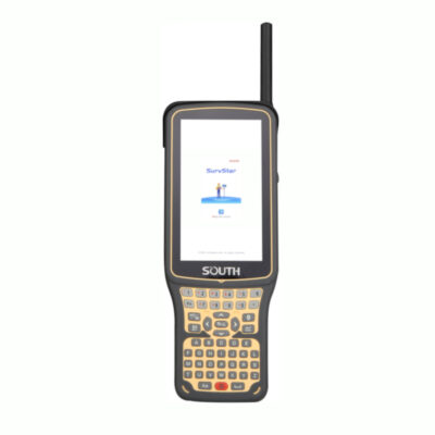
Yes. The NS30 is designed to work with a compatible remote controller, including the SOUTH H6 Plus Controller referenced in product materials. Long-range wireless communication can allow the surveyor to control the total station from the prism.
Can the NS30 work with RTK or GNSS equipment?
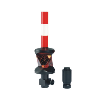
Yes. In SOUTH’s Prism Plus Position workflow, the NS30 can be used together with an RTK receiver, 360-degree prism, prism pole, and Survey Star software. This allows the crew to switch between total station and GNSS-based positioning when line-of-sight conditions change.
What are the NS30’s storage and operating system specifications?
Published materials list an Android-based operating system, approximately 4 GB of RAM, and approximately 64 GB of internal storage. Exact operating-system version, memory configuration, and software features may vary by production revision.
Setup, Battery, Safety, and Field Conditions
How is the NS30 set up on a job site?
The instrument is mounted on a stable tripod and tribrach, centered over the survey point, leveled using the circular and plate levels or electronic bubble, and then oriented using known points, backsight methods, resection, GNSS-assisted station setup, or another approved surveying procedure.
Does the NS30 have a laser plummet?
Yes. The NS30 uses a red laser plummet for centering the instrument over a station point. Published specifications list a 635 nm laser and approximately ±1.5 mm accuracy at 1.5 meters.
How long does the NS30 battery last?
Published specifications commonly list approximately four hours of operating time at 20°C, while other SOUTH materials may list longer operation depending on battery configuration and operating conditions. Battery life is affected by motor use, wireless communication, screen brightness, temperature, and measurement activity.
What environmental conditions can the NS30 operate in?
Published materials list an operating temperature range around -20°C to +50°C, with some documentation showing a wider range. The instrument is designed for outdoor surveying, but it should be protected from corrosive, explosive, flooded, or otherwise hazardous environments.
Is the NS30 waterproof and dustproof?
SOUTH materials list an IP54 or IP55 protection rating depending on the brochure or product revision. Confirm the exact protection rating for the supplied unit. The instrument should not be submerged, exposed to high-pressure water, or left unprotected in severe weather.
What safety precautions are important when using the NS30?
The NS30 includes a Class 3R laser-based EDM system. Trained personnel should operate it, avoid direct or reflected eye exposure, use appropriate laser safety controls, keep the beam away from people and reflective surfaces, and follow local workplace, traffic, electrical, and construction safety requirements.
How often should the NS30 be checked or calibrated?
The instrument should be checked regularly and especially after impact, transportation, extended storage, reassembly, or important measurement work. Checks may include leveling, tilt sensor, collimation, vertical index, instrument constant, laser alignment, prism search, and automatic recognition. Professional calibration should be performed according to the manufacturer’s guidance and project requirements.
What accessories are normally needed to use the NS30?
A practical setup generally includes a stable tripod, compatible tribrach, prism and prism pole, batteries and charger, controller for robotic operation, data-transfer accessories, carrying case, and suitable field software. RTK equipment may also be added for Prism Plus Position workflows.
Is the NS30 a good choice for every surveying application?
The NS30 is well suited to robotic surveying, construction layout, engineering set-out, topographic work, and monitoring. The correct model and configuration should be selected based on required angular accuracy, measurement range, prism type, software compatibility, environmental conditions, local support, and the qualifications required for the project.


 GPS & GNSS
 Total Stations
 Data collectors
 Software
 Correction services
 Machine control
 External radio
 Marine
 Accessories
Peter W. (verified owner) –
Still testing, good price for a robotic total station