


 GPS & GNSS
 Lidar scanning
 Total Station


Surveying Software for GNSS, Total Stations, LiDAR and CAD
Professional surveying software turns measurements from GNSS receivers, total stations, scanners and other instruments into usable project information. Depending on the application, software can help you configure equipment, collect coordinates, perform stakeout, process survey observations, work with CAD drawings, analyse point clouds or prepare deliverables for construction and engineering projects.
The software category at Global GPS Systems includes solutions for both field and office workflows. Available options cover data collection, GPS and GNSS software, total station software, post-processing, CAD, UAV and imaging applications, and 3D scanning and LiDAR software. Choosing the right package depends mainly on the equipment you use and what you need to do with the data before, during and after fieldwork.
Field Data Collection Software
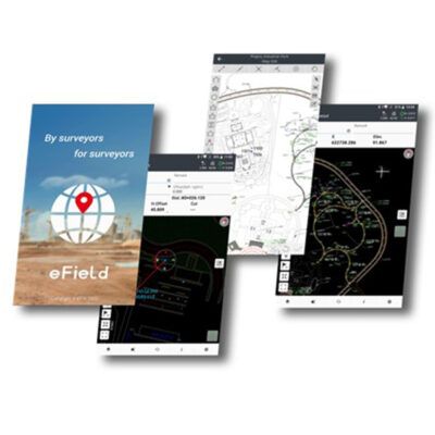
Data collection software is used on a survey controller, rugged tablet or compatible mobile device while measurements are being taken. It provides the working interface between the operator and instruments such as an RTK GNSS receiver or total station.
Typical field functions include creating projects, selecting coordinate systems, measuring points, assigning point codes, creating lines, importing design coordinates and performing stakeout. GNSS software may also provide access to receiver configuration and RTK correction settings, while total station applications can control measurements, station setup and construction layout.
For field crews, usability is particularly important. A straightforward interface can reduce the number of steps needed to measure or stake a point and makes it easier for construction workers and occasional survey users to complete routine positioning tasks correctly.
Software for RTK GPS and GNSS Surveying
GNSS field software is designed to work with compatible GPS and RTK GNSS receivers. It allows operators to see positioning information, monitor the RTK solution and record measured coordinates. More advanced applications can also manage coordinate reference systems, localisation, surface data, linework and stakeout calculations.
When network RTK is used, suitable software can manage the connection to an NTRIP correction service. The operator can then receive correction data through an internet-connected controller or receiver and work with centimetre-level GNSS positioning when field conditions and equipment allow.
Compatibility is important when selecting GPS software. Some packages are designed primarily around specific instrument manufacturers, while others support equipment from several brands. Always check that the intended GNSS receiver, controller and software combination is supported.
Total Station Software
Total station field software gives surveyors and construction crews a digital interface for measuring and setting out points. It can be used for station setup, backsight measurements, coordinate collection, line and offset work, construction layout and other common surveying operations.
Some field applications support both total stations and GNSS receivers. This can be useful on projects where GNSS is used in open areas and a total station is required close to buildings or in locations with restricted satellite visibility. Keeping both measurement methods in one project environment can simplify point management and reduce unnecessary data conversion.
Surveying and CAD Software for the Office
Office software is used after measurements have been collected or when survey data needs to be prepared before fieldwork. CAD-based packages can help users import coordinates, create drawings, calculate surfaces, prepare alignments, manage terrain models and generate information required for construction or engineering work.
The software selection includes solutions from developers such as Carlson and Aplitop. Products range from dedicated CAD and civil engineering applications to specialised modules for surveying, hydrology, GIS and point-cloud workflows. Packages such as Carlson Civil and Carlson Civil Suite are intended for broader engineering and design work, while specialised Aplitop applications cover tasks including surveying, tunnels and point-cloud processing.
Post-Processing Software
Not every GNSS workflow depends entirely on real-time RTK. Post-processing software is used to process measurements after fieldwork, often by combining rover observations with data from a base station or reference network. This is useful when real-time corrections are unavailable or when project procedures require observations to be reviewed and processed in the office.
Post-processing applications can also support quality-control workflows by giving users an opportunity to inspect measurement data before final coordinates are exported. The exact capabilities depend on the software and equipment being used.
3D Scanning and LiDAR Software
LiDAR and 3D scanning produce large point clouds rather than individual survey points. Specialist software is therefore needed to register, clean, visualise and process these datasets. Depending on the application, point-cloud software can help combine scans, remove unwanted data, extract geometry and prepare results for CAD or other design systems.
Dedicated software can also support specialised applications such as tunnel scanning and infrastructure inspection. Aplitop products within this category include tools developed for point-cloud editing, tunnel workflows and scan processing, providing options for users who work beyond traditional point-based surveying.
UAV and Imaging Software
Drone and imaging projects require software to turn photographs or sensor data into useful spatial information. Depending on the workflow, this may include organising imagery, processing survey data or combining photographic information with measured coordinates.
For RTK drone projects, the software workflow should be considered together with the GNSS positioning method. Accurate coordinates are only one part of the process; the collected imagery or sensor data still needs to be processed correctly to create usable mapping or inspection results.
How to Choose the Right Surveying Software
The first step is to identify what you need to accomplish rather than choosing software based only on the number of available functions. A construction crew performing GNSS stakeout has different requirements from a land surveyor processing observations or an engineer working with point clouds and CAD drawings.
- Equipment compatibility: confirm support for your GNSS receiver, total station, scanner or data collector.
- Field or office use: decide whether you need software for collecting measurements, processing data or both.
- Required workflow: consider point collection, stakeout, CAD, post-processing, LiDAR, GIS or imaging tasks.
- File compatibility: check that the software can exchange the formats required by your existing design and office workflow.
- Operating system: make sure the software runs on your controller, tablet or office computer.
- Team experience: software that matches the skills and daily tasks of the operator is often more practical than an unnecessarily complex package.
Software for Surveyors and Construction Teams
Professional surveyors may require advanced coordinate-system management, detailed coding, total station functions and flexible import and export options. Construction teams often place greater emphasis on simple stakeout workflows, clear graphical guidance and easy access to design coordinates.
GIS users may need software that combines accurate GNSS positioning with attribute information, while LiDAR specialists need tools capable of handling large point clouds. Understanding the intended workflow helps narrow down which software category and package is appropriate.
Surveying Software from Global GPS Systems
Global GPS Systems offers professional software for field data collection and office processing from suppliers including Aplitop, Carlson and GNSS equipment manufacturers. The range includes solutions for RTK GNSS, total stations, CAD, post-processing, GIS, LiDAR, 3D scanning and UAV-related workflows.
When choosing software, start with the instruments and data collector you already use or plan to purchase. Then consider the type of measurements you collect and the final information you need to deliver. Matching the software to the complete workflow helps ensure that measurements can move efficiently from the field to processing, design and final project output.
Surveying Software FAQ
Surveying Software Basics
What is surveying software used for?
Surveying software is used to collect, manage, process and analyse measurements from equipment such as RTK GNSS receivers, total stations and 3D scanners. Depending on the package, it can support field data collection, stakeout, coordinate calculations, CAD, post-processing or point-cloud workflows.
What is the difference between field and office surveying software?
Field software runs on a controller, tablet or compatible mobile device and is used while measurements are being collected. Office software is normally used afterwards to process, analyse, edit and prepare survey data, drawings or final project information.
Who uses professional surveying software?
Surveying software is used by land surveyors, construction crews, civil engineers, GIS professionals, drone operators, LiDAR specialists and other users working with accurate spatial measurements.
GNSS and Total Station Software
What software do I need for an RTK GNSS receiver?
You normally need compatible field data collection software that can communicate with the receiver. It should support the measurements, coordinate systems, RTK corrections and stakeout functions required for your work.
Can surveying software connect to an NTRIP correction service?
Many GNSS field applications can manage NTRIP connections when used with compatible hardware and internet access. This allows an RTK rover to receive real-time correction data from a correction network.
Can one software package work with both GNSS and total stations?
Some packages support both instrument types, allowing a project to contain GNSS and total station measurements in the same field environment. Compatibility depends on the instruments and software, so the supported equipment should always be checked first.
CAD, Post-Processing and LiDAR
What is survey CAD software used for?
Survey CAD software helps turn measured coordinates into drawings and engineering information. Depending on the package, it can be used for terrain models, contours, surfaces, alignments, civil design and preparation of data for construction stakeout.
When is GNSS post-processing software needed?
Post-processing software is useful when GNSS observations need to be processed after fieldwork rather than corrected entirely in real time. It can be used when an RTK connection is unavailable or when a project requires additional processing and quality control.
Do I need special software for LiDAR and 3D scanning?
Usually yes. Scanners create dense point clouds that require specialist tools for viewing, registration, cleaning and processing. Dedicated software can also extract useful geometry and prepare point-cloud information for CAD or engineering workflows.
Choosing Survey Software
How do I know if software is compatible with my surveying equipment?
Check the supported instrument models, communication methods and operating systems specified for the software. Compatibility should be confirmed for the GNSS receiver, total station, scanner or controller you intend to use.
Should I choose Android, Windows or desktop surveying software?
The right platform depends on where the software will be used. Android applications are common on modern field controllers, while Windows and desktop applications are often used for more extensive CAD, processing and engineering workflows in the office.
How do I choose the right surveying software?
Start with your equipment and the task you need to complete, such as GNSS data collection, stakeout, total station surveying, CAD, post-processing or point-cloud processing. Then compare compatible packages based on workflow, file formats and required functions. Global GPS Systems can help identify suitable software for your instruments and project requirements.
 GPS & GNSS
 Total Stations
 Data collectors
 Software
 Correction services
 Machine control
 External radio
 Marine
 Accessories