

 GPS & GNSS
 Lidar scanning
 Total Station
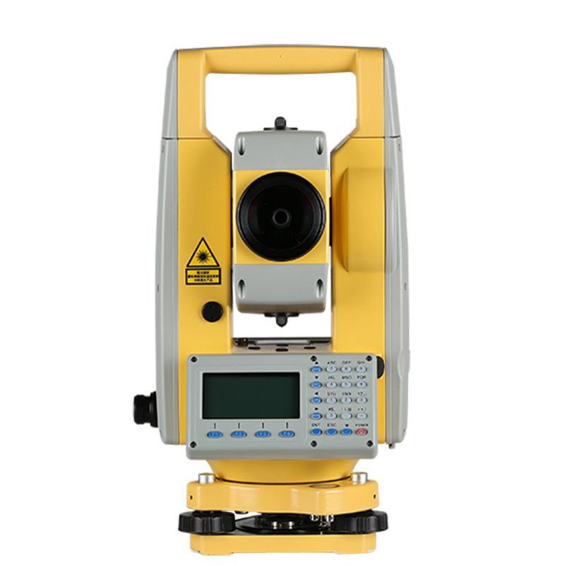
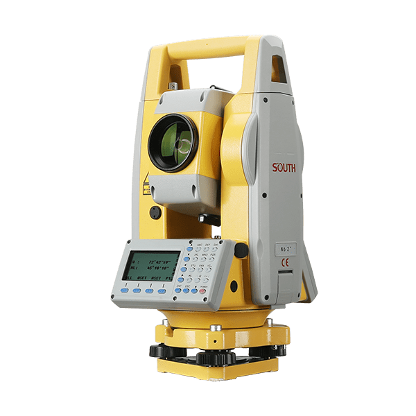
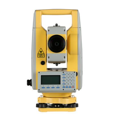
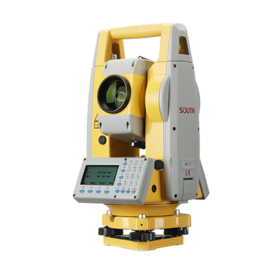
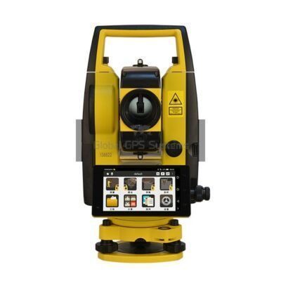
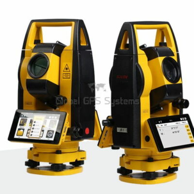
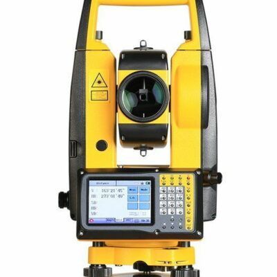
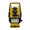
South N6+ Total Station
Get the best price for your setup
Contact our experts for the best possible price and configuration.
- Fast response
- Expert configuration advice
- No overpaying for features you do not need
The South N6+ Total Station is a manual surveying instrument for accurate angle, distance, and coordinate measurement on construction sites, road projects, topographic surveys, and infrastructure work. Its 2″ or 5″ angle accuracy, coaxial EDM, and 30× telescope support dependable layout, staking, boundary, and detail collection.
Measure prisms up to 5,000 m and reflectorless targets up to 1,500 m, depending on conditions. Built-in COGO, point-to-line, offset, stakeout, and road-design programs help crews complete common field calculations without extra equipment. Bluetooth and USB data transfer support TXT, CSV, and DXF workflows with compatible office or data-collection software. A dual-axis compensator, laser plummet, IP55 protection, and dual-sided display make the N6+ practical for surveyors, engineers, contractors, GIS teams, and other field professionals.
South N6+ Total Station Highlights
| Angle accuracy | 2″ or 5″ models |
|---|---|
| Distance measurement | Up to 5,000 m with prism; up to 1,000 or 1,500 m reflectorless |
| Distance accuracy | ±(2+2 ppm × D) mm with reflector; ±(3+2 ppm × D) mm reflectorless |
| Field programs | COGO, point-to-line, offset, stakeout, and road design |
| Data transfer and protection | Bluetooth, USB, IP55 dust and water protection |
Valued customers:










Find RTK Networks
Search NTRIP providers and connect to reliable RTK correction services.
Description
South N6+ Manual Total Station for Surveying and Construction
The South N6+ is a practical manual total station for surveyors, construction crews, civil engineers, GIS professionals, road contractors, and other field teams that need accurate angle and distance measurements without the cost or complexity of a robotic total station. It combines reflectorless EDM, prism-based long-range measurement, onboard survey programs, Bluetooth connectivity, USB data transfer, and a field-oriented operating interface in a durable instrument designed for everyday work.
For teams that already use RTK GNSS, the South N6+ can provide an important complementary workflow. GNSS is highly effective in open areas, but satellite positioning can become difficult around buildings, bridges, trees, steep cuts, industrial structures, and other obstructions. A total station allows crews to continue measuring, checking elevations, transferring points, and setting out construction details where a clear GNSS solution is not available.
Accurate distance and angle measurement for everyday fieldwork
The South N6+ uses a coaxial electronic distance measurement system to measure to prisms and selected surfaces without requiring a reflector. Depending on the instrument configuration and field conditions, prism measurements can reach up to approximately 5,000 metres, while reflectorless measurement is available at distances of up to 1,000 or 1,500 metres. The actual working range depends on the target surface, visibility, atmospheric conditions, aiming quality, and whether a prism is being used.
In practical terms, the reflectorless EDM is useful when a prism cannot be safely or conveniently placed on the target. Surveyors can measure building corners, retaining walls, road features, façade details, roof edges, utility structures, stockpiles, and other hard-to-access points from a stable instrument position. Prism measurement remains the preferred option when maximum range and the highest confidence in the target position are required.
The N6+ is available with 2-second or 5-second angular accuracy, allowing buyers to select a version that matches the required level of precision and the type of work being performed. Its absolute angle encoding system and dual-axis electronic compensator help maintain consistent readings when the instrument is correctly set up, levelled, and operated according to normal surveying practice.
Reflectorless measurement for difficult or inaccessible points
Reflectorless measurement can save time on active construction sites and in locations where placing a prism would be unsafe. Instead of sending a crew member onto a roof, across a traffic area, or close to an excavation edge, the operator can aim at a suitable surface from a controlled position. This is particularly useful for preliminary measurements, as-built checks, façade surveys, structural offsets, and points that are difficult to reach with a pole.
The laser and optical design are intended to provide a focused aiming point and reliable target acquisition over practical working distances. As with any reflectorless total station, results are influenced by the material and angle of the surface. Dark, reflective, transparent, highly angled, wet, or irregular targets may produce different results from a clean, light-coloured surface. For critical work, prism observations and independent checks should be used where appropriate.
Designed for manual surveying and construction layout
The South N6+ is a manual total station, meaning the operator turns and aims the instrument by hand rather than relying on automatic robotic target tracking. This makes it well suited to two-person surveying crews, construction layout teams, site engineers, and organisations that want dependable total station capability without paying for robotic functions they may not need.
Manual operation also gives the user direct control over the telescope, measurement trigger, target selection, and observation sequence. The instrument includes a trigger key and shortcut functions intended to reduce repeated button presses during routine measurements. For construction crews carrying out repetitive layout tasks, this can make the workflow easier to learn and more consistent between operators.
Onboard programs that support real field decisions
The N6+ includes onboard surveying functions for common calculation and layout tasks. Coordinate geometry tools can help users calculate positions and relationships between points directly in the field, reducing the need to return to the office for every simple calculation. Point-to-line and offset functions are useful when checking alignments, locating features relative to a baseline, or positioning points that do not lie directly on an existing survey line.
An onboard road program is available for road and infrastructure work. It supports practical tasks such as working with horizontal and vertical alignments, curve information, design points, and setting-out requirements. This can help surveyors and site engineers transfer road geometry from design data to the ground while keeping the main calculation steps within the instrument’s field workflow.
These functions are useful for boundary and topographic surveys, building set-out, foundation and column positioning, curb and drainage layout, road construction, utility work, machine-control preparation, as-built verification, and general civil engineering measurements.
Clear field operation with practical controls
The South N6+ uses a dual-sided LCD display and an alphanumeric keyboard so the instrument can be operated from either face. The display and menu layout are intended to keep key measurement information visible while the operator works through setup, observation, calculation, and staking-out routines.
For crews working in changing light and weather conditions, straightforward controls can be just as important as raw measurement performance. The N6+ provides access to instrument status, measurement settings, coordinate functions, point records, and data management without requiring a separate controller for every basic task. An external data collector can still be used when a project requires a more advanced field software environment.
Flexible data transfer and field software integration
Survey data can be transferred using Bluetooth, USB, and supported storage options. The integrated Bluetooth connection allows the total station to communicate with compatible external data collectors and field software without relying on a physical cable across the instrument setup. This can be useful when the operator wants to record observations in a tablet or controller-based workflow.
Data can be exported in commonly used formats such as TXT, DXF, and CSV, depending on the selected workflow and software configuration. This makes it easier to move observations into CAD, surveying, GIS, civil design, and construction documentation systems. The instrument also supports communication with South software and compatible third-party applications using supported communication commands.
For organisations operating mixed equipment fleets, this flexibility can help connect the N6+ with existing office and field processes. Buyers should confirm compatibility with their preferred data collector, survey software, coordinate system, file format, and cable or Bluetooth configuration before ordering.
Useful for surveying, construction, roads, and GIS field teams
The South N6+ is suitable for a broad range of professional users:
- Land surveyors: carry out topographic surveys, detail pickup, boundary-related measurements, control checks, and construction staking.
- Construction professionals: set out foundations, walls, columns, anchor bolts, slabs, curbs, drainage features, and site control points.
- Civil and road engineers: transfer alignment and profile information, check grades, measure existing conditions, and verify completed work.
- GIS and mapping teams: collect accurate positions for assets, structures, utilities, and site features where GNSS reception is obstructed or unreliable.
- Drone and photogrammetry teams: establish or check ground control, measure targets, and verify elevations or site features that support aerial mapping projects.
- General contractors and site supervisors: perform repeatable checks and layout tasks without depending entirely on outside surveying services.
It is especially useful for projects where a conventional total station is needed for accuracy and line-of-sight measurement, but automatic robotic tracking is not essential. It can also serve as a dependable backup or second instrument for surveying companies that already operate RTK GNSS equipment.
Built for outdoor site conditions
The N6+ is designed with an IP55 dust and water protection rating and an operating temperature range of approximately -20°C to +50°C. This makes it appropriate for normal outdoor surveying and construction environments, although the instrument should still be protected from prolonged exposure to heavy rain, mud, impact, extreme temperature changes, and improper storage.
The rechargeable lithium battery system is intended to support extended field sessions, with the exact operating time influenced by temperature, battery age, measurement frequency, Bluetooth use, display activity, and the condition of the battery. The package includes two batteries, allowing crews to keep one battery in use while the second is charging or available as a spare.
The instrument weighs approximately 5.5 kilograms with its standard configuration, so it can be transported between setups while remaining substantial enough for stable tripod-based work. A carrying case, lens cover, charger, batteries, tools, plummet, reflective sheet, storage media, and related accessories are included with the standard package, although the exact contents may vary by supplied configuration.
What the South N6+ means for your workflow
In day-to-day use, the value of the South N6+ comes from combining several familiar survey tasks in one instrument. A crew can occupy a known point, orient to a backsight, measure detail with a prism or reflectorless EDM, calculate offsets or coordinates, and set out design points without changing instruments for every operation.
For building and infrastructure projects, this can reduce the amount of manual measurement required with tapes and basic optical tools. For surveying companies, it provides a practical manual total station platform for routine work, construction support, and jobs where line-of-sight measurement is more reliable than satellite positioning. For GNSS users, it adds a second method for working in obstructed areas and checking critical points independently.
Choosing the right configuration
The N6+ is available in different angular accuracy and EDM configurations. When comparing setups, consider whether your work is primarily construction layout, topographic surveying, road work, utility measurement, or higher-precision control. Also consider the typical distance to your targets, the proportion of prism and reflectorless observations, the field software you use, and whether you need Bluetooth communication with a separate controller.
As with any total station, reliable results depend on correct tripod setup, instrument levelling, centring, prism constant settings, atmospheric corrections, target selection, and independent quality checks. The N6+ provides the measurement and calculation tools, while the survey workflow and verification procedures remain important parts of achieving accurate project results.
Support from Global GPS Systems
Global GPS Systems can help buyers select a South N6+ configuration that fits their fieldwork, software, accessories, and existing survey equipment. If you are comparing a manual total station with an RTK GNSS receiver or a robotic total station, the team can help identify which instrument type is appropriate for your site conditions and the level of automation you actually need.
Global GPS Systems also supports customers with configuration advice, accessories, delivery arrangements, and product guidance. For surveyors, engineers, construction workers, drone operators, GIS teams, and contractors building a practical measurement kit, the South N6+ provides a flexible total station option for accurate field measurement, layout, and site verification.
South N6+ Total Station package
The standard package includes the South N6+ instrument, lens cover, battery holder, two rechargeable batteries, charger, tools pouch, plummet, reflective sheet, storage media, USB cable, carrying case, belts, and documentation. Tripods, prism poles, prism sets, data collectors, and other accessories may be supplied separately or selected according to the project requirements.
Specifications
South N6+ Specifications
Product Overview
| Brand | SOUTH |
|---|---|
| Model | N6+ |
| Product type | Manual mechanical total station |
| Primary users | Land surveyors, construction surveyors, civil engineers, road designers, topographic surveyors, contractors and engineering consultants |
| Typical industries | Land surveying, construction, civil engineering, transportation infrastructure, road and highway development, topographic mapping, utilities, mining and site layout |
| Core functions | Angle measurement, electronic distance measurement, coordinate measurement, stakeout, resection, data collection, offset measurement, area calculation, missing line measurement, elevation measurement and road design calculations |
| Operating method | Manual aiming and manual instrument rotation; not a robotic or motorized total station |
Electronic Distance Measurement
| EDM type | Coaxial electronic distance measurement system |
|---|---|
| EDM carrier wave | Approximately 0.65–0.69 μm |
| EDM oscillation frequency | 150 MHz |
| Maximum range with single prism | Up to 5,000 m under favorable atmospheric and visibility conditions |
| Reflectorless range | Up to 1,000 m or 1,500 m depending on configuration and target conditions |
| Range with reflective sheet | Up to approximately 1,000 m, depending on the reflective sheet and environmental conditions |
| Range on gray targets | Approximately 450 m under specified target and atmospheric conditions |
| Prism distance accuracy | ±(2 + 2 ppm × D) mm |
| Reflectorless distance accuracy | ±(3 + 2 ppm × D) mm |
| Tracking-mode accuracy | Approximately ±(10 + 2 ppm × D) mm |
| Fine measurement time with reflector | Less than 0.3 seconds |
| Tracking measurement time with reflector | Less than 0.1 seconds |
| Reflectorless measurement time | Approximately 0.3–3 seconds, depending on range, target and environmental conditions |
| Minimum distance reading | Selectable between 0.1 mm and 1 mm |
| Distance units | Meters, U.S. feet, international feet and feet-inch |
| Atmospheric correction | Manual input or automatic correction |
| Earth curvature correction | Manual input or automatic correction |
| Prism constant correction | Manual input or automatic correction |
| Measurement modes | Fine single, fine repeated, fine three-times and tracking |
| Reflectorless laser spot | Published manual values are approximately 7 mm × 14 mm at 20 m and approximately 10 mm × 20 mm at 50 m; newer product information may specify smaller spot dimensions depending on revision |
Angle Measurement
| Available angular accuracy | 2 arc-seconds or 5 arc-seconds, depending on model configuration |
|---|---|
| Angle reading system | Absolute encoding |
| Minimum angle increment | Selectable between 1 arc-second and 5 arc-seconds; some operating modes also support 0.1 arc-second display settings |
| Horizontal detection method | Dual detection |
| Vertical detection method | Dual detection |
| Circle diameter | 79 mm |
| Angle display formats | Degrees, gons and mils |
| Vertical angle display | Zenith angle, vertical angle and percentage grade |
| Face settings | Horizontal left and horizontal right observations with selectable equation or differential coordinate behavior |
Telescope and Optical System
| Telescope image | Erect |
|---|---|
| Telescope magnification | 30× |
| Telescope tube length | 154 mm |
| Effective aperture | 45 mm; EDM effective aperture approximately 50 mm |
| Field of view | 1°30′ |
| Minimum focusing distance | 1.2 m |
| Resolving power | 3 arc-seconds |
| Reticle | Illuminated reticle |
| Optical plummet | Optional accessory depending on configuration |
| Optical plummet image | Erect |
| Optical plummet magnification | 3× |
| Optical plummet focusing range | 0.5 m to infinity |
| Optical plummet field of view | 5° |
Compensator, Leveling and Plummet
| Tilt sensor type | Dual-axis liquid-electric compensator |
|---|---|
| Compensator working range | ±4 arc-minutes |
| Compensator accuracy | 1 arc-second |
| Compensation modes | Dual-axis, single X-axis or compensator off |
| Laser plummet | Integrated laser plummet |
| Laser plummet accuracy | ±1.5 mm at 1.5 m |
| Plate vial sensitivity | 30 arc-seconds per 2 mm |
| Circular vial sensitivity | 8 arc-minutes per 2 mm |
| Auto-height function | Not included on the N6+ configuration; auto-height specifications apply to other N6-series variants |
Guide Light and Aiming Assistance
| Guide light | LED guide light available on newer N6+ configurations |
|---|---|
| Guide light colors | Red and green directional guidance lights |
| Guide light wavelengths | Published N6-series specifications list approximately 635 nm red and 590 nm green; newer N6+ product information may specify approximately 620–625 nm red and 521–524 nm green |
| Guide light operating range | Approximately 2–150 m on newer N6+ guide-light versions; other N6-series literature lists up to approximately 200 m |
| Guide light purpose | Provides left, right and correct-position guidance during stakeout and layout operations |
Onboard Software and Survey Functions
| Onboard operating system | Integrated onboard survey software with menu-driven field operation |
|---|---|
| Coordinate systems | NEZ or ENZ coordinate display and data-order selection |
| Station setup | Occupied-point setup, instrument-height input and backsight orientation by point or angle |
| Coordinate measurement | Coordinate calculation and recording using measured horizontal angle, vertical angle, slope distance, instrument height and target height |
| Stakeout | Point stakeout with directional and horizontal-distance guidance |
| Resection | Station resection using known control points |
| Offset programs | Angle offset, distance offset, plane offset and column offset |
| Point-to-line calculation | Calculates point coordinates and offsets relative to a defined line |
| Missing line measurement | Calculates horizontal distance, vertical distance, slope distance and horizontal offsets between points |
| Remote elevation | Remote elevation measurement and Z-coordinate calculation |
| Area calculation | Polygon area and perimeter calculation |
| Road design program | Road design, editing and stakeout functions with horizontal and vertical curve calculations |
| Additional field tools | Memory management, coordinate-file editing, code-file selection, instrument checks and measurement-file review |
| Correction settings | Atmospheric, earth-curvature, prism-constant, grid-factor and refraction-related settings |
Display, Keyboard and Controls
| Display | Dual-sided LCD display |
|---|---|
| Display format | 6-line LCD screen |
| Display illumination | Selectable display illumination |
| Keyboard | Alphanumeric 24-key keyboard |
| Hot keys | Direct-access keys for common functions such as stakeout, tilt, data confirmation, memory management, measurement-file viewing, coordinate-file viewing, resection and job creation |
| Trigger key | Dedicated trigger key for faster measurement operation |
| Star key menu | Quick access to display illumination, tilt sensor, Bluetooth, reflectorless mode, reflector mode, reflective-sheet mode and battery-voltage information |
| Buzzer functions | Selectable measurement buzzer and horizontal-angle buzzer |
| Automatic power-off | Selectable automatic shutdown after approximately 30 minutes without operation |
Data Storage and Communication
| Communication interfaces | USB port, USB flash drive interface and Bluetooth |
|---|---|
| Bluetooth range | Approximately 10 m |
| Data transfer | Bidirectional data transfer between the total station, computer, USB storage and compatible external data collectors |
| USB storage support | USB flash drives up to 256 GB are specified in the operation manual |
| Supported export formats | TXT, DAT, CSV and DXF, with additional SOUTH-specific measurement and coordinate formats |
| Data collection files | Measurement files and coordinate files, including SMD and SCD file types |
| Internal storage capacity | Up to approximately 96,000 data blocks according to N6+ brochure information |
| External software compatibility | SOUTH communication and transfer software; open Bluetooth commands support integration with compatible external data collectors and custom applications |
Power Supply
| Battery type | Rechargeable lithium battery |
|---|---|
| Battery model | LB-01 |
| Battery voltage | 7.4 V DC |
| Battery capacity | Published N6+ brochure specifications list approximately 3,100 mAh; newer N6-series specifications may list approximately 5,000 mAh depending on battery revision |
| Operating time | Approximately 10 hours per battery in the N6+ brochure; newer product information may specify longer operation depending on battery configuration and operating conditions |
| Battery quantity in standard package | 2 batteries listed on the Global GPS Systems package description |
| Charger | Dedicated SOUTH battery charger; charger model may vary by package revision |
| Charging input | Operation manual specifies a 110–220 V power supply for the charger |
| Battery-life conditions | Published operating time is measured under specified laboratory conditions and may be reduced by low temperatures, battery age, charging cycles and intensive measurement use |
Environmental and Physical Specifications
| Dust and water protection | IP55 or IP66 depending on instrument revision and published configuration |
|---|---|
| Operating temperature | -20°C to +50°C |
| Dimensions | Approximately 190 mm × 195 mm × 335 mm |
| Approximate instrument weight | Approximately 5.5 kg |
| Mounting system | Standard total-station tribrach mounting system |
| Atmospheric settings | Temperature and pressure input with selectable units, including Celsius/Fahrenheit and hPa, mmHg or inHg |
| Mainboard clock | Internal date and time function supported by a mainboard battery |
Standard Package Contents
| Item | Quantity | Notes |
|---|---|---|
| South N6+ main unit | 1 | Total station instrument |
| Lens cover | 1 | Protective optical cover |
| Battery holder | 1 | Battery compartment accessory |
| LB-01 rechargeable battery | 2 | Battery model and capacity may vary by revision |
| Tools pouch | 1 | Instrument adjustment and maintenance tools |
| Plummet | 1 | Plummet type may vary by configuration |
| SD card | 1 | Listed in the Global GPS Systems package description |
| Operation manual | 1 | Printed or digital documentation may vary |
| Warranty card | 1 | Included documentation |
| Battery charger | 1 | Charger model may vary by regional package |
| Reflective sheet | 1 | For reflective-sheet distance measurement |
| Carrying case | 1 | Protective instrument case |
| Instrument belt | 2 | Listed in the Global GPS Systems package description |
| Mini USB cable | 1 | For wired data communication where supplied |
Optional Accessories and Configuration Items
| Optical plummet | Optional according to manufacturer specifications |
|---|---|
| Wooden tripod | Available as an accessory or package component depending on configuration |
| Prism pole | Available as an accessory or package component depending on configuration |
| Prism set | Available as an accessory or package component depending on configuration |
| External data collector | Compatible Bluetooth or cable-connected data collectors may be used where supported by software |
| USB storage | Compatible USB flash drive for data import and export |
Specifications and package contents may vary by configuration, region or manufacturer update. Always check the current configuration before ordering.
Reviews (1)
1 review for South N6+ Total Station
Only logged in customers who have purchased this product may leave a review.
FAQ
South N6+ FAQ
Product Overview and Applications
What is the South N6+ Total Station?
The South N6+ is a manual total station for measuring horizontal angles, vertical angles, distances and point coordinates. It combines a 30x telescope, electronic angle measurement, reflector and reflectorless EDM, onboard surveying programs and multiple data-transfer options.
Is the South N6+ a manual or robotic total station?
The South N6+ is a manual total station. The operator manually aims and measures each target. It does not provide robotic automatic target tracking or remote instrument control.
Who uses the South N6+ Total Station?
The instrument is designed for land surveyors, construction surveyors, civil engineers, site engineers, road contractors, utility contractors, topographic survey teams and surveying companies that need reliable angle and distance measurements.
Which industries can use the South N6+?
The South N6+ is suitable for surveying and mapping, construction, civil engineering, road and infrastructure projects, land development, utility installation, mining support, topographic surveying and general engineering layout work.
What surveying tasks can be performed with the South N6+?
Typical tasks include topographic data collection, construction staking, boundary and detail surveys, elevation and height measurements, point positioning, as-built surveys, road alignment work, coordinate geometry calculations and setting out design points.
Is the South N6+ suitable for road construction and road design?
Yes. The N6+ includes an onboard road program for road alignment workflows, including horizontal and vertical curve calculations, road design data editing and setting out road points.
Measurement Performance and Accuracy
What is the measuring range of the South N6+?
With a prism, the South N6+ can measure up to approximately 5,000 metres in suitable conditions. Its reflectorless range is available in 1,000-metre or 1,500-metre configurations, depending on the selected model and target conditions.
What is the distance measurement accuracy?
With a reflector, the stated distance accuracy is ±(2 + 2 ppm × D) mm. For reflectorless measurements, the stated accuracy is ±(3 + 2 ppm × D) mm. Actual results depend on atmospheric conditions, target material, sighting conditions and instrument setup.
What angle accuracy options are available?
The South N6+ series is available with either 2-second or 5-second angular accuracy, depending on the configuration. Confirm the required accuracy before ordering if your project specifications require a specific model.
How fast does the South N6+ measure distance?
With a reflector, fine measurement can take less than 0.3 seconds and tracking measurement can take less than 0.1 seconds. Reflectorless measurement typically takes between 0.3 and 3 seconds, depending on the target and conditions.
Can the South N6+ measure without a prism?
Yes. The South N6+ includes reflectorless EDM for measuring suitable targets without placing a prism on the point. Reflectorless performance depends on distance, surface color, reflectivity, angle of incidence, weather and visibility.
What type of telescope does the South N6+ have?
The telescope provides 30x magnification, a 45 mm effective aperture for viewing and a 50 mm EDM aperture. It has an erect image, a 1°30′ field of view, a 1.2-metre minimum focus distance and approximately 3-second resolving power.
Functions, Software and Data Transfer
Which onboard programs are included?
The South N6+ provides onboard surveying functions such as coordinate geometry, point-to-line calculations, offset measurements and road design and staking functions. These programs help reduce the need for manual calculations in the field.
Can the South N6+ calculate coordinates?
Yes. The instrument can use measured angles and distances with known station and orientation information to calculate point coordinates. It can also support common coordinate geometry and setting-out workflows.
How can data be transferred from the South N6+?
Data can be transferred using Bluetooth, USB connections, an SD card and the RS-232 interface, depending on the exact instrument configuration. These options support transfer to computers, data collectors and compatible surveying software.
Which file formats can the South N6+ export?
The N6+ can export raw survey data in common formats such as TXT, DXF and CSV through compatible South communication software. Confirm the required format and workflow with your office software before purchasing.
Can the South N6+ connect to an external data collector?
Yes. The integrated Bluetooth capability can connect the total station with compatible external data collectors. Compatibility depends on the collector, field software, communication settings and available commands.
Does the South N6+ support two-way communication?
Yes. The N6+ supports bi-directional communication through compatible interfaces, allowing data to be sent to and received from external equipment or software.
How much internal data can the South N6+ store?
The N6+ series is specified with internal storage for approximately 96,000 data blocks. Storage capacity and file-management behavior can vary by firmware version and configuration.
Does the South N6+ correct for atmospheric conditions and earth curvature?
Yes. The instrument supports manual input and automatic correction options for atmospheric conditions, earth curvature and prism constants. Correct settings should be applied for the required survey accuracy.
Setup, Power, Durability and Package Contents
How is the South N6+ positioned over a survey point?
The N6+ uses a laser plummet for centering over the station point. It should be mounted on a stable, compatible tripod, carefully centered and leveled before measurements begin.
Does the South N6+ have a compensator?
Yes. It uses a dual-axis liquid-electric compensator with a working range of approximately ±4 minutes and stated compensator accuracy of 1 second. The instrument must still be correctly centered and leveled for reliable results.
How long does the battery last?
The South N6+ uses a rechargeable 7.4 V lithium battery. The stated operating time is up to approximately 16 hours under specified test conditions. Battery life can be shorter in cold weather, during intensive use or as the battery ages.
Is the South N6+ suitable for outdoor fieldwork?
Yes. The instrument is designed for outdoor surveying and has an IP55 dust and water-protection rating. It should not be submerged or exposed unnecessarily to heavy rain, water jets, condensation or extreme environmental conditions.
What operating temperatures are supported?
The stated operating temperature range is approximately -20°C to +50°C. Allow the instrument to acclimatize when moving between major temperature differences and follow the operating manual for storage and handling.
What is included with the South N6+?
The standard package includes the main unit, lens cover, battery holder, two LB-01 batteries, tools pouch, plummet, SD card, user manual, warranty card, charger, reflective sheet, carrying case, two belts and a Mini USB cable.
Does the package include a tripod, prism or prism pole?
The standard package does not necessarily include a tripod, prism set or prism pole. These items are typically selected separately according to the survey workflow and project requirements.
Does the South N6+ require regular calibration?
Yes. Total stations should be checked and calibrated at suitable intervals, especially after transport, impact, long periods of storage, major temperature changes or before high-accuracy work. The instrument should be serviced by a qualified technician when adjustment is required.
 GPS & GNSS
 Total Stations
 Data collectors
 Software
 Correction services
 Machine control
 External radio
 Marine
 Accessories
Peter Sørensen (verified owner) –
Problem not being able to mute audio in software and damaged paper manual.