

 GPS & GNSS
 Lidar scanning
 Total Station
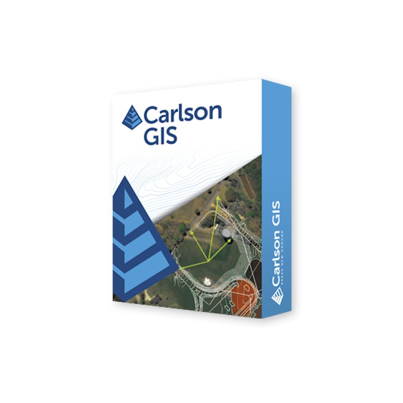
Carlson GIS CAD Mapping and Geospatial Data Management Software
Get the best price for your setup
Contact our experts for the best possible price and configuration.
- Fast response
- Expert configuration advice
- No overpaying for features you do not need
Carlson GIS is CAD-based GIS software for surveyors, engineers, GIS professionals and infrastructure teams that need to combine accurate drawing geometry with structured geospatial information. It lets users attach, edit, inspect, label, query and report GIS attributes directly from CAD entities, helping turn survey and engineering drawings into more useful geospatial datasets.
The software supports SHP exchange, Esri geodatabase and ArcGIS service workflows, polygon topology and georeferenced imagery. This makes Carlson GIS well suited to utility mapping, asset inventories, land records, infrastructure projects and survey deliverables where points, lines and areas need to carry descriptive information as well as coordinates.
- Connect GIS attributes directly to CAD points, lines and polygons.
- Import and export SHP data and work with Esri geospatial services.
- Use aerial imagery and online mapping services as geographic context for survey and engineering data.
Carlson GIS Highlights
| GIS data management | Capture, edit, inspect, label, query and report attribute data linked to CAD entities |
|---|---|
| GIS exchange | SHP import and export with associated GIS information |
| Esri integration | Geodatabase and ArcGIS Feature, Image and Map Service workflows |
| Mapping services | WFS and WMS support plus georeferenced map and aerial imagery |
| CAD environment | Included IntelliCAD or supported AutoCAD installation |
You may also like…




Valued customers:










Find RTK Networks
Search NTRIP providers and connect to reliable RTK correction services.
Description
Carlson GIS for CAD based mapping and geospatial data management
Carlson GIS combines professional CAD drawing tools with GIS data management for surveyors, civil engineers, GIS technicians, utility companies and infrastructure professionals. It is designed for projects where knowing the position of an object is only part of the job and each point, line or polygon also needs to carry useful descriptive information.
Instead of maintaining a CAD drawing and a separate set of asset records, Carlson GIS can associate GIS attributes directly with drawing entities. Users can capture and edit data, inspect attributes, create labels, run queries and prepare reports while continuing to work in the familiar Carlson CAD environment.
Combine accurate CAD geometry with GIS attributes
A CAD entity normally describes the location and geometry of an object. GIS adds information about what that object represents. With Carlson GIS, a surveyed point representing a hydrant can carry information about the asset, a polyline representing a utility can contain descriptive fields, and a polygon can represent an area together with its associated database information.
This is useful for projects involving utilities, municipal assets, property information, environmental features, infrastructure inventories and other mapped objects where coordinates alone are not enough. Fields can be structured around the information required by the project or client, helping create a dataset that can continue into asset management or wider GIS workflows.
Capture and edit GIS data directly in CAD
Carlson GIS includes tools for entering and editing attribute information associated with drawing entities. This allows a survey or engineering team to work with both the physical geometry and the database information without constantly switching between separate CAD and GIS applications.
The GIS Inspector provides a practical way to review attributes attached to selected features. For a drawing containing hundreds or thousands of assets, this makes it easier to identify what a particular point or line represents and inspect the information stored with it.
Existing information can also be updated as a project develops. This is useful for as-built surveys, asset inspections and infrastructure projects where field measurements may confirm a position while office staff complete or verify the associated records.
Query and report geospatial information
When a project contains structured GIS attributes, users need more than a graphical view of the drawing. Carlson GIS includes query and reporting functions that help identify features based on the information associated with them.
This can make large asset drawings easier to work with. Rather than manually searching a drawing for every feature of a particular type, users can work with the GIS information to find and review the relevant entities. Reporting tools can then present selected database information in a more useful form for project documentation or quality control.
Create labels from stored GIS data
Carlson GIS can use associated attribute information to create labels in the CAD drawing. This reduces the need to type separate text manually beside every object and helps keep labels consistent with the actual information stored in the GIS dataset.
For utility and infrastructure mapping, this can be used to display selected information about points, open polylines or closed areas. If the underlying data is updated, the GIS workflow provides a clearer relationship between the mapped object and the information used to describe it.
Import and export SHP files
Esri Shapefile data remains widely used for exchanging geographic information between surveying companies, engineering consultants, authorities and GIS departments. Carlson GIS supports SHP import and export together with GIS attributes, allowing information to move between the CAD drawing and other geospatial systems.
A surveyor may receive an SHP dataset containing existing utilities, parcels or infrastructure before starting fieldwork. That information can be brought into the project and combined with new GNSS or total station measurements. When the project is complete, relevant geometry and attributes can be delivered back into a GIS-compatible workflow.
This is particularly useful when the field and engineering teams work primarily with CAD but the final client maintains its information in GIS.
Work with Esri geodatabase and ArcGIS services
Carlson GIS also provides workflows for Esri geospatial information beyond traditional SHP files. Carlson’s GIS editor supports geodatabase import and export, while ArcGIS service tools provide access to Feature, Image and Map Services.
This helps organisations connect CAD-based surveying and engineering work with information maintained in an Esri environment. Existing GIS layers can provide project context, while updated or newly surveyed information can be prepared for use by the client’s GIS team.
Current Carlson 2026 GIS tools also support OAuth 2.0 authentication for private ArcGIS Feature, Image and Map Services. This is relevant to organisations whose online GIS information is protected rather than openly accessible.
Use Web Feature Service data
Web Feature Service, or WFS, can be used to obtain geographic features from compatible online services. Unlike a simple background image, feature-service data can provide actual mapped geometry together with associated GIS information.
For surveyors and engineers this can provide useful project context when authorities, utilities or other organisations publish suitable geographic datasets. Carlson has also expanded support for Esri REST services, providing another method for accessing modern online GIS sources where traditional WFS services are not available.
Add WMS and georeferenced imagery to CAD drawings
Carlson GIS includes tools for bringing georeferenced imagery into a project. Web Map Service, or WMS, support allows imagery from compatible servers to be placed within the CAD drawing using the project’s coordinate system.
Aerial photography and map imagery can help users understand how measured or designed geometry relates to roads, buildings, vegetation and surrounding land. This can be useful during project preparation, drawing checks and preliminary engineering work.
Imagery is normally best treated as contextual information rather than survey control. Where centimetre-level positioning or legal survey accuracy is required, measured GNSS, total station or other verified survey information remains the appropriate source.
Work with large areas of aerial imagery
Carlson’s GIS tools include routines for managing georeferenced images over larger project areas. Carlson also provides higher-resolution Google Earth image workflows using automatic tiling, with map options including aerial, road, terrain and hybrid views.
Automatic tiling helps avoid treating an entire large project as one oversized image. In practice, this can make background mapping more manageable while retaining enough visual detail for the area currently being reviewed.
Polygon topology for areas parcels and zones
Carlson GIS includes polygon topology creation and analysis for projects where closed areas need to be treated as meaningful geographic features rather than unrelated CAD lines.
This can be useful for parcels, land-use zones, environmental areas, service territories and other mapped regions. Structured polygons can carry their own GIS attributes and can be analysed or reported as areas within the larger dataset.
Practical software for asset mapping
Asset mapping is one of the strongest applications for Carlson GIS. A utility, municipality or infrastructure owner may need to manage large numbers of valves, chambers, pipes, poles, signs, street furniture or other physical assets. Each object requires an accurate position as well as information describing what it is.
A survey team can establish or update the position of these objects with GNSS or total station equipment and then use Carlson GIS to organise the related attributes. This creates a much more useful deliverable than a drawing containing anonymous points and lines.
For organisations carrying out repeat surveys or inspections, the same GIS structure can provide consistency between projects and make it easier to understand which information should be collected for each feature type.
Useful for GNSS and total station survey data
Carlson GIS fits naturally into workflows where geographic information begins with accurate field measurements. Survey points collected with RTK GNSS or a total station can form the positional basis of the map, while GIS attributes add the descriptive information required by the client.
This is useful for surveyors producing utility surveys, asset inventories, topographic datasets, environmental mapping or other projects where the final deliverable must contain both coordinates and structured feature information.
Because Carlson GIS is part of the wider Carlson software environment, teams can combine GIS functions with other Carlson survey and civil engineering modules when a project requires additional processing or design.
Useful for civil engineers and infrastructure teams
Civil engineering projects frequently depend on information maintained by several different organisations. Property boundaries, utilities, roads, environmental constraints and existing assets may all come from separate GIS datasets while the actual engineering design is produced in CAD.
Carlson GIS helps bring these two environments together. GIS layers can provide context for engineering work, while CAD entities created or edited during the project can carry the attributes needed for later GIS use.
This makes the software relevant to roads, utilities, land development, public infrastructure and other projects where technical drawings and geographic databases need to remain connected.
Use Carlson GIS as part of Civil Suite
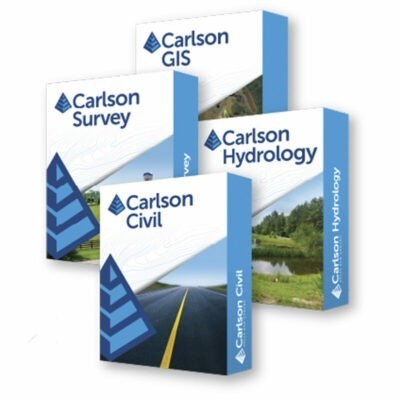
Carlson GIS is available as an individual module and is also included in Carlson Civil Suite alongside Carlson Survey, Carlson Civil and Carlson Hydrology. This can be useful for businesses that require more than GIS data management.
Carlson Survey handles the wider survey-processing workflow, Carlson Civil provides road and site design tools, Carlson Hydrology covers drainage and hydraulic design, and Carlson GIS provides the geospatial data-management layer. These modules share Carlson’s CAD-based working environment, making it easier for project data to continue through different stages of surveying and engineering.
Current Carlson 2026 CAD environment
Carlson GIS remains included in the current Carlson 2026 desktop software installer. The current release can run with the supplied IntelliCAD environment or on a supported AutoCAD, AutoCAD Map or Civil 3D installation.
Carlson 2026 includes IntelliCAD 12.1 and 13.1 and supports AutoCAD-based products from 2019 through 2026. For a company that does not already own AutoCAD, the included IntelliCAD option provides a complete CAD platform for the Carlson workflow. Businesses already standardised on a supported AutoCAD version can instead add Carlson’s GIS functions to their existing environment.
Who is Carlson GIS for?
Carlson GIS is designed primarily for land surveyors, civil engineers, GIS technicians, utility mapping specialists, municipalities, infrastructure managers and consultants who work with both CAD geometry and geospatial databases.
For a surveyor, it can provide a way to deliver attribute-rich GIS data from accurate field measurements. For an engineering company, it can bring existing geographic information into the CAD design environment. For utility and asset-management teams, it provides tools for connecting mapped objects with the information required to identify and manage them.
Carlson GIS from Global GPS Systems
Global GPS Systems can help determine how Carlson GIS fits into your existing field and office workflow, including the GNSS or total station equipment used to collect coordinates and the formats required for final GIS delivery.
For users who also require survey calculations, civil design or drainage tools, Global GPS Systems can help determine whether the individual GIS module or a wider Carlson software configuration such as Civil Suite better matches the work your team performs.
Specifications
Carlson GIS 2026 Specifications
Software Overview
| Product name | Carlson GIS |
|---|---|
| Current release researched | Carlson GIS 2026 |
| Product type | CAD-integrated Geographic Information System (GIS) mapping, data management and spatial analysis software |
| Primary applications | GIS data creation and editing, attribute management, survey/GIS integration, SHP and geodatabase exchange, web mapping, aerial imagery, spatial data labeling, mapping, planning and preliminary engineering |
| Typical users | Land surveyors, GIS analysts, civil engineers, planners, utility professionals, environmental consultants and mapping professionals |
| Application architecture | 64-bit |
| CAD environment | Works inside the Carlson CAD environment using included IntelliCAD or a separately licensed compatible AutoCAD, AutoCAD Map or Civil 3D installation |
| Native drawing workflow | DWG-based CAD and GIS workflow |
| Civil Suite | Included as one of the four modules in Carlson Civil Suite together with Carlson Survey, Carlson Civil and Carlson Hydrology |
| Select Suite eligibility | Carlson GIS is available as an eligible module in Carlson Select Suite configurations |
Core GIS Capabilities
| GIS data capture | Supported |
|---|---|
| GIS attribute editing | Supported |
| GIS data linking | Supported |
| GIS data labeling | Supported |
| GIS inspection | Supported |
| GIS querying | Supported |
| GIS reporting | Supported |
| Polygon topology | Creation and analysis tools supported |
| Survey-to-GIS workflow | Supported through Carlson points, coordinate databases and GIS attributes |
| CAD-to-GIS workflow | CAD entities can be linked to GIS records and attributes |
| GIS-to-CAD workflow | GIS features can be imported as CAD points and linework while retaining applicable attribute data |
Primary GIS Commands
| Command / Tool | Function |
|---|---|
| GIS Database Settings | Configures GIS databases, templates and project data storage |
| Input-Edit GIS Data | Creates and edits attribute information linked to drawing entities |
| GIS Inspector | Reviews GIS attribute information associated with drawing entities |
| GIS Inspector Settings | Controls which GIS features and attributes are displayed during inspection |
| GIS Query / Report | Queries attribute records and reports or highlights matching drawing entities |
| Hatch GIS Polylines | Applies hatch representation to GIS-linked polygon entities |
| Mark GIS Polylines | Graphically identifies applicable GIS-linked polylines |
| Label GIS Polyline – Closed Polyline Image | Labels closed GIS polygons using associated image information |
| Label GIS Polyline – Closed Polyline Data | Labels closed polygons using associated attribute values |
| Label GIS Polyline – Open Polyline Data | Labels linear GIS entities using associated attribute values |
| Links Manager | Manages links between drawing entities and GIS records |
| Create Links | Creates GIS database links for applicable drawing entities |
| Erase Links | Removes GIS links from selected entities |
GIS Database and Attribute Management
| Feature definitions | User-definable GIS feature types and attribute structures |
|---|---|
| Attribute definitions | User configurable |
| Multiple attributes per feature | Supported |
| Entity-linked records | GIS records can be associated with CAD points, symbols and linework |
| Template database | Supported for defining project GIS structures |
| Output database | Supported for project GIS records |
| Relational database access | Supported through applicable ODBC workflows |
| Attribute-based entity identification | Supported through GIS Inspector and GIS Query / Report |
| Feature attribute definitions from KML | Supported through Define GIS Features |
Point GIS Editor
| Point GIS Editor | Integrated spreadsheet-style GIS point and attribute editing tool |
|---|---|
| Point attributes | Create, review and edit GIS attributes associated with coordinate points |
| Add all attributes for feature | Supported |
| Multiple coordinate file import | Supported in documented current-generation workflows |
| Trimble JXL import | Supported |
| Trimble CSV configuration | Format settings supported |
| SQLite export | Supported in applicable Point GIS Editor workflows |
| CRDB attributes | GIS attributes can be stored with Carlson CRDB coordinate databases |
Esri SHP Compatibility
| SHP import | Supported |
|---|---|
| SHP export | Supported |
| DBF attribute data | Supported as part of Esri Shapefile workflows |
| SHX index files | Supported as part of Esri Shapefile datasets |
| PRJ projection files | Supported where supplied with the Shapefile dataset |
| Point geometry | Supported |
| Polyline / arc geometry | Supported |
| Polygon geometry | Supported |
| GIS attributes on imported linework | Supported |
| CRDB storage during SHP import | Supported for applicable imported point data |
Esri Geodatabase and ArcGIS Interoperability
| Esri geodatabase import | Supported |
|---|---|
| Esri geodatabase export | Supported |
| Geometry import | Supported for applicable geodatabase feature geometry |
| GIS attribute import | Supported with imported linework |
| ArcGIS service workflow | Supported through applicable Carlson GIS and web-service tools |
| Esri imagery / terrain | Can be accessed through applicable image and web-service workflows |
| CAD / Esri data exchange | Designed to move geometry and attribute information between Carlson CAD projects and Esri-compatible GIS workflows |
Database and GIS Data Formats
| Format / Interface | Import | Export / Use |
|---|---|---|
| Esri SHP | Yes | Yes |
| Esri Geodatabase | Yes | Yes |
| ODBC | Yes | Database connectivity / project-dependent |
| SQLite | Yes | Yes |
| SpatiaLite | Supported | Supported in applicable GIS database workflows |
| OpenGIS GML | Yes | Workflow-dependent |
| KML | Yes | Yes |
| KMZ | Yes | Yes |
| WFS | Yes | Used as an online GIS feature source |
| WMS | Map imagery | Used as an online map / image source |
SQLite and SpatiaLite
| SQLite database support | Supported |
|---|---|
| SpatiaLite support | Supported in Carlson GIS database commands |
| Import SQLite | Imports applicable GIS information from SQLite databases |
| Export SQLite | Exports applicable GIS information to SQLite databases |
| Point GIS Editor to SQLite | Supported |
ODBC Database Support
| Import ODBC | Integrated command |
|---|---|
| Relational databases | Applicable ODBC-accessible relational database sources can be used |
| Attribute import | Supported |
| Geometry / GIS data workflow | Depends on the structure and capabilities of the source database and ODBC driver |
Web Feature Service (WFS)
| WFS support | Supported |
|---|---|
| Online GIS feature import | GIS layers can be imported as linework with associated GIS data |
| User-defined WFS services | Supported |
| USGS National Map services | Included among documented default WFS service options |
| Internet connection | Required for live WFS access |
Web Map Service (WMS)
| WMS support | Supported |
|---|---|
| Carlson Image Server | Can be used as a map image source |
| User-specified WMS server | Supported |
| Map imagery placement | Web map imagery can be placed into the CAD drawing |
| Internet connection | Required for live WMS services |
KML / KMZ and Google Earth Interoperability
| KML import | Supported |
|---|---|
| KMZ import | Supported |
| KML export | Supported |
| KMZ export | Supported |
| KML Placemark | Can be imported as a point |
| KML Path | Can be imported as an open polyline |
| KML Polygon | Can be imported as a closed polyline |
| KML folders | Can be converted into CAD layers |
| KML overlay images | Supported |
| KML GIS attributes | Can be imported into the drawing |
| 3D KML elevations | Altitude values can be retained as CAD Z elevations |
| GIS attributes in exported KML | Supported |
| CAD layers to KML folders | Supported |
| Closed region shading | Supported for applicable KML/KMZ export |
| Points | Supported for KML/KMZ export |
| Polylines | Supported for KML/KMZ export |
| Text | Supported for KML/KMZ export |
| Solids | Supported for applicable KML/KMZ export |
| Images | Supported as applicable ground overlays |
Aerial Imagery and Web Mapping
| Aerial image management | Integrated |
|---|---|
| Large image areas | Supported |
| Image resolution adjustment | Supported |
| Image tiling | Automatic tiling is available for applicable large-area imagery workflows |
| Map types | Applicable aerial, road, terrain and hybrid map types are supported by documented online mapping workflows |
| Georeferenced images | Supported |
| Geo-tagged images | Supported by Place Image by World File workflows |
| World file positioning | Supported |
| Manual image positioning | Available for applicable non-georeferenced image workflows |
Image and 3D Surface Tools
| Drape Image on Surface | Supported |
|---|---|
| 3D draped imagery viewing | Supported |
| Color TIN by Image | Assigns colors to TIN faces using a georeferenced image |
| Image Inspector | Lists and reports images attached to entities |
| Camera symbols | Can be placed in the drawing and associated with applicable image workflows |
| Image layer control | Supported through applicable placement and CAD layer functions |
| Google / Esri terrain | Applicable terrain information can be incorporated into supported mapping and surface workflows |
GIS Inspector
| Attribute inspection | Displays GIS information linked to drawing entities |
|---|---|
| Feature selection | Supported |
| Displayed attribute selection | User configurable |
| Quick-view settings | Supported |
| Picture / image attribute display | Supported in applicable GIS configurations |
| Entity marking | GIS-linked objects can be highlighted or marked for identification |
GIS Query and Reporting
| Attribute query | Supported |
|---|---|
| User-defined query | Supported |
| Query drawing-linked GIS records | Supported |
| Query database records | Supported |
| Highlight matching entities | Supported |
| Report matching records | Supported |
| Area attribute labels | Closed polygons can be labeled using GIS attributes |
| Attribute tables | Tables can be created from applicable polygon attribute information |
Polygon and Linework GIS Tools
| Closed polygon GIS data | Supported |
|---|---|
| Open polyline GIS data | Supported |
| Polygon hatching | Supported |
| Polygon marking | Supported |
| Polygon labeling | Supported from attribute information |
| Polyline labeling | Supported from attribute information |
| Image-linked polygon labels | Supported |
| Polygon topology creation | Supported |
| Polygon topology analysis | Supported |
Coordinate and Survey Data Integration
| Carlson CRD | Supported |
|---|---|
| Carlson CRDB | Supported with GIS attribute capability |
| Point GIS attributes | Can be stored and reported with applicable Carlson coordinate databases |
| SurvPC GIS data | Compatible with applicable Carlson office/field GIS workflows |
| SurvCE GIS attributes | Legacy SurvCE GIS attribute information can be processed in applicable workflows |
| Survey point reporting | GIS attributes can be included in applicable point reports |
| Latitude / longitude reporting | Supported when a coordinate system is configured |
| Second grid system reporting | Supported in applicable geodetic report workflows |
Coordinate Systems and Georeferencing
| Drawing coordinate system | Configurable |
|---|---|
| Projection support | Extensive Carlson coordinate system and projection library |
| PRJ files | Supported with applicable spatial datasets |
| Georeferenced DWG workflow | Supported |
| Geolocate DWG Files | Can create Google Earth placemarks for georeferenced project drawings |
| Map-based drawing selection | Available through Carlson's geolocated drawing management functions |
General CAD Data Compatibility
| Format | Compatibility |
|---|---|
| DWG | Native drawing workflow |
| DXF | Supported |
| DGN | Supported through applicable IntelliCAD / CAD conversion functions |
| LandXML | Import and export supported by the Carlson CAD platform |
| KML / KMZ | Import and export supported |
| SHP | Import and export supported |
| GML | Import supported |
Civil 3D Interoperability
| Civil 3D object conversion | Available through Carlson's general CAD conversion tools |
|---|---|
| Civil 3D points | Can be converted to standard CAD / Carlson entities |
| Civil 3D surfaces | Conversion supported |
| Civil 3D centerlines | Conversion supported |
| Civil 3D pipe networks | Conversion supported |
| Civil 3D feature lines | Conversion supported |
| Civil 3D labels | Can be converted to standard CAD text |
General Drafting and CAD Utilities
| Drawing Cleanup | Included |
|---|---|
| Join Nearest | Included |
| Shrinkwrap Entities | Included |
| Polyline Utilities | Included |
| Drawing Inspector | Included |
| Layer Inspector | Included |
| Twist Screen | Included |
| 2D drafting | Supported through the CAD platform |
| 3D drafting | Supported through applicable CAD and Carlson commands |
3D and Planning Applications
| 3D surface imagery | Supported |
|---|---|
| Preliminary engineering studies | Supported through GIS, imagery, terrain and compatible Carlson engineering tools |
| Preliminary hydrologic studies | GIS information and terrain can support preliminary hydrologic analysis; full hydraulic design is provided by Carlson Hydrology |
| Planning analysis | Supported |
| Topographic feature acquisition | Supported from compatible GIS databases and online data services |
| Planimetric feature acquisition | Supported from compatible GIS databases and online data services |
Current Carlson 2026 Platform
| Release | Carlson 2026 |
|---|---|
| Included IntelliCAD | IntelliCAD 12.1 and IntelliCAD 13.1 |
| AutoCAD compatibility | AutoCAD 2019–2026 |
| AutoCAD Map compatibility | AutoCAD Map 2019–2026 |
| Civil 3D compatibility | Civil 3D 2019–2026 |
| 32-bit Windows | Not supported |
| Windows 8 and older | Not supported by the current Carlson 2026 installer |
| Current full installer date researched | July 30, 2026 |
| Current full installer size | Approximately 3.01 GB for the complete Carlson 2026 CAD-based installation package |
| Module installation | The common Carlson 2026 installer contains GIS and other Carlson CAD modules; available functionality is controlled by the purchased license |
CAD Platform Comparison
| Configuration | CAD Engine | Separate Autodesk License |
|---|---|---|
| Carlson GIS with IntelliCAD | IntelliCAD 12.1 / 13.1 included with Carlson 2026 | No |
| Carlson GIS for AutoCAD | Compatible full AutoCAD | Yes |
| Carlson GIS for AutoCAD Map | Compatible AutoCAD Map | Yes |
| Carlson GIS for Civil 3D | Compatible Civil 3D | Yes |
System Requirements – Carlson 2026 with IntelliCAD
| Component | Minimum / Supported | Recommended |
|---|---|---|
| Operating system | 64-bit Windows 8.1, Windows 10 or Windows 11 with IntelliCAD 13.1 | Current supported 64-bit Windows 10 or Windows 11 environment |
| Processor | Intel Core i5, AMD equivalent or better | Intel Core i7 / i9, AMD Ryzen 7 / 9 or comparable CPU with strong single-thread performance |
| RAM | 8 GB | 16 GB or more |
| Large aerial imagery projects | Additional memory is beneficial | 32 GB or more recommended for especially large raster / aerial image datasets |
| Graphics API | OpenGL 1.4 or higher compatible graphics hardware | Modern desktop-class discrete GPU |
| Graphics hardware | Compatible integrated or discrete graphics adapter | Discrete NVIDIA GPU preferred by Carlson for consistent driver support; compatible discrete AMD graphics also supported |
| Carlson application disk allowance | Approximately 750 MB additional space above the requirements of the selected CAD platform | SSD with additional free capacity for GIS databases, imagery and project drawings |
| Architecture | 64-bit | 64-bit |
AutoCAD-Based Installation Requirements
| Autodesk CAD license | Required separately when Carlson GIS is installed on AutoCAD, AutoCAD Map or Civil 3D instead of the included IntelliCAD platform |
|---|---|
| Supported Carlson 2026 Autodesk versions | 2019–2026 |
| System requirements | The computer must satisfy the requirements of the selected Autodesk CAD product in addition to Carlson requirements |
| Additional Carlson disk space | Approximately 750 MB above the selected CAD platform requirement |
| Architecture | 64-bit |
Carlson Civil Suite Integration
| Module | Primary Integration with GIS |
|---|---|
| Carlson Survey | Survey points, coordinate data, Field-to-Finish and GIS attribute workflows |
| Carlson Civil | Site, road, surface and land-development design using GIS and mapping data |
| Carlson Hydrology | GIS and terrain data can support drainage, watershed and hydrologic design workflows |
| Carlson GIS | Spatial data management, imagery, GIS databases, web services, attribute linking and mapping |
Typical GIS Workflows
| Workflow | Support | Typical Function |
|---|---|---|
| Survey-to-GIS mapping | Yes | Convert field-survey points and linework into attribute-rich GIS data |
| SHP editing and exchange | Yes | Move geometry and attributes between Carlson and Esri-compatible applications |
| Geodatabase exchange | Yes | Exchange applicable GIS feature geometry and attributes with Esri workflows |
| Web GIS data retrieval | Yes | Acquire GIS layers through WFS |
| Web imagery | Yes | Use WMS and supported online map imagery as project reference data |
| Aerial image management | Yes | Place, tile, adjust and georeference large imagery datasets |
| 3D image draping | Yes | Apply georeferenced imagery to terrain surfaces |
| Attribute querying | Yes | Locate, highlight and report entities according to GIS database values |
| Planning analysis | Yes | Combine CAD geometry, imagery, terrain and GIS layers for preliminary planning |
| KML/KMZ exchange | Yes | Exchange project geometry and GIS attributes with Google Earth-compatible applications |
Key GIS Data Exchange Summary
| Data Source / Format | Geometry | Attributes |
|---|---|---|
| Esri SHP | Yes | Yes |
| Esri Geodatabase | Yes | Yes |
| KML / KMZ | Yes | Yes, where included in source / export configuration |
| SQLite / SpatiaLite | Applicable spatial workflows | Yes |
| ODBC database | Database-dependent | Yes |
| OpenGIS GML | Yes | Applicable source attributes |
| WFS | Yes | Yes |
| WMS | Map image | Not used as editable feature geometry |
Version and Compatibility Notes
| Current version basis | Specifications combine the current Carlson 2026 platform requirements with currently documented Carlson GIS functions |
|---|---|
| Legacy documentation | Some GIS commands were introduced in earlier Carlson releases and remain part of the current GIS workflow |
| Online services | Availability of Google, Esri, WMS, WFS and other internet-hosted resources can depend on the service provider, credentials, network availability and software build |
| Database compatibility | Exact support can depend on database format, installed drivers and Carlson software version |
| CAD-specific features | Some commands and interoperability options vary depending on whether Carlson GIS is running on IntelliCAD, AutoCAD, AutoCAD Map or Civil 3D |
Specifications and package contents may vary by configuration, region or manufacturer update. Always check the current configuration before ordering.
Reviews (0)
Only logged in customers who have purchased this product may leave a review.
FAQ
Carlson GIS FAQ
Carlson GIS & Applications
What is Carlson GIS?
Carlson GIS is CAD-based geographic information system software designed for surveyors, engineers, mapping professionals and asset managers. It combines CAD drawing tools with GIS database functions for creating, editing, linking, querying, analysing and exchanging spatial data.
Who is Carlson GIS designed for?
Carlson GIS is designed for land surveyors, civil engineers, GIS technicians, utility companies, municipalities, infrastructure managers and other professionals who need to combine accurate CAD geometry with descriptive GIS attribute information.
What can Carlson GIS be used for?
Typical applications include utility and infrastructure mapping, asset inventories, parcel and property mapping, environmental projects, municipal GIS, survey mapping, site inventories and other projects where geographic features need to be linked to database information.
What is the difference between Carlson GIS and Carlson Survey?
Carlson GIS focuses on spatial databases, feature attributes, queries, GIS exchange formats and mapping analysis. Carlson Survey is primarily designed for processing land survey measurements, COGO, Field-to-Finish, traverse adjustment, surfaces and survey drafting. The two modules can be used together when a project requires both surveying and GIS data management.
Is Carlson GIS included in Carlson Civil Suite?
Yes. Carlson GIS is one of the four main programs included in Carlson Civil Suite, together with Carlson Civil, Carlson Survey and Carlson Hydrology. It can also be used as an individual Carlson module.
Does Carlson GIS require AutoCAD?
No. Carlson GIS can run with Carlson's included IntelliCAD platform, so a separate AutoCAD licence is not required. It can also operate on supported versions of full AutoCAD when an AutoCAD-based environment is preferred.
GIS Data, Attributes & Database Tools
Can Carlson GIS link database information to CAD objects?
Yes. Carlson GIS can associate database attributes with drawing entities such as points, lines and polygons. This allows a CAD object to represent both the physical location of an asset and descriptive information such as identification numbers, condition, material, size, owner or inspection information.
What is the GIS Inspector in Carlson GIS?
The GIS Inspector provides a convenient way to review GIS information associated with entities in the drawing. Users can select mapped features and inspect their linked attributes without manually searching through separate database tables.
Can GIS attributes be edited in Carlson GIS?
Yes. Carlson GIS includes tools for entering and editing GIS information associated with mapped features. Feature definitions can contain multiple attributes so users can maintain structured information for different types of assets or geographic objects.
Can I create my own GIS feature types and attributes?
Yes. Users can define GIS feature categories, features and attribute fields to match their own data standards. For example, a utility project could define separate feature types for valves, hydrants, pipes and manholes, each with its own required attributes.
Can Carlson GIS query and report on GIS data?
Yes. The software includes GIS query and reporting tools that allow users to find drawing features based on their associated database attributes. This can be used to identify or report features that match specific project criteria.
Can Carlson GIS link external files or documents to mapped features?
Yes. Carlson GIS includes link-management tools for associating additional information with drawing entities. These links can help connect mapped assets to related files, documents, photographs or other project information.
SHP, Esri, Maps & Data Exchange
Can Carlson GIS import Esri Shapefiles?
Yes. Carlson GIS supports importing Esri SHP files together with their associated attribute data. SHP geometry can be converted into CAD entities while information from the accompanying DBF database is retained as GIS attributes.
Can Carlson GIS export Shapefiles?
Yes. GIS features and their associated attribute information can be exported to Esri Shapefile format for use in other GIS applications. This makes it possible to move mapped information between Carlson and software that uses the widely supported SHP format.
Does Carlson GIS support Esri geodatabases?
Yes. Carlson GIS supports import and export workflows involving Esri geodatabase information. This allows GIS geometry and attributes to be exchanged with organisations that maintain their spatial information in Esri-based environments.
Can Carlson GIS work with Esri ArcGIS services?
Yes. Carlson has developed GIS tools for working with Esri ArcGIS services, allowing Carlson users to incorporate information from compatible web-based GIS services into their CAD and GIS workflow.
Does Carlson GIS support SQLite and SpatiaLite databases?
Yes. Carlson GIS supports SQLite and SpatiaLite for spatial database workflows. GIS information can be imported from and exported to supported SQLite databases, providing another option for exchanging spatial geometry and attribute data.
Can Carlson GIS import GIS data from other databases?
Yes. Carlson GIS includes ODBC import functionality for bringing GIS information from compatible databases, including relational database systems. This helps organisations connect existing databases with mapped CAD geometry instead of maintaining entirely separate datasets.
Can Carlson GIS use Google Earth and online map imagery?
Yes. Carlson GIS provides tools for working with georeferenced imagery and online mapping sources. Carlson supports Google Earth imagery with automatic tiling for larger areas, together with map display options such as aerial, road, terrain and hybrid mapping where the applicable online service is available.
Polygons, Mapping, CAD & Workflow
Can Carlson GIS create and analyse polygon topology?
Yes. Carlson GIS includes polygon topology tools for creating and analysing closed geographic areas. These functions are useful for applications such as parcels, land-use areas, service zones, environmental boundaries and other projects that require relationships between adjoining polygons to be checked or analysed.
Can Carlson GIS label features using database attributes?
Yes. GIS attributes can be used to automatically label mapped features. Carlson provides labelling tools for open and closed polylines, allowing information stored in the GIS database to be displayed directly on the CAD drawing.
Can Carlson GIS hatch or mark polygons based on GIS information?
Yes. Carlson GIS includes commands for hatching and marking GIS polylines. These tools help visually distinguish geographic areas or features according to their classifications or associated GIS information.
Can photographs and georeferenced images be used in Carlson GIS?
Yes. Carlson GIS supports georeferenced imagery and includes tools for placing images using geographic positioning information. Images can be incorporated into mapping workflows and used as a background for CAD and GIS features.
Can Carlson GIS work with data collected in Carlson field software?
Yes. Carlson GIS complements field data collected with Carlson applications such as SurvPC. Geometry and feature information collected in the field can be transferred into the office, where GIS attributes can be reviewed, edited, queried and incorporated into larger mapping databases.
Can Carlson GIS be used together with Carlson Civil and Carlson Hydrology?
Yes. Carlson GIS shares the same CAD-based environment used by Carlson Civil, Survey and Hydrology. This allows GIS information to be combined with survey measurements, civil designs, surfaces and hydrologic data without moving the project into a completely separate drawing system.

 GPS & GNSS
 Total Stations
 Data collectors
 Software
 Correction services
 Machine control
 External radio
 Marine
 Accessories
Reviews
There are no reviews yet