

 GPS & GNSS
 Lidar scanning
 Total Station
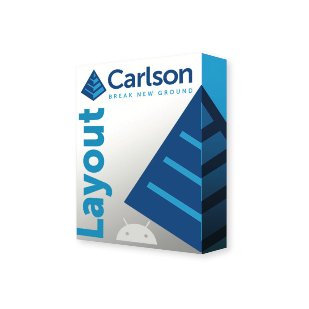
Carlson Layout Android Construction Stakeout and Field Layout Software
Get the best price for your setup
Contact our experts for the best possible price and configuration.
- Fast response
- Expert configuration advice
- No overpaying for features you do not need
Carlson Layout is Android field software for construction stakeout and site layout using RTK GNSS receivers, conventional total stations and robotic total stations. It gives construction crews, surveyors and site engineers practical tools for staking points, lines and surfaces directly from project data without needing a full desktop surveying package in the field.
DWG and DXF drawings can be opened through the mobile IntelliCAD engine, while support for Carlson coordinate files and projection systems makes it easier to move project information between the office and site. Crews can stake from fixed elevations or surfaces, work with line offsets and check design elevations directly in the field.
- Stake points, lines and surfaces using GNSS or total station equipment.
- Open DWG and DXF construction drawings directly on an Android field device.
- Connect to RTK corrections through cellular, modem or radio-based workflows.
Carlson Layout Highlights
| Platform | Android field software |
|---|---|
| Instrument support | RTK GNSS, conventional total stations and robotic total stations |
| CAD support | DWG and DXF through mobile IntelliCAD |
| Stakeout | Points, lines, surfaces, fixed elevations and line offsets |
| Optional modules | Survey and Roading modules for expanded field workflows |
You may also like…







Valued customers:










Find RTK Networks
Search NTRIP providers and connect to reliable RTK correction services.
Description
Carlson Layout for construction stakeout and field positioning
Carlson Layout is Android-based field software developed for construction professionals who need to transfer design information from the office to the ground using GNSS or total station equipment. It combines practical construction stakeout routines with CAD drawing support, coordinate geometry and broad instrument compatibility in a workflow intended for everyday site use.
The software is well suited to construction crews, site engineers, surveyors, groundworkers and contractors who regularly need to mark foundations, utilities, kerbs, roads, earthworks, structural points or other design positions. Instead of relying on printed drawings and manual measurements, crews can work directly with digital project information and navigate to the required position using connected surveying equipment.
Stake points lines and surfaces in the field
Carlson Layout supports the core tasks required for construction setting out. Users can stake individual points, follow lines and work from design surfaces, making the software useful across building construction, civil engineering, utilities and earthworks projects.
Layout can work with fixed design elevations or elevations taken from a surface model. This allows a crew to check whether the current ground or constructed level is above or below design without first creating a dedicated stake point for every location. On grading and excavation projects, this provides a quick way to check levels while moving around the site.
Line-based layout also allows positions to be set out by distance and offset from a reference line. This is useful when placing features parallel to kerbs, walls, utilities, road edges or other construction lines where the required working position is offset from the actual design element.
Bring DWG and DXF drawings directly to site
Construction information often arrives as CAD drawings rather than simple point lists. Carlson Layout supports DWG and DXF files through its mobile IntelliCAD engine, allowing drawing information to be viewed directly on the Android field device.
This gives the field crew visual context around the stakeout data. Instead of navigating only by point numbers, the operator can see nearby linework and other design features while working. That can make it easier to identify the correct foundation corner, utility line, kerb or structural element when a project contains large numbers of set-out points.
Carlson CRD and CRDB coordinate files are also supported, making it easier to exchange coordinate information with other Carlson software used in the office or by survey teams.
Work with RTK GNSS and total stations
Carlson Layout uses Carlson’s extensive instrument driver library and is designed to work with a wide range of GNSS receivers, conventional total stations and robotic total stations. This makes it suitable for companies that use equipment from different manufacturers or want field software that is not tied to one specific hardware platform.
With RTK GNSS, corrections can be received through workflows using a cellular connection, internal modem, internal radio or external radio, depending on the connected receiver and site setup. For contractors using an NTRIP correction service, this provides a straightforward route to centimetre-level positioning when suitable correction data and GNSS conditions are available.
Total station support is useful where satellite reception is limited or where the project requires measurements relative to established site control. Robotic total stations can also be used for one-person construction layout where the instrument and controller configuration supports that workflow.
Designed for construction crews as well as surveyors
Carlson Layout is deliberately focused on field layout rather than trying to reproduce every function of a complete surveying package. That makes it relevant to construction professionals who need reliable stakeout functions but do not necessarily require advanced boundary surveying, adjustment or specialist survey calculations.
A site engineer can use it to set foundation and structural positions, a groundworks crew can work with kerbs and drainage lines, and a surveyor can prepare coordinates and drawings in the office before handing the project to a construction team. The same project data can therefore move between office preparation and field layout without being recreated from scratch.
Coordinate systems and project positioning
Carlson Layout supports Carlson’s projection library, allowing project coordinates to be handled within established coordinate-system workflows. This is particularly important when GNSS is being used on projects designed in grid coordinates rather than arbitrary local values.
For local construction sites, project data can also be prepared around established site control. Using consistent coordinates between the drawing, field controller and survey equipment helps prevent the common problem of crews working from different versions or coordinate references.
Cloud based file handling
Project files can be handled through Google Drive and other cloud-storage workflows supported by the Android device. In practical terms, this can make it easier for an office technician to send an updated drawing or coordinate file to the field without physically connecting the controller to a computer.
This is especially useful on projects where drawings change during construction. Crews can receive updated files, while normal project-management procedures can still be used to make sure the correct revision is being set out.
Optional Survey Module
For users who need more than basic construction layout, Carlson offers an optional Survey Module. It expands Layout with functions including automatic point collection by interval, static data logging, advanced graphical averaging, SHP file import and export and Quick Codes for frequently used feature codes.
These additions are useful for surveyors, GIS-related fieldwork and construction teams that also need to collect as-built information. Quick Codes can speed up repetitive data collection by keeping commonly used feature codes directly available during measurement and stakeout.
Optional Roading Module
The optional Roading Module is aimed at contractors and survey teams working on roads, kerbs and linear infrastructure. It adds the ability to load centre lines and profiles, create a road definition from a polyline and stake an alignment.
Multiple road definitions can be created and switched between as work progresses, and road definitions can be shared between jobs on the same site. This makes the module useful on larger civil projects where several alignments or construction stages need to be handled within one project area.
Useful for construction verification and as built work
Carlson Layout is not limited to placing new points. Measurements and elevation checks can also help crews confirm completed work against the design. A user can check a surface or fixed elevation at the current position and identify whether excavation, fill or installed construction is at the required level.
This can be valuable for checking formation levels, concrete works, earthworks, kerbs and other construction elements before the next stage of a project begins. Where more detailed data collection is required, the optional Survey Module extends the available measurement tools.
Android field workflow
Because Carlson Layout runs on Android, it can be used on compatible Android phones, tablets and rugged field controllers. Carlson’s documentation confirms Android as the operating platform, while current product information focuses on modern Android field hardware for professional use.
For construction sites, a rugged Android controller or tablet is normally the practical choice because it provides a larger drawing view, physical protection and suitable connectivity for GNSS receivers or total stations.
Who is Carlson Layout for?
Carlson Layout is intended for construction layout professionals, surveyors, site engineers, civil contractors, groundworkers, utility contractors, road builders and other field crews that need to transfer digital design positions onto the ground. It is particularly useful for organisations that want a straightforward construction-focused interface while retaining access to professional GNSS and total station equipment.
It can also suit companies with mixed surveying hardware because Carlson provides drivers for a broad range of instruments. This can help businesses continue using existing GNSS receivers or total stations instead of selecting field software around a single hardware manufacturer.
Carlson Layout from Global GPS Systems
Global GPS Systems can help configure Carlson Layout for the GNSS receiver, total station, Android controller and RTK correction method used on your projects. This is useful when selecting a complete construction layout setup because software compatibility, communication method and field hardware all need to work together.
For customers who need additional surveying or road-construction functions, Global GPS Systems can also help determine whether the standard Layout configuration is sufficient or whether the optional Survey or Roading module better matches the required field workflow.
Specifications
Carlson Layout 2.0 Specifications
Software Overview
| Product name | Carlson Layout |
|---|---|
| Current generation | Carlson Layout 2.0 |
| Product type | Android field layout, construction stakeout and survey data collection software |
| Operating platform | Android smartphones and tablets |
| Primary applications | Construction layout, site stakeout, point and line stakeout, surface layout, as-built data collection, grading checks, road layout and survey fieldwork |
| Typical users | Construction contractors, civil contractors, utility contractors, concrete and foundation crews, surveyors, site engineers and construction layout professionals |
| GNSS support | Compatible RTK GNSS / GPS receivers |
| Conventional total station support | Supported with compatible instruments and configuration |
| Robotic total station support | Supported with compatible instruments and configuration |
| Hybrid GNSS + total station operation | Available through the Carlson Layout 2.0 Hybrid+ module |
| CAD engine | Mobile IntelliCAD engine |
| Hardware driver library | Full Carlson field instrument driver library |
Available Modules
| Module | Primary Function | Typical Application |
|---|---|---|
| Carlson Layout | Core construction layout, stakeout, CAD, coordinate and instrument functions | General site and construction layout |
| Survey Module | Expanded survey data collection, averaging, static logging, SHP support and Quick Codes | Survey and detailed as-built data collection |
| Roading Module | Centerline, profile and alignment-based road layout | Road, curb and civil infrastructure construction |
| Hybrid+ Module | Combined GNSS and robotic total station operation | Hybrid surveying and construction stakeout |
Core Construction Layout Functions
| Point layout | Supported |
|---|---|
| Line layout | Supported |
| Surface layout | Supported |
| Two-tap layout workflow | Simple point, line and surface layout workflow designed for rapid field operation |
| Point stakeout | Supported |
| Line stakeout | Supported |
| Line offsets | Layout by distance and offset from a selected line |
| Surface-based elevations | Points can be laid out using elevations derived from a design surface |
| Fixed elevations | Points can be laid out using user-defined fixed elevations |
| Surface elevation checking | Surface elevations can be checked without first creating a point |
| Fixed elevation checking | Fixed design elevations can be checked without first creating a point |
| Cut / fill guidance | Available during applicable elevation and surface stakeout workflows |
| Live navigation | Graphical guidance directs the operator toward the selected layout position |
| Sub-meter graphical guidance | Detailed graphical guides are displayed as the operator approaches the target |
Field Data Collection
| Point collection | Supported |
|---|---|
| As-built measurements | Supported |
| Point ID | Supported |
| Description | Supported |
| Layer assignment | Supported |
| Rod height configuration | Supported for compatible GNSS and total station workflows |
| GPS measurement settings | Includes applicable settings such as rod height, elevation mask, audio mode and receiver-specific configuration |
| Real-time GNSS accuracy display | Supported |
| GNSS solution status | Displayed during applicable GNSS measurement workflows |
| Satellite information | Displayed for compatible GNSS receivers |
CAD and Drawing Support
| Mobile CAD engine | IntelliCAD |
|---|---|
| DWG files | Full field support |
| DXF files | Full field support |
| CAD-to-field workflow | CAD drawings can be brought directly to the Android field device for layout |
| Point selection from CAD | Supported |
| Line selection from CAD | Supported |
| Surface-based stakeout | Supported with compatible design surface data |
| Map / plan view | Integrated graphical field map |
| Layer-based workflow | Supported through the mobile CAD environment |
Coordinate File Compatibility
| Carlson CRD | Supported |
|---|---|
| Carlson CRDB | Supported |
| ASCII coordinate import | Supported |
| ASCII coordinate export | Supported |
| Custom ASCII formats | Supported using customizable NLTemplate-based .io format definitions |
| CSV point export | Supported |
| HTML point export | Supported |
| PDF point reports | Supported through the configurable point-report template system |
| Custom import / export templates | Users can copy and modify supplied templates to create project-specific coordinate formats |
ASCII Coordinate Fields
| Point ID | Supported |
|---|---|
| X coordinate | Supported |
| Y coordinate | Supported |
| Z coordinate / elevation | Supported |
| Description | Supported |
| Layer | Supported |
| Date | Supported |
| Time | Supported |
| Horizontal standard deviation | Supported in applicable export templates |
| Vertical standard deviation | Supported in applicable export templates |
Coordinate Systems and Projections
| Carlson projection library | Full Carlson projection library supported |
|---|---|
| Projected coordinate systems | Supported |
| GNSS geographic coordinates | Supported through compatible GNSS receiver configurations |
| Geoid support | Supported in applicable GNSS workflows |
| Geoid application to mock location | Optional geoidal offset can be applied when Carlson Layout supplies Android mock positions |
| Mock-location coordinate output | WGS84 latitude and longitude can be broadcast to other Android applications |
GNSS / RTK Instrument Support
| GNSS receiver control | Supported through the Carlson driver library |
|---|---|
| RTK rover operation | Supported with compatible GNSS receivers |
| Base / rover operation | Supported with compatible receiver and radio configurations |
| NTRIP corrections | Supported through Data Collector Internet using a mobile-data or Wi-Fi connection |
| NTRIP credentials | Can be configured in the RTK settings |
| NTRIP mountpoint download | Supported |
| Receiver internal GSM | Supported with compatible GNSS hardware |
| Receiver internal radio | Supported with compatible base / rover hardware |
| External radio corrections | Supported with compatible equipment |
| Cell phone / tablet data connection | Can be used for applicable RTK correction connections |
| Real-time accuracy information | Displayed during GNSS operation |
RTK Correction Connection Methods
| Connection Method | Support | Typical Use |
|---|---|---|
| Data Collector Internet / NTRIP | Yes | RTK network corrections through tablet mobile data or Wi-Fi |
| Receiver Internal GSM | Yes, hardware-dependent | RTK network corrections using the receiver's internal cellular modem |
| Receiver Internal Radio | Yes, hardware-dependent | Local GNSS base-to-rover corrections |
| External Radio | Yes, hardware-dependent | External base / rover radio correction link |
Total Station Support
| Conventional total stations | Supported through compatible Carlson instrument drivers |
|---|---|
| Robotic total stations | Supported through compatible Carlson instrument drivers |
| Bluetooth communication | Supported on compatible Android devices and survey instruments |
| Instrument profiles | Instrument manufacturer, model and communication configuration can be stored in Layout |
| Multi-brand hardware support | Supported through Carlson's broad field instrument driver library |
| Carlson robotic total stations | Supported, including compatible Carlson CR-series instruments |
| One-person robotic layout | Supported with compatible robotic hardware and licensed configuration |
Survey Module
| Module type | Optional Carlson Layout expansion module |
|---|---|
| Auto by Interval | Supported |
| Static GNSS data logging | Supported with compatible GNSS hardware |
| Advanced Graphical Averaging | Supported |
| SHP file import | Supported |
| SHP file export | Supported |
| Quick Codes | Supported |
| Quick Code function | Favorite feature codes can be accessed from a side menu for one-touch storing and coding |
| Quick Codes during stakeout | Available while staking |
Roading Module
| Module type | Optional Carlson Layout 2.0 road construction and alignment module |
|---|---|
| Centerline loading | Supported |
| Profile loading | Supported |
| Create road from polyline | Supported |
| Multiple road definitions | Supported |
| Quick road-definition switching | Supported |
| Alignment stakeout | Supported |
| Shared road definitions | Road definitions can be shared between jobs on the same site |
| Typical applications | Road layout, curb layout, alignment stakeout and other linear civil construction workflows |
Hybrid+ Module
| Module type | Optional Carlson Layout 2.0 GNSS and robotic total station module |
|---|---|
| Simultaneous GNSS and total station workflow | Supported with compatible hardware |
| Smart Lock | Supported |
| Follow Me | Supported |
| Backup Tracking | Supported |
| Cross checking | Supported |
| GNSS-to-total-station switching | Designed for quick switching between GNSS and total station measurement |
| Typical application | Maintain productivity where satellite visibility or total station line of sight changes across a construction site |
Cloud and File Handling
| Google Drive integration | Supported |
|---|---|
| Other cloud storage services | Supported through compatible Android file and cloud-storage workflows |
| Local Android storage | Supported |
| USB file transfer | Supported by compatible Android devices |
| CAD field transfer | DWG and DXF files can be transferred to the Android device and opened directly in Layout |
| Coordinate file transfer | CRD, CRDB and customizable ASCII workflows supported |
Reporting
| Field reports | Integrated reporting options |
|---|---|
| Point coordinate reports | Supported |
| CSV coordinate reports | Supported |
| HTML coordinate reports | Supported |
| PDF coordinate reports | Supported |
| Custom report templates | NLTemplate-based point-report templates can be modified for project-specific output |
| Reportable coordinate fields | Can include point ID, X, Y, Z, description, layer, date, time and applicable horizontal / vertical precision values |
Android Mock Location Integration
| Android Mock Location provider | Carlson Layout can provide its high-accuracy GNSS position to the Android operating system |
|---|---|
| External Android app positioning | Compatible Android applications can use the GNSS position supplied by Carlson Layout |
| Esri Field Maps | Documented integration using Android Mock Locations |
| Documented minimum Layout version for BRx7 / Field Maps workflow | Carlson Layout 1.10.9 or newer |
| Mock Location Only mode | Available for using Layout primarily as the GNSS position provider |
| Background position broadcast | Mock-location broadcasting can continue while Layout is minimized on supported Android devices |
| Geoid correction | Optional geoid offset can be applied to the mock-location output |
Hardware Compatibility
| Instrument ecosystem | Multi-brand through Carlson's field driver library |
|---|---|
| RTK GNSS receivers | Supported |
| Conventional total stations | Supported |
| Robotic total stations | Supported |
| Carlson Viking | Compatible subject to current Layout build and receiver driver support |
| Carlson BRx-series GNSS | Supported; Carlson documentation specifically includes BRx7 workflows |
| Carlson CR-series robotic total stations | Supported with compatible model and Layout configuration |
| Third-party equipment | Supported where an applicable Carlson Layout instrument driver is available |
| Hardware lock-in | Not restricted to a single GNSS or total station manufacturer |
Bluetooth and Device Connectivity
| Bluetooth instrument communication | Supported |
|---|---|
| Android Bluetooth device selection | Survey instruments can be added and selected from the Layout communication configuration |
| Android Location service | Some Android devices require Location services to be enabled for Bluetooth device discovery and connection |
| Cellular data | Supported for internet-based RTK corrections when available on the Android device |
| Wi-Fi | Can be used for applicable internet, cloud and RTK correction workflows |
| USB | Can be used for file transfer on compatible Android hardware |
Current Layout 2.0 Recommended Android Device Profile
| Operating system | Android 12 or newer recommended for current Layout 2.0 deployments |
|---|---|
| Processor | Google Tensor or comparable 64-bit octa-core processor recommended |
| RAM | 12 GB recommended for current high-performance deployments |
| Internal storage | 64 GB or more recommended |
| USB | USB-C recommended |
| Cellular | 4G LTE capability and SIM support recommended when data-collector internet is required |
| Wi-Fi | 802.11 a/b/g/n/ac, 2.4 GHz and 5 GHz recommended |
| Bluetooth | Bluetooth 5.0 or newer recommended |
| Field protection | Rugged, drop-resistant, dustproof and waterproof hardware recommended; IP68-class devices are suitable for demanding field use |
Published Legacy Minimum Android Requirements
| Device type | Android phone or tablet |
|---|---|
| Published minimum Android version | Android 5.0 Lollipop or newer in Carlson's October 2020 installation manual |
| Built-in compass | Preferred |
| Built-in GPS | Preferred |
| Current deployment note | The older Android 5.0 minimum applies to legacy Layout releases; current Layout 2.0 installations should use current supported Android hardware and software |
Installation and Application Access
| Application format | Android application |
|---|---|
| Legacy installation method | APK package installation documented by Carlson |
| Upgrade installation | Installation behavior depends on Layout version and Android device |
| Device location permission | Required for applicable internal GPS, compass, Bluetooth and positioning functions |
| File access | Required for applicable CAD, coordinate, configuration and report file operations |
| Registration | Software registration / activation required |
Typical Construction Applications
| Application | Support | Typical Workflow |
|---|---|---|
| Building corners | Yes | Stake CAD or coordinate points in the field |
| Foundations | Yes | Layout points and lines from construction plans |
| Concrete layout | Yes | Stake points, lines, elevations and offsets |
| Curbs | Yes | Line, offset and Roading Module workflows |
| Utilities | Yes | Point, line and road / alignment-based layout |
| Site grading | Yes | Check design surfaces, fixed elevations and cut / fill |
| Road construction | Yes | Centerline, profile and alignment stakeout with Roading Module |
| As-built verification | Yes | Measure completed construction and compare with project design |
| Survey data collection | Yes | Expanded through the Survey Module |
Workflow Capability Summary
| Capability | Core Layout | Optional Module |
|---|---|---|
| GNSS RTK layout | Yes | Not required |
| Total station layout | Yes, configuration-dependent | Hybrid+ for combined GNSS / robotic workflow |
| Point stakeout | Yes | Not required |
| Line and offset stakeout | Yes | Not required |
| Surface layout | Yes | Not required |
| DWG / DXF | Yes | Not required |
| CRD / CRDB | Yes | Not required |
| Advanced graphical averaging | Standard functionality depends on configuration | Survey Module |
| Static GNSS logging | Not a core Layout feature | Survey Module |
| SHP import / export | Not a core Layout feature | Survey Module |
| Road alignment stakeout | Basic line workflows available | Roading Module for dedicated road definitions |
| Simultaneous GNSS + robotic total station | No | Hybrid+ Module |
Version and Compatibility Notes
| Carlson Layout 2.0 release | Current generation released with new Roading and Hybrid+ modules |
|---|---|
| Older Carlson brochure status | Some 2025 Carlson brochure material still describes Hybrid as “coming soon”; later Carlson release communications confirm Hybrid+ as part of Layout 2.0 |
| Module licensing | Survey, Roading and Hybrid+ functionality depends on the modules included with the purchased license |
| Instrument compatibility | Depends on the installed Layout build, licensed functionality, Android device, instrument model, firmware and communication method |
| Android compatibility | Exact compatibility should be verified for the Android tablet or smartphone used with the current Layout build |
Specifications and package contents may vary by configuration, region or manufacturer update. Always check the current configuration before ordering.
Reviews (0)
Only logged in customers who have purchased this product may leave a review.
FAQ
Carlson Layout FAQ
Carlson Layout & Construction Applications
What is Carlson Layout?
Carlson Layout is Android-based field software designed for construction layout and site positioning with compatible RTK GNSS receivers, conventional total stations and robotic total stations. It provides an easy-to-use interface for bringing design data into the field, staking points, lines and surfaces, checking elevations and performing coordinate geometry calculations.
Who is Carlson Layout designed for?
Carlson Layout is designed primarily for construction contractors, site engineers, layout professionals, foremen, survey technicians and other field personnel who need to transfer positions and elevations from construction plans to the jobsite without requiring a full surveying software package.
What can Carlson Layout be used for?
Typical applications include building and foundation layout, site grading, utility layout, road and alignment stakeout, checking finished or existing elevations, locating design points, setting offsets, positioning site features and recording as-built or verification measurements.
What is the difference between Carlson Layout and Carlson SurvPC?
Carlson Layout is a streamlined Android application focused on construction layout and straightforward field measurement. Carlson SurvPC is a more extensive Windows-based surveying package with a broader range of professional survey, COGO, GNSS, total station, road, surface and data-processing functions. Layout is generally intended for users who need an efficient construction-focused workflow rather than the complete functionality of SurvPC.
Does Carlson Layout run on Android?
Yes. Carlson Layout is developed for the Android platform and can be used on compatible Android tablets and mobile devices. This gives users a wide choice of field hardware, including rugged Android data collectors and tablets designed for construction environments.
Can Carlson Layout be used by contractors who are not professional surveyors?
Yes. Carlson Layout is specifically designed to simplify construction positioning and stakeout. Its workflow focuses on common field tasks such as selecting a design point, line or surface and navigating to the required position. Appropriate project control, coordinate systems and measurement equipment still need to be established correctly to achieve the required accuracy.
GNSS, Total Stations & Equipment Compatibility
Can Carlson Layout be used with RTK GNSS receivers?
Yes. Carlson Layout supports RTK GNSS receivers through Carlson's extensive hardware driver library. A compatible GNSS rover can provide high-accuracy positioning for construction stakeout, elevation checks, site measurements and other positioning tasks.
Can Carlson Layout connect to an RTK correction network?
Yes. Carlson Layout supports RTK workflows where corrections are received through a cellular connection, an internal modem, an internal radio or an external radio. This allows compatible GNSS equipment to use network RTK or local base-station corrections depending on the receiver and project configuration.
Can Carlson Layout be used with a total station?
Yes. Carlson Layout supports compatible conventional and robotic total stations in addition to GNSS equipment. This makes it possible to use optical positioning on projects where GNSS reception is limited by buildings, structures, trees or other obstructions.
Can Carlson Layout control a robotic total station?
Yes. Compatible robotic total stations can be operated through Carlson Layout. This allows a construction layout operator to work from the prism position while the robotic instrument automatically performs supported aiming, tracking and measurement functions.
Which brands of GNSS receivers and total stations work with Carlson Layout?
Carlson Layout uses Carlson's extensive instrument driver library and supports equipment from Carlson as well as many other surveying hardware manufacturers. Compatibility varies by instrument model, communication method and software version, so the exact GNSS receiver or total station should be checked before installation.
Does the GPS built into an Android tablet provide survey-grade accuracy in Carlson Layout?
No. The internal GNSS in a typical Android phone or tablet is intended mainly for navigation and generally does not provide the accuracy required for professional construction stakeout. High-accuracy work normally requires Carlson Layout to be connected to a compatible survey-grade RTK GNSS receiver or total station.
CAD Files, Points, Surfaces & Stakeout
Can Carlson Layout open DWG and DXF files?
Yes. Carlson Layout provides support for DWG and DXF CAD drawings through its mobile IntelliCAD technology. This allows construction drawings and design linework to be taken directly into the field and used as a graphical reference for measurement and stakeout.
Can Carlson Layout work with Carlson CRD and CRDB coordinate files?
Yes. Carlson Layout is compatible with Carlson CRD and CRDB coordinate files, making it easier to exchange point information with other Carlson field and office software.
Can I stake points from a CAD drawing with Carlson Layout?
Yes. Design information from supported CAD drawings can be used to create or select stakeout positions. Carlson Layout provides a streamlined workflow for navigating to project points and displaying the distance and direction required to reach the design location.
Can Carlson Layout stake lines and offsets?
Yes. Layout can position points relative to lines and supports layout by distance and offset from a line. This is useful for features such as building lines, kerbs, utilities, foundations, fences and other construction elements where an offset position is required.
Can Carlson Layout stake from a surface?
Yes. Carlson Layout can use design surfaces as the elevation reference during stakeout. This allows operators to compare their current measured elevation with the design surface and determine the required cut or fill at a location.
Can Carlson Layout check an elevation without storing a point?
Yes. One of Carlson Layout's construction-focused features is the ability to check either a fixed elevation or a surface elevation without first creating and storing a survey point. This is useful for quickly checking grade during excavation, grading, concrete and other construction operations.
Does Carlson Layout support coordinate systems and map projections?
Yes. Carlson Layout supports Carlson's projection library, allowing projects to be configured with appropriate coordinate reference systems. Correct projection, datum, units and site control settings are important when combining GNSS measurements with engineering or CAD design coordinates.
Survey Module, Roading & Data Workflow
What does the Carlson Layout Survey Module add?
The optional Survey Module extends Carlson Layout with additional field-data collection functions including Auto by Interval, static GNSS data logging, advanced graphical averaging, SHP file import and export and Quick Codes for faster feature coding while collecting or staking points.
What are Quick Codes in Carlson Layout?
Quick Codes are a user-defined list of frequently used feature codes available from a convenient side menu. They allow an operator to quickly assign descriptions or feature codes while storing measurements, reducing repetitive data entry during field collection.
Can Carlson Layout import and export shapefiles?
Yes. SHP file import and export is available through the optional Survey Module. This can be useful for construction, asset and GIS workflows where field information needs to be exchanged with mapping or geographic information systems.
What does the Carlson Layout Roading Module add?
The optional Roading Module adds tools for loading centerlines and profiles, creating a road from a polyline, defining multiple road configurations, switching between road definitions and staking alignments. Road definitions can also be shared between jobs on the same site.
Can Carlson Layout use Google Drive or cloud storage?
Yes. Carlson Layout integrates with Google Drive and other supported cloud-storage services to simplify moving project files between the office and field. An internet connection is required when actively transferring files through an online storage service.
Can Carlson Layout work without an internet connection?
Many field functions can be performed without an active internet connection once the required project files are stored on the Android device and the measurement equipment uses a connection that does not depend on the internet. Internet access is still required for functions such as cloud file transfer and network-based RTK corrections.

 GPS & GNSS
 Total Stations
 Data collectors
 Software
 Correction services
 Machine control
 External radio
 Marine
 Accessories
Reviews
There are no reviews yet