

 GPS & GNSS
 Lidar scanning
 Total Station
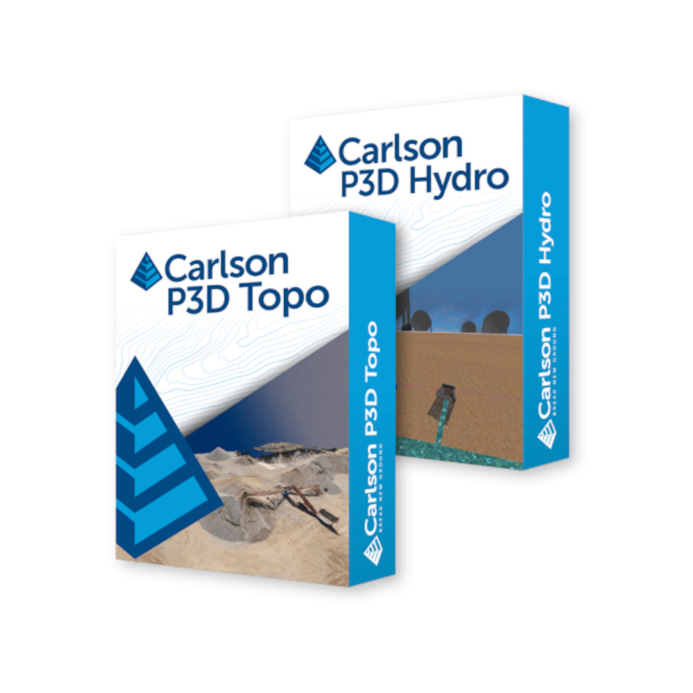
Carlson Precision 3D Topo Hydro Surface and Drainage Software
Get the best price for your setup
Contact our experts for the best possible price and configuration.
- Fast response
- Expert configuration advice
- No overpaying for features you do not need
Carlson Precision 3D Topo and Hydro is professional 3D engineering software for surveyors, civil engineers, contractors, LiDAR specialists and drone mapping professionals. P3D Topo turns survey points, polylines and dense point clouds into editable terrain surfaces, while P3D Hydro extends the same 3D environment into drainage, culvert, channel and storm sewer design.
The software is particularly useful when working with large LiDAR or UAV point clouds. Bare-ground filtering can help remove vegetation, vehicles and buildings, while cropping, thinning, merging and surface editing tools turn raw scan data into practical terrain models. Engineers can then calculate cut and fill volumes, edit surfaces with dynamic contours and transfer finished design information into established CAD workflows.
Carlson Precision 3D Topo Hydro Highlights
| Main modules | P3D Topo for terrain and point clouds plus P3D Hydro for drainage design |
|---|---|
| Point cloud support | LAS LAZ PLY XYZ PTS E57 and PCD workflows |
| Surface tools | Surface creation editing smoothing breaklines dynamic contours and volumes |
| Point cloud processing | Bare ground filtering cropping merging thinning and outlier removal |
| Hydrology design | Storm sewers culverts drainage areas runoff channels headwalls and grading |
| Data exchange | LandXML DXF TIN TN3 TTM and CAD based workflows |
| Processing platform | 64 bit multithreaded processing designed for large 3D datasets |
You may also like…



Valued customers:










Find RTK Networks
Search NTRIP providers and connect to reliable RTK correction services.
Description
Carlson Precision 3D Topo and Hydro 3D Engineering Software
Carlson Precision 3D Topo and Hydro is a 3D engineering platform for professionals who need to turn survey measurements, LiDAR scans, drone mapping data and terrain models into practical engineering information. Instead of using 3D only to visualise a project, Carlson P3D allows users to directly edit terrain, calculate quantities and develop drainage designs while working inside the 3D model.
The platform is divided into two main areas. P3D Topo focuses on point clouds, terrain surfaces and earthwork analysis. P3D Hydro builds on the terrain environment with tools for drainage analysis, culverts, channels, headwalls and storm sewer systems. This makes the software relevant from the initial survey and LiDAR processing stage through to civil and drainage design.
Turn LiDAR and Drone Point Clouds into Useful Terrain Models
P3D Topo is particularly useful for surveyors and drone mapping teams dealing with dense point clouds. Data captured by terrestrial LiDAR, mobile scanners, SLAM systems or aerial mapping workflows can contain millions of points, but a large point cloud is not automatically a useful engineering surface. Precision 3D provides tools for cleaning, reducing and organising that data before it is used for calculations or CAD deliverables.
Supported point-cloud workflows include common formats such as LAS, LAZ, PLY, XYZ, PTS, E57 and PCD. Multiple point-cloud files can be loaded and combined, which is useful when a project has been captured in several scans, flight blocks or survey areas.
For drone users, Precision 3D fits after the photogrammetry processing stage. The aerial images are first converted into a point cloud or terrain dataset using suitable photogrammetry software. P3D can then be used to clean the resulting point cloud, build terrain surfaces, calculate volumes and prepare data for engineering or CAD use.
Bare Ground Filtering for Survey and LiDAR Data
One of the practical challenges with LiDAR and drone surveys is separating the terrain from objects sitting above it. Precision 3D includes bare-ground filtering designed to identify and remove features such as trees, vegetation, vehicles and buildings from the working terrain dataset.
Filters can also be applied within selected polygon boundaries. This is useful when one section of a site requires different processing from another. For example, a surveyor may want to apply more aggressive filtering in a vegetated area while leaving a cleared construction zone largely unchanged.
Outlier, shadow-point and smart voxel filters provide additional methods for reducing noise and managing unnecessarily dense datasets. The objective is not simply to remove as many points as possible, but to produce a terrain dataset that remains detailed enough for the measurements and engineering calculations required.
Create Surfaces from Point Clouds Survey Points and Polylines
Precision 3D Topo can create terrain surfaces directly from point-cloud data as well as from conventional survey points and polylines. This means GNSS and total station measurements can be combined with LiDAR or drone data when a project requires several methods of data collection.
For example, an aerial survey may provide broad coverage of a quarry or construction site, while GNSS observations are used for breaklines, control points or areas that require additional detail. P3D allows these sources to contribute to the working surface instead of forcing the user to treat every dataset separately.
Surface creation can retain a high level of point-cloud detail or use grid reduction and simplification where a lighter model is more practical. This allows the user to balance surface resolution against computer performance and the level of detail actually needed for the project.
Edit Terrain Directly in a 3D Environment
A generated surface rarely needs to be accepted exactly as it was first calculated. Precision 3D includes interactive terrain editing tools so surveyors and engineers can correct the model while seeing the effect in 3D.
Points can be added or removed, elevations changed and breaklines introduced to control important terrain features. Triangle edges can be swapped or removed and sections of the surface can be cropped or merged. Dynamic contours update while the surface is edited, helping the user understand how a change affects the terrain rather than waiting until the end of the workflow.
Additional tools can smooth surfaces, improve ridges and valleys and remove small unwanted depressions. These functions are useful when automatically generated terrain contains local imperfections that do not represent the actual ground.
Work with Breaklines and Important Terrain Features
Breaklines are important when modelling features where elevation changes along a defined edge, such as kerbs, drainage channels, embankments, retaining structures and the top or bottom of a slope. Precision 3D allows breakline polylines to be added to existing surfaces so the triangulation follows these measured or designed features more accurately.
This is particularly useful when combining dense point-cloud data with conventional survey observations. A LiDAR dataset may contain many surface points, while a surveyor has measured the exact edge of a channel or kerb with GNSS or a total station. The breakline can then guide the terrain model through that critical geometry.
Calculate Cut Fill and Surface Volumes
P3D includes surface volume tools for comparing terrain models and calculating cut and fill. This makes the software useful for earthworks, stockpiles, quarry surveys, construction progress measurements and site preparation.
A contractor can compare the existing ground with a proposed surface, while a survey company can compare terrain captured on different dates to determine how much material has moved. Cut and fill values can be associated with the surfaces, giving the user immediate feedback while reviewing the 3D model.
For stockpile work, the ability to process large point clouds directly can reduce the need to manually select a relatively small set of individual survey points before calculating volume. The available density can be retained where it provides useful detail or reduced when a lighter surface is sufficient.
Create Pads Slopes Ditches and Designed Terrain
Precision 3D is not limited to modelling existing ground. Surface tools can also be used to create and modify proposed terrain. Pad templates, slope-based elevations and other grading tools allow engineers and contractors to develop surfaces for practical site work.
This can be useful when designing building pads, access areas, drainage features or earthworks. Because the work is carried out in 3D, the relationship between the proposed surface and surrounding existing terrain remains visible while the design is developed.
Precision 3D Hydro for Drainage Engineering
Carlson Precision 3D Hydro extends the platform from terrain modelling into hydrologic and hydraulic design. It can delineate drainage and ponding areas, calculate runoff from surface models and support drainage structures directly within the 3D environment.
This approach is useful because drainage design is closely connected to terrain. Instead of looking only at lines and numerical tables, engineers can inspect the drainage system in relation to the actual surface and see how culverts, pipes, inlets and grading interact with the site.
Full Storm Sewer Design
P3D Hydro includes tools for complete storm sewer design. Inlets and other drainage structures can be positioned in the model and connected into a pipe network, allowing designers to develop and revise the system while maintaining its relationship with the terrain.
For road and site projects, this can make low points, kerb lines, inlet locations and pipe crossings easier to understand. Carlson also provides collision analysis for situations where pipes or utilities cross, helping designers inspect horizontal and vertical clearance while developing the network.
Once the design is ready, DynamicCAD functionality can transfer the engineering information into conventional CAD deliverables. This helps keep the intuitive 3D design environment connected to the drawings commonly required for construction and project documentation.
Culvert Design in the 3D Terrain Model
P3D Hydro can locate low points, size culverts and position them directly within the terrain. Multiple barrel configurations are supported, allowing the drainage structure to be adapted to the hydraulic and physical requirements of the project.
Headwalls and endwalls can be selected using drag-and-drop workflows and fitted to the terrain using solid modelling. When a culvert or headwall is moved, the software can restore and recalculate the surrounding terrain rather than leaving the user to manually repair the complete model.
This is useful for road, railway, site-development and infrastructure projects where the drainage structure must fit both the hydraulic requirements and the shape of the surrounding ground.
Drainage Areas Runoff and Ponding
Terrain models can be used to identify drainage and ponding areas and support runoff calculations. This allows the engineer to analyse how water moves across the surface before deciding where drainage structures should be placed.
For a surveyor supplying terrain information to an engineering team, the practical benefit is that the same detailed surface produced from GNSS, total station, LiDAR or drone data can continue into drainage design rather than being simplified and rebuilt in a separate workflow.
Channel and Surface Grading Workflows
P3D Hydro can also support channel design and grading around drainage structures. Upstream and downstream surfaces can be modified so the final terrain works with the proposed culvert or drainage system rather than treating the structure as an isolated object.
For construction professionals, seeing the complete design in 3D can make it easier to understand the excavation and grading required around an inlet, outlet or channel. Engineers can inspect the relationship between the drainage system and the surrounding ground before producing the final CAD information.
Connect Survey Data with Engineering Design
Precision 3D is particularly relevant to companies working across both surveying and engineering. GNSS or total station points can define important site features, while LiDAR and drone data provide dense coverage. These sources can be combined into a terrain model that then becomes the basis for quantities, grading or hydrology design.
This reduces the gap between collecting a site and designing from it. Instead of exporting a simplified surface at every stage, users can retain more of the original 3D information and refine it as the project moves from measurement to engineering.
CAD Integration with DynamicCAD
Carlson describes DynamicCAD as a way of creating conventional CAD deliverables while the user continues working in the Precision 3D environment. P3D Hydro also integrates with Carlson Civil Suite, AutoCAD and MicroStation workflows.
This is important in professional projects because clients and contractors often still require familiar CAD files and drawings even when the engineering work itself is performed in an advanced 3D application. Precision 3D therefore does not require the entire downstream project team to change how they receive design information.
Exchange Terrain and Point Cloud Data
Precision 3D supports common survey and engineering data exchange workflows including LandXML and DXF, while terrain models can be moved through formats such as TIN, TN3 and TTM. Point clouds can be saved as LAS or LAZ, including LAS/LAZ versions 1.2, 1.3 and 1.4 with coordinate projection WKT information.
This interoperability is important for survey companies using equipment and software from several manufacturers. Data collected with an RTK GNSS receiver, total station, LiDAR scanner or drone does not necessarily need to originate from a Carlson instrument before it can become useful inside the P3D workflow.
Designed for Large 3D Datasets
Precision 3D is a 64-bit application and is designed to use available computer memory when working with large models. Its processing is multithreaded, allowing suitable operations to make use of multiple CPU cores, while the 3D display benefits from a capable graphics card.
This matters when working with modern LiDAR and drone projects because datasets can become much larger than traditional point surveys. Computer specification therefore has a noticeable effect on the practical experience, especially when displaying dense point clouds or high-resolution surfaces.
Who Uses Carlson Precision 3D Topo
P3D Topo is suited to professionals who need to convert measured 3D information into reliable terrain and quantity data. Typical users include land surveyors processing topographic surveys, contractors calculating earthworks, quarry operators measuring material movement, civil engineers preparing terrain models and drone or LiDAR professionals turning dense point clouds into engineering surfaces.
It is also useful for survey companies that deliver more than a raw point cloud. Instead of handing a client millions of points and expecting them to determine how to use the data, the surveyor can create a cleaned terrain model, contours, volumes or CAD-ready surface information.
Who Uses Carlson Precision 3D Hydro
P3D Hydro is aimed more directly at civil and drainage engineering. Typical projects include roads, land development, site drainage, culvert design, storm sewer systems and surface grading around hydraulic structures.
Surveyors may also use Hydro where their role extends into design or where they need to check how a proposed drainage system interacts with measured terrain. Construction companies can use the 3D model to better understand the relationship between earthworks and underground drainage before work begins.
Useful for Drone Surveying without Being Drone Processing Software
For drone pilots and UAV survey teams, it is useful to distinguish P3D from photogrammetry software. Precision 3D does not replace the stage that turns raw aerial photographs into a georeferenced point cloud. Instead, it becomes valuable after that point cloud has been created.
The resulting aerial point cloud can be filtered, cropped, merged and turned into a terrain model. Survey control and measured breaklines can be added, and the finished surface can then be used for volume calculations, engineering or CAD delivery. This makes P3D a practical bridge between drone mapping output and the engineering work that follows.
Current Carlson Precision 3D Platform
The current Carlson download is identified as Precision 3D 2025 and contains the modular P3D Topo and P3D Hydro components. Carlson updated the current full installer in May 2026. Users should select the module or licence configuration that matches whether their work is focused on terrain and point-cloud processing, hydrology design or both areas.
Choosing Carlson Precision 3D with Global GPS Systems
The right Precision 3D configuration depends on the data you collect and the deliverables you need to produce. A survey or drone mapping company mainly processing LiDAR, surfaces and volumes may focus on P3D Topo, while civil engineers designing drainage networks, culverts and storm sewers will require the Hydro capabilities.
Global GPS Systems can help determine how Carlson Precision 3D fits with your existing GNSS receivers, total stations, LiDAR scanners, drone mapping workflow and Carlson office software. Matching the software to the way your team collects and delivers data helps create a practical workflow from the original field survey or point cloud through to the finished terrain, quantity or drainage design.
Datasheets & Manuals
Specifications
Carlson Precision 3D Topo / Hydro Specifications
Software Overview
| Product name | Carlson Precision 3D Platform (Carlson P3D®) |
|---|---|
| Available modules | Carlson P3D Topo and Carlson P3D Hydro |
| Product type | Professional 3D terrain, point cloud, surface modeling and hydrology engineering software |
| Primary applications | Topographic surface creation, LiDAR and drone point cloud processing, terrain modeling, earthwork volumes, drainage analysis, culvert design, channel design and storm sewer design |
| Typical users | Land surveyors, civil engineers, drainage engineers, contractors, earthwork professionals, drone mapping specialists and geospatial professionals |
| Design environment | Interactive 3D engineering environment with direct visualization of terrain, surfaces, drainage structures and design changes |
| CAD deliverables | 3D designs can be transferred automatically to CAD for conventional engineering documentation |
| Topo module | Creates, edits and analyzes high-resolution terrain and surface models from survey data, point clouds, LiDAR and aerial drone data |
| Hydro module | Provides 3D drainage, runoff, culvert, channel and storm sewer design functionality |
Current Release and Platform
| Current official platform installer researched | Carlson Precision 3D Platform 2025 |
|---|---|
| Latest full installer date researched | May 15, 2026 |
| Installer components | P3D Topo and P3D Hydro |
| Installer size | Approximately 1.03 GB |
| Application architecture | 64-bit |
| Processing architecture | Multithreaded |
| CPU scaling | Performance can increase with additional CPU cores |
| Memory utilization | 64-bit architecture allows P3D to use available system RAM to support large models |
| Graphics acceleration | Uses advanced 3D shaders; performance benefits from graphics hardware with strong shader-processing capability |
P3D Topo Overview
| Primary purpose | Convert survey, LiDAR, point cloud and aerial drone mapping data into usable high-fidelity 3D terrain surfaces |
|---|---|
| Survey point import | Supported |
| Polyline import | Supported |
| Existing surface import | Supported |
| Point cloud import | Supported |
| Traditional LiDAR data | Supported |
| Aerial drone survey data | Supported |
| Point cloud editing | Supported |
| Surface model creation | Supported |
| Surface refinement using survey data | Supported |
| Surface volume calculations | Supported directly from point clouds and surface models |
| Texturing and presentation | Advanced 3D texturing and presentation tools included |
Point Cloud Import
| Maximum simultaneous point cloud files | Up to 50 files at once |
|---|---|
| LAS | Supported |
| LAZ | Supported |
| PLY | Supported |
| XYZ | Supported |
| PTS | Supported |
| E57 | Supported |
| PCD | Supported |
| Multiple-file processing | Point cloud files can be loaded and automatically merged |
| Multi-core processing | Point cloud processing uses multiple CPU cores |
| Point thinning during import | Supported |
| Outlier removal | Supported |
| Bare-earth classification | Supported |
Point Cloud Filtering and Editing
| Bare-ground filtering | Removes or classifies objects such as trees, vegetation, vehicles and buildings to isolate terrain |
|---|---|
| Polygon-limited bare-ground filtering | Supported |
| Polygon-limited filters | Point cloud filtering can be restricted to selected polygon boundaries |
| Point selector | Selects point cloud regions for editing |
| Crop selected points | Supported |
| Delete selected points | Supported |
| Create new cloud from selection | Supported |
| Copy point cloud region inside polygon | Supported |
| Merge point clouds | Supported |
| Crop point clouds | Supported |
| Delete individual / selected cloud points | Supported |
| Polygon crop / delete | Supported |
| Smart voxel grid reduction | Supported |
| Outlier filter | Supported |
| Shadow-point filter | Supported |
LAS / LAZ Export
| LAS / LAZ version 1.2 | Supported |
|---|---|
| LAS / LAZ version 1.3 | Supported |
| LAS / LAZ version 1.4 | Supported |
| Coordinate projection metadata | WKT coordinate projection information can be stored with exported LAS / LAZ data |
Surface Creation
| Surface from point cloud | Supported |
|---|---|
| Full-resolution surface | Surface can be created without point reduction for maximum available resolution |
| Grid-reduced surface | Supported for faster handling of large datasets |
| Simplified surface | Supported |
| Surface from imported points | Supported |
| Surface from imported polylines | Supported |
| Add points to existing surface | Supported |
| Add breaklines to existing surface | Supported |
| Crop surfaces | Supported |
| Merge surfaces | Supported |
Surface Editing
| Real-time surface editing | Supported |
|---|---|
| Dynamic contours | Contours update during applicable surface editing operations |
| Add surface points | Supported |
| Remove surface points | Supported |
| Add breaklines | Supported |
| Swap triangle edges | Supported |
| Remove triangles | Supported |
| Edit point elevation | Supported |
| Set elevation from slope | Supported |
| Surface smoothing | Supported |
| Improve ridges | Supported |
| Improve valleys | Supported |
| Remove dimples | Removes small shallow depressions from applicable terrain models |
| PAD template surfaces | Create pad surfaces for cut-and-fill design |
| Polyline surface texturing | Supported |
| Crop surface to polyline | Supported |
| Merge edited surfaces | Supported |
Volume and Earthwork Tools
| Point cloud volume calculation | Supported |
|---|---|
| Surface volume calculation | Supported |
| Surface-to-surface volume | Supported |
| Unified volume command | Provides volume calculation for applicable point cloud and surface workflows |
| Cut volume | Supported |
| Fill volume | Supported |
| Cut / fill display | Applicable surfaces can display cut-and-fill volume information in the properties interface |
| PAD cut / fill design | Supported using PAD template surfaces |
Topo Mapping and Visualization
| Google Maps photographic background | Supported in documented P3D Topo surface workflows |
|---|---|
| Automated Google surface creation | Supported in documented P3D Topo workflows |
| Surface image draping | Supported |
| 3D terrain visualization | Supported |
| Surface texturing | Supported |
| Presentation tools | Advanced 3D presentation tools included |
Topo Import and Export Formats
| Format / Data Type | Import | Export / Use |
|---|---|---|
| LandXML | Yes | Yes |
| LandXML 2.0 | Supported in current-generation P3D workflows | Supported in current-generation P3D workflows |
| DXF | Yes | Yes |
| TIN | Surface workflow support | Yes |
| TN3 | Surface workflow support | Yes |
| TTM | Surface workflow support | Yes |
| LAS / LAZ | Yes | Yes |
| E57 | Yes | Point cloud workflow |
| KML / KMZ | Supported in P3D Topo workflows | Supported |
| OBJ | Version-dependent | Supported by current-generation P3D Topo workflows |
| 3D PDF | Not applicable | Supported by current-generation P3D Topo workflows |
| Grid points | Survey / surface input supported | Grid points can be exported for surface creation in other software |
P3D Hydro Overview
| Primary purpose | 3D hydrologic and hydraulic engineering design using terrain and surface models |
|---|---|
| Storm sewer design | Full storm sewer design capability |
| Culvert design | Supported |
| Channel design | Supported |
| Drainage area delineation | Supported |
| Ponding area delineation | Supported |
| Runoff calculations | Calculated directly from surface models |
| DynamicCAD documentation | Automated plan and profile CAD design documentation |
| 3D-to-CAD workflow | Designs can be created in P3D while CAD deliverables are generated through DynamicCAD workflows |
Drainage and Watershed Analysis
| Drainage area delineation | Supported directly from terrain models |
|---|---|
| Ponding analysis | Supported |
| Surface runoff calculation | Supported |
| Low-point identification | Used for culvert and drainage structure placement |
| Low-point snapping | Supported for fast drainage-structure placement |
| Road curb analysis | Supported through curb-line snapping and storm sewer tools |
| Gutter spread analysis | Supported in storm sewer design workflows |
| Sag inlet analysis | Supported |
| On-grade inlet analysis | Supported |
Culvert Design
| Round culverts | Supported |
|---|---|
| Rectangular culverts | Supported |
| Automatic low-point placement | Supported |
| Culvert sizing | Supported |
| Multiple barrel designs | Supported |
| Headwall selection | Drag-and-drop selection supported |
| Endwall selection | Drag-and-drop selection supported |
| Headwall fitting | Headwalls can be fitted from the Headwall Library using solid modeling |
| Upstream grading | Supported |
| Downstream grading | Supported |
| Move existing culvert | Supported with terrain restoration |
| Move existing headwall | Supported with terrain restoration |
| DTM restoration | Surface can be restored when culverts or headwalls are relocated |
Channel Design
| Open-channel design | Supported |
|---|---|
| Channel grading | Supported within the 3D terrain environment |
| Channel liner selection | Automated channel liner selection is available in documented P3D Hydro workflows |
| Terrain interaction | Channel design is performed directly against the 3D surface model |
Storm Sewer Design
| Complete storm sewer network design | Supported |
|---|---|
| Inlet placement | Supported directly in the 3D model |
| Curb-line snap | Automatically follows applicable curb geometry for precise inlet placement |
| Low-point snap | Supported |
| Manholes | Supported |
| Open-throat inlets | Supported by documented drainage-structure libraries |
| Grate inlets | Supported by documented drainage-structure libraries |
| Combination inlets | Supported by documented drainage-structure libraries |
| Headwalls | Supported |
| Drainage structure library | Integrated library of drainage structures |
| Custom structure dimensions | Supported |
| Pipe connection snapping | Existing drainage structures can be selected as pipe connection points |
| Upstream-to-downstream design | Supported |
| Downstream continuation | Supported |
Automated Inlet and Pipe Layout
| Automatic inlet series placement | Supported along applicable road gutter geometry |
|---|---|
| Maximum pipe-length criterion | Can be used to control automatic inlet spacing |
| Maximum gutter-spread criterion | Can be used to control automatic inlet spacing |
| Automatic pipe creation | Pipes can be generated between automatically positioned drainage structures |
| Peak-flow sizing | Storm sewer pipes can be sized using calculated peak-flow conditions |
| Documented design storm examples | 10-year, 25-year, 50-year and 100-year storm events |
Pipe and Utility Network Visualization
| Storm sewer pipes | 3D display supported |
|---|---|
| Sanitary sewer networks | Applicable networks can be imported and displayed from Carlson Hydrology workflows |
| Water utility networks | Applicable networks can be displayed in 3D |
| Gas utility networks | Applicable networks can be displayed in 3D |
| Pipe material visualization | Applicable network data can display different pipe materials |
| Surface transparency | Can be used to inspect buried utility networks and drainage structures in the 3D environment |
Collision and Clearance Analysis
| Pipe collision analysis | Supported |
|---|---|
| Vertical pipe separation | Can be checked and reported |
| Horizontal pipe separation | Can be checked and reported |
| Crossing-clearance inspection | Supported in the 3D model |
| Visual interference review | Supported using the interactive 3D environment |
DynamicCAD and CAD Integration
| DynamicCAD | Supported |
|---|---|
| Automated plan documentation | Supported |
| Automated profile documentation | Supported |
| Simultaneous CAD drawing | Applicable P3D designs can be represented in CAD while the design is developed in the 3D environment |
| Drainage structures in CAD | Inlets and other structures can be represented in CAD with geometry corresponding to the 3D design |
| Carlson sewer data | Storm sewer designs can be transferred to compatible Carlson Hydrology / CAD workflows |
| Carlson Civil Suite integration | Supported |
| AutoCAD integration | Supported |
| MicroStation integration | Supported |
Interactive 3D Engineering Environment
| Direct 3D design | Supported |
|---|---|
| Terrain visualization | Supported |
| Point cloud visualization | Supported |
| Surface visualization | Supported |
| Drainage structure visualization | Supported |
| Underground network visualization | Supported for compatible pipe-network data |
| Interactive surface modification | Supported |
| Real-time contour feedback | Supported |
| Drag-and-drop engineering objects | Used for applicable Hydro structures such as headwalls and endwalls |
Performance Architecture
| Software architecture | 64-bit |
|---|---|
| Multithreaded processing | Yes |
| Multi-core CPU utilization | Supported; additional CPU cores can improve processing performance |
| Large-model memory support | 64-bit architecture can use available system RAM for large terrain and point cloud models |
| 3D shader acceleration | Used by the visualization engine |
| GPU dependency | Graphics cards with stronger advanced 3D shader performance can improve visualization performance |
| Large point cloud optimization | Includes thinning, grid reduction, voxel reduction and other point-reduction methods |
Typical Topo Workflows
| Workflow | Support | Primary Function |
|---|---|---|
| Drone survey processing | Yes | Import aerial point cloud / terrain data and create usable engineering surfaces |
| LiDAR terrain modeling | Yes | Filter and edit LiDAR data and create terrain models |
| Bare-earth extraction | Yes | Remove vegetation, buildings, vehicles and other non-ground objects |
| Survey surface refinement | Yes | Add survey points and breaklines to improve terrain models |
| Earthwork analysis | Yes | Calculate point-cloud, surface and surface-to-surface volumes |
| Terrain repair | Yes | Edit elevations, triangles, ridges, valleys and shallow depressions |
| PAD creation | Yes | Create cut / fill PAD template surfaces |
| CAD data exchange | Yes | Exchange terrain and design data using supported engineering file formats |
Typical Hydro Workflows
| Workflow | Support | Primary Function |
|---|---|---|
| Watershed / drainage analysis | Yes | Delineate drainage and ponding areas and analyze runoff |
| Culvert design | Yes | Size and position culverts with headwalls and multiple-barrel options |
| Channel design | Yes | Create drainage channels and select applicable channel lining |
| Storm sewer design | Yes | Create complete 3D storm sewer networks |
| Inlet placement | Yes | Place structures using curb-line and low-point snapping |
| Gutter spread analysis | Yes | Evaluate inlet spacing and roadway drainage |
| Utility coordination | Yes | Visualize compatible drainage, sanitary, water and gas networks |
| Pipe collision analysis | Yes | Check horizontal and vertical clearance between pipe networks |
| CAD documentation | Yes | Create traditional plan and profile deliverables from the 3D design |
Module Comparison
| Capability | P3D Topo | P3D Hydro |
|---|---|---|
| Point cloud processing | Primary functionality | Uses compatible terrain / surface data |
| LiDAR / drone data | Yes | Can use resulting terrain surfaces for drainage design |
| Surface creation | Yes | Uses and modifies surfaces as part of hydraulic design |
| Surface editing | Extensive | Design-related surface grading supported |
| Earthwork volumes | Yes | Surface-based workflows available |
| Drainage delineation | Terrain preparation | Yes |
| Runoff analysis | Not the primary module function | Yes |
| Culvert design | Not the primary module function | Yes |
| Channel design | Not the primary module function | Yes |
| Storm sewer design | Not the primary module function | Yes |
| DynamicCAD deliverables | Engineering data exchange supported | Automated plan / profile drainage documentation |
Configuration Notes
| Product configuration | P3D Topo and P3D Hydro are modular components of the Carlson Precision 3D Platform |
|---|---|
| Global GPS Systems application options | Topo or Hydro |
| Current full installer | The Carlson Precision 3D 2025 installation package contains both P3D Topo and P3D Hydro components |
| Feature availability | Available commands depend on the licensed module and installed software release |
| Legacy-version compatibility | Older Carlson Precision 3D releases may differ in file-format support, hydrology functions and interface features |
Specifications and package contents may vary by configuration, region or manufacturer update. Always check the current configuration before ordering.
Additional information
| Application | Topo, Hydro |
|---|
Reviews (0)
Only logged in customers who have purchased this product may leave a review.
FAQ
Carlson Precision 3D Topo / Hydro FAQ
Precision 3D Topo / Hydro & Applications
What is Carlson Precision 3D?
Carlson Precision 3D, also called Carlson P3D, is a 3D engineering and modelling platform designed for working directly with terrain, survey, point cloud and hydrology data. Instead of using 3D only for visualisation, Precision 3D provides engineering tools for creating and editing accurate terrain models, calculating volumes and designing drainage infrastructure in an interactive 3D environment.
What is the difference between Precision 3D Topo and Precision 3D Hydro?
Precision 3D Topo focuses on terrain and point cloud processing. It provides tools for creating, cleaning, editing and analysing 3D surfaces from survey data, LiDAR and drone point clouds. Precision 3D Hydro adds hydrology and drainage design functions such as watershed analysis, runoff calculations, culvert design, channels and storm sewer design.
Who is Carlson Precision 3D designed for?
Carlson Precision 3D is designed for land surveyors, civil engineers, drainage engineers, contractors, earthworks professionals, drone mapping specialists and LiDAR users who need to convert measured 3D data into accurate terrain models or engineering designs.
What can Carlson Precision 3D Topo be used for?
Precision 3D Topo can be used for processing drone and LiDAR point clouds, generating digital terrain models, cleaning survey data, editing surfaces, producing contours, calculating cut and fill quantities, combining multiple terrain datasets and preparing accurate surface models for CAD, engineering or construction workflows.
What can Carlson Precision 3D Hydro be used for?
Precision 3D Hydro is intended for drainage and hydrologic design. Applications include identifying drainage areas, analysing ponding, calculating runoff, designing culverts and channels, laying out storm sewer systems, positioning inlets and headwalls and evaluating how drainage infrastructure interacts with the surrounding terrain.
Can Precision 3D be used with drone survey and LiDAR data?
Yes. Processing point cloud data from aerial drone mapping and terrestrial or airborne LiDAR is a major application of Precision 3D Topo. Large point clouds can be cleaned, reduced, cropped and merged before being converted into usable high-resolution terrain surfaces.
Point Clouds, Terrain Models & Surface Editing
Can Carlson Precision 3D create surfaces directly from point clouds?
Yes. Precision 3D Topo can create terrain surfaces directly from point cloud data. Users can retain the original point density for maximum resolution or apply reduction and simplification methods when a smaller and faster surface model is preferred.
Can Precision 3D remove vegetation, buildings and vehicles from a point cloud?
Yes. Precision 3D includes a bare-ground filtering workflow designed to remove features such as trees, vegetation, vehicles and buildings from point cloud data. Filters can also be applied within selected polygon boundaries so specific parts of a project can be processed independently.
What point cloud editing tools are available in Precision 3D?
Point clouds can be cropped, merged and selectively edited. Users can select regions for deletion or extraction, create a new cloud from selected points, copy regions inside polygons and reduce unnecessary data using tools such as voxel-grid reduction, outlier filtering and shadow-point filtering.
Can Carlson Precision 3D save LAS and LAZ point clouds?
Yes. Precision 3D can save point cloud data in LAS and compressed LAZ formats. Carlson supports LAS/LAZ versions 1.2, 1.3 and 1.4, including coordinate projection information using WKT where applicable.
Can existing survey points and breaklines be added to a surface?
Yes. Precision 3D can create surfaces from imported points and polylines and can add survey points and breakline polylines to an existing surface. This allows LiDAR or drone-derived terrain to be refined using accurately surveyed features such as kerbs, ridges, channels, walls and other terrain discontinuities.
How can surfaces be edited in Carlson Precision 3D?
Precision 3D provides interactive surface editing with dynamically updating contours. Users can add or remove points, add breaklines, swap triangle edges, remove triangles, change point elevations, calculate elevations from a specified slope, smooth surfaces, improve ridges and valleys and remove small unwanted depressions or dimples.
Volumes, Drainage & Hydro Design
Can Carlson Precision 3D calculate cut and fill volumes?
Yes. Precision 3D includes surface-to-surface volume calculations for determining cut and fill. Surfaces used as the upper comparison surface can display calculated cut and fill information, making the software useful for earthworks, stockpiles, site preparation and existing-versus-design terrain comparisons.
Can Precision 3D identify drainage areas and low points?
Yes. Precision 3D Hydro can analyse terrain models to delineate drainage and ponding areas. This helps engineers understand how water moves across the terrain and identify low points where drainage structures such as culverts or inlets may be required.
Can Carlson Precision 3D Hydro calculate surface runoff?
Yes. Precision 3D Hydro includes tools for calculating runoff from terrain surfaces and defined drainage areas. These calculations can then be used as part of drainage, culvert and storm sewer design workflows.
Can Precision 3D Hydro design culverts?
Yes. Culvert design is a core Precision 3D Hydro function. Culverts can be positioned at low points and sized for the required drainage conditions. The software supports round and rectangular culvert designs as well as multiple-barrel configurations.
Can headwalls and endwalls be added to culverts?
Yes. Precision 3D Hydro includes a headwall library and uses solid modelling to fit headwalls and endwalls to culvert designs. Drag-and-drop tools are available to simplify the selection and placement of these structures within the 3D terrain model.
Can Carlson Precision 3D Hydro design storm sewer systems?
Yes. Precision 3D Hydro includes full storm sewer design capabilities. Users can place and edit pipes and inlets, analyse the system in 3D and evaluate elements such as pipe crossings and clearances. The visual workflow helps engineers understand how the drainage network fits within the surrounding terrain and other infrastructure.
Data Exchange, CAD Integration & Performance
Can Carlson Precision 3D work with AutoCAD and Carlson Civil Suite?
Yes. Precision 3D is designed to integrate with Carlson Civil Suite and AutoCAD-based workflows. Engineering work created in the 3D environment can be transferred into traditional CAD deliverables so designs can continue through drafting, documentation and construction workflows.
Does Carlson Precision 3D work with MicroStation?
Yes. Carlson lists integration with MicroStation for Precision 3D workflows. This allows organisations using DGN-based engineering environments to incorporate Precision 3D terrain and hydrology work into their existing project processes.
What is DynamicCAD in Carlson Precision 3D?
DynamicCAD connects the interactive Precision 3D design environment with CAD output. As a design is developed in Precision 3D, corresponding engineering information can be created in CAD, reducing the need to manually redraw the completed 3D design when preparing conventional project deliverables.
Which terrain and exchange formats can Precision 3D work with?
Precision 3D supports common surveying and engineering exchange formats including LandXML and DXF, together with Carlson and industry terrain formats. Carlson has also added support for formats used in 3D and geospatial workflows such as E57, KML/KMZ and OBJ. Exact import and export options can depend on the software version and module being used.
Can Carlson Precision 3D combine multiple surfaces?
Yes. Surfaces can be cropped and merged so information from different surveys or data sources can be combined into a single working terrain model. This is useful when a project contains data collected at different times, by different sensors or across separate areas.
Is Carlson Precision 3D suitable for large terrain and point cloud datasets?
Yes. Precision 3D is a 64-bit, multithreaded application designed to take advantage of available system memory and multiple processor cores. It also uses advanced 3D graphics processing and provides point cloud reduction tools, helping users manage large LiDAR, drone and terrain datasets efficiently. Performance depends on dataset size and the computer's processor, RAM and graphics hardware.


 GPS & GNSS
 Total Stations
 Data collectors
 Software
 Correction services
 Machine control
 External radio
 Marine
 Accessories
Reviews
There are no reviews yet