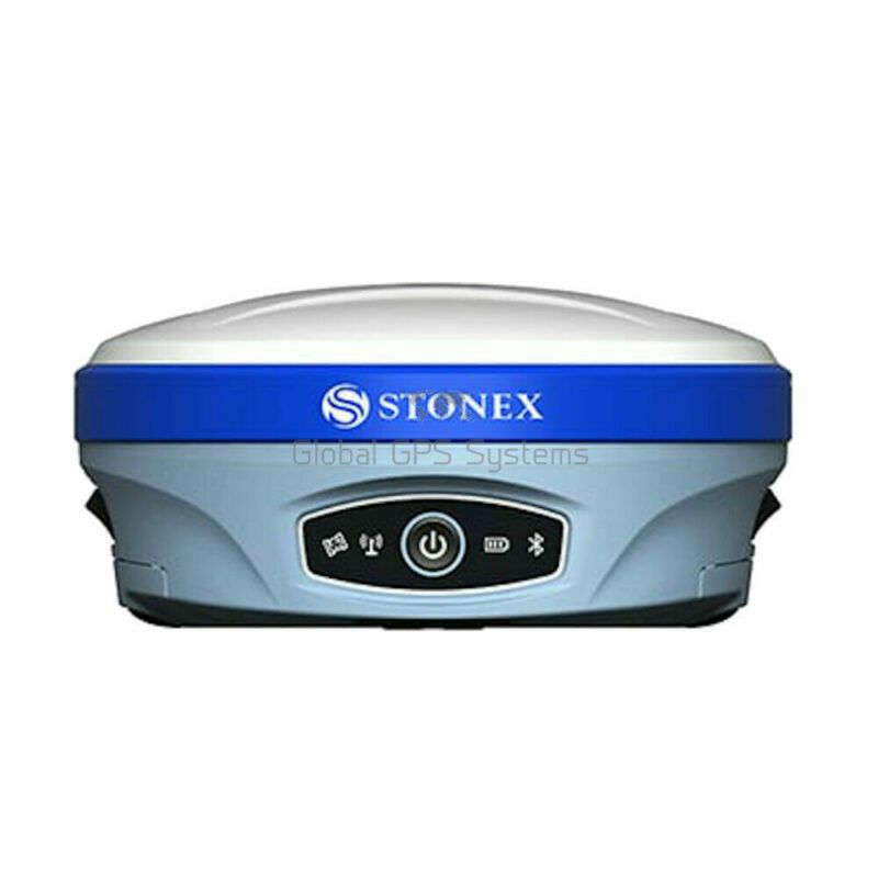
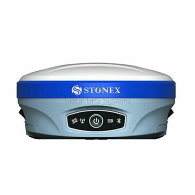
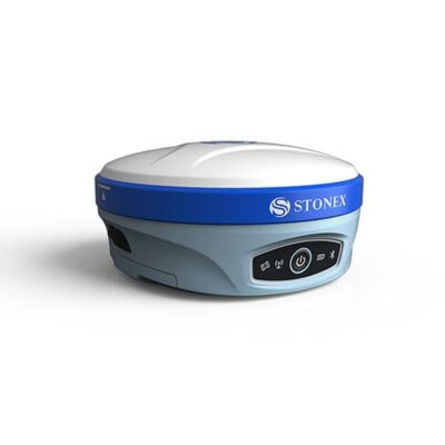
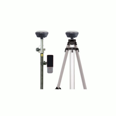
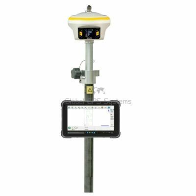
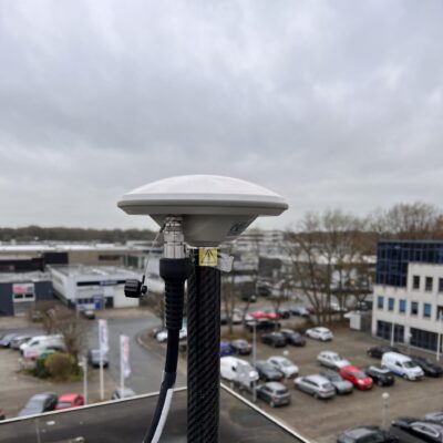
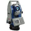
Stonex S900 RTK GNSS receiver. In combination with an RTK Subscription this receiver is capable of providing centimetre accuracy in real time. Because The Stonex S900 supports GPS, Glonass, Galileo, Beidou and QZSS satellite constellations it is capable of achieving this centimetre accuracy in tough conditions. Down below you can find which frequencies it supports. The Stonex S900 comes in 2 models: the S900 with 555 channels and the S900A with 800 channels. Both model are IMU enabled for tilt surveying up to 60 degrees.
Channels
555, 800
IMU Tilt Sensor
60º
Internet Modem
4G
UHF Radio
410-470MHz, 902.4 – 928MHz
GPS
L1 C/A, L1C, L2C, L2P, L5
GLONASS
L1 C/A, L2C, L2P, L3, L5
GALILEO
E1, E5A, E5B, ALTBOC, E6
BEIDOU
B1, B2, B3
1x S900A/S900 instrument unit
1x PSAA30R-150, Adapter for battery charger CH 04
2x BP 5S, Li-Ion battery 7.4V – 3400 mAh (S9i, S4IIC/H, S40)
1x CH 04, charger for battery BP 5S
1x Multi-port link cable between receiver and PC or controller [USB or 7-pins lemo for PC or controller, 7-pins lemo for receiver]
1x Measuring tape 3m (MT-300)
1x Carrying case for S900 (CC-900)
1x SW Cube-link
1x Pen Drive set 8Gb with Manual & Video Tutorial
The GNSS receiver S900 is the result of the continuous evolution of the Stonex GNSS integrated receivers. Featuring a high accuracy multi constellation antenna, a powerful UHF dual frequency transmitter and a GSM 4G modem, for a fully integrated multi-communication choice; all combined with a light and modern design.
Stonex S900 integrated GNSS receiver tracks all the present constellations and satellite signals GPS, GLONASS, BEIDOU, GALILEO, QZSS, IRNSS and through the upgradable firmware offers the opportunity to be day by day updated with the latest available features
. On S900 it is possible to insert 2 smart hot swappable batteries at the same time, ensuring a maximum of 12 hours of operation without stopping. To initialise, manage, monitor the settings of the receiver and to download data is available a user friendly Web UI. S900 is also equipped with E-Bubble functionality and the optional IMU technology. Fast initialisation, up to 60° inclination.
Unboxing The Stonex S900 RTK GPS Receiver
What are the performances of the S900 with IMU?
• Fast initialisation
• Up to 60° inclination
• 2 cm accuracy 30°
• 5 cm accuracy 60°
• Fast and precise survey
• No problem of electromagnetic disturbances
S900A description
Stonex S900A is equipped with an high performance GNSS board 800 channels and capable of supporting multiple satellite constellations: GPS, GLONASS, BEIDOU, GALILEO, QZSS and IRNSS, including L-Band correction. Through the 4G GSM modem a fast internet connection is guaranteed for the reception of correction data and the management of the maps in the background. In the amazingly compact structure the Bluetooth and Wi-Fi modules allow always reliable data flow to the controller, and the integrated TX/RX UHF radio with selectable frequencies, make S900A the perfect system for a GNSS Base + Rover. Stonex S900A integrates E-Bubble sensor that allows the measurement of difficult points with the pole not levelled. It is possible to measure points with an inclination of the pole up to 30° even in harsh environments and in the presence of magnetic fields. S900A is also equipped with the optional IMU technology. Fast initialisation, up to 60° inclination.
What are the performances of the S900A with IMU?
• Fast initialisation
• Up to 60° inclination
• 2 cm accuracy 30°
• 5 cm accuracy 60°
• Fast and precise survey
• No problem of electromagnetic disturbances
MULTI CONSTELLATION
Stonex GNSS receiver S900A with its 800 channels, provides an excellent on board real time navigation solution with high accuracy. All GNSS signals (GPS, GLONASS, BEIDOU, GALILEO, QZSS and IRNSS) are included, no additional cost.
4G MODEM
S900A has an internal 4G modem that operates with all world signals, a fast internet connection is guaranteed.
ELECTRONIC BUBBLE + IMU
S900A thanks to the E-Bubble can display directly on the software if the pole is vertical and the point will be recorded automatically when the pole is levelled. The IMU technology is also available as optional, only a fast initialisation is requested.
TWO INTELLIGENT BATTERIES
The dual slot for two Smart hot swappable batteries gives you up to 12 hours of battery life. The power level can be checked and seen on the controller or directly on a led bar on the battery.
DOUBLE FREQUENCY RADIO
The S900A GNSS receiver has integrated UHF double frequency radio, 410-470MHz and 902.4-928MHz. The needs of each country are supported.
Stonex S900 key features
RTK Enabled for 1-2cm accuracy. Compatible withRTK FIX
555 / 800 channels
GPS, Glonass, Galileo, Beidou and QZSS
4G Mobile data
UHF radio on 410 – 470MHz frequency for rover/base setup
IMU tilt survey up to 60 degrees (IMU Firmware upgrade required)
E-bubble
2x hot swappable battery system for continuous surveying
S900 applicable industries
This receiver can be used in all applications where a centimetre accurate position is needed:
Surveying
GIS applications
Earthworks
Roadworks
Construction
Agriculture
Mapping
Landfill
Hydrographic
UAV Base Station
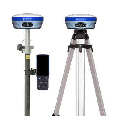
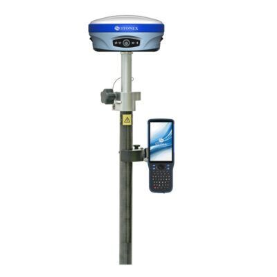
Rover setup
When using this device in a rover configuration you may need the following accessories besides the receiver itself
RTK Correction service. To achieve centimetre accuracy your receiver will need RTCM correction data so it can calculate your exact position. Without an RTK provider your receiver won’t be able achieve a 1-2 centimetre accuracy.
Surveying software. Your receiver provides you with the coordinates you need but you still need surveying software in order to process this information. Which software you need depends on your needs. We recommend keeping it simple and don’t pay for things you don’t need. Having that said, if you do have to do complicated surveying work make sure you get the right software. Some recommended options are Carlson, Aplitop andFieldGenius. If you need help, feel free to contact us by phone or via the chat below!
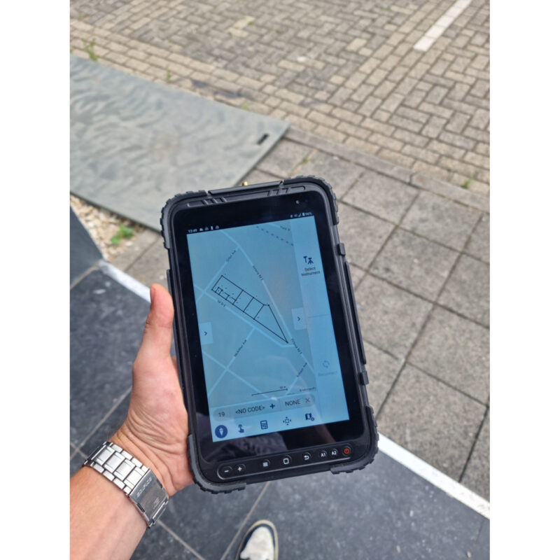
Data collector. You might need a tablet or controllerto run your software on. The type of tablet depends on which software you have chosen as some are Android based and some are Windows.
Bracket and Holders. These are used to connect your tablet to your surveying pole so the whole set is easier to handle.
Surveying pole. In order to get the best performance out of your receiver you want to minimise the disturbances around you and give it a clear sight to the satellites above. That why its recommended attaching your receiver on a 2 meter minimum surveying pole. These come in fixed rods and in telescopic rods.
Rover/Base setup
When you don’t have access to an RTK network you might have to setup your own base station in order to receive corrections. These are the accessories you might need besides the receiver itself:
A second RTK GNSS receiver. preferably from the same brand. If you already have another one, then make sure they run on the same frequency.
Surveying software. Your receiver provides you with the coordinates you need but you still need surveying software in order to process this information. Which software you need depends on your needs. We recommend keeping it simple and don’t pay for things you don’t need. Having that said, if you do have to do complicated surveying work make sure you get the right software. Some recommended options are Apglos, Carlson, Aplitop and FieldGenius. If you need help, feel free to contact us by phone or via the chat below!
Data collector. You might need a tablet or controller to run your software on. The type of tablet depends on which software you have chosen as some are Android based and some are Windows.
Bracket and Holders. These are used to connect your tablet to your surveying pole so the whole set is easier to handle.
Surveying pole. In order to get the best performance out of your receiver you want to minimise the disturbances around you and give it a clear sight to the satellites above. That why its recommended attaching your receiver on a 2 meter minimum surveying pole. These come in fixed rods and in telescopic rods.
Tripod and Tribrach. These are needed to setup your base station with the second receiver. The Tripod gives good stability so errors in sudden movements of the base station are avoided.
External Radio. Most RTK GNSS receiver have an internal UHF radio build in. However, sometimes the power output is not strong enough to give you the workable distance you need and an external radio required. Internal radios can go up to 3 Watts that can work up to 8km. External radios can easily achieve 35 Watt outputs, thereby increasing your working range.


Petra P. –
quick to respond, works easily even in difficult conditions