

GNSS
IMU Tilt Sensor in RTK GNSS Receivers: Is It Worth It?
An IMU tilt sensor has become one of the most useful features in modern RTK GNSS receivers. For many surveyors, construction layout teams and mapping professionals, it can make point collection faster, easier and more practical in difficult locations.
Instead of carefully levelling the pole for every single measurement, a GNSS receiver with IMU tilt compensation can calculate the position of the pole tip even when the receiver is tilted. This is especially useful when measuring next to walls, fences, slopes, trenches, kerbs, vehicles, trees or other obstacles.
However, an IMU tilt sensor is not magic. It still depends on good GNSS conditions, correct calibration or initialization, suitable field procedures and realistic accuracy expectations. This article explains what an IMU tilt sensor does, when it is useful and what to check before choosing an RTK GNSS receiver with tilt compensation.
Quick answer: should you choose an RTK GNSS receiver with an IMU tilt sensor?
For most RTK GNSS users, an IMU tilt sensor is worth having. It saves time because you do not need to keep the survey pole perfectly vertical for every point. It also makes it easier to measure hard-to-reach points, such as building corners, fence lines, trench edges, road edges and points close to obstructions.
An IMU tilt sensor is especially useful when you collect many points during a working day. The time saved on each point may seem small, but it quickly adds up on topographic surveys, construction checks, volume surveys and as-built measurements.
You should still check the receiver’s tilt accuracy, maximum tilt angle, initialization method, software support and field limitations before buying. For high-precision control points or critical set-out work, a carefully levelled pole may still be preferred.
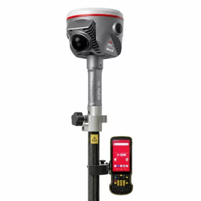
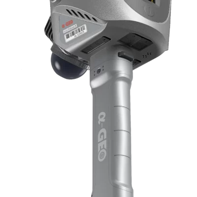
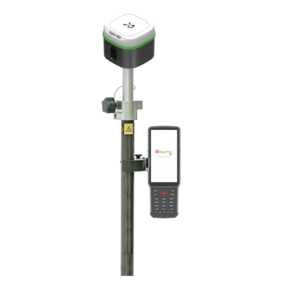
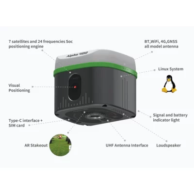
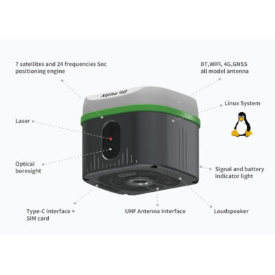
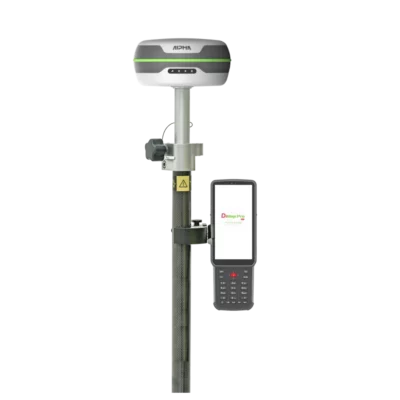
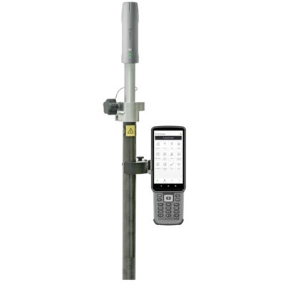
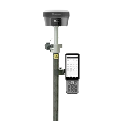
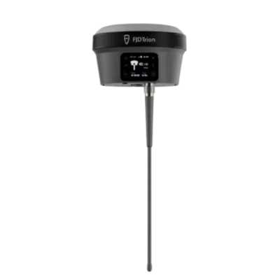
Some rtk gnss receivers with an imu tilt sensor
GPS & GNSS


GPS Rover Sets


GPS Rover Sets
What is an IMU tilt sensor in an RTK GNSS receiver?
An IMU stands for Inertial Measurement Unit. In an RTK GNSS receiver, the IMU helps the system understand how the receiver is moving and how much it is tilted. It commonly uses sensors such as accelerometers and gyroscopes, and in some systems it may also use magnetic or GNSS-based information.
The important point for field users is simple: the IMU helps the receiver calculate the position of the pole tip when the pole is not vertical.
Without tilt compensation, the GNSS antenna position is measured above the ground point. The surveyor must keep the pole vertical so that the antenna is directly above the point being measured. With IMU tilt compensation, the receiver can use the tilt angle and pole height to estimate where the pole tip is located, even when the antenna is leaning away from the point.
How does IMU tilt compensation work in practice?
In a normal RTK setup, the GNSS receiver calculates the position of the antenna using satellite signals and correction data. The survey software then applies the pole height to calculate the ground point below the antenna.
When the pole is vertical, this calculation is straightforward. When the pole is tilted, the antenna is no longer directly above the point. The IMU measures the receiver’s tilt and orientation, allowing the system to compensate for the offset between the antenna and the pole tip.
This means the operator can place the pole tip on the point, lean the receiver to a practical angle and still record the position of the point on the ground.
| Measurement method | How it works | Typical field impact |
|---|---|---|
| RTK GNSS without tilt compensation | The pole must be held vertical so the antenna is directly above the measured point. | Accurate and reliable, but slower when measuring many points or awkward locations. |
| RTK GNSS with IMU tilt compensation | The receiver uses tilt information to calculate the pole tip position while the pole is leaning. | Faster point collection and easier access to difficult points, depending on field conditions and receiver capability. |
Why does tilt compensation matter in fieldwork?
The biggest advantage of an IMU tilt sensor is practical speed. Surveying and construction layout often involve hundreds of points in a day. Every time the operator has to stop, centre the pole bubble and wait for a stable vertical position, time is lost.
With tilt compensation, the operator can work more naturally. The pole tip still needs to be placed correctly, but the pole does not always need to be perfectly upright. This helps reduce repeated levelling movements and makes the workflow smoother.
It also improves access. Some points are difficult to measure with a vertical pole because the receiver head hits an obstruction, the operator cannot stand in the ideal position, or the point is close to a wall, kerb, fence or machine. Tilting the pole can make those points measurable without changing the survey method.
When is an IMU tilt sensor useful?
An IMU tilt sensor is useful when speed, access and flexibility matter. It is especially valuable for everyday RTK GNSS work where many points must be measured efficiently.
Topographic surveys
During topographic surveys, a GNSS user may collect large numbers of points across a site. These can include ground levels, kerbs, drainage features, fences, walls, vegetation limits, utilities and surface changes. Tilt compensation helps the operator move quickly from point to point without spending unnecessary time levelling the pole.
Construction layout and site checks
On construction sites, access is often limited by materials, excavations, machinery and safety barriers. A tilt-enabled GNSS receiver can help measure or check points near obstacles without forcing the operator into an awkward or unsafe position.
Measuring near walls, fences and buildings
Building corners, fence lines and wall edges can be difficult to measure with a vertical GNSS pole because the antenna may not fit directly above the point. Tilting the receiver away from the obstruction makes it easier to keep the pole tip on the correct location.
Trenches, slopes and embankments
On slopes or next to trenches, keeping the pole vertical can be uncomfortable and unstable. Tilt compensation can make these measurements more practical, especially when the operator needs to stand slightly away from the measured point.
GIS and asset mapping
For GIS teams mapping assets such as signs, covers, inspection points, utility features or road furniture, tilt compensation can speed up collection and make it easier to reach points near traffic, vegetation or fixed structures.
What are the main advantages of an IMU tilt sensor?
The value of an IMU tilt sensor comes from saving time and reducing awkward field procedures. It is not only a convenience feature; it can change how efficiently a GNSS rover is used during daily work.
- Faster point collection: less time spent centring the pole bubble for every point.
- Easier access: useful near buildings, fences, trenches, kerbs and other obstacles.
- More comfortable operation: reduces awkward body positions when measuring difficult points.
- Better productivity: small time savings per point can become significant over a full survey day.
- Practical for one-person crews: helps solo operators work faster in varied field conditions.
What are the limitations of IMU tilt compensation?
An IMU tilt sensor is helpful, but it does not remove the need for good survey practice. The user must still understand when tilt compensation is suitable and when a more controlled measurement method is needed.
The first limitation is accuracy. Tilt compensation depends on the quality of the IMU, the GNSS position, the pole height setting, the receiver orientation and the software calculation. As the pole is tilted more, small errors in angle or setup can have a larger effect at the pole tip.
The second limitation is GNSS quality. Tilt compensation cannot fix poor satellite visibility, multipath, weak correction data or an unstable RTK solution. If the receiver does not have a reliable fixed RTK solution, the tilted point will not become reliable just because the IMU is active.
The third limitation is field procedure. Some receivers need a short movement or initialization process before the IMU is ready. Others may require calibration steps, firmware support or specific data collection software settings. Always check the manufacturer’s workflow for the receiver being used.
Should you always measure with the pole tilted?
No. Tilt compensation should be used when it helps the job, not as a replacement for all careful measurements.
For many detail points, as-built points and general mapping tasks, tilt compensation is very practical. For control points, calibration points, machine-control reference checks or critical construction layout points, it may be better to use a vertical pole, bipod or tripod depending on the accuracy requirement.
A good field approach is to use the IMU where it improves speed and access, while still using traditional levelled methods for points that require the highest confidence.
How much tilt is possible with an RTK GNSS receiver?
The maximum usable tilt angle depends on the receiver model and manufacturer specifications. Some RTK GNSS receivers allow larger tilt angles than others. The stated maximum tilt angle should always be checked in the product datasheet or manual.
It is also important to understand that maximum tilt angle is not the only thing that matters. Buyers should check how accuracy changes with tilt angle, whether the receiver requires calibration, whether magnetic interference affects the system and whether the field software clearly shows IMU status.
| What to check | Why it matters |
|---|---|
| Maximum tilt angle | Shows how far the pole can be tilted according to the manufacturer. |
| Tilt accuracy specification | Helps estimate whether the receiver is suitable for your required precision. |
| Initialization method | Some receivers need movement or a short setup process before tilt is active. |
| Magnetic interference sensitivity | Some systems may be affected by nearby metal objects or electromagnetic interference. |
| Software compatibility | The controller software must support tilt measurement and display the correct status. |
| Pole height setup | An incorrect pole height can directly affect the measured ground point. |
IMU tilt sensor versus electronic bubble: what is the difference?
An electronic bubble helps the user see whether the pole is vertical. It is mainly a guidance tool. The operator still tries to keep the pole upright before recording the point.
An IMU tilt sensor goes further. It measures the tilt and helps calculate the ground point even when the pole is not vertical. This allows compensated measurements rather than simply warning the user that the pole is leaning.
Both features can be useful, but they are not the same. An electronic bubble helps improve vertical measurements, while IMU tilt compensation allows practical tilted measurements.
Does an IMU tilt sensor replace good GNSS practice?
No. A tilt-enabled GNSS receiver still needs the same basic RTK conditions as any other receiver. Good satellite visibility, stable correction data, a correct coordinate system and a fixed RTK solution remain important.
The operator should still avoid poor measurement conditions where possible. Tall buildings, dense trees, reflective surfaces, vehicles and steel structures can all affect GNSS performance. Tilt compensation helps with pole angle, but it does not remove multipath or poor satellite geometry.
When should you avoid using tilt compensation?
There are situations where a levelled pole may be the safer option. This is especially true when the point has a high accuracy requirement or will be used as a reference for other work.
- Control point measurement
- Site calibration or localization points
- Critical construction layout points
- Machine-control reference checks
- Measurements in poor GNSS conditions
- Locations with strong magnetic or metal interference, depending on receiver technology
In these cases, use a method that matches the required tolerance. That may mean a vertical pole, bipod, tripod, repeated observations or a total station depending on the job.
How to choose an RTK GNSS receiver with IMU tilt compensation
When comparing RTK GNSS receivers, do not choose based only on the words “IMU tilt” in the product description. Different receivers can have different workflows, limitations and supported software features.
Buyers should compare how the tilt system works in real field use. A fast and reliable IMU workflow can make a big difference during long survey days. A system that requires frequent re-initialization or has unclear status information may slow the operator down.
Important buying questions
- What is the stated tilt accuracy?
- What is the maximum supported tilt angle?
- Does the IMU need calibration or initialization?
- Is the tilt system affected by magnetic interference?
- Does the data collector software support tilt measurements clearly?
- Can the software store tilt quality information with the measured point?
- Is the receiver suitable for the required coordinate system, correction service and field workflow?
Why IMU tilt compensation is valuable for modern RTK workflows
RTK GNSS work is no longer only about reaching centimetre-level positioning in ideal open-sky conditions. Many users now work in busy construction sites, urban areas, road corridors, utilities, drainage projects, landscaping, GIS mapping and infrastructure maintenance.
In these environments, the ability to measure efficiently around obstacles is important. An IMU tilt sensor helps the operator keep moving while still recording useful field data. It can reduce frustration, improve productivity and make one-person GNSS work more practical.
This is why many modern RTK GNSS receivers now include tilt compensation as a standard or optional feature. For many buyers, it is one of the most noticeable upgrades compared with older GNSS rovers.
Is an RTK GNSS receiver without IMU still a good choice?
Yes. A receiver without IMU tilt compensation can still be a good choice when the budget is lower, the work is mostly in open areas, or the user mainly measures points where the pole can easily be held vertical.
For example, agricultural boundaries, basic mapping, open terrain surveys and some base-rover workflows may not always require tilt compensation. The best choice depends on the work type, required accuracy, site conditions and budget.
However, for users who regularly measure many detail points or work around obstacles, choosing a receiver with IMU tilt compensation can be a practical long-term investment.
Related Global GPS Systems product categories
Global GPS Systems offers several product categories that are relevant when comparing RTK GNSS receivers with or without IMU tilt compensation.
- RTK GNSS receivers: for users who need high-accuracy GNSS positioning with correction data.
- GPS rover sets: complete rover packages for field measurement and stakeout workflows.
- GPS rover-base sets: suitable when users want their own base station and rover setup.
- Data collectors: controllers and tablets for field software, point collection and stakeout.
- Correction services: RTK correction options for network-based positioning workflows.
- Survey poles and accessories: poles, bipods, mounts and field accessories for accurate GNSS work.
Conclusion: is an IMU tilt sensor worth it?
An IMU tilt sensor is worth considering for most users buying a modern RTK GNSS receiver. It can save time, make difficult points easier to measure and improve day-to-day field productivity.
The main benefit is not only measuring with the pole tilted. The real benefit is a smoother workflow. Surveyors, construction teams and mapping users can collect more points with less interruption, especially in areas where a perfectly vertical pole is difficult or slow to achieve.
For high-precision control work, critical layout or poor GNSS environments, traditional careful measurement methods are still important. But for many everyday RTK tasks, IMU tilt compensation is one of the most useful features to have in a GNSS rover.
When comparing receivers, check the tilt specifications, initialization method, software support and overall RTK workflow. The right receiver should not only include an IMU sensor; it should make tilt compensation reliable and easy to use in real field conditions.