


Top 5 best RTK GNSS Receivers for Land Surveying
Finding a good GPS antenna for your land surveying projects can be difficult and time [...]
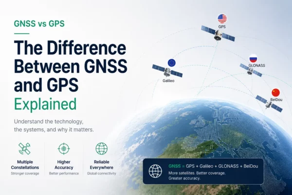
The difference between GNSS and GPS explained
GPS is only one satellite navigation system. GNSS is the wider term for all global [...]

What is RTK and what does it stand for?
Real Time Kinematic is a technique used to increase the accuracy of GNSS (GPS, Glonass, [...]
LiDAR Survey for Urban Village Reconstruction
LiDAR Survey for Urban Village Reconstruction Background Information Project Locatiion: Guangzhou, ChinaPurpuse: Provide reference for the reconstruction [...]
Revolutionary LiDAR User Training: An In-job Training Story
Using LiDAR on a project When a new methodology comes into the survey society, people [...]
RTK GPS with IMU in Hydrographic Surveying
Now SOUTH G6 can output the IMU data and the on board software of SDE-260D [...]
Fly PPK Drone and get your precise POS data with Skylines
Transforming more tough fieldwork, like GCP (Ground Control Point) measurements, into fast processing is always [...]
2 Comments