


Beginner’s Guide to Buying Your First GPS Surveying Set
Buying your first GPS surveying set can be confusing. This beginner’s guide explains what a [...]
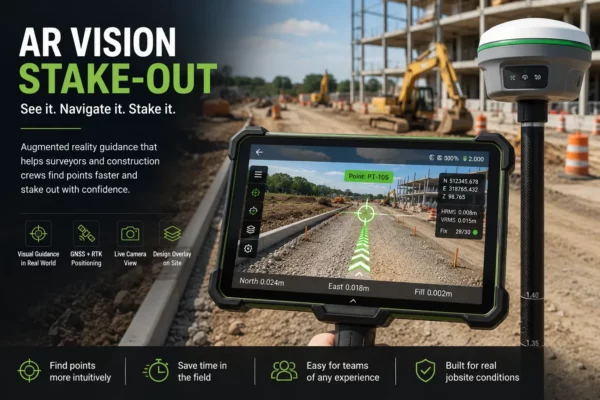
AR Vision Stake-Out: How Augmented Reality Makes GNSS Stakeout Easier in the Field
AR vision stake-out uses GNSS positioning, camera views and augmented reality guidance to help surveyors [...]


When Was GPS Invented? The Evolution of GPS and GNSS Technology
GPS began as a military satellite navigation project and became one of the most important [...]
Land Surveyor: Exploring the Role, Salary, and Path to Success
Land surveying is an exciting and rewarding profession that offers a blend of fieldwork and [...]

GNSS Surveying Methods: Exploring Accuracy and Techniques
GNSS surveying methods offer a wide range of accuracy levels and techniques to meet the [...]

Enhancing GNSS Surveying with Augmented Reality: A Revolutionary Stakeout Technique
Augmented Reality is transforming the field of GNSS surveying stakeouts, providing surveyors with unprecedented visualization [...]

What Is SBAS in GNSS? Accuracy and Field Uses
SBAS improves standard GNSS positioning by sending correction and integrity data from regional satellite systems [...]
Why You Should Invest In a GNSS Receiver With a Strong GNSS Chip
When it comes to GNSS receivers, the strength of the GNSS chip plays a pivotal [...]
The Differences Between .DXF and .DWG Files
When it comes to computer-aided design (CAD) software, two file formats stand out: .DXF and [...]
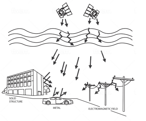
Overcoming Signal Interference in GPS Land Surveying
Signal interference is a major challenge in GPS land surveying that can cause significant errors [...]
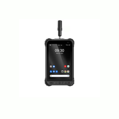
Rugged Android Tablet with GPS: Your Ultimate Solution for Tough Environments
A rugged Android tablet with GPS is a valuable tool for businesses and individuals who [...]