


 GPS & GNSS
 Lidar scanning
 Total Station


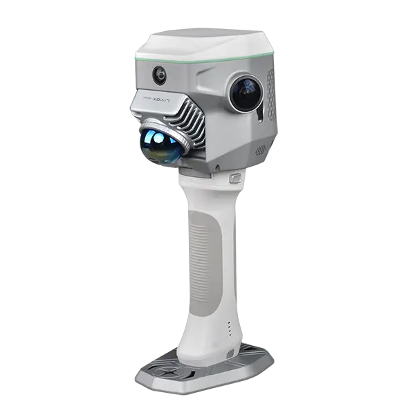

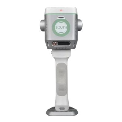
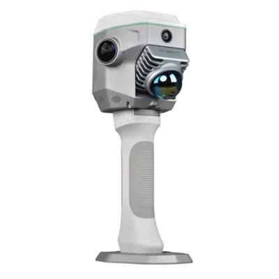
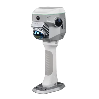
South Supreme ME Visual LiDAR RTK GNSS Receiver
Get the best price for your setup
Contact our experts for the best possible price and configuration.
- Fast response
- Expert configuration advice
- No overpaying for features you do not need
The South Supreme ME is a Visual-LiDAR RTK GNSS receiver for surveyors, engineers, construction teams, GIS users and mapping professionals who need accurate measurements in both open-sky and GNSS-limited environments. It combines RTK positioning, SLAM LiDAR scanning, contactless Air Measurement, IMU tilt and camera-based workflows in one field-ready system.
Use it for standard RTK point collection, façade measurement, stockpile and volume work, road and pipeline corridors, indoor-outdoor mapping, underpasses, industrial sites and other areas where a normal GNSS rover can struggle.
South Supreme ME Highlights
| GNSS Engine | 1698 channels with GPS, GLONASS, Galileo, BeiDou, SBAS, IRNSS, QZSS and MSS L-Band support |
|---|---|
| LiDAR Scanning | Up to 200,000 points per second with 360° horizontal field of view |
| Detection Range | Up to 70 m maximum LiDAR detection range |
| Air Measurement | Contactless measurement with 5 cm accuracy at 15 m range |
| SLAM Accuracy | Relative accuracy ≤1 cm, RTK absolute accuracy down to 3–5 cm, PPK down to 2–4 cm |
| IMU Tilt | Calibration-free tilt measurement with optimal accuracy within 60° |
| Camera System | Dual 12 MP panoramic cameras, 8 MP front camera and 2 MP downward camera |
You may also like…


Valued customers:










Find RTK Networks
Search NTRIP providers and connect to reliable RTK correction services.
Description
South Supreme ME Visual-LiDAR RTK GNSS Receiver
The South Supreme ME is built for field teams who need more than a standard RTK rover. It combines high-accuracy GNSS positioning with SLAM LiDAR scanning, visual measurement, IMU tilt compensation and camera-based workflows. For surveyors, construction workers, civil engineers, GIS teams, drone mapping professionals and asset managers, this means one system can handle normal RTK point collection as well as complex measurement jobs where satellite visibility is poor or direct access is difficult.
In open areas, the South Supreme ME works as a high-performance RTK GNSS receiver. On sites with buildings, bridges, façades, pipelines, stockpiles, underpasses or indoor-outdoor transitions, the integrated LiDAR and visual tools help the operator keep collecting useful data without relying only on traditional point-by-point GNSS measurement.
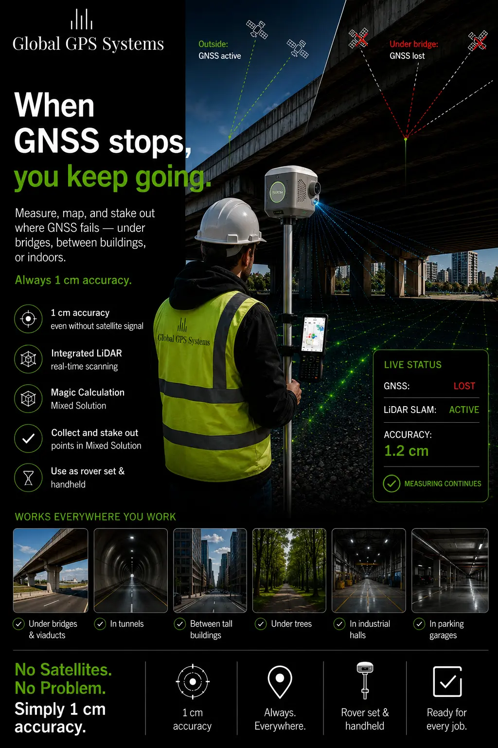
Hybrid RTK and SLAM LiDAR for real field conditions
Many projects are not limited to clean, open-sky GNSS work. A survey may start on a road corridor, continue under a bridge, move along a building façade and end near trees, traffic, machinery or steel structures. The South Supreme ME is designed for these mixed conditions by combining RTK GNSS positioning with handheld SLAM LiDAR technology.
The system captures up to 200,000 points per second and can be used to create 3D point cloud data while the operator moves through the site. This is useful for mapping surfaces, structures, excavation areas, stockpiles, industrial installations and other features where collecting every point manually would take too much time.
Air Measurement for contactless surveying
Air Measurement allows the user to capture 3D coordinates without standing directly over every measured point. The South Supreme ME combines laser sensing and AI image matching so operators can measure hard-to-reach or unsafe points from a distance. This is practical for façades, edges, slopes, traffic areas, pipework, construction details and objects behind obstacles.
With 5 cm accuracy at 15 m range, Air Measurement gives field crews a practical way to capture more information while reducing unnecessary movement around the site. For simple construction layout, as-built checks, engineering measurements and GIS feature capture, this can make fieldwork faster and safer than measuring each point by direct occupation.
Useful in GNSS-limited areas
The South Supreme ME is especially useful when a normal RTK receiver loses performance due to blocked sky view or multipath. Its mixed-solution positioning function is designed to help maintain measurement capability for a short period when GNSS signals are interrupted, for example under overpasses, in tunnels, in underground garages or around dense urban structures.
This makes the receiver a strong option for surveyors and mapping teams who regularly move between outdoor RTK work and obstructed environments. Instead of stopping work when the GNSS fix becomes unstable, the operator can continue collecting data with the integrated SLAM and visual measurement workflow.
Integrated camera system for visual workflows
The South Supreme ME includes four cameras for point cloud colorization, visual measurement and AR stakeout workflows. Two 12 MP panoramic cameras support colour point cloud creation, while the 8 MP front camera supports Air Measurement and the 2 MP downward camera supports AR stakeout.
For field crews, this makes the collected data easier to understand and check. Colour point clouds can help identify site features, surfaces, objects and structures more clearly than geometry alone. Visual and AR workflows also help with stakeout tasks because the operator can relate design information to the real site environment.
IMU tilt for faster point collection
The built-in IMU tilt function helps users measure points without perfectly leveling the pole every time. This is useful around obstacles, near walls, on slopes, beside trenches or in places where keeping the pole vertical is difficult. The South Supreme ME offers optimal tilt performance within 60°, helping operators work faster while keeping measurements practical for real site conditions.
Point clouds, volumes and post-processing
The South Supreme ME is suitable for 3D mapping, earthwork volume calculation, stockpile measurement, excavation checks, façade capture and infrastructure documentation. The system can support colour point clouds and export point cloud data for further processing. This makes it useful for teams that need more than coordinates and want a clearer 3D record of the site.
For construction and engineering users, this can support progress documentation, quantity checks and as-built workflows. For GIS and asset teams, it can help capture features in complex environments where conventional GNSS-only data collection is too limited.
Who uses the South Supreme ME?
The South Supreme ME is suitable for professional users who need accurate positioning and richer site data in one system. Typical users include land surveyors, civil engineers, construction layout crews, road and rail teams, utility and pipeline surveyors, GIS data collectors, mining and quarry teams, drone mapping companies and asset inspection professionals.
It is especially useful for companies that often work around buildings, bridges, industrial sites, stockpiles, tunnels, underpasses or other areas where standard RTK GNSS receivers can lose reliability.
Practical applications
- RTK surveying and stakeout in open-sky conditions
- SLAM LiDAR scanning for indoor and outdoor mapping
- Façade, bridge, pipeline and structure measurement
- Stockpile, excavation and earthwork volume calculation
- GIS feature collection in complex environments
- As-built documentation and construction progress checks
- Visual and AR-assisted stakeout workflows
Why buy from Global GPS Systems?
Global GPS Systems supplies RTK GNSS, LiDAR and surveying equipment to professionals worldwide. When choosing the South Supreme ME, buyers can get support with product selection, field workflows, RTK correction setup, accessories and practical configuration advice. This is important for a hybrid system because the right setup depends on how the receiver will be used: standard rover work, LiDAR scanning, Air Measurement, volume calculation, GIS data collection or a combination of these workflows.
For teams comparing advanced GNSS receivers, laser RTK systems and SLAM LiDAR solutions, the South Supreme ME offers a flexible all-in-one option for demanding fieldwork where speed, access and reliable data capture matter.
Specifications
South Supreme ME Specifications
Product Overview
| Product Name | South Supreme ME |
|---|---|
| Product Type | Visual-LiDAR RTK GNSS receiver / GNSS RTK Hybrid SLAM LiDAR surveying system |
| Primary Technologies | GNSS RTK, SLAM LiDAR, visual positioning, IMU tilt compensation, Air Measurement, AR visual stakeout |
| Typical Applications | Surveying, construction layout, infrastructure mapping, façade scanning, stockpile and earthwork volume calculation, indoor/outdoor mapping, utility and pipeline surveys, GNSS-limited environments |
| Best Use Environments | Open-sky GNSS areas, urban canyons, underpasses, tunnels, underground garages, industrial sites, building façades, bridges, corridors and hard-to-reach targets |
GNSS Engine and Satellite Tracking
| GNSS Channels | 1,698 channels |
|---|---|
| GNSS Features | Full-constellation tracking with smart dynamic sensitivity positioning technology |
| GPS Signals | L1C, L1C/A, L2C, L2P(Y), L5 |
| GLONASS Signals | G1, G2, G3 |
| BeiDou / BDS Signals | B1I, B2I, B3I, B1C, B2a, B2b |
| Galileo Signals | E1, E5a, E5b, E6, AltBOC |
| QZSS Signals | L1, L2C, L5 |
| NavIC / IRNSS | Supported |
| SBAS | Supported |
| MSS / L-Band | B2b-PPP and E6B HAS support listed |
| Positioning Output Frequency | 1 Hz to 10 Hz according to manufacturer specification; product listing also notes output up to 20 Hz |
| Initialization Time | < 10 seconds |
| Cold Restart | < 12 seconds |
| Initialization Reliability | > 99.9% |
| IMU Refresh Rate | 200 Hz |
GNSS Accuracy
| Single Point Positioning | Horizontal: 1.5 m RMS; Vertical: 2.5 m RMS |
|---|---|
| DGPS / Code Differential | Horizontal: 0.4 m RMS; Vertical: 0.8 m RMS |
| Real Time Kinematic RTK | Horizontal: 8 mm + 1 ppm RMS; Vertical: 15 mm + 1 ppm RMS |
| RTK NTRIP | Horizontal: 8 mm + 0.5 ppm RMS; Vertical: 15 mm + 0.5 ppm RMS |
| Post Processed Kinematic PPK | Horizontal: 3 mm + 1 ppm RMS; Vertical: 5 mm + 1 ppm RMS |
| Precise Point Positioning PPP | Supports PPP-B2b; Horizontal: 10 cm; Vertical: 20 cm |
| High-Precision Static | Horizontal: 2.5 mm + 0.1 ppm RMS; Vertical: 3.5 mm + 0.4 ppm RMS |
| Static and Rapid Static | Horizontal: 2.5 mm + 0.5 ppm RMS; Vertical: 5 mm + 0.5 ppm RMS |
| Positioning Refresh Rate | 1 Hz / 5 Hz / 10 Hz |
| Time for First Fixed Solution | Cold start: 45 seconds; Hot start: 10 seconds; Single repeat: 1 second |
| RTK Initialization Time | 2 to 8 seconds |
IMU Tilt Measurement
| IMU Module | Built in for GNSS; supports tilt survey option |
|---|---|
| Tilt Measurement Accuracy | 8 mm + 0.7 mm/° tilt |
| Recommended Tilt Range | Optimal accuracy within 60° |
| IMU Refresh Rate | 200 Hz |
SLAM LiDAR Scanner
| Laser Scanner | Livox Mid-360 |
|---|---|
| Scanning Range | 0.1 m to 70 m |
| Detection Range by Reflectivity | 70 m at 80% reflectivity; 40 m at 10% reflectivity |
| Measurement Rate | 200,000 points per second |
| Field of View | 360° horizontal x 59° vertical |
| Laser Wavelength | 905 nm |
| Laser Safety Class | Class 1, IEC 60825-1:2014, eye-safe |
| Loop Closure Free Operation | Available when RTK is enabled outdoors |
| PPK Mode | Available |
| Real-Time Assessment | Available |
SLAM and LiDAR Accuracy
| SLAM Relative Accuracy | ≤ 10 mm |
|---|---|
| Range Noise | Approximately 5 mm to 20 mm, optimized |
| SLAM Absolute Accuracy with RTK | Best up to 3 cm to 5 cm, powered by onboard RTK |
| SLAM Absolute Accuracy with PPK | Best up to 2 cm to 4 cm, post processed |
| SLAM Accuracy Range Note | 3 cm to 5 cm at 20 m radius; error increases approximately 3 cm per additional 10 m according to listing data |
Visual, Camera and Contactless Measurement
| SLAM Colorization Cameras | 12 MP x 2, left and right panoramic cameras |
|---|---|
| Contactless Visual-LiDAR Survey Camera | 8 MP front-facing camera |
| GNSS / AR Stakeout Camera | 2 MP downward-facing camera |
| Total Camera Count | 4 cameras |
| Graphic Processor | NVIDIA graphics processor for real-time true-colour image processing |
| Air Measurement Function | Combines laser sensing technology and AI image matching for contactless measurement |
| Contactless Measurement Accuracy | ≤ 5 cm at 15 m range |
| Colour Point Clouds | Supported |
| Visual Positioning | Supported |
| CAD and AR Stakeout | Supported |
Mixed Solution and Stakeout Performance
| Magicalc Mixed Solution | Maintains positioning when GNSS satellite signals are limited or temporarily unavailable |
|---|---|
| Positioning Accuracy While Satellites Are Unlocked | Best up to 2 cm to 3 cm; typical 5 cm to 10 cm, by Mixed Solution / Magicalc |
| Manufacturer Brochure Mixed Solution Claim | Capable of maintaining 5 cm accuracy for a few minutes when GNSS satellite signals are out of reach |
| Super Stakeout Accuracy | Optimal: Horizontal 8 mm + 1 ppm RMS; Vertical 15 mm + 1 ppm RMS |
| Super Stakeout Typical Accuracy | Typical: Horizontal 10 mm + 1 ppm RMS; Vertical 20 mm + 1 ppm RMS |
| AR Visual Stakeout Accuracy | Optimal: Horizontal 8 mm + 1 ppm RMS; Vertical 15 mm + 1 ppm RMS |
| AR Visual Stakeout Typical Accuracy | Typical: Horizontal 10 mm + 1 ppm RMS; Vertical 20 mm + 1 ppm RMS |
Physical Specifications
| Dimensions | 134 mm x 147 mm x 138 mm |
|---|---|
| Net Weight | 1.38 kg |
| Housing Material | Magnesium aluminium alloy shell |
| Temperature Sensor | Built in, intelligent variable frequency control |
| Power Button | Single power button; supports power on/off, self-test, mode setting, factory reset and forced reboot functions according to user manual |
| Indicators | Power, SLAM, data, satellite and charging indicator lights |
| Mounting / Interface | Connector for carbon pole, telescopic pole or battery handle grip |
| Magnetic Attachment | Built-in magnet patch supports magnetic attachment for mobile phones |
Power and Battery
| Power Supply | Built-in battery plus handgrip battery; external power supply supported |
|---|---|
| Built-in Battery Endurance | ≥ 0.5 hours according to manufacturer specification |
| Handgrip Battery Endurance | ≥ 2 hours according to manufacturer specification |
| Listing Battery Information | Inbuilt 7.4 V 5000 mAh rechargeable lithium-ion battery; hot-swappable 7.4 V 6800 mAh handgrip battery, 87.32 Wh |
| Listing Battery Life | Air Measurement / indoor mapping / point cloud scanning: > 3 hours; GNSS rover and static mode: > 24 hours |
| Power Consumption | 26 W |
| Charging Time | 1 to 2 hours according to manufacturer specification; user manual notes approximately 2 to 2.5 hours from 0% to 100% for main unit and controller batteries |
| Input Voltage | 14.4 V |
| Power Output | 30 W |
| Uninterruptible Power Design | Supports internal battery, handle battery and external power to reduce restarts during long operations |
Communications
| Wi-Fi Module | Built in; serves as hotspot source |
|---|---|
| WLAN | 802.11 b/g/n standard |
| Network Telecom | Built-in Nano SIM card slot |
| Bluetooth | BT 4.2 BR/EDR + BLE standard according to manufacturer specification; listing also notes Bluetooth 5.0 and backward compatibility |
| NFC Wireless | Auto pairing between device and controller by touch |
| Audio Messaging | iVoice smart audio for status broadcasting and voice instructions |
| Voice Languages | Chinese, English, Korean, Russian, Portuguese, Spanish and Turkish as default; listing also notes French, Italian and Arabic |
| Web Interaction | Web UI via Wi-Fi or USB connection for receiver status monitoring and configuration |
Radio and Correction Support
| Feature | ME | ME Plus |
|---|---|---|
| Radio Datalink | N/A according to manufacturer ME/ME Plus comparison | Rx module built in |
| Wireless Radio | N/A according to manufacturer ME/ME Plus comparison | Available |
| UHF Antenna | Configuration dependent | RX radio antenna included where ME Plus radio module is supplied |
| UHF Frequency Range | 410 MHz to 470 MHz where UHF receive module is configured | 410 MHz to 470 MHz |
| Radio Protocols | Configuration dependent | Farlink, TrimTalk and SOUTH listed |
| Network Correction Support | VRS, FKP, MAC and NTRIP | VRS, FKP, MAC and NTRIP |
Interfaces and Data Ports
| SIM Card Slot | Nano SIM card slot |
|---|---|
| Type-C Port | Charging, OTG and Ethernet support according to listing data |
| TF Card Slot | For SLAM data storage |
| UHF Antenna Interface | Available on supported configurations |
| Data Network Port | Listed in supporting materials |
| Data Transfer | USB plug-and-play data transmission; FTP and HTTP data download supported |
| External USB Storage | Supported via OTG according to listing data |
Data Management and Formats
| Internal Storage | 64 GB SSD internal storage according to listing data |
|---|---|
| TF Card | 256 GB TF card listed in standard configuration |
| Static Data Format | South STH, RINEX 2.x / RINEX 3.02 and related formats |
| Differential Data Format | RTCM 3.0 / RTCM 3.2 according to manufacturer specification; listing also notes RTCM 2.1, 2.3, 3.1 and 3.2 |
| GNSS Output Format | NMEA 0183, PJK plane coordinate and binary code |
| Network Mode | VRS, FKP, MAC and NTRIP |
| Point Cloud Output | LAS point cloud output with GEO coordinates |
| Point Cloud Export Formats | Raw format exportable to LAS or LAZ directly or through included software |
| Automatic Cycling Storage | Supported according to listing data |
| Sample Interval | Customizable sample interval up to 20 Hz according to listing data |
Environmental Specifications
| Operating Temperature | -20°C to +55°C |
|---|---|
| Storage Temperature | -40°C to +80°C |
| Operating Humidity | 80% non-condensing |
| Ingress Protection | IP64 |
| Laser Scanner Protective Cover | Included; removed only when SLAM is enabled |
| Camera Lens Protective Cover | Included; removed only when SLAM is enabled |
Field Software
| Field Software | SurvStar app |
|---|---|
| License | Perpetual fieldwork software license listed in standard configuration |
| Supported Functions | Data collection control, project management, real-time point cloud browsing and processing, visual positioning, CAD and AR stakeout, measurement and calculation functions |
| Android App | Android mobile app with lifetime license and driver included according to listing data |
| Cloud Services | Remote management, firmware updates, online registration and related services according to listing data |
| Secondary Development | Secondary development package and OpenSIC observation data format / interaction interface definition listed |
Post-Processing Software
| Post-Processing Software | AcuteLas Studio |
|---|---|
| License | Perpetual SLAM processing software license listed in standard configuration |
| Supported Processing | Trajectory processing, LiDAR data processing and fusion, point cloud classification, data quality check, quality report output, coordinate system conversion and topographic survey modules |
| Supported Output Workflows | Colour point clouds, LAS / LAZ point cloud export and georeferenced point cloud processing |
Recommended Computer Specifications for AcuteLas Studio
| Operating System | Windows 10 IoT Enterprise or higher |
|---|---|
| Processor | Intel 13th Gen Core i7 processor or better |
| RAM | 32 GB or better |
| Storage | SSD 1 TB or better |
H9 Data Collector Specifications
| Data Collector | H9 |
|---|---|
| CPU | 8 cores, 2.0 GHz |
| Battery | 7700 mAh high-capacity battery |
| Display | 6-inch touchscreen |
| Keyboard | QWERTY full keyboard |
| Operating System | Android 12 |
| Workflow Focus | Optimized for processing SLAM data and photogrammetry data |
Standard Configuration / Included Items
| Item | Quantity | Notes |
|---|---|---|
| Main Unit | 1 | Model ME; radio configuration may vary by ME / ME Plus version |
| Laser Scanner Protective Cover | 1 | Removed only when SLAM is enabled |
| Camera Lens Protective Cover | 1 | Removed only when SLAM is enabled |
| Handgrip Battery Unit | 1 | Model iGrip; 49 W, 3400 mAh listed in manual configuration example |
| Base Stand | 1 | Installed only when SLAM handheld mode is in use |
| Charger Adapter | 1 | For charging system batteries |
| Charging Cable | 1 | Included |
| Data Transfer Cable | 1 | 1 m |
| TF Card | 1 | 256 GB |
| TF Card Reader | 1 | Included |
| Cleaning Cloth | 1 | Included |
| Magnet Ring | 1 | Installed only when SLAM handheld mode is in use |
| Fieldwork Software License | 1 | SurvStar; code registration, perpetual |
| SLAM Processing Software License | 1 | AcuteLas Studio; code registration, perpetual |
| Antenna | 1 | UHF antenna; ME Plus includes RX radio antenna where built-in radio module is supplied |
Specifications and package contents may vary by configuration, region or manufacturer update. Always check the current configuration before ordering.
Reviews (2)
2 reviews for South Supreme ME Visual LiDAR RTK GNSS Receiver
Only logged in customers who have purchased this product may leave a review.
FAQ
South Supreme ME FAQ
Product Overview
What is the South Supreme ME?
The South Supreme ME is a hybrid Visual-LiDAR RTK GNSS receiver that combines RTK GNSS positioning, SLAM LiDAR scanning, IMU tilt measurement, cameras and visual measurement workflows in one field system.
Who is the South Supreme ME made for?
The South Supreme ME is made for surveyors, civil engineers, construction professionals, GIS teams, mapping specialists, infrastructure crews and asset managers who need accurate GNSS measurement, 3D scanning and contactless data capture.
Is the South Supreme ME a GNSS receiver or a LiDAR scanner?
It is both. The system combines a professional RTK GNSS receiver with integrated SLAM LiDAR, allowing users to collect conventional GNSS points, point clouds and visual measurements with one device.
What makes the South Supreme ME different from a standard RTK rover?
A standard RTK rover is mainly used for point measurement in open-sky GNSS conditions. The South Supreme ME adds SLAM LiDAR scanning, contactless Air Measurement, visual positioning, colour point clouds and AR stakeout, making it more suitable for complex or GNSS-limited environments.
Which industries use the South Supreme ME?
The South Supreme ME is used in land surveying, construction, civil engineering, road and bridge work, utility mapping, pipeline mapping, municipal surveying, GIS data collection, 3D documentation and infrastructure inspection.
What types of projects is the South Supreme ME suitable for?
It is suitable for road surveys, bridge surveys, façade scanning, stockpile volume calculation, excavation measurement, underpass and tunnel mapping, utility and valve mapping, construction progress documentation, visual stakeout and indoor-outdoor 3D mapping.
GNSS, RTK and Accuracy
How many GNSS channels does the South Supreme ME have?
The South Supreme ME has a 1698-channel GNSS engine with multi-constellation support for signals including GPS, GLONASS, Galileo, BeiDou, QZSS, IRNSS, SBAS and MSS L-Band, depending on signal availability and configuration.
What RTK accuracy can the South Supreme ME achieve?
The listed RTK accuracy is 8 mm + 1 ppm horizontally and 15 mm + 1 ppm vertically for UHF RTK, and 8 mm + 0.5 ppm horizontally and 15 mm + 0.5 ppm vertically for NTRIP RTK.
Does the South Supreme ME support PPK?
Yes. The South Supreme ME supports PPK workflows. The listed PPK accuracy is 3 mm + 1 ppm horizontally and 5 mm + 1 ppm vertically under suitable field conditions.
Can the South Supreme ME work where GNSS signals are limited?
Yes. The system includes mixed-solution positioning technology designed to help maintain measurement capability for short periods when satellite signals are obstructed, such as under overpasses, near buildings, in urban corridors or in other difficult GNSS environments.
Does the South Supreme ME support IMU tilt measurement?
Yes. The receiver supports IMU tilt measurement with optimal accuracy within 60 degrees, helping users collect points without keeping the pole perfectly level for every observation.
Does the South Supreme ME support RTK network corrections?
Yes. The system supports network correction methods including VRS, FKP, MAC and NTRIP, making it suitable for use with compatible RTK correction services.
LiDAR, Visual Measurement and Stakeout
What is the LiDAR scanning range of the South Supreme ME?
The LiDAR scanner has a listed range of up to 40 m at 10% reflectivity and up to 70 m at 80% reflectivity, depending on target surface and field conditions.
How fast does the South Supreme ME capture point clouds?
The integrated LiDAR scanner captures up to 200,000 points per second, allowing users to create dense point clouds for mapping, modelling and documentation.
What SLAM LiDAR accuracy can the South Supreme ME achieve?
The listed SLAM relative accuracy is less than or equal to 1 cm. Absolute SLAM accuracy is listed as down to 3-5 cm with RTK and down to 2-4 cm with PPK under suitable conditions.
What is Air Measurement?
Air Measurement is a contactless measuring function that combines laser sensing and image matching to collect 3D coordinates without directly occupying every measured point. It is useful for walls, slopes, excavations, pipework, bridge details and other hard-to-reach objects.
How accurate is contactless Air Measurement?
The listed Air Measurement accuracy is 5 cm at a 15 m range. Actual results can vary depending on distance, surface, visibility, setup and field conditions.
Does the South Supreme ME support colour point clouds?
Yes. The system uses panoramic cameras for SLAM LiDAR colourisation, helping users create true-colour point clouds that are easier to interpret, check and deliver.
Does the South Supreme ME support AR visual stakeout?
Yes. The receiver includes a downward-facing camera for AR visual stakeout, helping users navigate to stakeout points with visual guidance in the field.
Software, Data and Field Use
What software is used with the South Supreme ME?
The South Supreme ME uses Android field software for data collection and field control, and AcuteLas Studio for Windows post-processing. The software supports workflows such as georeferencing, colourisation, point cloud processing, classification, quality checking and LAS or LAZ export.
Can the South Supreme ME export LAS or LAZ point clouds?
Yes. The system supports point cloud export to LAS and LAZ formats, either directly or through the included software, depending on the workflow.
What controller is used with the South Supreme ME?
The system can be used with the H9 data collector, which is designed for field surveying, SLAM data handling and photogrammetry workflows. It features an Android operating system, touchscreen, keyboard and high-capacity battery.
How long does the South Supreme ME battery last?
The listed battery life is more than 3 hours for Air Measurement, indoor mapping and point cloud scanning, and more than 24 hours in GNSS rover or static mode. Battery life depends on workflow, settings and field conditions.
Is the South Supreme ME suitable for outdoor fieldwork?
Yes. The receiver has a magnesium aluminium alloy shell, weighs approximately 1.38 kg, has IP64 dust and water protection, and is designed to operate from -20°C to +55°C.
What affects the accuracy of the South Supreme ME?
Accuracy can be affected by satellite geometry, multipath, obstructions, RTK correction quality, target reflectivity, scan distance, movement, observation time, atmospheric conditions, temperature and the selected workflow.
 GPS & GNSS
 Total Stations
 Data collectors
 Software
 Correction services
 Machine control
 External radio
 Marine
 Accessories
Bert Rupke (verified owner) –
hoe ze die lidar hebben geintegreert is geniaal. schkel van gps naar point cloud als bereik slecht is
Lukas Zimmermann (verified owner) –
Tested the mixed solution that combines gnss and lidar. Absolutely amazing feature!