

 GPS & GNSS
 Lidar scanning
 Total Station
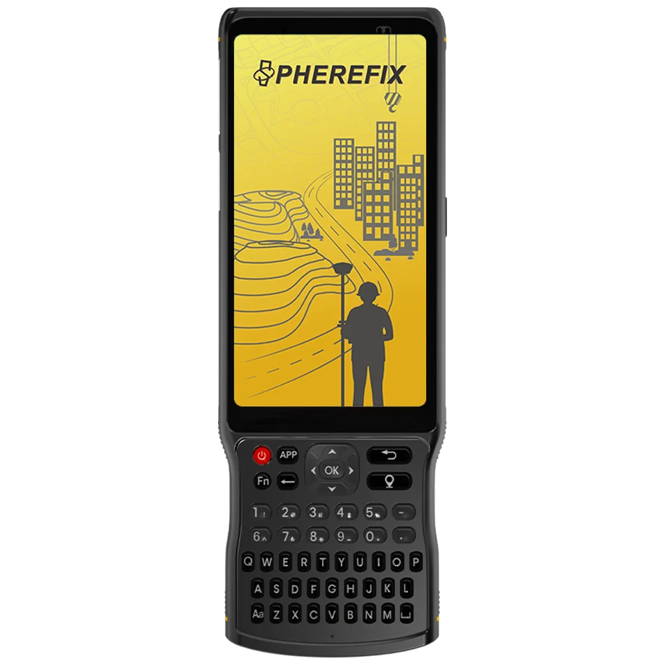
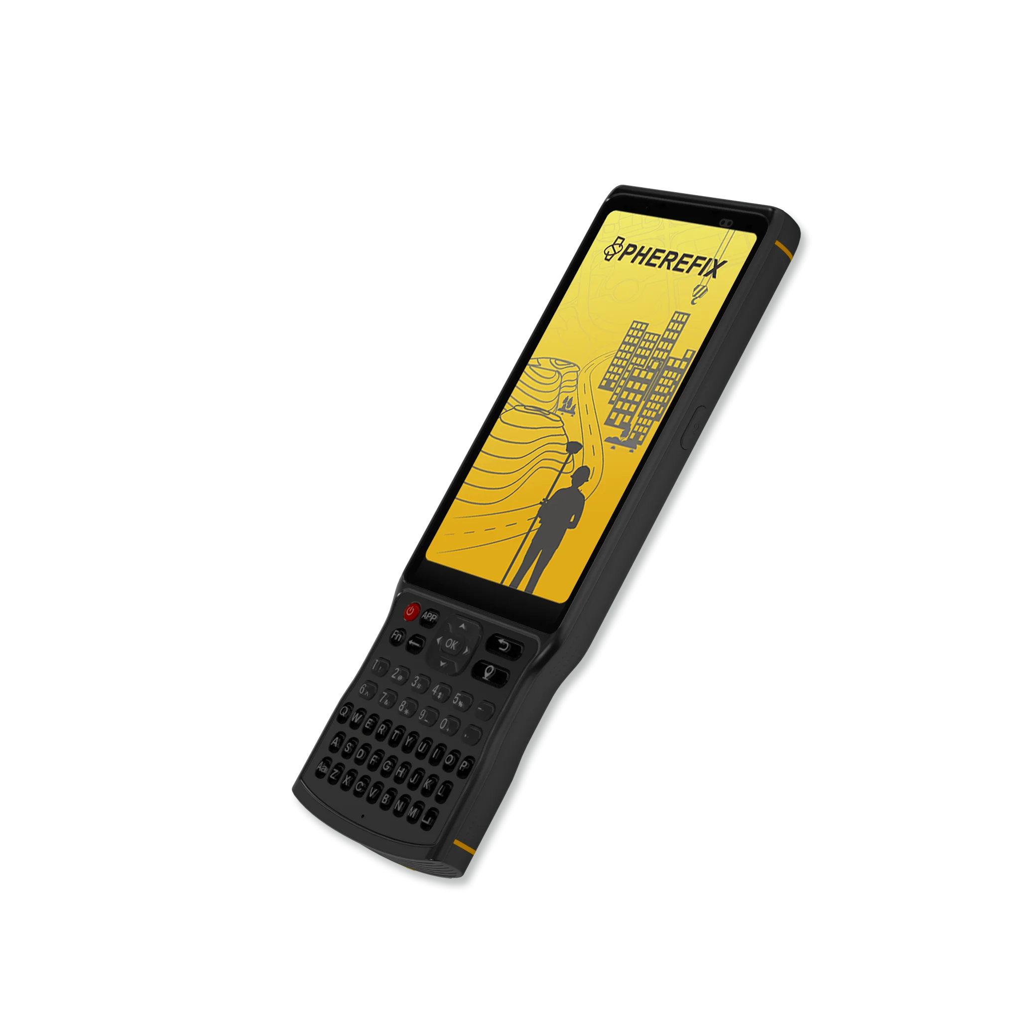
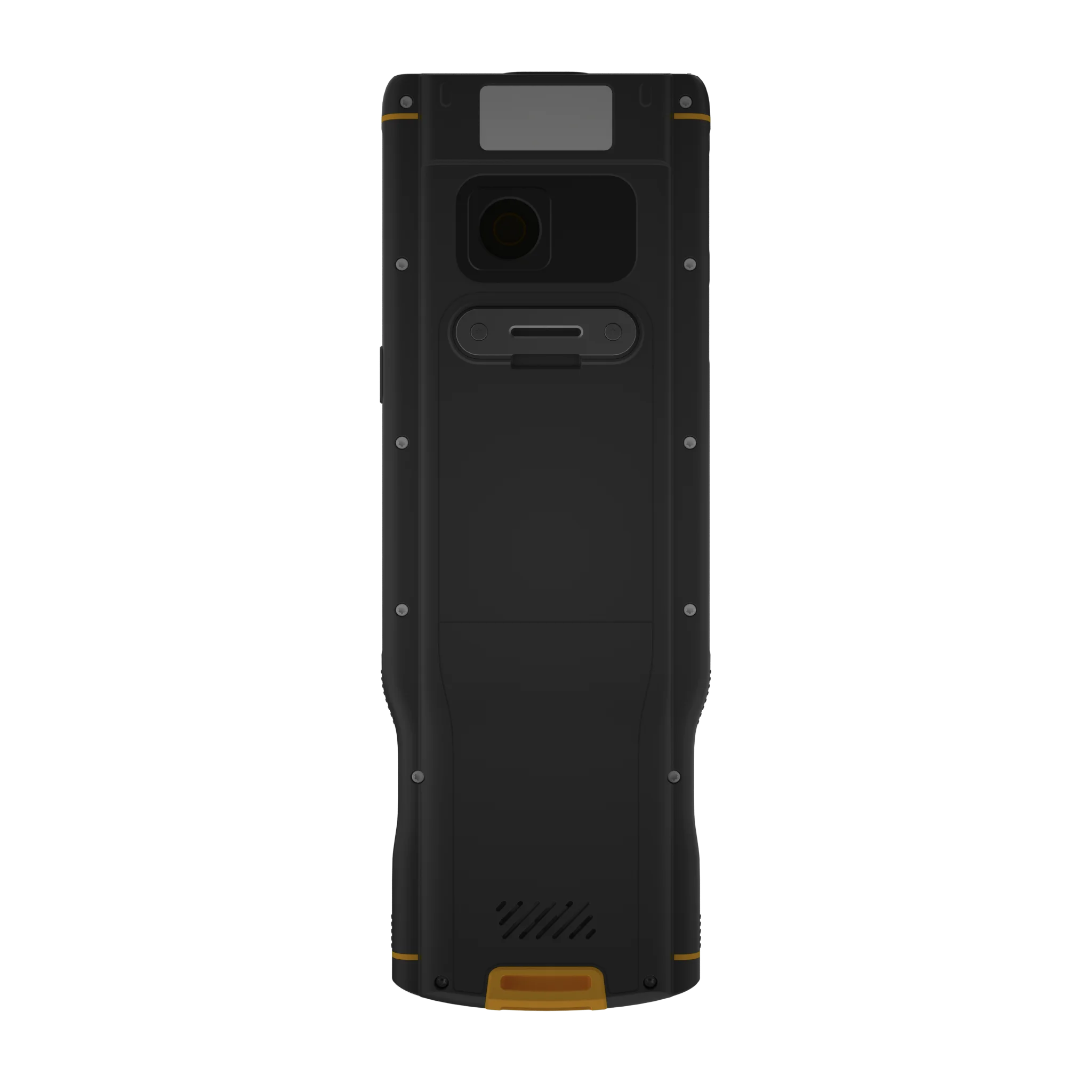
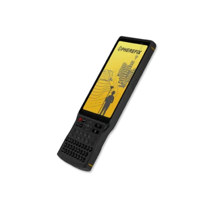
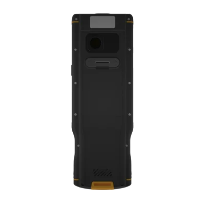
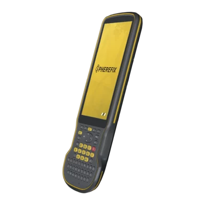
Spherefix C100T Rugged Android GNSS Survey Data Controller
Get the best price for your setup
Contact our experts for the best possible price and configuration.
- Fast response
- Expert configuration advice
- No overpaying for features you do not need
The Spherefix C100T Data Controller is a rugged Android field terminal for GNSS surveying, construction layout and GIS data collection. It combines a sunlight-readable 5.45-inch touchscreen with a physical keypad, giving field crews a practical way to enter point codes, control survey software and manage measurements in bright or demanding outdoor conditions.
An eight-core processor, 4 GB of RAM and 64 GB of internal storage provide the performance needed for compatible surveying and mapping applications. Integrated 4G, Wi-Fi, Bluetooth and NFC support communication with RTK GNSS receivers, correction services and office systems, while the 9,000 mAh battery provides up to 18 hours of stated operation.
Spherefix C100T Highlights
| Operating system | Android 11 |
|---|---|
| Display | 5.45-inch sunlight-readable touchscreen with 720 × 1440 resolution |
| Processor and memory | Eight-core 2.0 GHz processor with 4 GB RAM and 64 GB storage |
| Connectivity | 4G, dual-band Wi-Fi, Bluetooth 5.0 BLE, NFC and dual-SIM support |
| Battery and protection | 9,000 mAh battery, up to 18 hours operation and IP68 protection |
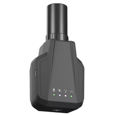
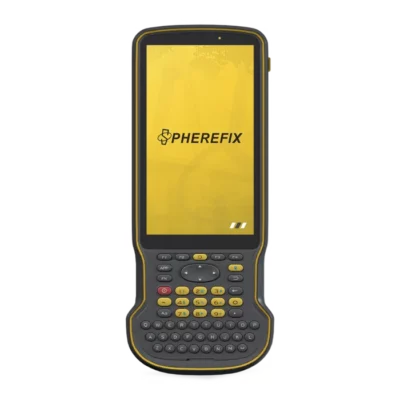
Valued customers:










Find RTK Networks
Search NTRIP providers and connect to reliable RTK correction services.
Description
A purpose-built controller for GNSS fieldwork
The Spherefix C100T Data Controller is designed for surveyors, construction professionals, GIS users and engineering teams that need a dependable field terminal for controlling GNSS equipment and managing measurement data. It provides the portability of an Android handheld together with the physical controls and environmental protection required for regular outdoor use.
The C100T can be paired with a compatible RTK GNSS receiver through Bluetooth and used to run supported surveying or data-collection software. In the field, this gives users a single device for configuring the receiver, connecting to correction services, collecting points, entering feature codes, carrying out stakeout work and reviewing stored project data.
Readable controls in bright outdoor conditions
The 5.45-inch HD touchscreen is designed to remain readable in direct sunlight. This is useful on open construction sites, roads, railway corridors and agricultural land where standard consumer-device screens can be difficult to see. Its narrow handheld format also makes the controller practical to use on a survey pole or carry between measurement locations.
A physical keypad supports faster and more controlled data entry when touchscreen-only operation is inconvenient. Dedicated navigation, function, application and measurement buttons provide quick access to frequently used actions. The configurable application button can be assigned to supported software, while the positioning button can be used for rapid measurement functions within a compatible survey application.
Android performance for surveying software
The C100T runs Android 11 and uses an eight-core 2.0 GHz processor with 4 GB of RAM. This hardware is intended to provide smooth operation for compatible GNSS surveying, GIS and mapping applications without making the controller unnecessarily large or complicated.
Its 64 GB of built-in storage provides space for project files, coordinate data, drawings, photographs and application data. Storage can be expanded with a compatible microSD card of up to 512 GB when additional capacity is needed for larger projects or long-term field records.
Flexible communication in the field
Integrated 4G mobile connectivity allows the controller to access network RTK correction services, cloud platforms and online project information where network coverage is available. Dual-SIM support can be useful for crews working across regions or using more than one mobile network. The second card position can alternatively be used for microSD storage.
Bluetooth 5.0 BLE supports wireless communication with compatible GNSS receivers and other field equipment. Dual-band 2.4 GHz and 5 GHz Wi-Fi provides access to local networks and mobile hotspots, while NFC adds another option for compatible identification or data-transfer workflows.
Battery capacity for full working days
The integrated 9,000 mAh battery provides up to 18 hours of stated operating time. This helps survey and construction teams work through a normal field day without stopping to replace batteries or repeatedly recharge the controller.
USB-C charging simplifies power management because the controller can be charged from compatible mains adapters, computers or field power supplies. Rapid-charging support helps reduce downtime between projects, although actual operating and charging times will depend on screen brightness, mobile-network use, connected equipment and installed applications.
Designed for difficult site conditions
An IP68 protection rating helps protect the C100T against dust and water during outdoor use. The controller is also specified to withstand a 1.2-metre pole drop, making it better suited to active surveying and construction environments than a conventional smartphone or tablet.
Its operating-temperature range supports work in both cold and hot field conditions. A sealed port design helps maintain environmental protection, provided that the charging and card-slot covers are correctly closed after use.
Camera and field documentation
The built-in 13 MP rear camera can be used to record site conditions, survey markers, installed assets and other project details. Linking photographs with field notes and measured features can make collected information clearer for office teams, clients and later site visits.
Audio, vibration and LED notifications provide visible and physical feedback while working in noisy environments. Integrated light and motion sensors support normal Android device functions and compatible field applications.
Applications for the Spherefix C100T
The C100T is suitable for a broad range of GNSS and geospatial workflows. Surveyors can use it for topographic measurement, stakeout and point coding. Construction teams can use it for site layout, level checks and recording completed work. GIS and utility crews can collect asset information, photographs and coordinates directly in the field.
- RTK GNSS receiver control and network correction access
- Construction layout and point stakeout
- Topographic and cadastral data collection
- Utility and infrastructure asset mapping
- Road, railway and corridor surveys
- GIS feature collection and field documentation
Choosing a field controller from Global GPS Systems
Global GPS Systems supplies professional GNSS equipment for surveyors, engineers, construction crews and GIS professionals. The Spherefix C100T is a practical choice for users who need a rugged Android controller with a physical keyboard, long battery endurance and the communication options required for modern RTK workflows.
Before selecting a configuration, check that the required survey application, GNSS receiver and mobile-network bands are compatible with the controller. The C100T is a field data terminal rather than a survey-grade RTK receiver by itself, so accurate centimetre-level positioning requires connection to suitable GNSS equipment and a compatible correction source.
Datasheets & Manuals
Specifications
Spherefix C100T Data Controller Specifications
Product Overview
| Product Type | Rugged Android data controller for GNSS surveying and field data collection |
|---|---|
| Model | C100T |
| Primary Applications | GNSS receiver control, RTK surveying, construction layout, GIS data collection, mapping and other outdoor measurement workflows |
| Key Features | 5.45-inch sunlight-readable display, physical survey keypad, Android operating system, octa-core processor, dual-SIM cellular connectivity, IP68 protection and up to 18 hours of operation |
| Survey Software Compatibility | Compatible with multiple Android-based surveying and measurement applications |
Operating System and Processor
| Operating System | Android 11 |
|---|---|
| Processor | Octa-core processor |
| Processor Frequency | 2.0 GHz |
| Application Support | Supports compatible Android surveying, GIS and field-data applications |
Memory and Storage
| RAM | 4 GB |
|---|---|
| Internal Storage | 64 GB ROM |
| External Storage | MicroSD card support |
| Maximum External Storage Capacity | Up to 512 GB |
| Supported Memory Card Types | microSD and microSDHC |
| Memory Card File System | FAT file system |
Display and Touchscreen
| Display Size | 5.45 inches |
|---|---|
| Display Resolution | 720 × 1440 pixels |
| Outdoor Visibility | Sunlight-readable display |
| Touchscreen Type | Capacitive touchscreen |
| Multi-Touch Support | 5-point multi-touch |
Physical Keypad and Controls
| Keypad Type | Integrated physical alphanumeric survey keypad |
|---|---|
| Power Button | Controls power on, power off, sleep and wake functions |
| Navigation Buttons | Dedicated up, down, left and right navigation controls |
| Back Button | Returns to the previous screen or main interface |
| Application Button | Provides quick access to application-related actions |
| FN Button | Short press switches to the physical numeric keyboard; long press accesses virtual-keyboard settings |
| Aa Button | Toggles the physical keyboard capital-letter state |
| Enter Button | Confirms the selected command or function |
| Delete Button | Deletes the character located before the cursor |
| Positioning Button | Provides quick measurement or management access in compatible surveying applications |
| Space Button | Inserts a space during text entry |
Camera and Sensors
| Rear Camera | 13 megapixels |
|---|---|
| Camera Flash | Supported |
| Ambient Light Sensor | Supported |
| Accelerometer | Supported |
| NFC | Supported |
Positioning
| Integrated Satellite Positioning | GPS, BeiDou, GLONASS and assisted GNSS positioning |
|---|---|
| Supported Positioning Systems | GPS, BDS, GLONASS and A-GPS |
| Positioning Purpose | General device navigation, field-location support and application positioning |
| Survey Receiver Connection | Connects wirelessly to compatible external GNSS and RTK receivers |
Bluetooth and Wi-Fi
| Bluetooth Version | Bluetooth 5.0 |
|---|---|
| Bluetooth Low Energy | Supported |
| Wi-Fi Standards | IEEE 802.11 a/b/g/n/ac |
| Wi-Fi Frequency Bands | 2.4 GHz and 5 GHz dual-band Wi-Fi |
Mobile Network Connectivity
| Cellular Technologies | LTE FDD, LTE TDD, WCDMA, GSM and TD-SCDMA |
|---|---|
| 4G Connectivity | Supported |
| SIM Configuration | Dual Nano-SIM support or one Nano-SIM plus one microSD card |
| Dual-SIM Operation | Dual-network, dual-standby capability |
| SIM Slot 1 | Nano-SIM |
| SIM Slot 2 | Nano-SIM or microSD card |
Cellular Frequency Bands
| Network Type | Supported Bands |
|---|---|
| LTE FDD | Band 1 |
| LTE TDD | B34, B38, B39, B40 and B41 |
| WCDMA | B1, B2, B5 and B8 |
| GSM | B2, B3, B5 and B8 |
| TD-SCDMA | B34 and B39 |
Interfaces and Notifications
| USB Interface | USB Type-C |
|---|---|
| USB Functions | Battery charging, computer connection and data transfer |
| Audio Notification | Supported |
| Vibration Notification | Supported |
| LED Indicators | Supported |
Battery and Power
| Battery Type | Integrated rechargeable lithium-ion battery |
|---|---|
| Battery Capacity | 9000 mAh |
| Battery Removal | Non-removable |
| Maximum Operating Time | Up to 18 hours |
| Rapid Charging | Supported |
| Charging Interface | USB Type-C |
| Charging Sources | Compatible USB charger or computer USB connection |
Environmental and Ruggedness Specifications
| Ingress Protection Rating | IP68 |
|---|---|
| Dust Protection | Dust-tight enclosure |
| Water Protection | Protected against water ingress under the applicable IP68 test conditions |
| Drop Resistance | Withstands a 1.2 m pole drop |
| Electrostatic Discharge Protection | Air discharge: ±15 kV; contact discharge: ±8 kV |
| Outdoor Use | Designed for surveying and field-data work in harsh outdoor environments |
| Waterproof Port Protection | USB, SIM and storage-card port cover must be fully closed after use to maintain the ingress-protection rating |
Physical Specifications
| Dimensions | 221 × 78 × 16.5 mm |
|---|---|
| Weight | 410.6 g |
| Form Factor | Rugged handheld field controller with touchscreen and physical keypad |
Supported Field Workflows
| GNSS Surveying | Configuration and control of compatible GNSS and RTK receivers |
|---|---|
| Construction Layout | Field stakeout, point collection and design-coordinate layout with compatible software |
| GIS Data Collection | Collection of geographic features, attributes, photographs and field notes |
| Mapping | Mobile mapping and position-based field-data management |
| Network RTK | Cellular internet connectivity for compatible NTRIP and network-correction workflows |
| Offline Field Work | Internal and expandable storage for local projects, maps and measurement data |
Specifications and package contents may vary by configuration, region or manufacturer update. Always check the current configuration before ordering.
Reviews (0)
Only logged in customers who have purchased this product may leave a review.
FAQ
C100T Data Controller FAQ
Overview and Surveying Applications
What is the C100T Data Controller?
The C100T is a rugged Android data controller designed for professional GNSS surveying, construction layout, mapping and field data collection. It provides a touchscreen, physical keypad, mobile connectivity and long battery life for operating compatible surveying software and GNSS receivers.
Who is the C100T designed for?
The C100T is intended for land surveyors, construction professionals, civil engineers, GIS teams, utility mapping crews, railway contractors, machine-control support teams and other users who collect or manage positioning data outdoors.
What surveying tasks can be performed with the C100T?
When used with compatible GNSS equipment and field software, the C100T can support topographic surveys, point stakeout, construction layout, road surveys, utility data collection, GIS feature mapping, cadastral work and as-built measurements.
Is the C100T itself an RTK receiver?
The C100T is primarily a field data controller rather than a survey-grade RTK receiver. It is designed to connect to a compatible GNSS or RTK receiver, display measurement information and control field data-collection workflows.
Can the C100T be used for GIS data collection?
Yes. Compatible Android GIS applications can use the controller for recording points, lines, polygons, attributes, photographs and other field information. The available functions and export formats depend on the installed software.
Can the C100T be used on construction sites?
Yes. Its rugged enclosure, physical keypad, sunlight-readable display and IP68 protection make it suitable for construction layout, site verification and other outdoor measurement workflows.
Operating System, Display and Controls
Which operating system does the C100T use?
The C100T runs Android 11, allowing compatible Android surveying, mapping and data-management applications to be installed and operated on the controller.
What processor and memory does the C100T have?
The controller has an eight-core 2.0 GHz processor, 4 GB of RAM and 64 GB of internal storage. This configuration is designed to support field measurement software, maps, project files and routine data processing.
What type of display does the C100T use?
The C100T has a 5.45-inch sunlight-readable display with a resolution of 720 × 1440 pixels. The screen is designed to remain visible during outdoor surveying work in bright conditions.
Does the C100T have a touchscreen?
Yes. It has a five-point capacitive touchscreen that can be used to navigate Android applications, maps, forms and surveying software.
Does the C100T include a physical keypad?
Yes. The controller includes a physical keypad with navigation, number, letter, function, enter, delete and measurement-related keys. The keypad can make data entry and software control easier during fieldwork.
Can the shortcut buttons be configured?
The programmable APP button can be assigned to a selected application through the controller settings. This provides faster access to frequently used surveying or data-collection software.
Does the C100T have a camera?
Yes. It has a 13-megapixel rear camera with a flash. The camera can be used to document survey points, assets, site conditions and field observations when supported by the selected application.
Connectivity and Compatibility
How does the C100T connect to a GNSS receiver?
The C100T can connect to compatible GNSS receivers through Bluetooth or another connection method supported by the receiver and surveying software. Compatibility should be confirmed for the specific receiver model and application.
Does the C100T support Bluetooth?
Yes. It supports Bluetooth 5.0 with Bluetooth Low Energy. Bluetooth can be used to communicate with compatible GNSS receivers, sensors and other field equipment.
Does the C100T support Wi-Fi?
Yes. The controller supports 2.4 GHz and 5 GHz Wi-Fi using IEEE 802.11 a/b/g/n/ac standards. Wi-Fi can be used for software access, project synchronization, file transfer and internet connectivity.
Does the C100T support 4G mobile networks?
Yes. It supports multiple LTE, WCDMA and GSM network bands. Mobile connectivity can be used for internet access, cloud synchronization and receiving network RTK corrections where compatible coverage and services are available.
Can the C100T use two SIM cards?
Yes. One configuration supports two Nano SIM cards. Alternatively, the second slot can be used for a microSD memory card, meaning that two SIM cards and a memory card may not be usable simultaneously.
Does the C100T support NTRIP corrections?
The controller can provide an internet connection for compatible surveying software that supports NTRIP. Receiving RTK corrections also requires a compatible GNSS receiver, valid caster credentials and suitable mobile or Wi-Fi coverage.
Can the C100T storage be expanded?
Yes. The C100T supports microSD storage cards with capacities of up to 512 GB. The memory card should use a supported file system and shares its slot with the second SIM position.
Does the C100T have NFC and USB connectivity?
Yes. NFC is supported, and the controller includes a USB Type-C connection for charging and compatible data-transfer functions. Available USB functions may depend on the connected device, cable and Android settings.
Battery, Durability and Field Use
How long does the C100T battery last?
The built-in 9,000 mAh battery provides up to approximately 18 hours of operation. Actual battery life varies according to screen brightness, mobile data use, Bluetooth activity, software workload, temperature and network conditions.
Can the C100T battery be removed?
No. The 9,000 mAh battery is integrated into the controller and is not designed to be removed by the user.
Does the C100T support rapid charging?
Yes. The controller supports rapid charging through its USB Type-C port when used with compatible charging equipment. The protective port cover should be closed correctly after charging to maintain environmental protection.
Is the C100T waterproof and dustproof?
The C100T has an IP68 protection rating, meaning its enclosure is designed to resist dust and water under the applicable test conditions. Covers and ports must be properly secured to maintain this protection.
Can the C100T withstand drops?
The controller is specified to withstand a 1.2-metre pole drop under defined test conditions. Careful handling is still recommended because impacts, exposed ports and repeated drops can damage the device.
What temperatures can the C100T operate in?
The specified operating temperature range is -20°C to +55°C, while the storage temperature range is -40°C to +70°C. Extreme temperatures may affect battery runtime, display performance and charging.
 GPS & GNSS
 Total Stations
 Data collectors
 Software
 Correction services
 Machine control
 External radio
 Marine
 Accessories
Reviews
There are no reviews yet