
 GPS & GNSS
 Lidar scanning
 Total Station
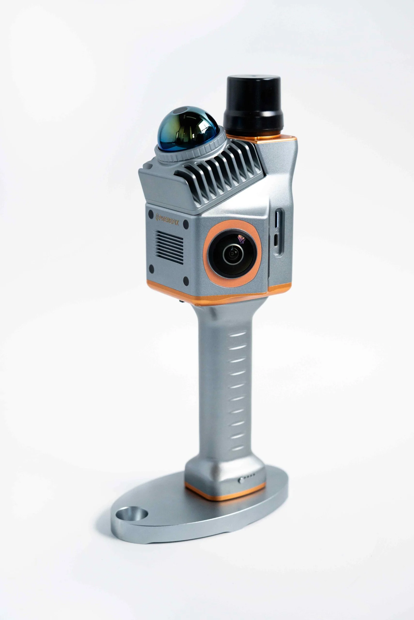
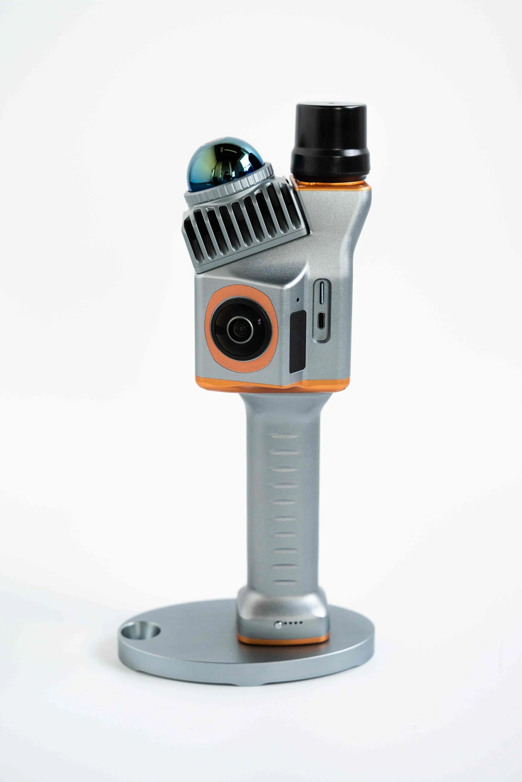
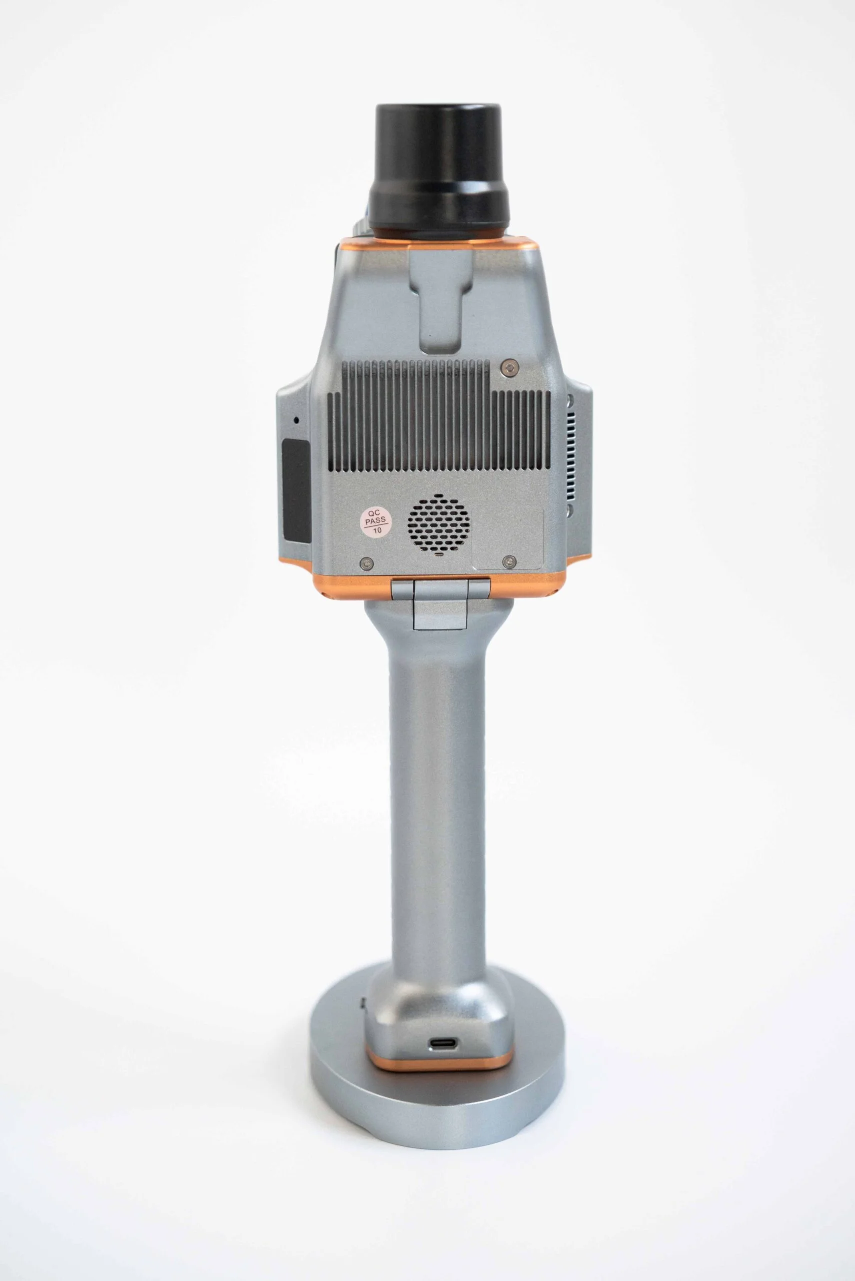
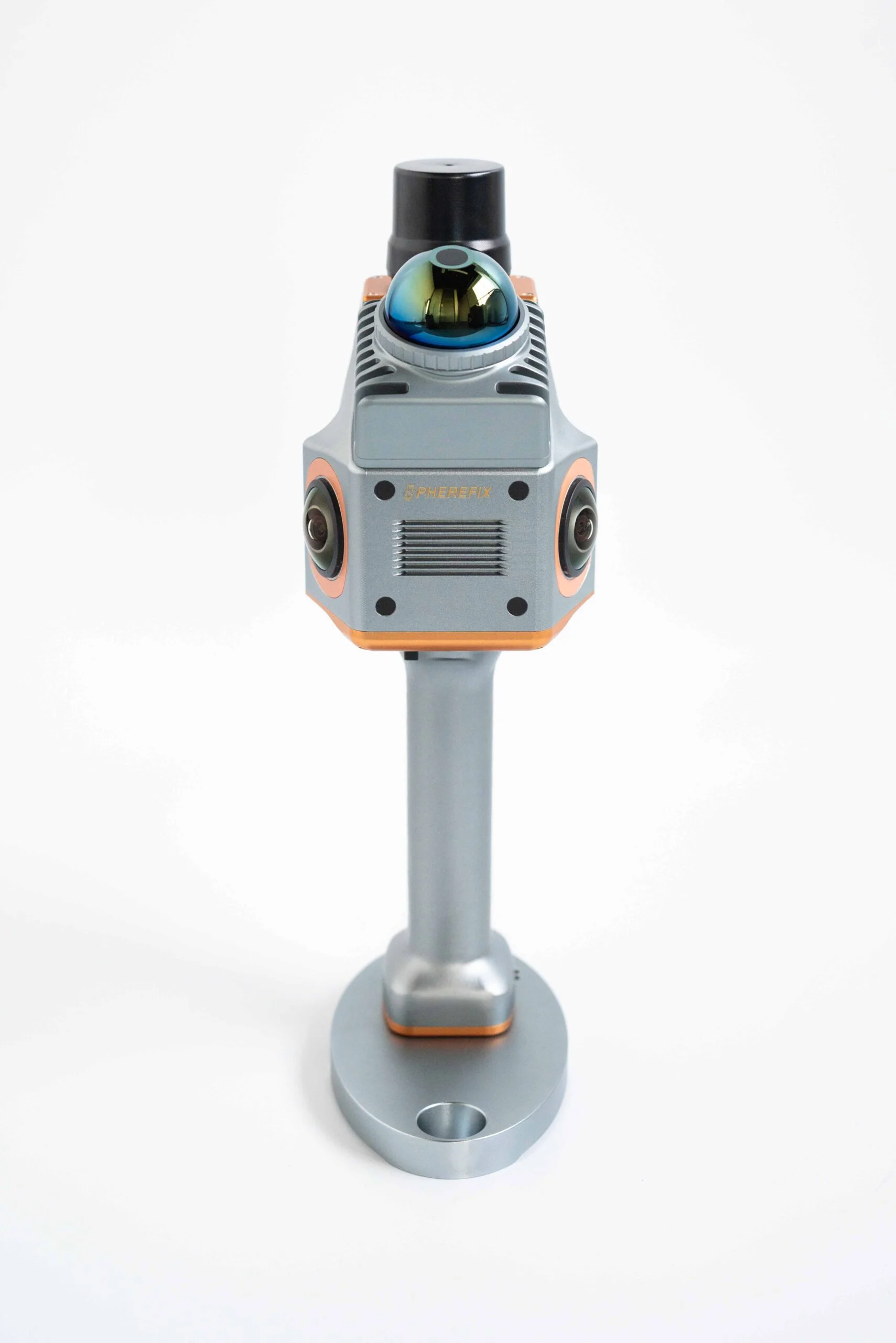
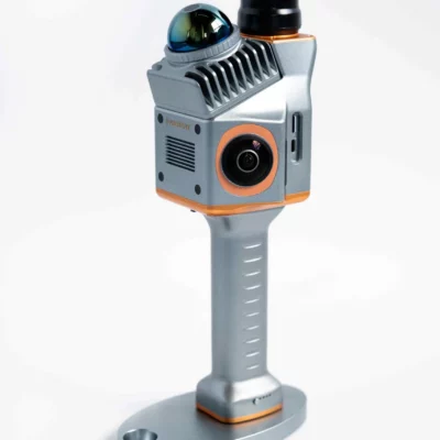
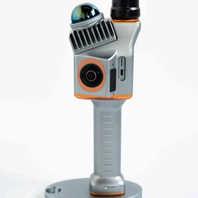
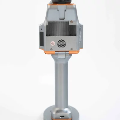
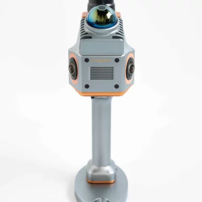
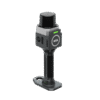
Spherefix Sphere360 Handheld LiDAR Scanner with RTK SLAM
This product is available
Get the best price for your setup
Contact our experts for the best possible price and configuration.
The Sphere360 Handheld LiDAR Scanner is a lightweight mobile mapping system for capturing detailed 3D point clouds while walking through indoor, outdoor and GNSS-challenged environments. It combines a Livox Mid-360 laser scanner with GNSS, inertial positioning and SLAM processing, allowing surveyors, construction teams, GIS professionals and asset inspectors to document sites without setting up a static scanner at every position.
SLAM, RTK-SLAM and PPK-SLAM modes support different working conditions, from indoor buildings and underground spaces to georeferenced outdoor surveys. The scanner records up to 200,000 points per second across a wide 360° field of view, while synchronized fisheye cameras add colour information for easier interpretation and 3D modelling.
Sphere360 Handheld LiDAR Scanner Highlights
| Mapping modes | SLAM, RTK-SLAM and PPK-SLAM |
|---|---|
| Point-cloud accuracy | Up to ≤3 cm relative and ≤5 cm absolute under suitable conditions |
| LiDAR performance | 200,000 points per second with a 40 m range at 10% reflectivity |
| Scanning field of view | 360° horizontal and 59° vertical |
| Colour capture | Dual synchronized ultra-wide-angle fisheye cameras |
| System weight | Approximately 1.0 kg |
| GNSS support | GPS, GLONASS, Galileo and BeiDou |
| Operating temperature | -20°C to 55°C |
Valued customers:










Find RTK Networks
Search NTRIP providers and connect to reliable RTK correction services.
Description
Fast 3D site capture with handheld LiDAR
The Sphere360 Handheld LiDAR Scanner is designed for professionals who need to capture buildings, infrastructure, terrain and assets more efficiently than is practical with repeated static scanner setups. The operator can walk through the survey area while the system continuously records laser, positioning and movement data to create a connected 3D point cloud.
Its compact 1 kg design makes it suitable for construction sites, stairways, plant rooms, tunnels, car parks, forest plots and other locations where carrying larger survey equipment can be inconvenient. The integrated controller, storage, positioning sensors and removable handle battery form a self-contained field system that can be deployed quickly.
SLAM mapping indoors and in GNSS-denied locations
Standard GNSS equipment requires a usable satellite signal, which can be difficult inside buildings, below ground, beneath structures or near tall obstructions. Sphere360 uses simultaneous localisation and mapping technology to calculate the scanner’s movement from the geometry around it while building the point cloud.
This allows teams to capture indoor rooms, corridors, staircases, underground areas and covered structures without relying continuously on GNSS. Smooth walking and sufficient overlap between scanned areas help the SLAM system maintain a reliable trajectory, particularly around corners and through areas with repetitive geometry.
RTK-SLAM and PPK-SLAM for georeferenced outdoor surveys
For outdoor mapping, RTK-SLAM and PPK-SLAM combine satellite positioning with LiDAR and inertial measurements. RTK-SLAM can support georeferenced data capture when real-time corrections are available, while PPK-SLAM allows positioning information to be refined after collection.
The integrated positioning system tracks GPS, GLONASS, Galileo and BeiDou signals. Under suitable survey conditions and with an appropriate workflow, the system is specified for relative point-cloud accuracy of up to 3 cm and absolute accuracy of up to 5 cm. Actual results depend on satellite visibility, correction quality, site geometry, scan technique and processing settings.
Wide coverage from the Livox Mid-360 sensor
The Livox Mid-360 records up to 200,000 points per second and provides a 360° horizontal field of view with approximately 59° of vertical coverage. Its specified measuring range reaches 40 m on surfaces with 10% reflectivity.
In practical fieldwork, this broad coverage helps the scanner record walls, floors, ceilings, façades, vegetation and surrounding structures during a single walkthrough. The non-repetitive scanning pattern gradually fills surface detail as the operator moves, supporting dense point clouds without requiring the instrument to remain fixed on a tripod.
Colourised point clouds for easier interpretation
Two synchronized ultra-wide-angle fisheye cameras capture image information alongside the laser measurements. This can be used to produce colourised point clouds and locally registered panoramic imagery, making objects and materials easier to recognise than in an uncoloured intensity-only dataset.
Colour data is useful for building documentation, digital twins, condition records, architectural modelling and visual communication with colleagues or clients. It can also help distinguish features that have similar geometry but different surface colours or finishes.
Designed for construction surveying and site documentation
Construction teams can use the Sphere360 to record existing conditions, document progress, capture complex interiors and create a spatial record before areas become inaccessible. Point clouds can support measurements, coordination, floor-plan production, volume calculations and comparisons between captured conditions and design information.
The handheld workflow is especially useful when a fast overall record is more important than collecting isolated points individually. It does not replace every total-station, GNSS receiver or high-end static scanning task, but it can significantly improve productivity for site capture, preliminary surveys and documentation work.
Applications across surveying GIS and inspection
Surveyors can use the system for mobile topographic and building surveys, while GIS teams can collect three-dimensional information for asset inventories and mapping projects. Infrastructure inspectors can document utility areas, power-line corridors, façades and hard-to-access structures. Forestry and environmental teams can capture terrain and vegetation in areas with low canopy cover, subject to local conditions and project requirements.
Other suitable workflows include underground mapping, parking-area surveys, heritage documentation, BIM data collection, industrial facility capture, stockpile measurement and digital-twin creation. Drone operators may also use terrestrial scans to complement aerial data by recording façades, covered areas and ground-level details that are difficult to see from above.
Field operation and live project monitoring
Scanning is controlled through a companion mobile application, with point-cloud information displayed during acquisition. This gives the operator immediate feedback on the scan trajectory and area coverage, helping identify missed sections before leaving the site.
Wi-Fi connectivity supports communication between the scanner and the mobile device. The system includes onboard flash storage and MicroSD storage for project data. A removable handle battery allows the power source to be exchanged during longer field sessions.
Point-cloud processing workflow
Sphere360 works with the PointFlow processing workflow for preparing and refining collected data. Available processing operations can include point-cloud optimisation, noise filtering, colour generation, image brightness adjustment, removal of moving objects and uniform point resampling.
Depending on the selected processing configuration, project data can be prepared in formats such as LAS or TXT for use in compatible point-cloud, CAD, GIS, BIM and modelling software. Buyers should confirm the required output formats and software workflow for their intended application before deployment.
Built for demanding working environments
The scanner has a specified operating range of -20°C to 55°C and a power consumption below 25 W. Its integrated design reduces the number of separate components that need to be carried around a project, while the compact dimensions make it easier to use in narrow rooms, stairs and other restricted spaces.
As with any SLAM scanner, good operating technique affects the final result. Operators should move smoothly, turn gradually, maintain suitable distance from surfaces and create loop closures where practical. Survey control or independent check measurements should be used whenever the project requires verified absolute accuracy.
Choosing and supporting your Sphere360 workflow
Global GPS Systems can help buyers assess whether the Sphere360 fits their required accuracy, working environment, coordinate system and deliverable formats. This is particularly important when integrating handheld LiDAR with existing GNSS, CAD, GIS, BIM or drone-survey workflows.
Before ordering, consider whether the work is mainly indoor or outdoor, whether absolute georeferencing is required, which correction service or base station will be used, and how the resulting point clouds must be processed. Matching these requirements to the correct field and software configuration helps create a dependable workflow from data capture through to the finished deliverable.
Datasheets & Manuals
Datasheets and manuals
Datasheets & manuals
Specifications
Spherefix Sphere360 Handheld LiDAR Scanner Specifications
Product Overview
| Product Type | Handheld mobile LiDAR and SLAM mapping system |
|---|---|
| Primary Functions | 3D point-cloud capture, mobile mapping, colourised point-cloud generation, panoramic image capture and survey data processing |
| Positioning Technologies | LiDAR, SLAM, GNSS and inertial navigation system (INS) fusion |
| LiDAR Sensor | Livox MID-360 |
| POS Module | gSpin 210 GNSS/INS positioning and orientation system |
| Camera System | Dual ultra-wide-angle fisheye cameras for texture capture and colourised point clouds |
| Operation Environment | Indoor and outdoor operation, including GNSS-denied and low-light environments |
| System Design | All-in-one handheld design integrating the control unit, LiDAR, cameras, GNSS/INS, storage, wireless connectivity and removable handle battery |
Mapping Performance
| Relative Accuracy | ≤3 cm under suitable operating conditions |
|---|---|
| Absolute Accuracy | ≤5 cm under suitable operating conditions |
| Mapping Modes | SLAM, RTK-SLAM and PPK-SLAM |
| GNSS-Independent Mapping | Supported using LiDAR-SLAM in indoor, underground and other satellite-denied environments |
| Colourised Point Clouds | Supported through time-synchronised LiDAR and dual-camera capture |
| Panoramic Image Capture | Locally registered panoramic image generation supported |
| Real-Time Acquisition Display | Point-cloud data can be viewed during data collection through the companion application |
| Recommended Survey Path | Closed-loop routes are recommended where practical to reduce accumulated SLAM drift; open-path operation is also supported |
LiDAR Specifications
| LiDAR Model | Livox MID-360 |
|---|---|
| Scanning Technology | Non-repetitive scanning |
| Maximum Measuring Range | 40 m at 10% target reflectivity |
| Point Rate | 200,000 points per second, single/first return |
| Horizontal Field of View | 360° |
| Vertical Field of View | -7° to +52° |
| Range Precision at 10 m | ≤2 cm under specified test conditions |
| Range Precision at 0.2 m | ≤3 cm under specified test conditions |
| Close-Proximity Blind Zone | 0.1 m according to the Livox MID-360 sensor specification |
| Angular Precision | <0.15° (1σ) according to the Livox MID-360 sensor specification |
| Typical Frame Rate | 10 Hz according to the Livox MID-360 sensor specification |
| Laser Safety Classification | Class 1 eye-safe laser product in accordance with IEC 60825-1:2014, based on the Livox MID-360 sensor specification |
| Laser Wavelength | Spherefix documentation states 1535 nm; the official Livox MID-360 sensor specification states 905 nm. Confirm the fitted sensor specification before ordering. |
GNSS and POS Specifications
| POS Model | gSpin 210 |
|---|---|
| POS Update Rate | 200 Hz |
| GNSS Constellations | GPS, GLONASS, Galileo and BeiDou |
| GPS Bands | L1, L2 and L5 |
| GLONASS Bands | L1 and L2 |
| Galileo Bands | E1, E5a and E5b |
| BeiDou Bands | B1C, B1, B2, B2a, B2b and B3 |
| Supported Positioning Signal Set | GPS L1/L2; GLONASS L1/L2; Galileo E1/E5b; BeiDou B1/B3/B2a |
| BeiDou-Only Mode | Supported |
| Horizontal Positioning Accuracy | ±0.02 m |
| Vertical Positioning Accuracy | ±0.03 m |
| Pitch Accuracy | 0.015° |
| Roll Accuracy | 0.015° |
| Heading Accuracy | 0.040° |
| Integrated Navigation Sensors | GNSS receiver and inertial measurement/navigation components integrated into the scanner head |
| External GNSS Antenna Connection | GNSS antenna interface provided on the scanner assembly |
Camera Specifications
| Camera Type | Dual fisheye cameras |
|---|---|
| Published Camera Resolution | 2 × 20 MP in the current Spherefix specification table |
| Documentation Variation | The user-guide introduction separately describes two 13 MP cameras; confirm the camera configuration supplied with the selected production version. |
| Camera Field of View | 200° horizontal and 200° vertical per published specification |
| Capture Synchronisation | Time-synchronised camera and LiDAR scanning |
| Colour Capture | Captures ambient-light colour texture for true-colour point clouds |
| Image Output Function | Supports colourised point-cloud processing and locally registered panoramic imagery |
Physical Specifications
| Dimensions | 16.5 × 12.0 × 32.4 cm |
|---|---|
| Weight | 1.0 kg |
| Form Factor | Handheld, all-in-one mobile scanning system |
| Main Modules | LiDAR scanner head and snap-in handle battery |
| Handle Function | Provides the hand grip and system power |
| Battery Replacement | Hot-swappable handle battery design |
| Phone Mount | Integrated or attachable phone-holder position provided |
| Base Assembly | Positioning base plate secured to the handle using captive screws |
Power and Charging
| System Input Voltage | 12-20 V |
|---|---|
| System Power Consumption | <25 W |
| Charging Interface | USB Type-C |
| Recommended Charger | USB Power Delivery adapter rated at 65 W or higher |
| Charging Configuration | The LiDAR head and handle battery can be charged independently |
| Battery Status Indication | Four handle LEDs flash during charging and remain illuminated when fully charged |
| Power Control | Physical power switch with power-status indicators |
| Published Battery Runtime | Not stated in the current technical specification table |
| Published Battery Capacity | Not stated in the current technical specification table |
Storage, Connectivity and Interfaces
| Internal Storage | 64 GB internal flash memory |
|---|---|
| Removable Storage | 128 GB MicroSD/TF card |
| Memory Card Slot | TF/MicroSD card slot |
| Wireless Connectivity | Integrated Wi-Fi module |
| Wireless Status | Dedicated Wi-Fi status indicator |
| Data Interface | USB Type-C interface |
| Charging Interface | Separate USB Type-C charging connection identified in the device documentation |
| Mobile Device Operation | Data collection is initiated and monitored through a companion mobile application |
| Wireless Data Transfer | Supported as part of the acquisition and processing workflow |
Software and Processing
| Pre-Processing Software | PointFlow |
|---|---|
| PointFlow Function | Spherefix-developed point-cloud pre-processing software for importing projects, processing captured data and configuring reconstruction parameters |
| Post-Processing Platform | Point Cloud Automata |
| Point Cloud Automata Availability | Optional |
| Post-Processing Functions | Point-cloud classification and further post-processing |
| Processing Workflow | Field acquisition, wireless or storage-based data transfer, point-cloud pre-processing, colourisation, classification and post-processing |
| Processing Field-of-View Setting | Configurable from 0° to 360°; the documented SLAM default is 270° × 360° |
| Outdoor Processing Distance Setting | 1-100 m |
| Indoor Processing Distance Setting | 0.5-50 m |
| Intensity Setting Range | 0-255 |
| Documented Scene Presets | Outdoor building, indoor space and other application-specific processing modes |
Environmental Specifications
| Operating Temperature | -20°C to +55°C |
|---|---|
| Lighting Requirements | LiDAR-SLAM operation does not require external lighting; ambient light is required when capturing useful colour-camera texture |
| GNSS Requirements | GNSS is not required for pure SLAM mapping; GNSS reception is used for RTK-SLAM and PPK-SLAM workflows |
| Suitable Environments | Indoor spaces, underground areas, tunnels, parking structures, urban areas, low-canopy vegetation and other GNSS-challenged locations |
| Ingress Protection Rating | Not stated in the current Sphere360 specification table |
| Humidity Rating | Not stated in the current Sphere360 specification table |
Device Components and Controls
| Component | Function | Location or Notes |
|---|---|---|
| Laser Sensor | Captures 3D range and point-cloud data | Mounted at the top of the scanner head |
| Dual Fisheye Cameras | Capture colour texture and panoramic imagery | Integrated into the scanner head |
| GNSS/INS Unit | Provides georeferencing, position and attitude data | Integrated into the scanner head |
| GNSS Antenna | Receives satellite positioning signals | Mounted on the upper assembly |
| Wi-Fi Module | Provides wireless communication and data transfer | Includes a dedicated Wi-Fi indicator |
| Handle Battery | Powers the system and serves as the hand grip | Snap-in, removable and hot-swappable |
| Power Switch | Turns the scanner on and off | Located on the handle assembly |
| Phone Holder | Supports a mobile device used for scanner control | Mounted alongside the scanner assembly |
| TF Card Slot | Accepts removable MicroSD/TF storage | Located on the scanner head |
| USB Type-C Data Interface | Provides a wired device or data connection | Located on the scanner head |
| USB Type-C Charging Interface | Connects the USB PD charging supply | Head and handle can be charged independently |
| Power Indicators | Display battery and charging status | Four LED indicators on the handle |
| Base Plate and Latch | Secure the scanner head and handle assembly | Mechanical mounting and locking components |
Typical Applications
| Surveying | Rapid mobile mapping, topographic data capture and as-built surveying |
|---|---|
| Architecture and Construction | Building documentation, floor plans, façade capture, renovation surveys and as-built modelling |
| Digital Twins | Reality capture for digital-twin, BIM, AR and VR workflows |
| Infrastructure Inspection | Road, utility, power-line and civil-infrastructure documentation |
| Indoor Mapping | Rooms, stairways, corridors, warehouses and multi-level parking structures |
| Underground Mapping | Tunnels, caverns, mine drifts, bunkers and other GNSS-denied locations |
| Forestry and Vegetation | Low-canopy forest mapping and vegetation-area data capture |
| Urban Mapping | Buildings, streetscapes and locations affected by satellite-signal obstruction |
Operating Considerations
| Reflective Surfaces | Large areas of glass, mirrors and highly specular materials may create reflections and reduce point-cloud quality. |
|---|---|
| Featureless Environments | Long repetitive corridors, smooth tunnels and open areas with limited geometric features may reduce SLAM accuracy. |
| Route Planning | Multiple closed loops are recommended for long or complex surveys where practical. |
| Accumulated Drift | SLAM drift can increase with travel distance, particularly on long open paths without loop closure or external positioning constraints. |
| Colour Capture in Darkness | LiDAR geometry can be recorded without illumination, but camera-based colour texture quality depends on available ambient light. |
| Minimum-Range Objects | Objects very close to the LiDAR, especially dark, thin, polished or water-covered surfaces, may not be captured reliably. |
Specifications and package contents may vary by configuration, region or manufacturer update. Always check the current configuration before ordering.
FAQ
Sphere360 Handheld LiDAR Scanner FAQ
Product Overview and Applications
What is the Sphere360 Handheld LiDAR Scanner?
The Sphere360 is a lightweight handheld 3D laser scanner designed to capture accurate point-cloud data while an operator walks through indoor or outdoor environments. It combines LiDAR, SLAM, GNSS, INS and synchronized cameras in an integrated mobile mapping system.
What is the Sphere360 used for?
The Sphere360 is used for rapid 3D mapping, land surveying, building documentation, infrastructure inspection, digital twin creation, underground mapping, forestry surveys and asset documentation.
Which industries can use the Sphere360?
The scanner is suitable for surveying, engineering, construction, architecture, utilities, mining, forestry, facility management, infrastructure maintenance, public safety and digital twin projects.
Can the Sphere360 scan both indoor and outdoor environments?
Yes. The Sphere360 is designed for indoor and outdoor data capture. SLAM enables mapping in areas with limited or unavailable satellite reception, while GNSS-supported modes can improve positioning and georeferencing in suitable outdoor environments.
What types of locations can be scanned with the Sphere360?
Typical locations include buildings, stairways, corridors, parking structures, tunnels, underground spaces, outdoor building sites, low-canopy forests, utility corridors and power-line inspection areas.
Can the Sphere360 be used to create digital twins?
Yes. Its LiDAR and synchronized camera data can support the creation of detailed three-dimensional representations of buildings, infrastructure and other physical assets for digital twin, inspection and documentation workflows.
Accuracy and LiDAR Performance
What accuracy can the Sphere360 achieve?
The Sphere360 is specified with relative accuracy of up to 3 cm and absolute accuracy of up to 5 cm under suitable operating, positioning and processing conditions. Actual results depend on the environment, survey method, control data and trajectory quality.
What is the scanning range of the Sphere360?
The integrated Livox Mid-360 LiDAR has a stated measuring range of up to 40 metres on targets with 10% reflectivity. Effective range can vary with surface reflectivity, lighting, weather, angle of incidence and environmental conditions.
How many points per second does the scanner collect?
The Sphere360 can collect up to 200,000 LiDAR points per second using single-echo, non-repetitive scanning.
What is the LiDAR range accuracy?
The published specifications state a range accuracy of up to 2 cm at 10 metres and up to 3 cm at 0.2 metres under the specified test conditions.
Does the Sphere360 produce colourised point clouds?
Yes. The scanner includes two synchronized 20-megapixel cameras that support true-colour, high-definition 3D data capture and point-cloud colourisation.
Can the Sphere360 scan complex or narrow spaces?
Yes. Its handheld design, compact dimensions and SLAM positioning make it suitable for spaces such as stairways, corridors, underground areas and other locations where tripod-based scanning or GNSS-only equipment may be difficult to use.
Mapping Modes and Field Operation
Which mapping modes does the Sphere360 support?
The Sphere360 supports SLAM, RTK-SLAM and PPK-SLAM mapping modes. This allows users to select a workflow based on satellite visibility, correction availability and the required level of georeferencing.
What is SLAM mapping?
SLAM stands for simultaneous localization and mapping. It allows the scanner to estimate its movement while creating a map of the surrounding environment, making it useful for indoor areas and other locations where GNSS signals are weak or unavailable.
What is the difference between SLAM, RTK-SLAM and PPK-SLAM?
SLAM creates a map primarily from onboard sensor data. RTK-SLAM incorporates real-time GNSS corrections during data collection, while PPK-SLAM applies GNSS corrections during post-processing. The most appropriate mode depends on the site, available correction service and project requirements.
Can the Sphere360 work without a GNSS signal?
Yes. Standard SLAM mapping can be used in GNSS-denied environments such as buildings, tunnels and underground spaces. GNSS-based positioning is required when the project needs direct global coordinates through RTK-SLAM or PPK-SLAM.
Which satellite navigation systems does the Sphere360 support?
The positioning system supports signals from GPS, GLONASS, Galileo and BeiDou. Supported frequencies include multiple bands, helping the system maintain positioning performance in suitable outdoor environments.
How portable is the Sphere360?
The scanner weighs approximately 1.0 kg and measures about 16.5 × 12.0 × 32.4 cm. Its compact handheld format is designed for mobile data collection without repeatedly setting up a stationary laser scanner.
Data, Processing and Project Planning
How much data can the Sphere360 store?
The system includes 64 GB of internal flash memory and supports a 128 GB MicroSD card. Actual recording capacity depends on scan duration, camera use, project settings and the amount of data collected.
How is Sphere360 scan data processed?
Sphere360 data is processed through the PointFlow processing platform, which supports the workflow from captured sensor data to refined three-dimensional point clouds. Processing requirements depend on the mapping mode and intended deliverables.
Can Sphere360 data be used in CAD, GIS or BIM workflows?
Processed point clouds can support common surveying, CAD, GIS, BIM, inspection and digital twin workflows. Confirm the required point-cloud format and software compatibility for your specific application before beginning a project.
Does the Sphere360 replace a tripod laser scanner?
The Sphere360 can be faster and more practical for mobile mapping and large or complex spaces. A tripod scanner may still be preferred for projects requiring very high local detail, controlled static observations or specialized precision. Some projects use both technologies together.
What factors can affect point-cloud accuracy?
Accuracy can be affected by walking speed, abrupt movement, repetitive geometry, reflective or moving surfaces, limited environmental features, poor GNSS reception, incorrect control points and incomplete scan-loop closure. Following a planned scanning route and recommended operating procedures improves results.
How should a Sphere360 scanning route be planned?
Plan a continuous route with stable movement, sufficient overlap and coverage from multiple directions. Where possible, return to previously scanned areas to help close the SLAM loop. Avoid excessive speed, sudden rotations and long paths through featureless spaces.
Is training recommended before using the Sphere360?
Yes. Although the handheld workflow is designed for efficient field capture, operator training is recommended for route planning, SLAM loop closure, RTK or PPK setup, control-point use, data processing and quality verification.
Reviews (0)
Only logged in customers who have purchased this product may leave a review.
 GPS & GNSS
 Total Stations
 Data collectors
 Software
 Correction services
 Machine control
 External radio
 Lasers & levellers
 Marine
 Accessories
Reviews
There are no reviews yet