


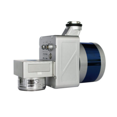
Greenvalley LiAir X3
Login to view pricing or to request a quote
Log in

Request pricing
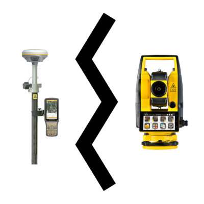
Limited time offer! 1 year free RTK license with every Lidar or GNSS purchase!
Get a personalised quotation with detailed advise from our experts.

Find RTK Networks
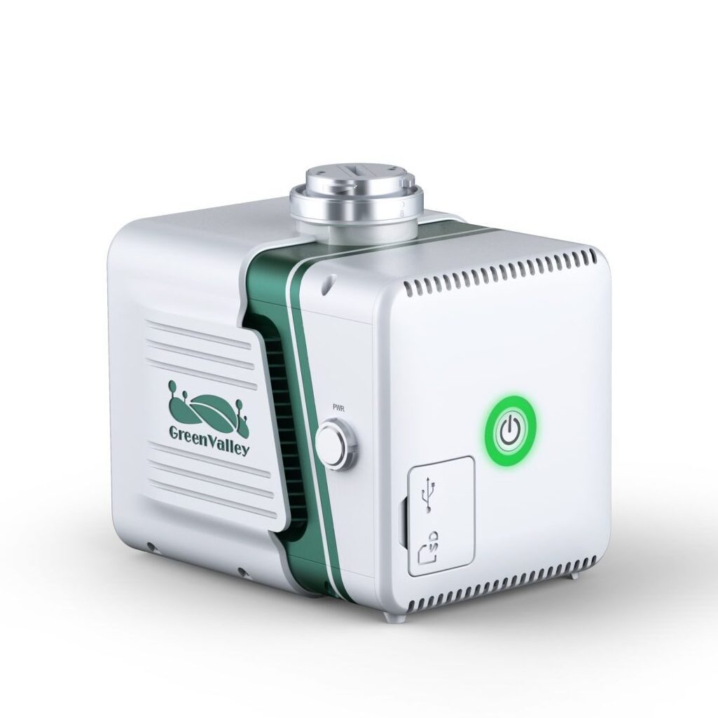
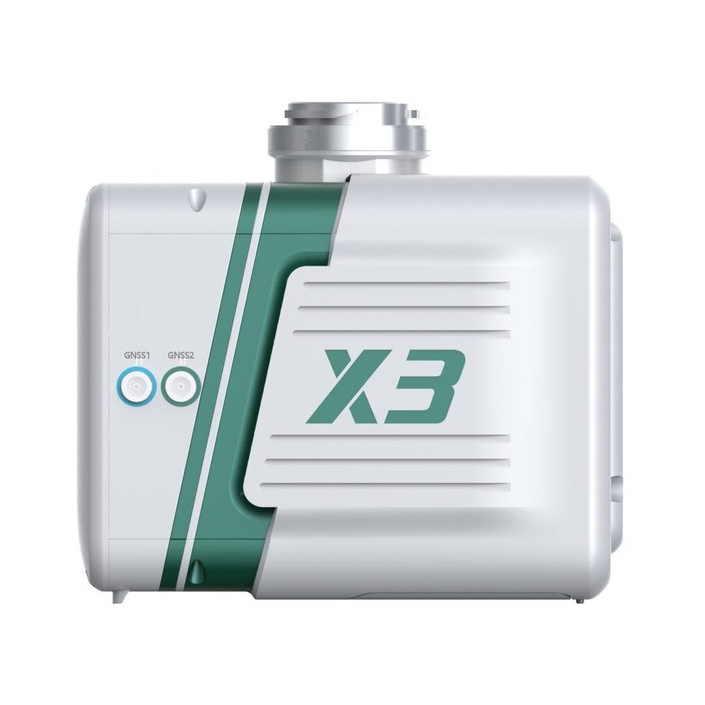
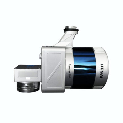
Search NTRIP ProvidersWith it’s rugged design with an IP54 rating the liAir X3 is a strong device. It’s the newest high performance unit in the LiAir series. It’s a lightweight LiDAR device equipped with an upgraded 26 Megapixels camera.
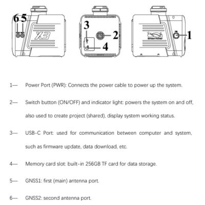
The LiAir X3 system integration is comprised of multiple technologies, including:
- A dynamic differential GNSS receiver for measuring the spatial position of the reference point of the laser signal transmission.
- Attitude measurement equipment for measuring the attitude parameters, namely inertial measurement unit (IMU)
- Laser ranging equipment used to measure the distance between the laser signal emission reference point and the ground point, that is, the core part of the entire integrated system, the laser scanner.
- The storage control system, which is used for data storage and device control, receiving the signals transmitted from the ground to the airborne, and controling the parameters adjustment, data acquistition and downloading.
- Power supply and management unit.
LiGeoreference software included
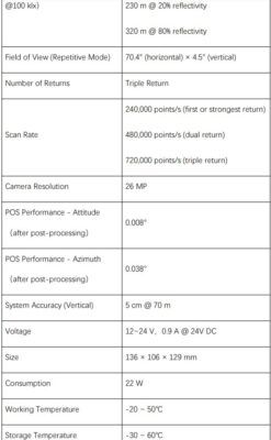
- Range Accuracy: ± 2cm (1σ@20m)
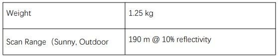
- Weight: 1.25 kg (Incl. camera)
- Scan Range: 190m at 10% reflectance – 450m at 80% reflectance
Inlcuded in package:
- 1x LiAir X3 LiDAR system
- 1x GNSS antenna assembly kit
- 1x 256GB TF card
- 1x USB flash drive
- 1x Product documentation
- 1x USB cord
- 2x GNSS antenna
- 1x Card reader
- 1x Assembly tool
Datasheets and manuals

Valued customers:


Greenvalley LiAir X3
Login to view pricing or to request a quote
Log in
Request pricing
Limited time offer! 1 year free RTK license with every Lidar or GNSS purchase!
Get a personalised quotation with detailed advise from our experts.

Worldwide Shipping From The Netherlands
100% Shipping Insurance on Damage and Loss
Experts in Import / Export / Tax and Duties
Premium Support from Product Experts


Reviews
There are no reviews yet.