

GNSS
IMU Tilt Compensation in GNSS Surveying: What It Means and Why It Matters
IMU tilt compensation has become one of the most useful features in modern GNSS RTK rovers. For surveyors, construction layout teams, GIS users, and mapping professionals, it can make point measurement faster and more practical in difficult field conditions.
Instead of holding the pole perfectly vertical for every measurement, an IMU-equipped GNSS receiver can calculate the position of the pole tip even when the pole is tilted. This is especially useful near walls, fences, trenches, buildings, traffic, slopes, vegetation, and other places where a straight vertical pole position is difficult or unsafe.
Quick answer: what is IMU tilt compensation?
IMU tilt compensation is a GNSS receiver function that uses an internal inertial measurement unit to correct the measured point when the survey pole is tilted. The IMU measures movement and orientation, while the GNSS receiver calculates the antenna position. The receiver and field software then use this information to estimate the correct ground point at the pole tip.
In practical terms, IMU tilt compensation helps you measure points without always needing to center the bubble level perfectly. It does not remove the need for good GNSS conditions, correct pole height, proper setup, or field checks, but it can make everyday RTK work faster and more flexible.
What is an IMU?
An IMU, or inertial measurement unit, is a sensor package that measures movement and rotation. In surveying GNSS receivers, it is used to understand how the receiver is positioned in space while it is being moved or tilted.
A typical IMU uses sensors such as accelerometers and gyroscopes. Accelerometers help detect acceleration and movement, while gyroscopes help detect rotation. In a GNSS rover, this information is combined with satellite positioning data so the system can understand not only where the antenna is, but also how the pole is tilted.
This is important because a GNSS antenna is mounted at the top of the survey pole, while the point you want to measure is usually at the pole tip on the ground. When the pole is vertical, the antenna position can be corrected using the entered pole height. When the pole is tilted, the antenna is no longer directly above the ground point. IMU tilt compensation helps solve that problem.
What does IMU tilt mean in GNSS surveying?
IMU tilt means the GNSS receiver can measure the angle and direction of the survey pole and compensate for that tilt. Instead of assuming the antenna is directly above the pole tip, the system calculates where the pole tip is based on the receiver position, pole height, tilt angle, and tilt direction.
This makes it possible to collect points while holding the pole at an angle. For example, a surveyor may need to measure the corner of a building, the edge of a wall, the bottom of a trench, or a point close to a fence. Without tilt compensation, the pole normally needs to be vertical above the exact point. With IMU tilt compensation, the pole can be angled while the receiver calculates the corrected point position.
How does IMU tilt compensation work?
In a standard GNSS rover measurement, the receiver calculates the position of the antenna. The survey software then applies the pole height vertically downward to estimate the ground point. This works well only when the pole is level.
With IMU tilt compensation, the receiver also measures the pole’s orientation. The software uses the tilt information to calculate the offset from the antenna to the pole tip. The result is a corrected position for the actual point on the ground.
| Measurement type | How the point is measured | Field impact |
|---|---|---|
| Standard GNSS measurement | The pole should be held vertical and the pole height is applied straight down from the antenna. | Reliable when the pole is level, but slower or harder near obstacles. |
| IMU tilt-compensated measurement | The receiver measures the pole tilt and calculates the pole-tip position from the tilted antenna position. | Faster and more flexible when measuring points that are difficult to access vertically. |
The exact workflow depends on the receiver, controller, and field software. Some systems require specific movement before the IMU is initialized. Others are designed to work with minimal calibration. Always follow the manufacturer’s instructions for the receiver and software you are using.
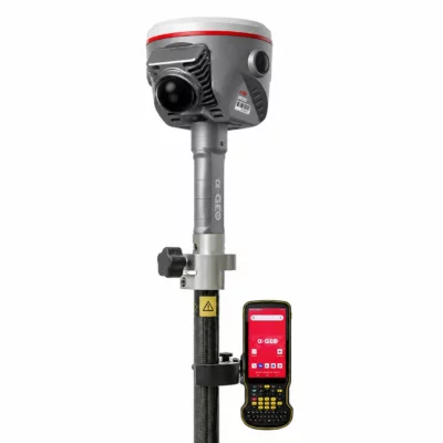
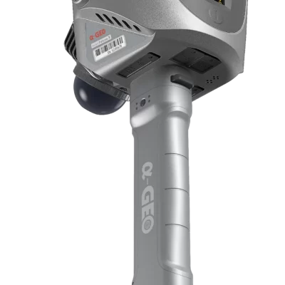
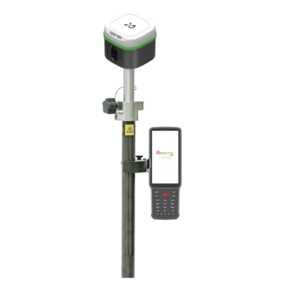
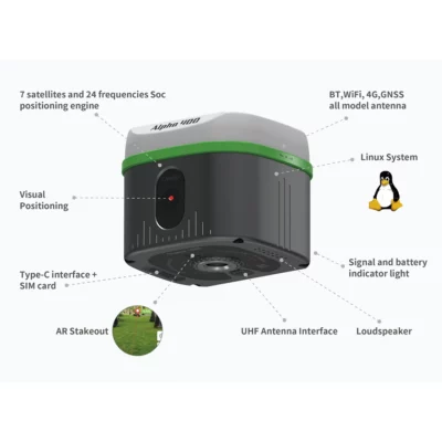
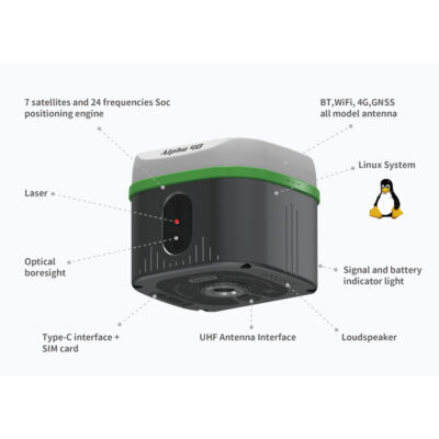
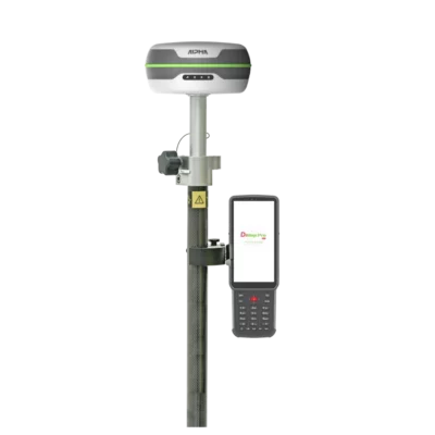
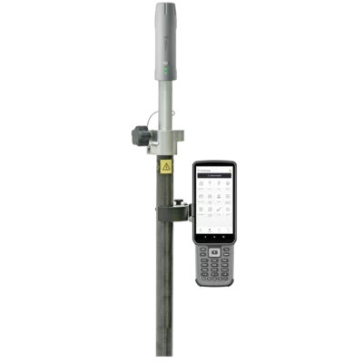
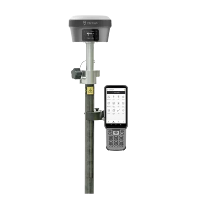
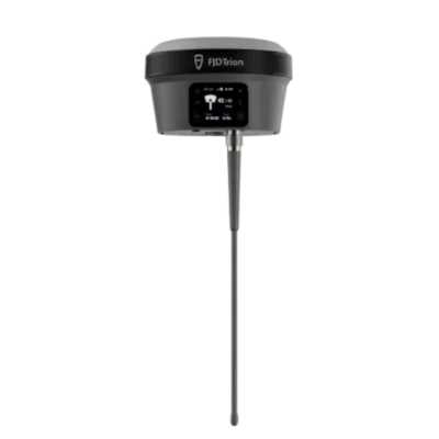
some popular gnss receivers with an imu tilt sensor
GPS & GNSS


GPS Rover Sets


GPS Rover Sets
Why IMU tilt compensation matters in the field
Surveying is rarely done in perfect conditions. Points are often located near objects, traffic, slopes, trenches, fences, building corners, kerbs, or equipment. Holding a GNSS pole perfectly vertical can slow the work down, and in some situations it may be physically difficult or unsafe.
IMU tilt compensation helps solve this by giving the operator more freedom. A surveyor can lean the pole to reach a point while standing in a safer or more comfortable position. A construction layout user can stake or check points more quickly without constantly waiting for the bubble to settle. A GIS user can collect asset positions near walls, signs, cabinets, and utility features more easily.
The biggest advantage is not only speed. It is also access. IMU tilt can help collect points that would otherwise require awkward positioning, repeated attempts, or another measurement method.
Common uses for IMU tilt compensation
IMU tilt compensation is useful in many daily RTK workflows. It is especially valuable where the point is visible and reachable with the pole tip, but the antenna cannot be placed vertically above it.
- Measuring fence lines, walls, kerbs, and building corners
- Collecting points along trenches, slopes, ditches, and embankments
- Working near parked vehicles, machinery, traffic, or barriers
- Measuring utility covers, signs, poles, cabinets, and street furniture
- Speeding up topographic surveys where many points must be collected
- Improving comfort when measuring points on uneven or sloped ground
- Helping construction layout teams stake points faster on busy sites
IMU tilt compensation versus electronic bubble tilt sensors
Not all tilt systems are the same. Older or simpler tilt functions may use electronic bubble sensors or magnetometer-based systems. Modern IMU-based tilt compensation generally uses inertial sensors and GNSS data to calculate orientation and pole-tip position.
| Feature | Electronic bubble or basic tilt sensor | IMU-based tilt compensation |
|---|---|---|
| Main purpose | Helps detect whether the pole is level or tilted. | Calculates the corrected pole-tip position while the pole is tilted. |
| Field workflow | The operator may still need to level the pole carefully. | The operator can often measure with the pole intentionally tilted. |
| Productivity benefit | Useful for quality control and warnings. | Useful for faster measurement and difficult point access. |
| Things to check | Tilt limits, calibration, and software warnings. | Initialization, tilt accuracy, supported workflows, and manufacturer limits. |
When comparing GNSS receivers, it is important to check what type of tilt technology is actually included. Some products may advertise tilt, but the real field performance, calibration requirements, and supported measurement methods can differ.
Does IMU tilt compensation replace good surveying practice?
No. IMU tilt compensation is a productivity feature, not a replacement for proper survey methods. The receiver still needs reliable GNSS positioning, correct pole height, suitable correction data, and proper field procedures.
Surveyors should still check control points, monitor RTK quality, understand coordinate systems, and verify important measurements. For high-accuracy work, critical points, legal boundary work, monitoring, or engineering control, the operator should follow the required project specifications and quality checks.
IMU tilt compensation helps make point collection easier, but it does not make every point automatically correct. Poor satellite visibility, multipath, wrong pole height, incorrect coordinate settings, unstable RTK fixes, or bad site conditions can still affect the result.
What should you check before buying an IMU GNSS receiver?
When choosing an RTK rover with IMU tilt compensation, do not look only at the feature name. The details matter. Different receivers and software packages may support different tilt angles, workflows, initialization methods, and accuracy specifications.
| What to check | Why it matters |
|---|---|
| Tilt compensation type | Confirms whether the receiver uses true IMU-based tilt compensation or a simpler tilt sensor. |
| Specified tilt accuracy | Shows the manufacturer’s expected performance under stated conditions. |
| Maximum supported tilt angle | Helps determine how far the pole can be leaned while still staying within specification. |
| Calibration or initialization | Some receivers may require movement, setup steps, or specific procedures before tilt is available. |
| Software compatibility | The field software must support the receiver’s tilt workflow correctly. |
| Supported measurement modes | Check whether tilt works for topo, stakeout, linework, offsets, control checks, or other workflows you use. |
| Quality indicators | Good field software should show useful warnings, tilt status, RTK status, and measurement quality. |
| Service and support | Training, firmware updates, and support are important when using advanced GNSS features. |
When is IMU tilt especially useful?
IMU tilt is most useful when you need efficient RTK measurements in real-world environments. It is valuable for topographic surveys, construction layout, roadwork, utilities, GIS asset mapping, as-built surveys, and general site measurement.
For example, on a construction site, a layout operator may need to measure or stake points between materials, formwork, equipment, and workers. Holding the pole perfectly vertical at every point can slow the process. IMU tilt allows more natural pole handling, which can speed up repetitive work.
For utility and GIS work, many assets are close to walls, kerbs, cabinets, fences, or street furniture. Tilt compensation can help the operator place the pole tip on the asset while keeping the receiver in a better position for satellite visibility or operator safety.
What are the limitations of IMU tilt compensation?
IMU tilt compensation is powerful, but it has limits. The most important limitation is that it still depends on the quality of the GNSS position. If the GNSS solution is poor, the tilt-compensated point may also be poor.
Multipath, blocked sky view, nearby buildings, trees, metal structures, bad correction data, or an unstable RTK solution can all affect results. Tilt compensation can correct for the angle of the pole, but it cannot fully solve poor satellite geometry or bad positioning conditions.
Users should also be careful with pole height. Since the receiver uses pole height as part of the pole-tip calculation, an incorrect pole height can create measurement errors. A damaged pole, loose quick-release adapter, wrong antenna height setting, or incorrect measurement method can reduce accuracy.
Another limitation is workflow suitability. Some projects require strict procedures where tilted measurements may need additional checks or may not be accepted for certain control or legal measurements. Always follow the requirements of the job, client, or local regulations.
How to use IMU tilt compensation correctly
Good results come from combining the technology with proper field habits. Before starting work, confirm that the receiver, controller, field software, coordinate system, correction source, and pole height are set correctly. Check a known point when possible, and repeat important measurements if the point is critical.
During measurement, watch the software indicators. A good workflow should include checking RTK fixed status, residuals or precision estimates, tilt status, and any warnings shown by the controller. If the receiver asks for initialization or movement, complete that step before relying on tilt measurements.
For critical points, it is often smart to measure the point more than once, from different pole directions, or with the pole vertical when practical. This helps confirm that the tilt compensation and GNSS solution are behaving as expected.
IMU tilt compensation in RTK workflows
IMU tilt compensation is commonly used with RTK GNSS. In an RTK setup, the rover receives correction data from a base station, CORS network, VRS network, or NTRIP service. The RTK solution provides the precise antenna position, while the IMU helps calculate the corrected pole-tip position when the pole is tilted.
The full measurement still depends on the complete system. The receiver, correction service, controller, field software, pole, antenna height settings, and coordinate system must all work together. Tilt compensation is one part of the workflow, not the entire workflow.
Related Global GPS Systems product categories
Global GPS Systems supplies equipment for professional surveying, construction, mapping, GIS, and machine-control workflows. If you are comparing IMU tilt compensation, the most relevant product categories are RTK GNSS receivers, GNSS rover kits, field controllers, surveying software, tripods and poles, and correction-service-compatible equipment.
When choosing a receiver, consider how you work in the field. A surveyor doing topographic work may value speed and repeatability. A construction layout user may focus on stakeout workflow and software compatibility. A GIS user may need a practical combination of accuracy, portability, and easy data export. Global GPS Systems can help compare these requirements across different equipment options.
FAQ: IMU and IMU tilt compensation
What does IMU mean on a GNSS receiver?
IMU stands for inertial measurement unit. In a GNSS receiver, it is a sensor system that helps measure movement, rotation, and orientation. This information allows the receiver and field software to calculate the position of the pole tip when the pole is tilted.
What is IMU tilt compensation?
IMU tilt compensation is a function that corrects GNSS measurements when the survey pole is not vertical. It uses the receiver’s position, pole height, and IMU orientation data to calculate the actual point at the pole tip.
Do I still need to level the pole with IMU tilt compensation?
For many normal measurements, IMU tilt compensation reduces the need to level the pole perfectly. However, you should still follow the receiver manufacturer’s instructions and the project’s survey requirements. Some critical measurements may still require additional checks or vertical pole observations.
Is IMU tilt compensation accurate?
IMU tilt compensation can be accurate when used within the manufacturer’s specifications and under good GNSS conditions. Accuracy depends on the receiver, software, tilt angle, pole height, RTK quality, site conditions, and correct setup.
Can IMU tilt compensation work near buildings or trees?
It can help with access near buildings, walls, fences, and other obstacles, but it does not remove normal GNSS limitations. Buildings, trees, and reflective surfaces can cause blocked signals or multipath. Always check RTK quality and verify important points.
Does IMU tilt compensation need calibration?
That depends on the receiver. Some systems are designed to work with minimal or no field calibration, while others may require initialization or movement before tilt compensation is active. Always check the manufacturer’s workflow for your specific model.
What is the difference between IMU tilt and a bubble level?
A bubble level helps the operator hold the pole vertical. IMU tilt compensation calculates the pole-tip position even when the pole is tilted. The bubble is a leveling aid, while IMU tilt compensation is a measurement correction technology.
Is IMU tilt useful for construction layout?
Yes, IMU tilt can be very useful for construction layout because it helps operators stake and check points faster, especially around formwork, machinery, materials, slopes, trenches, and other site obstacles.
Should I buy a GNSS receiver with IMU tilt compensation?
If you often measure points near obstacles, work on busy construction sites, collect many topo points, or need faster field workflows, an IMU-equipped GNSS receiver can be a strong advantage. If most of your work is static, control-based, or done in open areas with slower workflows, the benefit may be less important.
What should I compare before choosing an IMU RTK rover?
Compare the receiver’s tilt technology, stated accuracy, supported tilt angle, initialization workflow, field software compatibility, RTK performance, supported correction services, controller options, service support, and accessories. Do not choose based only on the word “tilt” in the product description.