

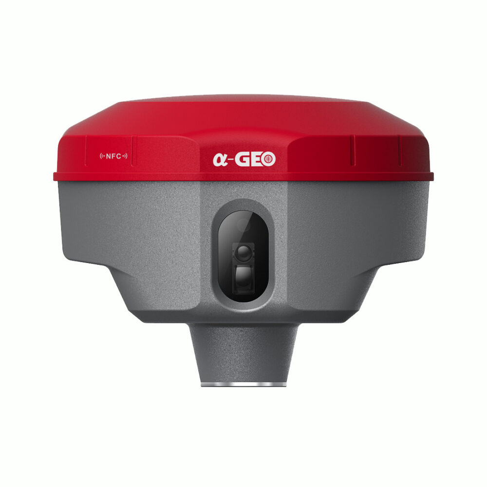
a-GEO Matrix 2
This product is Available
Contact our experts for the best possible price and configuration.
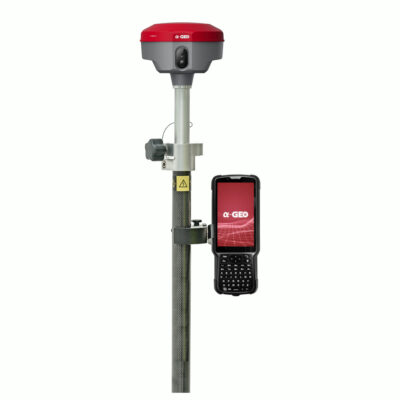
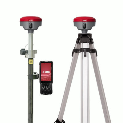
The a-GEO Matrix 2 RTK GNSS Receiver is a next-generation, compact, and smart laser AR RTK designed for precision in any surveying project. Equipped with cutting-edge GNSS technology, this versatile device features Bluetooth, Internal Radio, Wi-Fi, and a 4G modem, along with a powerful 7000mAh built-in battery and advanced IMU tilt compensation. Ideal for professionals seeking a GNSS receiver for land surveying and construction, the a-GEO Matrix 2 ensures unmatched accuracy and efficiency.
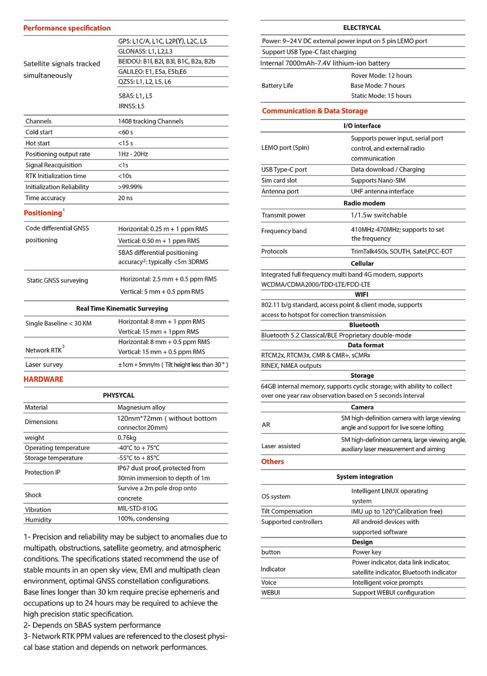
| ✅ Channels | 1408 |
| ✅ IMU Tilt Sensor | 60º |
| ✅ Internet Modem | 4G |
| ✅ UHF Radio | 410 – 470MHz |
| GPS | L1C/A, L1C, L2C, L2P(Y), L5 |
| GLONASS | L1, L2, L3 |
| GALILEO | E1, E5a, E5b, E6 |
| BEIDOU | B1I, B2I, B3I, B2a, B2b |
Valued customers:


Find RTK Networks
Search NTRIP providers and connect to reliable RTK correction services.
Description
Precision and Efficiency Redefined with the a-GEO Matrix 2 RTK GNSS Receiver
When accuracy and reliability are non-negotiable, the a-GEO Matrix 2 stands out as the ultimate solution. This state-of-the-art GNSS receiver for land surveying and construction projects combines innovative technology with user-friendly design, providing professionals with the perfect blend of performance and ease of use.
Key Features and Benefits
Unmatched Accuracy with AR Real Scene Stakeout
Say goodbye to guesswork with the a-GEO Matrix 2’s AR real scene stakeout feature. Surveyors can effortlessly pinpoint stakeout locations by following on-screen arrows, eliminating the need to move the pole back and forth. This feature streamlines workflows, saving time and reducing errors, making your staking tasks more precise and efficient.
Advanced Laser Survey Technology
Thanks to its patented laser coordinate measurement and quick calibration technology, the a-GEO Matrix 2 delivers centimeter-level accuracy. The built-in camera overcomes glare from sunlight, enhancing visibility and making field measurements faster and more user-friendly. This feature is perfect for professionals seeking land surveying equipment that performs flawlessly under challenging conditions.
Superior IMU Tilt Compensation
The a-GEO Matrix 2 is equipped with an advanced IMU tilt sensor, providing calibration-free, magnetic interference-resistant performance. The super IMU allows for fast initialization and enables data collection or stakeout of topo points up to 120°, significantly enhancing productivity. This innovation eliminates the frustration of repeated initialization, offering seamless operation in the field.
Versatile Connectivity for Seamless Workflows
Stay connected in any environment with integrated Bluetooth, internal radio, Wi-Fi, and a 4G modem. These connectivity options ensure real-time data sharing and communication, making the a-GEO Matrix 2 the go-to GNSS receiver for construction projects that demand constant, accurate data transfer.
Designed to Solve Common Surveying Struggles
- Time-Consuming Stakeouts? The AR real scene stakeout makes locating and marking points quick and hassle-free.
- Accuracy Challenges in Harsh Environments? Patented laser technology and a sun-resistant camera deliver reliable precision.
- Frustration with Tilt Compensation? The super IMU eliminates repeated calibration, allowing smooth and uninterrupted workflows.
Why Choose the a-GEO Matrix 2?
- Unrivaled Precision with AR stakeout and laser measurement.
- Enhanced Efficiency through superior IMU tilt compensation.
- Versatility for both land surveying equipment and construction applications.
- Reliable Connectivity with Bluetooth, Wi-Fi, internal radio, and 4G modem.
Datasheets & Manuals
Datasheets and manuals
Reviews (0)
Only logged in customers who have purchased this product may leave a review.
Reviews
There are no reviews yet