

 GPS & GNSS
 Lidar scanning
 Total Station

SatLab Cygnus Lite Handheld SLAM LiDAR Scanner with RTK
Get the best price for your setup
Contact our experts for the best possible price and configuration.
- Fast response
- Expert configuration advice
- No overpaying for features you do not need
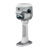
The SatLab Cygnus Lite is a lightweight handheld SLAM LiDAR scanner for fast 3D point-cloud collection indoors and outdoors. Integrated RTK, a 20° tilted scanning mechanism and dual 12 MP cameras help surveyors, construction teams and BIM professionals capture georeferenced, colourised data while walking naturally through the site.
At only 1 kg with the battery installed, the scanner is easy to carry through buildings, confined areas and larger project sites. Live colourised, elevation and intensity views in the SatPoint app help operators check coverage while scanning, reducing the risk of returning to the field for missed areas.
SatLab Cygnus Lite Highlights
| Scanning technology | Handheld LiDAR with SLAM and integrated RTK |
|---|---|
| Point measurement rate | Up to 200,000 points per second |
| Scanning range | Up to 40 m at 10% reflectivity and 70 m at 80% reflectivity |
| Camera system | Two 12 MP cameras for real-time RGB point-cloud colourisation |
| Field of view | 360° × 59° LiDAR field of view with a 20° tilted scanning design |
| RTK performance | 8 mm + 1 ppm horizontal and 15 mm + 1 ppm vertical under suitable RTK conditions |
| Indoor accuracy | Specified at ±2.5 cm with ±1 cm precision |
| Weight | 1.0 kg including battery |
Valued customers:










Find RTK Networks
Search NTRIP providers and connect to reliable RTK correction services.
Description
Portable 3D scanning for surveying construction and BIM
The SatLab Cygnus Lite is a compact handheld SLAM LiDAR scanner developed for professionals who need to capture complete 3D site information without setting up a scanner at multiple fixed positions. An operator can walk through a building, around a structure or across a work area while the system records geometry and builds a point cloud in real time.
This workflow is particularly useful for building surveys, indoor mapping, construction progress recording, volume measurement, scan-to-BIM projects and 3D reconstruction. It allows surveyors, engineers, GIS teams and construction professionals to document complex environments more efficiently than point-by-point measurement methods.
SLAM scanning with integrated RTK positioning
The scanner combines SLAM processing with an integrated multi-frequency, multi-constellation GNSS RTK module. SLAM supports continuous positioning while moving through enclosed or geometrically complex areas, while RTK can connect outdoor scans to a recognised coordinate system when suitable satellite reception and correction data are available.
RTK corrections can be received from a CORS or NTRIP service through a connected mobile network. Where live RTK is not practical, ground control points can be collected to support later alignment and georeferencing. This makes the Cygnus Lite suitable for workflows that move between outdoor areas, partially covered spaces and building interiors.
Wider coverage with fewer gaps
The LiDAR assembly uses a 20° tilted configuration instead of pointing only straight above the handle. This provides a wider view of walls, ceilings, floors, equipment and surrounding surfaces as the operator moves. In practical fieldwork, the increased coverage can help reduce shadows and missing areas around corners, overhead features and objects close to the walking route.
The scanner records up to 200,000 points per second with a 360° × 59° LiDAR field of view. Its specified range reaches up to 40 metres on low-reflectivity surfaces and up to 70 metres on highly reflective surfaces, giving operators flexibility across rooms, industrial spaces, façades and open work areas.
Real-time colourised point clouds
Two 12 MP wide-angle cameras capture imagery for RGB point-cloud colourisation. Colour helps users interpret scanned geometry by making doors, pipes, structural elements, surface changes and site conditions easier to recognise than in an uncoloured point cloud.
The camera arrangement provides a 360° × 270° field of view. During data collection, the SatPoint app can display live 3D data in colourised, intensity or elevation mode. The operator can therefore monitor progress and identify weak coverage before leaving the site.
Lightweight operation in confined areas
With a battery installed, the SatLab Cygnus Lite weighs approximately 1 kg. Its compact handheld design is well suited to staircases, corridors, plant rooms, construction interiors and other areas where a tripod-based scanner or heavier mobile mapping system may be difficult to position.
Each 3150 mAh handle battery provides up to approximately 90 minutes of operation under stated conditions, and two handle batteries are supplied with the standard package. The batteries can be exchanged to extend field time, while USB Type-C PD charging supports a straightforward charging workflow between projects.
SatPoint software workflow
The SatPoint Android app controls the scanner and provides live project information, device status and data management. Android 12 or later is recommended. A compatible phone can be attached using the supplied MagSafe ring, allowing the operator to view the scan while moving through the site.
After collection, SatPoint PC supports point-cloud processing, project management and export. Photo and point-cloud overlays help users inspect features and take measurements with more visual context. The software also supports batch processing and coordinate-system or projection workflows where available.
Processed data can be exported in commonly used LAS, PCD and PLY formats for transfer into compatible CAD, BIM, GIS and point-cloud applications. Data can be moved wirelessly or through USB 3.0, and the removable TF card provides 256 GB of supplied storage with support for cards up to 512 GB.
Typical applications
- Scan to BIM: capture existing buildings and interiors as a spatial reference for modelling, renovation and coordination.
- Indoor mapping: record rooms, corridors, warehouses, plant areas and other spaces where GNSS alone cannot provide continuous positioning.
- Volume measurement: create point clouds of stockpiles, stored materials and excavated areas for further calculation in compatible software.
- 3D reconstruction: document structures, façades, industrial environments and site conditions in three dimensions.
- Construction documentation: record progress, visible installations and existing conditions for engineering and project records.
Designed for field use
The scanner is rated IP54 and is designed for indoor and outdoor operation. Its stated operating-temperature range is −20°C to +55°C. Laser Class 1 operation supports routine professional use when the equipment is operated according to the manufacturer’s safety instructions.
The standard package includes the Cygnus Lite mainframe, two handle batteries, a GCP benchmark, Type-C cable, Type-C charger, 256 GB TF card, polishing cloth, MagSafe ring and SatPoint PC USB dongle.
Buying and support from Global GPS Systems
Global GPS Systems can help buyers assess whether the SatLab Cygnus Lite fits their required accuracy, scan range, coordinate workflow and output software. This is especially valuable when comparing handheld SLAM scanners for construction, surveying, GIS, BIM or asset-capture projects. Product specialists can also assist with configuration, compatible accessories, RTK correction options and integration into an existing field-to-office workflow.
Datasheets & Manuals
Specifications
SatLab Cygnus Lite Handheld SLAM Scanner Specifications
Product Overview
| Product Type | Lightweight handheld LiDAR SLAM scanner |
|---|---|
| Positioning Technologies | LiDAR SLAM with integrated multi-constellation, multi-frequency RTK GNSS |
| Scanner Configuration | Handheld scanner with detachable battery handle |
| Scanner Tilt Angle | 20° |
| Primary Functions | 3D scanning, point-cloud collection, real-time visualization, RGB point-cloud colorization, RTK georeferencing and post-processing |
| Recommended Applications | Volume measurement, Scan-to-BIM, indoor mapping and 3D reconstruction |
| Operating Environments | Designed for indoor and outdoor use |
LiDAR Performance
| LiDAR Field of View | 360° × 59° |
|---|---|
| Point Measurement Rate | 200,000 points per second |
| Scan Frequency | 10 Hz |
| Measurement Range at 10% Reflectivity | 0.1 to 40 m |
| Measurement Range at 80% Reflectivity | 0.1 to 70 m |
| Laser Classification | Class 1 |
| Range Noise | ±1 cm |
| Indoor Accuracy | ±2.5 cm |
| Indoor Precision | ±1 cm |
| Processing Modes | Real-time processing and post-processing |
RTK GNSS Performance
| Measurement | Accuracy | Additional Term |
|---|---|---|
| Horizontal RTK | 0.8 cm | + 1 ppm |
| Vertical RTK | 1.5 cm | + 1 ppm |
GNSS and Georeferencing
| GNSS Module | Integrated high-precision, multi-constellation, multi-frequency GNSS module |
|---|---|
| RTK Integration | Built-in RTK module for georeferenced SLAM data collection |
| CORS Corrections | Supported through a connected mobile device and cellular network |
| Ground Control Support | Supports collection using ground control points and the supplied GCP benchmark |
| Coordinate Systems and Projections | Supported through SatPoint PC; availability may depend on software version and configuration |
Cameras and Imaging
| Camera Configuration | Dual HD wide-angle cameras |
|---|---|
| Camera Resolution | 12 MP × 2 |
| Camera Field of View | 360° × 270° |
| Point-Cloud Colorization | Real-time RGB colorization |
| Image Coverage | Full-field-of-view image capture for realistic point-cloud reconstruction |
| Image and Point-Cloud Overlay | Supported in SatPoint PC for inspection and measurement |
Real-Time Mobile Operation
| Mobile Application | SatLab SatPoint APP |
|---|---|
| Supported Mobile Operating System | Android |
| Recommended Android Version | Android 12 or higher |
| Manufacturer-Recommended Devices | Samsung Galaxy S22, S23 and S24 |
| Real-Time Display Modes | Colorized, intensity and elevation point-cloud modes |
| Application Functions | Live 3D visualization, scanner control, device-status monitoring and data management |
| Mobile Device Mounting | Supports a MagSafe-compatible mobile-device stand using the supplied ring |
Desktop Software and Data Processing
| Desktop Software | SatLab SatPoint PC |
|---|---|
| Post-Processing | Generates, processes and exports point-cloud data after scanning |
| Batch Processing | Supported |
| Measurement Tools | Supports inspection and measurement using combined imagery and point-cloud overlays |
| Project Georeferencing | Supports CORS-based RTK positioning and ground-control-point workflows |
| Software License Hardware | SatPoint PC USB dongle included in the standard package |
Data Formats, Storage and Transfer
| Supported Point-Cloud Formats | .las, .pcd and .ply |
|---|---|
| Storage Type | Removable TF memory card |
| Included Storage Capacity | 256 GB |
| Maximum Supported Storage | Up to 512 GB |
| Wireless Data Transfer | Supported |
| Wired Data Transfer | USB 3.0 |
Physical Specifications
| Weight | 1.0 kg with battery |
|---|---|
| Dimensions with Battery | 297 × 103 × 104 mm |
| Mainframe Dimensions | 133 × 104 × 103 mm |
| Battery Configuration | Detachable battery handle |
| Ergonomic Features | Compact handheld construction designed for extended operation and access to confined or difficult-to-reach areas |
Battery and Charging
| Battery Capacity | 3150 mAh per battery |
|---|---|
| Included Batteries | 2 detachable handle batteries |
| Maximum Operating Time | Up to 90 minutes per battery |
| Electrical Input | 14.4 V |
| Charging Connection | USB Type-C |
| Charging Standard | USB Power Delivery, 30 W |
| Average Charging Time | Approximately 1.5 hours |
Environmental Specifications
| Operating Temperature | -20°C to +55°C |
|---|---|
| Storage Temperature | -20°C to +60°C |
| Ingress Protection Rating | IP54 |
| Indoor Use | Supported |
| Outdoor Use | Supported |
Key Features
| Wide-Coverage Scanning | 20° tilted scanner design expands scan coverage and helps reduce missing data and point-cloud gaps |
|---|---|
| Integrated RTK and SLAM | Combines satellite positioning and SLAM processing for stable, georeferenced data collection |
| Onboard Processing | Supports real-time point-cloud processing and visualization during scanning |
| Realistic Reconstruction | Dual cameras provide full-coverage RGB imagery for detailed colorized 3D models |
| Portable Design | 1 kg operating weight with compact dimensions for mobile field use |
| Replaceable Power System | Two detachable battery handles support extended field operation with battery swapping |
Typical Applications
| Volume Measurement | Three-dimensional capture and calculation of stockpiles, excavations and material volumes |
|---|---|
| Scan-to-BIM | Reality capture for building documentation, renovation planning and BIM model development |
| Indoor Mapping | Mobile capture of rooms, corridors, industrial facilities and other GNSS-challenged environments |
| 3D Reconstruction | Colorized digital reconstruction of structures, objects and complex environments |
| Surveying and Mapping | RTK-georeferenced mobile point-cloud collection for topographic and asset-mapping workflows |
Package Contents
| Item | Quantity | Notes |
|---|---|---|
| SatLab Cygnus Lite Mainframe | 1 | LiDAR scanner main unit |
| Handle Battery | 2 | 3150 mAh detachable battery handles |
| GCP Benchmark | 1 | For ground-control-point workflows |
| USB Type-C Cable | 1 | For charging or connectivity |
| USB Type-C Charger | 1 | 30 W USB Power Delivery charger |
| TF Memory Card | 1 | 256 GB |
| Polishing Cloth | 1 | For cleaning optical and exterior surfaces |
| MagSafe Ring | 1 | For compatible mobile-device mounting |
| SatPoint PC USB Dongle | 1 | Desktop software license hardware |
Specifications and package contents may vary by configuration, region or manufacturer update. Always check the current configuration before ordering.
Reviews (0)
Only logged in customers who have purchased this product may leave a review.
FAQ
SatLab Cygnus Lite FAQ
Product Overview and Applications
What is the SatLab Cygnus Lite?
The SatLab Cygnus Lite is a lightweight handheld LiDAR scanner for capturing 3D point clouds while walking through or around a site. It combines SLAM positioning, an integrated multi-constellation RTK GNSS module and two 12 MP cameras to produce detailed, colorized 3D data.
Who is the SatLab Cygnus Lite designed for?
The Cygnus Lite is designed for surveyors, engineers, architects, construction professionals, BIM specialists, geospatial teams, facility managers and other users who need to capture buildings, infrastructure, stockpiles or complex environments efficiently.
What can the Cygnus Lite be used for?
Typical applications include indoor mapping, Scan to BIM, as-built documentation, volume measurement, 3D reconstruction, construction progress recording, topographic data collection and the documentation of spaces that are difficult to measure with conventional equipment.
Can the Cygnus Lite scan both indoors and outdoors?
Yes. The scanner is designed for indoor and outdoor use. SLAM supports mobile scanning where GNSS reception is unavailable, while the integrated RTK module can improve positioning and georeferencing when suitable satellite reception and correction data are available outdoors.
Is the Cygnus Lite suitable for confined or hard-to-reach spaces?
Yes. Its compact handheld design and approximately 1 kg operating weight make it suitable for corridors, stairways, plant rooms, building interiors and other spaces where a larger mobile mapping system may be difficult to operate.
How does the 20-degree tilt design improve scanning?
The scanner's 20-degree tilt expands the area covered by the LiDAR during normal handheld operation. This helps capture floors, walls, ceilings and surrounding objects from more useful angles, reducing gaps and missing data in the resulting point cloud.
Accuracy, LiDAR and RTK
How accurate is the SatLab Cygnus Lite?
The published specifications state indoor accuracy of approximately ±2.5 cm and indoor precision of approximately ±1 cm. The integrated RTK module is specified at 0.8 cm + 1 ppm horizontally and 1.5 cm + 1 ppm vertically under suitable RTK conditions. Actual results depend on the environment, scanning method, satellite visibility, correction quality and processing workflow.
What is the difference between the scanner's indoor accuracy and RTK accuracy?
Indoor accuracy describes the expected performance of the SLAM-generated point cloud in environments without GNSS. RTK accuracy describes the positioning performance of the GNSS module when it has sufficient satellite reception and valid correction data. RTK performance should not be interpreted as the accuracy of every individual LiDAR point.
How do SLAM and RTK work together?
SLAM estimates the scanner's movement by matching LiDAR observations as the operator walks. RTK GNSS provides an external positioning reference in suitable outdoor conditions. Combining these technologies can improve positioning stability and place the scan within a real-world coordinate system.
Does the Cygnus Lite require an RTK correction service?
An RTK correction service is required when the project needs RTK-positioned or directly georeferenced results. The scanner can connect to a CORS or NTRIP correction network through a mobile cellular data connection. For indoor or non-georeferenced work, SLAM scanning can still be used without an active RTK correction stream.
Can ground control points be used with the Cygnus Lite?
Yes. Ground control points can be collected during the survey to help control, verify or georeference the point cloud. A GCP benchmark is included in the standard package described by the manufacturer.
What are the LiDAR range and measurement rate?
The Cygnus Lite records up to 200,000 points per second at a 10 Hz scanning frequency. Its specified range is approximately 0.1 to 40 metres on surfaces with 10% reflectivity and up to 70 metres on surfaces with 80% reflectivity. Dark, reflective, transparent or distant surfaces may produce different results.
Cameras, Software and Data
Does the Cygnus Lite create colorized point clouds?
Yes. Two 12 MP HD wide-angle cameras capture imagery for real-time RGB point-cloud colorization. This produces a more recognizable 3D representation and can make features easier to identify during inspection, measurement and modelling.
Can the point cloud be viewed while scanning?
Yes. The SatPoint mobile app can display the developing 3D point cloud during data collection. Available viewing modes include colorized, elevation and intensity displays, helping the operator check coverage before leaving the site.
Which mobile app is used with the Cygnus Lite?
The scanner is operated with the SatLab SatPoint app for Android. The app provides device control, device-status information, live point-cloud viewing and project data management.
Which phones are compatible with the SatPoint app?
SatLab recommends Android 12 or later. The published product information lists the Samsung Galaxy S22, S23 and S24 as recommended devices. Compatibility should be confirmed before using a different Android phone or tablet.
What is SatPoint PC used for?
SatPoint PC is the desktop software used to process scans, generate point clouds, review projects, combine photographs with point-cloud data and export results. It also supports batch project processing and coordinate-system or projection workflows where applicable.
Which point-cloud formats can the Cygnus Lite export?
The published export formats are LAS, PCD and PLY. These widely used point-cloud formats can be transferred into compatible surveying, CAD, BIM, GIS, inspection and 3D-modelling software.
Operation, Battery and Hardware
How much does the SatLab Cygnus Lite weigh?
The scanner weighs approximately 1 kg with its battery installed. Its low weight is intended to reduce operator fatigue during extended mobile scanning sessions.
How long does the battery last?
Each 3150 mAh handle battery provides up to approximately 90 minutes of operation under suitable conditions. The standard package described by SatLab includes two handle batteries, allowing one battery to be exchanged when the other is depleted.
How is the Cygnus Lite charged?
The batteries charge through USB Type-C using a PD 30 W charger. The published average charging time is approximately 1.5 hours, although charging time can vary with the power source, battery condition and ambient temperature.
How much storage does the scanner provide?
The Cygnus Lite uses removable TF card storage. A 256 GB card is included in the manufacturer's listed package, and storage can be expanded to a maximum of 512 GB using a compatible card.
How can scan data be transferred?
Data can be transferred wirelessly or through a USB 3.0 connection. The removable TF card also provides a practical way to move project data to a computer for processing and archiving.
Is the Cygnus Lite weather resistant?
The scanner has an IP54 rating, meaning it is protected against limited dust ingress and water splashes. It is not designed for submersion or prolonged exposure to heavy rain. The specified operating temperature range is -20°C to +55°C.
Is the Cygnus Lite laser safe?
The LiDAR is classified as a Class 1 laser under the published specifications. Class 1 products are considered safe during normal intended use, but operators should still follow the supplied safety instructions and avoid opening or modifying the scanner.
 GPS & GNSS
 Total Stations
 Data collectors
 Software
 Correction services
 Machine control
 External radio
 Marine
 Accessories
Reviews
There are no reviews yet