

 GPS & GNSS
 Lidar scanning
 Total Station
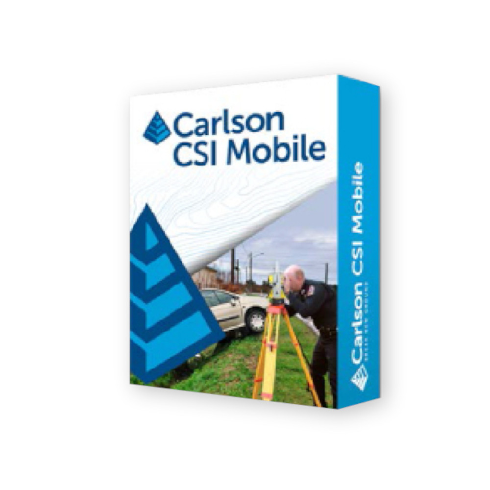
Carlson CSI Mobile Crash and Crime Scene Mapping Software
Get the best price for your setup
Contact our experts for the best possible price and configuration.
- Fast response
- Expert configuration advice
- No overpaying for features you do not need
Carlson CSI Mobile is field data collection and scene-mapping software developed for police crash investigators, crime-scene teams and professional accident reconstruction specialists. It combines surveying measurement tools with a workflow designed around forensic scene documentation, allowing investigators to collect accurate points, draw scene linework and document vehicles and evidence directly in the field.
Depending on the selected configuration, CSI Mobile can be used with conventional total stations, robotic total stations, GNSS equipment or a Hybrid+ setup. Its vehicle tools, scene symbols and simplified field commands help reduce the amount of manual drafting required after leaving the scene.
- Measure crash and crime scenes with professional surveying equipment.
- Create vehicle, road and evidence graphics while collecting field measurements.
- Transfer measured scene data into Carlson CSI Office for further reconstruction and final presentation.
Carlson CSI Mobile Highlights
| Application | Crash investigation, crime-scene mapping and accident reconstruction |
|---|---|
| Instrument options | Conventional total station, robotic total station and GPS/GNSS configurations |
| Available configurations | Basic Total Station, Robotics, GPS and Hybrid+ |
| Vehicle mapping | Draw vehicles to scale from measured or known vehicle points |
| Field documentation | Point collection, linework, offsets, scene symbols and specialised road markings |
You may also like…






Valued customers:










Find RTK Networks
Search NTRIP providers and connect to reliable RTK correction services.
Description
Carlson CSI Mobile for crash and crime scene mapping
Carlson CSI Mobile is specialised field software for law enforcement officers, forensic mapping teams and accident reconstruction professionals who need to accurately document crash and crime scenes using surveying equipment. Rather than relying on hand sketches and separate notes, investigators can collect measured points and build scene information directly on a field controller while they work.
The software is based on Carlson’s professional surveying data-collection technology but adapts the workflow and terminology for forensic investigations. It can be configured for conventional total stations, robotic total stations or GPS/GNSS equipment, allowing an agency or reconstruction specialist to choose the measurement method that suits its existing hardware and working environment.
Capture accurate scene measurements in the field
CSI Mobile allows investigators to store measured points directly from connected survey instruments. A conventional or robotic total station can be used where line-of-sight measurements are preferred, while a GPS configuration provides a GNSS-based workflow for suitable outdoor scenes.
The software includes instrument setup, orientation, point storage, offsets and raw-data functions commonly required for professional measurement work. For investigators, this means important scene features can be recorded as coordinated measurements rather than estimated positions on a sketch.
This approach is useful for traffic collisions, roadway investigations, outdoor crime scenes and other situations where the relationship between vehicles, evidence, road markings and fixed objects needs to be documented clearly.
Draw scene linework while measurements are being taken
Measurements are not limited to a list of point numbers. Carlson CSI Mobile can create linework in the field, allowing investigators to see the developing scene as data is collected. Points can be connected to represent kerbs, road edges, structures and other physical features, helping the operator identify missing information before equipment is packed away.
Field shots can be extended or joined to existing linework, while dedicated offset and Move Up functions help document objects that cannot be measured directly. This is particularly useful when an evidence point is obstructed, close to traffic or otherwise difficult to occupy safely with a prism or GNSS pole.
Vehicle mapping with fewer field measurements
One of the specialised functions in CSI Mobile is its vehicle-drawing workflow. The software includes vehicle dimension information that can be used to create a correctly scaled vehicle graphic after selecting the appropriate vehicle information and measuring known locations on the vehicle.
For an undamaged vehicle, a complete scaled representation can be generated from a limited number of field shots rather than measuring every corner and body detail individually. Damaged vehicles can also be documented from measurements around the affected area. This reduces repetitive field work while retaining measured positioning information for the scene drawing.
Document skid marks road markings and scene evidence
CSI Mobile includes symbols and line styles intended specifically for crash and crime-scene work. Investigators can record common urban and roadside features such as evidence points, poles, manholes, hydrants, trees and road signs without having to manually draft every item from scratch.
Special line designations can be used for features such as skid marks, lane separation lines, stop lines and similar roadway markings. Because these features are represented graphically during collection, the field operator can check the scene for completeness instead of discovering missing information later in the office.
Simplified workflow for investigators
A field program used at an active road or crime scene needs to keep commonly used functions easy to reach. CSI Mobile uses a simplified interface that separates the main survey and file functions from graphical commands, reducing the amount of menu navigation required while measurements are being collected.
Feature codes can also be used to speed repetitive collection. Sequential features can be automatically identified as measurements continue, helping investigators maintain an organised dataset without manually entering a new description for every individual point.
Create reusable scene information
For locations that are investigated repeatedly, scene information can be reused rather than recreated from the beginning. This can be useful at intersections, sections of road or other locations where multiple incidents may occur over time. Existing fixed features can provide context while new measurements are added for the current investigation.
The ability to review the graphical scene during collection also provides an immediate quality-control check. Investigators can see whether vehicle positions, roadway features and evidence locations have been captured before the scene is cleared.
Total station robotic and GNSS workflows
Global GPS Systems offers CSI Mobile in configurations for Basic Total Station, Robotics, GPS and Hybrid+. This allows the software licence to be matched to the equipment and measurement workflow used by the investigation team.
A conventional total station configuration is suited to teams working with manually operated survey instruments. Robotics provides support for robotic measurement workflows, while the GPS configuration enables compatible GNSS measurement. A Hybrid+ configuration is available for workflows that use a combination of measurement technologies.
For organisations already using professional survey hardware, this flexibility can make it possible to build a forensic mapping setup around familiar measurement methods rather than introducing an entirely separate approach to scene surveying.
From field measurements to Carlson CSI Office
CSI Mobile is designed to work alongside Carlson CSI Office. Measurements and scene information collected in the field can be brought into the office environment for further drawing, analysis and reconstruction work.
This field-to-office workflow is useful when the person documenting the scene is not the same person preparing the final reconstruction. The field operator can concentrate on collecting reliable spatial information while the reconstruction specialist works with the resulting dataset later in the investigation.
CSI Office adds more extensive forensic diagramming and presentation tools, including 3D scene viewing, vehicle information, point editing and drawing tools. For organisations using both products, CSI Mobile provides the measurement side of the workflow while CSI Office provides the more detailed desktop reconstruction environment.
Who uses Carlson CSI Mobile?
Carlson CSI Mobile is intended primarily for police crash investigation units, traffic investigation teams, crime-scene personnel, state and regional law enforcement agencies and independent accident reconstruction consultants. It is also relevant to forensic specialists with surveying experience who require coordinate-based scene documentation rather than basic photographic or sketch-based recording.
The software is particularly useful where a scene must be measured efficiently while roads are closed or access is restricted. By creating usable point data and graphics during field collection, teams can reduce the amount of information that needs to be reconstructed later from handwritten notes.
Carlson CSI Mobile from Global GPS Systems
Choosing the correct CSI Mobile configuration depends on the instruments you intend to use and how your investigation team collects scene data. Global GPS Systems can help match the software configuration to a conventional total station, robotic total station or compatible GNSS workflow and can advise on a complete field measurement setup where required.
For teams planning a complete field-to-office reconstruction workflow, Global GPS Systems can also help determine how CSI Mobile fits alongside Carlson CSI Office and compatible surveying hardware.
Datasheets & Manuals
Specifications
Carlson CSI Mobile Specifications
Software Overview
| Product name | Carlson CSI Mobile |
|---|---|
| CSI meaning | Carlson Software Investigations |
| Product type | Professional field data collection, forensic mapping and accident / crime scene documentation software |
| Primary applications | Traffic accident mapping, crash reconstruction field measurements, crime scene mapping, evidence collection and forensic scene documentation |
| Typical users | Police departments, state police, accident reconstruction specialists, forensic investigators and consulting firms |
| Measurement equipment | Conventional total stations, robotic total stations and compatible GNSS / GPS receivers depending on licensed version and hardware |
| Companion office software | Carlson CSI Office |
| Field-to-office workflow | Scene measurements, coordinates, linework and other collected data can be transferred to CSI Office for analysis, reconstruction and final drawing production |
| Software heritage | Derived from Carlson SurvCE surveying technology and adapted specifically for law-enforcement and forensic workflows |
| Current documentation status | Carlson's current support portal categorizes CSI Mobile documentation as a legacy product; Global GPS Systems currently lists CSI Mobile as available |
Available CSI Mobile Versions
| Version | Primary Instrument Configuration | Notes |
|---|---|---|
| CSI Mobile Basic Total Station | Conventional total station | Field measurement, scene mapping, point collection, linework and conventional survey functions |
| CSI Mobile Robotics | Robotic total station | Adds workflows for compatible robotic instruments and one-person instrument operation |
| CSI Mobile GPS | GNSS / GPS receiver | Provides GNSS-oriented configuration, localization, position collection and applicable GPS utilities |
| CSI Mobile Hybrid+ | Combined field instrument configuration | Listed by Global GPS Systems as a selectable CSI Mobile version; exact functionality depends on the supplied software build, license and compatible equipment |
Accident and Crime Scene Mapping
| Traffic accident mapping | Supported |
|---|---|
| Crime scene mapping | Supported |
| Digital field measurements | Uses professional surveying measurement methods and compatible high-precision survey equipment |
| Field linework | Can be drawn directly while collecting scene measurements |
| Existing-line extension | Field shots can be stored by extending from existing linework |
| Existing-line joining | Field shots can be joined to points on existing lines |
| Move Up command | Included for simplified scene measurement workflows |
| Offset command | Included for measuring objects or features that cannot be occupied directly |
| Scene graphics | Field measurements can be displayed graphically during collection |
| Field editing | Collected points and linework can be reviewed and edited in the field |
Vehicle Database and Vehicle Mapping
| Vehicle database | Integrated library of vehicle makes, models and dimensions |
|---|---|
| Vehicle library size | More than 40,000 automobile makes and models according to the current Global GPS Systems product listing |
| Vehicle selection | Vehicle can be selected by applicable year, manufacturer and model |
| Undamaged vehicle drawing | A complete vehicle can be drawn to scale using two known field shots when sufficient vehicle database information is available |
| Damaged vehicle drawing | Supported using field measurements of the damaged portions of the vehicle |
| Car measurement tool | Supports vehicle measurement from three point shots or from an appropriate known vehicle point depending on workflow |
| Scale-based vehicle graphics | Vehicle graphics are generated using stored dimensional information and measured scene points |
| Accident report data | Can create a text-file accident report using applicable vehicle make and model information |
Forensic Symbol and Linework Tools
| Symbol library | Integrated accident and crime scene symbol library |
|---|---|
| Evidence symbols | Supported |
| Road signs | Supported |
| Utility poles | Supported |
| Manholes | Supported |
| Fire hydrants | Supported |
| Trees and landscape features | Supported |
| Skid mark line style | Special thickened line designation available |
| Lane separation lines | Special line designation supported |
| Stop lines / road markings | Special line designation supported |
| Automatic feature numbering | Description codes can increment automatically for multiple related features, such as EP1, EP2 and subsequent codes |
User Interface
| Interface design | Field-oriented graphical user interface designed for law-enforcement workflows |
|---|---|
| Menu structure | Simplified two-area workflow consisting of survey / file commands and graphic commands / options |
| Graphic map screen | Supported |
| Touch operation | Supported on compatible touchscreen field controllers and tablet PCs |
| Keyboard operation | Supported on compatible controllers |
| Hot keys | Supported on applicable hardware |
| Quick Calculator | Integrated |
| Battery status | Supported on compatible field hardware |
| View options | Configurable map and graphical display options |
Job and File Management
| Job creation and selection | Supported |
|---|---|
| Job Settings | Configurable |
| System settings | Configurable per job |
| Formatting settings | Configurable |
| Stake settings | Configurable |
| Point list | Supported |
| Raw data | Stored and accessible |
| Feature code list | Supported |
| Job notes | Supported |
| File deletion | Supported |
| Data transfer | Supported |
| Import / export | Supported |
Total Station Functions
| Total station setup | Supported |
|---|---|
| Instrument orientation | Supported |
| Backsight orientation | Supported |
| Remote benchmark | Supported |
| Robotic orientation | Supported with compatible robotic equipment and licensed functionality |
| Store points | Supported |
| Total station offsets | Supported |
| Resection | Supported in total station configurations |
| Set collection | Supported |
| Level check | Supported for compatible total stations |
| Leveling | Supported |
| Remote elevation | Supported |
| Automatic interval measurements | Supported |
GNSS / GPS Functions
| GPS instrument setup | Supported with compatible receiver configuration |
|---|---|
| GPS base / rover setup | Supported |
| GPS Utilities | Supported with compatible receiver drivers |
| Store GPS points | Supported |
| GPS offsets | Supported |
| Localization | Supported in GPS configurations |
| Monitor / SkyPlot | Supported |
| Raw GPS logging | Supported |
| Data Collector Internet | Supported by applicable legacy CSI Mobile / SurvCE-compatible hardware and receiver configurations |
Stakeout Functions
| Point stakeout | Supported |
|---|---|
| Line stakeout | Supported |
| Arc stakeout | Supported |
| Offset stakeout | Supported |
| Elevation difference | Supported |
| Grid / Face | Supported |
| Slope stakeout | Supported |
| Road stakeout | Supported |
COGO Functions
| Keyboard coordinate input | Supported |
|---|---|
| Inverse | Supported |
| Area calculation | Supported |
| Intersections | Supported |
| Point projection | Supported |
| Station Store | Supported |
| Coordinate transformation | Supported |
| Manual traverse | Supported |
| Calculator | Integrated |
Road and Alignment Functions
| Centerline Editor | Supported |
|---|---|
| Draw Centerline | Supported |
| Profile Editor | Supported |
| Draw Profile | Supported |
| Template Editor | Supported |
| Draw Template | Supported |
| Store Sections | Supported |
| Road Utilities | Included |
Map and Graphic Functions
| Map screen | Integrated |
|---|---|
| Graphical point display | Supported |
| Graphical linework display | Supported |
| Draw functions | Integrated |
| Map COGO functions | Integrated |
| Map view controls | Supported |
| Graphic editing tools | Supported for applicable scene linework and entities |
Instrument Compatibility
| Instrument driver approach | CSI Mobile uses Carlson's field-survey instrument driver technology |
|---|---|
| Conventional total stations | Supported across numerous documented legacy instrument families |
| Robotic total stations | Supported with compatible Robotics configuration |
| GNSS / GPS receivers | Supported with compatible GPS configuration |
| Documented total station brands | Includes applicable Geodimeter / Trimble, Leica, Nikon, Pentax, Sokkia and Topcon instruments |
| Documented GNSS brands / drivers | Includes applicable Leica, NavCom, NMEA, NovAtel, Septentrio, Ashtech / Magellan, Sokkia, Topcon, Trimble and other supported legacy receiver configurations |
| Peripheral setup | Supported through the Equipment configuration interface |
| Driver compatibility note | Instrument support depends on the CSI Mobile software build, licensed version, communication method and instrument firmware |
Field Controller Compatibility
| General controller support | Global GPS Systems and Carlson documentation describe support for major brands of compatible survey data collectors |
|---|---|
| Windows Mobile data collectors | Supported by legacy CSI Mobile builds |
| Windows tablet PCs | CSI Mobile PC installation available for supported Windows tablet PCs in Carlson's published software archive |
| Carlson Surveyor2 | Documented supported platform |
| Carlson RT3 | Documented supported rugged Windows tablet platform |
| Carlson Surveyor | Legacy installation available |
| Carlson CR+ | Legacy onboard CSI Mobile installation available |
| GeoMax Zoom90 | Legacy onboard CSI Mobile installation available |
| GeoMax Zipp20 | Legacy onboard CSI Mobile installation available |
Legacy Mobile System Requirements
| Component | Minimum | Recommended in Carlson Legacy Documentation |
|---|---|---|
| Mobile operating system | Windows CE 4.2 or later | Windows Mobile 6.x or later |
| Processor | StrongARM, XScale or compatible processor supported by the operating system | Carlson-compatible field controller |
| RAM | 64 MB | 128 MB |
| Drive space | 128 MB | 512 MB |
| PC data-transfer connection | 9-pin serial connection | USB connection or USB storage device |
Data Transfer
| USB transfer | Supported on compatible hardware |
|---|---|
| Serial transfer | Supported on compatible hardware |
| USB storage device transfer | Supported on applicable platforms |
| Carlson SurvCom integration | Supported for data transfer between compatible CSI Mobile collectors and Carlson desktop software |
| Microsoft ActiveSync | Used by legacy Windows XP-era mobile-device transfer workflows |
| Windows Mobile Device Center | Used by applicable legacy Windows Mobile transfer workflows on later Windows releases |
| Field-to-office data transfer | Compatible scene and survey data can be transferred for subsequent CSI Office processing |
CSI Mobile and CSI Office Workflow
| Workflow Stage | CSI Mobile | CSI Office |
|---|---|---|
| Scene measurement | Primary field application | Processes imported measurements |
| Total station / GNSS operation | Supported according to license and hardware | Not the primary function |
| Field linework | Yes | Can refine and complete drawings |
| Vehicle placement | Yes | Yes, with additional reconstruction tools |
| Scene reconstruction | Field-oriented mapping | Detailed office reconstruction and drafting |
| 3D scene viewing | Field map environment | Full office 3D scene viewing documented |
| Final reports and drawings | Basic field and text output | Advanced reports, CAD drawings and forensic documentation |
Primary Workflow Capabilities
| Capability | Support | Application |
|---|---|---|
| Accident scene measurement | Yes | Digitally map roads, vehicles and evidence |
| Crime scene measurement | Yes | Map evidence, structures and scene features |
| Vehicle reconstruction field data | Yes | Generate scaled vehicle representations from minimal measurements |
| Conventional total station surveying | Yes | High-precision scene measurement |
| Robotic total station surveying | Version-dependent | One-person scene measurement with compatible equipment |
| GNSS / GPS surveying | Version-dependent | Coordinate-based outdoor scene mapping |
| Stakeout | Yes | Points, lines, arcs and offsets |
| COGO | Yes | Coordinate geometry calculations in the field |
| Field graphics | Yes | Review and edit scene geometry during collection |
| Office reconstruction workflow | Yes | Transfer collected data to Carlson CSI Office |
Version and Compatibility Notes
| Global GPS Systems listing | Lists CSI Mobile as available in Basic Total Station, Robotics, GPS and Hybrid+ configurations |
|---|---|
| Carlson current support classification | CSI Mobile appears in the Legacy Products section of Carlson's current Help portal |
| Archived Windows tablet installer | Carlson's published CSI Mobile 5.0 archive includes a CSI Mobile PC installer for supported Windows tablet PCs dated September 12, 2017 |
| Archived Windows Mobile installer | Legacy CSI Mobile installers are available for supported Windows Mobile data collectors |
| Hardware compatibility | Compatibility should be confirmed for the exact data collector, total station or GNSS receiver before ordering |
| Operating system compatibility | Depends on the supplied CSI Mobile build and target controller; the archived manual primarily documents Windows CE and Windows Mobile platforms |
| Instrument driver compatibility | Depends on software version, licensed module, communication interface and instrument firmware |
Specifications and package contents may vary by configuration, region or manufacturer update. Always check the current configuration before ordering.
Additional information
| Version | CSI Mobile Basic Total Station, CSI Mobile Robotics, CSI Mobile GPS, CSI Mobile Hybrid+ |
|---|
Reviews (0)
Only logged in customers who have purchased this product may leave a review.
FAQ
Carlson CSI Mobile FAQ
Carlson CSI Mobile & Forensic Applications
What is Carlson CSI Mobile?
Carlson CSI Mobile is field data collection and mapping software designed specifically for crime scene investigation and traffic accident reconstruction. It allows investigators to measure evidence, vehicles, road features and other scene details with compatible surveying equipment while simultaneously building a graphical representation of the scene in the field.
Who is Carlson CSI Mobile designed for?
Carlson CSI Mobile is designed for police departments, highway patrol and state police units, crash reconstruction teams, forensic investigators and independent accident reconstruction consultants. Carlson developed the software with input from law enforcement professionals, including the Cincinnati Police Department.
Can Carlson CSI Mobile be used for both crash and crime scene investigations?
Yes. Carlson CSI Mobile supports both traffic accident and crime scene mapping. Investigators can collect measured points, draw linework, document vehicles, record evidence locations and place symbols for objects such as road signs, utility poles, fire hydrants, trees and other scene features.
What is the difference between Carlson CSI Mobile and Carlson CSI Office?
Carlson CSI Mobile is primarily used at the scene to collect measurements and create field linework, while Carlson CSI Office is used on an office computer for detailed forensic diagramming, editing, reporting and 3D scene development. The two applications are designed to work together so field measurements can be transferred into an office reconstruction workflow.
Can Carlson CSI Mobile create a scene drawing while measurements are being collected?
Yes. CSI Mobile displays collected points and linework graphically while investigators work. Features can be drawn and edited in the field, helping the operator identify missing measurements before leaving the scene and reducing the amount of drafting required later.
Why use surveying software for accident or crime scene documentation?
Survey-based scene mapping records evidence as measured coordinates rather than relying only on sketches or photographs. This provides a scaled spatial record of vehicle positions, evidence, roadway geometry and other features that can be reviewed, analysed and incorporated into forensic diagrams after the scene has been cleared.
Vehicles, Evidence & Scene Mapping
Does Carlson CSI Mobile include a vehicle database?
Yes. Carlson CSI Mobile includes an extensive vehicle library containing dimensions for a large number of automobile makes, models and model years. Investigators can select the appropriate vehicle and use known measured points to place a correctly scaled representation of that vehicle in the scene drawing.
How many measurements are needed to draw an undamaged vehicle?
An undamaged vehicle can typically be drawn to scale using two measured points when the correct year, make and model is selected from the vehicle database. CSI Mobile uses the stored vehicle dimensions together with those measurements to generate the vehicle outline.
Can Carlson CSI Mobile document damaged vehicles?
Yes. Damaged vehicles can be represented using measurements taken around the damaged portion of the vehicle. This allows investigators to document deformation and create a scene drawing that more closely represents the actual post-collision vehicle condition.
What does the Car function in Carlson CSI Mobile do?
The Car function simplifies vehicle measurement and placement. Depending on the workflow, a vehicle can be established using measured points or a known reference point such as a wheel position. Vehicle dimensions from the database are then used to create the scaled vehicle representation.
Can skid marks and road markings be shown differently in CSI Mobile?
Yes. CSI Mobile supports special line types and thicker linework for features such as skid marks, lane separation lines, stop bars and other pavement markings. This makes important accident-scene features easier to identify in the field drawing and subsequent forensic diagram.
Does Carlson CSI Mobile include symbols for evidence and scene features?
Yes. The software includes symbols for common accident and crime scene features. These can be used to represent items such as evidence points, road signs, trees, manholes, utility poles, fire hydrants and other objects so the field drawing communicates more than coordinates alone.
Total Stations, GNSS & Equipment Compatibility
Can Carlson CSI Mobile be used with a total station?
Yes. The Basic Total Station configuration is designed for data collection with compatible conventional total stations. Measurements from the total station can be stored directly in CSI Mobile and used to construct the accident or crime scene drawing.
Can Carlson CSI Mobile control a robotic total station?
Yes. A Robotics configuration is available for compatible robotic total stations. This allows an investigator to operate supported robotic instruments remotely from the prism position, which can make one-person scene measurement practical and reduce the number of personnel required for data collection.
Can Carlson CSI Mobile be used with GNSS or RTK GPS equipment?
Yes. A GPS configuration is available for compatible GNSS receivers. With suitable RTK corrections and survey-grade GNSS equipment, investigators can collect accurate coordinates without requiring line of sight between every measured point and a total station.
What is Carlson CSI Mobile Hybrid+?
CSI Mobile Hybrid+ is intended for workflows that combine compatible GNSS and robotic total station equipment. This gives investigators the flexibility to use GNSS where satellite visibility is suitable and switch to optical total station measurements where buildings, trees, bridges or other obstructions make GNSS less practical.
Which brands of total stations and data collectors work with Carlson CSI Mobile?
Carlson CSI Mobile is designed to support a broad range of professional data collectors and surveying instruments rather than being restricted to a single hardware manufacturer. Exact compatibility depends on the CSI Mobile version, device operating system, communication method and instrument driver, so the specific total station, robotic instrument or GNSS receiver should be checked before configuration.
Which Carlson CSI Mobile version do I need?
The appropriate configuration depends on the measurement equipment being used. CSI Mobile is offered in configurations for conventional total stations, robotic total stations, GNSS and Hybrid+ workflows. A department using several measurement technologies should select the modules required for all of the instruments it plans to use.
Field Workflow, Reporting & CSI Office
Can linework be drawn directly in Carlson CSI Mobile?
Yes. Investigators can create linework while measurements are collected instead of waiting until returning to the office. Field shots can be connected to existing points or lines, and description codes can be used to organise features as the scene is mapped.
What are the Move Up and Offset tools in Carlson CSI Mobile?
Move Up and Offset are field measurement tools for recording features that cannot be occupied or measured directly. They can help position points relative to measured geometry when an object is obstructed, inaccessible or inconvenient to measure directly from the instrument setup.
Can Carlson CSI Mobile automatically organise multiple lines with the same feature code?
Yes. The software provides a start-and-end line coding workflow that can automatically increment feature descriptions. For example, multiple edge-of-pavement features can be separated into codes such as EP1 and EP2, helping keep different lines organised while measurements are being collected.
Can Carlson CSI Mobile create an accident report?
Yes. CSI Mobile can produce accident-related information as a text report, including information associated with selected vehicle makes and models. The collected scene data can also be transferred to Carlson CSI Office for more extensive diagramming, reporting and presentation.
Can data collected with CSI Mobile be transferred to Carlson CSI Office?
Yes. CSI Mobile and CSI Office are designed as companion products. Field measurements can be transferred to CSI Office, where the data can be imported into a scene drawing, reviewed and edited, combined with photographs and symbols, and developed into a more detailed 2D or 3D forensic diagram.
How can Carlson CSI Mobile help reduce time spent at an accident scene?
CSI Mobile is designed to combine measurement and drawing tasks while investigators are still in the field. Vehicle templates can reduce the number of measurements required, linework can be generated during data collection, specialised scene symbols can be inserted immediately and robotic or GNSS equipment can accelerate point collection. This can help teams document the required scene geometry efficiently before a roadway or other restricted area is reopened.

 GPS & GNSS
 Total Stations
 Data collectors
 Software
 Correction services
 Machine control
 External radio
 Marine
 Accessories
Reviews
There are no reviews yet