


 GPS & GNSS
 Lidar scanning
 Total Station
Lidar & 3D scanning
Lidar & 3D scanning
Lidar & 3D scanning
Lidar & 3D scanning

Lidar & 3D scanning
Lidar & 3D scanning
Lidar & 3D scanning
Lidar & 3D scanning
Lidar & 3D scanning
Lidar & 3D scanning
Lidar & 3D scanning
Lidar & 3D scanning
Lidar & 3D scanning
Lidar & 3D scanning
Lidar & 3D scanning
Lidar & 3D scanning
Lidar & 3D scanning
LiDAR and 3D scanning equipment for professional surveying and mapping
LiDAR and 3D scanning systems make it possible to capture large amounts of spatial information quickly and turn physical environments into detailed digital 3D data. Instead of measuring individual points one by one, a scanner records thousands or even hundreds of thousands of measurements while you work. The resulting point cloud can be used for surveying, mapping, construction documentation, volume calculations, inspection, modelling and many other applications.
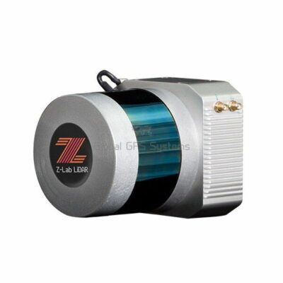
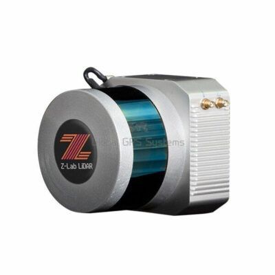
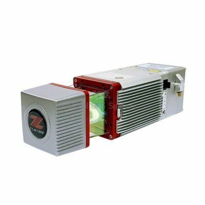
Our range includes portable 3D scanners, handheld LiDAR scanners, SLAM scanners, RTK-enabled scanning systems and stationary 3D scanners. Different systems are designed for different workflows, so the best choice depends on the area you need to scan, the required accuracy, working environment and type of final deliverable.
What is LiDAR and 3D scanning?
LiDAR stands for Light Detection and Ranging. A LiDAR sensor sends laser pulses towards surrounding surfaces and measures the returning signal to calculate distance. By repeating this process rapidly in many directions, the scanner builds a three-dimensional representation of its surroundings.
In practical fieldwork, this means a user can capture walls, floors, structures, roads, stockpiles, terrain, vegetation and other objects as a dense collection of measured points. These points form a 3D point cloud that can later be viewed, measured, processed or converted into drawings and models.
Modern systems increasingly combine LiDAR with technologies such as SLAM, GNSS, RTK, IMU sensors and cameras. These technologies help determine the scanner's movement and position while data is being collected. Depending on the equipment and workflow, this can reduce the amount of traditional station setup required and make scanning practical across larger or more complex sites.
Portable and handheld 3D scanners
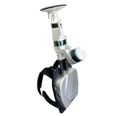
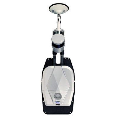
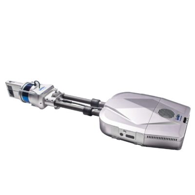
Portable LiDAR scanners are designed for mobile data collection. Instead of moving a tripod-mounted scanner from position to position, an operator can walk through or around the area while the system continuously records the environment. This makes handheld scanning particularly useful where speed and mobility are important.
Typical applications include building interiors, construction sites, warehouses, industrial facilities, roads, tunnels and outdoor terrain. A portable scanner can also be useful for sites containing many rooms, corridors or objects where repeated stationary setups would take considerably more time.
Many mobile scanners use SLAM technology. SLAM, or Simultaneous Localization and Mapping, allows the system to estimate its position while simultaneously building a map of its surroundings. This is particularly useful indoors or in other areas where reliable GNSS reception is unavailable.
RTK LiDAR and georeferenced 3D scanning
For surveying, GIS and construction work, collecting a detailed point cloud is often only part of the job. The scan may also need to be positioned correctly within a project coordinate system. This is where LiDAR systems that integrate RTK GNSS can provide an important advantage.
RTK positioning can help connect scan data to real-world coordinates while working outdoors with suitable correction data and satellite visibility. Depending on the scanner and project requirements, this can simplify georeferencing and reduce the amount of manual alignment required later.
For sites that include both outdoor and indoor areas, systems combining GNSS, RTK, inertial positioning and SLAM can provide a more flexible workflow. The exact performance still depends on the scanner, environment, processing method and survey procedure, so buyers should consider more than the headline accuracy specification alone.
Stationary 3D scanners
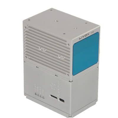
Stationary or tripod-mounted 3D scanners are commonly selected when controlled scanning from fixed positions is preferred. The scanner captures its surroundings from one position before being moved to another setup point. Multiple scans can then be registered together to create a complete point cloud of the project area.
This type of scanner can be a good fit for detailed building surveys, industrial measurement, infrastructure documentation, deformation-related work and projects where consistent scan geometry is more important than maximum walking speed.
Common applications for LiDAR scanners
LiDAR has become useful across a wide range of surveying, engineering, construction and mapping workflows. The ability to capture dense 3D information can reduce time spent taking individual measurements while also creating a much more complete digital record of the site.
- Topographic surveying: capture terrain, structures and surrounding features for mapping and design.
- Construction documentation: record existing conditions, project progress and completed work.
- As-built surveys: create detailed spatial records of buildings, infrastructure and installations.
- Volume calculations: scan stockpiles, excavations and earthworks for later measurement.
- Architecture and BIM: collect existing building geometry for drawings and 3D modelling.
- GIS and asset mapping: capture physical features and infrastructure for spatial databases.
- Industrial inspection: document complex facilities, machinery areas and structural environments.
- Forestry and environmental mapping: collect three-dimensional information about terrain and vegetation.
How to choose the right LiDAR or 3D scanner
The most expensive or highest-specification scanner is not automatically the best system for every project. A construction company documenting building interiors has different requirements from a surveyor mapping outdoor terrain or an engineer capturing detailed industrial structures.
Required accuracy
Start by determining how accurate the final measurements need to be. Consider both the scanner's measurement performance and the accuracy of the complete workflow. Positioning, SLAM processing, control points, RTK corrections, scan registration and environmental conditions can all influence the final result.
Scanning range
Range determines how far away the scanner can collect useful measurements. A longer range can be important for large structures, open terrain, roads, quarries and other areas where objects cannot always be approached closely. For smaller interiors, maximum range may be less important than portability and efficient SLAM performance.
Portable or stationary workflow
Choose a handheld or backpack-style scanner when you need to move quickly through larger or complicated environments. Choose a stationary scanner when fixed scan positions fit the project better or when the required workflow depends on highly controlled setups.
GNSS and RTK integration
If scans need to fit directly into an existing survey coordinate system, consider equipment with GNSS or RTK integration. For indoor-only projects, GNSS capability is less important because satellite reception is normally unavailable and positioning is usually handled through SLAM, control points or scan registration.
Point cloud processing
The scanner itself is only one part of a 3D scanning workflow. Collected data normally needs to be processed before it can be used in CAD, GIS, BIM or measurement software. Check what processing software is available, which file formats can be exported and whether the workflow fits the software already used by your team.
Camera and point cloud colourisation
Some scanners use integrated cameras to add colour or imagery to the point cloud. Coloured point clouds can make complex datasets easier to interpret and can be valuable for building documentation, inspection and presentation. If geometry is the main priority, image quality may be less important than scanning accuracy, range and processing speed.
LiDAR for construction professionals
Construction teams can use 3D scanners to create a detailed record of a site without manually measuring every visible feature. This can be useful for progress documentation, earthworks, floor and structural checks, renovation projects and as-built recording. A mobile scanner is especially practical when an operator needs to collect information across multiple rooms, floors or work areas during a single site visit.
LiDAR for surveyors and engineers
For surveyors, a LiDAR scanner complements rather than automatically replaces GNSS receivers and total stations. GNSS and total stations remain useful when precise individual points, control or stakeout are required, while LiDAR is particularly effective when the objective is to capture a dense representation of an entire area or structure.
Combining these measurement methods can create an efficient workflow. Survey control can establish the project reference, while LiDAR provides the detailed surface information needed for drawings, models, quantities and analysis.
LiDAR for GIS and mapping
GIS professionals can use LiDAR to capture detailed three-dimensional information about roads, buildings, utilities, vegetation and other assets. Georeferenced point clouds can provide a detailed spatial source for mapping and asset-management projects, particularly when conventional point-by-point collection would not capture enough information efficiently.
LiDAR software and point cloud processing
Processing software is an important part of any scanning system. Typical workflows can include importing raw scans, SLAM processing, trajectory optimisation, point cloud registration, coordinate transformation, noise filtering, colourisation and exporting the finished dataset.
Before choosing hardware, consider what you ultimately need to deliver. A user producing CAD drawings may need a different workflow from someone creating BIM models, calculating stockpile volumes or importing georeferenced point clouds into GIS software. Choosing compatible hardware and software from the beginning can save significant processing time later.
Related surveying equipment
LiDAR systems are often used alongside RTK GNSS receivers, total stations, data collectors and 3D scanning software. GNSS equipment can provide project control and accurate outdoor positioning, while total stations can be used for control points and precise conventional measurements. Dedicated point cloud and survey software is then used to process, inspect and export the collected data.
Choosing a LiDAR system with Global GPS Systems
When comparing LiDAR and 3D scanning equipment, focus on the complete field-to-office workflow rather than a single specification. Consider where the system will be used, the size of the areas being scanned, required accuracy, whether RTK positioning is needed and what files must ultimately be delivered to your customer or project team.
Global GPS Systems supplies professional LiDAR and 3D scanning solutions from multiple manufacturers. This makes it possible to compare different scanning technologies and workflows based on the actual requirements of your projects. For buyers moving into 3D scanning for the first time, selecting compatible hardware, positioning technology and processing software is particularly important for creating a practical workflow from field collection through to the final point cloud, drawing or model.
LiDAR & 3D Scanning FAQ
LiDAR and 3D scanning basics
What is a LiDAR scanner?
A LiDAR scanner uses laser measurements to determine the distance to surrounding surfaces and create a three-dimensional collection of measured points. This point cloud can represent terrain, buildings, roads, structures and other objects for surveying, mapping, modelling and inspection.
What is a 3D point cloud?
A point cloud is a large collection of points with three-dimensional coordinates representing surfaces captured by a scanner. Depending on the system and workflow, the points may also contain additional information such as colour, intensity or positioning data.
What is the difference between LiDAR and 3D scanning?
3D scanning is a broad term for technologies used to capture the shape of real objects or environments. LiDAR is one method of 3D scanning that measures distance using laser light. Professional 3D scanning systems can also combine LiDAR with cameras, GNSS, RTK and inertial sensors.
Choosing a LiDAR scanner
Should I choose a handheld or stationary 3D scanner?
A handheld scanner is generally better when mobility and fast coverage are important, such as walking through buildings, construction sites or complex environments. A stationary scanner is useful when you prefer controlled scans from fixed positions. The best option depends on project size, required accuracy and your normal field workflow.
How much scanning range do I need?
The required range depends on the size and accessibility of the objects you need to capture. Indoor building work often requires less range than surveying large outdoor structures, roads, terrain or quarries. Do not consider maximum range alone; accuracy, point density and performance on different surfaces are also important.
What should I look for when comparing LiDAR scanners?
Compare measurement accuracy, useful scanning range, field of view, point collection rate, positioning technology, portability, battery life, environmental protection and processing software. You should also consider how easily the resulting data can be exported into your existing CAD, GIS or BIM workflow.
SLAM, GNSS and RTK
What does SLAM mean on a LiDAR scanner?
SLAM stands for Simultaneous Localization and Mapping. It allows a mobile scanner to estimate its movement while building a map of the environment. This makes it possible to collect 3D data while walking and is especially useful indoors where GNSS signals are unavailable.
Why would I need RTK on a LiDAR scanner?
RTK can help position outdoor scan data accurately within a real-world coordinate system when suitable GNSS reception and correction data are available. This can be useful for surveying, construction and GIS projects where the point cloud needs to align with other georeferenced project data.
Can LiDAR work without GPS or GNSS?
Yes. Many scanners, particularly SLAM systems, can scan indoors and in other environments without GNSS reception. Depending on the required output, control points, scan registration or other positioning methods may be used to place the resulting point cloud into the required coordinate system.
Applications and processing
What can a LiDAR scanner be used for?
Common applications include topographic surveys, as-built documentation, construction progress recording, stockpile and excavation measurements, building capture, infrastructure surveys, BIM, GIS mapping, industrial inspection and terrain mapping.
Do I need special software for a LiDAR scanner?
Most professional LiDAR workflows require software to process the collected data. Depending on the system, this can include SLAM processing, trajectory correction, scan registration, georeferencing, point cloud filtering, colourisation and export to formats used by CAD, GIS or BIM software.
Does a LiDAR scanner replace an RTK GNSS receiver or total station?
Not necessarily. These instruments are often complementary. LiDAR is efficient for capturing dense 3D information across an area or structure, while GNSS receivers and total stations remain useful for survey control, stakeout and precise individual measurements. Many professional workflows use a combination of these technologies.
 GPS & GNSS
 Total Stations
 Data collectors
 Software
 Correction services
 Machine control
 External radio
 Marine
 Accessories