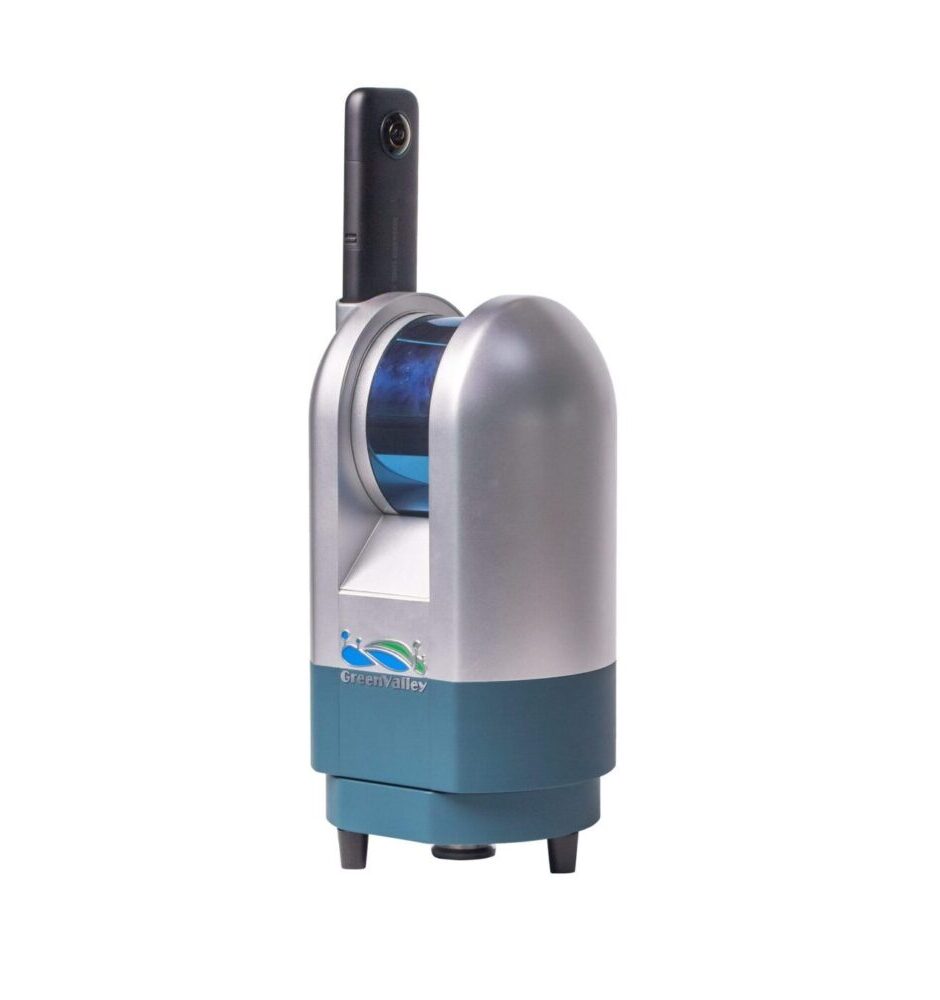
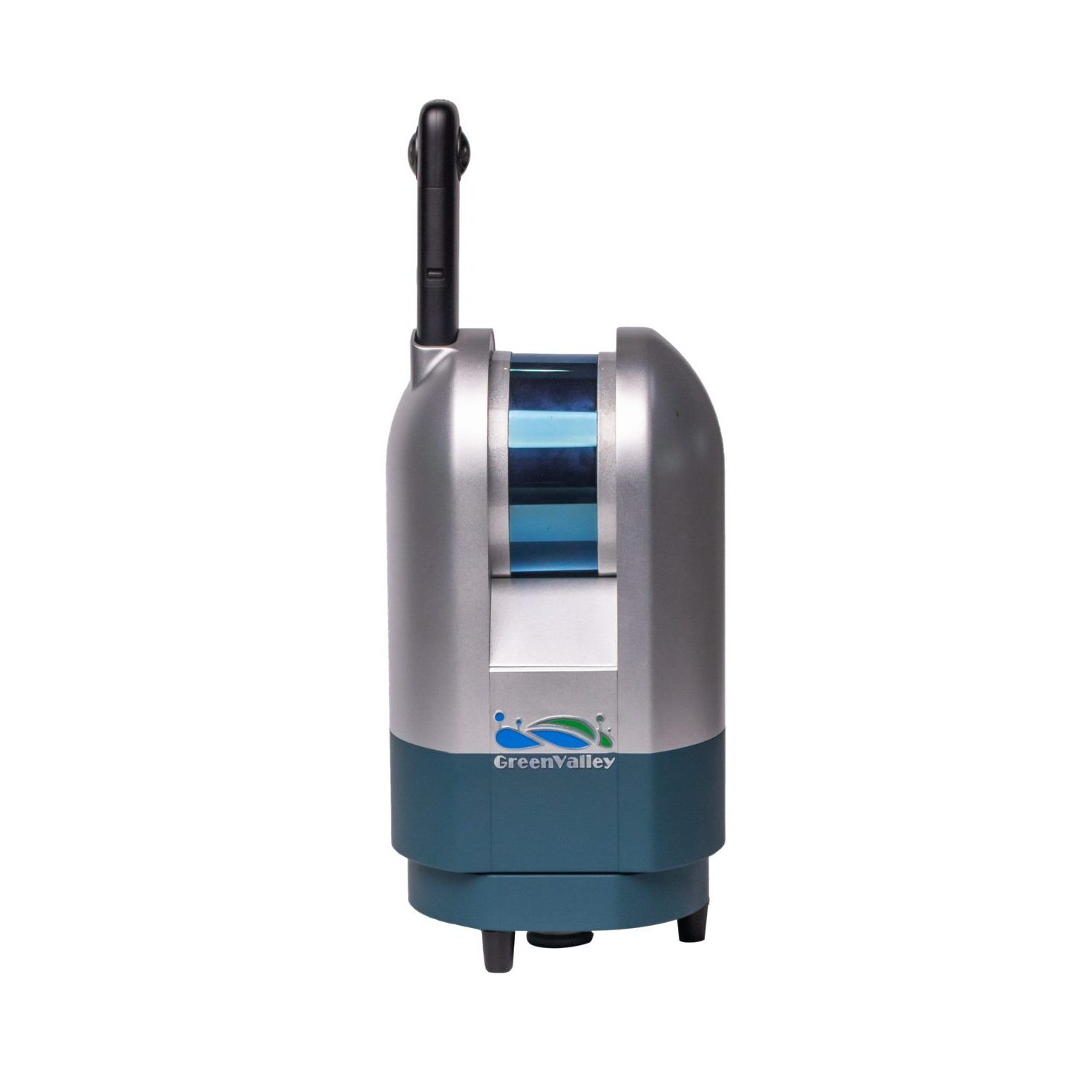
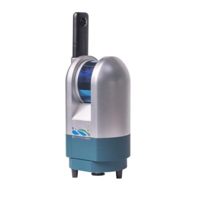
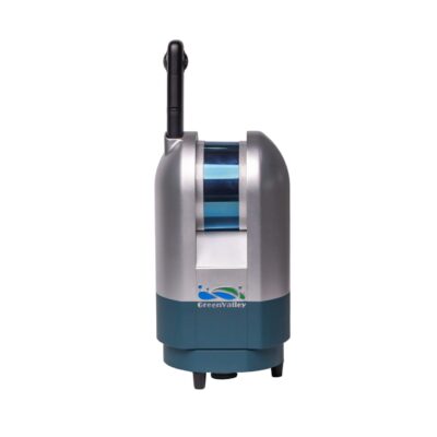
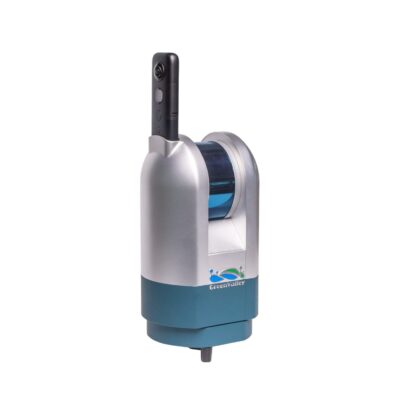
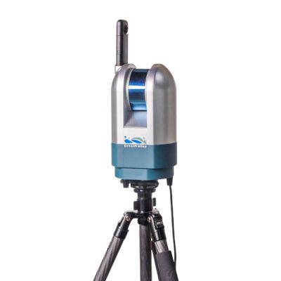
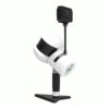
Greenvalley LiPod

SKU: lipod Categories: ,

Global GPS Systems
What Our Clients Say
4.73 store rating (442 reviews) | 4.72 product rating

Greenvalley LiPod

Terrestrial 3D Laser Scanner.

LiFuser software included

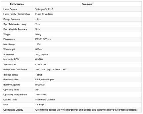
  • Weight: 3.5 kg (Excl. Battery)
  • Absolute Accuracy: ≤5cm
  • Camera: Panoramic Camera

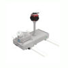
Inlcuded in package:

  • 1x LiPod cable
  • 1x Battery
  • 1x Battery charger
  • 1x Battery compartment
  • 1x Laser sensor
  • 1x Carbon fiber tripod
  • 1x Data transfer cable


Datasheets and manuals

Datasheet

Manual

RECOMMENDED DATA COLLECTORS:

RECOMMENDED SOFTWARE:

Greenvalley LiPod

SKU: lipod Categories: ,

Global GPS Systems
What Our Clients Say
4.73 store rating (442 reviews) | 4.72 product rating

Description

LiPod Product Review

LiPod by GreenValley International makes terrestrial 3D laser scanning (TLS) easier and more affordable than ever before. Its compact and lightweight design makes this high accuracy LiDAR surveying solution easy to transport and operate. LiPod allows users to quickly survey large interior and exterior sites without the need for inserting registration targets.

Lightweight Design

The device weighs only 3.0 kg (6.6 lbs) and is equipped with a carbon fiber tripod.

Automatic Leveling

An integrated high-precision, dual-axis compensator allows users to save time leveling the device at each scanning location.

Multi-Sensor Integration

The multiple sensor design with a panoramic camera makes the LiPod more than just a simple 3D laser scanner.

LiPod Frequently Asked Questions

What should I do if I cannot find the LiPod connection after powering on the system?
In general, in 1 minute after powering on the LiPod system, a Wi-Fi connection called ‘LiPod’ should be available. If not, try refreshing your phone or tablet. If the problem is not resolved after 5 minutes, please power off the system, reboot the computer, and then search for Wi-Fi networks again.

Why I cannot see any point cloud displayed when I click on the Start button as the computer is started and connected to Wifi?
Please check: (1) Check the device data acquisition status. Only a recording state displays point clouds (2) if the mobile device has been connected to another device, please clear browsing data.

Why can’t the power be turned on after booting, and the green button does not light up?
Please check:(1)The battery is sufficient;(2)The battery cable is connected. To avoid battery damage, do not overdischarge the battery. It is recommended to stop the collection operation when the power is below 30%, replace the battery or fully charge the battery.

When the device is turned on/restarted, the interface prompts “Server Failure” after the first connection, why?
The default IP address is 192.168.12.1:8090/#/LiPod. You are advised to delete LiPod from the IP address and enter the IP address again, that is, 192.168.12.1:8090.

How long can I scan with LiPod on one battery charge?
LiPod can operate for 4 hours with one fully charged battery.

What are the recommended operation environments and conditions for LiPod?
Operation of the system should be carried out when ambient temperatures are within the −10° to 40°C range. You should avoid operating the LiPod outdoors on wet-weather conditions.

What is the ANSI Laser Safety Standard rating of LiPod sensor?
ANSI Laser Safety Standard rating of LiPod is Class-1 (eye-safe).

What is the ANSI Laser Safety Standard rating of LiPod sensor?
ANSI Laser Safety Standard rating of LiPod is Class-1 (eye-safe).

Reviews (0)

Reviews

There are no reviews yet.

Only logged in customers who have purchased this product may leave a review.

NEED HELP WITH GPS?

Top 5 best RTK GNSS Receivers for Land Surveying

Finding a good GPS antenna for your land surveying projects can be difficult and time [...]

GPS Help Guide – Should You Have an IMU Tilt Sensor in Your RTK GNSS Receiver?

The IMU tilt sensor makes sure that even if your RTK GNSS receiver isn't level, [...]

GPS Help Guide – Do I Need Internet In My RTK GNSS Receiver?

A question we hear a lot is if you need internet in your RTK GNSS [...]

GPS help guide – Which RTK GPS receiver do I need

Where surveying with GNSS was only a job for the educated land surveyor with years [...]

GPS help guide – The basics of RTK GPS

Finding a good RTK GPS set for land surveying or any other type of stakeout [...]

RTK GNSS With 60° tilt:

GPS & GNSS

South INNO7

RTK GNSS Receivers

Kolida K30

GPS & GNSS

Carlson BRX7

GPS & GNSS

Stonex S990A

42%

GPS & GNSS

Kolida K1 Pro

GPS & GNSS

EFIX F7

RTK GNSS With internet:

GPS & GNSS

South INNO7

RTK GNSS Receivers

Kolida K30

GPS & GNSS

Tersus Oscar

GPS & GNSS

Carlson BRX7

GPS & GNSS

Stonex S990A

42%

GPS & GNSS

Kolida K1 Pro

Select your currency
EUR Euro