

 GPS & GNSS
 Lidar scanning
 Total Station
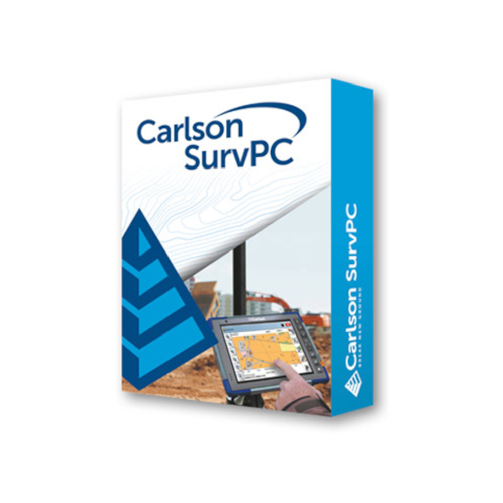
Carlson SurvPC Windows Surveying and Data Collection Software
Get the best price for your setup
Contact our experts for the best possible price and configuration.
- Fast response
- Expert configuration advice
- No overpaying for features you do not need
Carlson SurvPC 7 is Windows surveying and field data collection software for land surveyors, construction crews, engineers and GIS professionals. Designed for Windows tablets and field computers, it connects directly to supported GNSS receivers, manual total stations and robotic total stations for point collection, setting out, COGO calculations and project data management.
SurvPC lets field crews work with survey points, CAD drawings, surfaces, alignments and GIS information without constantly returning to the office. Depending on the selected licence modules, it can support RTK GNSS, robotic surveying, advanced road stakeout and Hybrid+ workflows that combine GNSS and a robotic total station in the same project.
Carlson SurvPC 7 Highlights
| Operating platform | Windows 10 with Windows 11 recommended |
|---|---|
| Survey equipment | GNSS receivers manual total stations and robotic total stations depending on licence |
| Field functions | Point collection stakeout COGO surfaces and Field to Finish workflows |
| CAD and data support | DWG DXF DGN SHP LandXML and common survey data formats |
| Advanced workflows | Optional Advanced Roading Hybrid+ Esri GIS and BIM capabilities |
| Hybrid surveying | Combine compatible GNSS and robotic total station equipment with Hybrid+ |
You may also like…



Valued customers:










Find RTK Networks
Search NTRIP providers and connect to reliable RTK correction services.
Description
Carlson SurvPC 7 Surveying Software for Windows Field Controllers
Carlson SurvPC 7 is professional Windows field software for surveyors, construction professionals, engineers and GIS crews who need to collect, calculate and stake survey data directly on a tablet or field computer. It provides one working environment for GNSS receivers, conventional total stations and robotic total stations, helping crews use the same familiar software across different types and brands of surveying equipment.
SurvPC is intended for real fieldwork rather than only office processing. A surveyor can connect to the instrument, create or open a job, configure the coordinate system, collect points, set out design positions, calculate geometry and review the project on the map while still on site. This makes it suitable for topographic surveys, construction layout, control work, road projects, as-built surveys, GIS collection and many other coordinate-based tasks.
Use SurvPC with GNSS and Total Stations
One of the main reasons survey companies use SurvPC is its broad equipment support. The software includes drivers for surveying instruments from Carlson and many other established manufacturers, allowing companies to use one field software platform across different GNSS receivers and total stations.
For an RTK GNSS workflow, SurvPC can control the rover, configure RTK communication, display satellite and solution information and store measured coordinates. With a total station, the same software provides instrument setup, backsight and orientation routines, prism settings, point collection and stakeout. Robotic configurations add remote instrument control for one-person fieldwork when supported by the connected instrument and selected licence.
Collect Survey Points Directly in the Field
Point collection is at the centre of the SurvPC workflow. Crews can store individual observations, average GNSS measurements, work with total station offsets and automatically collect positions by interval where appropriate. Point descriptions and feature codes can be recorded at the time of measurement so the information needed in the office is captured while the feature is still in front of the surveyor.
For a topographic survey, this means points for kerbs, buildings, fences, utilities, road markings or ground levels can be measured and coded as the crew moves through the site. Using a consistent feature-code system can reduce the amount of manual drafting required later because symbols and linework can already be associated with the collected field data.
Professional Stakeout for Construction
SurvPC includes dedicated routines for staking points, lines, arcs and offsets. Construction workers and surveyors can load design information, select the required position and follow graphical and numerical guidance toward the stakeout point. Cut and fill information can be shown where elevation data is available, making the software useful for foundations, utilities, roads, structures and general site layout.
Because the drawing and survey data are visible on the map screen, operators can also understand the point in relation to the rest of the project instead of working only from a coordinate list. This is especially useful on busy construction sites where design revisions, offsets and multiple working areas have to be managed throughout the day.
COGO Calculations Without Returning to the Office
SurvPC provides coordinate geometry tools directly in the field. These include inverse calculations, areas, intersections, transformations, station calculations, manual traverses, point averaging and other common survey routines.
In practice, this means a surveyor can calculate a missing coordinate, create an offset point, determine an intersection or transform project data without stopping fieldwork to open separate office software. These functions are useful both for traditional boundary and topographic surveying and for construction crews dealing with design information that changes while work is underway.
Work with CAD Drawings in the Field
SurvPC is designed to make CAD information useful at the measuring pole. The map environment can work with formats including DWG, DXF and DGN, while survey and design information can also be exchanged using formats such as LandXML.
This allows a contractor or surveyor to bring an engineer’s site drawing into the field and use the geometry as a reference for measurements and stakeout. Instead of reducing an entire design to a simple point list, useful lines, layers and other project geometry can remain visible while the work is carried out.
Field to Finish Surveying
Feature coding and Field-to-Finish workflows can reduce the separation between data collection and final drawing preparation. Codes entered while measuring can control descriptions, layers, linework and symbols, allowing structured survey information to be created as points are collected.
This is particularly useful for survey companies with repeatable coding standards. A crew can measure a series of points along a kerb, fence or building and apply the appropriate field code while still on site. The resulting data can then continue into Carlson office software with less repetitive interpretation and redrawing.
Surface and Volume Work in the Field
SurvPC includes tools for working with terrain and surface information. Survey points can be used to create and inspect surfaces, while existing terrain models can support elevation calculations, stakeout and cut or fill guidance.
For construction crews this can be useful when checking excavation, fill areas, stockpiles or finished grades. Surveyors can review measured data while still on site and identify missing areas before packing up the equipment, reducing the risk of needing an additional visit simply because part of the surface was not measured.
Advanced Road and Infrastructure Stakeout
The optional Advanced Roading functionality extends SurvPC for road, highway and infrastructure work. Centerlines, profiles, templates, cross sections and superelevation information can be used for road stakeout and slope staking.
Stake Road can guide the operator to positions along the design and provide information for the relevant template or cross section. Stake Slope can calculate the catch point where a designed cut or fill slope intersects the existing ground. These functions are particularly useful for highway contractors, earthworks crews and engineering surveyors working from corridor-based design data.
Hybrid Plus GNSS and Robotic Total Station Workflow
Hybrid+ is an optional SurvPC workflow that allows compatible GNSS and robotic total station equipment to be used together. Instead of treating GNSS and the robot as completely separate surveying systems, the operator can configure both and select the most suitable measurement method while working in the same project.
This is practical on sites where working conditions change throughout the day. GNSS may be the quickest option in an open area, while the robotic total station can take over near buildings, beneath structures or in locations with poor satellite visibility. SurvPC can also use GNSS information to assist robotic prism searching and can perform cross-checks between the two measurement methods.
Where supported, GNSS IMU information can also contribute to the Hybrid+ workflow. For example, pole tilt information from the GNSS receiver can be used while the robotic total station is active, helping crews maintain a practical one-pole setup across different parts of the jobsite.
GIS Data Collection with Survey Grade Equipment
SurvPC is also suitable for GIS professionals who need accurate field positioning rather than basic consumer-device coordinates. SHP data can be imported and exported, and SurvPC provides Esri workflow options for organisations that manage spatial features and attributes in ArcGIS environments.
This allows GIS crews to combine survey-grade GNSS measurement with descriptive feature information. A utility, inspection point, asset or boundary feature can be measured accurately and its associated attributes managed during the same field visit. Supported Esri workflows depend on the selected SurvPC configuration, software architecture and the ArcGIS services being used.
Optional BIM Stakeout
For building and infrastructure projects, an additional BIM module is available for 64-bit SurvPC. It allows supported IFC and Revit model data to be viewed in the field and used for stakeout. Individual model elements such as walls, columns or pipes can be selected and converted into practical layout positions.
This gives construction surveyors another way to work from modern design information without first reducing every BIM element to a separate coordinate file. BIM support is an additional module, so it should be selected only when this type of model-based field workflow is required.
SurvNet Field for Survey Network Adjustment
Current SurvPC 7 versions also include SurvNet Field functionality for working with survey observations in the field. Current releases support total station, GNSS and mixed total station/GNSS jobs, providing another tool for crews carrying out control work and checking survey networks before leaving the site.
This can be valuable on control surveys because problems can be identified while the crew and equipment are still present. A questionable observation can be checked or repeated immediately rather than being discovered only after the data has reached the office.
Modern Windows Tablet Workflow
SurvPC 7 is designed for Windows field computers and rugged tablets. The current version requires Windows 10, with Windows 11 recommended by Carlson. Both 64-bit and legacy 32-bit installations exist, although 64-bit SurvPC is the appropriate choice for newer functionality such as BIM and ArcGIS Online workflows.
The Windows environment also gives field crews more processing and graphics capability than older handheld data collectors. Larger drawings and design files can be taken into the field, making SurvPC particularly useful on modern rugged tablets where a full project map is an important part of the workflow.
Flexible SurvPC Licence Options
SurvPC is modular, so the software can be configured around the equipment and type of work actually being used. Available configurations include options for conventional total stations, robotic instruments, GNSS, advanced roading and Hybrid+ workflows. This avoids requiring every crew to use the same software configuration when their field tasks are different.
A construction crew operating only an RTK rover may need a different licence from a surveyor using both GNSS and a robotic total station. Likewise, road contractors may benefit from Advanced Roading, while a general topographic survey team may not require it.
Typical Carlson SurvPC Applications
- RTK GNSS surveying and point collection
- Manual and robotic total station surveying
- Construction layout and stakeout
- Topographic and detail surveys
- Road and infrastructure stakeout
- Earthworks surfaces and volume checks
- Control and survey network measurements
- GIS asset and feature collection
- As-built surveys and construction verification
Choosing the Right Carlson SurvPC Configuration
The correct SurvPC licence depends on the instruments you want to connect and the routines your crew needs in the field. It is worth checking whether the setup will use GNSS only, a conventional total station, a robotic total station or a combination of GNSS and robotics before selecting the software modules. Advanced Roading, Hybrid+ and other specialised functionality should be added when those workflows are actually required.
Global GPS Systems can help match Carlson SurvPC to your existing GNSS receiver, total station, Windows data collector and field workflow. This is particularly useful when combining equipment from different manufacturers or building a complete GNSS and robotic surveying setup, because the correct software modules and communication options can be selected before the system is put into the field.
Datasheets & Manuals
Specifications
Carlson SurvPC Specifications
Software Overview
| Product name | Carlson SurvPC |
|---|---|
| Product type | Professional Windows field surveying, data collection, stakeout and construction layout software |
| Current major version | SurvPC 7.x |
| Operating platform | Microsoft Windows |
| Primary applications | Land surveying, GNSS RTK surveying, conventional and robotic total station surveying, construction layout, stakeout, road construction, GIS data collection, BIM layout, monitoring and field COGO |
| GNSS support | Yes, with appropriate GNSS module |
| Conventional total station support | Yes |
| Robotic total station support | Yes, with appropriate Robotics module |
| Hybrid GNSS + robotic surveying | Supported with the Hybrid+ module |
| CAD functionality | Integrated field CAD and map environment for viewing, creating and editing survey geometry |
| Field-to-Finish | Supported |
| GIS functionality | Supported |
| Roading | Standard road tools plus optional Advanced Roading functionality |
| BIM support | Available through the optional BIM module on 64-bit SurvPC |
Available Software Configurations and Modules
| Configuration / Module | Function | Dependency / Notes |
|---|---|---|
| SurvPC Basic | Conventional total station surveying and core field functionality | Base total station configuration |
| SurvPC Robotics | Robotic total station control and one-person robotic surveying | Requires SurvPC Basic |
| SurvPC GPS | GNSS / RTK surveying functionality | Requires SurvPC Basic in the combined configuration |
| SurvPC GPS Only | GNSS / RTK surveying without total station functionality | Does not require SurvPC Basic |
| Advanced Roading | Extended roadway design, modeling and stakeout tools | Requires an applicable Basic / Total Station or GPS configuration |
| Hybrid+ | Simultaneous GNSS and robotic total station surveying | Requires Total Station, Robotics and GPS functionality |
| BIM | IFC and Revit model visualization, coordinate extraction and stakeout | Available on 64-bit SurvPC |
| Monitoring | Automated total station deformation monitoring | Optional SurvPC 7 module |
| Tunneling | Tunnel geometry, section and stakeout functionality | Optional SurvPC 7 module |
Windows and Application Architecture
| SurvPC 7 operating system | Windows 10 required; Windows 11 recommended by Carlson |
|---|---|
| Recommended SurvPC 7 architecture | 64-bit |
| 32-bit SurvPC 7 | Available for specific legacy applications |
| 32-bit recommended use cases | Spectra Precision Focus 30 / 35 connection and legacy offline Esri ArcMap document workflows |
| BIM architecture requirement | 64-bit SurvPC |
| ArcGIS Online architecture requirement | 64-bit SurvPC 7 or later |
Minimum System Requirements
| Processor | Intel Pentium or more powerful processor |
|---|---|
| RAM | 1 GB minimum |
| Free storage | 3 GB minimum |
| 64-bit hardware | Supported and recommended for normal SurvPC 7 installations |
| Serial interface | 1 × 9-pin RS-232 port optional |
| Wi-Fi | 802.11 b/g/n optional |
| Bluetooth | Bluetooth 2.0 or later recommended as a minimum for supported wireless instrument connections |
| UHD / 4K tablets | Not supported according to Carlson's current SurvPC system requirements |
Survey Instrument Compatibility
| GNSS receivers | Supports hundreds of current and legacy RTK GNSS receivers through Carlson's instrument driver library |
|---|---|
| Conventional total stations | Supported |
| Robotic total stations | Supported |
| Carlson equipment | Supported, including compatible Carlson Viking, BRx-series GNSS receivers, CRx / CRT robotic total stations and other Carlson field hardware |
| Additional supported manufacturers | Includes equipment from manufacturers such as Altus, Ashtech, GeoMax, Leica, Pentax, Sokkia, Spectra Precision, Stonex and Topcon, depending on model and driver availability |
| Peripheral equipment | Supports applicable laser, depth sounder, light bar, cable and output peripherals through the SurvPC equipment interface |
Core Survey Data Collection
| Store points | Supported |
|---|---|
| GNSS point averaging | Supported |
| Total station offsets | Supported |
| GNSS offsets | Supported |
| Automatic point numbering | Supported |
| Point descriptions | Supported |
| Feature coding | Supported |
| Linework collection | Supported |
| GIS attributes | Can be collected with field features |
| Photos | Images can be associated with points and linework |
| Raw measurement storage | Supported |
| Raw data reprocessing | Supported |
GNSS and RTK Functions
| GNSS rover configuration | Supported |
|---|---|
| GNSS base configuration | Supported with compatible receivers |
| Raw GNSS mode | Supported |
| RTK correction configuration | Supported through compatible receiver communication and correction interfaces |
| GNSS Monitor / Skyplot | Supported |
| Mission planning | Available within GNSS tools |
| GNSS averaging | Multi-observation point averaging with statistical analysis |
| IMU integration | Supports compatible GNSS receiver tilt / IMU measurements |
| GNSS tolerance profiles | Supported |
| GPS tolerance band | Live survey screens can indicate when configured measurement tolerances are exceeded |
| Geoid support | Supported, including downloading compatible geoid files from within the software when Internet access is available |
Total Station and Robotic Survey Functions
| Instrument orientation | Supported |
|---|---|
| Backsight orientation | Supported |
| Remote benchmark | Supported |
| Advanced occupation | Supports multiple backsights with least-squares processing |
| Robotic orientation | Supported with compatible robotic instruments |
| Resection | Supported |
| Set collection | Supported |
| Direct / reverse measurements | Supported |
| Automatic reverse-face turn | Supported with compatible motorized instruments |
| Automatic measurement after turn | Supported with compatible robotic instruments |
| Robotic prism search | Supported according to instrument capabilities |
| GPS-assisted prism search | Supported with compatible Hybrid+ configurations |
| Automatic backsight check | Available from supported robotic workflows |
Hybrid+ GNSS and Robotic Total Station
| Simultaneous GNSS and RTS connection | Supported |
|---|---|
| Mixed hardware brands | GNSS receivers and robotic total stations can be mixed and matched from Carlson's supported driver library |
| Hybrid+ Setup Wizard | Included |
| Auto Localization | Can automatically localize GNSS measurements to robotic total station control using sufficient common points |
| GPS Search | Uses GNSS position to guide the robotic total station toward the prism |
| Follow Me | Continuously turns the robotic total station toward the GNSS / prism location |
| Smart Lock | Designed to automatically acquire the prism when the operator slows to make a measurement |
| Smart Staking | Uses GNSS navigation while moving toward a stake point and transitions to robotic total station measurement when appropriate |
| Backup Tracking | GNSS position can be displayed when the robotic total station is not tracking |
| GNSS IMU with total station | Compatible GNSS tilt sensors can be used to adjust robotic total station prism measurements |
| Electronic level display | Compatible GNSS IMU data can provide a digital level indication during total station operation |
Stakeout Functions
| Point stakeout | Supported |
|---|---|
| Line stakeout | Supported |
| Arc stakeout | Supported |
| Offset stakeout | Supported |
| Elevation difference | Supported |
| Cut / fill stakeout | Supported using compatible surface and design files |
| Slope stakeout | Supported |
| Road stakeout | Supported |
| Obstructed Point Stakeout | Provides guidance for setting otherwise inaccessible points using azimuth and distance |
| Voice stakeout prompting | Supported, including optional cut / fill and tolerance prompts |
| Stake cut sheets | Supported |
COGO Functions
| Coordinate input | Supported |
|---|---|
| Inverse | Supported |
| Traverse | Supported |
| Sideshot | Supported |
| Radial stakeout | Supported |
| Area calculations | Supported from points or polyline geometry |
| Intersections | Supported |
| Point projection | Supported |
| Station store | Supported |
| Coordinate transformations | Supported |
| Plane similarity transformation | Supported |
| Rigid-body transformation | Supported |
| Triangle calculator | Supported |
| Curve calculator | Supported |
| Quick calculator | Integrated |
Field-to-Finish
| Feature code library | Supported |
|---|---|
| Automatic point symbols | Supported based on feature codes |
| Automatic layers | Supported based on feature-code definitions |
| Automatic linework | Supported |
| Line continuation | Supported |
| New line from existing vertex | Supported |
| Curve coding | Supported through special feature codes |
| Close figure coding | Supported |
| Offset coding | Supported |
| Field-to-Finish redraw | Point symbols and coded linework can be regenerated after coordinate changes |
| Active line review | Supported |
CAD and Map Screen
| 2D polylines | Create and edit |
|---|---|
| 3D polylines | Create and edit |
| Circles | Supported |
| Move / copy / rotate | Supported |
| Trim / extend | Supported |
| Fillet | Supported |
| Offsets | 2D, 3D, segment and buffer offset tools |
| Layer management | Layer visibility, color, current layer and other properties |
| Point-to-polyline generation | Supported |
| Polyline-to-points generation | Supported |
| Reference drawings / XREF | Supported |
| Reference drawing updates | Manual or configurable timed refresh |
| Reference drawing layer control | Supported |
CAD, GIS and Survey File Compatibility
| Format | Import | Export / Use |
|---|---|---|
| DWG | Yes | Yes |
| DXF | Yes | Yes |
| DGN | Yes | Supported for applicable drawing workflows |
| Esri SHP | Yes | Yes |
| LandXML | Yes | Yes |
| ASCII TXT / CSV / ASC / XYZ | Yes | Yes, with user-configurable formats |
| KML | Project-dependent | Yes |
| KMZ | Project-dependent | Yes |
| Carlson CRD / CRDB | Native | Native |
| Carlson TIN / FLT | Yes | Yes |
| Topcon TN3 | Yes | Yes |
| Carlson PLN / LN3 | Yes | Yes |
| Raw survey data | Supported across compatible equipment and formats | Supported |
Additional Road Data Compatibility
| LandXML road models | Supported |
|---|---|
| InRoads | ASCII alignment, profile and applicable section conversion supported |
| Caice | Supported by applicable road conversion utilities |
| Geopak | Supported by applicable road conversion utilities |
| ISPOL | Supported by applicable alignment, profile, section and surface workflows |
| Leica GSI | Supported by applicable alignment and profile conversion tools |
| MOSS | Supported by applicable road conversion utilities |
| SDMS | Supported by applicable road conversion utilities |
| Sokkia SDR | Supported by applicable road / survey conversion utilities |
| TDS RD5 | Supported by applicable centerline, profile and section conversion utilities |
| Terramodel / Geodimeter | Supported by applicable profile and section conversion tools |
Coordinate Systems, Geoids and Localization
| Predefined coordinate systems | Hundreds of commonly used projection systems are included |
|---|---|
| User-defined coordinate systems | Supported |
| PRJ coordinate-system files | Can be loaded for compatible user-defined projection workflows |
| Transverse Mercator | Supported |
| Lambert Conformal Conic | Supported |
| Datum configuration | Supported |
| Geoid models | Supported |
| Grid-to-ground calculations | Automatic scale-factor calculation available with configured projection |
| Ground-to-grid calculations | Supported |
| Multi-point GNSS localization | Supported |
| Plane Similarity localization | Least-squares translation, rotation and scale |
| Rigid Body localization | Least-squares translation and rotation without scale |
| Helmert transformation | 7-parameter method supported |
| Base Translation by Rover Reading | Supported for applicable GNSS workflows |
Surface and Volume Functions
| TIN surface creation | Supported |
|---|---|
| Triangulation from survey points | Supported |
| Breaklines | Supported |
| Contour generation | Supported |
| Custom contour interval | Supported |
| Volume calculation | Supported in the field |
| Surface elevation inquiry | Supported |
| Elevation Difference | Supports comparison between measured positions and design surfaces |
| Surface Inspector | Supports plan-versus-as-built elevation comparison and selection of locations for storage or stakeout |
| LandXML surface import | Supported |
| LandXML surface export | Supported |
| DXF 3DFACE to DTM | Supported |
Roading Functions
| Centerline Editor | Included with applicable road functionality |
|---|---|
| Centerline drawing | Supported |
| Profile Editor | Supported |
| Profile drawing | Supported |
| Template Editor | Supported |
| Template drawing | Supported |
| Cross-section storage | Supported |
| Slope stakeout | Supported |
| Road stakeout | Supported |
| Road surface models | Supported |
| LandXML road models | Supported |
| Multiple road surfaces / subgrades | Supported where present in compatible road-model data |
| Road Network stakeout | Supports Carlson Road Network workflows including intersections and cul-de-sacs |
| BIM / DTM road staking | Available with applicable SurvPC 7 modules and configuration |
| Real-time sectioning | Supported in applicable BIM / advanced road staking workflows |
SurvNET Least-Squares Adjustment
| In-field least-squares adjustment | Supported in SurvPC 7 |
|---|---|
| Total station observations | Supported |
| GNSS vectors | Supported |
| Interconnected traverses | Supported |
| Triangulation networks | Supported |
| Trilateration networks | Supported |
| Resections | Supported |
| Redundant observations | Supported |
| Dual-baseline procedures | Supported in applicable GNSS field workflows |
| Time-delay observations | Supported |
| Statistical analysis | Supported |
| Error ellipses | Supported in applicable averaging / analysis screens |
| Outlier management | Supported |
| PDF reporting | Supported |
Graphical Averaging and Quality Control
| Graphical point averaging | Supported |
|---|---|
| Horizontal statistics | Displayed during applicable averaging sessions |
| Vertical statistics | Displayed during applicable averaging sessions |
| Real-time error ellipses | Supported |
| Outlier removal | Supported |
| Redundant averaging sessions | Supported |
| Time delay between sessions | User configurable |
| RTK reset between sessions | Supported in applicable GNSS averaging workflows |
| Blunder detection | Integrated for applicable averaging and field-survey operations |
BIM Module
| Architecture | 64-bit SurvPC required |
|---|---|
| IFC models | Supported |
| Autodesk Revit RVT models | Supported |
| 2D model visualization | Supported |
| 3D model visualization | Supported |
| BIM stakeout | Supported |
| Coordinate extraction | Supported |
| Solid extraction | Supported |
| Element metadata | Can be accessed for supported model components |
| As-built collection | Can be performed against BIM model geometry |
| Model-to-field verification | Supports comparison of field data with model geometry |
| Projected boundaries | Can be created from supported BIM solids |
GIS and Esri Integration
| GIS attribute collection | Supported |
|---|---|
| GIS attribute editing | Supported |
| SHP files | Import and export supported |
| GIS Inspector | Provides access to GIS attribution from the map screen |
| ArcGIS Online | Supported with an applicable SurvPC Esri configuration, active Internet connection and valid ArcGIS Online account |
| ArcGIS Online architecture | 64-bit SurvPC 7 or later |
| ArcGIS Online editing | Supported for applicable hosted data and feature workflows |
| Offline map packages | Supported in applicable ArcGIS Online workflows using compatible MMPK packages |
| Legacy ArcMap MXD workflow | Supported with the 32-bit ArcGIS Legacy Engine configuration |
| Esri feature classes | Can be viewed and edited with applicable Esri configuration |
| Survey-grade Esri data capture | Supported using compatible GNSS or total station equipment |
Web Maps and Image Overlays
| Online web map overlays | Supported |
|---|---|
| Internet connection | Required for live web map services |
| Configurable map services | Supported |
| WMTS | Supported by the Web Map Overlay configuration |
| Image overlay format | PNG and JPG options available for compatible web imagery |
| Local image overlays | Supported |
| Reference use | Online imagery is intended as a visual reference and should not be assumed to have survey-grade positional accuracy |
Monitoring Module
| Application | Automated deformation monitoring using a compatible robotic total station |
|---|---|
| Typical structures | Bridges, buildings, walls and other structures requiring movement monitoring |
| Multiple monitoring targets | Supported |
| Reference targets | Supported |
| Static targets | Supported |
| Automatic measurement cycles | Supported |
| Continuous monitoring | Supported |
| Configurable cycles | Supported |
| Configurable sets per target | Supported |
| Delay between cycles | Configurable |
| Horizontal movement tolerance | User configurable |
| Vertical movement tolerance | User configurable |
| Failed-target retries | User configurable |
| Email alerts | Can be sent when configured movement tolerances are exceeded |
| End-of-cycle reports | Can be emailed automatically |
| Real-time logging | Results can be logged to file or a configured communication port |
Tunneling Module
| Tunnel stakeout | Supported |
|---|---|
| Road / invert geometry | Supported |
| Tunnel dome | Supported |
| Counter-dome geometry | Supported |
| Tunnel key | Supported |
| Drainage geometry | Supported |
| Tunnel section staking | Supported with the applicable Tunneling configuration |
Specialty Survey Functions
| RoboScan | Available for compatible robotic total station workflows |
|---|---|
| Building Face | Supported |
| Remote Elevation | Supported |
| Catenary Survey | Supported for power lines, cables and other suspended flexible features |
| Catenary ground-clearance check | Supported against a specified ground surface |
| Catenary curve deviation warning | Supported |
| Catenary report | Supported |
| Weather data in catenary report | Current METAR weather information can be retrieved with Internet access |
| Email catenary report | Supported |
Reports and Export
| Coordinate reports | Supported |
|---|---|
| Point reports | Supported |
| Stake reports | Supported |
| Volume reports | Supported |
| Job reports | Supported |
| Raw data reports | Supported |
| PDF output | Supported for applicable SurvPC 7 reports |
| HTML output | Supported for applicable reports |
| Custom HTML report templates | Supported |
| Email export | Supported for applicable coordinate and report workflows with Internet access |
| KML export | Supported |
| KMZ export | Supported |
| Google Earth workflow | KML / KMZ output can be generated for viewing in compatible mapping applications |
Carlson Cloud
| Office-to-field messaging | Supported with Internet connectivity and Carlson Cloud account |
|---|---|
| Field-to-field messaging | Supported |
| File transfer | Office-to-field and peer-to-peer transfers supported |
| Crew View | Displays participating crew / rover locations when configured |
| JobShare | Can share job data between SurvPC field users in near real time |
| Multiple crews in same job | Supported by SurvPC Carlson Cloud workflows |
| Duplicate point resolution | Configurable for shared jobs |
| Automatic cloud login | Configurable |
| Individual chat conversations | Supported |
Customization and Productivity
| Command Hotlists | User-configurable quick-access command lists |
|---|---|
| Multiple saved Hotlists | Supported |
| Python scripting | Supported for advanced customization |
| User Python scripts | Supported through a dedicated UserScripts folder |
| Carlson-supplied scripts | Supported through the SurvPCScripts directory |
| Command aliases | User configurable |
| Linework-code aliases | User configurable |
| Tolerance Profiles | Multiple customized tolerance configurations can be created and selected |
| Software updates in field | SurvPC can check for available software updates with Internet connectivity |
| Release notes | Accessible from within SurvPC |
| Geoid download in field | Supported with Internet connectivity |
User Interface
| Interface type | Graphical touch-oriented field surveying interface |
|---|---|
| Landscape orientation | Supported |
| Portrait orientation | Supported with adaptive interface layout |
| Manual orientation control | Supported |
| Keyboard input | Supported |
| Touchscreen input | Supported |
| Quick calculator | Integrated into numerical input workflows |
| Status bar | Displays job, instrument and other operational status information |
| Equipment selector | Provides rapid switching between configured instrument modes |
| Audible feedback | Configurable |
| Voice stakeout prompts | Configurable |
Language Support
| Multilingual interface | Yes |
|---|---|
| Number of languages | More than two dozen languages are available depending on SurvPC release |
| English | Supported |
| Spanish | Supported |
| German | Supported |
| French | Supported |
| French Canadian | Supported |
| Portuguese | Supported |
| Dutch | Supported |
| Czech | Supported |
| Russian | Supported |
| Greek | Supported |
| Italian | Supported |
| Polish | Supported |
| Hungarian | Supported |
| Swedish | Supported |
| Latvian | Supported |
| Additional languages | Additional translations are available depending on installed release and language package |
SurvPC 7 Key Capabilities
| SurvNET in the Field | In-field least-squares survey-network adjustment and quality analysis |
|---|---|
| Enhanced averaging | Statistics, real-time error ellipses, outlier control and redundant observation sessions |
| Blunder detection | Improved measurement quality checking |
| BIM model support | IFC and Revit visualization and stakeout |
| Reference drawing updates | Reference CAD drawings can be refreshed automatically |
| ArcGIS Online integration | Supported with applicable Esri configuration |
| Point history | Enhanced Point Information can display modification history |
| Editable rod heights | Supported through applicable point-information workflows |
| Custom reports | Coordinate, point, stake, volume and job reports with PDF / HTML support |
| Tolerance Profiles | Quick switching between customized survey tolerance settings |
| Catenary Survey | Guided power-line and suspended-cable surveying with reporting |
| Monitoring | Automated deformation monitoring with tolerance-based alerts |
| Tunneling | Specialized tunnel stakeout tools |
| BIM Roading | Road stakeout using BIM and DTM models with real-time sectioning |
| In-field software update | Supported with an Internet connection |
| In-field geoid download | Supported with an Internet connection |
Compatibility Notes for Current Carlson Hardware
| Carlson Viking | Requires SurvPC 7.12 or later with current Carlson firmware / driver workflows |
|---|---|
| Carlson RTk5 / RTk5+ | Current Carlson configurations require SurvPC 7.12 or later |
| Carlson CRT robotic total station | Requires SurvPC 7.12 or later |
| Driver compatibility | Instrument support can depend on SurvPC build, instrument firmware and selected communication method |
Specifications and package contents may vary by configuration, region or manufacturer update. Always check the current configuration before ordering.
Additional information
| Version | SurvPC Basic (Contains TS Only), SurvPC Robotic (Requires SurvPC Basic), SurvPC GPS (Requires SurvPC Basic), SurvPC GPS Only (Does Not Require SurvPC Basic), SurvPC Adv. Roading (Requires SurvPC Basic or GPS), SurvPC Hybrid+ (Requires Basic, Robotics and GPS turned on) |
|---|
Reviews (0)
Only logged in customers who have purchased this product may leave a review.
FAQ
Carlson SurvPC FAQ
Carlson SurvPC, Applications & Licensing
What is Carlson SurvPC?
Carlson SurvPC is professional Windows-based field surveying software for collecting measurements, staking out points and designs, performing survey calculations and controlling GNSS receivers and total stations. It combines data collection, COGO, CAD, mapping, surface, GIS and equipment-control functions in one field application.
Who is Carlson SurvPC designed for?
Carlson SurvPC is designed for land surveyors, civil engineers, construction layout crews, infrastructure contractors, GIS professionals and other field users who work with GNSS receivers, conventional total stations or robotic total stations.
What can Carlson SurvPC be used for?
SurvPC can be used for topographic surveys, boundary fieldwork, GNSS data collection, construction stakeout, road and infrastructure projects, as-built surveys, surface and volume calculations, GIS data collection, control surveys and conventional or robotic total station measurements.
What is the difference between Carlson SurvPC and Carlson SurvCE?
Carlson SurvPC is designed for full Windows computers and rugged Windows data collectors, while SurvCE was developed for Windows Mobile field controllers. They share many surveying concepts and workflows, but SurvPC is the appropriate Carlson field software for modern Windows-based devices such as the Carlson RT4+.
What is the difference between Carlson SurvPC and Carlson Survey?
Carlson SurvPC is primarily field software used to control survey instruments, collect measurements and perform stakeout. Carlson Survey is CAD-based office software used for processing survey data and producing finished drawings and plans. Data can be transferred between SurvPC and Carlson office software to create a field-to-office workflow.
Which Carlson SurvPC modules are available?
SurvPC is modular so the software can be configured for different equipment and workflows. Available options include SurvPC Basic for conventional total stations, Robotic for supported robotic total stations, GPS for GNSS surveying, GPS Only as a standalone GNSS configuration, Advanced Roading for additional road functions and Hybrid+ for combined robotic total station and GNSS workflows. Some modules require other SurvPC modules to be enabled.
GNSS, Total Stations & Survey Equipment
Which GNSS receivers and total stations work with Carlson SurvPC?
SurvPC supports a large driver library covering Carlson equipment and many third-party GNSS receivers, conventional total stations and robotic total stations. Supported manufacturers include brands such as Carlson, Leica, GeoMax, Sokkia, Topcon, Spectra Precision, Stonex, Pentax and others. Compatibility should be checked for the specific manufacturer, model and SurvPC version being used.
Can Carlson SurvPC control an RTK GNSS rover?
Yes. With the appropriate GPS module, SurvPC can connect to compatible GNSS receivers, configure rover settings, monitor positioning quality and collect RTK survey measurements. Receiver-specific functions depend on the hardware and driver selected in SurvPC.
Can Carlson SurvPC configure an RTK base station?
Yes. SurvPC includes GPS Base functions for compatible receivers. A base can be configured on a known position, previously surveyed point, entered latitude and longitude, grid coordinates, local coordinates or other supported position sources before broadcasting RTK corrections to a rover.
Does Carlson SurvPC support NTRIP corrections?
Yes. With compatible GNSS equipment, SurvPC can configure RTK correction sources including NTRIP. Depending on the receiver, supported correction methods can also include internal UHF radio, TCP/IP, UDP/IP and other network or radio-based correction links.
Can Carlson SurvPC control a robotic total station?
Yes. With the SurvPC Basic and Robotic modules, compatible robotic total stations can be controlled from the field computer. Depending on the instrument, SurvPC can provide functions such as robotic search, tracking, remote measurements, stakeout, sets and other instrument-specific controls.
What is Hybrid+ in Carlson SurvPC?
Hybrid+ allows a compatible GNSS receiver and robotic total station to be connected within the same SurvPC workflow. The surveyor can switch between GNSS and optical measurements as site conditions change. Hybrid+ can also use GNSS information to help the robotic total station search for the prism and can use supported GNSS IMU information during total station measurements.
Data Collection, Stakeout & Field Calculations
Can Carlson SurvPC collect and stake out survey points?
Yes. Point collection and stakeout are core SurvPC functions. Surveyors can store measured points with coordinates, elevations and descriptions and then stake points, lines, offsets and other project geometry using connected GNSS or total station equipment.
Does Carlson SurvPC support Field-to-Finish surveying?
Yes. SurvPC supports Field-to-Finish workflows using feature codes collected with survey points. Coded measurements can automatically create linework and point symbols in the field, allowing the surveyor to see the developing drawing while measurements are being collected and reducing drafting work later in the office.
Can Carlson SurvPC import CAD drawings?
Yes. SurvPC supports CAD and mapping data for use as field references and stakeout information. Supported workflows include importing or working with formats such as DWG, DXF and DGN, as well as SHP and LandXML data.
Can Carlson SurvPC create surfaces and calculate volumes in the field?
Yes. SurvPC includes tools for triangulating survey data, creating surfaces and contours and calculating volumes between surfaces. This can be useful for stockpiles, excavations, earthworks and comparing existing and proposed ground conditions directly in the field.
Can Carlson SurvPC be used for road stakeout?
Yes. SurvPC provides road-related functions for working with centerlines, profiles, templates, sections and stakeout. The Advanced Roading module expands these capabilities for more involved road and infrastructure projects, including slope and road stakeout workflows.
Does Carlson SurvPC include survey adjustment and GNSS averaging tools?
Yes. SurvPC can average multiple GNSS measurements to improve confidence in a stored point and includes raw-data processing tools. SurvNET least-squares adjustment is also available for analysing and adjusting networks containing redundant total station measurements and GNSS vectors directly in the field.
Coordinate Systems, GIS, Data Exchange & Windows Requirements
Does Carlson SurvPC support coordinate systems and GNSS localization?
Yes. SurvPC includes extensive coordinate-system and localization functions. Users can select predefined projections, configure datums and geoids, apply grid-to-ground settings and establish local coordinate systems using known control points. Supported localization methods include plane similarity, rigid-body and Helmert transformation workflows.
Can Carlson SurvPC work with Esri and GIS data?
Yes. SurvPC provides GIS functions and supports SHP data as well as optional Esri integration. SurvPC 7 can connect to ArcGIS Online when configured with the required Esri access, allowing compatible GIS maps and feature data to be used during field data collection.
Which file formats can Carlson SurvPC import and export?
SurvPC supports a wide range of surveying, CAD and GIS formats. Depending on the workflow, these include DXF, DWG, DGN, LandXML, SHP, ASCII point files such as TXT and CSV, surface files, raw survey data and other industry-specific formats.
Can Carlson SurvPC export data to Google Earth?
Yes. SurvPC can export KML and KMZ data for viewing in applications such as Google Earth. This provides a convenient way to visualise collected points and project information geographically or share field information with users who do not have surveying software.
Can photos be attached to survey points in Carlson SurvPC?
Yes. On compatible Windows field computers with a camera, SurvPC can associate photographs with field data. This can be useful for documenting survey monuments, utilities, assets, site conditions, construction progress and other measured features.
What computer or data collector is required for Carlson SurvPC?
SurvPC is designed for Windows-based computers and rugged field controllers. Carlson SurvPC 7 requires Windows 10, with Windows 11 recommended. Carlson lists a minimum of 1 GB RAM and approximately 3 GB of available storage, although a modern Windows field computer with more memory is recommended for comfortable use with larger drawings, surfaces and project files. Bluetooth is useful when connecting wirelessly to GNSS receivers and total stations.

 GPS & GNSS
 Total Stations
 Data collectors
 Software
 Correction services
 Machine control
 External radio
 Marine
 Accessories
Reviews
There are no reviews yet