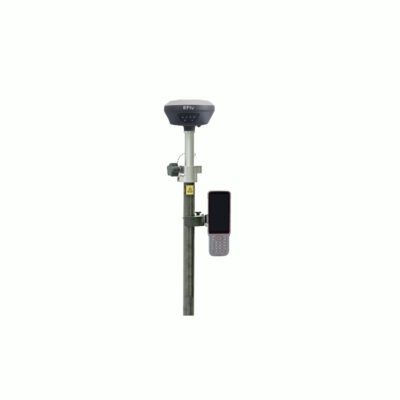
The South Insight V4 Receiver
Experience precision and efficiency with the South Insight V4 RTK GNSS receiver. Featuring IMU tilt compensation, AR stake-out, and a vision system, this GPS receiver ensures accurate results in tough environments. Eliminate blind spots and reduce labor – the ultimate solution for modern surveying.
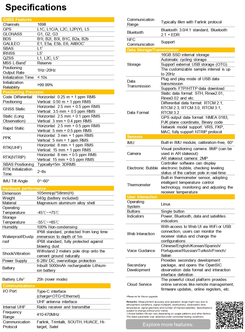
| ✅ Channels |
1698 |
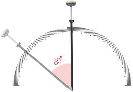
| ✅ IMU Tilt Sensor |
60º |
| ❌ Internet Modem |
None |
| ✅ UHF Radio |
410 – 470MHz |
| GPS |
L1C, L1C/A, L2C, L2P(Y), L5 |
| GLONASS |
G1, G2, G3 |
| GALILEO |
E1, E5a, E5b, E6, AltBOC* |
| BEIDOU |
B1l, B2l, B3l, B1C, B2a, B2b |
South Insight V4 Rover and Base Set – Precision GNSS for Land Surveying
Experience unmatched precision and efficiency with the South Insight V4 rover and base set, your ultimate GNSS solution for professional land surveying. Designed to excel even in the most challenging environments, this GNSS rover and base set for land surveying offers groundbreaking accuracy, speed, and ease of use, significantly enhancing your productivity on site.
Key Features of the South Insight V4 GNSS Rover and Base Set
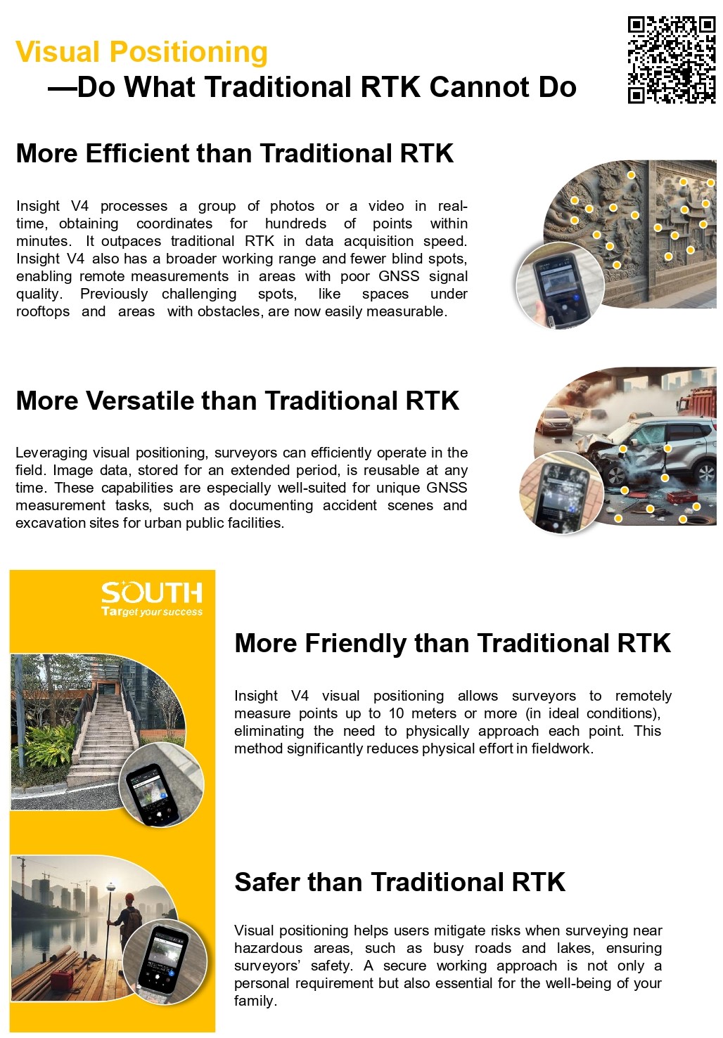
Dual-Camera AR Stakeout
The South Insight V4 GNSS receiver integrates innovative dual-camera technology, enabling effortless stakeout of points, lines, and curves. With cameras located at both the front and bottom, this GPS set for construction simplifies complex surveying tasks, allowing you to precisely stake points using intuitive augmented reality (AR) guidelines directly from the app.
Robust IMU Tilt Compensation
Eliminate interruptions caused by signal loss with the South Insight V4’s advanced GPS set with IMU tilt sensor. The device’s superior IMU tilt compensation ensures seamless operation, allowing you to accurately measure points without constantly leveling the pole. This feature significantly boosts productivity, especially in challenging terrains or dense urban areas.
Superior GNSS Performance
Equipped with 1698 channels and dual-engine GNSS algorithms, this GNSS rover and base set delivers exceptional signal quality and processing speed. Whether surveying under thick forest canopies, among tall city buildings, or in open fields, this GNSS set for construction maintains high accuracy and reliability, making it ideal for diverse surveying needs.
Why Choose the South Insight V4 GNSS Rover and Base Set?
- Accuracy and Reliability: Achieve precise positioning consistently, even under difficult conditions.
- Effortless Operation: Easy-to-use AR stakeout combined with reliable IMU tilt compensation simplifies your workflow.
- Enhanced Productivity: Reduce surveying time with continuous, interruption-free measurements and advanced GNSS technology.
Comprehensive Accessories for Enhanced Versatility
The South Insight V4 rover and base set comes complete with all the essential accessories to maximize your efficiency and adaptability in the field:
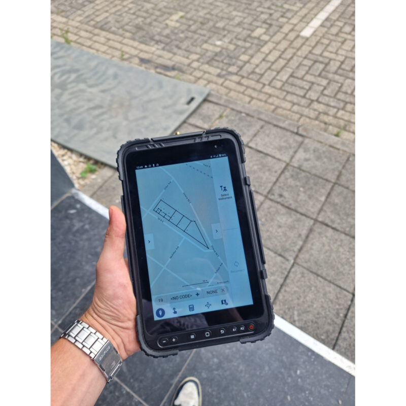
- South H6 Data Collector: The South H6 data collector is a robust and reliable device for managing your survey data.
- SurvStar Surveying Software: The SurvStar Software is an intuitive software solution that streamlines your workflow and ensures precise results.
- Surveying Pole and Data Collector Bracket: For convenient and stable operation during surveys.
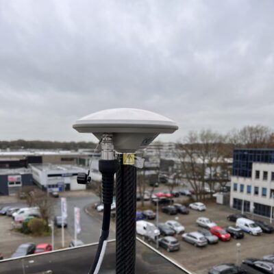
- Tripod, Tribrach, and Adapter: Ensures stability and accuracy for fixed-point measurements.
Customizable Accessories for Your Needs
This rover and base set is flexible to match your specific requirements. Prefer using a tablet instead of the included controller? Or need different software for your workflow? These accessories can be easily modified or upgraded to suit your preferences, ensuring the perfect fit for your projects.


Reviews
There are no reviews yet.