

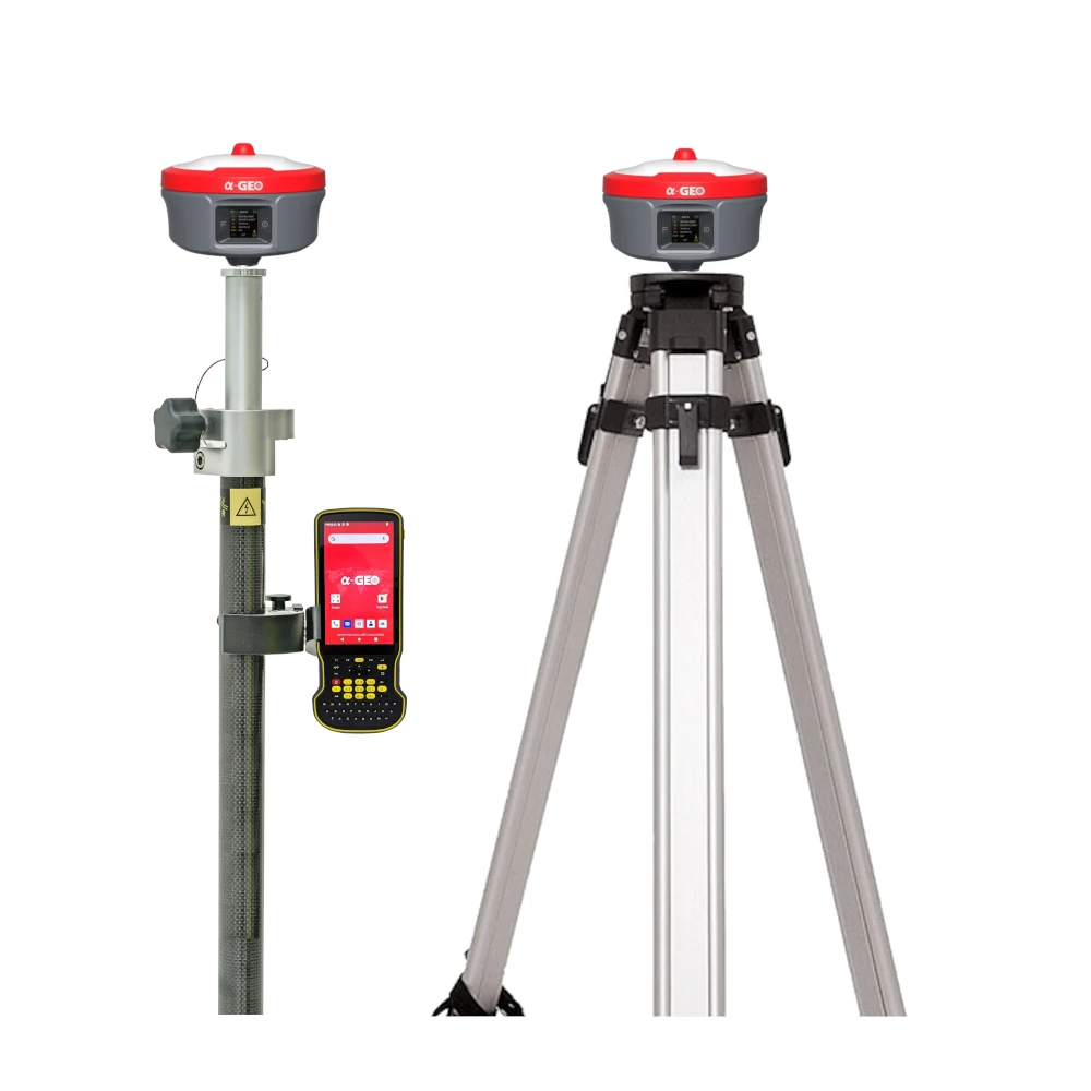


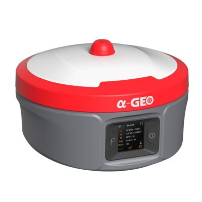
a-Geo Matrix Ultra Super Rover & Base Set
The a-Geo Matrix Ultra Super Rover & Base Set is a high-performance GNSS solution designed to deliver efficiency, reliability, and long-range communication for modern surveying. Equipped with an advanced 2W/5W high-efficiency radio module, it strikes the perfect balance between power consumption and signal coverage. With intelligent optimization of transmit power, signal quality, and energy use, the Ultra Super Rover & Base Set achieves maximum energy-performance efficiency (EPE) across diverse field conditions—making it the ideal choice for demanding surveying and construction projects.
| ✅ Channels | 1408 |
| ✅ IMU Tilt Sensor | 120º |
| ✅ Internet Modem | 4G |
| ✅ UHF Radio | 410 – 470MHz |
| GPS | L 1 C/A, L2C, L2P, L5 |
| GLONASS | L1, L2 |
| GALILEO | E1, E5a, E5b, E6 |
| BEIDOU | B1, B1C, B2, B2a, B2b, B3 |


Valued customers:


Find RTK Networks
Search NTRIP providers and connect to reliable RTK correction services.
Description
a-Geo Matrix Ultra Super Rover & Base Set Product Review
High-Capacity Battery for Continuous Field Operations
The a-Geo Matrix Ultra Super Rover & Base Set is powered by a 14,000mAh high-density stackable battery system, engineered for industry-leading runtime and non-stop productivity. Designed for demanding environments, it allows surveyors to work longer without interruptions, even in the toughest field conditions.
Optimized Power Efficiency
- 40 Hours of Rover Operation – Extended runtime in network RTK mode, ensuring uninterrupted workflows on long projects.
- 7 Hours of Base Station Transmission – Reliable operation at 5W UHF output power, guaranteeing stable communication across large sites.
- Smart Energy Management – Dynamic power optimization adjusts consumption in real time, maximizing efficiency while sustaining peak performance.

Optional Modular Battery System with Intelligent Power Optimization
In addition to its high-capacity battery, the a-Geo Matrix Ultra Super Rover & Base Set also features an advanced 7,000mAh modular lithium-polymer battery. With an impressive 98.5% energy conversion efficiency, it delivers unparalleled endurance for both rover and base station applications.
Exceptional Runtime Performance
- 20 Hours of Continuous Rover Operation – Reliable RTK performance during extended surveying sessions.
- 6 Hours of Full-Power Base Transmission – Stable 2W UHF broadcasting for consistent communication across challenging environments.
Smart Energy Management
The intelligent system uses real-time load balancing across critical components. By auto-adjusting consumption based on satellite and radio conditions, it ensures maximum efficiency without sacrificing performance.

Dual-Camera & Laser Hybrid Measurement System
The a-Geo Matrix Ultra Super Rover & Base Set introduces an advanced hybrid system that combines dual-camera technology with laser measurement for superior accuracy and productivity. This unique design enables centimeter-level precision, enhanced visualization, and faster workflows for modern surveying.
Side Camera – Photogrammetry Engine
Equipped with a dual RGB/IR sensor system, the side camera captures simultaneous images while performing centimeter-grade (±2cm) real-time geotagging. Through direct pixel-to-position mapping, surveyors gain accurate, reliable photogrammetry results.
Downward Camera – AR Stakeout Assistant
The downward camera delivers real-time AR design overlays directly on terrain. With an 84° distortion-free field of view and 30fps RTK video, it provides millimeter-level stakeout precision, minimizing errors and reducing rework.
Laser Measurement Module
Featuring a Class 3A eye-safe reflectorless laser, the system enables rapid “walk-and-map” continuous ranging. High sampling rates allow for efficient position data collection, ensuring faster project completion in complex environments.

Datasheets & Manuals
Datasheets and manuals
Datasheets
Reviews (0)
Only logged in customers who have purchased this product may leave a review.

Reviews
There are no reviews yet