


a-Geo Matrix III Rover & Base Set
a-Geo Matrix III Rover & Base Set
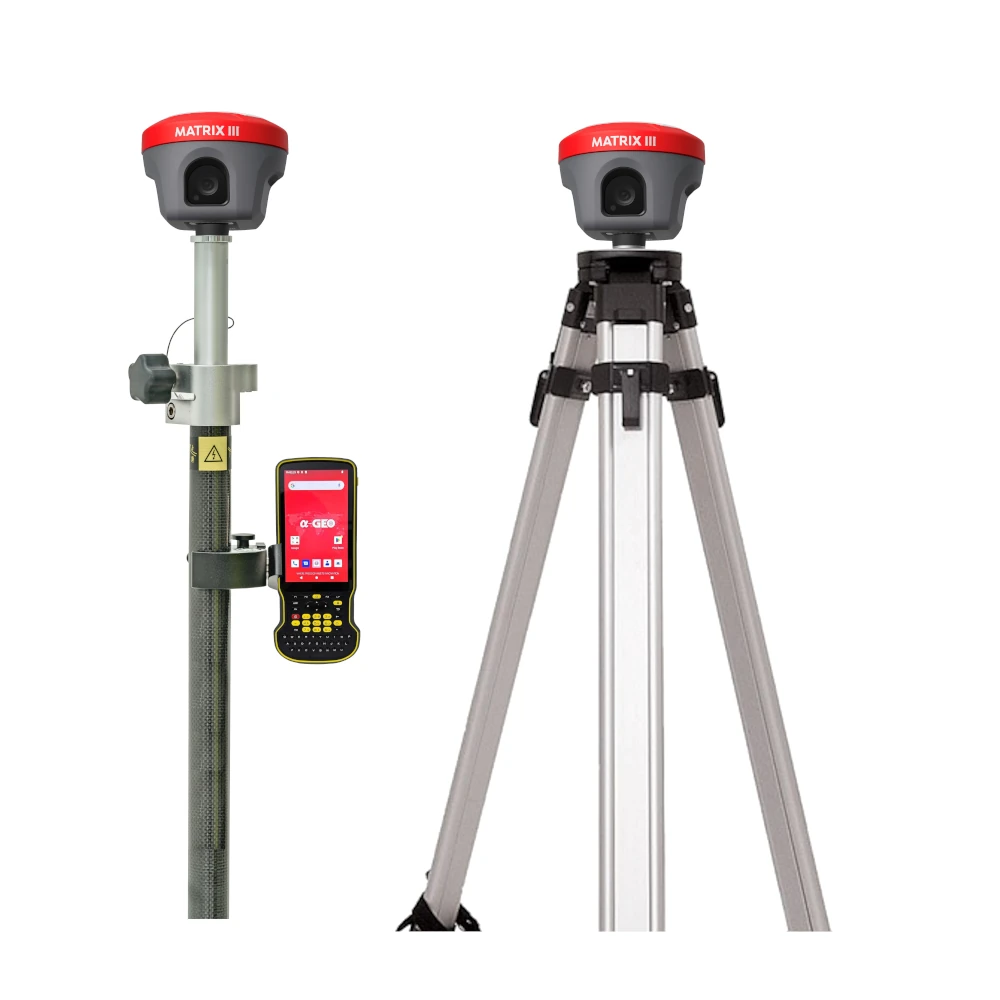
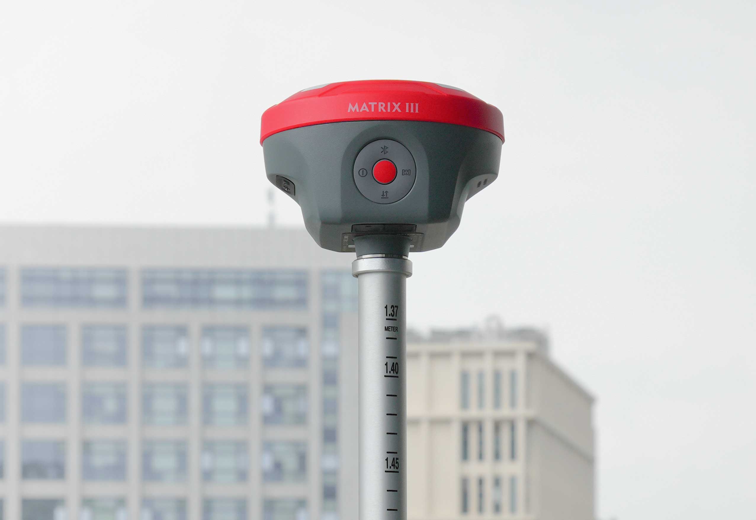
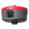
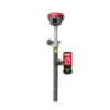
The a-Geo Matrix III Rover & Base Set is a next-generation GNSS receiver that redefines modern surveying with laser measurement, AR stakeout, and advanced GNSS technology. Featuring a 100-meter high-precision laser module, a 5MP auxiliary camera, and a 1408-channel multi-constellation GNSS engine, it delivers unmatched accuracy and reliability in even the most challenging environments. Built for speed, efficiency, and adaptability, the Matrix III sets a new benchmark in geospatial technology—making it the ultimate choice for professionals who demand precision and performance on every project.
| ✅ Channels | 1408 |
| ✅ IMU Tilt Sensor | 120º |
| ✅ Internet Modem | 4G |
| ✅ UHF Radio | 410 – 470MHz |
| GPS | L 1 C/A, L2C, L2P, L5 |
| GLONASS | L1, L2 |
| GALILEO | E1, E5a, E5b, E6 |
| BEIDOU | B1, B1C, B2, B2a, B2b, B3 |
Datasheets and manuals
Datasheets


Valued customers:


Find RTK Networks
Search NTRIP providers and connect to reliable RTK correction services.
Description
a-Geo Matrix III Rover & Base Set Product Review
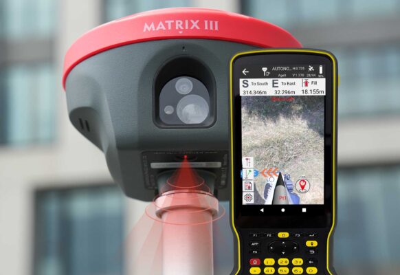
Innovation Breakthrough: 100-Meter Laser Measurement
The a-Geo Matrix III Rover & Base Set is equipped with a high-performance laser module that transforms the way surveyors measure and stake out. With a maximum range of 100 meters, it delivers unmatched stability, precision, and adaptability, meeting the demands of long-distance measurements in even the toughest environments.
Key Advantages of the Laser Module
- Extended Range – Effectively measures distances up to 100 meters, surpassing traditional GNSS limitations.
- High Precision – Powered by advanced algorithms and optical design to achieve centimeter-level accuracy.
- Environmental Adaptability – Strong anti-interference performance ensures stable operation in low-light and extreme temperature conditions.
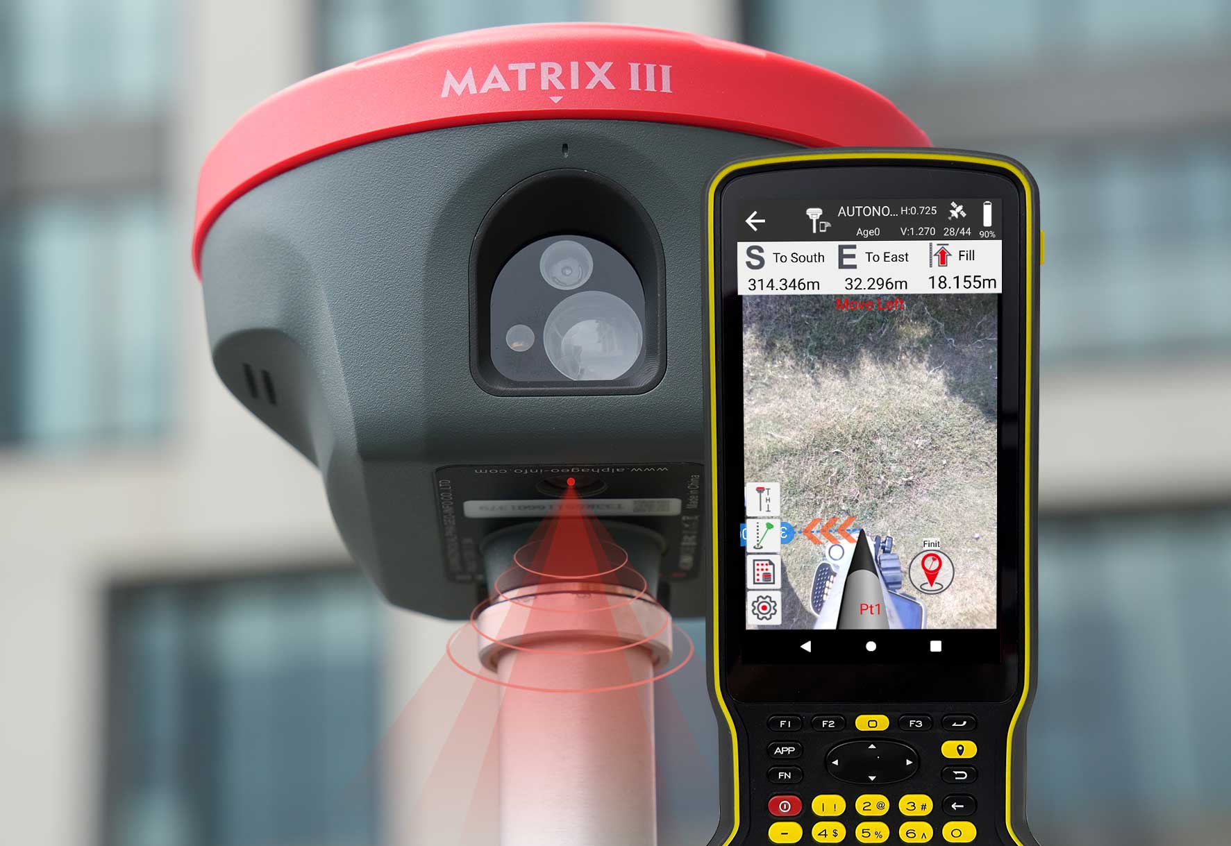
Right to the Point with AR Real-Scene Stakeout
With augmented reality real-scene stakeout, the a-Geo Matrix III Rover & Base Set makes positioning faster, easier, and more accurate than ever before.
How AR Stakeout Improves Productivity
- Direct Ground Marking – Surveyors can quickly identify and mark stakeout points with precision.
- One-Pass Accuracy – By following arrows on a real-world map, points can be staked out in a single pass, eliminating repeated back-and-forth adjustments.
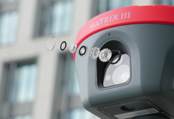
Dual-Dimensional Empowerment with 5MP HD Auxiliary Camera
The Matrix III Rover & Base Set integrates a 5MP high-definition auxiliary camera into its laser module, enhancing reliability and performance in complex surveying environments.
Enhanced Laser-Assisted Coordinate Positioning
- Clear Target Capture – The f/2.08mm wide-aperture lens ensures sharp and accurate imaging of feature points.
- Low-Light Operation – Maintains strong performance in conditions below 500 Lux illumination.
- No Blind Aiming – Solves the problem of traditional laser systems by ensuring precise targeting in every situation.
Rugged RTK Data Collector for the a-Geo Matrix III Rover & Base Set
The S60III RTK data collector is the perfect companion to the a-Geo Matrix III Rover & Base Set, delivering speed, durability, and efficiency for advanced field measurements and mapping tasks. Powered by the latest Qualcomm industrial-grade processor, it ensures smooth and reliable performance even in the most demanding conditions. Its slim, ergonomic design with a standard English keyboard makes it both practical and comfortable for extended field use.
Reliable Connectivity Options
The S60III provides surveyors with a complete set of advanced communication tools:
- Bluetooth 5.0 – Fast and stable device pairing
- Dual-band Wi-Fi (2.4G / 5G) – Flexible and reliable wireless connectivity
- 4G modem with global coverage – Seamless access to RTK corrections worldwide
These connectivity features guarantee uninterrupted communication with GNSS receivers and RTK networks, allowing professionals to maintain consistent accuracy, efficiency, and productivity in every project.
Reviews (0)
Only logged in customers who have purchased this product may leave a review.
Find RTK Networks
Search NTRIP providers and connect to reliable RTK correction services.
Reviews
There are no reviews yet