


 GPS & GNSS
 Lidar scanning
 Total Station

Lidar & 3D scanning
Lidar & 3D scanning
Lidar & 3D scanning
Lidar & 3D scanning
Lidar & 3D scanning
Lidar & 3D scanning
Lidar & 3D scanning
Lidar & 3D scanning

Lidar & 3D scanning
Lidar & 3D scanning

Lidar & 3D scanning
Lidar & 3D scanning
Lidar & 3D scanning
Lidar & 3D scanning

Lidar & 3D scanning
Lidar & 3D scanning
Lidar & 3D scanning
Lidar & 3D scanning
Lidar & 3D scanning
SLAM LiDAR scanners for fast mobile 3D mapping
SLAM LiDAR scanners are designed to capture detailed three-dimensional data while the operator walks through or around a site. Unlike traditional stationary laser scanning, which normally requires multiple fixed scanner setups, a mobile SLAM scanner continuously measures the surrounding environment and calculates its own movement at the same time. This makes SLAM scanning particularly useful when large, complex or difficult-to-access areas need to be captured efficiently.
SLAM stands for Simultaneous Localization and Mapping. In practical fieldwork, the technology allows a scanner to build a 3D map while estimating where it is within that map. Combined with LiDAR, inertial sensors, cameras and, on selected systems, GNSS or RTK positioning, this creates a flexible way to collect point cloud data indoors and outdoors.
Global GPS Systems offers a broad range of SLAM LiDAR solutions, including handheld scanners, backpack systems and integrated RTK SLAM equipment. The right system depends on your required accuracy, scanning range, working environment and how the final point cloud will be used.
How does a SLAM LiDAR scanner work?
A LiDAR sensor sends laser pulses towards surrounding surfaces and measures how long the reflections take to return. These measurements are converted into three-dimensional points. While the scanner is moving, the SLAM algorithm compares newly collected geometry with previously scanned parts of the environment to estimate the scanner's changing position and trajectory.
The result is a continuously built 3D point cloud of the area being scanned. Instead of stopping at individual stations, an operator can normally walk through rooms, corridors, around structures or across a site while collecting data. This can make the field stage substantially more efficient for projects where dense spatial information is more useful than individual measured points.
Where are SLAM LiDAR scanners used?
Mobile SLAM scanners are used across surveying, construction, engineering, architecture, GIS and asset-management projects. They are particularly useful where the environment contains many surfaces or structures that would require a large number of setups with a stationary scanner.
- Building surveys: capture rooms, corridors, staircases, façades and other building geometry for documentation and modelling.
- Construction: record site conditions, progress, completed work and existing structures.
- As-built surveys: create detailed point clouds of buildings, industrial installations and infrastructure.
- Infrastructure: scan tunnels, roads, bridges, stations and other complex environments.
- Volume measurements: collect surfaces for stockpile, excavation and earthwork calculations.
- GIS and asset mapping: capture three-dimensional information about buildings, roads and physical assets.
- Industrial facilities: document pipework, equipment areas, structural elements and complicated indoor spaces.
Handheld SLAM LiDAR scanners
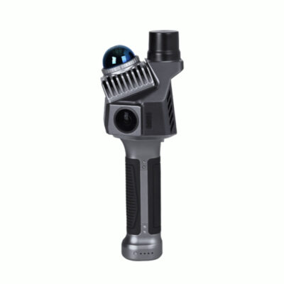
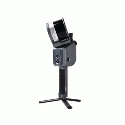
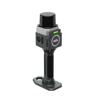
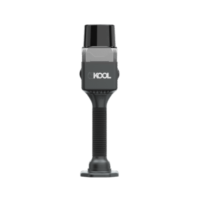
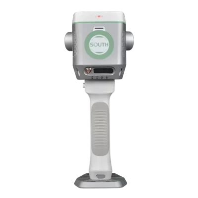
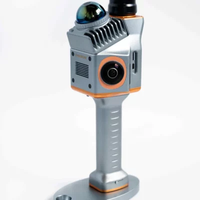
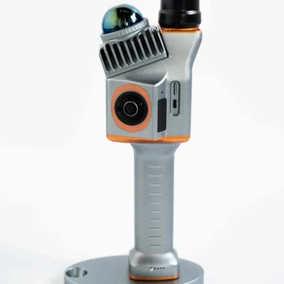
Handheld SLAM scanners are built for mobility. The operator carries the scanner while moving naturally through the project area, allowing a large amount of geometry to be captured during a relatively simple field procedure. This is useful for construction workers, surveyors and engineers who need more spatial detail than conventional point measurements can provide but do not want to repeatedly reposition a tripod-mounted laser scanner.
Portable systems can vary significantly in scanning range, measurement performance, sensor configuration and processing workflow. Some are optimized for compact indoor environments, while others are designed for larger outdoor areas or mixed indoor-outdoor projects.
SLAM LiDAR with RTK GNSS
Some mobile scanners combine SLAM with RTK GNSS positioning. This can be especially useful when outdoor point clouds need to be connected to an existing project coordinate system. Where satellite reception and RTK corrections are available, GNSS can provide an additional positioning reference alongside the scanner's LiDAR and inertial sensors.
This combination is useful on construction sites, roads, open terrain and other projects where georeferenced results are important. A user may begin scanning outdoors with GNSS positioning and continue into areas where satellite reception becomes weaker, while SLAM and inertial positioning support the mobile mapping workflow. Exact performance depends on the scanner, environment, control method and processing procedure.
Indoor scanning without GNSS
One of the main reasons SLAM scanning is useful is that it does not require continuous satellite reception. GNSS normally performs poorly or is completely unavailable inside buildings, underground environments and covered structures. SLAM instead uses the surrounding geometry to estimate movement and maintain the scanner trajectory.
This makes the technology particularly suitable for offices, warehouses, industrial buildings, parking facilities, tunnels and renovation projects. For projects that require the resulting point cloud to match a defined survey coordinate system, control points or other georeferencing methods may still be used.
Loop closure and good SLAM scanning practice
A good scanning route can have a significant effect on the quality of SLAM data. Where possible, the operator should scan in a way that allows the system to recognise previously captured areas. Returning to an already scanned location creates what is commonly called a loop closure. This provides the processing algorithm with additional information that can help improve the estimated trajectory.
Very fast movement, featureless environments, rapidly moving objects or repeatedly identical geometry can make localization more difficult for some systems. Following the manufacturer's recommended walking pattern and maintaining sufficient overlap between areas generally produces a more reliable dataset.
SLAM scanner accuracy
When comparing SLAM scanners, it is important to distinguish between individual LiDAR measurement accuracy and the accuracy of the complete mapped trajectory. A LiDAR sensor may measure nearby surfaces very precisely, while the final point cloud is also influenced by SLAM trajectory estimation, scanning route, environment, GNSS positioning, control and processing.
This means the quoted specification alone does not tell the whole story. A surveyor working on detailed engineering measurements may have different requirements from a contractor who primarily needs rapid site documentation or volume calculations. Choose the system according to the accuracy required in the final deliverable rather than only the headline sensor specification.
Scanning range and point cloud density
Scanning range determines how far the LiDAR sensor can collect useful returns. Longer range can be valuable in warehouses, industrial facilities, large structures, outdoor construction sites and infrastructure projects. In smaller indoor environments, maximum range may be less important than portability, trajectory stability and the ability to capture surfaces from multiple directions.
Point density is also important. A denser point cloud can reveal more surface detail, but it also increases the amount of data that must be stored and processed. For general site mapping, maximum possible density is not always necessary. The most suitable setting depends on the size of the project and the level of detail required.
Cameras and colourized point clouds
Many modern SLAM LiDAR scanners include one or more cameras. The imagery can be used to add colour information to the point cloud, making the final dataset easier to interpret. Colourized point clouds can be particularly useful for building documentation, architectural work, asset identification and projects where users need to visually recognise objects after returning to the office.
Camera capability should be considered alongside LiDAR performance rather than in isolation. For measurement-focused work, scanning quality, positioning performance and a reliable processing workflow remain essential.
SLAM LiDAR software and processing
Software is an important part of a mobile scanning system. Raw sensor information normally needs to be processed to calculate the scanner trajectory and generate the finished point cloud. Depending on the system, processing may include SLAM optimization, point cloud generation, GNSS integration, control-point adjustment, filtering, colourization and coordinate transformation.
Before selecting a scanner, check which output formats can be created and whether they fit your existing CAD, GIS, BIM or point cloud workflow. For construction and surveying teams, easy export into existing software can be just as important as scanning speed in the field.
Choosing the right SLAM LiDAR scanner
There is no single SLAM scanner that is best for every project. Start by considering where and how you expect to use the equipment. A team mainly scanning indoor buildings will usually prioritize different features from a survey company working on georeferenced outdoor mapping.
Consider your required accuracy
Determine the accuracy needed in the final drawings, measurements or models. If the scanner will be used for survey-grade work, pay particular attention to trajectory performance, control options and georeferencing rather than only the LiDAR sensor specification.
Consider the size of your sites
For small buildings, portability and an efficient indoor workflow may be most important. Larger industrial sites, infrastructure projects and outdoor environments may benefit from greater scanning range, longer operating time and additional positioning options.
Decide whether you need RTK
If your point clouds regularly need real-world coordinates, a scanner with integrated or compatible RTK GNSS can simplify field and office workflows. For predominantly indoor projects, RTK capability may be less important than SLAM performance and the availability of control-point workflows.
Check the complete field-to-office workflow
Consider how the scanner is operated, how quickly data can be checked in the field, how processing works and which files can be exported. A scanner that integrates well with your existing workflow may be more productive than a system with stronger specifications but complicated processing requirements.
SLAM LiDAR compared with stationary laser scanning
SLAM and stationary laser scanners solve similar measurement problems in different ways. A stationary scanner collects detailed data from fixed positions and is moved between setups. A SLAM scanner continuously maps the surroundings while the operator moves.
Stationary scanning can be appropriate when controlled setups and highly structured scan positions are required. SLAM scanning is particularly attractive when speed, mobility and complete coverage are priorities. Some surveying companies use both technologies and select the most suitable method for each project.
SLAM LiDAR compared with RTK GNSS surveying
A SLAM scanner does not automatically replace an RTK GNSS receiver. RTK GNSS is highly efficient for collecting individual georeferenced survey points outdoors, while SLAM LiDAR is designed to capture large amounts of surface geometry. On many projects the two technologies complement each other.
For example, RTK GNSS can be used to establish control or measure specific survey features, while a SLAM scanner captures the surrounding building, terrain or infrastructure as a dense point cloud. Systems that integrate both technologies can further streamline this combined workflow.
Professional SLAM LiDAR scanners from Global GPS Systems
Global GPS Systems supplies a range of professional mobile scanning solutions, including systems such as the Alpha Geo Lixel L2 Pro, FJ Dynamics Trion series, GreenValley LiBackpack systems, GeoSun scanners and RTK-enabled SLAM solutions. Different models are designed for different combinations of portability, scanning range, positioning and project scale.
When selecting a SLAM LiDAR scanner, compare the complete workflow rather than choosing on one specification alone. Consider measurement requirements, project size, indoor or outdoor use, RTK capability, software compatibility and the type of output your clients or project teams need. This approach helps ensure that the selected scanner is practical in everyday fieldwork as well as capable of producing the required final data.
SLAM LiDAR Scanners FAQ
SLAM LiDAR basics
What is a SLAM LiDAR scanner?
A SLAM LiDAR scanner combines laser scanning with Simultaneous Localization and Mapping technology. It captures the surrounding geometry while estimating its own position and movement, allowing an operator to create a 3D point cloud while walking through or around a site.
What does SLAM mean in 3D scanning?
SLAM stands for Simultaneous Localization and Mapping. The system uses sensor information and recognizable geometry in the environment to calculate its trajectory while simultaneously building a map of the surroundings.
What is the main advantage of SLAM scanning?
The main advantage is mobility. Instead of repeatedly setting up a scanner on a tripod, an operator can move continuously through the project area. This can make data collection much faster for buildings, construction sites, industrial facilities and other complex environments.
Accuracy and field use
How accurate is a SLAM LiDAR scanner?
Accuracy depends on the individual scanner, scanning route, environment, trajectory calculation, control method and processing workflow. When comparing systems, consider the expected accuracy of the finished point cloud rather than only the accuracy specification of the LiDAR sensor itself.
Can SLAM LiDAR scanners be used indoors?
Yes. Indoor mapping is one of the main applications for SLAM technology because the scanner does not need continuous GNSS reception to calculate its movement. Typical indoor applications include offices, warehouses, factories, staircases, tunnels and other enclosed spaces.
What is loop closure in SLAM scanning?
Loop closure occurs when the scanner returns to an area that was previously captured. Recognising the same geometry gives the SLAM algorithm additional information about the scanner trajectory and can help improve the consistency of the resulting point cloud.
RTK and positioning
Do SLAM LiDAR scanners need GPS?
No. SLAM scanners can operate without GPS or GNSS and are therefore well suited to indoor environments. GNSS can still be useful outdoors when the point cloud needs to be positioned within a real-world coordinate system.
What is the advantage of an RTK SLAM LiDAR scanner?
An RTK-enabled SLAM scanner can combine mobile 3D scanning with accurate outdoor GNSS positioning when suitable corrections and satellite visibility are available. This can simplify georeferencing for surveying, GIS and construction projects.
Can I scan from outdoors into a building?
Many SLAM systems are designed for mixed environments and can continue collecting data when the operator moves from outdoors into areas without GNSS reception. The exact workflow depends on the scanner and how it combines SLAM, inertial positioning and GNSS information.
Applications and choosing a scanner
What can I use a SLAM LiDAR scanner for?
Common applications include building surveys, as-built documentation, construction progress recording, BIM data capture, industrial mapping, infrastructure surveys, stockpile measurements, GIS mapping and three-dimensional documentation of complex environments.
Should I choose a SLAM scanner or a stationary laser scanner?
Choose a SLAM scanner when fast mobile capture and efficient coverage are priorities. A stationary laser scanner can be preferable when the project requires controlled scanning from fixed positions. Many surveying and engineering companies use both methods depending on the job.
What should I compare when buying a SLAM LiDAR scanner?
Compare final mapping accuracy, scanning range, portability, sensor configuration, RTK or GNSS capability, camera options, operating time, point cloud processing and supported export formats. The best scanner is the one that fits both your fieldwork and the software used to produce the final deliverables.
 GPS & GNSS
 Total Stations
 Data collectors
 Software
 Correction services
 Machine control
 External radio
 Marine
 Accessories