Levellers
Levellers for Surveying: What They Are and How They Work
Levelling is a key aspect of land surveying that involves measuring the height difference between two points. It’s an essential technique in civil engineering, construction, and architecture, helping to create accurate topographic maps, establish building foundations, and ensure infrastructure projects are safe and stable. One of the primary tools used in levelling is a leveller. In this article, we’ll explore what levellers for surveying are, how they work, and why they’re so important.
What are Levellers for Surveying?
Levellers are specialized surveying instruments used to measure the height difference between two points. They consist of a telescope and a level bubble mounted on a tripod. The telescope is used to sight a staff or a rod placed at the point being surveyed, while the level bubble helps to ensure the instrument is correctly positioned.
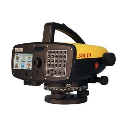
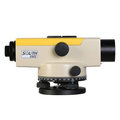
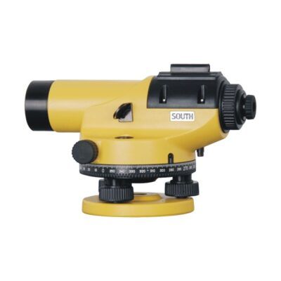
Levellers for surveying come in several different types, including dumpy levels, wye levels, tilting levels, and digital levels. Dumpy levels are the most common type and consist of a telescope with a horizontal and vertical crosshair that’s used to sight a staff or rod. Wye levels are similar to dumpy levels, but they have a pivoting wye mount that allows the telescope to rotate in any direction. Tilting levels have a tilting mechanism that enables the telescope to be adjusted to any angle, while digital levels use electronic sensors to provide more accurate readings.
some popular auto levellers for surveying
How Do Levellers for Surveying Work?
The principle behind levelling is simple: by measuring the height difference between two points, we can determine the slope or gradient of the land. To do this, we need to set up the leveller at a benchmark, which is a known elevation point, and then sight a staff or rod placed at the point being surveyed. By measuring the vertical distance between the leveller and the staff, we can calculate the height difference between the two points.
The leveller’s level bubble is used to ensure the instrument is correctly positioned. If the bubble is not centered, it means the instrument is not level, and the readings will be inaccurate. Levellers for surveying also have a range of adjustments to enable the instrument to be calibrated for different conditions. These adjustments include the horizontal tangent screw, the vertical tangent screw, and the cross-bubble adjustment.
Why are Levellers for Surveying Important?
Levelling is a critical aspect of land surveying, providing essential information for a range of industries. By accurately measuring the height difference between two points, we can create topographic maps that show the shape and contour of the land. This information is crucial for civil engineering projects, where the slope of the land can affect the stability of buildings and infrastructure.
Levelling is also essential for establishing building foundations. By measuring the slope and gradient of the land, engineers can ensure that the foundation is level and stable, preventing structural damage and collapse. Levelling is also used in road construction, where the slope of the road must be carefully measured to ensure safe driving conditions.
Choosing the Right Leveller for the Job
Choosing the right leveller for the job is essential for accurate surveying. Surveyors should consider a range of factors when selecting a leveller, including the type of project, the level of accuracy required, and the environmental conditions. Some of the key factors to consider when selecting a leveller are:
Accuracy
The accuracy of a leveller depends on its design, with digital levels generally providing the highest level of precision. Surveyors should choose a leveller that meets the required level of accuracy for the project.
Environmental Conditions
The environmental conditions can affect the accuracy of the leveller, with factors such as temperature, humidity, and wind speed all potentially affecting readings. Surveyors should choose a leveller that’s suitable for the environmental conditions of the project.
Type of Project
Different types of projects require different levels of accuracy, with complex engineering projects requiring a higher level of precision than basic topographic mapping. Surveyors should choose a leveller that’s suitable for the type of project they’re working on.
Ease of Use
Levellers should be easy to set up and use, with clear and intuitive controls. Surveyors should choose a leveller that’s easy to use, even in challenging field conditions.
Maintenance
Levellers require regular maintenance to ensure accurate readings. Surveyors should choose a leveller that’s easy to maintain and has a reliable service and support network.
Conclusion
Levellers for surveying are an essential tool for land surveying, providing accurate measurements of the height difference between two points. Levelling is critical in civil engineering, construction, and architecture, helping to create accurate topographic maps, establish building foundations, and ensure infrastructure projects are safe and stable. With a range of different types of levellers available, surveyors can choose the right tool for the job, providing reliable and accurate data for a range of industries.