

GNSS
Land Surveying: Understanding the Science of Measuring and Mapping Land
Introduction
Land surveying is the science and technology of measuring and mapping land. It involves the use of various tools and techniques to determine the precise location, shape, and size of land parcels, as well as the boundaries between them. Land surveyors use this information to create accurate maps and plans for a wide range of purposes, including land development, construction, and land-use planning.
The Importance of Land Surveying
Land surveying is critical for a wide range of activities, including construction, land-use planning, and land development. Without accurate surveys, it would be impossible to know the precise location, shape, and size of land parcels, or the boundaries between them. This could lead to disputes and legal issues down the line.
Accurate land surveys are also important for construction projects. Before construction can begin, surveyors must determine the precise location and elevation of the land, as well as any potential hazards or obstacles. This information is used to create construction plans and ensure that the project is built on solid ground.
Land-use planning is another important area where land surveying plays a crucial role. Surveyors use mapping and GIS technology to create detailed maps of the land, which are used to make informed decisions about land-use planning. This includes identifying areas that are suitable for development, as well as those that should be preserved for environmental or other reasons.
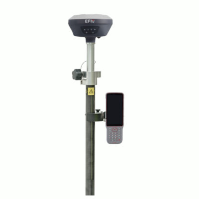
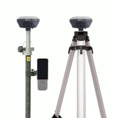
some popular gps rover sets used for land surveying

Types of Land Surveying
There are several different types of land surveying, each with its own set of tools and techniques. Some of the most common types of land surveying include:
-
Boundary Surveying: This type of surveying is used to determine the precise location and boundaries of land parcels. It involves the use of various tools and techniques, including GPS, total stations, and aerial photography, to create accurate maps and plans.
-
Topographic Surveying: This type of surveying is used to determine the shape and elevation of the land. It involves the use of various tools and techniques, including GPS, total stations, and aerial photography, to create detailed maps of the land.
-
Geodetic Surveying: This type of surveying is used to determine the precise location and elevation of large areas of land. It involves the use of advanced tools and techniques, including GPS and satellite imagery, to create accurate maps and plans.
-
Hydrographic Surveying: This type of surveying is used to determine the shape and depth of bodies of water. It involves the use of various tools and techniques, including sonar, GPS, and aerial photography, to create detailed maps of the water bodies.
-
Construction Surveying: This type of surveying is used to determine the precise location and elevation of land for construction projects. It involves the use of various tools and techniques, including total stations, GPS, and aerial photography, to create accurate construction plans.
Land surveying is an essential science that plays a crucial role in a wide range of activities, including construction, land-use planning, and land development. With the help of advanced tools and techniques, surveyors are able to create accurate maps and plans that are used to make informed decisions and ensure that projects are built on solid ground.
Another important aspect of land surveying is the ability to adapt to new technologies. With the advancement of technology, land surveyors are now able to use drones, 3D laser scanning, and GIS software to create more accurate and detailed maps and plans. These technologies allow surveyors to cover larger areas in a shorter amount of time, and to create more detailed and accurate maps.
Another important aspect of land surveying is the ability to work with and communicate with other professionals. Land surveyors often work with architects, engineers, and planners to ensure that their plans and maps are accurate and in line with other project requirements. They also need to be able to effectively communicate with clients and stakeholders to ensure that their needs and requirements are met.
In addition, land surveying also includes other aspects like:
- Cadastral Surveying: This type of surveying deals with the mapping and registration of land ownership. This type of survey is typically used for land registration, land tenure and land information management.
- Mining Surveying: This type of surveying is used in the mining industry to map out mines, determine mineral reserves, and plan mining operations.
- Engineering Surveying: This type of surveying is used to plan and design engineering projects such as roads, bridges, and building foundations.
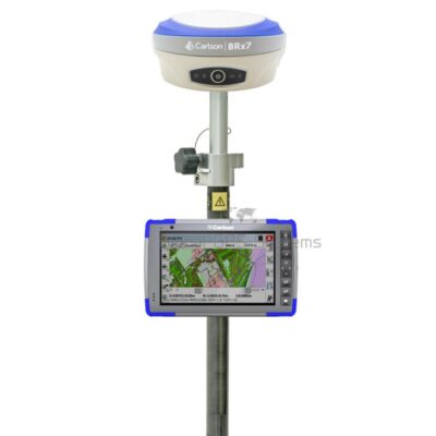
some popular gps rover and base sets for land surveying


Conclusion
In conclusion, land surveying is a critical science that plays a vital role in many areas of life, including construction, land-use planning, and land development. With the help of advanced tools and techniques, surveyors are able to create accurate maps and plans that are used to make informed decisions and ensure that projects are built on solid ground. Land surveying is also an exciting and challenging field that offers many opportunities for career growth and advancement. If you are interested in a career in land surveying, you will need to have a strong background in mathematics, as well as an understanding of the principles and techniques of surveying. Many states also require that land surveyors be licensed, which typically requires passing an exam and meeting other qualifications.
Overall, land surveying is an important and dynamic field that plays a critical role in many aspects of our lives. It is a field that will continue to be in high demand in the future as the population continues to grow and urban areas expand, and technology is constantly advancing. Land Surveyors are key players in the development of our communities, ensuring safety and accuracy in construction and land use.
In summary, land surveying is the science and technology of measuring and mapping land. It involves the use of various tools and techniques to determine the precise location, shape, and size of land parcels, as well as the boundaries between them. Land surveyors use this information to create accurate maps and plans for a wide range of purposes, including land development, construction, and land-use planning. Land surveying is critical for a wide range of activities, including construction, land-use planning, and land development. With the help of advanced tools and techniques, surveyors are able to create accurate maps and plans that are used to make informed decisions and ensure that projects are built on solid ground.