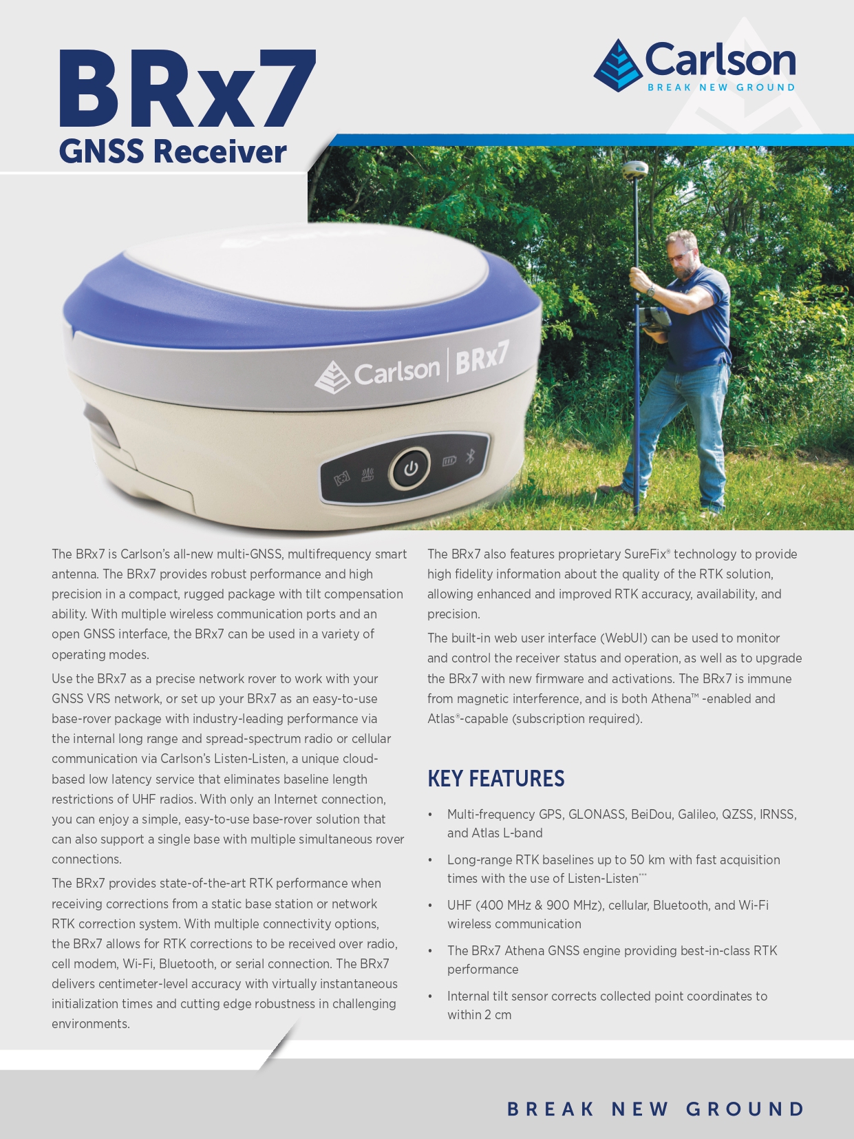
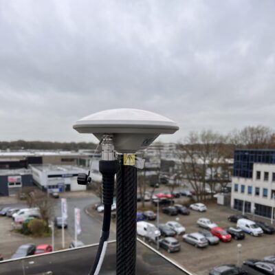
The Carlson BRX7 RTK GNSS Receiver
The Carlson BRX7 is a high-performance GNSS receiver for land surveying and construction. With multi-frequency satellite tracking, tilt compensation, and advanced communication options like GSM LTE and UHF radios, it delivers centimeter-level accuracy and seamless connectivity. Designed for tough environments, the BRX7 ensures reliable, precise data collection on any job site.
| ✅ Channels |
800 |
| ✅ IMU Tilt Sensor |
60º |
| ✅ Internet Modem |
4G |
| ✅ UHF Radio |
410 – 470MHz 902.4 – 928MHz |
| GPS |
L1CA, L1P, L1C, L2P, L2C, L5 |
| GLONASS |
G1, G2, G3, P1, P2 |
| GALILEO |
E1BC, E5a, E5b, E6BC, ALTBOC |
| BEIDOU |
B1i, B2i, B3i, B10C, B2A, B2B, ACEBOC |
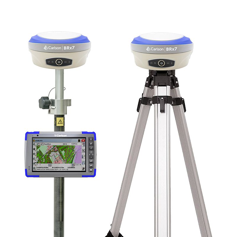
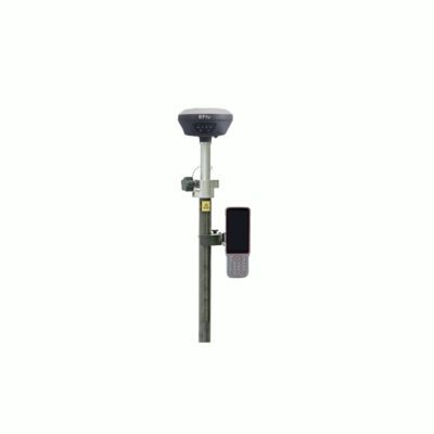
Carlson BRX7 Rover and Base Set: Precision Redefined for Land Surveying and Construction
This high-end GPS set is the ultimate solution for professionals seeking accuracy, efficiency, and reliability in land surveying and construction. This state-of-the-art GNSS rover and base set for land surveying combines advanced technology with rugged durability, delivering centimeter-level precision in even the most challenging environments.
Unmatched Performance with Advanced GNSS Technology
Equipped with multi-frequency satellite tracking, the Carlson BRX7 GNSS rover and base set ensures exceptional signal stability and accuracy. Whether you’re navigating dense urban landscapes or remote construction sites, this system guarantees consistent and precise data collection. Its integrated IMU tilt compensation allows surveyors to capture accurate measurements without needing to level the pole, saving valuable time and reducing human error.
Seamless Connectivity and Versatility with the Carlson BRX7 GNSS Rover and Base Set
Designed for maximum versatility, this GPS set with IMU tilt sensor features advanced communication options, including GSM LTE and UHF radios. This ensures seamless data transmission, enabling professionals to work efficiently across large job sites. As a GNSS set for construction, it adapts effortlessly to various workflows, supporting complex projects with ease.
Built for Tough Environments
Constructed with durability in mind, the Carlson BRX7 GNSS rover and base set is engineered to withstand harsh weather and rugged terrains. Its robust design makes it the ideal GPS set for construction and land surveying professionals who demand reliable performance in any condition.
The Carlson BRX7 Rover and Base Set Solves Common Surveying Struggles
Traditional surveying equipment often struggles with accuracy in challenging terrains, connectivity issues, and time-consuming setups. The Carlson BRX7 rover and base set addresses these challenges with:
- Centimeter-Level Accuracy: Enhanced by multi-frequency GNSS technology and IMU tilt compensation.
- Faster Data Collection: Thanks to its innovative tilt compensation feature, reducing downtime.
- Seamless Communication: With GSM LTE and UHF radios for uninterrupted data transfer.
- Rugged Durability: Designed to perform in extreme conditions without compromising precision.
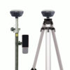
Comprehensive Accessories for Enhanced Versatility
The Carlson BRX7 rover and base set comes complete with all the essential accessories to maximize your efficiency and adaptability in the field:
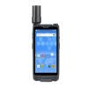
- Carlson RT4 Data Collector: The Carlson RT4 data collector is a robust and reliable device for managing your survey data.
- SurvPC/CE Surveying Software: The SurvPC and SurvCE software are intuitive software solutions that streamlines your workflow and ensures precise results.
- Surveying Pole and Data Collector Bracket: For convenient and stable operation during surveys.
- Tripod, Tribrach, and Adapter: Ensures stability and accuracy for fixed-point measurements.
Customizable Accessories for Your Needs
The Carlson BRX7 set is flexible to match your specific requirements. Prefer using a tablet instead of the included controller? Or need different software for your workflow? These accessories can be easily modified or upgraded to suit your preferences, ensuring the perfect fit for your projects.


Reviews
There are no reviews yet