

 GPS & GNSS
 Lidar scanning
 Total Station
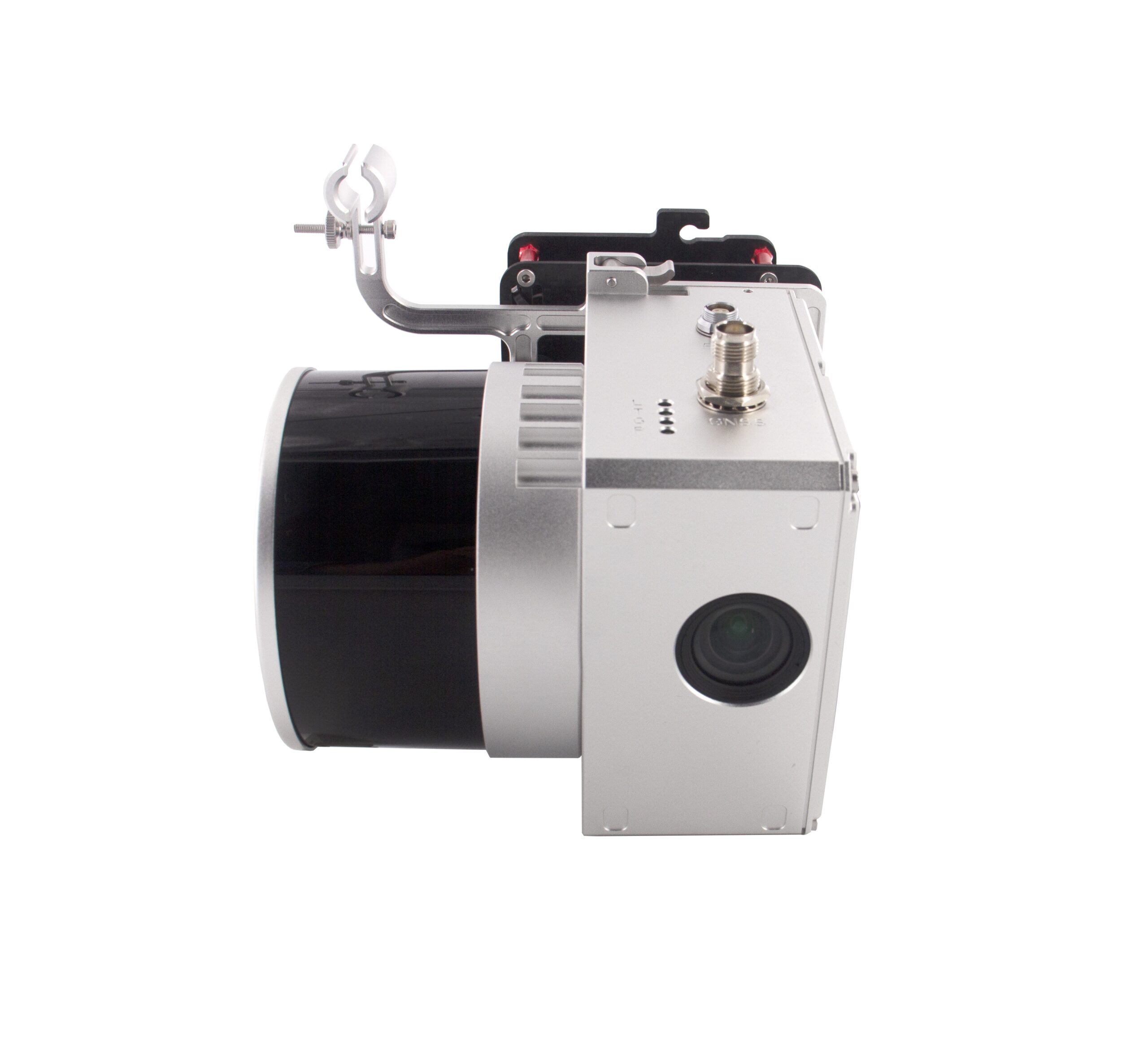
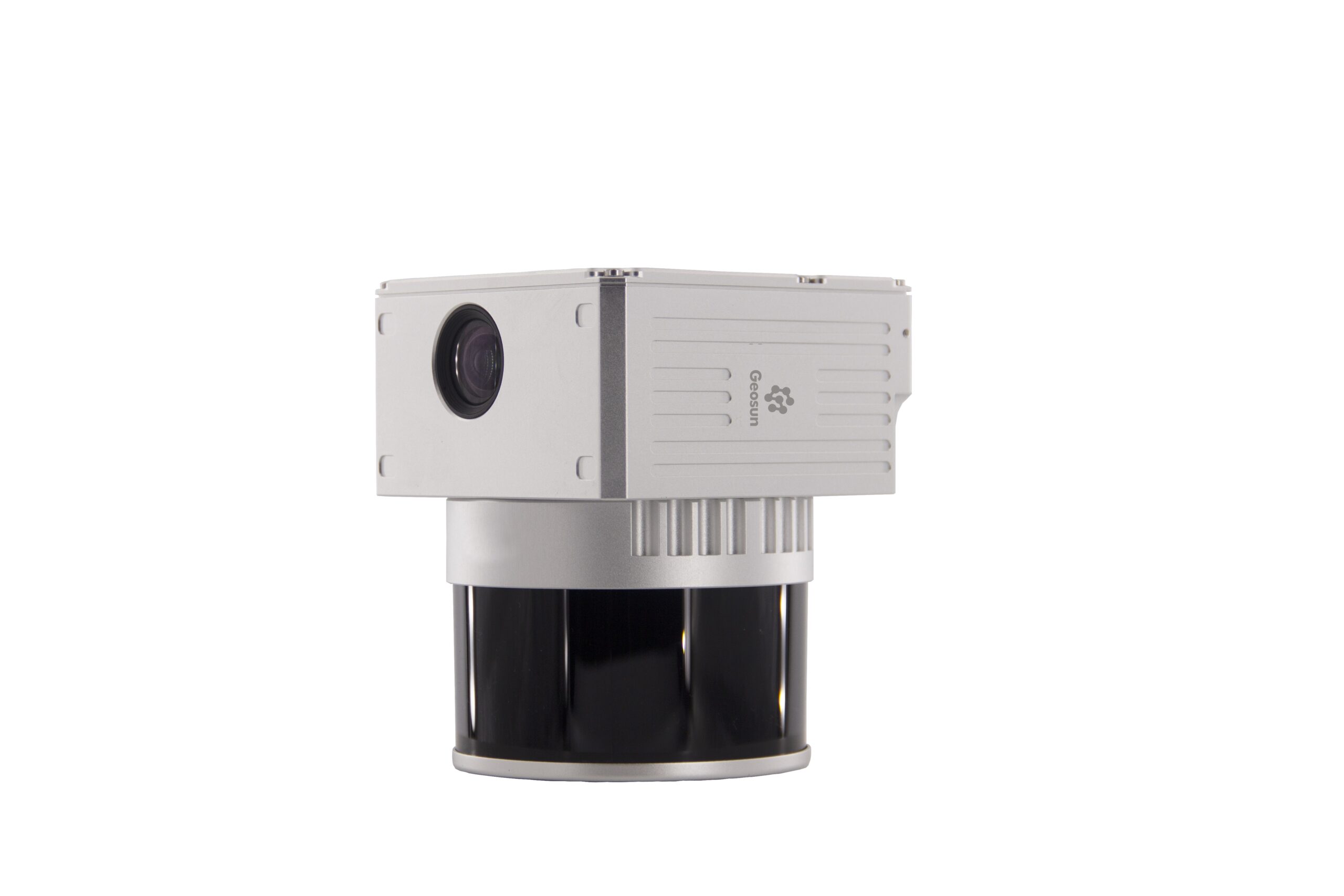
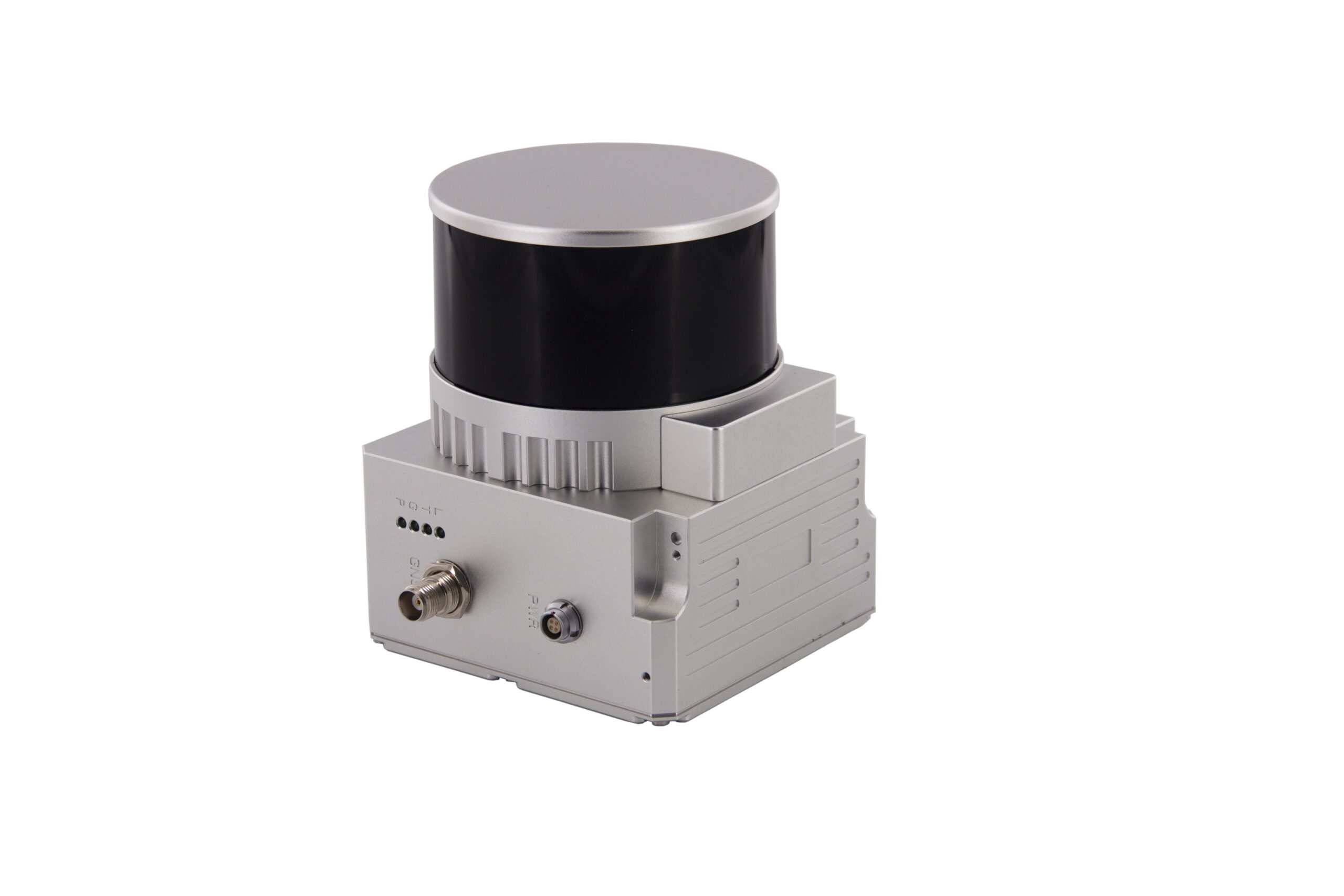
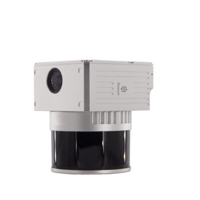
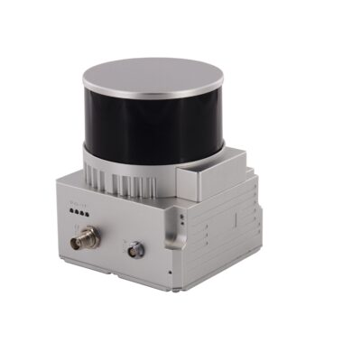
Geosun GS 130X 120m Compact UAV LiDAR Mapping System
Get the best price for your setup
Contact our experts for the best possible price and configuration.
- Fast response
- Expert configuration advice
- No overpaying for features you do not need
The Geosun GS-130X Series is a compact UAV LiDAR mapping system for surveyors, drone operators, engineers and GIS professionals who need detailed 3D data without carrying a heavy long-range payload. It combines a 32-channel laser scanner, GNSS/INS positioning and a 26 MP RGB camera in a lightweight system for multi-rotor and VTOL platforms. With a measuring range of up to 120 m at 10% reflectivity, dual returns and a point-cloud rate of up to 1.28 million points per second, the GS-130X is suited to topographic surveys, construction sites, power-line inspection, mining, forestry, agriculture and urban mapping.
Geosun GS-130X Series Highlights
| LiDAR range | Up to 120 m at 10% reflectivity |
|---|---|
| Laser channels | 32-channel LiDAR |
| Point rate | Up to 1,280,000 points/sec |
| Laser returns | Dual echo |
| Camera | 26 MP RGB camera with 83° FOV |
| GNSS / INS | 200 Hz positioning and attitude system |
| Platforms | Multi-rotor UAV and VTOL |
| Weight | Approx. 1.26 kg for AGS302 and AGS303 configurations |
Valued customers:










Find RTK Networks
Search NTRIP providers and connect to reliable RTK correction services.
Description
Compact UAV LiDAR for detailed 3D mapping
The Geosun GS-130X Series is an integrated LiDAR mapping payload designed for professional drone surveying, engineering, GIS and inspection work. It brings the laser scanner, GNSS positioning, inertial navigation and RGB imaging required for georeferenced point-cloud collection together in one compact unit, making it practical for multi-rotor drones and VTOL aircraft where payload weight and survey efficiency both matter.
Unlike long-range LiDAR systems intended to fly hundreds of metres above the project, the GS-130X is designed around lower-altitude, higher-detail data collection. Its laser provides a measuring range of up to 120 m at 10% reflectivity, making the system particularly suitable for construction sites, terrain surveys, power infrastructure, mines, forestry and other projects where the drone can work relatively close to the surface or object being measured.
32-channel LiDAR with up to 1.28 million points per second
The GS-130X uses a 32-channel laser scanner capable of recording up to 1,280,000 points per second. A high point acquisition rate allows the sensor to capture dense 3D information while the aircraft is moving, helping survey teams represent terrain, buildings, vegetation and infrastructure in detail.
The scanner uses dual echoes, meaning a laser pulse can provide more than one measurement when it interacts with different surfaces. This is useful around vegetation, cables and other complex environments where several objects may lie along the same laser path.
Useful point density at practical UAV flight heights
Geosun’s example operating figures show why the GS-130X is suited to detailed aerial mapping. At an aircraft speed of 10 m/s, the system is specified at approximately 228 points/m² from 50 m and 160 points/m² from 100 m. The corresponding example coverage figures are around 1 km² and 1.68 km² per flight respectively under the manufacturer’s stated conditions.
In real projects, point density and coverage will vary with flight height, speed, overlap, flight pattern, terrain and the surfaces being measured. Flying lower generally increases the amount of geometric detail, while increasing altitude can improve coverage efficiency.
Integrated GNSS and inertial positioning
Accurate airborne LiDAR requires more than measuring the distance between the scanner and the ground. The system also needs to know precisely where the aircraft is located and how the sensor is oriented at the instant each laser point is recorded. The GS-130X therefore combines its LiDAR with a high-rate GNSS and inertial positioning system operating at 200 Hz.
The positioning system supports GPS, GLONASS, BeiDou and Galileo signals. This multi-constellation support provides the trajectory data needed to georeference the laser measurements during post-processing and produce a usable spatial point cloud.
AGS302 and AGS303 configurations
The GS-130X Series is available from Global GPS Systems in AGS302 and AGS303 configurations. Both use the same basic 120 m 32-channel LiDAR concept, 26 MP camera and compact UAV form factor, but their attitude specifications differ.
The AGS302 documentation specifies pitch and roll accuracy of approximately 0.015° and heading accuracy of 0.040°. The AGS303 increases the stated attitude performance to approximately 0.005° pitch and roll and 0.017° heading. This difference is relevant on projects where the quality of the calculated sensor orientation has a stronger influence on the final point-cloud accuracy, especially as flight height increases.
26 MP camera for colour point clouds and visual context
An integrated 26 MP RGB camera with an 83° field of view records imagery alongside the laser data. This imagery can be used to add colour to the point cloud and provides visual context when interpreting terrain, buildings, vegetation and infrastructure.
For surveyors and GIS teams, having imagery and LiDAR collected during the same mission makes it easier to recognise objects in the final dataset and reduces the need to perform an additional photographic flight purely for visual reference.
Lightweight design for professional drones
The AGS302 and AGS303 product documentation lists a system weight of approximately 1.26 kg and dimensions of roughly 11.5 × 11 × 12 cm. This relatively compact form factor helps make LiDAR accessible to professional UAVs without requiring the much larger aircraft normally associated with heavy long-range airborne scanning systems.
The system is designed for multi-rotor and VTOL platforms and operates over a stated temperature range of approximately -20°C to +55°C. Platform compatibility still depends on payload capacity, power supply, mounting, flight time and the required survey configuration.
Topographic surveying and construction mapping
For survey and construction teams, the GS-130X can collect dense elevation and surface information across sites that would take considerably longer to measure point by point from the ground. The resulting LiDAR data can support terrain models, earthwork analysis, site documentation, planning and other engineering workflows.
Because LiDAR measures geometry directly, it can also be useful on surfaces where conventional image-only photogrammetry is more difficult, although project accuracy should always be evaluated against the required deliverable and control workflow.
Power lines, mining, forestry and infrastructure
The combination of high point rate, dual echoes and airborne operation makes the GS-130X suitable for more than conventional land surveying. Geosun demonstrates the system for power-line inspection, mine surveying and water-related infrastructure projects, while its general application areas also include forestry, agriculture and urban planning.
For utility surveys, LiDAR can capture wires, poles, surrounding terrain and vegetation in three dimensions. In mining and earthworks, it can document slopes, excavation areas and stockpiles. Forestry teams can use the multiple returns and dense point cloud to obtain information from different vegetation levels where site conditions allow.
Point-cloud processing workflow
The GS-130X workflow includes Geosun’s Shuttle software for trajectory processing and gAirHawk for LiDAR point-cloud processing. The positioning trajectory is combined with the laser observations to calculate the geographic location of the measured points, after which the point cloud can be taken into suitable survey, GIS, CAD, engineering or specialist LiDAR software.
An optional route-planning workflow can also be used to prepare UAV missions. For repetitive or larger surveys, proper flight planning is important for achieving the required overlap, point density and coverage while making efficient use of available flight time.
Who is the GS-130X designed for?
The GS-130X is particularly relevant for survey companies, construction teams, drone service providers, civil engineers, GIS specialists, utilities, forestry professionals and mine operators that need detailed airborne 3D data without stepping up to a heavier long-range LiDAR payload. Its 120 m class range and high point rate make it a practical choice for low-altitude professional mapping where detail and compact payload size are more important than extreme operating distance.
Choosing the right GS-130X configuration
The choice between AGS302 and AGS303 should be based on the required attitude performance, flight height, expected accuracy and final deliverables rather than laser range alone. Aircraft payload capacity, ground control strategy, vegetation, required point density and processing workflow should also be considered before configuring a complete survey system.
Global GPS Systems can help match the Geosun GS-130X configuration to your UAV platform and project requirements, including the choice between AGS302 and AGS303, expected survey workflow and the supporting hardware required for professional LiDAR data collection.
Specifications
GeoSun gAirHawk GS-130X Series UAV LiDAR Scanning System Specifications
Product Overview
| Product family | GeoSun gAirHawk GS-130X Series |
|---|---|
| Global GPS Systems configurations | GS-130X AGS302 and GS-130X AGS303 |
| Product type | Compact professional UAV / mobile LiDAR mapping system |
| System architecture | Integrated 32-channel LiDAR scanner, multi-constellation GNSS, INS/POS, storage/control unit and RGB mapping camera |
| LiDAR sensor | Hesai XT32 / Pandar XT32 |
| Primary platforms | Multi-rotor UAV, VTOL fixed-wing UAV and vehicle/mobile mapping platforms |
| Primary applications | Topographic surveying, power-line inspection, forestry, vegetation monitoring, mining, urban mapping, land surveying, agriculture, water-conservancy projects, construction, infrastructure inspection and 3D spatial-data acquisition |
AGS302 and AGS303 Comparison
| Specification | GS-130X AGS302 | GS-130X AGS303 |
|---|---|---|
| LiDAR scanner | Hesai XT32 | Hesai XT32 |
| LiDAR channels | 32 | 32 |
| Detection range | Up to 120 m at 10% reflectivity | Up to 120 m at 10% reflectivity |
| System accuracy stated in seller datasheet | ≤10 cm at 110 m | ≤10 cm at 120 m |
| POS update frequency | 200 Hz | 200 Hz |
| Position accuracy | ≤0.05 m | ≤0.05 m |
| Pitch accuracy | 0.015° | 0.005° |
| Roll accuracy | 0.015° | 0.005° |
| Heading accuracy | 0.040° | 0.017° |
| Camera | 26 MP RGB, 16 mm, 83° FOV | 26 MP RGB, 16 mm, 83° FOV |
| Weight | 1.26 kg | 1.26 kg |
| Storage | 64 GB internal; up to 128 GB TF / microSD | 64 GB internal; up to 128 GB TF / microSD |
LiDAR Scanner Specifications
| LiDAR model | Hesai XT32 / Pandar XT32 |
|---|---|
| Number of channels | 32 |
| Laser wavelength | 905 nm |
| Laser class | Class 1 |
| Laser safety standard | IEC 60825-1:2014 |
| Minimum documented range | Approximately 0.3 m |
| Maximum range at 10% reflectivity | 120 m |
| Typical range accuracy | ±1 cm |
| Close-range accuracy | Approximately ±5 cm from 0.3–1 m in detailed GeoSun product documentation |
| Scan frequencies | 10 Hz and 20 Hz |
| Horizontal field of view | 360° |
| FOV configuration | Adjustable |
| Echo mode | Double echo / dual return |
| Maximum published dual-echo point rate | 1,280,000 points/second |
| Beam divergence | Approximately 0.03° × 0.03° in current GeoSun GS-130X solution documentation |
| Vegetation penetration | Small beam divergence and multi-return acquisition are designed for improved penetration and point collection in vegetation |
System Survey Accuracy
| AGS302 datasheet system accuracy | ≤10 cm at 110 m |
|---|---|
| AGS303 datasheet system accuracy | ≤10 cm at 120 m |
| Current manufacturer product-page accuracy | Less than 0.1 m at 120 m |
| Other GeoSun product summaries | 10 cm at 100 m is also published in some GS-130X listings |
| Accuracy dependency | Achievable survey accuracy depends on flight altitude, GNSS conditions, base-station data, trajectory processing, boresight calibration, target geometry and processing workflow |
POS / GNSS / INS Specifications
| Specification | AGS302 | AGS303 |
|---|---|---|
| POS update frequency | 200 Hz | 200 Hz |
| Position accuracy | ≤0.05 m | ≤0.05 m |
| Pitch accuracy | 0.015° | 0.005° |
| Roll accuracy | 0.015° | 0.005° |
| Heading accuracy | 0.040° | 0.017° |
| Trajectory output | Position, velocity and attitude | Position, velocity and attitude |
GNSS Signal Support
| GPS | L1 / L2 / L5 |
|---|---|
| GLONASS | L1 / L2 |
| BeiDou | B1 / B2 / B3 |
| Galileo | E1 / E5a / E5b |
| Supported constellations | GPS, GLONASS, BeiDou and Galileo |
| Survey positioning workflow | GNSS/INS trajectory post-processing for direct georeferencing of LiDAR and image data |
RGB Mapping Camera
| Camera type | Built-in RGB mapping camera on the Global GPS Systems configuration |
|---|---|
| Effective resolution | 26 MP |
| Lens focal length | 16 mm |
| Camera field of view | 83° |
| Camera triggering | Distance- or time-based triggering is documented in GeoSun GS-130X integration information |
| Image georeferencing | Camera data can be synchronized with the system trajectory for colorized point-cloud generation |
| Color point cloud | Supported |
Airborne Mapping Efficiency
| Flight Height | Point Density at 10 m/s | Published Single-Flight Coverage |
|---|---|---|
| 50 m | 228 points/m² | 1 km² |
| 100 m | 160 points/m² | 1.68 km² |
Example Mapping Mission
| Documented system | GS-130X |
|---|---|
| Example flight speed | 10 m/s |
| Example flight altitude | 70 m |
| Example application | Urban planning |
| Typical outputs | Georeferenced point cloud and RGB-colored point cloud |
Electrical Specifications
| Input voltage | 12–24 VDC |
|---|---|
| Power consumption | Approximately 10 W |
| Power source | External aircraft, UAV or vehicle DC supply |
| Power cable | Included in the Global GPS Systems package |
Storage Specifications
| Internal storage | 64 GB |
|---|---|
| Removable storage | TF / microSD card |
| Maximum documented removable-storage capacity | 128 GB |
| Global GPS Systems supplied memory card | 128 GB microSD card |
Physical Specifications
| Weight | 1.26 kg |
|---|---|
| Seller datasheet dimensions | 115 × 110 × 120 mm |
| Later manufacturer published dimensions | Approximately 142–144 × 109 × 120 mm depending on hardware / enclosure revision |
| Housing material | Aluminum-alloy body in GeoSun product documentation |
| Payload class | Compact airborne / mobile LiDAR payload |
Environmental Specifications
| Seller datasheet operating temperature | -20°C to +55°C |
|---|---|
| Later manufacturer operating temperature | -20°C to +65°C in detailed GS-130X product listings |
| Ingress protection | No dedicated model-level IP rating is stated in the reviewed GS-130X datasheets |
| Outdoor use | Designed for UAV and mobile surveying; platform integration should provide any additional weather protection required by the mission |
Platform Compatibility
| Multi-rotor UAV | Supported |
|---|---|
| VTOL fixed-wing UAV | Supported |
| Vehicle / mobile mapping | Supported in GeoSun GS-130X documentation |
| DJI Matrice 300 integration | Documented by GeoSun for applicable mounting configurations |
| Other UAV brands | Supported where payload, power, mounting and flight-controller requirements are compatible |
Trajectory Processing Software
| Software | GeoSun Shuttle |
|---|---|
| Purpose | High-precision GNSS/INS trajectory post-processing |
| Position output | Supported |
| Velocity output | Supported |
| Attitude output | Supported |
| GNSS constellations | GPS, GLONASS, BeiDou and Galileo |
Point Cloud Processing Software
| Software | GeoSun gAirHawk |
|---|---|
| Current documented generation | gAirHawk 5.0 in GeoSun GS-130X product documentation |
| Raw data loading | Supported |
| Point-cloud optimization | Supported |
| Coordinate-system workflow | Four default coordinate options are documented in gAirHawk 5.0 product material |
| Processing start / stop control | Supported |
| Color point cloud | Supported using synchronized RGB imagery |
| LAS output | Supported |
| Custom TXT output | Supported |
Mission Planning Software
| Software | GeoSun WayPoint Master |
|---|---|
| Availability | Optional |
| Purpose | Customized UAV route and LiDAR mission planning |
| Survey mission planning | Supported |
| Corridor applications | Suitable for power lines, roads, waterways and other linear mapping projects |
Typical Applications
| Application | Typical GS-130X Function |
|---|---|
| Topographic surveying | High-density terrain and surface point-cloud acquisition |
| Power-line inspection | Conductor, tower, vegetation and terrain mapping |
| Forestry | Canopy, vegetation and ground-surface mapping using multi-return LiDAR |
| Vegetation monitoring | High-density 3D vegetation and terrain acquisition |
| Mine surveying | Pit, stockpile, slope and terrain mapping |
| Smart-city mapping | Urban 3D point-cloud and colorized spatial-data acquisition |
| Construction | Site documentation, terrain mapping and as-built data acquisition |
| Water conservancy | Reservoir, channel, embankment and surrounding-terrain mapping |
| Agriculture | Terrain and crop / vegetation mapping |
| Land planning | 3D spatial-data acquisition for planning and design |
| Mobile mapping | Vehicle-mounted 360° point-cloud acquisition |
Global GPS Systems Package Contents
| Item | Quantity | Notes |
|---|---|---|
| GS-130X UAV LiDAR scanning system | 1 | AGS302 or AGS303 configuration |
| Power connection cable | 1 | For connection to the compatible UAV / platform power supply |
| GNSS antenna | 1 | External GNSS antenna |
| GNSS antenna cable | 1 | Connects the GNSS antenna to the LiDAR scanning system |
| 128 GB microSD card | 1 | Removable data storage |
| GeoSun Shuttle software | 1 | High-precision GNSS positioning and orientation post-processing software |
| GeoSun gAirHawk software | 1 | LiDAR point-cloud processing software |
| Carrying case | 1 | Protective transport case |
| USB drive | 1 | Software / documentation media depending on supplied configuration |
| Built-in RGB camera | 1 | 26 MP, 16 mm focal length, 83° FOV on the Global GPS Systems package |
Transport Packaging
| Protective case | Suitcase-style hard carrying case with EVA protective liner |
|---|---|
| Published transport-case size | Approximately 450 × 365 × 200 mm in GeoSun product documentation |
| External shipping protection | Protective hard carton around the carrying case is documented by GeoSun |
| Transport suitability | Manufacturer documentation describes the package as suitable for air and sea shipment |
Published Specification Differences
| Specification | Seller Datasheets | Later GeoSun Product Documentation |
|---|---|---|
| System accuracy | AGS302: ≤10 cm at 110 m; AGS303: ≤10 cm at 120 m | Generally stated as less than 0.1 m at 120 m; some summary listings state 10 cm at 100 m |
| Dimensions | 115 × 110 × 120 mm | Approximately 142–144 × 109 × 120 mm in later product listings |
| Operating temperature | -20°C to +55°C | -20°C to +65°C in detailed current product listings |
| LiDAR point rate | Dual echo 1,280,000 pts/s | 1,280,000 pts/s is repeated in current GS-130X solution material; some older mobile-mapping material contains a lower 640,000 pts/s figure |
| POS attitude accuracy | Depends on AGS302 or AGS303 | Current detailed GS-130X listings commonly use the higher-specification AGS303 values of 0.005° pitch/roll and 0.017° heading |
Documentation and Configuration Notes
| Manufacturer | Wuhan GeoSun Navigation Technology Co., Ltd. |
|---|---|
| Manufacturer product family | gAirHawk |
| Global GPS Systems variants researched | GS-130X AGS302 and GS-130X AGS303 |
| Official seller datasheets researched | GS-130X AGS302 POS datasheet and GS-130X AGS303 POS datasheet |
| Additional manufacturer documentation | Current GeoSun GS-130X LiDAR Solution documentation and GeoSun GS-130X UAV / mobile mapping product specifications |
| Main AGS302 / AGS303 difference | The LiDAR and camera specifications are essentially the same in the seller datasheets; AGS303 provides substantially higher published pitch, roll and heading accuracy than AGS302 |
| Hardware-revision note | GeoSun has published GS-130X systems with different enclosure dimensions, temperature limits and point-rate descriptions; final aircraft integration should use the mechanical drawing and electrical specification supplied with the exact unit |
| Survey-planning note | Actual point density, coverage and final accuracy depend on flight altitude, speed, overlap, target reflectivity, GNSS conditions, POS configuration, calibration and processing workflow |
Specifications and package contents may vary by configuration, region or manufacturer update. Always check the current configuration before ordering.
Additional information
| Model | GS-130X AGS302, GS-130X AGS303 |
|---|
Reviews (0)
Only logged in customers who have purchased this product may leave a review.
FAQ
GeoSun GS-130X Series LiDAR Scanning System FAQ
GS-130X Series, Models & Applications
What is the GeoSun GS-130X Series?
The GeoSun GS-130X Series is a compact professional LiDAR mapping system designed primarily for UAV surveying. It integrates a 32-channel laser scanner, multi-frequency GNSS receiver, inertial navigation system, onboard storage and an RGB camera into one payload for collecting georeferenced 3D point clouds and colour imagery.
Which models are available in the GeoSun GS-130X Series?
The GS-130X Series is available in GS-130X AGS302 and GS-130X AGS303 configurations. Both use the same 32-beam LiDAR with a 120 m range at 10% reflectivity, 360° field of view and up to 1.28 million points per second. The main difference is the performance of the integrated positioning and orientation system, with the AGS303 providing higher specified pitch, roll and heading accuracy.
What is the difference between the GS-130X AGS302 and AGS303?
The principal difference is INS attitude performance. The AGS302 is specified with approximately 0.015° pitch/roll accuracy and 0.040° heading accuracy, while the AGS303 improves these specifications to approximately 0.005° pitch/roll and 0.017° heading. Both configurations specify positioning accuracy of up to approximately 0.05 m and use the same core LiDAR technology.
What is the GeoSun GS-130X used for?
Typical GS-130X applications include topographic surveying, land surveying, power-line inspection, forestry, vegetation monitoring, mining, stockpile surveys, water-conservancy projects, agriculture, urban mapping, construction projects and smart-city data collection.
Who is the GeoSun GS-130X designed for?
The GS-130X is designed for professional survey companies, UAV mapping operators, geospatial service providers, engineers, forestry specialists, utility inspection teams, mining companies and other organisations that need high-density 3D spatial data from a compact airborne LiDAR payload.
Can the GS-130X be used in areas with vegetation?
Yes. The GS-130X uses a small laser beam divergence and supports dual returns, making it useful for surveying areas containing trees and other vegetation. Multiple returns can help capture information from vegetation as well as surfaces beneath gaps in the canopy, although ground visibility depends on vegetation density and flight conditions.
LiDAR Range, Accuracy & Point Cloud Performance
What is the measurement range of the GeoSun GS-130X?
The GS-130X has a specified LiDAR measurement range of approximately 120 m on targets with 10% reflectivity. Actual usable range depends on target reflectivity, atmospheric conditions, scan angle, surface characteristics and the required survey accuracy.
How accurate is the GeoSun GS-130X?
The LiDAR scanner has a specified range accuracy of approximately ±1 cm under suitable conditions. GeoSun specifies complete system accuracy of approximately 10 cm at around 110 m for the AGS302 and approximately 10 cm at 120 m for the AGS303. Final project accuracy also depends on GNSS conditions, flight geometry, INS performance, calibration and processing.
What is the difference between LiDAR range accuracy and overall system accuracy?
LiDAR range accuracy describes how accurately the scanner measures the distance between the sensor and a target. Overall system accuracy describes the accuracy of the final georeferenced 3D coordinates and also includes errors from GNSS positioning, aircraft attitude, timing, mounting calibration and data processing.
How many points per second can the GS-130X collect?
The GS-130X can produce up to approximately 1,280,000 points per second in dual-echo operation. The high measurement rate helps create dense point clouds for terrain, buildings, vegetation, utility corridors and other detailed survey features.
What field of view does the GS-130X provide?
The GS-130X provides a full 360° LiDAR field of view, with the scanning field adjustable for different project requirements. Full surrounding coverage can be useful for capturing terrain as well as vertical or oblique features such as façades, towers and power-line structures.
Does the GS-130X support multiple LiDAR returns?
Yes. The GS-130X supports dual-echo measurement. This means a laser pulse can record two returns when it encounters more than one surface, which is particularly useful for collecting information in vegetation and other environments with partially obscured surfaces.
What point density can the GS-130X achieve?
GeoSun's reference specifications list approximately 228 points/m² at a 50 m flight height and approximately 160 points/m² at 100 m when flying at around 10 m/s. Actual point density varies with altitude, speed, scan settings, overlap, terrain and flight-path design.
GNSS, INS, Camera & Processing Software
Does the GeoSun GS-130X include GNSS and an INS?
Yes. The GS-130X integrates a multi-frequency GNSS receiver with an inertial navigation system. The positioning system records the location and orientation of the LiDAR throughout the mission so the individual laser measurements can be transformed into georeferenced 3D coordinates.
Which GNSS satellite systems does the GS-130X support?
The integrated GNSS system supports GPS, GLONASS, BeiDou and Galileo. Documented signals include GPS L1/L2/L5, GLONASS L1/L2, BeiDou B1/B2/B3 and Galileo E1/E5a/E5b.
What is the GNSS/INS update rate of the GS-130X?
The GS-130X positioning and orientation system has a specified update frequency of 200 Hz. A high update rate helps accurately record the rapidly changing position and orientation of a UAV during flight.
Does the GeoSun GS-130X include a camera?
Yes. The GS-130X package offered here includes a built-in 26 MP RGB camera with a 16 mm focal length and an approximately 83° field of view. The imagery can be combined with LiDAR measurements to produce colourised point clouds and additional visual mapping information.
What software is used to process GS-130X data?
The GS-130X workflow uses GeoSun Shuttle for high-precision GNSS/INS trajectory processing and GeoSun gAirHawk for LiDAR point-cloud processing. Together these applications process the recorded navigation and laser data into georeferenced point clouds.
Which point cloud file formats can the GS-130X produce?
The GeoSun processing workflow supports standard LAS point-cloud output as well as custom TXT point-cloud data. LAS is widely supported by professional surveying, GIS, CAD, forestry and point-cloud processing applications.
Is flight-planning software available for the GS-130X?
Yes. GeoSun offers WayPoint Master as an optional customised route-planning solution. Flight planning can be used to define survey routes according to project boundaries, required coverage, flight height, speed and other mission parameters.
UAV Compatibility, Hardware & Field Operation
Which platforms can carry the GeoSun GS-130X?
The GS-130X is designed primarily for compatible multi-rotor and VTOL UAV platforms. GeoSun also documents vehicle-based use for the GS-130X, allowing the same LiDAR technology to be incorporated into suitable mobile-mapping configurations.
How much does the GeoSun GS-130X weigh?
The GS-130X weighs approximately 1.26 kg. Its relatively low weight makes it suitable for professional UAV platforms that have sufficient payload capacity for the LiDAR system, mounting hardware and any other required equipment.
How large is the GeoSun GS-130X?
The documented GS-130X housing measures approximately 11.5 × 11 × 12 cm. Its compact integrated design combines the LiDAR scanner, positioning system, storage, electronics and camera into a single survey payload.
How much onboard storage does the GS-130X have?
The GS-130X has 64 GB of onboard storage and supports a TF memory card up to 128 GB. The package listed for this system includes a 128 GB MicroSD card for recording survey data.
What is the operating temperature range of the GS-130X?
The GS-130X datasheets specify an operating temperature range of approximately -20°C to +55°C. The complete survey should also remain within the environmental limits of the UAV, batteries and other components used with the system.
What is included with the GeoSun GS-130X?
The listed GS-130X package includes the LiDAR scanning system, power connection cable, GNSS antenna, GNSS antenna cable, 128 GB MicroSD card, Shuttle positioning and orientation post-processing software, gAirHawk LiDAR processing software, carrying case, USB drive and built-in 26 MP camera.
 GPS & GNSS
 Total Stations
 Data collectors
 Software
 Correction services
 Machine control
 External radio
 Marine
 Accessories
Reviews
There are no reviews yet