

 GPS & GNSS
 Lidar scanning
 Total Station
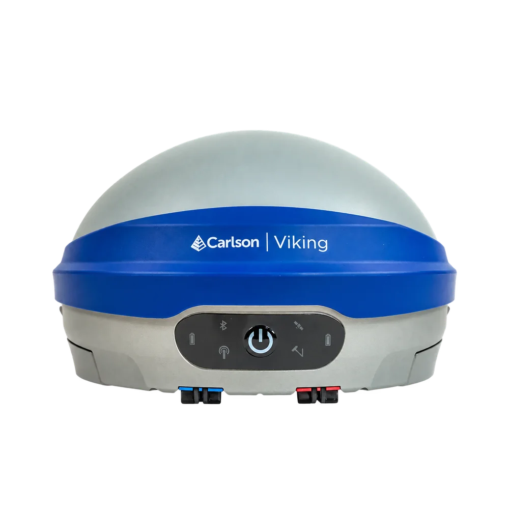
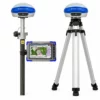
Carlson Viking Triple Fix RTK GNSS Receiver with IMU Tilt
Get the best price for your setup
Contact our experts for the best possible price and configuration.
- Fast response
- Expert configuration advice
- No overpaying for features you do not need
The Carlson Viking is a high-precision multi-frequency RTK GNSS receiver for land surveying, construction, GIS mapping, engineering and other professional positioning work. Configurable as either a rover or base station, it combines two GNSS RTK modules with three independent RTK engines in Carlson’s TRIPLE-FIX architecture, giving field crews an additional level of confidence in the RTK solution when working around buildings, machinery, vegetation and other difficult GNSS environments.
An integrated calibration-free IMU allows measurements with the pole tilted up to 60°, helping crews reach corners, building edges, trenches and other points where keeping the pole perfectly vertical is difficult. The receiver tracks 632 channels across GPS, GLONASS, Galileo, BeiDou, QZSS and NavIC and includes 4G cellular, UHF, Bluetooth and Wi-Fi connectivity for flexible RTK correction workflows. Dual hot-swappable batteries and an IP67-rated enclosure make the Viking suitable for long working days in demanding field conditions.
Carlson Viking Highlights
| RTK technology | 2 GNSS RTK modules with 3 independent RTK engines and Carlson TRIPLE-FIX |
|---|---|
| RTK accuracy | Horizontal 0.6 cm + 0.5 ppm | Vertical 1 cm + 1 ppm |
| IMU tilt compensation | Calibration-free pole tilt compensation up to 60° |
| Satellite tracking | 632 channels with GPS, GLONASS, Galileo, BeiDou, QZSS and NavIC |
| Connectivity | 4G LTE, UHF radio, Wi-Fi, Bluetooth, RS232 and USB Ethernet |
| Field design | IP67 housing, dual hot-swappable batteries, up to approximately 12 hours operation and 1.35 kg with batteries |
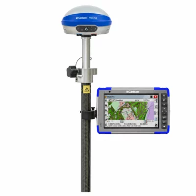
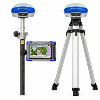
Valued customers:










Find RTK Networks
Search NTRIP providers and connect to reliable RTK correction services.
Description
High confidence RTK positioning for demanding fieldwork
The Carlson Viking RTK GNSS receiver is designed for professionals who need accurate positioning but cannot always work with a completely open view of the sky. Surveyors, construction crews, civil engineers and GIS teams regularly work beside buildings, machinery, trees and other objects that can reflect or obstruct GNSS signals. Viking combines a high-performance GNSS antenna, multi-frequency satellite tracking and Carlson’s GAMA RTK processing technology to provide a robust positioning solution for these environments.
The receiver can work as either a GNSS rover or RTK base station, making it suitable for anything from an individual survey pole to a complete base and rover system. It is designed by Carlson and assembled in Maysville, Kentucky using components from the USA and Europe.
TRIPLE-FIX RTK adds another check to your position
A major difference between the Carlson Viking and a conventional RTK receiver is its TRIPLE-FIX architecture. Inside the receiver are two GNSS RTK modules and three independent RTK engines, including Carlson’s GAMA RTK engine. Rather than relying on only one RTK calculation, the receiver can compare solutions generated by multiple engines.
In practical fieldwork, this gives the operator more information about whether independent calculations agree on the fixed position. That is particularly useful when surveying close to structures, under partial tree cover or around equipment where multipath and poor satellite geometry can make an apparently fixed solution less dependable. It does not remove the need for good survey practice, but it gives experienced operators another layer of information when assessing a measurement.
Measure with the pole tilted instead of perfectly level
The Viking has an integrated six-axis IMU for pole tilt compensation. Once initialized, the system calculates the position of the pole tip even when the receiver itself is not directly above it. There is no routine magnetic calibration procedure, and the inertial sensors are designed to operate without relying on the surrounding magnetic field.
This is particularly useful when measuring building corners, kerbs, fences, trenches, utility features, stockpiles and other points that are difficult to occupy with a perfectly vertical pole. Tilt compensation can be used at inclinations up to 60°, allowing the surveyor to concentrate on placing the pole tip on the point rather than repeatedly leveling the antenna.
Use the Viking as a rover or an RTK base
Viking is designed for flexible correction workflows. As a rover it can receive RTK corrections through an NTRIP connection, direct IP connection, Carlson services, serial connection or UHF radio. Support for common RTK correction protocols including RTCM3, CMR and CMR+ helps the receiver fit into existing GNSS infrastructure instead of limiting it to a single correction method.
When configured as a base station, Viking can transmit corrections through its integrated UHF radio or network-based connections. This makes it suitable for a dedicated local base and rover setup, temporary construction site control or integration into a wider positioning workflow. UHF configuration and permitted radio frequencies vary by region, so the correct regional radio configuration should always be selected for the country where the equipment will be used.
Multi-constellation GNSS for better satellite availability
The receiver has 632 GNSS channels and supports GPS, GLONASS, Galileo, BeiDou, QZSS and NavIC. Tracking multiple constellations and frequencies gives the positioning engine more observations to work with, which can be especially valuable where part of the sky is obstructed.
Carlson also incorporates signal processing intended to reduce the impact of multipath, radio interference, jamming and spoofing. Multipath is particularly relevant on construction sites and in built-up areas because GNSS signals can reflect from walls, vehicles and machinery before reaching the antenna. Reducing the influence of these reflected signals helps the receiver maintain a more stable positioning solution in places where GNSS work is normally more difficult.
Designed for surveying construction GIS and drone work
The Carlson Viking can cover several different roles within a geospatial operation. Land surveyors can use it for control, topographic surveys, setting out and detail collection. Construction teams can use accurate coordinates for site layout, checks and as-built measurements, while GIS crews can capture accurately positioned assets and features directly in the field.
- Surveying: RTK control, topographic work, stakeout and detailed point collection.
- Construction and civil engineering: site layout, position checks and as-built measurements.
- GIS and asset mapping: high-accuracy collection of utilities, infrastructure and other mapped features.
- Drone surveying: survey control and ground control workflows, with the Viking also able to operate as a correction base for compatible RTK drones when the required Carlson software and correction service are configured.
- Marine and specialist positioning: base or rover operation for applications requiring accurate GNSS coordinates and flexible data interfaces.
Connectivity for modern RTK workflows
The Viking includes an integrated 4G LTE cellular modem, configurable UHF radio, Wi-Fi and Bluetooth. Two RS232 interfaces and USB Ethernet provide additional options when the receiver needs to connect with other equipment or specialist software. This combination allows crews to choose between internet-based correction services and a local radio base depending on the project and available infrastructure.
A built-in web interface provides access to receiver configuration, GNSS status, correction settings, data logging and system administration. This is useful for technicians setting up a base station as well as surveyors who want deeper information about receiver status without relying only on the field software.
RINEX logging and static GNSS measurements
In addition to real-time RTK work, the Viking can record raw GNSS observations for static positioning. Recorded data can be exported as RINEX for post-processing and control establishment. Internal storage and a removable SD card provide options for keeping field data on the receiver, making the Viking useful for projects that combine real-time positioning with longer static observations.
Made for long days in the field
The housing carries an IP67 ingress protection rating and is designed to withstand temporary immersion in water. Carlson also specifies MIL-STD-810G shock and vibration testing. The receiver weighs approximately 1.35 kg with both batteries installed, while its dual hot-swappable battery arrangement allows one battery to be replaced while the receiver remains powered by the other.
This is useful during long field sessions because the receiver does not have to be shut down simply to exchange a depleted battery. Batteries can be charged externally, while the receiver also supports external power for longer-term base station installations.
Integrated with Carlson field software
The Carlson Viking is designed to work closely with Carlson SurvPC and Carlson Layout. Surveyors can monitor the RTK solution, IMU status and correction connection directly from their normal field workflow. Supported Carlson Hybrid+ workflows can also combine GNSS observations with robotic total station measurements, which can be useful on projects where some points are better observed with satellites and others with an optical instrument.
Carlson Viking from Global GPS Systems
Choosing the correct GNSS receiver is only part of building a reliable RTK workflow. Global GPS Systems can help determine whether the Carlson Viking should be configured as a rover, base station or complete base and rover system and can assist with compatible data collectors, field software, correction services and accessories. This is particularly useful when the receiver needs to work with an existing NTRIP network, local UHF base, construction workflow or RTK drone setup.
For surveyors, engineers and field crews looking for a professional RTK GNSS receiver with multi-engine position validation, calibration-free IMU tilt compensation and flexible base or rover operation, the Carlson Viking provides a versatile platform for both everyday measurement and more demanding positioning environments.
Specifications
Carlson Viking Specifications
Product Overview
| Product type | High-precision multi-frequency GNSS RTK smart antenna / base and rover receiver |
|---|---|
| Operating modes | RTK Rover and RTK Base Station |
| Positioning technology | Carlson GAMA® RTK navigation engine with Triple-Fix RTK architecture |
| Triple-Fix architecture | 2 GNSS RTK modules with 3 independent RTK engines |
| Integrated orientation sensor | Six-axis IMU with 3D orientation and automatic tilt compensation |
| Typical applications | Land surveying, marine surveying, GIS mapping, construction, machine control and other high-precision RTK applications |
| Assembly | Maysville, Kentucky, USA; components sourced from the USA and Europe |
| Receiver part number | 8015.020.001 |
GNSS and RTK Positioning
| GNSS channels | 632 channels |
|---|---|
| GNSS architecture | Dual GNSS RTK modules |
| RTK engines | 3 independent RTK engines |
| GNSS frequencies | Multi-frequency |
| Supported constellations | GPS, GLONASS, Galileo, BeiDou, QZSS and NavIC (IRNSS); Carlson specifies support for all GNSS constellations and signals supported by the receiver |
| L-Band corrections | Supported |
| RTK horizontal accuracy | 0.6 cm + 0.5 ppm |
| RTK vertical accuracy | 1 cm + 1 ppm |
| Triple-Fix status | Reported when all three RTK engines achieve RTK Fixed and their solutions agree |
| RTK Fixed+ status | Reported when the GAMA® RTK engine and one secondary OEM RTK engine agree |
| Accuracy conditions | Actual accuracy depends on multipath environment, number of satellites, satellite geometry, ionospheric activity and other operating conditions |
IMU and Tilt Compensation
| IMU | Integrated six-axis inertial sensor system |
|---|---|
| Tilt compensation | Automatic, calibration-free pole tilt compensation |
| Maximum published tilt angle | Up to 60° |
| Magnetic interference | IMU solution is designed to operate without reliance on magnetic heading and is specified as immune to magnetic interference |
| IMU calibration | Automatic life-cycle IMU error calibration |
| Hybrid positioning | Tightly coupled GNSS/IMU hybridization for position, velocity, tilt and heading |
Tilt Accuracy with 2 m Pole
| Pole Tilt | Published Accuracy |
|---|---|
| 20° | 0.7 cm |
| 30° | 0.9 cm |
| 45° | 1.2 cm |
| 60° | 1.5 cm |
GNSS Signal Processing
| Anti-jamming | Interference monitoring and mitigation for resistance to GNSS radio-frequency jamming |
|---|---|
| Anti-spoofing | GNSS spoofing protection and monitoring |
| Multipath mitigation | Additional correlators are used to estimate multipath errors in pseudorange and carrier-phase measurements |
| High-dynamic tracking | Designed to maintain GNSS tracking during rapid antenna displacement, vibration and shock |
| Ionospheric mitigation | Processing designed to mitigate normal and scintillating ionospheric conditions, including space-weather events |
| Adaptive filtering | Real-time adaptive filtering adjusts GNSS observation models according to measured signal conditions |
RTK Correction Interfaces and Protocols
| RTK protocol selection | Automatic protocol detection, RTCM3, CMR and CMR+ |
|---|---|
| Rover correction inputs | CLI, Direct IP, Carlson Listen-Listen, TCP Server, NTRIP, serial and UHF |
| Base correction outputs | Supports multiple independent output channels with individually configured correction settings |
| NTRIP | NTRIP client functionality plus configurable internal NTRIP Caster |
| External UHF support | Serial correction output and pass-through configuration for compatible external UHF radios |
Wireless Connectivity
| Cellular modem | Integrated 4G LTE Cat 4 cellular modem |
|---|---|
| Cellular coverage | Region-specific modem versions for North America, South America, APAC, EMEA and Asia |
| Cellular antennas | 2 internal antennas |
| Wi-Fi | Integrated single-band 2.4 GHz Wi-Fi |
| Wi-Fi standards | 802.11 ax/ac/a/b/g/n as specified in the Carlson Viking v1.12 manual |
| Bluetooth | Bluetooth 2.1 + EDR and Bluetooth Low Energy 5.4 |
| Integrated UHF | Fully configurable UHF radio with transmit and receive capability in rover and base modes |
| UHF bands | 400 MHz and 900 MHz options; permitted frequencies and settings are region dependent |
| Approved UHF antenna gain | 0 dBi and 5 dBi whip antennas, country dependent |
| UHF antenna impedance | 50 Ω |
| UHF connector | TNC antenna connector |
Processor, Memory and Storage
| Main processor | 1.7 GHz dual-core 64-bit ARM processor; Carlson product specifications identify dual Cortex-A55 cores |
|---|---|
| Secondary processor | 250 MHz Cortex-M33 according to the Carlson product specification |
| RAM | 2 GB DDR4 |
| Internal storage | 16 GB eMMC |
| Removable storage | Removable SD card for data recording |
Physical Ports and Interfaces
| Serial interfaces | 2 × RS-232 |
|---|---|
| USB connectivity | USB connection supporting Ethernet over USB |
| 5-pin connector | ODU G80F1C-P05QF00-0000; external DC power and RS-232 serial interface |
| 7-pin connector | ODU G80F1C-P07QC00-0000; USB / Ethernet-over-USB and diagnostic RS-232 interface |
| SD card access | Removable SD card slot |
| SIM card | Internal cellular SIM card support |
| UHF antenna connection | TNC connector |
5-Pin Connector Pinout
| Pin | Signal | Function |
|---|---|---|
| 1 | GND | Ground |
| 2 | TXD | RS-232 output |
| 3 | GND | Ground |
| 4 | RXD | RS-232 input |
| 5 | Power | External power input |
7-Pin Connector Pinout
| Pin | Signal | Function |
|---|---|---|
| 1 | Reserved | Reserved |
| 2 | RXD | RS-232 input |
| 3 | USB_DN (-) | USB data negative |
| 4 | USB_DP (+) | USB data positive |
| 5 | GND | Ground |
| 6 | USB VBUS | USB power |
| 7 | TXD | RS-232 output |
Data Output and Logging
| Standard NMEA | NMEA 0183 v4.11 |
|---|---|
| Standard NMEA network port | 8092 over Ethernet or Wi-Fi |
| Carlson proprietary NMEA | Supported |
| Proprietary NMEA network port | 8082 over Ethernet or Wi-Fi |
| NMEA serial output | Supported over RS-232 |
| NMEA Bluetooth output | Supported |
| NMEA position references | APC, ARP or user-defined offset |
| Native binary logging | Carlson NJS binary format |
| RINEX | RINEX 3 and RINEX 4 files can be generated/downloaded through the Web UI |
| Logging modes | Static, Stop+Go and Kinematic |
| Logging rate | User configurable |
| Extended diagnostic logging | Supported |
Antenna Reference and Survey Measurements
| GPS L1 phase-center offset | 74.34 mm |
|---|---|
| GPS L2 phase-center offset | 68.55 mm |
| Antenna Reference Point (ARP) | Base of the antenna mount |
| Slant Height Measurement Point (SHMP) | Outer edge of the integrated blue Viking antenna |
| SHMP offset above ARP | 42 mm |
| 5/8" quick-release adapter height offset | +40 mm |
| UHF extension bracket height offset | +3 mm |
Battery and Power
| Battery system | 2 removable lithium batteries |
|---|---|
| Battery capacity | 25 Wh per battery |
| Hot-swappable | Yes; batteries are designed to be replaced one at a time while maintaining operation |
| Published battery runtime | Up to 12 hours in the v1.12 hardware specifications table; published Carlson materials contain differing runtime figures depending on document and operating conditions |
| Battery storage life | More than 6 months; approximately 5% discharge per month specified in the manual |
| External DC input | 11–17 V DC according to the v1.12 technical specification table |
| Recommended external voltage | 13.8 V DC |
| External charging | Dual-bay external battery charger |
| In-unit charging / power | Supported through the supplied power connection; Carlson product information specifies USB-C in-unit charging |
| Battery indicators | Separate status indication for Battery A and Battery B |
Dimensions and Construction
| Dimensions (W × L × H) | 159 × 159 × 95 mm |
|---|---|
| Approximate product-page size | 160 mm diameter × 95 mm high |
| Weight | 1.35 kg / 2.98 lb with 2 batteries installed |
| Housing | Anodized aluminium housing |
| Top cover | Plastic |
| Seal | Nitrile rubber O-ring |
| Fasteners | Steel screws |
Environmental and Ruggedness
| Ingress protection | IP67 |
|---|---|
| Water protection | Protected against temporary immersion to a depth of 1 m |
| Operating temperature | -40°C to +65°C (-40°F to +149°F) |
| Recommended internal-battery temperature range | -10°C to +65°C to reduce battery degradation |
| Low-temperature battery note | Battery degradation may occur below -20°C |
| Storage temperature | -40°C to +85°C (-40°F to +185°F) |
| Humidity | Up to 100% |
| Mechanical shock | MIL-STD-810G, Method 516.6 |
| Vibration | MIL-STD-810G, Method 514.6 |
| Range-pole drop | 2 m drop on concrete floor |
| Free drop | 1 m free drop on hardwood floor |
| Flammability / safety | Specified to fulfil applicable US and EU safety standards; UL-recognized batteries |
| Chemical resistance | Cleaning agents, soapy water, industrial alcohol, water vapor and solar/UV radiation |
User Interface and Indicators
| Power control | Front-panel power button |
|---|---|
| Status indications | GNSS, Battery A, Battery B, IMU Tilt, Corrections and Bluetooth status functions are identified on the front panel |
| GNSS indicator | Blinks when position is valid; solid when RTK Fixed |
| Corrections indicator | Blinks when new GNSS corrections are received |
| Tilt indicator | Multi-colour status indication for IMU initialization and alignment condition |
| Battery LED ≥40% | Solid green |
| Battery LED 20–40% | Blinking yellow |
| Battery LED below 20% | Blinking red |
| Audio | Integrated speaker for GNSS status indications and warning beeps |
Configuration and Software Integration
| Integrated management interface | Built-in browser-based Web UI |
|---|---|
| Default local Web UI address | 192.168.10.1 |
| Web UI access | Wi-Fi or Ethernet over USB |
| Web UI authentication | Password-protected local interface |
| GAMA® command interface | GAMA® CLI for receiver configuration and third-party integration |
| GAMA® CLI network port | 8086 unless disabled by firewall configuration |
| Carlson field software | Designed for integration with Carlson SurvPC and Carlson Layout / Grade workflows |
| SurvPC compatibility note | Receivers with GAMA firmware 1.4.2 or later require Carlson SurvPC 7.12 or later |
| Firmware update | Automatic update check with internet access or manual firmware upload through the Web UI |
| Network security | Configurable services firewall / network access control |
Compliance and Certifications
| CE | CE marked; compliance stated with Radio Equipment Directive 2014/53/EU |
|---|---|
| FCC | FCC Part 15 Class B digital device compliance |
| Canada | ISED; CAN ICES-003(B) / NMB-003(B) |
| Australia / New Zealand | Regulatory Compliance Mark (RCM) |
| Environmental compliance | WEEE, RoHS and REACH compliance stated by Carlson |
| UHF regulatory configuration | UHF frequencies, licensing and permitted radio settings depend on country or region; 900 MHz operation uses regional configuration and firmware-enforced restrictions where applicable |
| COCOM operating limit | GNSS measurements, output streams and logging are disabled if calculated velocity exceeds 1,000 knots or calculated altitude exceeds 18,000 m until the condition clears |
Viking Rover Kit
| Item | Quantity | Part Number / Notes |
|---|---|---|
| Viking GNSS Smart Antenna | 1 | 8015.020.001 |
| Viking Battery | 2 | 8015.058.001 |
| Viking dual-bay external battery charger | 1 | 8015.060.001 |
| Viking USB Wall Charger | 1 | 8015.060.002 |
| Viking 7-pin Blue USB-A Data Cable | 1 | 8015.064.001 |
| Viking 5-pin Red USB-C Power Cable | 1 | 8015.064.005 |
| UHF 400 MHz antenna | 1 | 8015.042.001 |
| UHF 900 MHz antenna | 1 | 8015.042.002 |
| 5/8" quick-release adapter | 1 | 8015.085.001 |
| Viking Rover Case | 1 | 8015.080.002 |
Kit part number: 8015.020.001
Viking Rover + Base Kit
| Item | Quantity | Part Number / Notes |
|---|---|---|
| Viking GNSS Smart Antenna | 2 | 8015.020.001 |
| Viking Battery | 4 | 8015.058.001 |
| Viking dual-bay external battery charger | 2 | 8015.060.001 |
| Viking USB Wall Charger | 1 | 8015.060.002 |
| Viking 7-pin Blue USB-A Data Cable | 1 | 8015.064.001 |
| Viking 5-pin Red USB-C Power Cable | 2 | 8015.064.005 |
| Viking 5-pin Red Power Cable to SAE | 1 | 8015.064.002 |
| Viking Power Cable SAE to alligator clips | 1 | 8015.064.003 |
| UHF 400 MHz antenna | 2 | 8015.042.001 |
| UHF 900 MHz antenna | 2 | 8015.042.002 |
| 5/8" quick-release adapter | 2 | 8015.085.001 |
| UHF cable extension bracket | 2 | 8015.064.004 |
| Tape Measure | 1 | 8015.080.004 |
| Tribrach | 1 | 8030.054.001 |
| Tribrach Adapter | 1 | 8030.054.020 |
| Viking Rover + Base Case | 1 | 8015.080.003 |
Kit part number: 8015.020.002
Specifications and package contents may vary by configuration, region or manufacturer update. Always check the current configuration before ordering.
Reviews (0)
Only logged in customers who have purchased this product may leave a review.
FAQ
Carlson Viking FAQ
Product, Technology & Applications
What is the Carlson Viking?
The Carlson Viking is a multi-frequency GNSS RTK smart antenna designed for centimeter-level positioning. It can operate as either an RTK rover or base station and combines dual GNSS RTK modules, three RTK engines, an integrated IMU, UHF radio, cellular connectivity and a built-in web interface.
Who is the Carlson Viking designed for?
The Viking is designed for professionals who need high-accuracy GNSS positioning, including land surveyors, civil engineers, GIS and mapping professionals, construction layout crews, marine surveyors and users of advanced RTK or machine-control workflows.
Can the Carlson Viking be used as both a base station and a rover?
Yes. A Viking can be configured as an RTK rover receiving corrections or as a base station transmitting corrections to compatible rovers. This allows the same receiver platform to be used for different GNSS field workflows.
What is Triple-Fix technology on the Carlson Viking?
Triple-Fix uses two independent GNSS RTK modules and three RTK positioning engines to cross-check the calculated position. When the Carlson GAMA engine agrees with one secondary engine, the receiver can report RTK Fixed+. When all three independent solutions agree, it reports Triple-Fix. This architecture is designed to increase confidence in the RTK solution and reduce the risk of an incorrect fix.
What is the Carlson GAMA RTK engine?
GAMA is Carlson Software's RTK navigation engine. It uses multi-frequency GNSS observations, adaptive filtering, signal-quality monitoring, outlier detection and tightly integrated IMU data to calculate high-precision positioning in changing field conditions.
Where is the Carlson Viking made?
The Carlson Viking is designed and engineered by Carlson Software and assembled in Maysville, Kentucky, USA, using components sourced from the United States and Europe.
Accuracy, GNSS & Tilt Compensation
What RTK accuracy does the Carlson Viking provide?
Carlson specifies RTK horizontal accuracy of 0.6 cm + 0.5 ppm and vertical accuracy of 1 cm + 1 ppm. Actual accuracy depends on factors such as satellite geometry, correction quality, baseline length, multipath, atmospheric conditions and the number of satellites available.
How accurate is the Carlson Viking when the survey pole is tilted?
With a 2 m pole, Carlson specifies tilt-compensated accuracy of approximately 0.7 cm at 20 degrees, 0.9 cm at 30 degrees, 1.2 cm at 45 degrees and 1.5 cm at 60 degrees. This allows points to be measured without keeping the pole perfectly vertical.
Does the Carlson Viking tilt sensor require calibration?
The integrated IMU provides automatic, calibration-free pole tilt compensation. It is designed to be immune to magnetic interference and automatically maintains its calibration during operation. Some movement may be required to initialize or maintain the IMU solution, and the receiver provides a status indicator showing when tilt compensation is ready.
Which satellite constellations does the Carlson Viking support?
The Viking is a 632-channel, multi-frequency GNSS receiver that supports major satellite constellations including GPS, GLONASS, Galileo, BeiDou, QZSS and NavIC/IRNSS. Tracking multiple constellations and frequencies increases the number of observations available for positioning.
Can the Carlson Viking work near buildings, machinery or other difficult GNSS environments?
The Viking includes multipath mitigation and advanced signal-processing technology designed to improve positioning reliability where GNSS signals can be reflected or disturbed, such as near buildings, heavy machinery and construction sites. GNSS performance can still be affected when satellite visibility is severely obstructed.
Does the Carlson Viking protect against GNSS jamming and spoofing?
The Viking includes interference monitoring and mitigation technology designed to increase resilience against radio interference, GNSS jamming and spoofing. Its signal-processing system also includes technology intended to improve operation during high vibration, ionospheric scintillation and solar-weather events.
Does the Carlson Viking support L-Band corrections?
Yes. Carlson lists support for L-Band corrections as part of the Viking's GNSS capabilities. Availability and use of a particular L-Band correction service depend on the correction provider, geographic coverage and the required service configuration.
RTK Corrections, Connectivity & Software
Does the Carlson Viking work with Carlson SurvPC and Carlson Layout?
Yes. The Viking is designed for integration with Carlson SurvPC and Carlson Layout field software. SurvPC can be used to configure the receiver, collect survey data and manage base and rover workflows.
Can the Carlson Viking connect to an NTRIP or network RTK service?
Yes. In rover mode, the Viking can receive RTK corrections through NTRIP as well as UHF, Direct IP, TCP, serial connections and supported Carlson correction services. The receiver supports common RTK correction protocols including RTCM3, CMR and CMR+.
Does the Carlson Viking require an internet connection?
No. An internet connection is not required for every workflow. A Viking base and rover can communicate using UHF radio, for example. Cellular or other network connectivity is required when the chosen correction source or workflow depends on an internet-based service such as NTRIP.
What communication options are built into the Carlson Viking?
The Viking includes Wi-Fi, Bluetooth, an LTE Cat 4 cellular modem and configurable UHF radio. It also provides serial RS-232 connections, Ethernet over USB and removable SD-card storage, allowing it to support a range of field and integration workflows.
What can be configured through the Carlson Viking Web UI?
The built-in Web UI can be used from a compatible browser to configure rover or base operation, networking, correction inputs and outputs, NTRIP settings, satellite settings and data logging. It can also display GNSS position status, satellites, IMU attitude, correction age, networking information, storage and system diagnostics, as well as provide firmware and administration functions.
Can the Carlson Viking log raw GNSS data and export RINEX?
Yes. The Viking can record Carlson NJS raw GNSS data and NMEA data to internal storage or an SD card. Recorded NJS observations can be downloaded as RINEX 3 or RINEX 4 for post-processing. Carlson also documents workflows for using RINEX 3 observations with services such as OPUS and AUSPOS. Standard NMEA 0183 output and the GAMA command-line interface are available for integration with compatible third-party systems.
Battery, Durability & Field Use
How long does the Carlson Viking battery last?
The Viking uses two removable lithium batteries, and the current Carlson user manual specifies battery life of up to approximately 12 hours. Actual operating time depends on factors such as radio use, cellular connectivity, temperature, receiver configuration and battery condition.
Can Carlson Viking batteries be changed without turning the receiver off?
Yes. The two batteries are hot-swappable, allowing one battery to be replaced while the other continues powering the receiver. Carlson instructs users not to remove both batteries simultaneously while the unit is operating.
How are the Carlson Viking batteries charged?
The batteries can be charged using the supplied external dual-bay charger. The receiver also supports in-unit charging through its power connection and USB-C charging cable, making it possible to recharge or externally power the unit in different field setups.
Is the Carlson Viking waterproof and suitable for harsh field conditions?
The Viking has an IP67 ingress-protection rating and is designed to resist dust and temporary immersion in water to a depth of 1 metre. It is also tested for shock and vibration to MIL-STD-810G methods and is designed for demanding surveying and construction environments.
What is the operating temperature range of the Carlson Viking?
The specified receiver operating range is -40°C to +65°C, with a storage range of -40°C to +85°C. Carlson notes that battery performance can degrade at very low temperatures and recommends approximately -10°C to +65°C when using the internal batteries to reduce battery degradation.
How large and heavy is the Carlson Viking?
The Viking measures approximately 159 × 159 × 95 mm and weighs approximately 1.35 kg with both lithium batteries installed. It uses a standard 5/8-inch survey mounting interface and can be installed on a range pole or suitable base-station setup.
 GPS & GNSS
 Total Stations
 Data collectors
 Software
 Correction services
 Machine control
 External radio
 Marine
 Accessories
Reviews
There are no reviews yet