

 GPS & GNSS
 Lidar
 RTK Data & NTRIP
 Total Station
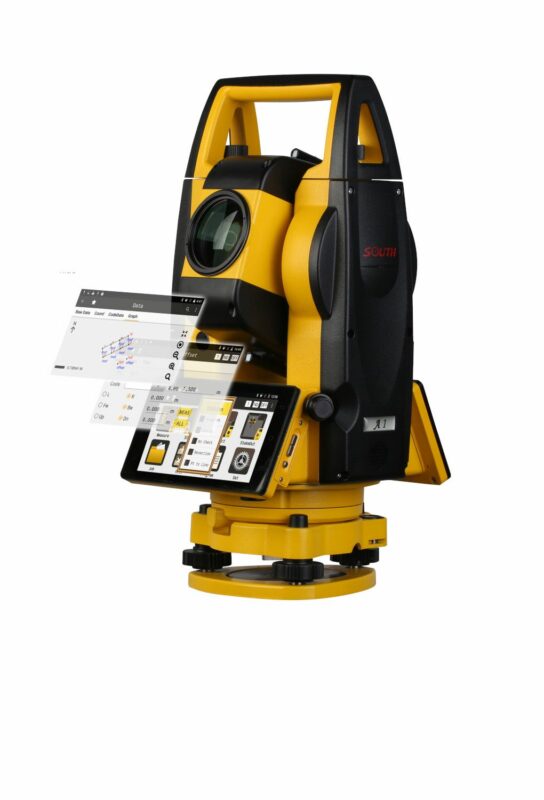
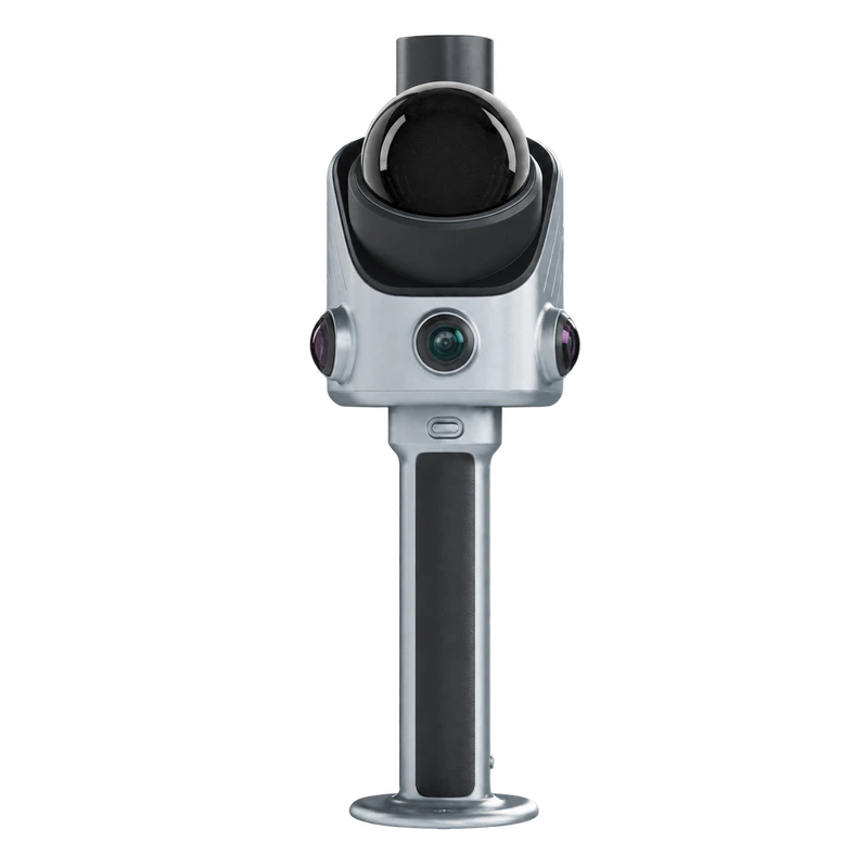
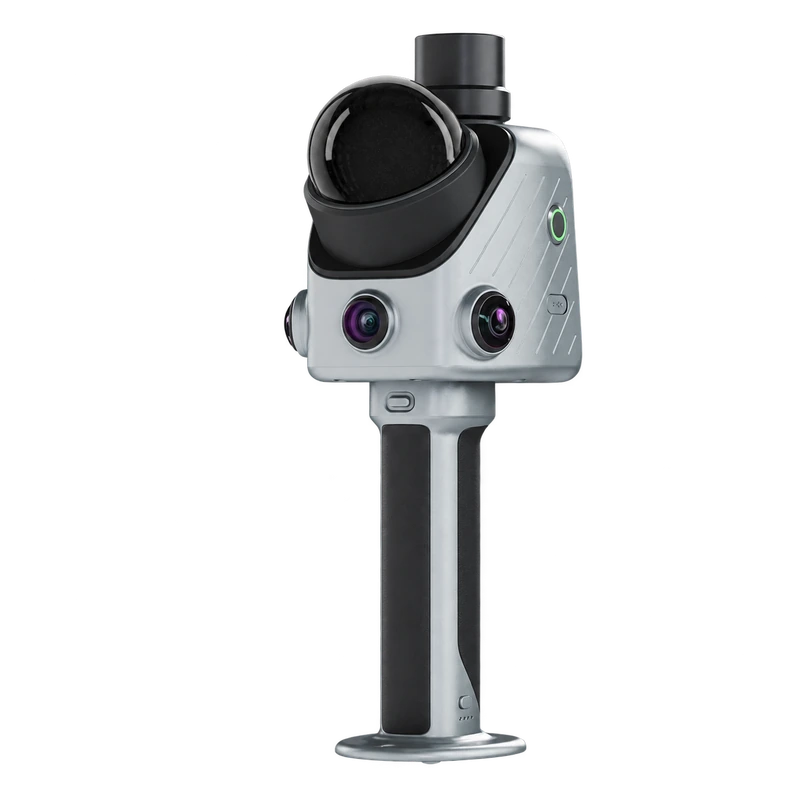
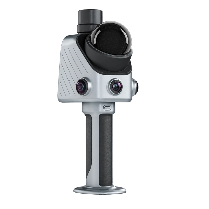
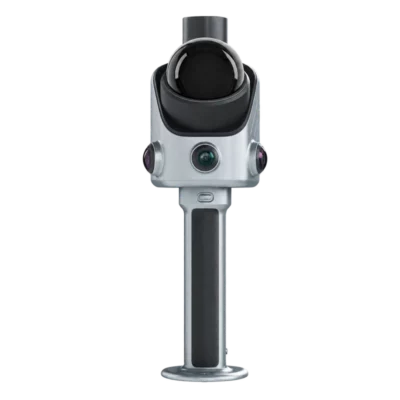
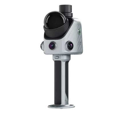
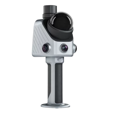
FJD Trion X1 Handheld SLAM LiDAR Scanner with GNSS and 360 Camera
Get the best price for your setup
Contact our experts for the best possible price and configuration.
- Fast response
- Expert configuration advice
- No overpaying for features you do not need
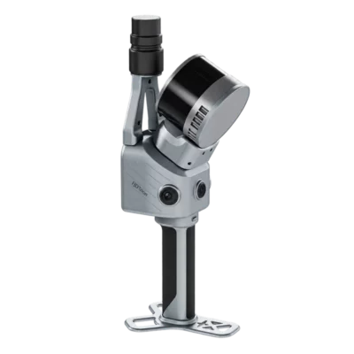
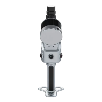
The FJD Trion X1 is a handheld 3D SLAM LiDAR scanner designed for professional surveying, construction documentation, infrastructure inspection and asset mapping. Combining laser scanning, GNSS-assisted positioning and 360° imaging, it allows operators to capture detailed 3D point clouds while walking through buildings, construction sites and outdoor environments.
With a scanning range of up to 70 m, 384,000 points per second and specified post-processing accuracy of ≤1 cm relative and 3 cm absolute under test conditions, the Trion X1 supports detailed reality capture. Its 3.9-inch OLED display provides guided scanning instructions, while integrated issue marking and voice notes help connect field observations directly to the scanned environment. FJD Trion Model Web supports task planning, collaboration and reporting, making the X1 particularly useful for teams that need a consistent scanning workflow across multiple sites.
FJD Trion X1 Highlights
| Scanning technology | Handheld 3D LiDAR with Visual SLAM |
|---|---|
| Scanning range | 40 m at 10% reflectivity; 70 m at 80% reflectivity |
| Scanning speed | 384,000 points per second |
| Post-processing accuracy | ≤1 cm relative; 3 cm absolute under specified conditions |
| Field of view | 360° horizontal × 62° vertical |
| Camera system | 2 × 48 MP panoramic cameras and front-facing camera |
| Positioning | Integrated GNSS-assisted positioning and georeferencing |
| Display | 3.9-inch OLED touchscreen-style field interface |
| Field documentation | Guided scanning, issue marking and voice observations |
| Battery life | Up to 5 hours with one set of two batteries |
| Weight and protection | 900 g main unit; 1.3 kg full setup; IP54 |
Valued customers:










Find RTK Networks
Search NTRIP providers and connect to reliable RTK correction services.
Description
FJD Trion X1 Handheld SLAM LiDAR Scanner for Professional 3D Mapping
The FJD Trion X1 is a professional handheld 3D LiDAR scanner developed for surveying, construction documentation, infrastructure inspection and digital site mapping. Combining SLAM laser scanning, GNSS-assisted positioning, panoramic imaging and a built-in display, it allows operators to capture detailed spatial information while moving through buildings and outdoor environments.
What sets the Trion X1 apart is its integrated approach to fieldwork. Instead of simply collecting a point cloud, users can follow predefined scanning tasks, mark important issues directly in the captured data and record observations during the survey. The collected information can then be reviewed and organised through FJD Trion Model Web, helping teams create consistent and traceable site documentation.
With a scanning rate of 384,000 points per second, a maximum measurement range of 70 metres and a lightweight 1.3 kg complete setup, the Trion X1 is suitable for surveyors, construction companies, engineers, GIS specialists and inspection teams that need efficient 3D data collection across different project locations.
384000 Points per Second for Detailed 3D Scanning
The FJD Trion X1 captures up to 384,000 laser measurements per second, creating a three-dimensional representation of the surrounding environment as the operator moves through the survey area. The scanner uses SLAM technology to estimate its position and orientation while continuously collecting measurements.
With a 360° horizontal and 62° vertical scanning field of view, the X1 can collect information about walls, building structures, roads, vegetation, machinery and other visible surfaces. This is particularly useful for documenting environments where collecting individual measurements with a traditional surveying instrument would require many separate setups.
The LiDAR sensor provides a measurement range of up to 40 metres on surfaces with 10% reflectivity and 70 metres on surfaces with 80% reflectivity. In practice, bright surfaces may be detected at greater distances than dark or poorly reflective materials.
The resulting point clouds can be used to study existing conditions, extract dimensions, create 3D models and prepare data for construction, engineering and GIS workflows.
Centimetre-Level Accuracy for Reality Capture
The FJD Trion X1 provides specified post-processing point cloud accuracy of 1 cm or better for relative measurements and 3 cm for absolute measurements under laboratory test conditions. This makes it relevant for documenting building geometry, infrastructure features and site conditions where detailed spatial information is required.
Relative accuracy describes the consistency of measurements within the processed point cloud, while absolute accuracy describes how closely the data corresponds to its reference coordinate system. The distinction matters when combining LiDAR data with existing surveying measurements or engineering drawings.
Actual accuracy depends on the environment, scanning procedure, SLAM performance, available positioning information and processing methods. Projects requiring verified engineering coordinates should include suitable control measurements and independent accuracy checks.
Guided Scanning for Consistent Fieldwork
One of the main advantages of the FJD Trion X1 is its guided reality capture workflow. Survey managers can define a task before sending an operator to the site, helping ensure that the required areas, features and observations are included in the survey.
Using FJD Trion Model Web, teams can define the capture area, plan a scanning route and identify important priorities. The task can then be synchronised with the Trion X1, allowing the operator to follow the instructions directly on the scanner’s built-in display.
This is particularly useful for construction companies, inspection teams and organisations that work across multiple sites. Instead of relying entirely on individual operator experience, the scanning procedure can be prepared in advance and followed consistently.
For example, a construction inspection team can define which rooms, structural components or installations must be recorded before arriving at the project location. The operator can then follow the planned route and document issues as they are encountered.
Mark Issues Directly in the 3D Point Cloud
The Trion X1 allows operators to mark important observations during scanning using an on-screen crosshair. These issue markers can be associated with locations in the captured three-dimensional data, helping connect inspection findings to the physical environment.
This is useful when documenting construction defects, damaged infrastructure, maintenance requirements or other site conditions that need further attention.
Instead of preparing a separate list of observations and manually matching them to photographs or drawings afterwards, the operator can connect an issue to the scanned location during the field visit.
Project managers and engineers can subsequently review the scan and its associated observations to better understand where each issue was recorded. This creates a more useful record for follow-up inspections, maintenance planning and project discussions.
Voice Notes and Field Observations
The FJD Trion X1 supports voice observations during scanning, allowing operators to record useful information without stopping to write detailed notes. This is particularly practical on construction sites and during infrastructure inspections, where observations may need to be documented quickly.
Voice recordings can be processed through FJD Trion Model Web, which supports transcription of field observations for review and reporting. This helps teams combine the measured 3D environment with contextual information about site conditions.
For international surveying and construction teams, multilingual voice-note workflows can also make it easier to document findings in the operator’s preferred language. Transcription availability and language support depend on the software service configuration.
Integrated 3.9 Inch OLED Display
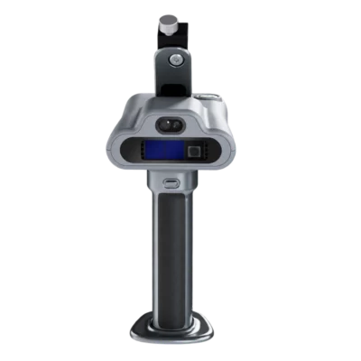
The Trion X1 includes a built-in 3.9-inch OLED display with a resolution of 1280 × 1024 pixels. The screen provides a dedicated interface for the scanning workflow, allowing operators to view guidance and capture information directly on the instrument.
This reduces the need to rely on a separate smartphone for basic field guidance. Operators can follow assigned routes, check what they are capturing and identify relevant features while working through the survey area.
The integrated display is especially useful in active construction environments where carrying additional devices may be inconvenient. Keeping the scanning guidance on the instrument also helps operators remain focused on collecting the required data.
Integrated GNSS for Outdoor Mapping and Georeferencing
The FJD Trion X1 combines SLAM scanning with GNSS-assisted positioning to support outdoor mapping and georeferenced reality capture workflows. GNSS information can help connect recorded 3D data to real-world coordinates, which is useful when working with existing site plans, GIS datasets and surveying information.
For outdoor applications such as material yards, road infrastructure and landscape mapping, georeferenced point clouds can support the spatial documentation of assets and terrain.
GNSS positioning depends on satellite reception and the selected processing workflow. Buildings, trees and other obstructions can limit satellite visibility, while indoor environments generally require SLAM-based positioning and suitable survey control. The X1’s published 3 cm absolute point cloud accuracy should not be confused with a separately specified RTK GNSS accuracy.
Two 48 MP Panoramic Cameras for Visual Documentation
The Trion X1 features two 48 MP panoramic cameras that support 360° imaging alongside LiDAR measurements. A separate front-facing camera provides a resolution of 1280 × 1024 pixels and an 80° × 44° field of view.
Combining panoramic imagery with laser scanning data helps users interpret the captured environment. Engineers and project managers can recognise building materials, structural features, vegetation, equipment and other visible objects more easily when reviewing a scan with photographic context.
The integrated Visual SLAM capability also contributes visual information to the scanner’s localisation workflow. Panoramic images can be exported in JPG format for documentation and review.
For construction inspections and as-built surveys, having 3D geometry and visual records within a coordinated project workflow can reduce the need to manage separate sets of photographs and measurements.
Compact Design with Up to 5 Hours of Battery Life
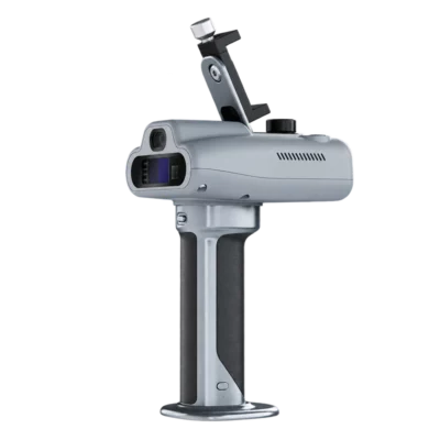
The FJD Trion X1 is designed for portable fieldwork. The main scanner weighs approximately 900 g, while the complete operating setup weighs around 1.3 kg. Its dimensions of 114 × 152 × 329 mm make it practical to carry between rooms, buildings and survey locations.
The system provides up to five hours of operation with one set of two batteries, allowing teams to perform multiple scanning sessions during a working day. A 67 W fast charger supports simultaneous charging of two batteries.
With 512 GB of internal storage, expandable to 1 TB, the X1 can store substantial point cloud and image datasets. Data can be transferred through wireless networking, USB Type-C or a USB flash drive.
The scanner features an IP54 enclosure and an operating temperature range of -20°C to +50°C. This provides resistance to dust and splashing water, although the instrument should not be treated as waterproof or suitable for operation in all weather conditions.
Applications in Construction Surveying and Asset Mapping
Construction Progress and As-Built Documentation
Construction professionals can use the Trion X1 to document buildings, structural elements, mechanical installations and existing site conditions. The guided scanning workflow helps teams capture the required areas consistently, while issue marking and voice notes support the recording of defects or incomplete work.
Processed point clouds can support comparisons with design information, renovation planning and the creation of as-built documentation.
Building Renovation and Facility Management
Architects, contractors and facility managers can use handheld scanning to capture the layout of existing buildings, including rooms, corridors, mechanical installations and service areas. The collected data provides a geometric reference for refurbishment planning, space management and maintenance projects.
Infrastructure Inspection and Asset Management
The Trion X1 can be used to document visible infrastructure features such as retaining walls, roads, bridges and other structures. Inspection teams can associate observations with locations in the scanned environment, helping organise findings for maintenance and follow-up work.
Urban Trees and Landscape Mapping
For GIS and environmental professionals, the X1 can capture 3D information about trees, green spaces, campus roads and landscape assets. The resulting point clouds can support the documentation of visible vegetation structures and spatial relationships between assets.
Additional forestry analysis tools in the FJD Trion software ecosystem can be used for tasks such as tree measurements and vegetation analysis, depending on the available software modules.
Material Yards and Stockpile Surveys
The Trion X1 can capture stockpiles, bulk materials and surrounding terrain for volume-related documentation. When combined with suitable positioning, processing and control measurements, point cloud data can be used to calculate material volumes and compare changes between survey periods.
Forensic and Incident Scene Documentation
The combination of three-dimensional scanning, panoramic imaging and location-linked observations makes the X1 relevant for incident scene documentation and safety inspections. Teams can record the visible layout of a location and add notes describing important findings.
For forensic or regulatory purposes, appropriate evidence handling, measurement validation and documentation procedures must still be followed.
Point Cloud Processing with FJD Trion Model
After completing a survey, collected data can be processed using FJD Trion Model, the professional point cloud processing environment for FJD scanning systems.
The software supports point cloud processing, registration, measurement and analysis, helping users prepare spatial data for surveying, construction and engineering projects. Supported point cloud export formats include LAS, PLY, PTS and E57, providing compatibility with a wide range of third-party point cloud applications.
Depending on the selected software modules, further workflows can include 2D drawing preparation, volume calculations, forestry analysis, classification and geometric measurements.
For surveyors who need to move between field data collection and office-based engineering software, these export options allow captured information to be incorporated into compatible CAD, GIS and modelling workflows.
FJD Trion Model Web for Planning and Reporting
FJD Trion Model Web extends the scanning workflow beyond point cloud processing. Before a site visit, project managers can define capture tasks, planned routes and inspection priorities. These instructions can then be sent to the Trion X1 for field execution.
After the survey, the collected scans, issue markers and field observations can be reviewed together. Model Web supports online collaboration and report generation, helping teams communicate site findings to engineers, project managers and clients.
This workflow is especially useful for organisations that regularly inspect multiple sites or coordinate several field operators. It helps establish a repeatable approach to collecting and reviewing project information rather than relying on isolated scanning sessions.
Available cloud services, transcription functionality and advanced software features depend on the selected software configuration and licensing.
FJD Trion X1 at Global GPS Systems
The FJD Trion X1 is designed for surveyors, construction companies, engineers, inspection specialists and GIS professionals who need detailed 3D site information together with a structured field documentation workflow.
Its combination of handheld SLAM scanning, GNSS-assisted positioning, panoramic imaging, guided instructions and location-linked observations makes it particularly useful for teams working across multiple project locations.
At Global GPS Systems, we help customers select professional LiDAR and GNSS equipment suited to their surveying and mapping requirements. Contact our team for guidance on the FJD Trion X1, compatible accessories, software configurations and the best workflow for your projects.
Specifications
FJDynamics FJD Trion X1 Handheld 3D LiDAR Scanner Specifications
General Specifications
| Manufacturer | FJDynamics |
|---|---|
| Brand | FJD Trion |
| Product Name | FJD Trion X1 |
| Model | X1 |
| Product Type | Handheld 3D LiDAR reality capture scanner |
| Scanning Technology | 3D LiDAR with visual simultaneous localisation and mapping (Visual SLAM) |
| Primary Function | Mobile 3D scanning, spatial documentation, site inspection, georeferenced reality capture and digital asset recording |
| Maximum Point Acquisition Rate | 384,000 points/second |
| Maximum LiDAR Measurement Range | 70 m at 80% target reflectivity |
| LiDAR Range at 10% Reflectivity | 40 m |
| LiDAR Field of View | 360° horizontal × 62° vertical |
| Post-Processed Relative Accuracy | ±1 cm |
| Post-Processed Absolute Accuracy | ±3 cm |
| Laser Safety Classification | Class 1 |
| Integrated Panoramic Cameras | 2 × 48 MP |
| Integrated Front Camera | 1280 × 1024 pixels |
| Visual SLAM | Supported |
| GNSS Integration | Supported for outdoor positioning and georeferencing workflows |
| Integrated Display | 3.9-inch OLED |
| Display Resolution | 1280 × 1024 pixels |
| Internal Storage | 512 GB, expandable to 1 TB |
| Battery Operating Time | Up to 5 hours with one set of two batteries |
| Power Consumption | Approximately 18 W |
| Weight | 900 g main unit; 1.3 kg complete setup |
| Dimensions | 114 × 152 × 329 mm |
| Operating Temperature | -20°C to +50°C |
| Ingress Protection | IP54 |
| Point Cloud Export Formats | LAS, PLY, PTS, E57 |
| Primary Applications | Construction surveying, as-built documentation, MEP inspection, infrastructure assessment, forensic scene documentation, urban asset management, stockpile measurement and 3D site mapping |
LiDAR Scanner Specifications
| LiDAR Type | Mobile 3D laser scanner |
|---|---|
| Maximum Point Rate | 384,000 points/second |
| Maximum Detection Range at 80% Reflectivity | 70 m |
| Maximum Detection Range at 10% Reflectivity | 40 m |
| Horizontal Scanning Field of View | 360° |
| Vertical Scanning Field of View | 62° |
| Combined Field of View | 360° × 62° |
| Laser Eye Safety Rating | Class 1 |
| 3D Point Cloud Acquisition | Supported |
| Continuous Mobile Scanning | Supported |
| Scan Resumption | Supported |
| Visual SLAM Integration | Supported |
| Panoramic Image Integration | Supported |
| GNSS-Assisted Georeferencing | Supported through compatible positioning workflows |
| Laser Wavelength | Not specified in the manufacturer X1 brochure |
| Minimum Measuring Distance | Not specified in the manufacturer X1 brochure |
| Angular Resolution | Not specified in the manufacturer X1 brochure |
| Laser Scan Frequency | Not specified separately from the published point acquisition rate |
| Multiple Return Capability | Not specified in the manufacturer X1 brochure |
| Measurement Range Qualification | Published detection distances depend on target reflectivity. Practical performance also varies with atmospheric conditions, surface geometry and scanning environment. |
Measurement Accuracy and Positioning Performance
| Post-Processed Relative Accuracy | ±10 mm |
|---|---|
| Post-Processed Absolute Accuracy | ±30 mm |
| Accuracy Specification Type | Post-processed 3D point cloud accuracy |
| Relative Accuracy Reference | Manufacturer laboratory test conditions |
| Absolute Accuracy Reference | Manufacturer laboratory test conditions |
| Positioning Integration | GNSS-assisted outdoor georeferencing |
| SLAM-Based Spatial Registration | Supported |
| Continued Scan Registration | Supported through scan resumption functionality |
| RTK Positioning Accuracy | Not separately specified in the published X1 brochure |
| PPK Positioning Accuracy | Not separately specified in the published X1 brochure |
| Accuracy Qualification | Manufacturer accuracy values are laboratory-tested. Actual accuracy depends on the environment, scanning workflow, positioning conditions, available reference data and post-processing. |
RGB and Panoramic Camera Specifications
| Panoramic Imaging System | Integrated dual-camera RGB panoramic imaging |
|---|---|
| Number of Panoramic Cameras | 2 |
| Resolution per Panoramic Camera | 48 megapixels |
| Combined Panoramic Camera Configuration | 2 × 48 MP |
| Panoramic Imaging Field of View | 360° horizontal × 360° vertical, manufacturer-stated panoramic imaging coverage |
| Image Export | Supported |
| Image Export Format | JPG |
| Panoramic Image Application | Site documentation, visual context and spatial inspection records |
| Image and LiDAR Integration | Supported |
| Colourised Point Cloud Workflow | Supported through compatible FJD Trion processing software |
| Visual Site Documentation | Supported |
| Image Format Qualification | JPG is the manufacturer-confirmed exported image format; RAW image export is not specified. |
Front Camera Specifications
| Camera Type | Integrated front-facing camera |
|---|---|
| Image Resolution | 1280 × 1024 pixels |
| Horizontal Field of View | 80° |
| Vertical Field of View | 44° |
| Combined Field of View | 80° × 44° |
| Visual SLAM | Supported |
| Front Camera Integration | Integrated into the scanner's multi-sensor capture system |
| Field Visualisation | Supports operator awareness and visual capture workflows |
GNSS and Georeferencing Specifications
| GNSS Capability | Supported |
|---|---|
| GNSS Application | Outdoor positioning and georeferenced site documentation |
| GNSS-Assisted Point Cloud Processing | Supported |
| Real-World Coordinate Integration | Supported through applicable positioning and processing workflows |
| Outdoor Asset Mapping | Supported |
| Material Yard Georeferencing | Supported |
| GNSS Constellations | Not specified individually in the manufacturer X1 brochure |
| GNSS Tracking Channels | Not specified in the manufacturer X1 brochure |
| GNSS Signal Frequencies | Not specified in the manufacturer X1 brochure |
| RTK Correction Interface | Not specified in the manufacturer X1 brochure |
| GNSS Positioning Rate | Not specified in the manufacturer X1 brochure |
| GNSS Accuracy Qualification | The published ±3 cm post-processed absolute point cloud accuracy should not be interpreted as a separate GNSS receiver RTK accuracy specification. |
Visual SLAM and Scanning Functions
| SLAM Technology | Visual simultaneous localisation and mapping |
|---|---|
| Mobile Mapping | Supported |
| Continuous 3D Scanning | Supported |
| Scan Resumption | Supported |
| Continuation of Existing Scans | Supported through the manufacturer scan continuation workflow |
| 3D Spatial Reconstruction | Supported through compatible point cloud processing software |
| LiDAR and Camera Integration | Supported |
| GNSS-Assisted Outdoor Mapping | Supported |
| Guided Scanning | Supported |
| On-Device Route Guidance | Supported |
| Predefined Capture Tasks | Supported through FJD Trion Model Web |
| On-Site Observation Recording | Supported |
| Spatial Issue Markers | Supported |
| Voice Annotation | Supported through the compatible microphone and processing workflow |
Guided Field Capture and Inspection Functions
| Task Planning Platform | FJD Trion Model Web |
|---|---|
| Pre-Survey Capture Area Definition | Supported |
| Pre-Survey Route Planning | Supported |
| Capture Priorities | Configurable through the project planning workflow |
| Task Synchronisation | Tasks can be synchronised from Model Web to the X1 scanner |
| On-Screen Route Instructions | Supported |
| Step-by-Step Operator Guidance | Supported |
| On-Site Issue Marking | Supported |
| Issue Marking Method | On-device crosshair for marking locations in the captured 3D data |
| Spatial Issue Association | Issue markers can be associated with their corresponding 3D locations |
| Voice Notes During Scanning | Supported |
| External Microphone Support | Supported |
| Voice Note Transcription | Supported through FJD Trion Model Web for supported languages |
| Multilingual Field Observations | Supported through compatible voice recording and transcription workflows |
| Issue Review | Supported through FJD Trion Model Web |
| Task and Scan Review | Supported |
| Report Generation | Supported through FJD Trion Model Web |
| Reporting Data | 3D scans, capture route information, issue markers and supported voice transcriptions |
Integrated Display and Operator Interface
| Display Type | OLED |
|---|---|
| Display Size | 3.9 inches |
| Display Resolution | 1280 × 1024 pixels |
| Integrated Field Display | Yes |
| Route Guidance Display | Supported |
| Capture Guidance | Supported |
| Field Task Instructions | Supported |
| Issue Marking Interface | On-device crosshair |
| On-Device Capture Review | Supported through the manufacturer's guided field workflow |
| External Smartphone Requirement for Basic Guided Operation | Not required for the manufacturer's described integrated-display capture workflow |
| Operator Interface Purpose | Displays capture direction, task guidance and relevant field workflow information |
Battery and Electrical Specifications
| Power Supply Type | DC handheld battery system |
|---|---|
| Battery Configuration | Two-battery operating set |
| Maximum Published Battery Life | Up to 5 hours with one set of two batteries |
| Power Consumption | Approximately 18 W |
| Charging System | 67 W fast charging |
| Simultaneous Dual-Battery Charging | Supported |
| Charger Rating | 67 W |
| Battery Capacity | Not specified in the published manufacturer X1 brochure |
| Battery Voltage | Not specified in the published manufacturer X1 brochure |
| Battery Chemistry | Not specified in the published manufacturer X1 brochure |
| Charging Time | Not specified in the published manufacturer X1 brochure |
| Battery Endurance Qualification | The published maximum endurance applies to one set of two batteries. Actual runtime depends on battery condition, scanning workload, temperature and operating configuration. |
Data Storage and Communication
| Internal Storage | 512 GB |
|---|---|
| Maximum Published Storage Capacity | 1 TB |
| Storage Expansion | Supported up to 1 TB |
| Wireless Data Export | Supported |
| Wired Data Connection | USB Type-C |
| USB Flash Drive Export | Supported |
| Data Export Methods | Wireless network, USB Type-C and USB flash drive |
| Point Cloud Export | Supported |
| Panoramic Image Export | Supported |
| Task Synchronisation | Supported between FJD Trion Model Web and the X1 |
| Cloud Project Workflow | Supported through FJD Trion Model Web |
| Wireless Standard | Not specified in the published X1 brochure |
| Bluetooth Version | Not specified in the published X1 brochure |
| USB Type-C Transfer Speed | Not specified in the published X1 brochure |
Point Cloud and Image Output Formats
| LAS | Supported |
|---|---|
| PLY | Supported |
| PTS | Supported |
| E57 | Supported |
| JPG Image Export | Supported |
| 3D Point Cloud Output | Supported |
| Panoramic Image Output | Supported |
| Georeferenced Spatial Data | Supported through compatible GNSS-assisted processing workflows |
| Point Cloud Post-Processing | Supported through FJD Trion Model |
| Cloud Project Review | Supported through FJD Trion Model Web |
| Data Processing Qualification | Supported export formats and processing functions depend on the current software version and applicable licence. |
Software and Processing Platforms
| Desktop and Tablet Processing Software | FJD Trion Model |
|---|---|
| Web-Based Project Platform | FJD Trion Model Web |
| Point Cloud Processing | Supported |
| Point Cloud Editing | Supported |
| Point Cloud Analysis | Supported |
| Project Planning | Supported through Model Web |
| Scan Task Assignment | Supported through Model Web |
| Capture Route Planning | Supported |
| Field Task Synchronisation | Supported |
| Issue Marker Review | Supported |
| Voice Note Transcription | Supported for applicable languages through Model Web |
| 3D Project Management | Supported |
| Browser-Based Project Access | Supported |
| Online Collaboration | Supported |
| Project Reporting | Supported |
| Report Sharing | Supported through applicable Model Web workflows |
| Professional Point Cloud Processing Platform | PC or compatible tablet |
| Software Licence and Subscription | Depends on selected software edition, account and service configuration |
Physical and Mechanical Specifications
| Scanner Design | Portable integrated handheld LiDAR scanner |
|---|---|
| Length | 114 mm |
| Width | 152 mm |
| Height | 329 mm |
| Overall Dimensions | 114 × 152 × 329 mm |
| Main Unit Weight | 900 g |
| Complete Setup Weight | 1.3 kg |
| Integrated Display | 3.9-inch OLED |
| Integrated LiDAR | Included |
| Panoramic RGB Cameras | 2 integrated cameras |
| Front Camera | 1 integrated camera |
| GNSS Integration | Supported |
| Microphone Support | External microphone supported |
| Battery System | Handheld dual-battery operating configuration |
| Base Assembly | Factory-assembled base configuration described by the manufacturer |
| Weight Qualification | The published 900 g value applies to the main unit; the complete setup weighs approximately 1.3 kg. |
Environmental and Safety Specifications
| Operating Temperature | -20°C to +50°C |
|---|---|
| Storage Temperature | -40°C to +60°C |
| Ingress Protection Rating | IP54 |
| Dust Protection | IP5X — dust-protected enclosure |
| Water Protection | IPX4 — protection against splashing water |
| Laser Safety Classification | Class 1 |
| Indoor Scanning | Supported |
| Outdoor Scanning | Supported within the specified operating conditions |
| Storage Humidity | Not specified in the published manufacturer brochure |
| Operating Humidity | Not specified in the published manufacturer brochure |
| Environmental Protection Qualification | IP54 does not provide a waterproof or submersible rating. Protect the scanner against heavy water exposure and environmental conditions beyond the manufacturer's limits. |
Professional Applications
| Construction Surveying | 3D capture of construction sites, structural conditions and project progress |
|---|---|
| As-Built Documentation | Recording existing site and building conditions |
| Renovation Surveys | 3D documentation of buildings before and during renovation |
| MEP Documentation | Spatial recording of mechanical, electrical and plumbing installations |
| Construction Quality Inspection | 3D site records and location-linked issue documentation |
| Forensic Scene Documentation | 3D and panoramic documentation of incidents and investigation scenes |
| Safety Inspections | Site condition capture with issue markers and field observations |
| Urban Tree Management | 3D documentation of urban trees and related assets |
| Campus Asset Mapping | Documentation of roads, facilities and outdoor infrastructure |
| Green Belt and Landscape Surveying | 3D capture of vegetation corridors and landscape features |
| Material Yard Mapping | 3D documentation of storage yards and material areas |
| Stockpile Measurement | 3D volume records using compatible point cloud processing workflows |
| Outdoor Asset Georeferencing | GNSS-assisted spatial documentation |
| Infrastructure Documentation | 3D spatial records for inspection and maintenance workflows |
| Multi-Site Inspection Programmes | Standardised scanning tasks and reporting across different operators and sites |
| Digital Site Records | Combined 3D scanning, panoramic imagery, issue markers, field notes and reports |
Hardware Components and Package Configuration
| Item | Quantity | Notes |
|---|---|---|
| FJD Trion X1 Scanner | 1 system | Main handheld 3D LiDAR scanning unit |
| Integrated LiDAR Sensor | 1 integrated unit | 384,000 points/second; up to 70 m at 80% reflectivity |
| Panoramic RGB Cameras | 2 integrated cameras | 48 MP per camera |
| Front Camera | 1 integrated camera | 1280 × 1024 pixels |
| Integrated OLED Display | 1 | 3.9-inch, 1280 × 1024 pixels |
| Battery System | Configuration-dependent | Manufacturer specifies a two-battery set for up to 5 hours of operation; verify the quantity supplied |
| Battery Charging Equipment | Configuration-dependent | 67 W fast charging with simultaneous dual-battery charging support |
| Scanner Base | Configuration-dependent | Manufacturer describes a factory-assembled base |
| External Microphone | Optional / configuration-dependent | Supported for field voice notes; inclusion not confirmed |
| USB Type-C Cable | Configuration-dependent | Verify cable inclusion |
| USB Flash Drive | Configuration-dependent | Supported data export medium; inclusion not confirmed |
| Protective Carrying Case | Not confirmed | Verify against selected package contents |
| FJD Trion Model Software | Licence-dependent | PC/tablet point cloud processing software |
| FJD Trion Model Web | Account/service-dependent | Project planning, guided capture coordination, collaboration and reporting |
| User Documentation | Configuration-dependent | Product brochure and applicable operating instructions |
Manufacturer Documentation and Technical Notes
| Product Page | Global GPS Systems – FJD Trion X1 |
|---|---|
| Product Datasheet | FJD Trion X1 Product Brochure (PDF) |
| Manufacturer Brochure Revision | August 2026 |
| Manufacturer Brochure Library | FJD Trion Official Product Brochures |
| Official Product Specifications | FJD Trion X1 Manufacturer Product Page |
| Laser Range Qualification | 40 m at 10% reflectivity and 70 m at 80% reflectivity are manufacturer-published values. Actual maximum ranging distance depends on target properties and measurement conditions. |
| Accuracy Qualification | ±1 cm relative and ±3 cm absolute are laboratory-tested post-processed point cloud accuracy values. Field results may vary with environment, workflow and operating conditions. |
| Battery Qualification | Up to 5 hours applies to operation with one set of two batteries. The manufacturer does not specify a universal runtime for every operating condition. |
| Weight Qualification | Main scanner unit: 900 g. Full setup: 1.3 kg. |
| GNSS Qualification | GNSS-assisted georeferencing is supported, but individual satellite frequencies, RTK accuracy and other receiver-specific values are not published in the referenced X1 brochure. |
| Software Qualification | Guided capture, voice transcription, collaboration and reporting functions depend on compatible FJD Trion Model Web services, software versions and account access. |
| Product Identification | These specifications apply to the FJD Trion X1 and must not be substituted with specifications from the FJD Trion T1, C1, P1, P2 or V4e models. |
Specifications and package contents may vary by configuration, region or manufacturer update. Always check the current configuration before ordering.
Reviews (0)
Only logged in customers who have purchased this product may leave a review.
FAQ
FJ Dynamics Trion X1 Handheld 3D LiDAR Scanner FAQ
General Information and Key Features
What is the FJ Dynamics Trion X1 LiDAR scanner?
The FJD Trion X1 is a professional handheld 3D LiDAR scanner designed for reality capture, surveying, construction documentation, infrastructure inspection and asset management. It combines LiDAR scanning, Visual SLAM technology, GNSS positioning support, two 48 MP panoramic cameras and a built-in OLED display. Unlike conventional handheld laser scanners, the Trion X1 also supports guided field workflows, allowing teams to plan scanning tasks, follow predefined routes, mark issues and generate reports. Its compact design makes it suitable for collecting detailed 3D data across multiple sites and projects.
What are the main features of the FJD Trion X1?
The FJD Trion X1 features a LiDAR measurement rate of 384,000 points per second, a 360° × 62° scanning field of view, a maximum specified range of 70 meters at 80% reflectivity and post-processed relative accuracy of ±1 cm. It integrates two 48 MP panoramic cameras, a front-facing Visual SLAM camera, GNSS positioning support and a 3.9-inch OLED touchscreen display. Additional features include guided scanning routes, issue marking, voice note support, scan resumption, 512 GB of internal storage and up to 5 hours of battery operation.
How accurate is the FJD Trion X1 3D laser scanner?
The FJD Trion X1 has a manufacturer-specified post-processing relative accuracy of ±1 cm and absolute accuracy of ±3 cm under laboratory test conditions. Relative accuracy describes the consistency of measurements within the point cloud, while absolute accuracy refers to positioning within a reference coordinate system. Actual results depend on scanning technique, environmental geometry, GNSS conditions, georeferencing, survey control and data processing. Projects requiring certified survey accuracy should include appropriate independent verification.
What is the maximum scanning range of the FJD Trion X1?
The FJD Trion X1 has a specified LiDAR scanning range of up to 70 meters for targets with 80% reflectivity and 40 meters for targets with 10% reflectivity. Surface reflectivity influences the effective measuring distance, meaning light-colored and highly reflective objects may be detected farther away than dark surfaces. Actual scanning performance also depends on environmental conditions, scanning geometry and object characteristics. The scanner is suitable for indoor and outdoor 3D documentation within its specified operating range.
How many laser points per second can the FJD Trion X1 capture?
The FJD Trion X1 captures up to 384,000 laser measurement points per second. Its LiDAR sensor provides a 360-degree horizontal and 62-degree vertical scanning field of view, enabling continuous collection of three-dimensional measurements while the operator moves through an environment. The high measurement rate supports detailed point cloud generation for buildings, construction sites, infrastructure and outdoor assets. Actual point density depends on scanning speed, distance to surfaces, scanning trajectory and the processing workflow.
What makes the FJD Trion X1 different from other handheld SLAM scanners?
The FJD Trion X1 combines 3D LiDAR measurement with a guided field documentation workflow. Using FJD Trion Model Web, teams can define scanning areas, routes and priorities before visiting a site. These instructions can be synchronized with the scanner and displayed on its integrated OLED screen. During scanning, operators can mark issues, record observations and add voice notes linked to the captured project. This makes the X1 particularly useful for standardized surveys, recurring inspections and projects involving multiple operators or locations.
Applications and Professional Surveying
What industries and professionals use the FJD Trion X1?
The FJD Trion X1 is designed for land surveying, construction, architecture, civil engineering, facility management, infrastructure inspection, forensic documentation, forestry and material management. Typical users include surveyors, architects, BIM specialists, construction managers, infrastructure inspectors, engineering consultants and asset management teams. The scanner is especially useful for organizations that need repeatable 3D documentation across different sites, with consistent scanning procedures, issue tracking and centralized project reporting.
Can the FJD Trion X1 be used for construction surveying and as-built documentation?
Yes. The FJD Trion X1 is suitable for capturing construction progress, existing site conditions, renovation areas and as-built building geometry. Operators can scan rooms, corridors, structures and accessible construction areas to create detailed 3D point clouds. Its guided scanning workflow helps teams follow consistent inspection routes and document important locations. The resulting data can support construction verification, progress reporting, design coordination and comparison with digital building models. Accurate dimensional comparisons require suitable processing software and survey control.
Is the FJD Trion X1 suitable for Scan-to-BIM and architectural surveying?
Yes. The FJD Trion X1 can capture three-dimensional measurements of building interiors, facades, structural elements and mechanical, electrical and plumbing installations. These point clouds can be imported into compatible CAD and BIM software to support existing-condition surveys, renovation planning and Scan-to-BIM workflows. The scanner provides geometric reference data, while the creation of detailed BIM objects, floor plans and engineering drawings generally requires additional modeling and verification.
Can the FJD Trion X1 be used for facility management and infrastructure inspection?
Yes. The FJD Trion X1 is particularly suitable for building inspections, facility documentation, infrastructure maintenance and asset management. Inspection teams can follow predefined scanning routes, record 3D information and mark defects or areas requiring attention. The scanner also supports voice observations and integration with FJD Trion Model Web for centralized reporting. These features help facility managers maintain consistent documentation across buildings, installations and recurring inspection projects.
Can the FJD Trion X1 be used for forensic and incident scene documentation?
Yes. The FJD Trion X1 supports three-dimensional documentation of incident locations, accident scenes and safety-related environments. Its LiDAR sensor captures spatial geometry, while the integrated panoramic cameras provide visual context. Operators can mark specific locations and attach observations during scanning. The resulting 3D records can support scene review, spatial analysis and investigation reporting. For forensic or legally sensitive applications, appropriate evidence handling, measurement validation and chain-of-custody procedures remain essential.
Can the FJD Trion X1 be used for forestry, urban tree mapping and stockpile measurements?
Yes. The FJD Trion X1 can support urban tree inventories, landscape documentation, material yard mapping and stockpile measurement. Its LiDAR scanner collects three-dimensional measurements of visible tree structures, surrounding terrain, storage areas and material piles. GNSS-assisted positioning can help connect outdoor scans to geographic coordinates. With suitable processing software, point clouds can be used for geometric analysis, asset documentation and volume calculations. Results depend on scanning coverage, positioning quality and the visibility of measured surfaces.
Technical Specifications and Hardware
Does the FJD Trion X1 use SLAM technology and work without GPS?
Yes. The FJD Trion X1 uses Simultaneous Localization and Mapping (SLAM) technology, including visual information from its integrated cameras, to estimate the scanner's movement and construct a 3D map. SLAM allows the scanner to operate indoors and in other environments where GNSS signals are weak or unavailable. The scanner also supports GNSS-assisted georeferencing for outdoor applications. SLAM accuracy depends on environmental geometry, scanning trajectory and available visual and geometric features.
Does the FJD Trion X1 include GNSS and RTK positioning?
The FJD Trion X1 includes GNSS positioning support for outdoor georeferencing and location-aware reality capture workflows. GNSS information helps connect captured 3D data to real-world coordinates for applications such as site mapping and asset documentation. The manufacturer specifies post-processed absolute accuracy of ±3 cm under reference conditions. Dedicated RTK performance specifications and correction requirements should be confirmed for the selected configuration. GNSS positioning performance depends on satellite visibility, correction availability and the processing workflow.
Does the FJD Trion X1 include cameras for colorized 3D point clouds?
Yes. The FJD Trion X1 includes two 48 MP panoramic cameras providing 360-degree imaging coverage and a front-facing camera with a resolution of 1280 × 1024 pixels and a field of view of 80° × 44°. The camera system supports visual SLAM, scene documentation and point cloud colorization. Panoramic images can also be exported in JPG format. Combining LiDAR geometry with image information helps users interpret building conditions, infrastructure features and other scanned environments.
What is the purpose of the built-in display on the FJD Trion X1?
The FJD Trion X1 features an integrated 3.9-inch OLED display with a resolution of 1280 × 1024 pixels. The display allows operators to review scanning information, follow predefined routes and view guidance directly on the scanner without relying on a separate smartphone. It also supports field documentation by allowing users to identify and mark locations that require attention. The integrated display is especially useful for inspection teams working with standardized capture procedures.
How much does the FJD Trion X1 weigh and what are its dimensions?
The FJD Trion X1 main scanning unit weighs approximately 900 grams, while the complete specified configuration weighs approximately 1.3 kg. Its dimensions are 114 × 152 × 329 mm. The compact handheld design makes it suitable for operators who need to move through buildings, construction sites, industrial facilities and outdoor environments. The lightweight configuration helps reduce operator fatigue during extended scanning and documentation sessions.
What is the battery life of the FJD Trion X1?
The FJD Trion X1 provides up to 5 hours of operation with one set of two batteries under manufacturer test conditions. The scanner has a typical power consumption of approximately 18 W and uses a DC handheld battery power supply. It supports a 67 W fast charger capable of charging both batteries simultaneously. Actual battery endurance depends on scanning activity, display usage, environmental temperature and operating conditions.
Is the FJD Trion X1 waterproof and suitable for outdoor scanning?
The FJD Trion X1 has an IP54 ingress protection rating and a specified operating temperature range of -20°C to +50°C. IP54 provides protection against limited dust ingress and splashing water but does not make the scanner waterproof or suitable for immersion. The LiDAR sensor has a Class 1 eye-safety rating. The scanner can be used outdoors within its environmental limitations, but it should be protected from heavy rain, excessive moisture and unsuitable operating conditions.
Software, Data Processing and Scanning Workflow
Which software is used with the FJD Trion X1?
The FJD Trion X1 works with FJD Trion Model Web and FJD Trion Model. FJD Trion Model Web provides browser-based project planning, task management, online collaboration, issue documentation and reporting. FJD Trion Model supports professional point cloud editing, processing and analysis on compatible PCs and tablets. Together, these applications allow teams to manage scanning projects from preparation and field acquisition through data processing and final documentation. Available functions depend on the software version and configuration.
How does the guided scanning workflow of the FJD Trion X1 work?
The FJD Trion X1 supports a guided workflow consisting of planning, capturing, documenting and reviewing. Before a site visit, a project manager can define the scanning area, inspection route and important tasks in FJD Trion Model Web. The instructions are then synchronized with the scanner. During fieldwork, the operator follows the guidance on the built-in display, captures 3D data and marks important observations. After scanning, the collected measurements, issue markers and notes can be reviewed together in Model Web.
Can the FJD Trion X1 mark defects and record voice notes during scanning?
Yes. The FJD Trion X1 allows operators to mark issues directly during scanning using an on-screen crosshair, linking observations to locations within the captured 3D data. The scanner also supports voice notes for recording inspection findings and other field observations. With a compatible external microphone, operators can capture spoken information during site visits. FJD Trion Model Web supports transcription of recorded observations in supported languages, helping teams organize findings and prepare reports.
Can the FJD Trion X1 resume an interrupted scanning project?
Yes. The FJD Trion X1 supports scan resumption, allowing operators to continue data collection after an interrupted scanning session. This feature is useful for larger environments, multi-stage inspections and projects that cannot be completed in one continuous session. Successful continuation and alignment depend on the available overlap, recognizable environmental features and the processing workflow. Operators should verify the resulting point cloud to ensure that all required areas have been captured correctly.
Which point cloud file formats does the FJD Trion X1 support?
The FJD Trion X1 supports exporting processed point cloud data in LAS, PLY, PTS and E57 formats. These formats are widely used in professional surveying, 3D visualization, point cloud processing and CAD/BIM workflows. LAS is commonly used for geospatial LiDAR datasets, while E57 is useful for exchanging terrestrial scanning data between compatible applications. The scanner also supports JPG image exports. Available export options depend on the processing software and selected workflow.
How much storage does the FJD Trion X1 have and how is scanning data transferred?
The FJD Trion X1 includes 512 GB of internal storage, expandable to 1 TB. This capacity is used to record LiDAR measurements, images and project information during fieldwork. Data can be transferred using a wireless network, USB Type-C connection or USB flash drive. Storage requirements depend on scanning duration, image acquisition and project size. Regular data transfers and backups are recommended for large projects or recurring inspection workflows.
 GPS & GNSS
 Total Stations
 Data collectors
 Software
 Correction services
 Machine control
 External radio
 Marine
 Accessories
Reviews
There are no reviews yet