

 GPS & GNSS
 Lidar scanning
 Total Station
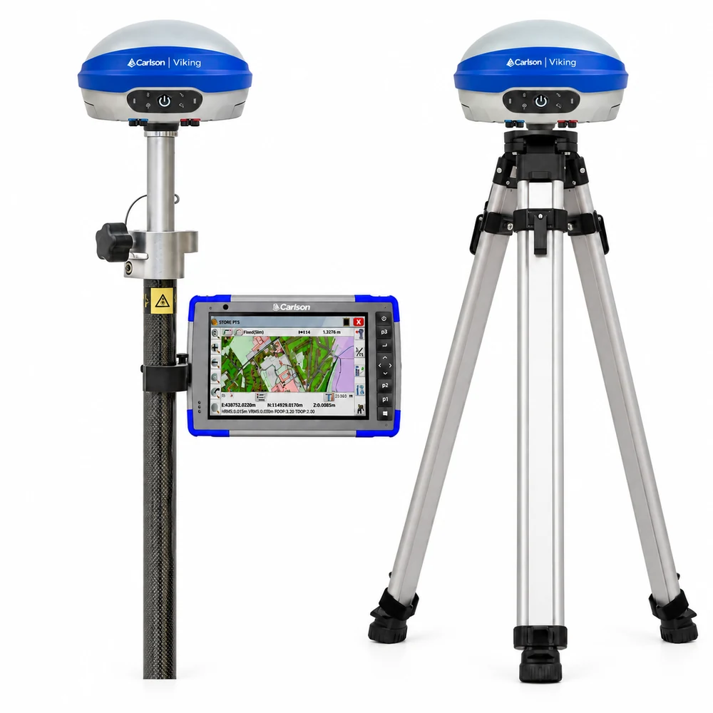
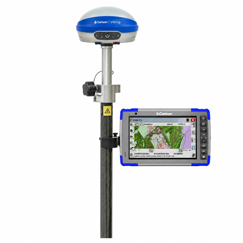
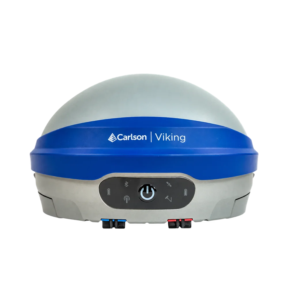
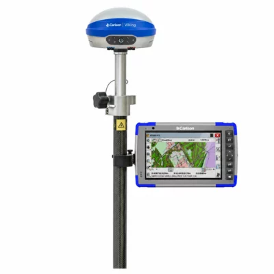
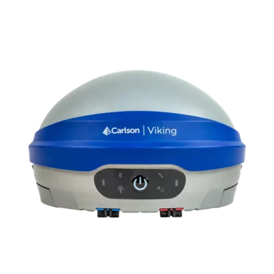
Carlson Viking RTK GNSS Rover and Base Set with RT4 Plus and SurvPC
Get the best price for your setup
Contact our experts for the best possible price and configuration.
- Fast response
- Expert configuration advice
- No overpaying for features you do not need
The Carlson Viking RTK Base and Rover Set with RT4+ is a complete professional GNSS solution for surveyors, construction teams, engineers, GIS professionals and other users who need their own centimetre-level RTK positioning system. The set combines two Carlson Viking GNSS receivers with the rugged Carlson RT4+ Windows data collector and Carlson SurvPC. One Viking operates as the RTK base station while the second is used as the rover, giving field crews a self-contained base and rover workflow without depending on an external RTK correction network.
Both Viking receivers feature 632-channel multi-constellation GNSS, dual GNSS RTK modules and three independent RTK engines with Carlson Triple-Fix technology. The rover also provides calibration-free IMU tilt compensation up to 60°, making it easier to survey building corners, kerbs, trenches, utilities and other difficult points without keeping the pole perfectly vertical. Integrated UHF radios allow corrections to be transmitted directly between base and rover, while 4G, Wi-Fi and Bluetooth provide additional communication options. The RT4+ runs Carlson SurvPC on Windows 11 and provides a rugged 7-inch field interface for base setup, rover configuration, surveying and stakeout.
Carlson Viking RTK Base and Rover Set Highlights
| GNSS system | 2 Carlson Viking RTK GNSS receivers configurable as base or rover |
|---|---|
| RTK technology | Dual GNSS RTK modules with 3 independent RTK engines and Carlson Triple-Fix |
| RTK accuracy | Horizontal 0.6 cm + 0.5 ppm and vertical 1 cm + 1 ppm |
| IMU tilt compensation | Calibration-free rover pole tilt compensation up to 60° |
| Satellite tracking | 632 channels with GPS, GLONASS, Galileo, BeiDou, QZSS and NavIC |
| Base rover communication | Integrated UHF radio plus cellular, Wi-Fi and Bluetooth connectivity |
| Data collector | Carlson RT4+ with Windows 11, Intel N200, 16 GB RAM and 256 GB SSD |
| Field software | Carlson SurvPC for base setup, rover configuration, data collection and stakeout |
| Field protection | Viking IP67 and RT4+ IP68 rugged construction |
Valued customers:










Find RTK Networks
Search NTRIP providers and connect to reliable RTK correction services.
Description
Complete RTK base and rover system for professional fieldwork
The Carlson Viking RTK Base and Rover Set with RT4+ provides a complete professional positioning system for teams that want to operate their own GNSS base and rover. Two Carlson Viking receivers form the GNSS system: one receiver is established over the project reference point as the RTK base station, while the second Viking receives correction data and is used as the mobile rover. The Carlson RT4+ running SurvPC provides the field interface for configuring the equipment, collecting survey data and carrying out stakeout.
This type of setup is particularly useful for land surveying, construction, earthworks, civil engineering and other projects where crews want direct control over their RTK corrections rather than relying entirely on a third-party correction network. Once the base is established correctly, the rover can work throughout the site using real-time correction information transmitted from the base.
Two Carlson Viking receivers with interchangeable roles
Both GNSS receivers in the system are Carlson Viking units. Each Viking can operate as either an RTK base or rover, so the hardware is not permanently restricted to one role. This provides useful flexibility for survey companies and construction teams because either receiver can be configured for the required job.
On a normal base and rover project, one Viking remains stationary over the control point while the second moves around the site. For other projects, either receiver can also be used independently as a rover with a suitable external correction service or configured as a base for another compatible RTK receiver.
Direct RTK corrections from base to rover
The Viking includes an integrated UHF radio, allowing the base receiver to transmit RTK corrections directly to the Viking rover when both radios are configured with compatible settings. This creates a self-contained local RTK system that does not require a mobile internet connection between the two receivers.
This is useful on construction sites, rural projects, earthworks jobs and survey locations where cellular reception is limited or where a direct radio connection is preferred. Actual radio performance depends on terrain, buildings, vegetation, antenna setup, radio configuration and local radio regulations.
The Viking also provides cellular, Wi-Fi, Bluetooth and other communication options, allowing the receivers to be integrated into different correction workflows when required.
Triple Fix technology for demanding GNSS environments
The Carlson Viking uses two GNSS RTK modules together with three independent RTK engines. Carlson’s Triple-Fix architecture allows the receiver to calculate and compare multiple RTK solutions rather than depending on a single positioning engine.
For the rover operator, this is especially valuable when working in real field conditions where satellite reception can be affected by buildings, machinery, fences, vehicles or vegetation. Reflected and partially obstructed satellite signals can make GNSS positioning more difficult, so having independent RTK calculations available provides another level of information when evaluating the solution.
Triple-Fix does not replace normal survey control procedures or independent checks, but it is designed to reduce the risk associated with relying on a single RTK calculation in challenging locations.
Centimetre level RTK positioning
The Viking is specified for RTK horizontal accuracy of 0.6 cm + 0.5 ppm and vertical accuracy of 1 cm + 1 ppm under appropriate operating conditions. For everyday fieldwork, this makes the base and rover system suitable for accurate coordinate collection, construction layout, topographic surveying, control work and many other professional GNSS applications.
As with any RTK system, final accuracy depends on factors including the quality of the base coordinate, satellite conditions, correction link, baseline length and the surveying procedures being used. Establishing the base correctly is therefore just as important as achieving an RTK fixed solution at the rover.
632 channel multi-constellation GNSS
Each Viking receiver supports 632 GNSS channels and tracks GPS, GLONASS, Galileo, BeiDou, QZSS and NavIC. Multi-frequency and multi-constellation tracking gives both the base and rover access to observations from a large number of available satellites.
For the rover, this helps maintain useful satellite geometry as the surveyor moves around buildings, equipment and other obstacles. At the base, broad satellite support provides the observations needed to generate modern multi-constellation RTK corrections for the rover.
Survey with the rover pole tilted up to 60 degrees
When a Viking is used as the rover, its integrated IMU provides calibration-free pole tilt compensation up to 60°. The receiver calculates the position of the pole tip even when the GNSS antenna is not directly above it, allowing the operator to measure without carefully levelling the pole for every point.
This can save significant time when collecting large numbers of points and makes difficult features easier to reach. Building corners, kerbs, trenches, fences, drainage features, utilities and points beside machinery can often be measured by placing the pole tip directly on the required position and allowing the IMU to compensate for the pole angle.
Establish the base over project control
The accuracy of the complete base and rover system depends on the coordinate assigned to the base station. For professional survey work, the base is normally established over a known control point whenever suitable project control is available. SurvPC provides dedicated GPS Base tools for entering and configuring the base position.
Depending on the project, a base can be established from known geographic or grid coordinates, an existing surveyed point, local coordinates or a newly determined position. Previously established base information can also be reused when returning to a project.
This is especially useful on construction sites that run for weeks or months. The base receiver can be installed over the same surveyed control point on each visit so the rover continues working within the established project coordinate system.
Carlson RT4 Plus rugged survey data collector
The Carlson RT4+ is the field controller for the system. It runs Microsoft Windows 11 and uses an Intel N200 processor with 16 GB RAM and a 256 GB PCIe SSD. This provides the performance required for SurvPC, survey coordinate files, drawings, maps, surfaces and other project information used during fieldwork.
The 7-inch high-visibility display is designed for outdoor operation. Its capacitive touchscreen can be used with gloves and a compatible stylus and is designed to remain practical in wet field conditions. Physical navigation controls and programmable buttons provide additional input options when using a touchscreen is less convenient.
Carlson SurvPC connects the complete workflow
Carlson SurvPC provides dedicated configuration tools for both the GNSS base and rover. The base setup allows the operator to connect to the first Viking, define its position, enter antenna information and configure the method used to transmit RTK corrections. The rover configuration is then used to connect the second Viking and define how it receives those corrections.
When using the integrated UHF radios, the base and rover need compatible radio parameters. Once communication is established and the rover achieves a suitable RTK fixed solution, the same SurvPC environment can be used for normal survey and stakeout operations.
Current Carlson Viking receivers require SurvPC 7.12 or higher. Using a supported software version ensures that the correct Viking drivers and configuration options are available on the RT4+.
Topographic and detail surveying
For land surveyors, the base and rover system provides a practical setup for collecting large numbers of accurately positioned points throughout a project. The rover can be used for topographic measurements, boundary-related field observations where GNSS methodology is appropriate, site detail, terrain surveys and general coordinate collection.
Tilt compensation is especially helpful during detail surveys because the pole can be positioned against features that would otherwise be awkward to occupy while maintaining a perfectly vertical antenna.
Construction setting out and as built measurements
Construction professionals can use the rover to take digital design information directly into the field. SurvPC supports point, line and other stakeout routines that guide the operator toward the required project position and provide information such as horizontal differences and cut or fill.
The same equipment can then be used to record completed work for as-built documentation. Keeping both layout and measurement within the same base reference helps crews maintain a consistent coordinate framework throughout the project.
A self contained system for sites without RTK network coverage
One of the main reasons to use a dedicated base and rover is independence from external RTK correction networks. When the two Viking receivers communicate directly by UHF, the field team can operate in locations where mobile data is unavailable or unreliable, provided the radio link between base and rover remains suitable.
This can be valuable for rural surveys, new developments, road construction, large earthworks sites and remote engineering projects. It also gives the survey team direct control over the physical base point used as the reference for the job.
Flexible enough to use with network RTK
Owning a base and rover system does not prevent the Viking rover from being used with network corrections. The Viking supports several RTK correction input methods, including UHF and NTRIP-based workflows. This means the rover can be used with the local Viking base on one project and with a suitable RTK network on another.
Likewise, the second Viking remains a fully capable GNSS receiver rather than hardware that can only operate as a dedicated base. This flexibility is valuable for companies whose survey requirements change from project to project.
GIS and infrastructure mapping
The Viking rover can also be used for accurate GIS and asset data collection. Utilities, drainage systems, road furniture, inspection points and other infrastructure can be positioned with the GNSS rover while project information is handled through the RT4+ and compatible field software workflows.
A local base can be particularly useful on large sites where repeated asset surveys need to remain within the same project coordinate reference over an extended period.
Ground control for drone mapping
Drone survey teams can use the rover to measure ground control points and independent checkpoints for photogrammetry projects. Accurately surveyed points provide a coordinate reference for the aerial dataset and can be used to independently check the resulting model or orthophoto.
The ability to operate one Viking as a base also makes the system useful to teams that combine conventional ground surveying with compatible RTK drone workflows.
Designed for long days in the field
Each Viking uses dual hot-swappable batteries and is designed for more than 12 hours of operation under specified conditions. A depleted battery can be replaced while the other remains installed, helping avoid unnecessary interruption to a long base or rover session.
The Viking receivers have an IP67-rated enclosure and are designed for professional outdoor use. The RT4+ has an IP68 rating and a removable battery rated for up to 15 hours under specified operating conditions. Together, the equipment is suited to the dust, rain and changing conditions encountered on active survey and construction sites.
One system for survey construction engineering and GIS teams
A complete base and rover set is useful for organisations that carry out different types of positioning work. A surveyor can collect topographic data in the morning, a construction crew can use the same system for layout, and the rover can later be used for as-built measurements, utility mapping or ground control.
Because both Viking receivers can be configured as either a base or rover, the equipment can also be reorganised as project requirements change. This makes the set more flexible than a system where the base hardware has only one dedicated function.
Carlson Viking base and rover set from Global GPS Systems
Global GPS Systems can help configure the Carlson Viking RTK Base and Rover Set around your project requirements and existing equipment. Important considerations include the correct regional UHF configuration, coordinate system, base setup method, RTK correction workflow, SurvPC configuration and any accessories required for mounting the base and rover in the field.
For surveyors, construction professionals, engineers and GIS teams looking for their own complete RTK system, two Carlson Viking receivers combined with the RT4+ and SurvPC provide a flexible solution that covers the full workflow from establishing the base station to measuring and staking centimetre-level positions with the rover.
Specifications
Carlson Viking RTK GNSS Rover and Base Set with RT4+ and SurvPC FAQ
System, Applications & Setup
What is the Carlson Viking RTK GNSS Rover and Base Set?
The Carlson Viking RTK GNSS Rover and Base Set is a complete professional surveying system built around two Carlson Viking GNSS receivers, a Carlson RT4+ rugged data collector and Carlson SurvPC field software. One Viking is normally set up as the stationary RTK base while the second is used as the mobile rover, allowing crews to generate and use their own centimetre-level RTK corrections in the field.
What is included in the Carlson Viking base and rover system?
The core system combines two Carlson Viking RTK GNSS receivers, a Carlson RT4+ Windows data collector and Carlson SurvPC field software. The two Viking receivers provide the base and rover positioning system, while the RT4+ and SurvPC are used to configure the equipment, collect measurements and perform stakeout. Exact accessories and mounting equipment should be checked against the selected set configuration.
Who is the Carlson Viking Rover and Base Set designed for?
The system is designed for professional land surveyors, construction and earthworks crews, civil engineers, infrastructure contractors, GIS teams and other users who need accurate GNSS positioning and want the ability to operate their own RTK base station.
What surveying jobs can the Carlson Viking base and rover set be used for?
Typical applications include topographic surveying, site surveys, boundary-related field measurements where GNSS methods are appropriate, construction stakeout, earthworks, road projects, utility mapping, as-built surveys, GIS and asset mapping, control surveys and the measurement of ground control and check points for drone mapping.
What is the advantage of a base and rover set compared with a rover-only set?
A rover-only system normally depends on an external RTK correction source such as an NTRIP or CORS network. With two Viking receivers, one unit can generate corrections locally and transmit them directly to the rover. This provides greater independence from external correction networks and can be particularly useful on remote sites, construction projects or locations with unreliable mobile internet coverage.
Can either Carlson Viking receiver be used as the base or rover?
Yes. Both receivers are full Carlson Viking GNSS units and can be configured as either an RTK base or an RTK rover. Their roles are not permanently fixed, allowing the two receivers to be reorganised for different projects and workflows.
RTK Accuracy, Triple-Fix & Tilt Compensation
What RTK accuracy does the Carlson Viking provide?
Carlson specifies RTK horizontal accuracy of 0.6 cm + 0.5 ppm and vertical accuracy of 1 cm + 1 ppm under suitable operating conditions. Actual field accuracy depends on factors including the accuracy of the base coordinates, distance between base and rover, satellite geometry, multipath, atmospheric conditions and the quality of the correction link.
What is Carlson Triple-Fix technology?
The Carlson Viking contains two GNSS RTK modules and uses three independent RTK positioning engines. Carlson's Triple-Fix architecture compares independent positioning solutions to provide additional information about the reliability of the calculated RTK position rather than relying on a single positioning engine.
Why is Triple-Fix useful when surveying?
GNSS measurements can become more difficult near buildings, machinery, vehicles, fences, vegetation and other objects that block or reflect satellite signals. By calculating and comparing multiple RTK solutions, Triple-Fix is designed to provide increased confidence in the positioning solution. Normal survey checks and good field procedures are still important.
Does the Carlson Viking rover have IMU tilt compensation?
Yes. When a Viking is used as the rover, its integrated IMU provides calibration-free pole tilt compensation up to 60 degrees. The system calculates the position of the survey pole tip even when the pole is not held vertically.
What is tilt compensation useful for?
Tilt compensation makes it easier to measure points that are difficult to occupy with a vertical survey pole. Typical examples include building corners, kerbs, trenches, drainage features, utilities, fences, walls and points close to machinery or other obstacles. It can also speed up normal point collection because the pole does not need to be carefully levelled for every measurement.
Which GNSS satellite constellations does the Carlson Viking support?
Each Carlson Viking is a 632-channel multi-frequency GNSS receiver supporting major satellite constellations including GPS, GLONASS, Galileo, BeiDou, QZSS and NavIC. Tracking multiple constellations and frequencies provides access to more satellite observations and can improve satellite geometry in demanding field environments.
Base Station, Corrections & Connectivity
How do the Carlson Viking base and rover communicate?
The Viking includes an integrated UHF radio with transmit and receive capability. In a typical local base and rover configuration, the base transmits RTK correction data by UHF and the rover receives those corrections directly. The receivers also provide cellular, Wi-Fi and Bluetooth connectivity for other supported workflows.
Does the Carlson Viking base and rover set require an internet connection?
No. When the base and rover communicate directly using their integrated UHF radios, the RTK correction link does not depend on mobile internet. Internet connectivity is required when using internet-based services such as NTRIP or other online data and correction services.
Can the Viking rover also use an NTRIP or CORS correction network?
Yes. The Viking rover is not limited to corrections from the supplied Viking base. It can also be configured for supported network RTK and NTRIP workflows, allowing the same rover to use a local base on one project and an external correction network on another.
How is the Carlson Viking base station positioned?
For accurate professional work, the base is normally established over a known control point or assigned an accurately determined coordinate. Carlson SurvPC provides tools for configuring the GPS base, entering the base position and antenna information and selecting the correction output. The quality of the base coordinate directly affects the coordinates produced by the rover.
Can I set up the base on an unknown point?
Yes, but the method used to determine the base coordinate is important. A base can be configured from known coordinates, previously surveyed control, local project coordinates or a newly determined position. If accurate absolute coordinates are required, the base position must first be established to the required accuracy. Simply averaging an autonomous GNSS position will not provide survey-grade absolute control.
How far can the Carlson Viking rover work from the base station?
There is no single guaranteed base-to-rover radio range because performance depends on terrain, buildings, vegetation, antenna height, radio settings, permitted transmitter power and local radio regulations. Open line-of-sight conditions generally provide better UHF communication than obstructed or urban environments. Increasing the GNSS baseline can also influence achievable RTK performance.
Do the base and rover need to use the same UHF settings?
Yes. For direct UHF operation, the base and rover radios must be configured with compatible frequency, protocol, channel spacing and correction settings. Carlson provides dedicated Viking base and rover configuration tools in SurvPC. Radio frequencies and permitted transmission power must comply with the regulations applicable in the country where the equipment is used.
RT4+, SurvPC & Field Operation
What does the Carlson RT4+ do in the base and rover set?
The Carlson RT4+ is the field data collector and controller for the system. It is used to configure the Viking base and rover, monitor GNSS and RTK status, collect survey points, perform stakeout, work with project coordinate files and drawings and manage field data through Carlson SurvPC.
What operating system does the Carlson RT4+ use?
The Carlson RT4+ runs Microsoft Windows 11. It features an Intel N200 processor, 16 GB of RAM and a 256 GB PCIe SSD, providing a full Windows environment for Carlson SurvPC and compatible field and office workflows.
Does the set use Carlson SurvPC?
Yes. Carlson SurvPC provides the main field interface for configuring both Viking receivers and performing survey work. It includes dedicated GPS Base and GPS Rover workflows as well as functions for point collection, stakeout, coordinate geometry and other surveying operations. Current Carlson Viking receivers require SurvPC 7.12 or later for supported Viking operation.
Is the GNSS inside the RT4+ used for centimetre-level surveying?
No. The RT4+ is primarily the data collector in this system. Survey-grade centimetre positioning is provided by the external Carlson Viking rover. The RT4+'s own integrated GNSS can be useful for general positioning and navigation but does not replace the Viking for high-accuracy RTK surveying.
How rugged are the Carlson Viking receivers and RT4+?
The Carlson Viking receivers have an IP67-rated enclosure designed for professional outdoor surveying, while the Carlson RT4+ has an IP68 rating. The equipment is intended for field environments where dust, rain, vibration and changing weather conditions are common.
How long can the Carlson Viking and RT4+ operate in the field?
Each Viking uses two hot-swappable lithium batteries and is specified for up to approximately 12 hours of operation under suitable conditions. The RT4+ uses a removable battery and is specified for up to approximately 15 hours. Actual operating time varies with radio transmission, cellular and Wi-Fi use, screen brightness, temperature and other operating conditions.
Reviews (0)
Only logged in customers who have purchased this product may leave a review.
FAQ
Carlson Viking RTK GNSS Rover and Base Set with RT4+ and SurvPC FAQ
System, Applications & Setup
What is the Carlson Viking RTK GNSS Rover and Base Set?
The Carlson Viking RTK GNSS Rover and Base Set is a complete professional surveying system built around two Carlson Viking GNSS receivers, a Carlson RT4+ rugged data collector and Carlson SurvPC field software. One Viking is normally set up as the stationary RTK base while the second is used as the mobile rover, allowing crews to generate and use their own centimetre-level RTK corrections in the field.
What is included in the Carlson Viking base and rover system?
The core system combines two Carlson Viking RTK GNSS receivers, a Carlson RT4+ Windows data collector and Carlson SurvPC field software. The two Viking receivers provide the base and rover positioning system, while the RT4+ and SurvPC are used to configure the equipment, collect measurements and perform stakeout. Exact accessories and mounting equipment should be checked against the selected set configuration.
Who is the Carlson Viking Rover and Base Set designed for?
The system is designed for professional land surveyors, construction and earthworks crews, civil engineers, infrastructure contractors, GIS teams and other users who need accurate GNSS positioning and want the ability to operate their own RTK base station.
What surveying jobs can the Carlson Viking base and rover set be used for?
Typical applications include topographic surveying, site surveys, boundary-related field measurements where GNSS methods are appropriate, construction stakeout, earthworks, road projects, utility mapping, as-built surveys, GIS and asset mapping, control surveys and the measurement of ground control and check points for drone mapping.
What is the advantage of a base and rover set compared with a rover-only set?
A rover-only system normally depends on an external RTK correction source such as an NTRIP or CORS network. With two Viking receivers, one unit can generate corrections locally and transmit them directly to the rover. This provides greater independence from external correction networks and can be particularly useful on remote sites, construction projects or locations with unreliable mobile internet coverage.
Can either Carlson Viking receiver be used as the base or rover?
Yes. Both receivers are full Carlson Viking GNSS units and can be configured as either an RTK base or an RTK rover. Their roles are not permanently fixed, allowing the two receivers to be reorganised for different projects and workflows.
RTK Accuracy, Triple-Fix & Tilt Compensation
What RTK accuracy does the Carlson Viking provide?
Carlson specifies RTK horizontal accuracy of 0.6 cm + 0.5 ppm and vertical accuracy of 1 cm + 1 ppm under suitable operating conditions. Actual field accuracy depends on factors including the accuracy of the base coordinates, distance between base and rover, satellite geometry, multipath, atmospheric conditions and the quality of the correction link.
What is Carlson Triple-Fix technology?
The Carlson Viking contains two GNSS RTK modules and uses three independent RTK positioning engines. Carlson's Triple-Fix architecture compares independent positioning solutions to provide additional information about the reliability of the calculated RTK position rather than relying on a single positioning engine.
Why is Triple-Fix useful when surveying?
GNSS measurements can become more difficult near buildings, machinery, vehicles, fences, vegetation and other objects that block or reflect satellite signals. By calculating and comparing multiple RTK solutions, Triple-Fix is designed to provide increased confidence in the positioning solution. Normal survey checks and good field procedures are still important.
Does the Carlson Viking rover have IMU tilt compensation?
Yes. When a Viking is used as the rover, its integrated IMU provides calibration-free pole tilt compensation up to 60 degrees. The system calculates the position of the survey pole tip even when the pole is not held vertically.
What is tilt compensation useful for?
Tilt compensation makes it easier to measure points that are difficult to occupy with a vertical survey pole. Typical examples include building corners, kerbs, trenches, drainage features, utilities, fences, walls and points close to machinery or other obstacles. It can also speed up normal point collection because the pole does not need to be carefully levelled for every measurement.
Which GNSS satellite constellations does the Carlson Viking support?
Each Carlson Viking is a 632-channel multi-frequency GNSS receiver supporting major satellite constellations including GPS, GLONASS, Galileo, BeiDou, QZSS and NavIC. Tracking multiple constellations and frequencies provides access to more satellite observations and can improve satellite geometry in demanding field environments.
Base Station, Corrections & Connectivity
How do the Carlson Viking base and rover communicate?
The Viking includes an integrated UHF radio with transmit and receive capability. In a typical local base and rover configuration, the base transmits RTK correction data by UHF and the rover receives those corrections directly. The receivers also provide cellular, Wi-Fi and Bluetooth connectivity for other supported workflows.
Does the Carlson Viking base and rover set require an internet connection?
No. When the base and rover communicate directly using their integrated UHF radios, the RTK correction link does not depend on mobile internet. Internet connectivity is required when using internet-based services such as NTRIP or other online data and correction services.
Can the Viking rover also use an NTRIP or CORS correction network?
Yes. The Viking rover is not limited to corrections from the supplied Viking base. It can also be configured for supported network RTK and NTRIP workflows, allowing the same rover to use a local base on one project and an external correction network on another.
How is the Carlson Viking base station positioned?
For accurate professional work, the base is normally established over a known control point or assigned an accurately determined coordinate. Carlson SurvPC provides tools for configuring the GPS base, entering the base position and antenna information and selecting the correction output. The quality of the base coordinate directly affects the coordinates produced by the rover.
Can I set up the base on an unknown point?
Yes, but the method used to determine the base coordinate is important. A base can be configured from known coordinates, previously surveyed control, local project coordinates or a newly determined position. If accurate absolute coordinates are required, the base position must first be established to the required accuracy. Simply averaging an autonomous GNSS position will not provide survey-grade absolute control.
How far can the Carlson Viking rover work from the base station?
There is no single guaranteed base-to-rover radio range because performance depends on terrain, buildings, vegetation, antenna height, radio settings, permitted transmitter power and local radio regulations. Open line-of-sight conditions generally provide better UHF communication than obstructed or urban environments. Increasing the GNSS baseline can also influence achievable RTK performance.
Do the base and rover need to use the same UHF settings?
Yes. For direct UHF operation, the base and rover radios must be configured with compatible frequency, protocol, channel spacing and correction settings. Carlson provides dedicated Viking base and rover configuration tools in SurvPC. Radio frequencies and permitted transmission power must comply with the regulations applicable in the country where the equipment is used.
RT4+, SurvPC & Field Operation
What does the Carlson RT4+ do in the base and rover set?
The Carlson RT4+ is the field data collector and controller for the system. It is used to configure the Viking base and rover, monitor GNSS and RTK status, collect survey points, perform stakeout, work with project coordinate files and drawings and manage field data through Carlson SurvPC.
What operating system does the Carlson RT4+ use?
The Carlson RT4+ runs Microsoft Windows 11. It features an Intel N200 processor, 16 GB of RAM and a 256 GB PCIe SSD, providing a full Windows environment for Carlson SurvPC and compatible field and office workflows.
Does the set use Carlson SurvPC?
Yes. Carlson SurvPC provides the main field interface for configuring both Viking receivers and performing survey work. It includes dedicated GPS Base and GPS Rover workflows as well as functions for point collection, stakeout, coordinate geometry and other surveying operations. Current Carlson Viking receivers require SurvPC 7.12 or later for supported Viking operation.
Is the GNSS inside the RT4+ used for centimetre-level surveying?
No. The RT4+ is primarily the data collector in this system. Survey-grade centimetre positioning is provided by the external Carlson Viking rover. The RT4+'s own integrated GNSS can be useful for general positioning and navigation but does not replace the Viking for high-accuracy RTK surveying.
How rugged are the Carlson Viking receivers and RT4+?
The Carlson Viking receivers have an IP67-rated enclosure designed for professional outdoor surveying, while the Carlson RT4+ has an IP68 rating. The equipment is intended for field environments where dust, rain, vibration and changing weather conditions are common.
How long can the Carlson Viking and RT4+ operate in the field?
Each Viking uses two hot-swappable lithium batteries and is specified for up to approximately 12 hours of operation under suitable conditions. The RT4+ uses a removable battery and is specified for up to approximately 15 hours. Actual operating time varies with radio transmission, cellular and Wi-Fi use, screen brightness, temperature and other operating conditions.

 GPS & GNSS
 Total Stations
 Data collectors
 Software
 Correction services
 Machine control
 External radio
 Marine
 Accessories
Reviews
There are no reviews yet