SurvX Product Review
What is SurvX?
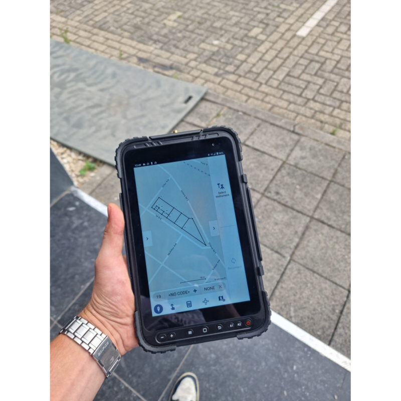
South SurvX Software, or simply SurvX, is a cutting-edge Android GNSS surveying and mapping application designed to elevate your surveying and mapping tasks to a new level of efficiency. With years of market experience integrated into its design, SurvX combines the best features of international mainstream surveying and mapping software to deliver unparalleled performance. Whether you are conducting RTK control, GIS data collection, road design, or simply leveraging the Google Map view functionality, SurvX surveying software ensures accuracy and ease of use.
Outstanding Features of South SurvX Software
Graphic Interaction and Humanized Design
SurvX stands out with its intuitive graphic interaction features and humanized operation processes. This land surveying field software simplifies complex tasks, making it accessible even for those new to surveying technology. Its user-friendly interface reduces learning curves and increases productivity.
Versatility Across Applications
From GIS data collection to RTK control, South SurvX Software is versatile and adaptable to various professional requirements. It’s also a reliable choice for field software for construction projects, offering precision and reliability when managing data on-site. Additionally, this software for data collecting seamlessly integrates with your workflow, allowing you to focus on results rather than technical hurdles.
Integrated Google Map View
The inclusion of Google Map view in SurvX enhances your mapping capabilities. Visualize locations, plan routes, and execute projects with ease using this advanced feature. This unique addition further establishes SurvX as a leading choice in data collecting software.















Anagonou –
J aime votre logiciel
Thordur Ivarsson (verified owner) –
The software works well for my application
Dan Cazacu (verified owner) –
ok
Tomáš (verified owner) –
Temporarily running on a ZenPhone6(Android 11), clear graphical interface, fast responses, lots of measuring tools
Marco U. Pérez García (verified owner) –
Excelente
Anonymous (verified owner) –
Good product at a good price
Willem (verified owner) –
could be better in combination with the H6, the survey point button on the H6 does not work in survX
harli jürgenson (verified owner) –
very comfortable, excellnt dwg import