

GNSS, Total Station
Total Station Surveying vs GNSS Surveying: Understanding the Differences
Total Station, Robotic Total Station or GNSS Receiver: Which Survey Tool Fits Your Job?
A total station and a GNSS receiver are both used to measure positions in the field, but they do it in very different ways. A total station measures angles and distances from the instrument to a target. A GNSS receiver calculates its position from satellite signals, usually with correction data when centimetre-level accuracy is required.
For surveyors, engineers, construction layout teams and machine-control users, the right choice depends on the working environment. Open sites often suit RTK GNSS. Built-up areas, tunnels, tree cover and high-precision layout often need a total station. Robotic total stations sit between these workflows by giving total station accuracy with a more efficient one-person setup.
Quick answer
A GNSS receiver is usually the faster choice for open-sky surveying, topographic work, large sites, GIS data collection and machine-control positioning. A total station is usually the better choice when you need high precision relative measurements, work near buildings, measure under trees, set out construction points or work where satellite signals are blocked or unreliable.
A robotic total station does the same core measurement work as a total station, but it can automatically search for, lock onto and track a prism. This makes it much more efficient for one-person layout and surveying workflows.
How does a total station work?
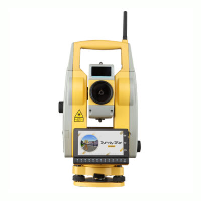
A total station is an optical surveying instrument that measures horizontal angles, vertical angles and distances. It is set up over a known point or positioned using a resection, then it measures to a prism, reflector, target or reflectorless surface.
The instrument calculates point positions based on the measured angle, slope distance and height information. This makes it very useful for work where the relationship between points must be controlled precisely, such as building layout, road construction, boundary work, deformation monitoring and engineering surveys.
Manual total stations
A manual total station is operated directly by a surveyor at the instrument. The user aims the telescope, measures the target and records the point. Manual total stations are often used for smaller survey jobs, control work, detail surveys and construction tasks where a two-person workflow is acceptable.
They are generally simpler than robotic systems, but the operator must stay at the instrument. If a prism is used, another person normally holds the prism pole at the point being measured or set out.
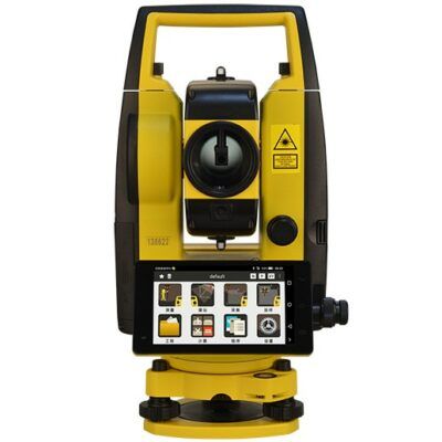
Robotic total stations
A robotic total station adds motorised movement, automatic target search and prism tracking. Instead of one person standing at the instrument and another holding the prism, a single operator can often work from the prism pole using a field controller.
This is especially useful for construction layout, road set-out, building corners, anchor bolts, utilities, kerbs, monitoring points and repetitive stakeout work. The robotic total station follows the prism as the operator moves around the site, which can reduce walking, communication errors and crew size.
Robotic total stations are not the same as GNSS receivers. They still measure with angles and distances from the instrument. Their main advantage is automation, not satellite positioning.
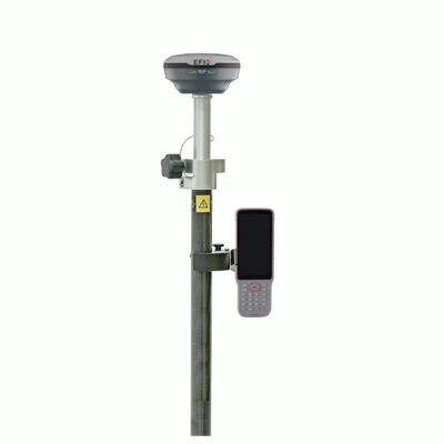
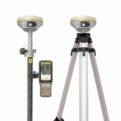
How does a GNSS receiver work?
A GNSS receiver measures its position using signals from satellite navigation systems. In everyday language, many people still call this GPS, but GNSS is the broader term because professional receivers can use multiple satellite constellations, depending on the receiver and configuration.
For survey-grade work, a GNSS receiver is commonly used as an RTK rover. RTK stands for Real-Time Kinematic. The rover receives satellite signals and correction data from a base station, CORS network, VRS network or other correction service. With suitable conditions and correct setup, this allows the receiver to produce precise field positions in real time.
GNSS is powerful because it does not need line of sight to an instrument. You can move around a large site and collect points quickly, as long as the receiver has a good view of the sky and access to correction data when high accuracy is required.
Main difference between a total station and a GNSS receiver
| Feature | Total station | Robotic total station | GNSS receiver |
|---|---|---|---|
| Measurement method | Measures angles and distances from the instrument | Measures angles and distances with automated target tracking | Calculates position from satellite signals and correction data |
| Best working environment | Controlled sites, construction layout, urban areas, obstructed locations | One-person layout, construction, engineering and repetitive stakeout | Open-sky sites, topographic surveys, GIS, large areas and machine control |
| Line of sight needed | Yes, to prism or measured surface | Yes, to prism or measured surface | No line of sight to an instrument, but needs satellite visibility |
| Satellite signal needed | No | No | Yes |
| Typical crew setup | Often two-person, depending on workflow | Often one-person with a field controller | Often one-person rover workflow |
| Strength | Precise angle and distance measurement | Total station precision with faster field operation | Fast positioning over large open areas |
| Main limitation | Needs setup, orientation and line of sight | Needs line of sight and prism lock | Can struggle near obstructions, trees, buildings and signal interference |
When is a GNSS receiver the better choice?
A GNSS receiver is often the better choice when the site has open sky and the work involves many points spread over a large area. Because the rover calculates its own position, the operator can move freely without constantly maintaining line of sight to a fixed instrument.
GNSS is commonly used for topographic surveys, earthworks, road corridors, field mapping, utility mapping, stockpile surveys, boundary reconnaissance, drone ground control points and machine-control workflows. It is also useful when crews need quick coordinates in a known coordinate system.
Modern RTK GNSS receivers may support features such as multi-constellation tracking, NTRIP correction services, UHF radio corrections, IMU tilt compensation and integration with field software. The exact features depend on the model, subscription, controller and software being used.
Good GNSS receiver use cases
- Large open construction sites
- Topographic surveys with many spread-out points
- Road, rail and utility corridor work
- GIS and asset mapping
- Drone mapping ground control points
- Machine-control positioning and site calibration
- Fast stakeout where satellite conditions are reliable
When is a total station the better choice?
A total station is usually the better tool when satellite signals are weak, blocked or unreliable. It is also the better choice when the work depends on precise local geometry, tight construction tolerances or repeatable measurements from a controlled setup.
Because a total station does not rely on satellites, it can work close to buildings, under roofs, beside high walls, in dense urban areas, under tree cover and inside certain structures. The instrument only needs a clear line of sight to the prism, target or measured surface.
Total stations are widely used for building layout, gridlines, anchor bolts, façade work, road set-out, bridge work, monitoring, tunnel-related work, control networks and engineering measurements.
Good total station use cases
- Construction layout with tight tolerances
- Urban surveying near buildings
- Work under tree cover or near signal obstructions
- Indoor or partially covered measurement tasks
- Monitoring points and deformation checks
- Precise control surveys
- Reflectorless measurements to walls, façades or hard-to-reach surfaces
Where do robotic total stations fit?
A robotic total station is often the best choice when you need total station measurement but want a faster and more flexible workflow. It is especially valuable for layout crews that repeatedly move between design points, because the operator can control the instrument from the prism pole.
Instead of walking back to the instrument after every point, the user can view stakeout directions on the controller, move the prism, let the instrument track the target and measure the point. This can make robotic systems very efficient for construction layout and engineering work.
Robotic total stations are also useful when GNSS is not reliable. For example, a building site with cranes, walls, steel structures and partial roof cover may be difficult for GNSS, but a robotic total station can still perform well if it maintains line of sight to the prism.
Accuracy: which one is more precise?
There is no single answer because accuracy depends on the instrument, setup, environment, correction source, control quality and field procedure.
A total station is generally stronger for precise relative measurements, layout and short-to-medium distance engineering work because it directly measures angles and distances from a controlled setup. A GNSS receiver is very efficient for accurate real-world coordinates over open areas, but its performance depends heavily on satellite visibility, correction quality, multipath, coordinate settings and site conditions.
For high-quality results, both systems need good field practice. A total station must be set up, levelled, oriented and checked correctly. A GNSS receiver must have a reliable fix, correct antenna height, suitable correction data and a properly configured coordinate system.
Why GNSS can struggle near obstructions
GNSS receivers need clean satellite signals. Problems can occur when signals are blocked, reflected or disturbed. This is common near buildings, trees, metal structures, vehicles, cliffs, cranes and other obstructions.
One common issue is multipath. This happens when satellite signals reflect from nearby surfaces before reaching the antenna. The receiver may still show a position, but the quality can be affected. This is why open sky is so important for professional GNSS work.
RTK status also matters. A fixed RTK solution is normally preferred for precise survey work. A float solution indicates the receiver has not fully resolved the carrier-phase ambiguities, so the position may not be suitable for high-accuracy work.
Why total stations need line of sight
A total station does not need satellites, but it does need visibility between the instrument and the target. If a truck, wall, machine, person or building blocks the sight line, the instrument cannot measure the prism or surface correctly.
This is why total station planning is important. The surveyor must choose suitable setup locations, control points and backsight points. On large or complex sites, several setups may be required to complete the work.
With a robotic total station, prism tracking can also be interrupted if the prism is hidden or if the instrument locks onto the wrong target. Good prism choice, target ID settings and clear working procedures help reduce these issues.
Field workflow comparison
| Workflow | Best suited tool | Reason |
|---|---|---|
| Open-field topographic survey | GNSS receiver | Fast point collection across large areas with no instrument line-of-sight requirement |
| Building gridline layout | Total station or robotic total station | Strong control over geometry and layout positions |
| One-person construction stakeout | Robotic total station or GNSS receiver | Depends on satellite visibility and required tolerance |
| Urban survey near tall buildings | Total station or robotic total station | GNSS signals may be blocked or reflected |
| Machine control on open earthworks site | GNSS receiver | Efficient positioning for machines and site models |
| Monitoring movement over time | Total station or robotic total station | Repeatable measurements to fixed targets |
| Drone mapping ground control | GNSS receiver or total station | GNSS is efficient in open areas; total station helps where GNSS is unreliable |
Can you use a GNSS receiver and total station together?
Yes. Many professional survey workflows use both. GNSS can quickly establish site control or collect open-area data, while a total station can handle detailed layout, obstructed areas and high-precision local measurements.
For example, a surveyor may use an RTK GNSS receiver to measure control points around a construction site, then use a robotic total station for building layout near steelwork and walls. On a road project, GNSS may be used for open corridor work while the total station is used for structures, kerbs, bridges and areas with poor satellite visibility.
This combination is often more reliable than trying to force one instrument to handle every situation.
Things to check before choosing
Before choosing between a total station, robotic total station and GNSS receiver, look carefully at the job conditions. The best instrument is not always the most advanced one. It is the instrument that fits the site, accuracy requirement and workflow.
| Question to ask | Why it matters |
|---|---|
| Is there open sky? | GNSS works best when satellite visibility is strong. |
| Are there buildings, trees or cranes nearby? | These can block or reflect GNSS signals. |
| Do you need line-of-sight measurements? | Total stations need visibility to the prism or surface. |
| Is one-person operation important? | Robotic total stations and GNSS rovers can support efficient one-person workflows. |
| What accuracy is required? | Construction layout, monitoring and control work may require different methods than general mapping. |
| Which coordinate system is required? | GNSS workflows depend heavily on correct coordinate system and transformation settings. |
| Do you already have site control? | Total station work often depends on good control points, backsights and setup checks. |
| Which field software will be used? | Software compatibility affects stakeout, coding, CAD import, reporting and data export. |
Why this matters in the field
Choosing the wrong tool can cost time and reduce confidence in the data. A GNSS receiver used beside tall buildings may produce unstable results. A manual total station used for a large open topographic survey may be slower than necessary. A robotic total station may be the perfect solution for one-person layout, but it still needs a clear sight line to the prism.
Professional survey work is not only about the instrument. It is about matching the instrument to the environment, checking measurements, using the right software and understanding the limitations of each method.
Which one should you buy?
Choose a GNSS receiver if most of your work is outdoors, open-sky and spread over larger areas. It is a strong choice for topographic surveys, machine control, GIS mapping, drone control points and general RTK positioning.
Choose a manual total station if you need a cost-effective optical instrument for precise angle and distance measurement, and you are comfortable with a conventional setup and workflow.
Choose a robotic total station if you do construction layout, engineering set-out, monitoring or frequent stakeout work and want the productivity of one-person operation with total station measurement principles.
Many surveyors and construction professionals eventually use both GNSS and total station equipment. GNSS gives speed and flexibility in open areas. Total stations give control and reliability when satellite positioning is not the best option.
Related Global GPS Systems product categories
Global GPS Systems supplies equipment for both satellite-based and optical surveying workflows. Depending on your work, relevant categories include RTK GNSS receivers, total stations, robotic total stations, data collectors, correction services, surveying software and machine-control solutions.
If you are comparing equipment, check the working environment first. Open-sky earthworks, road corridors and mapping projects often point toward GNSS. Building layout, urban measurement and high-precision set-out often point toward a total station or robotic total station.