

 GPS & GNSS
 Lidar scanning
 Total Station
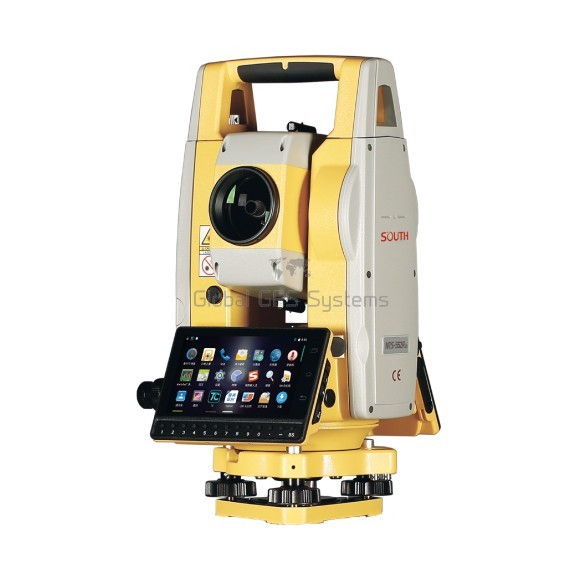
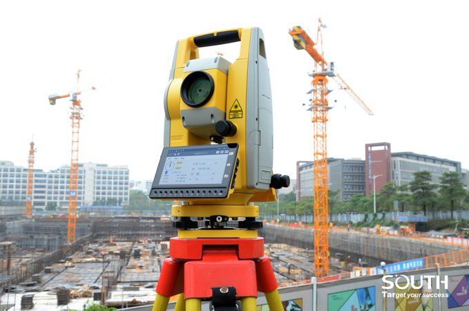
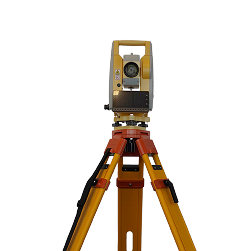
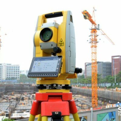
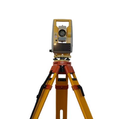
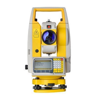
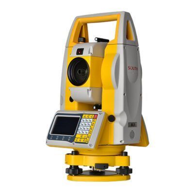
South N1 Android Total Station
Get the best price for your setup
Contact our experts for the best possible price and configuration.
- Fast response
- Expert configuration advice
- No overpaying for features you do not need
The South N1 Android Total Station is a practical manual surveying instrument for construction layout, topographic work, road design, boundary surveys, and site measurement. Its dual-laser EDM measures distances quickly with prism and non-prism targets, while 2″ angle accuracy supports dependable field positioning. The Android-based interface, touchscreen, numeric keypad, and onboard surveying software help crews collect points, calculate coordinates, perform resections, measure offsets, and stake out points or lines directly in the field. USB-C, Bluetooth, Wi-Fi, SIM, and TF-card connectivity simplify data transfer between the total station, office software, and mobile devices. With an IP55-rated housing and up to eight hours of operation, the South N1 suits surveyors, engineers, contractors, GIS teams, and infrastructure crews.
South N1 Android Total Station Highlights
| Angle accuracy | 2″ |
|---|---|
| Distance accuracy | ±(2+2 ppm × D) mm with prism |
| Non-prism range | 1,000 m standard; 1,500 m or 2,000 m optional |
| Field software | Android 11 with onboard surveying, COGO, road, CAD, and stake-out tools |
| Display and durability | 5.5-inch color touchscreen, IP55 protection, up to 8 hours’ operation |
You may also like…
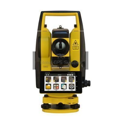
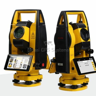
Total Stations
Valued customers:










Find RTK Networks
Search NTRIP providers and connect to reliable RTK correction services.
Description
South N1 for Practical Surveying and Construction Layout
The South N1 is a manual Android total station designed for surveyors, site engineers, construction teams, mapping professionals, and other field users who need dependable angle and distance measurements without relying entirely on satellite visibility. It combines a precision telescope, dual-laser electronic distance measurement, onboard surveying software, touchscreen operation, and flexible data-transfer options in one field-ready instrument.
Unlike an RTK GNSS receiver, which determines position from satellite signals and correction services, a total station measures angles and distances to a prism or suitable target. This makes the South N1 especially useful on sites where buildings, trees, bridges, steep terrain, indoor structures, or other obstructions limit GNSS reception. It can also work alongside RTK GNSS equipment, allowing crews to use GNSS for open-sky control and the total station for detailed layout, construction positioning, and measurements in obstructed areas.
Accurate Angle and Distance Measurement for Everyday Fieldwork
The South N1 provides 2-second angular accuracy and electronic distance measurement suitable for general surveying, engineering layout, topographic work, and construction positioning. Its prism measurement range can extend up to 5,000 metres in suitable conditions, while reflectorless measurement is available in different range configurations depending on the instrument version. The published N1 configurations include reflectorless ranges up to approximately 1,000, 1,500, or 2,000 metres, so buyers should confirm the exact EDM option supplied with their setup.
In practical terms, reflectorless measurement allows the operator to measure many surfaces without placing a prism directly on the point. This can be useful when measuring building façades, retaining walls, road edges, stockpiles, columns, inaccessible corners, or points across a busy work area. A prism remains the preferred target for demanding long-range work and the highest consistency, while reflectorless measurement can save time when access is difficult or the target cannot safely be occupied.
The EDM is designed for fast target acquisition and short measurement intervals. Fine measurement can take approximately 0.3 seconds, while tracking mode can update more quickly for applications where the prism or target is being observed continuously. The dual-laser EDM design helps produce a strong return signal and stable measurements across a range of common site conditions, although actual performance will always depend on visibility, target reflectivity, atmospheric conditions, distance, and the operator’s setup.
Built for Construction, Engineering, and Topographic Surveys
The South N1 is suitable for a broad range of work where accurate coordinates, elevations, lines, and distances are required. Construction workers can use it to establish building corners, check grid lines, position foundations, set column locations, transfer elevations, verify as-built points, and lay out structural or civil works. Surveyors can use it for detail surveys, control observations, traverses, boundary-related fieldwork, and general topographic data collection.
For road and infrastructure projects, the onboard functions support alignment work, reference lines, road elements, arc calculations, and stake-out operations. This helps field crews work from design information directly at the site instead of relying on separate hand calculations for every point. The instrument can also support measurements around obstructions by using resection, free-station workflows, and traverse methods to extend the working area when a direct setup on a known control point is not practical.
The South N1 can be useful for contractors who do not need a robotic total station but still want digital workflows and onboard calculations. It is a manual instrument, meaning the operator normally aims and measures the target with the assistance of a prism person or field partner. This arrangement can be cost-effective for two-person crews, small contractors, survey departments, and firms that perform regular layout and measurement work without requiring automated target tracking.
Onboard Surveying Software for a More Direct Workflow
The N1 includes onboard surveying software designed to guide the user through common field operations. The interface uses graphical icons, electronic bubble information, instrument status tools, and clearly organized measurement menus. This gives the instrument a more familiar feel for users who are accustomed to mobile devices, while still providing the dedicated controls and numeric keypad expected on a total station.
Common workflows include known-point station setup, backsight checking, station-height calculation, resection, free station, point-to-line setup, coordinate collection, distance offsets, plane offsets, column offsets, remote elevation measurement, missing-line calculations, and line or point extension. These functions are valuable when the point being measured cannot be occupied directly or when the site geometry requires additional calculations in the field.
For construction layout, the stake-out tools can guide the operator toward a point by displaying movement information such as left or right, toward or away, and elevation difference. Once the prism is positioned close to the design location, the crew can record the final observation and continue to the next point. Reference-line and arc stake-out functions can also help position walls, curbs, alignments, circular features, offsets, and other elements derived from a project design.
COGO tools are available for coordinate geometry tasks such as inverse calculations, coordinate computation, area and perimeter calculations, included angles, equidistant points, triangle calculations, and unit conversions. These features reduce the need to move repeatedly between the instrument and a separate calculator or field notebook, especially during preliminary layout and verification work.
CAD and Digital Mapping Support
One of the practical strengths of the South N1 is its ability to support digital mapping and CAD-based field workflows. Depending on the software version and configuration, project data can be transferred in common formats such as TXT, CSV, XLS, DAT, DXF, and related survey formats. CAD files can be used for stake-out and reference work, allowing field crews to work from drawing information that more closely matches the project design.
With a map-driven workflow, the operator can view points, lines, surfaces, and other survey elements in a graphical environment rather than working only from numerical lists. This can make it easier to identify the correct point, understand the relationship between measured features, and reduce mistakes when several similar points are located close together. Digital coding and descriptions also help organize collected information for later office processing and CAD production.
For small construction companies and site teams, this type of onboard workflow can reduce dependence on a separate data collector. For professional survey firms, it provides a practical field interface for capturing observations that can later be transferred to office software for adjustment, drafting, quantity calculations, or project documentation.
Large Touchscreen and Practical Operator Controls
The N1 is equipped with a high-resolution colour touchscreen, with the N1 2.0 configuration identified with a 5.5-inch display. The screen provides a clearer view of measurement results, icons, maps, stake-out guidance, and job information than a basic monochrome instrument display. A brightness sensor and adjustable display settings help the operator work in changing light conditions.
The touchscreen is complemented by a numeric keypad and dedicated controls, giving users more than one way to operate the instrument. The EDM trigger key is particularly useful when the telescope is already aimed at the target and the operator wants to take a measurement with a simple button press. This can speed up repetitive observations and allow the user to maintain a stable viewing position during measurement.
The telescope provides 30x magnification, a 1.2-metre minimum focus distance, and an erect image. These characteristics are appropriate for general site surveying, control observations, layout, and long-distance target aiming. The integrated laser pointer can assist with target aiming and identifying the approximate measurement location, while the dual-axis compensator helps monitor small deviations from a level setup.
Flexible Data Transfer and Connectivity
Survey data can be transferred using USB Type-C with OTG support, a TF card, Bluetooth, and WLAN. Selected configurations also include a micro-SIM slot and mobile network support. These options give field crews flexibility when moving jobs, point files, CAD drawings, and measured data between the total station, another controller, a computer, or a connected network.
Bluetooth and Wi-Fi can be useful when the crew wants to reduce cable use on site. USB Type-C provides a straightforward wired option for copying files or connecting compatible equipment, while removable storage can help separate projects and archive completed work. Mobile connectivity may be useful for teams that need to exchange data from the field, although network availability and regional cellular-band compatibility should be confirmed before purchase.
Rugged Enough for Regular Site Use
The South N1 has an IP55 environmental protection rating and is specified for operation between approximately -20°C and 50°C. This level of protection is intended for normal outdoor surveying and construction conditions, including dust exposure and light water contact. It is not a substitute for careful handling, proper case storage, or protection from heavy rain, standing water, mud, and impacts.
The instrument weighs approximately 5.7 kilograms and uses a 7.4-volt lithium-ion battery. A stated operating time of up to around eight hours can support a typical working day, although actual battery life depends on screen brightness, wireless communication, temperature, EDM use, and the condition of the battery. Crews working long shifts or in remote locations should consider carrying a charged spare battery and following good charging and storage practices.
Who Should Consider the South N1?
The South N1 is a practical choice for professionals who need a capable manual total station with modern onboard software and digital data handling. It is well suited to:
- Land and engineering surveyors collecting points, checking control, and performing topographic measurements.
- Construction contractors setting out foundations, walls, columns, roads, drainage, and site features.
- Civil engineering teams working on road alignments, earthworks, utilities, bridges, and infrastructure improvements.
- Small surveying and construction firms that want onboard calculations without moving immediately to a robotic total station.
- GIS and mapping crews collecting structured field data for later CAD, GIS, or asset-management workflows.
- Drone-mapping teams using a total station to establish or verify control points in areas where satellite positioning is obstructed or unreliable.
- Site engineers and inspectors checking dimensions, elevations, clearances, as-built conditions, and construction tolerances.
Drone pilots and photogrammetry teams may use the South N1 as part of a wider surveying workflow rather than as a replacement for a drone or RTK GNSS receiver. It can help measure ground control, verify checkpoints, and collect detail beneath trees, beside structures, or in locations where an aerial survey requires independent ground observations.
How It Compares with RTK GNSS Equipment
The South N1 and an RTK GNSS receiver solve different measurement problems. RTK GNSS is often faster for collecting open-area points and can provide centimetre-level positioning when correction data and satellite visibility are available. A total station does not require a clear view of the sky, but it does require line of sight between the instrument and the prism or target.
For many professional crews, the most useful approach is to combine both technologies. GNSS can establish control and provide efficient positioning across open areas, while the South N1 can handle detailed layout, building corners, indoor or partially covered areas, vertical faces, and work close to obstructions. Buyers comparing RTK GNSS equipment should therefore consider whether their projects require optical line-of-sight measurement, construction stake-out, elevation transfer, or detailed positioning where satellite signals may be interrupted.
Choosing the Correct South N1 Configuration
The N1 product family has been supplied in more than one hardware and software revision. Product information for different versions identifies differences such as Android operating system version, display size, reflectorless EDM range, processor and memory configuration, and onboard software naming. The current supplied configuration should therefore be confirmed before ordering, especially when a project depends on a specific reflectorless range, cellular band, software version, or file-transfer method.
It is also important to select the complete field setup rather than the instrument alone. Depending on the work, a suitable package may include a prism and prism pole, tripod, tribrach, batteries, charger, carrying case, data cables, spare storage, and any required field software or accessories. The right setup will depend on whether the instrument is being used for construction layout, topographic survey, cadastral work, road design, monitoring, or combined GNSS and total station operations.
South N1 Support from Global GPS Systems
Global GPS Systems can help buyers match the South N1 configuration and accessories to their actual field requirements. This is useful for customers who are moving from basic optical instruments, comparing a manual total station with an RTK GNSS receiver, or building a combined GNSS and total station workflow. Before purchasing, discuss the required EDM range, software revision, data formats, cellular compatibility, prism setup, and expected working environment.
With its combination of precise angular measurement, long-range EDM capability, onboard calculations, CAD-oriented workflows, mobile-style operation, and practical field durability, the South N1 is designed for professionals who need reliable measurement and layout tools across construction, surveying, engineering, mapping, and infrastructure projects. It offers a direct way to collect and use field data while remaining flexible enough to support both traditional total station procedures and modern digital project workflows.
Specifications
South N1 Specifications
Product Overview
| Brand | South |
|---|---|
| Model | N1 Series, version N1 2.0 |
| Product type | Manual Android total station |
| Primary use | Angle, distance and coordinate measurement for surveying, construction, mapping and civil engineering |
| Operating system | Android 11.0 |
| Onboard surveying software | Survey Star |
| Developer support | Open Android platform with SDK support |
Typical Users and Industries
| Professional users | Land surveyors, civil engineers, construction layout crews, geomatics technicians, mapping professionals and site supervisors |
|---|---|
| Land surveying | Topographic surveys, boundary surveys, control-point establishment, traversing, resection and coordinate collection |
| Construction | Building layout, foundation positioning, structural alignment, site grading, as-built surveys and point stakeout |
| Civil engineering | Road design, road alignment, infrastructure construction, utility layout, corridor surveys and earthwork measurement |
| Mapping and GIS | Digital field mapping, feature collection, coded data capture, CAD-based stakeout and map-driven workflows |
| Mining and industrial surveying | Site measurement, alignment work, stockpile calculations, volume estimation and dimensional control |
| Recommended operating environment | Field surveying applications requiring manual total-station operation, integrated calculations and onboard data management |
Distance Measurement
| Measurement Mode | Range | Accuracy |
|---|---|---|
| With reflector or prism | Up to 5,000 m | ±(2 mm + 2 ppm × D) |
| Reflectorless, optional configuration | 1,000 m, 1,500 m or 2,000 m | ±(3 mm + 2 ppm × D) |
| Fine measurement interval | Approximately 0.3 seconds | With reflector or prism |
| Tracking measurement interval | Approximately 0.1 seconds | With reflector or prism |
| Reflectorless measurement interval | Approximately 0.3 to 3 seconds | Depending on target and conditions |
| EDM technology | Dual-laser electronic distance measurement system | |
| Reflectorless target condition | Range specification is based on high-reflectivity white targets; actual performance varies with target material, color, angle, atmospheric conditions and visibility | |
| Prism range condition | Range specification is based on suitable reflector or prism targets and favorable visibility conditions | |
Angle Measurement
| Angle accuracy | 2 arc seconds |
|---|---|
| Horizontal and vertical measurement method | Absolute continuous, diametrical encoding |
| Encoder disk diameter | 79 mm |
| Angle display resolution | 0.1 arc second |
| Selectable angle units | Degrees, gons and mils |
| Vertical angle reference options | Vertical zero, horizontal zero or plus/minus 90 degrees |
Telescope
| Telescope image | Erect |
|---|---|
| Magnification | 30× |
| Tube length | 154 mm |
| Effective aperture | 45 mm; EDM aperture 50 mm |
| Resolving power | 3 arc seconds |
| Field of view | 1 degree 30 minutes |
| Minimum focusing distance | 1.2 m |
| Reticle | Illuminated reticle with four brightness levels |
Compensator and Vials
| Compensator type | Liquid dual-axis compensator |
|---|---|
| Compensator setting accuracy | 1 arc second |
| Compensator range | ±4 arc minutes |
| Plate vial | 30 arc seconds per 2 mm |
| Circular vial | 8 arc minutes per 2 mm |
| Compensator settings | Compensator off, X-axis or dual-axis operation |
Laser Plummet and Aiming
| Standard plummet | Laser point plummet |
|---|---|
| Laser plummet brightness | Four brightness levels |
| Laser plummet accuracy | ±1.5 mm at 1.5 m instrument height |
| Laser wavelength | 630 to 670 nm |
| Laser classification | Class 2 according to IEC 60825-1 |
| Laser output power | Less than 0.4 mW |
| Optional plummet | Optical plummet |
| Optional optical plummet image | Erect |
| Optional optical plummet magnification | 3× |
| Optional optical plummet focusing range | 0.5 m to infinity |
| Optional optical plummet field of view | 5 degrees |
| EDM trigger key | Dedicated measurement trigger for quick target acquisition and measurement |
| Laser pointer | Coaxial aiming assistance for target alignment |
Operating System and Processing
| Operating system | Android 11.0 |
|---|---|
| Processor | MediaTek MT6762 |
| Random-access memory | 4 GB RAM |
| Internal storage | 64 GB ROM |
| User interface | Android-based touchscreen interface with numeric and functional keys |
| Brightness sensor | Integrated brightness sensor with virtual button functionality |
| Audio | Integrated microphone and speaker |
Display and Controls
| Display type | Color TFT LCD touchscreen |
|---|---|
| Display size | 5.5 inches |
| Display resolution | 720 × 1280 pixels |
| Touch control | Capacitive color touchscreen |
| Keypad | Numeric keypad with user-defined numeric and functional keys |
| Reticle illumination | Four brightness levels |
| Virtual controls | On-screen toolbar, electronic bubble, electronic compass and quick-function controls |
Communication and Data Transfer
| SIM interface | Micro SIM |
|---|---|
| USB interface | USB Type-C with OTG support |
| Memory card interface | TF card slot |
| Bluetooth | Bluetooth 4.0 |
| WLAN | Dual-band single-stream 802.11a/b/g/n wireless LAN for data link communication |
| 3G network support | 2100 MHz, 900 MHz, CDMA BC0 and TD-SCDMA A/F |
| 4G LTE support | LTE bands 1, 3, 7, 38, 39, 40 and 41 |
| Supported data formats | TXT, DXF, DAT, CSV and XLS |
| CAD file support | DWG and DXF files for CAD stakeout workflows |
| Data transfer methods | USB OTG, TF card, Bluetooth, WLAN and cellular network connectivity |
Surveying and Calculation Functions
| Basic measurement | Angle, distance and coordinate measurement |
|---|---|
| Station setup | Known point, station height, backsight check, resection, point-to-line, free station and station setup without control point |
| Data collection | Point collection, coded data collection, distance offset, plane offset, column offset, missing line measurement, line extension and remote elevation measurement |
| Stakeout | Point, angle and distance, reference line, line, reference-line offset and arc stakeout |
| COGO calculations | Coordinate reduction, XYZ calculation, inverse calculation, area, perimeter, included angle, distance conversion, angle conversion, average point, equidistant points and triangle calculations |
| Road functions | Horizontal alignment, vertical alignment, road design, road stakeout and centerline stakeout |
| CAD stakeout | Import and use DWG or DXF files for graphical CAD-based stakeout |
| Mapping functions | Point, line, surface and shape drawing with graphical field guidance and digital map generation |
| Job management | Create, open, review, manage and delete survey jobs; view job attributes and measurement data |
| Measurement modes | Single, continuous, tracking and multiple-measurement modes |
| Target modes | Non-prism, sheet and prism target modes |
| Atmospheric corrections | Temperature, pressure, parts-per-million and grid-factor settings |
| Units | Meters, U.S. survey feet, international feet, feet-inch formats, degrees, gons and mils |
Power
| Battery type | Rechargeable lithium-ion battery |
|---|---|
| Battery voltage | 7.4 V |
| Operating time | Approximately 8 hours |
| Power management | Rechargeable field battery system with Android-based power controls |
Physical and Environmental Specifications
| Dimensions | 350 × 170 × 217 mm |
|---|---|
| Weight | Approximately 5.7 kg |
| Operating temperature | -20 °C to +50 °C |
| Ingress protection | IP55 |
| Field durability | Designed for outdoor surveying and construction environments |
Standard and Optional Configuration Items
| Item | Configuration | Notes |
|---|---|---|
| South N1 total station instrument | Standard | Manual Android total station body |
| Laser plummet | Standard | Integrated laser point plummet |
| Optical plummet | Optional | May be supplied instead of or in addition to the standard configuration depending on package |
| Reflectorless EDM range | Optional | Available as 1,000 m, 1,500 m or 2,000 m configuration |
| Battery and charger | Configuration dependent | Confirm quantity and charger type with the supplied package |
| Carrying case and accessories | Configuration dependent | Package contents are not fixed in the available technical documentation |
Technical Notes
| Distance notation | D represents the measured distance in kilometers when used with the stated ppm specification |
|---|---|
| Reflectorless accuracy | Actual reflectorless performance depends on target reflectivity, surface condition, incidence angle, weather and visibility |
| Range conditions | Published range values are measured under specified favorable conditions and should not be treated as guaranteed field range for every target |
| Software naming | Current manufacturer documentation identifies the onboard application as Survey Star; product listings may use different software names for particular configurations or documentation versions |
| Configuration status | Reflectorless range, plummet type, cellular compatibility, accessories and included software features may vary by market or instrument configuration |
Specifications and package contents may vary by configuration, region or manufacturer update. Always check the current configuration before ordering.
Reviews (0)
Only logged in customers who have purchased this product may leave a review.
FAQ
South N1 FAQ
Product Overview and Applications
What is the South N1 Android Total Station?
The South N1 is a manual total station for measuring horizontal angles, vertical angles, distances and coordinates. It combines a dual-laser electronic distance meter, onboard surveying software, an Android-based interface, a color touchscreen and multiple data-transfer options for professional field surveying.
Who uses the South N1 Total Station?
The South N1 is designed for land surveyors, construction surveyors, civil engineers, site engineers, geospatial professionals, utility contractors, road and infrastructure teams, mining surveyors and technical education or training departments.
Which industries use the South N1?
Typical industries include land surveying, construction, civil engineering, road and railway infrastructure, building layout, utilities, mining, topographic mapping, industrial surveying, property development and public works.
What surveying tasks can be completed with the South N1?
The South N1 can be used for topographic surveys, detail surveys, construction layout, point collection, stake-out, reference-line work, resection, free-station setup, road design, traverse work, area and volume calculations, offset measurements and coordinate calculations.
Is the South N1 a manual or robotic total station?
The South N1 is a manual total station. The operator aims and measures each target manually. It is suitable for teams that need professional angle and distance measurement without the remote robotic operation associated with a robotic total station.
Can the South N1 be used for construction layout?
Yes. Its stake-out, reference-line, point-to-line, line, arc and road-design functions support construction layout, alignment checks, foundation positioning, column placement, curb layout, road work and other coordinate-based field tasks.
Accuracy, Range and Measurement
What is the angular accuracy of the South N1?
The South N1 is specified with 2-second angular accuracy. This specification is suitable for many general surveying, construction, infrastructure and topographic applications. The required accuracy should always be assessed against the tolerances of the specific project.
What is the distance accuracy of the South N1?
For prism measurements, the datasheet specifies distance accuracy of ±(2 + 2 ppm × D) millimetres. For non-prism measurements, the specified accuracy is ±(3 + 2 ppm × D) millimetres, where D is the measured distance in kilometres.
What is the maximum prism measurement range?
The South N1 datasheet specifies a prism range of up to 5,000 metres under suitable conditions. Actual range depends on the prism, atmospheric conditions, visibility, target alignment and the reflectivity of the target.
What is the non-prism measurement range?
Non-prism range options are listed as 1,000, 1,500 or 2,000 metres depending on the instrument configuration. The product page highlights a 1,500-metre non-prism range. Confirm the exact range of the supplied configuration before ordering.
How fast can the South N1 measure a target?
The South N1 is specified with a fine measurement time of approximately 0.3 seconds and a tracking measurement interval of approximately 0.1 seconds. Measurement speed can vary with the target, distance, environmental conditions and selected measurement mode.
What is the advantage of the dual-laser EDM?
The dual-laser electronic distance meter is designed to improve return-signal strength and measurement stability. This can help the instrument acquire targets quickly and maintain reliable measurements in challenging field conditions, although performance still depends on visibility, target surface and atmospheric conditions.
Survey Software and Field Functions
Which surveying functions are built into the South N1?
Built-in functions include known-point station setup, station-height determination, backsight checks, resection, free station, point-to-line setup, distance and plane offsets, column offsets, missing-line measurement, remote elevation measurement, point and coordinate collection, stake-out, reference lines, arc stake-out, COGO calculations, area and perimeter calculations, traverse and road-design tools.
Can the South N1 perform resection or free-station setup?
Yes. The station functions support resection and free-station workflows for determining the instrument position from measured known or reference points. The quality of the result depends on the geometry and accuracy of the control points used.
Can the South N1 stake out points, lines and arcs?
Yes. The instrument supports point stake-out, angle-and-distance stake-out, line stake-out, reference-line stake-out and arc stake-out. Stake-out guidance helps the operator move the prism toward the required position using directional and distance differences.
Can the South N1 be used for road surveying and road design?
Yes. Its road and alignment tools support horizontal and vertical alignment work, road design, middle-line stake-out, traverse workflows and related coordinate calculations. Road elements can be entered manually or imported in supported formats.
Can CAD files be used with the South N1?
The N1 software supports CAD stake-out workflows using DWG and DXF files. CAD data can be imported to the instrument and used to guide field stake-out, subject to correct coordinate systems, units, layers and file preparation.
Which onboard software is included with the South N1?
The product page describes Map Star software, while the linked N1 2.0 datasheet refers to Survey Star. Because software names and operating-system versions may vary between N1 configurations, confirm the exact software version supplied with the instrument before purchase.
Connectivity, Operating Conditions and Ownership
Which operating system does the South N1 use?
The product page describes an Android 6.0 operating system, while the linked N1 2.0 datasheet lists Android 11.0. This indicates that specifications may vary by product version. Ask the supplier to confirm the operating system of the exact unit being supplied.
How can survey data be transferred from the South N1?
Depending on the configuration, data can be transferred using USB Type-C OTG, a TF or microSD card, Bluetooth, WLAN or a SIM-based mobile connection. The product documentation lists support for common survey and CAD-related formats including TXT, DXF, DAT, CSV and XLS.
Does the South N1 support Bluetooth and Wi-Fi?
Yes. The datasheet lists Bluetooth 4.0 and dual-band WLAN connectivity. These interfaces can support data transfer and communication with compatible field equipment, controllers or computers.
Does the South N1 have mobile connectivity?
The datasheet lists a micro-SIM slot and 3G and 4G communication bands for supported configurations. Mobile-network compatibility depends on the regional model, carrier frequency bands and local network availability.
How long does the South N1 battery last?
The datasheet specifies an operating time of approximately eight hours. Actual battery life depends on EDM use, screen brightness, wireless communication, mobile data, temperature and measurement frequency.
Is the South N1 suitable for outdoor fieldwork?
Yes. The instrument is specified with an IP55 protection rating and an operating temperature range of approximately -20°C to 50°C. IP55 protection helps protect against dust and water jets, but the instrument should not be submerged or exposed to conditions beyond its rated limits.
How much does the South N1 weigh?
The datasheet lists a weight of approximately 5.7 kilograms and dimensions of about 350 × 170 × 217 millimetres. Transport-case and accessory weights are not included in this instrument specification.
Does the South N1 have a touchscreen and physical keypad?
Yes. The N1 is specified with a high-resolution color touchscreen and a numerical keypad with user-defined functional keys. This combination allows operators to use graphical workflows while retaining quick physical data entry in the field.
Can developers integrate applications with the South N1?
The product page describes a free SDK package for developers. Integration possibilities depend on the installed operating-system version, available SDK documentation and the requirements of the intended application. Confirm compatibility with the supplier before developing custom software.
What should be checked before ordering a South N1?
Confirm the exact N1 version, angular accuracy, non-prism range, onboard software, Android version, communication bands, included batteries and charger, prism or non-prism configuration, data formats, accessories, calibration documentation, warranty coverage and regional support arrangements.
What maintenance does the South N1 require?
Keep the telescope lenses, EDM window, tribrach and optical surfaces clean; protect the instrument during transport; check and adjust the compensator, collimation and other calibration parameters at recommended intervals; and use a qualified service center for repairs or precision calibration.

 GPS & GNSS
 Total Stations
 Data collectors
 Software
 Correction services
 Machine control
 External radio
 Marine
 Accessories
Reviews
There are no reviews yet