
 GPS & GNSS
 Lidar scanning
 Total Station

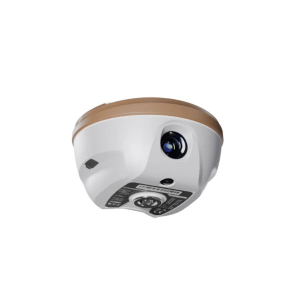
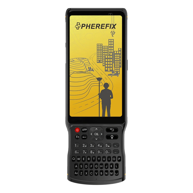
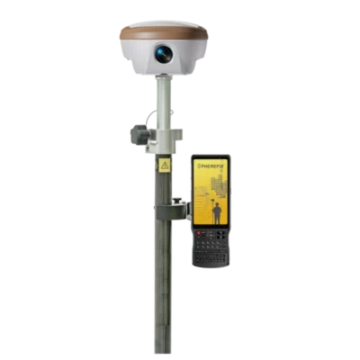

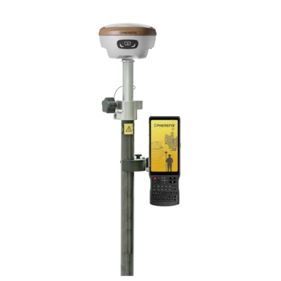
Spherefix SP35Pro RTK GNSS Rover Set
Currently unavailable
Get the best price for your setup
Contact us for expected delivery time.
This product is end of life

Valued customers:










Find RTK Networks
Search NTRIP providers and connect to reliable RTK correction services.
Description
A complete visual RTK rover set
The Spherefix SP35Pro Rover Set combines a multi-band RTK GNSS receiver, a rugged Android data controller and the communication functions required for everyday rover surveying. It is intended for surveyors, construction professionals, civil engineers, GIS teams and field crews who need reliable centimetre-level coordinates without carrying separate equipment for conventional surveying and visual measurement.
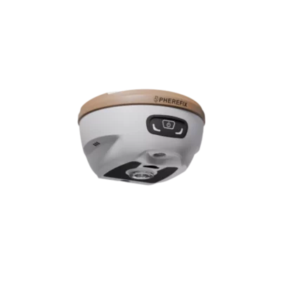
At the centre of the set is the SP35Pro receiver. It integrates full-constellation satellite tracking, an IMU tilt sensor, camera-based photogrammetry and augmented-reality stakeout. The included C100T controller provides the interface for project setup, coding, point measurement, stakeout and data management.
Photogrammetry for difficult measuring points
The SP35Pro includes a 1/2.6-inch wide-angle photogrammetry camera that works with the receiver’s GNSS and inertial positioning data. This gives field crews an additional way to capture features that are inconvenient, unsafe or impossible to occupy directly with the survey pole.
Typical applications include measuring building corners, façades, trench edges, roadside objects, utility features and points behind fences or other obstacles. Instead of forcing the pole tip onto every feature, the operator can collect suitable visual data and calculate the required point through the compatible field software.
Photogrammetry does not replace every conventional RTK observation, but it can reduce the time spent finding access to difficult points and extend the range of work that can be completed with one rover set.
AR real-scene stakeout
For construction layout and point stakeout, the receiver uses an ultra-wide-angle camera to display guidance over a live image of the site. This AR real-scene stakeout function helps the operator connect the digital design position with objects and directions visible in the field.
Traditional stakeout screens normally guide the user with arrows, distances and left-or-right values. AR guidance adds a visual reference, making it easier to understand which direction to walk and where the target lies in relation to the surrounding site. This can be particularly useful when setting out many points, working on open ground or assisting operators who perform setting-out work less frequently.
Measure accurately with the pole tilted
The integrated IMU supports tilt compensation through an angle of up to 60°. Within this range, the stated tilt positioning error is less than 2 cm. The survey pole therefore does not need to be held perfectly vertical for every measurement.
This makes point collection easier beside walls, underneath vegetation, near machinery and along fences or other obstructions. It can also improve comfort during long topographic surveys because the operator spends less time carefully levelling the pole before recording each point.
1408-channel multi-constellation GNSS receiver
The SP35Pro tracks signals from GPS, GLONASS, BeiDou, Galileo, QZSS, SBAS and NavIC across multiple frequencies. Its 1408-channel GNSS board gives the receiver access to a broad range of available satellite signals.
In practical fieldwork, multi-constellation tracking can improve satellite availability when part of the sky is obstructed by buildings, trees or site equipment. Positioning performance will still depend on satellite geometry, correction quality, radio or mobile coverage and the surrounding environment.
The specified RTK accuracy is ±(8 mm + 1 ppm) horizontally and ±(15 mm + 1 ppm) vertically under suitable conditions. The receiver supports RTCM 3.x correction data and an update frequency of up to 20 Hz, making it suitable for detailed surveying, setting out, as-built recording and GIS data collection.
Network RTK and radio correction support
An integrated 4G modem allows the SP35Pro to receive network corrections from compatible NTRIP or CORS services. This is usually the most convenient rover workflow where suitable mobile coverage and a correction network are available.
For work with a local GNSS base station, the receiver also contains a 410–470 MHz transceiver radio with selectable 0.5 W and 1.5 W output. Support for common radio protocols gives the set flexibility when working with compatible base receivers and existing survey equipment.
Wi-Fi is used for receiver configuration and data-intensive visual functions, while Bluetooth provides a convenient connection between the receiver and controller. NFC is also available for supported connection and identification workflows.
C100T Android survey controller
The included C100T is designed for outdoor surveying and data collection. Its 5.45-inch sunlight-readable touchscreen is combined with a physical keyboard, allowing the operator to use touch controls or hardware keys depending on the application, weather and personal preference.
An eight-core processor, Android 11 operating system, 4 GB of RAM and 64 GB of internal storage provide a practical platform for compatible surveying software. The controller also includes a 13 MP rear camera, Wi-Fi, Bluetooth and mobile network connectivity.
The C100T has an IP68-rated housing for protection against dust and water during normal field use. Its 9000 mAh battery provides up to 18 hours of stated operating time, helping the controller and receiver remain available throughout a full working day.
Lightweight equipment for mobile crews
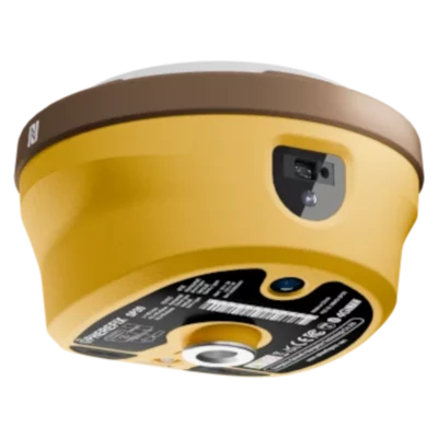
The SP35Pro receiver weighs approximately 770 g and measures 134 mm in diameter by 86 mm high. Its magnesium-alloy body and plastic top cover keep the system compact while providing protection for normal construction and surveying environments.
The receiver is IP68 rated, has a specified operating range from −30°C to +65°C and is designed to withstand a 2 m pole drop at room temperature. Its internal 6500 mAh battery provides more than 16 hours of typical rover operation using GSM, while USB Power Delivery support provides practical charging options in the office, vehicle or field.
Applications for the SP35Pro Rover Set
The rover set can be used for topographic and cadastral surveys, construction layout, earthworks, road projects, utility surveys, boundary work, as-built measurement and GIS asset collection. Its visual functions are particularly valuable for crews that regularly stake out design points or encounter features that cannot be reached directly with a pole.
- Topographic surveys and site measurement
- Construction setting out and as-built checks
- Road, infrastructure and earthworks projects
- Utility mapping and GIS asset collection
- Visual measurement of difficult or inaccessible points
Configuration and support from Global GPS Systems
Global GPS Systems can help configure the Spherefix SP35Pro Rover Set for the intended correction service, survey software and field workflow. Mobile-network compatibility, UHF frequency requirements, coordinate systems and available RTK correction services can differ between countries and projects, so the complete setup should be matched to the location in which it will be used.
This package is a suitable choice for buyers who want a complete GNSS rover with an included field controller and who will benefit from photogrammetry, IMU tilt measurement and camera-guided stakeout. Users specifically looking for integrated laser distance measurement should consider a receiver designed with a dedicated laser module rather than assuming that function is included in the SP35Pro.
Datasheets & Manuals
Datasheets and manuals
Specifications
SphereFix SP35Pro Rover Set Specifications
System Overview
| Product type | Professional multi-frequency GNSS RTK rover set |
|---|---|
| Receiver model | SphereFix SP35Pro |
| Data controller model | SphereFix C100T |
| Receiver operating modes | RTK rover, RTK base and static surveying |
| Primary applications | Land surveying, topographic mapping, construction stakeout, infrastructure surveying, cadastral work, GIS data collection, photogrammetry and AR real-scene stakeout |
| Key functions | Centimetre-level RTK positioning, 60° IMU tilt compensation, AR visual stakeout, photogrammetry, cellular NTRIP corrections and integrated UHF/LoRa radio |
SP35Pro Receiver Hardware
| Processor architecture | ARM Cortex-A7 |
|---|---|
| Operating system | Linux |
| GNSS channels | 1408 |
| Internal storage | 8 GB |
| Integrated IMU | High-precision inertial measurement module with tilt compensation |
| Integrated imaging | AR real-scene stakeout camera and photogrammetry camera |
| Integrated communication systems | 4G cellular modem, Bluetooth, Wi-Fi, NFC and 410–470 MHz data radio |
GNSS Satellite Tracking
| Constellation | Supported Signals | Notes |
|---|---|---|
| GPS | L1 C/A, L1C, L2P(Y), L2C, L5 | Multi-frequency tracking |
| GLONASS | L1, L2, L3 | Multi-frequency tracking |
| BeiDou | B1I, B2I, B3I, B1C, B2a, B2b | PPP-B2b support |
| Galileo | E1, E5a, E5b, E6 | PPP-E6 support |
| QZSS | L1, L2, L5 | Supported |
| SBAS | L1 | Supported |
| NavIC / IRNSS | L5 | Latest compatible firmware may be required |
GNSS Data and Initialization
| Position output format | NMEA 0183 |
|---|---|
| Correction input/output protocol | RTCM 3.x |
| Maximum data update rate | Up to 20 Hz |
| Signal recapture time | Less than 1 second |
| Cold-start time | Less than 40 seconds |
| RTK initialization time | 10 seconds or less |
| Internal noise level | 1 mm or less |
| Phase-centre offset | 2.5 mm or less |
| Time accuracy | 20 ns RMS |
| Speed accuracy | 0.03 m/s RMS |
Positioning Accuracy
| Positioning Mode | Horizontal Accuracy | Vertical Accuracy |
|---|---|---|
| Single-point positioning | 1.5 m RMS | 2.5 m RMS |
| DGPS | 0.4 m RMS | 0.8 m RMS |
| RTK | ±(8 mm + 1 ppm) RMS | ±(15 mm + 1 ppm) RMS |
| Static surveying | ±(2.5 mm + 1 ppm) RMS | ±(5 mm + 1 ppm) RMS |
| AR stakeout | ±(8 mm + 1 ppm) | ±(15 mm + 1 ppm) |
IMU Tilt Compensation
| Maximum compensated tilt | 60° |
|---|---|
| Tilt positioning accuracy | Less than 2 cm within the supported 60° tilt range |
| Pole levelling requirement | Measurements can be collected without precisely levelling the survey pole while IMU compensation is active |
| Typical uses | Measuring obstructed points, building corners, road edges, trenches, slopes and locations where a vertical pole is difficult to maintain |
AR Real-Scene Stakeout Camera
| Function | Camera-assisted augmented-reality point stakeout |
|---|---|
| Sensor size | 1/2.8 inch |
| Aperture | f/2.5 |
| Image resolution | 1920 × 1080 pixels |
| Field of view | 69.3° ±3° |
| Lens distortion | Less than 0.38% |
| Stakeout guidance | Displays visual navigation and target information over the live camera image on a compatible controller |
Photogrammetry Camera
| Photogrammetry support | Supported |
|---|---|
| Sensor size | 1/2.6 inch |
| Focal length | 3.27 mm |
| Aperture | f/2.8 |
| Image resolution | 1920 × 1080 pixels |
| Diagonal angle of view | 83° |
| Horizontal angle of view | 72° |
| Vertical angle of view | 51° |
| Lens distortion | Less than 0.5% |
Receiver Wireless Connectivity
| Bluetooth | BR, EDR and BLE |
|---|---|
| Wi-Fi | IEEE 802.11 b/g/n/ac |
| NFC | Supported |
| Cellular modem | Integrated 4G full-network modem with LTE, WCDMA and GSM support |
| SIM support | Integrated SIM-card interface |
| NTRIP corrections | Supported through the receiver modem or connected data controller |
| Wi-Fi hotspot | Supported for controller, smartphone, tablet or computer connections |
| Web interface | Built-in browser-based interface for receiver status, configuration, data management and firmware maintenance |
Receiver Cellular Bands
| Network | Supported Bands | Technology |
|---|---|---|
| LTE FDD | B1, B2, B3, B4, B5, B7, B8, B18, B19, B20, B25, B26, B28 | 4G |
| LTE TDD | B38, B39, B40, B41 | 4G |
| WCDMA | B1, B2, B4, B5, B6, B8, B19 | 3G |
| GSM | B2, B3, B5, B8 | 2G |
Integrated UHF and LoRa Data Radio
| Radio type | Integrated transceiver data radio with LoRa support |
|---|---|
| Frequency range | 410–470 MHz |
| Selectable transmit power | 0.5 W or 1.5 W |
| Air baud rates | 4800, 9600 and 19200 bps |
| Supported radio protocols | TRIMTALK, TRIMMK3, SOUTH, TRANSEOT, SATEL and LoRa |
| Radio operation | Supports receiving corrections as a rover and transmitting corrections when configured as a base |
Receiver Data Links and Survey Functions
| Bluetooth data link | Supported |
|---|---|
| Wi-Fi data link | Supported |
| Cellular data link | Supported |
| Internal radio data link | Supported |
| External radio operation | Supported with a compatible external radio and cable configuration |
| CORS / RTN operation | Supported through NTRIP correction services |
| Point surveying | Supported |
| Tilt surveying | Supported |
| Static data collection | Supported |
| Point stakeout | Supported |
| AR visual stakeout | Supported |
| Photogrammetry | Supported |
| Raw GNSS data recording | Supported |
SP35Pro Receiver Battery and Charging
| Battery type | Integrated rechargeable lithium battery |
|---|---|
| Battery rating | 7.4 V, 6500 mAh |
| Battery configuration | 2P2S |
| Typical receiver operating time | More than 16 hours in typical GSM rover operation |
| Charging interface | USB Type-C |
| USB Power Delivery input | 12 V / 2 A |
| USB DCP input | 5 V / 3 A |
SP35Pro Receiver Environmental Specifications
| Ingress protection | IP68 |
|---|---|
| Operating temperature | -30°C to +65°C |
| Storage temperature | -40°C to +85°C |
| Drop resistance | Designed to withstand a 2 m pole drop at room temperature |
| Dust protection | Dust-tight enclosure in accordance with the IP68 rating |
| Water protection | Protected against water ingress in accordance with the IP68 rating |
SP35Pro Receiver Physical Specifications
| Dimensions | Ø134 × 86 mm |
|---|---|
| Diameter | 134 mm |
| Height | 86 mm |
| Weight | 770 g or less |
| Housing construction | Magnesium-alloy shell with an ABS/PC plastic top cover |
C100T Data Controller System
| Operating system | Android 11 |
|---|---|
| Processor | 8-core 2.0 GHz processor |
| RAM | 4 GB |
| Internal storage | 64 GB |
| Expandable storage | MicroSD card support up to 512 GB |
| Surveying software compatibility | Compatible with multiple Android-based GNSS and surveying applications |
| User input | Capacitive touchscreen and physical survey keypad |
C100T Display and Camera
| Display size | 5.45 inches |
|---|---|
| Display resolution | 720 × 1440 pixels |
| Outdoor visibility | Sunlight-readable display |
| Touch panel | 5-point capacitive touchscreen |
| Rear camera | 13 MP with LED flash |
| Sensors | Ambient-light sensor and accelerometer |
| Notifications | Audio, vibration and LED indicators |
C100T Communications
| Bluetooth | Bluetooth 5.0 with BLE |
|---|---|
| Wi-Fi | IEEE 802.11 a/b/g/n/ac |
| NFC | Supported |
| Cellular network | 4G LTE with WCDMA, GSM and regional legacy-network support |
| SIM configuration | Dual-SIM dual-standby option or one Nano-SIM plus one MicroSD card |
| Integrated GNSS | GPS, BeiDou, GLONASS and assisted-GNSS support |
| USB interface | USB Type-C with OTG support |
C100T Cellular Bands
| Network | Supported Bands | Technology |
|---|---|---|
| LTE FDD | B1, B2, B3, B4, B5, B7, B8, B12, B17, B20, B28 | 4G |
| LTE TDD | B34, B38, B39, B40, B41 | 4G |
| WCDMA | B1, B2, B5, B8 | 3G |
| GSM | B2, B3, B5, B8 | 2G |
| TD-SCDMA | B34, B39 | Regional legacy network |
C100T Battery and Charging
| Battery type | Integrated non-removable rechargeable battery |
|---|---|
| Battery capacity | 9000 mAh |
| Typical operating time | Up to 18 hours |
| Rapid charging | Supported |
| Charging interface | USB Type-C |
C100T Environmental and Physical Specifications
| Ingress protection | IP68 |
|---|---|
| Operating temperature | -20°C to +55°C |
| Drop resistance | Designed to withstand a 1.2 m pole drop |
| Electrostatic discharge protection | ±15 kV air discharge and ±8 kV contact discharge |
| Dimensions | 221 × 78 × 16.5 mm |
| Weight | Approximately 410.6 g |
| Construction | Rugged handheld housing designed for outdoor surveying environments |
Rover Set Included Items
| Item | Quantity | Notes |
|---|---|---|
| SphereFix SP35Pro GNSS receiver | 1 | Multi-frequency RTK receiver with IMU, AR stakeout and photogrammetry |
| SphereFix C100T data controller | 1 | Android 11 rugged survey controller |
| Telescopic survey pole | 1 | Rover pole for mounting the GNSS receiver |
| Controller pole bracket | 1 | Mounts the C100T controller to the survey pole |
| UHF radio antenna | 1 | For operation with the receiver’s integrated 410–470 MHz radio |
| Receiver charging and data cable | 1 | USB Type-C cable |
| Receiver power adapter | 1 | Regional plug type may vary |
| Controller charging cable and adapter | 1 set | Regional plug type may vary |
| Receiver transport case | 1 | Protective field transport case |
Specifications and package contents may vary by configuration, region or manufacturer update. Always check the current configuration before ordering.
FAQ
Spherefix SP35Pro Rover Set FAQ
Rover Set Overview and Applications
What is the Spherefix SP35Pro Rover Set?
The Spherefix SP35Pro Rover Set is a professional RTK GNSS surveying solution built around the SP35Pro multi-frequency receiver and the rugged C100T Android data controller. It is designed for accurate point measurement, stakeout, mapping and other geospatial fieldwork.
What equipment is included in the SP35Pro Rover Set?
The set combines an SP35Pro GNSS receiver with a C100T data controller and the field accessories required for a rover workflow, including a survey pole and controller mounting bracket. Confirm the current packing list before ordering because supplied accessories can vary by configuration or region.
Who is the SP35Pro Rover Set designed for?
The set is suitable for land surveyors, civil engineers, construction contractors, GIS teams, utility professionals, mapping specialists and infrastructure crews that require reliable centimeter-level positioning in the field.
Which surveying tasks can be completed with this rover set?
The SP35Pro Rover Set can be used for topographic surveys, point collection, construction stakeout, as-built measurement, control surveys, cadastral work, road and infrastructure projects, utility mapping, terrain mapping and localization workflows.
Is the SP35Pro Rover Set a complete base-and-rover system?
No. This product is configured as a rover set and contains one GNSS receiver. It can receive corrections from a compatible NTRIP or CORS network, or from a separate GNSS base station. Projects requiring an independent local base should use a rover-and-base configuration.
Can the SP35Pro receiver also be used as a base station?
Yes. The SP35Pro receiver supports rover, base and static operating modes. However, converting the receiver to base operation leaves no separate receiver available as the rover, so two receivers are normally required for a local base-and-rover workflow.
Accuracy, GNSS and Measurement Functions
What positioning accuracy can the SP35Pro Rover Set achieve?
Under suitable RTK conditions, the published horizontal accuracy is ±(8 mm + 1 ppm) and the published vertical accuracy is ±(15 mm + 1 ppm). Actual accuracy depends on correction quality, satellite geometry, atmospheric conditions, multipath, mobile coverage and correct field procedures.
Which satellite constellations does the SP35Pro track?
The receiver tracks signals from GPS, GLONASS, BeiDou, Galileo, QZSS, SBAS and NavIC. Its multi-constellation, multi-frequency design improves satellite availability and positioning reliability in challenging survey environments.
How many GNSS channels does the SP35Pro have?
The SP35Pro has 1,408 GNSS channels for tracking multiple frequencies and satellite constellations simultaneously.
Does the SP35Pro support tilt-compensated surveying?
Yes. The integrated IMU supports pole-tilt compensation through a range of up to 60 degrees. The published tilt-compensation accuracy is less than 2 cm under suitable operating conditions, allowing points to be measured without holding the pole perfectly vertical.
What is AR real-scene stakeout?
AR real-scene stakeout displays directional guidance and design points over a live camera view on the controller. This gives the operator a more intuitive way to navigate to a stakeout point than using only arrows, distances and coordinate values.
What is the SP35Pro photogrammetry function used for?
The integrated photogrammetry camera combines images with GNSS and inertial data so that points can be determined from captured imagery. This can help measure features that are difficult, obstructed or unsafe to occupy directly with the survey pole.
Does the SP35Pro Rover Set include laser measurement?
No. The SP35Pro model uses photogrammetry and AR real-scene stakeout. Customers who specifically require camera-assisted laser measurement should compare it with the Spherefix SP35, which is designed with a laser surveying module.
Corrections, Connectivity and Data Collection
Does the SP35Pro Rover Set require an RTK correction service?
Centimeter-level RTK positioning requires correction data. The rover can receive corrections from a compatible NTRIP or CORS network through the internet, or from a nearby GNSS base station using the built-in radio.
Can the rover connect to an NTRIP or CORS network?
Yes. The SP35Pro can receive network RTK corrections using a configured internet connection. A compatible correction-service subscription or account, suitable mountpoint and valid login credentials are required.
Does the SP35Pro have a built-in mobile modem?
Yes. The receiver includes 4G Full-Netcom mobile connectivity. The C100T controller also supports mobile data, allowing correction data and online services to be accessed through the configured receiver or controller connection.
What wireless communication options are available?
The SP35Pro includes 4G, Wi-Fi, Bluetooth, NFC and a built-in UHF or LoRa data radio. These connections support communication with the controller, internet-based RTK corrections, receiver configuration and base-to-rover radio links.
What frequency range does the built-in radio use?
The integrated transceiver operates in the 410–470 MHz range with selectable 0.5 W or 1.5 W transmission power. Operators must use frequencies and power settings that comply with local radio regulations.
Can the SP35Pro work with a base station from another brand?
Interoperability may be possible because the receiver supports commonly used radio protocols and RTCM correction formats. The frequency, channel spacing, radio protocol, correction format and message settings must match the third-party base station.
Which GNSS data formats does the receiver support?
The SP35Pro supports commonly used formats including RTCM 3.x correction messages and NMEA-0183 output. Raw-data recording, output streams and other data settings can be configured through the receiver interface.
How is survey data collected and exported?
Survey points are collected through compatible Spherefix field software on the C100T controller. The software supports project management, point surveying, tilt surveying, stakeout, localization, point databases and data export for further processing in compatible office, GIS or CAD workflows.
Controller, Battery and Field Durability
What are the main features of the C100T data controller?
The C100T is a rugged Android controller with an eight-core processor, a 5.45-inch sunlight-readable touchscreen, physical controls, mobile connectivity and an IP68-rated enclosure. It is designed for running field-surveying software in outdoor conditions.
How long do the receiver and controller batteries last?
The SP35Pro receiver provides more than 16 hours of published operating time in a typical GSM rover workflow. The C100T controller provides up to approximately 18 hours of operation. Actual runtime varies with screen brightness, mobile connectivity, radio power, camera use, temperature and software activity.
How is the SP35Pro receiver charged?
The receiver charges through its USB Type-C connection. It supports USB Power Delivery at 12 V/2 A and USB charging at 5 V/3 A when used with compatible charging equipment.
Is the SP35Pro Rover Set suitable for rain and dusty environments?
Yes. Both the receiver and controller are designed for demanding field use and have an IP68 protection rating. Covers, seals and connection ports must be correctly closed to maintain protection against water and dust.
Can the SP35Pro withstand accidental drops?
The receiver is specified to withstand a 2-metre pole drop at room temperature. Its housing combines a magnesium-alloy shell with an ABS and polycarbonate top cover for a balance of low weight and field durability.
How much does the SP35Pro receiver weigh?
The SP35Pro receiver weighs approximately 770 g and measures about 134 mm in diameter by 86 mm in height. Its compact, lightweight design helps reduce fatigue during extended pole-mounted surveying.
Reviews (0)
Only logged in customers who have purchased this product may leave a review.


 GPS & GNSS
 Total Stations
 Data collectors
 Software
 Correction services
 Machine control
 External radio
 Lasers & levellers
 Marine
 Accessories
Reviews
There are no reviews yet