
 GPS & GNSS
 Lidar scanning
 Total Station


SphereFix SP35Se RTK GNSS Rover Set
This product is available
Get the best price for your setup
Contact our experts for the best possible price and configuration.
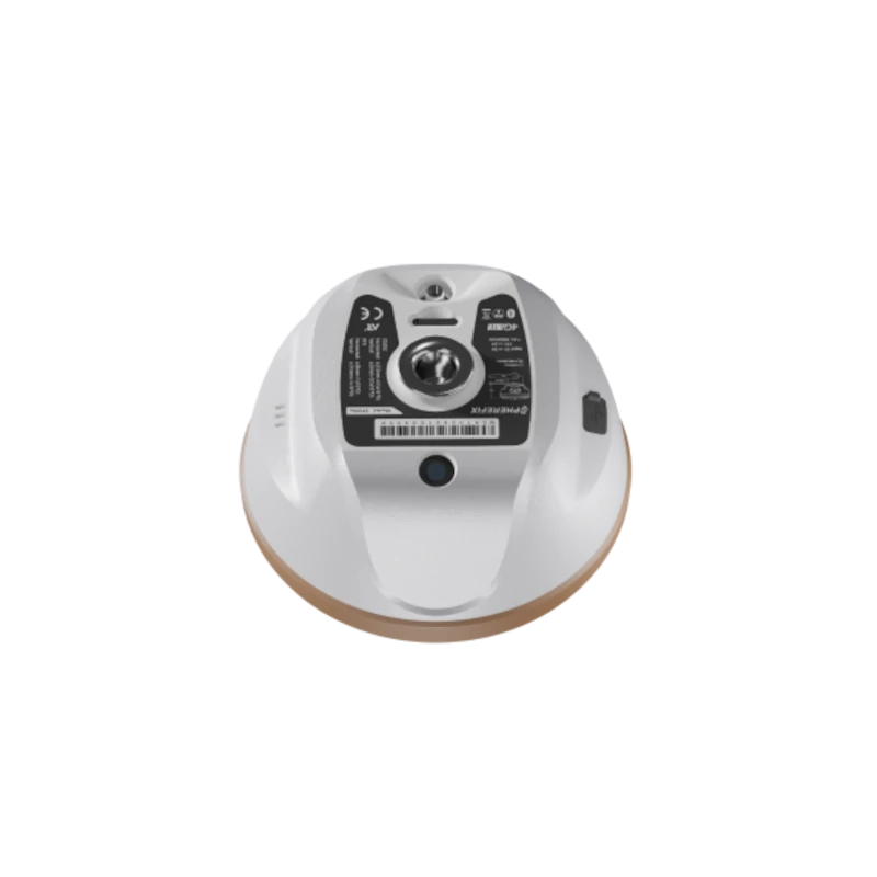
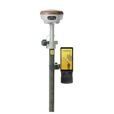
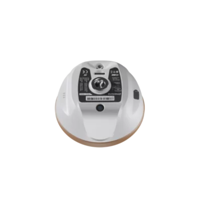
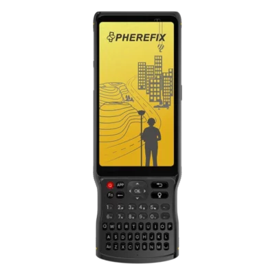
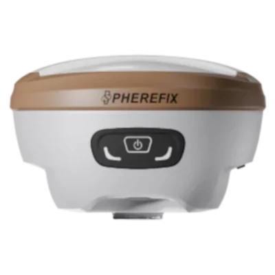
The SphereFix SP35Se RTK GNSS Rover Set is a complete field surveying solution built around the lightweight SP35Se receiver and rugged C100T Android data controller. It is designed for construction setting out, land surveying, GIS data collection, utility mapping and drone ground-control work requiring reliable centimetre-level RTK positioning.
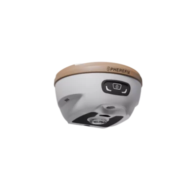
The SP35Se tracks all major satellite constellations across 1,408 channels and includes a 60° IMU tilt sensor, allowing users to measure points without keeping the pole perfectly vertical. Its integrated camera supports AR real-scene stakeout, helping operators find design points using visual guidance over a live view of the site.
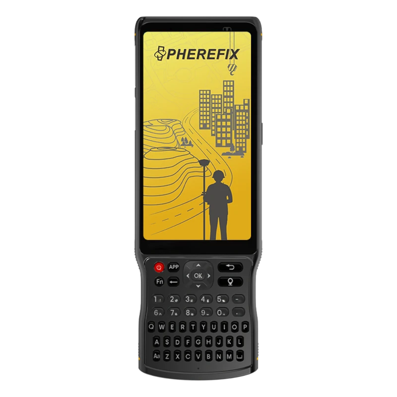
The included C100T controller provides a practical interface for survey and mapping software. Its sunlight-readable touchscreen, physical keypad, Android operating system, dual-SIM 4G connection and long battery life make the set suitable for full working days in demanding outdoor conditions.
SphereFix SP35Se Rover Set Highlights
| GNSS receiver | 1,408 channels with GPS, GLONASS, Galileo, BeiDou, QZSS, SBAS and NavIC support |
|---|---|
| IMU tilt measurement | Measurements with the pole tilted by up to 60°, with less than 2 cm specified tilt error |
| Visual stakeout | Integrated wide-angle camera for AR real-scene stakeout guidance |
| Data controller | C100T with Android 11, 5.45-inch sunlight-readable display and physical survey keypad |
| Connectivity | 4G, Wi-Fi, Bluetooth, NFC and integrated 410–470 MHz UHF/LoRa radio |
| Field protection | IP68-rated receiver and controller for dusty and wet working environments |


Valued customers:










Find RTK Networks
Search NTRIP providers and connect to reliable RTK correction services.
Description
Complete RTK GNSS Rover Set for Surveying and Construction
The SphereFix SP35Se RTK GNSS Rover Set combines a compact multi-constellation GNSS receiver with the rugged SphereFix C100T Android data controller. Together, they provide a practical field system for collecting accurate coordinates, setting out design points and recording site information using real-time RTK corrections.
The set is suitable for land surveyors, construction crews, engineers, GIS professionals, utility teams and drone operators. It can be used for topographic surveys, construction layout, earthworks, utility mapping, asset collection, boundary work, ground-control points and general centimetre-accurate positioning.
Reliable Multi-Constellation RTK Positioning
The SP35Se receiver uses a 1,408-channel GNSS board capable of tracking signals from GPS, GLONASS, Galileo, BeiDou, QZSS, SBAS and NavIC. Tracking several constellations and frequencies gives the receiver access to more satellites, which can improve positioning availability and satellite geometry on sites with a partially obstructed view of the sky.
For field users, this helps reduce time spent waiting for an RTK fixed solution and supports more consistent work around buildings, trees, machinery and other common site obstructions. Actual positioning performance will still depend on satellite visibility, correction quality, multipath, atmospheric conditions and the surrounding environment.
Faster Point Collection with 60° IMU Tilt
An integrated IMU allows measurements to be taken while the survey pole is tilted by up to 60 degrees. Within the stated operating range, the specified additional positioning error is less than 2 cm. Users therefore do not need to level the pole carefully for every observation.
This makes point collection faster and provides access to locations where a vertical pole is difficult to use, such as beside walls, beneath overhangs, close to fences or around parked equipment. It is also useful on uneven terrain, where repeatedly levelling a pole can slow down a survey.
Camera-Assisted AR Stakeout
The SP35Se includes a wide-angle camera for AR real-scene stakeout. Compatible field software can display stakeout guidance over a live camera image, helping the operator see the direction of the target point in relation to the actual site.
This visual workflow is easier to follow than relying only on numerical distances and directional arrows. It can reduce unnecessary walking when approaching a design point and is particularly useful for construction personnel who perform setting-out work without using GNSS equipment every day.
SphereFix C100T Android Data Controller
The included C100T data controller provides the interface for configuring the receiver, connecting to RTK corrections, recording points and running compatible survey or mapping software. It uses Android 11 and an eight-core processor, offering a familiar platform for modern field applications.
Its 5.45-inch sunlight-readable touchscreen is designed to remain usable outdoors, while the physical keypad gives operators an alternative to touchscreen-only control when working with gloves or in wet conditions. The rugged IP68 housing helps protect the controller against water and dust during regular site use.
The C100T supports dual-SIM 4G communication, Wi-Fi, Bluetooth and NFC. Its stated battery endurance of up to 18 hours supports extended field sessions, although actual runtime depends on screen brightness, mobile connectivity, temperature and software use.
Network RTK and Local Radio Corrections
The rover can receive correction data over a mobile internet connection using an NTRIP service. This is a convenient configuration for users working in an area covered by a suitable RTK correction network, as no separate local base receiver is required.
The SP35Se also has an integrated 410–470 MHz UHF/LoRa radio with selectable transmission power. This allows it to communicate with a compatible local base station when mobile coverage or a correction-network service is not available. The manufacturer states a potential radio range of up to 10 km in suitable open conditions, but practical range depends on terrain, antenna height, obstructions, interference, radio configuration and local regulations.
Designed for Daily Outdoor Work
The SP35Se receiver weighs approximately 750 grams, helping reduce fatigue during long days of pole-based surveying. Its magnesium-alloy construction and IP68 protection make it suitable for dusty construction sites, damp weather and regular transport between projects.
The receiver’s internal battery provides more than 16 hours of typical rover operation when using a mobile data connection. Battery life may be shorter when using high radio power, working in low temperatures or operating several communication functions continuously.
Internal data storage supports the recording of survey and raw GNSS observations. Rover, base and static operating modes allow the receiver to be adapted to different field and post-processing workflows.
Applications in Surveying, Construction and GIS
Surveyors can use the SP35Se Rover Set for detail surveys, control work, topographic mapping and setting out. Construction teams can locate design coordinates, check completed work, record levels and position foundations, utilities, piles, roads and site features.
GIS and utility workers can collect accurate positions for pipes, cables, chambers, valves, inspection points and other assets. Drone operators can use the system to measure ground-control points and independent checkpoints for photogrammetry and mapping projects.
The combination of IMU tilt measurement and camera-assisted stakeout also makes the system accessible to construction workers and field technicians who need accurate GNSS results without following a traditional survey workflow for every point.
Choosing the Correct Rover Configuration
An RTK rover requires a suitable source of correction data to achieve centimetre-level results. This may be a regional NTRIP service or a compatible local base station. The required field software, coordinate system, radio settings and accessories will vary between projects and countries.
Global GPS Systems can help configure the SphereFix SP35Se Rover Set for surveying, construction, GIS or drone-control applications. Support is available when selecting compatible correction services, software, poles, mounts and base-station equipment, as well as when preparing the system for local coordinate and communication requirements.
Datasheets & Manuals
Datasheets and manuals
Specifications
Spherefix SP35Se Rover Set Specifications
System Overview
| Product Type | Professional multi-constellation GNSS RTK rover surveying set |
|---|---|
| Receiver Model | Spherefix SP35Se |
| Data Controller Model | Spherefix C100T |
| Primary Applications | Land surveying, construction layout, cadastral surveying, topographic surveying, geodesy, GIS data collection, control surveys and point stakeout |
| Operating Configuration | RTK rover using corrections received through an NTRIP or CORS network, internal UHF/LoRa radio or compatible external correction source |
| Key Functions | Centimetre-level RTK positioning, IMU tilt compensation, AR real-scene stakeout, multi-frequency GNSS tracking, cellular network corrections and static data collection |
SP35Se Receiver System
| Operating System | Linux |
|---|---|
| Processor Architecture | ARM Cortex-A7 |
| GNSS Channels | 1408 channels |
| Supported Constellations | GPS, GLONASS, BeiDou, Galileo, QZSS, SBAS and NavIC (IRNSS) |
| Supported Survey Modes | RTK rover, RTK base, static surveying, tilt surveying and AR stakeout |
| Data Update Rate | Up to 20 Hz |
| Navigation Data Format | NMEA 0183 |
| Correction Data Protocol | RTCM 3.x |
GNSS Signal Tracking
| Satellite System | Supported Signals | Additional Support |
|---|---|---|
| GPS | L1 C/A, L1C, L2P(Y), L2C and L5 | Multi-frequency tracking |
| GLONASS | L1, L2 and L3 | Multi-frequency tracking |
| BeiDou | B1I, B2I, B3I, B1C, B2a and B2b | PPP-B2b supported |
| Galileo | E1, E5a, E5b and E6 | PPP-E6 supported |
| QZSS | L1, L2 and L5 | SBAS support |
| SBAS | L1 | Satellite-based augmentation support |
| NavIC | L5 | Latest compatible firmware may be required |
Positioning Accuracy
| Positioning Mode | Horizontal Accuracy | Vertical Accuracy |
|---|---|---|
| Single Point, RMS | 1.5 m | 2.5 m |
| DGPS, RMS | 0.4 m | 0.8 m |
| RTK, RMS | ±(8 mm + 1 ppm) | ±(15 mm + 1 ppm) |
| Static Surveying, RMS | ±(2.5 mm + 1 ppm) | ±(5 mm + 1 ppm) |
| AR Stakeout | ±(8 mm + 1 ppm) | ±(15 mm + 1 ppm) |
Receiver Measurement Performance
| Tilt Compensation | Integrated IMU-based tilt measurement |
|---|---|
| Maximum Specified Tilt Angle | 60° |
| Tilt Compensation Accuracy | Less than 2 cm within the specified tilt range |
| Velocity Accuracy | 0.03 m/s RMS |
| Time Accuracy | 20 ns RMS |
| Internal Noise Level | ≤1 mm |
| Phase Centre Offset | ≤2.5 mm |
| Cold Start Time | Less than 40 seconds |
| Signal Reacquisition Time | Less than 1 second |
| RTK Initialisation Time | Typically within 10 seconds under suitable satellite and correction conditions |
AR Real-Scene Stakeout Camera
| Camera Function | Real-scene augmented-reality point stakeout |
|---|---|
| Image Resolution | 1920 × 1080 pixels |
| Sensor Size | 1/2.8 inch |
| Aperture | f/2.5 |
| Field of View | 69.3° ±3° |
| Lens Distortion | Less than 0.38% |
| Controller Connection | Wi-Fi connection to compatible field software on the C100T controller |
| Stakeout Display | Displays the target direction and stakeout point over a live view of the surrounding environment |
Receiver Radio Communication
| Internal Radio Type | Integrated UHF/LoRa transceiver |
|---|---|
| Frequency Range | 410–470 MHz |
| Selectable Transmit Power | 0.5 W or 1.5 W |
| Air Baud Rates | 4800, 9600 and 19200 bps |
| Supported Radio Protocols | TRIMTALK, TRIMMARK III, SOUTH, TRANSEOT, SATEL and LoRa |
| Published Open-Area Range | Up to approximately 10 km when operating as a base transmitter under suitable open-area conditions |
| Radio Antenna | External 450–470 MHz terminal antenna |
Receiver Wireless and Network Connectivity
| Bluetooth | Bluetooth BR, EDR and BLE |
|---|---|
| Wi-Fi | IEEE 802.11 b/g/n/ac |
| NFC | Supported |
| Cellular Modem | Integrated 4G LTE modem with WCDMA and GSM fallback |
| LTE FDD Bands | B1, B2, B3, B4, B5, B7, B8, B18, B19, B20, B25, B26 and B28 |
| LTE TDD Bands | B38, B39, B40 and B41 |
| WCDMA Bands | B1, B2, B4, B5, B6, B8 and B19 |
| GSM Bands | B2, B3, B5 and B8 |
| Receiver SIM Support | Integrated SIM-card slot for receiver-based mobile data communication |
| Network RTK Support | Compatible with CORS and NTRIP correction workflows through the receiver or connected controller |
Receiver Storage and Data Management
| Internal Storage | 8 GB |
|---|---|
| Data Recording | Supports raw GNSS observations, static data, differential data, NMEA output and configurable data streams |
| Receiver Web Interface | Browser-based Web UI accessible through the receiver Wi-Fi hotspot |
| Default Web UI Address | 10.10.10.10 |
| Web UI Functions | System status, satellite skyplot, receiver configuration, operating modes, data-stream settings, file management, logs and firmware updates |
| File Transfer | Recorded files can be viewed and downloaded through the receiver Web UI |
Receiver Power
| Battery Type | Integrated rechargeable lithium battery |
|---|---|
| Battery Configuration | 2P2S |
| Battery Voltage | 7.4 V |
| Battery Capacity | 6500 mAh |
| Typical Rover Operating Time | More than 16 hours when using a mobile-network data link under typical operating conditions |
| Charging Interface | USB Type-C |
| USB Power Delivery Input | 12 V / 2 A |
| USB DCP Input | 5 V / 3 A |
| Fast-Charging Support | USB Power Delivery with a compatible charger |
Receiver Physical and Environmental Specifications
| Dimensions | Ø134 × 86 mm |
|---|---|
| Weight | ≤0.75 kg |
| Housing | Magnesium-alloy shell with ABS/PC plastic top cover |
| Ingress Protection | IP68 |
| Operating Temperature | -30°C to +65°C |
| Storage Temperature | -40°C to +85°C |
| Drop Resistance | Designed to withstand a 2 m pole drop at room temperature |
| Field Protection | Dustproof, water-resistant, shock-resistant and vibration-resistant construction for outdoor surveying |
C100T Controller System
| Operating System | Android 11 |
|---|---|
| Processor | 8-core 2.0 GHz processor |
| Memory | 4 GB RAM |
| Internal Storage | 64 GB ROM |
| Expandable Storage | MicroSD card support up to 512 GB |
| Controller Type | Rugged Android field data collector with touchscreen and physical survey keypad |
| Compatible Use | Receiver configuration, RTK surveying, point collection, stakeout, mapping, coordinate management and field-data transfer |
C100T Display and User Interface
| Display Size | 5.45 inches |
|---|---|
| Display Resolution | 720 × 1440 pixels |
| Outdoor Visibility | Sunlight-readable display |
| Touch Panel | 5-point capacitive touchscreen |
| Physical Controls | Integrated alphanumeric survey keypad, navigation controls, function keys and dedicated positioning key |
| Notifications | Audio, vibration and LED indicators |
| Sensors | Ambient-light sensor and accelerometer |
C100T Camera and GNSS
| Rear Camera | 13 MP |
|---|---|
| Camera Flash | Supported |
| Integrated Navigation | GPS, BeiDou, GLONASS and assisted GNSS support |
| Typical Camera Uses | Field documentation, site photographs and feature attribution within compatible surveying applications |
C100T Connectivity
| Bluetooth | Bluetooth 5.0 with BLE |
|---|---|
| Wi-Fi | IEEE 802.11 dual-band, 2.4 GHz and 5 GHz |
| NFC | Supported |
| Cellular Network | 4G LTE with WCDMA, GSM and supported regional fallback networks |
| LTE FDD Bands | B1, B2, B3, B4, B5, B7, B8, B12, B17, B20 and B28 |
| LTE TDD Bands | B34, B38, B39, B40 and B41 |
| WCDMA Bands | B1, B2, B5 and B8 |
| GSM Bands | B2, B3, B5 and B8 |
| SIM Configuration | Available with one Nano-SIM plus MicroSD or dual Nano-SIM configuration, depending on regional version |
| USB Interface | USB Type-C with OTG support |
C100T Power
| Battery Type | Integrated non-removable rechargeable battery |
|---|---|
| Battery Capacity | 9000 mAh |
| Published Operating Time | Up to approximately 18 hours, depending on display brightness, cellular use, GNSS use and application workload |
| Rapid Charging | Supported |
| Charging Interface | USB Type-C |
C100T Physical and Environmental Specifications
| Dimensions | 221 × 78 × 16.5 mm |
|---|---|
| Weight | Approximately 410.6 g |
| Ingress Protection | IP68 |
| Operating Temperature | -20°C to +55°C |
| Drop Resistance | Designed to withstand a 1.2 m pole drop |
| Electrostatic Discharge Protection | ±15 kV air discharge and ±8 kV contact discharge |
| Environmental Protection | Water-resistant, dust-resistant, shock-resistant and vibration-resistant field construction |
Field Software and Workflow
| Receiver Connection | Bluetooth or Wi-Fi connection between the SP35Se receiver and C100T controller |
|---|---|
| Correction Workflows | NTRIP/CORS through the controller or receiver, receiver cellular modem, internal radio or compatible external correction link |
| Survey Functions | Point surveying, tilt surveying, static surveying, point stakeout, AR stakeout, localisation, calibration and coordinate management |
| Project Management | Supports field-project creation, coordinate-system configuration, code libraries and point databases through compatible surveying software |
| Base Coordinate Entry | Supports averaged current-position coordinates or manually entered known coordinates when the receiver is configured as a base |
| Data Exchange | Import and export support depends on the installed field software and selected file format |
Rover Set Contents
| Item | Quantity | Notes |
|---|---|---|
| Spherefix SP35Se GNSS Receiver | 1 | Multi-frequency RTK receiver with IMU tilt compensation and AR stakeout camera |
| Spherefix C100T Data Controller | 1 | Android rugged field controller |
| Controller Pole Bracket | 1 | For mounting the C100T controller to the survey pole |
| Survey Pole | 1 | Rover pole supplied with the set; pole type and length may vary by configuration |
| 450–470 MHz Radio Antenna | 1 | For the SP35Se internal UHF/LoRa radio |
| SP35Se Receiver Carrying Case | 1 | Protective transport and storage case |
| Receiver USB Type-C Data and Charging Cable | 1 | For charging, data transfer and receiver maintenance |
| C100T USB Type-C Cable | 1 | For controller charging and data transfer |
| Power Adapter | 1 or more | Plug type, output rating and number of adapters may vary by regional package |
Specifications and package contents may vary by configuration, region or manufacturer update. Always check the current configuration before ordering.
FAQ
Spherefix SP35Se Rover Set FAQ
Rover Set and Applications
What is the Spherefix SP35Se Rover Set?
The Spherefix SP35Se Rover Set is a professional RTK GNSS surveying solution built around the SP35Se multi-frequency receiver and the Spherefix C100T Android data controller. It is designed for accurate field measurement, mapping and stakeout work.
What is included in the Spherefix SP35Se Rover Set?
The set combines the SP35Se GNSS receiver with a C100T data controller and the field accessories required to operate them as a rover, including a controller bracket and survey pole. Always check the current package specification before ordering because supplied accessories can vary by configuration.
Who is the SP35Se Rover Set designed for?
The system is designed for land surveyors, civil engineers, construction layout teams, GIS specialists, utility contractors, infrastructure professionals, environmental surveyors and other field users who require accurate real-time positioning.
What jobs can be completed with the SP35Se Rover Set?
The rover set can be used for topographic surveys, construction stakeout, cadastral and boundary work, road surveys, earthwork measurement, utility mapping, control-point collection, as-built surveys and GIS asset data collection.
Is the SP35Se Rover Set suitable for construction stakeout?
Yes. The set supports centimeter-level RTK positioning, pole tilt compensation and AR real-scene stakeout, making it suitable for setting out points, lines, foundations, utilities and other construction design features.
Is this a complete base and rover system?
No. This product is configured primarily as a rover set. It can receive corrections from a compatible RTK network or an existing GNSS base station. A separate receiver and additional accessories are required when creating a dedicated base-and-rover system.
Accuracy and GNSS Performance
What accuracy can the Spherefix SP35Se achieve?
Under suitable RTK conditions, the SP35Se is designed to deliver centimeter-level positioning. Its published RTK accuracy is approximately ±(8 mm + 1 ppm) horizontally and ±(15 mm + 1 ppm) vertically.
Does the SP35Se Rover support tilt compensation?
Yes. The integrated tilt-measurement system allows points to be measured while the survey pole is tilted by up to 60 degrees. The published tilt accuracy is less than 2 cm under suitable operating conditions.
What is AR real-scene stakeout?
AR real-scene stakeout uses the receiver’s integrated camera to display stakeout guidance over a live view of the site. This gives the operator a visual indication of where the target point is located and can make navigation to stakeout points faster and more intuitive.
Which satellite constellations does the SP35Se track?
The receiver supports GPS, GLONASS, Galileo, BeiDou, QZSS, SBAS and NavIC. Using signals from multiple satellite constellations improves satellite availability and supports reliable positioning in a wide range of locations.
How many GNSS channels does the SP35Se have?
The SP35Se has 1,408 high-speed GNSS channels for tracking multiple satellite systems and frequencies simultaneously.
Does the rover always provide centimeter-level accuracy?
Centimeter-level results require a valid RTK correction source, a fixed RTK solution, sufficient satellite visibility and appropriate field procedures. Accuracy can be reduced near buildings, trees, reflective surfaces, radio interference or other signal obstructions.
RTK Corrections and Connectivity
How does the SP35Se Rover receive RTK corrections?
The rover can receive correction data through a mobile internet connection, Wi-Fi or its integrated 410–470 MHz UHF and LoRa radio. The appropriate method depends on whether corrections are supplied by an NTRIP network or a local GNSS base station.
Can the Rover Set connect to an NTRIP or CORS network?
Yes. The C100T controller and SP35Se receiver support mobile data connections that can be used with compatible surveying software to receive corrections from an NTRIP or CORS service.
Is an RTK correction subscription required?
An RTK correction source is required for real-time centimeter-level positioning. This may be a regional correction-network subscription, a private NTRIP caster or a compatible local base station. Availability and coverage depend on the country and project location.
What communication options does the SP35Se provide?
The receiver includes full-network 4G cellular communication, Bluetooth, Wi-Fi, NFC and an integrated 0.5 W or 1.5 W radio operating between 410 and 470 MHz.
What is the range of the integrated LoRa radio?
When an SP35Se is configured as a base station and transmits at 1.5 W, the published radio range is up to 10 km in unobstructed open conditions. Actual range depends on terrain, antenna height, interference, radio settings and local regulations.
Can the SP35Se work with third-party base stations?
The receiver supports common radio protocols such as TRIMTALK, TRIMMK3, SOUTH, TRANSEOT, SATEL and LoRa, as well as RTCM correction data. Compatibility should be confirmed for the intended base station, frequency, protocol and channel settings.
C100T Controller and Field Durability
What is the Spherefix C100T data controller?
The C100T is a rugged Android field controller used to configure the receiver, connect to RTK correction services, collect survey points, perform stakeout work and manage field data.
What are the main C100T controller specifications?
The C100T features Android 11, an eight-core 2.0 GHz processor, 4 GB of RAM, 64 GB of storage, a 5.45-inch sunlight-readable touchscreen, a 13-megapixel rear camera and Wi-Fi, Bluetooth and 4G connectivity.
How long do the receiver and controller batteries last?
The SP35Se receiver has a 7.4 V, 6,500 mAh battery and is rated for more than 16 hours of typical rover operation using a cellular connection. The C100T has a 9,000 mAh battery with a published operating time of up to 18 hours. Actual runtime depends on network use, radio settings, display brightness and temperature.
Can the C100T screen be used in bright sunlight?
Yes. The controller has a 5.45-inch sunlight-readable HD touchscreen designed for outdoor surveying and construction environments.
Are the SP35Se receiver and C100T controller waterproof?
Both devices have an IP68 protection rating for resistance to water and dust under the conditions covered by that rating. Covers, ports and seals must be correctly closed to maintain protection.
Can the SP35Se withstand demanding field conditions?
Yes. The receiver uses a magnesium-alloy shell with a durable plastic top cover and is specified to withstand a 2-metre pole drop at room temperature. Its operating temperature range is approximately -30°C to +65°C.
How much does the SP35Se receiver weigh?
The SP35Se receiver weighs approximately 750 g and measures about 134 mm in diameter by 86 mm in height. Its lightweight design helps reduce operator fatigue during long surveying sessions.
Reviews (0)
Only logged in customers who have purchased this product may leave a review.

 GPS & GNSS
 Total Stations
 Data collectors
 Software
 Correction services
 Machine control
 External radio
 Lasers & levellers
 Marine
 Accessories
Reviews
There are no reviews yet