
 GPS & GNSS
 Lidar scanning
 Total Station
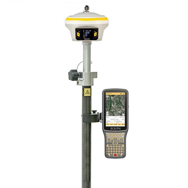
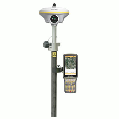
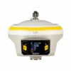
SOUTH INNO7 RTK GNSS Rover Set with IMU
Currently unavailable
Get the best price for your setup
Contact us for expected delivery time.
This product is end of life


Valued customers:










Find RTK Networks
Search NTRIP providers and connect to reliable RTK correction services.
Description
A complete RTK GNSS rover set for professional fieldwork
The SOUTH INNO7 Rover Set is designed for surveyors, construction crews, civil engineers, GIS teams and other professionals who need reliable centimetre-level coordinates in the field. The package brings together the INNO7 GNSS receiver, a SOUTH H6 data collector, SurvStar field software, a survey pole and a controller bracket to create a practical mobile surveying system.
It is particularly suitable for users working with an NTRIP, CORS or commercial RTK correction service. Once the receiver and controller are connected to the correction network, the operator can measure points, record features, set out designs and check positions without installing a local base receiver on every project.
Multi-constellation tracking for dependable positioning
The INNO7 uses a 1,598-channel GNSS board to track signals from GPS, GLONASS, Galileo, BeiDou, QZSS and other supported satellite systems. Tracking multiple frequencies and constellations gives the receiver more observations to work with, which can improve availability and solution stability when part of the sky is obscured.
In open conditions and with a suitable RTK correction source, the receiver is specified to achieve horizontal accuracy of 8 mm + 1 ppm and vertical accuracy of 15 mm + 1 ppm. This level of performance supports detailed topographic surveying, construction layout, utility mapping, earthwork checks and accurate GIS data collection.
Measure difficult points with 60° IMU tilt compensation
The integrated IMU allows the survey pole to be tilted by up to 60° while the receiver calculates the position of the pole tip. This makes it easier to reach points beside walls, under overhangs, near parked machinery, at trench edges and around other physical obstructions.
The IMU initializes through a short movement rather than a lengthy manual calibration process. In practical fieldwork, this reduces the time spent carefully centring the pole bubble at every point and helps operators maintain productivity across uneven or congested sites.
Network RTK rover operation
The receiver can obtain correction data through its cellular modem using an NTRIP service. This workflow is well suited to surveyors and construction teams working inside an established RTK network because it removes the need to carry and secure a separate base station.
Network RTK is useful for short site visits, dispersed GIS projects, construction checks and jobs where setting up a local base would take more time than the measurement itself. The receiver manual also provides configuration options for NTRIP client operation, cellular data links and rover working modes.
Internal UHF radio for flexible correction reception
In addition to cellular corrections, the INNO7 contains an internal UHF radio operating in the 410–470 MHz range. This allows the rover to receive correction data from a compatible local base station when a cellular network is unavailable or when the project requires an independent base-and-rover workflow.
The radio supports output power up to 3 W and SOUTH’s FarLink protocol. A typical range of up to 15 km is stated for favourable conditions, although real working distance depends on terrain, antenna height, interference, obstructions, radio configuration and local frequency regulations.
SOUTH H6 controller and SurvStar field software
The supplied SOUTH H6 data collector provides the field interface for configuring the receiver, managing projects and recording measurements. Mounted on the survey pole with the included bracket, it keeps the map, point information and survey controls within easy reach while moving around the site.
SurvStar software supports common GNSS surveying tasks such as point collection, coding, stakeout and project management. This makes the set suitable for both straightforward construction positioning and more structured survey work involving coordinate systems, control points and feature data.
Touchscreen control and wireless connectivity
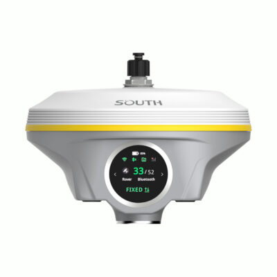
A 1.54-inch colour touchscreen on the receiver displays important operating information and provides access to common settings. Operators can check the working mode, satellite status, communications and battery condition without relying entirely on the field controller.
Bluetooth, Wi-Fi and NFC support communication with compatible controllers and mobile devices. The receiver can also provide a Wi-Fi hotspot and web-based management interface for configuration and status checks.
Storage and power for full field sessions
The INNO7 has 64 GB of internal solid-state storage for static observations and other receiver data. Cycle storage can automatically remove older files when required, helping prevent work from stopping because the memory is full.
The internal battery is specified for approximately 12 hours of rover operation under the manufacturer’s test conditions. Actual endurance varies with cellular use, radio operation, temperature, screen use and receiver settings.
Built for surveying and construction environments
The receiver has an IP68-rated housing designed to resist dust and water ingress during outdoor work. Its magnesium-alloy construction is intended for regular use on construction sites, roads, infrastructure projects and survey jobs where equipment may be exposed to rain, dirt and frequent transport.
The combination of network RTK, UHF reception and tilt measurement makes the set useful across a broad range of applications, including:
- Topographic and detail surveying
- Construction setting out and position checks
- Road, bridge and infrastructure measurement
- Utility and asset mapping
- Ground control and check points for drone surveys
Practical value for different users
For land surveyors, the INNO7 provides the accuracy and data handling required for control, detail and stakeout work. Construction teams can use the rover to position foundations, services, kerbs and other design elements directly from site coordinates. GIS crews can collect assets with substantially higher positional accuracy than a standard handheld GNSS device.
Drone operators can use the system to establish accurately coordinated ground control points and independent checkpoints for photogrammetry projects. Engineers and site managers can also use it to verify completed work, compare actual positions with designs and record reliable as-built information.
Buying and technical support from Global GPS Systems
Global GPS Systems can help configure the SOUTH INNO7 Rover Set for the intended correction service, coordinate system and field workflow. Correct setup is important because reliable RTK surveying depends on more than the receiver alone; the controller, field software, mobile connection, correction source and project coordinates must all work together.
Support with NTRIP settings, radio compatibility, coordinate-system configuration and field-software setup helps teams begin work with a system suited to their region and application.
Datasheets & Manuals
Datasheets and manuals
Specifications
South INNO7 Rover Set Specifications
System Overview
| Manufacturer | SOUTH Surveying & Mapping Technology Co., Ltd. |
|---|---|
| Product name | South INNO7 Rover Set |
| System type | Complete multi-constellation RTK GNSS rover surveying system |
| Primary components | South INNO7 GNSS receiver, South H6 rugged data collector, SurvStar field surveying software, survey pole and data collector bracket |
| Receiver operating system | Linux |
| Controller operating system | Android 8.1 |
| Typical applications | Land surveying, cadastral surveying, construction layout, engineering surveying, topographic mapping, road surveying, utility mapping, pipeline surveying, control-point measurement and GIS data collection |
| Correction sources | NTRIP network corrections, integrated UHF radio corrections, compatible Wi-Fi corrections and supported satellite correction services |
| Notable functions | IMU tilt compensation, dual RTK engine, 5G-capable receiver modem, integrated UHF transceiver, 64 GB receiver storage, touchscreen receiver interface, rugged Android controller and field-survey software |
GNSS Tracking
| GNSS channels | 1598 |
|---|---|
| GPS signals | L1, L1C, L2C, L2P and L5 |
| GLONASS signals | L1 C/A, L1P, L2 C/A, L2P and L3 |
| BeiDou BDS-2 signals | B1I, B2I and B3I |
| BeiDou BDS-3 signals | B1I, B3I, B1C, B2a and B2b where supported |
| Galileo signals | E1, E5a, E5b, E6C and AltBOC where supported |
| SBAS | L1 where supported; compatible with WAAS, MSAS, EGNOS and GAGAN |
| IRNSS / NavIC | L5 where supported |
| QZSS | L1, L2C and L5 where supported |
| MSS L-band | Reserved; service and configuration dependent |
| Position output rate | 1 Hz to 20 Hz |
| Initialization time | Less than 10 seconds |
| Initialization reliability | Greater than 99.99% |
Positioning Accuracy
| Positioning mode | Horizontal accuracy | Vertical accuracy |
|---|---|---|
| Code differential GNSS | 0.25 m + 1 ppm RMS | 0.50 m + 1 ppm RMS |
| Static GNSS | 2.5 mm + 0.5 ppm RMS | 5 mm + 0.5 ppm RMS |
| Real-time kinematic, baseline under 30 km | 8 mm + 1 ppm RMS | 15 mm + 1 ppm RMS |
| SBAS | Typically less than 5 m 3DRMS | |
RTK and Correction Performance
| RTK initialization time | Typically 2 to 8 seconds |
|---|---|
| Maximum stated RTK baseline | Less than 30 km for the specified RTK accuracy |
| Dual RTK engine | Performs secondary coordinate checking and calculation to reduce false fixed solutions and improve coordinate reliability |
| RTK XTRa | Can maintain positioning for up to approximately 5 minutes following interruption of the primary correction link when the required subscription and sufficient satellite coverage are available |
| BeiDou PPP | Supports compatible BeiDou precise point-positioning corrections without a local base receiver or CORS connection where service coverage is available |
| Network RTK models | VRS, FKP and MAC |
| Network correction protocol | NTRIP |
| Static surveying | Supported with internal raw-observation logging for post-processing |
| PPK surveying | Supported through compatible field and office-software workflows |
IMU Tilt Compensation
| IMU type | Integrated inertial measurement unit |
|---|---|
| Maximum tilt angle | 60° |
| IMU initialization | Approximately 2 to 5 seconds of receiver movement |
| Tilt compensation accuracy | Additional horizontal pole-tip uncertainty typically less than 10 mm + 0.7 mm per degree of tilt up to 30° |
| Calibration | Calibration-free during normal operation |
| Magnetic interference resistance | IMU operation does not depend on a magnetic compass and is designed to remain usable in magnetically disturbed environments |
| Stationary tilt retention | Maintains the tilt solution for approximately 40 seconds while the receiver remains stationary on a point |
| Electronic bubble | Real-time pole-level display through compatible controller software |
Integrated UHF Radio
| Radio type | Integrated UHF transmit-and-receive radio |
|---|---|
| Frequency range | 410 to 470 MHz |
| Transmit power | Selectable 1 W, 2 W or 3 W |
| Operating modes | Radio receiver, transmitter, router and repeater |
| Supported protocols | Far-link, TrimTalk 450S, SOUTH, HUACE, Hi-Target and Satel |
| Typical maximum range | Approximately 15 km using Far-link under suitable line-of-sight and radio conditions |
| UHF antenna interface | 1 dedicated UHF antenna connection |
Receiver Cellular and Wireless Communications
| Cellular modem | Integrated high-speed 5G network communication module |
|---|---|
| Cellular compatibility | Backward compatible with 4G and 3G networks; supported bands may vary by regional modem configuration |
| SIM card slot | Standard SIM card slot |
| Cellular antenna interface | 1 cellular/GPRS antenna connection with internal and external antenna selection |
| Automatic network connection | Intelligent PPP dial-up technology for automatic connection and reconnection |
| Bluetooth | Bluetooth 4.0 and Bluetooth 2.1 + EDR |
| NFC | Short-range automatic receiver-to-controller pairing at distances below approximately 10 cm when used with an NFC-compatible controller |
| Wi-Fi standard | IEEE 802.11 b/g |
| Wi-Fi hotspot | Receiver can broadcast a hotspot for access to its web management interface |
| Wi-Fi datalink | Supports transmission and reception of GNSS correction streams over Wi-Fi |
Receiver Data Storage and Formats
| Internal storage | 64 GB solid-state storage |
|---|---|
| Cyclic storage | Automatically removes the oldest files when available storage becomes insufficient |
| Estimated storage duration | Up to approximately four years at a 5-second sampling interval, depending on file type and logging configuration |
| External storage | Supports external USB storage |
| Maximum configurable sampling rate | Up to 50 Hz |
| USB data transfer | Plug-and-play USB data transmission |
| Remote data download | FTP and HTTP |
| Differential correction formats | CMR+, SCMRx, RTCM 2.1, RTCM 2.3, RTCM 3.0, RTCM 3.1 and RTCM 3.2 |
| Position output formats | NMEA 0183, PJK plane coordinates, binary output and Trimble GSOF |
Receiver Ports and Interfaces
| 5-pin LEMO port | External DC power input and RS-232 serial communication |
|---|---|
| 7-pin LEMO port | External USB OTG and Ethernet functions |
| UHF antenna port | 1 |
| Cellular antenna port | 1 |
| SIM interface | 1 standard SIM card slot |
| Web management | Receiver-status monitoring and configuration through Wi-Fi or USB connection |
| Secondary development | Supports a development package with OpenSIC observation-data format and interaction-interface definitions |
| Cloud services | Remote management, firmware updates, online registration and related receiver-management services |
Receiver User Interface
| Display | 1.54-inch high-definition color LCD touchscreen |
|---|---|
| Display resolution | 240 × 240 pixels |
| Physical buttons | 2-button visual operating interface |
| LED indicators | 2 LEDs for data interaction and Bluetooth status |
| Touchscreen functions | Receiver configuration, operating-mode selection, status viewing and information browsing |
| Voice guidance | Receiver-status and operation prompts |
| Voice languages | Chinese, English, Korean, Spanish, Portuguese, Russian and Turkish |
Receiver Sensors
| Inertial sensor | Integrated IMU for tilt-compensated pole measurements |
|---|---|
| Electronic bubble | Supported through compatible field-controller software |
| Temperature sensor | Integrated thermometer with intelligent temperature monitoring and receiver thermal-control functions |
Receiver Power System
| External power input | 6 to 28 V DC with overvoltage protection |
|---|---|
| Typical power consumption | 2 W |
| Battery type | Rechargeable, removable lithium-ion battery |
| Battery voltage | 7.4 V |
| Battery capacity | 3400 mAh |
| Battery replacement | Externally removable battery design |
Receiver Battery Runtime
| Operating mode | Typical runtime | Operating notes |
|---|---|---|
| Static mode | Up to 16 hours | Runtime under nominal operating conditions |
| Internal UHF base mode | Up to 10 hours | Runtime varies with radio power and transmission duty cycle |
| Rover mode | Up to 12 hours | Runtime varies with cellular, Bluetooth, Wi-Fi, display and logging use |
Receiver Physical Specifications
| Dimensions | 153 mm diameter × 106 mm height |
|---|---|
| Weight | Approximately 1.2 kg including battery |
| Housing material | Magnesium-aluminium alloy shell |
| Mounting arrangement | Suitable for survey-pole or tribrach mounting with the appropriate adapter |
Receiver Environmental Specifications
| Ingress protection | IP68 |
|---|---|
| Water protection | Protected against prolonged immersion at a depth of up to 1 m under the manufacturer’s stated test conditions |
| Dust protection | Fully protected against blowing dust under the stated IP68 test conditions |
| Drop resistance | Designed to withstand a natural 2 m survey-pole drop onto concrete |
| Operating temperature | -25°C to +65°C |
| Storage temperature | -35°C to +80°C |
| Humidity | 100% non-condensing |
South H6 Data Collector System
| Controller model | South H6 |
|---|---|
| Controller type | Rugged Android field data collector |
| Operating system | Android 8.1 |
| Processor | Octa-core, 2.0 GHz |
| RAM | 4 GB |
| Internal storage | 64 GB |
| Storage expansion | Supports up to 128 GB additional storage |
| Integrated GNSS | GPS, GLONASS and BeiDou |
South H6 Display and Controls
| Display size | 5 inches |
|---|---|
| Display type | Sunlight-readable capacitive touchscreen |
| Display resolution | 720 × 1280 pixels |
| Keypad | Full physical QWERTY keypad with separate letter and number keys |
| Audio | Integrated speaker and microphone |
| Camera | 13-megapixel autofocus camera |
| Flashlight | Integrated high-brightness LED flash |
South H6 Cellular and Wireless Communications
| Cellular network | 4G LTE with backward-compatible cellular technologies according to regional network support |
|---|---|
| SIM configuration | Dual nano-SIM card slots |
| GSM bands | B2, B3, B5 and B8 |
| FDD-LTE bands | B1, B2, B3, B4, B5, B7, B8, B12, B13, B17, B20, B25 and B28 |
| TDD-LTE bands | B38, B39, B40 and B41 |
| TD-SCDMA bands | B34 and B39 |
| WCDMA bands | B1, B2, B5 and B8 |
| CDMA | CDMA1x and CDMA2000 BC0 |
| Wi-Fi | IEEE 802.11 a/b/g/n, 2.4 GHz and 5 GHz |
| Typical Wi-Fi range | Up to approximately 30 m under suitable conditions |
| Bluetooth | Bluetooth 4.1 |
| Typical Bluetooth range | More than 20 m under suitable conditions |
| USB | USB Type-C with OTG support |
| NFC | Supported |
South H6 Sensors
| Gyroscope | Integrated |
|---|---|
| Electronic compass | Integrated |
| G-sensor / accelerometer | Integrated |
| NFC sensor | Integrated |
| Integrated GNSS sensor | GPS, GLONASS and BeiDou support |
South H6 Power
| Battery type | Rechargeable lithium-ion battery |
|---|---|
| Battery capacity | 9200 mAh |
| Typical operating time | Up to 15 hours |
| Typical standby time | Up to 240 hours |
South H6 Physical and Environmental Specifications
| Dimensions | 235 × 90 × 35 mm |
|---|---|
| Weight | Approximately 520 g |
| Ingress protection | IP67 |
| Drop resistance | 1.5 m |
| Operating temperature | -20°C to +60°C |
| Storage temperature | -30°C to +70°C |
SurvStar Field Software
| Software type | Android field surveying and data-collection software |
|---|---|
| Receiver connection | Supports connection to the INNO7 receiver through compatible Bluetooth communication |
| Survey methods | RTK rover, network RTK, static and compatible PPK workflows |
| Data collection | Point, line, feature and attribute collection |
| Stakeout functions | Point, line, surface, CAD and other supported field stakeout workflows |
| Coordinate systems | Supports configurable coordinate systems, projections, geoid models, localization and site calibration |
| CAD support | Supports compatible DXF and DWG field workflows, subject to software version |
| Electronic bubble display | Displays the receiver’s real-time pole-level status |
| Data import and export | Supports commonly used surveying formats through compatible software workflows |
| Raw-data conversion | Compatible SOUTH software can convert receiver observation data to RINEX for post-processing |
Rover Set Package Contents
| Item | Quantity | Notes |
|---|---|---|
| South INNO7 RTK GNSS receiver | 1 | 1598-channel receiver with integrated IMU, cellular modem and UHF radio |
| South H6 data collector | 1 | Rugged Android controller with touchscreen and full physical keypad |
| SurvStar field software | 1 license | License type, activation method and included modules may vary by configuration |
| Survey pole | 1 | Rover pole for mounting the GNSS receiver |
| Data collector bracket | 1 | Mounts the H6 controller to the survey pole |
| Receiver battery | Configuration dependent | 7.4 V, 3400 mAh removable lithium-ion battery |
| Receiver battery charger | Configuration dependent | Power plug and charging arrangement may vary by destination region |
| UHF antenna | Configuration dependent | Frequency and antenna length may vary according to regional radio configuration |
| Cellular antenna | Configuration dependent | For receiver cellular-network operation |
| Receiver communication and data cables | Configuration dependent | May include LEMO, USB or OTG cables according to the supplied package |
| Controller charger and cable | Configuration dependent | For charging the South H6 data collector |
| Transport case | Configuration dependent | Protective case arrangement may vary by set configuration |
Operating Conditions and Requirements
| RTK correction requirement | Centimetre-level real-time positioning requires correction data from a compatible NTRIP service, local base station or other supported correction source |
|---|---|
| Cellular service requirement | A compatible SIM card, data plan and local network coverage are required for cellular correction delivery |
| UHF operating conditions | Radio range depends on antenna height, terrain, obstructions, interference, radio power, protocol and local radio regulations |
| Accuracy conditions | Positioning accuracy depends on atmospheric conditions, multipath, obstructions, observation time, satellite geometry, correction quality, baseline length and the number of tracked satellites |
| Satellite correction services | RTK XTRa, precise point positioning and other satellite correction functions may require a separate subscription and regional service availability |
| Radio licensing | Use of the integrated UHF transmitter is subject to applicable national frequency, power and licensing regulations |
Specifications and package contents may vary by configuration, region or manufacturer update. Always check the current configuration before ordering.
FAQ
South INNO7 Rover Set FAQ
Rover Set Overview and Applications
What is the South INNO7 Rover Set?
The South INNO7 Rover Set is a complete RTK GNSS surveying solution built around the South INNO7 receiver. It combines centimetre-level positioning, IMU tilt compensation, a field controller, surveying software, a survey pole and mounting accessories for professional field data collection and stakeout.
Who is the South INNO7 Rover Set designed for?
The set is designed for land surveyors, construction professionals, civil engineers, utility contractors, GIS teams, infrastructure companies and other users who need accurate positioning in the field.
What surveying tasks can the South INNO7 Rover Set perform?
It can be used for topographic surveys, cadastral work, construction layout, point stakeout, earthworks, road projects, utility mapping, control-point measurement, site documentation and GIS data collection.
Is this a rover-only system?
Yes. This package is configured primarily as a rover set. It receives RTK corrections from an NTRIP or CORS network, another GNSS receiver operating as a base station, or a compatible external correction source.
Can the South INNO7 receiver also be used as a base station?
The INNO7 receiver itself supports both transmitting and receiving UHF correction data, so it can be configured as a base station. However, a complete base setup may require additional equipment such as a tripod, tribrach, antenna accessories, radio configuration and a second GNSS receiver for rover operation.
Can the rover set be used without an RTK correction service?
The receiver can collect standalone GNSS positions without an RTK service, but centimetre-level real-time accuracy normally requires corrections from an NTRIP network, CORS service or local base station.
Accuracy, Satellites and IMU Tilt
What accuracy can the South INNO7 Rover Set achieve?
Under suitable RTK conditions, the published accuracy specification is 8 mm + 1 ppm horizontally and 15 mm + 1 ppm vertically. Actual results depend on satellite visibility, correction quality, baseline distance, multipath, atmospheric conditions and correct surveying procedures.
Which satellite constellations does the South INNO7 track?
The receiver supports GPS, GLONASS, Galileo and BeiDou signals. Depending on the selected GNSS board version, it can also support additional regional and augmentation signals.
What is the difference between the 336-channel and 1598-channel versions?
The versions use different GNSS boards and tracking-channel configurations. The 1598-channel model can track a wider range of satellite signals, while both versions are intended for professional RTK surveying. The best option depends on regional signal availability and project requirements.
Does the South INNO7 Rover Set include tilt compensation?
Yes. The receiver has an integrated IMU tilt sensor that supports measurements with the survey pole tilted by up to 60 degrees.
Why is IMU tilt compensation useful?
Tilt compensation allows users to measure points without keeping the pole perfectly vertical. This is useful beside buildings, under vehicles, near trenches, at corners, along fences and in other locations where direct vertical pole placement is difficult.
Does the IMU require manual calibration?
The INNO7 uses a calibration-free IMU. It is normally initialized through brief movement of the receiver and does not require the traditional magnetic calibration routine used by some older tilt systems.
Connectivity, Controller and Surveying Software
Does the South INNO7 support mobile RTK corrections?
Yes. The receiver includes a 5G mobile-network modem with backward compatibility for supported 4G and 3G networks. A compatible SIM card, mobile coverage and access to an NTRIP correction service are required for mobile-network RTK operation.
Does the receiver have an internal UHF radio?
Yes. The INNO7 includes a 410–470 MHz internal UHF radio that can receive or transmit RTK correction data.
What is the maximum UHF radio range?
The published working range is up to approximately 15 km when using the FarLink protocol under suitable conditions. Actual range depends on terrain, line of sight, antenna position, interference, radio power and local radio regulations.
Which UHF radio protocols are supported?
The receiver supports several common protocols, including FarLink, TrimTalk450S, SOUTH, SOUTH+, SOUTHx, HUACE, Hi-Target and Satel. Compatibility should be checked before connecting to equipment from another manufacturer.
Which data collector is included with the rover set?
The standard set is supplied with a South H6 data collector. The controller is used to configure the receiver, connect to correction services, collect survey points, perform stakeout and manage field data.
Which surveying software is included?
The rover set includes SurvStar field surveying software. SurvStar supports common GNSS workflows such as project setup, coordinate-system configuration, point collection, line and surface stakeout, coding and data import or export.
Can the controller or software be changed?
Yes. The rover set can be configured with alternative compatible controllers, tablets or field software when a different workflow is required. Compatibility with the INNO7 receiver and required file formats should be confirmed before changing the standard configuration.
Field Use, Data Storage and Included Equipment
What equipment is included in the South INNO7 Rover Set?
The set includes the South INNO7 GNSS receiver, a South H6 data collector, SurvStar surveying software, a survey pole and a data collector bracket. Receiver accessories such as batteries, charger, communication cables, antennas and a carrying case are also supplied according to the selected package configuration.
Is the rover set ready for field surveying?
The package contains the main hardware and software needed for rover operation. Before field use, the receiver and controller must be configured with the correct coordinate system, units, correction source and project settings.
How much internal storage does the South INNO7 have?
The receiver provides 64 GB of internal storage for GNSS data. It also supports automatic cyclic storage, which manages older files when the available memory becomes limited.
Is the South INNO7 suitable for harsh field conditions?
Yes. The receiver has an IP68 dust and water resistance rating and is designed for professional outdoor surveying. The published specification also states resistance to a natural 2-metre pole drop onto concrete.
What temperatures can the receiver operate in?
The published operating-temperature range is approximately -25°C to +65°C. Battery runtime and performance may be affected by very hot or cold conditions.
How long can the South INNO7 operate on its batteries?
Published operating time is up to approximately 12 hours in rover mode. Actual battery life depends on mobile-network use, UHF operation, screen activity, temperature, battery condition and receiver settings.
Reviews (2)
2 reviews for SOUTH INNO7 RTK GNSS Rover Set with IMU
| 5 star | 100% | |
| 4 star | 0% | |
| 3 star | 0% | |
| 2 star | 0% | |
| 1 star | 0% |
Only logged in customers who have purchased this product may leave a review.
 GPS & GNSS
 Total Stations
 Data collectors
 Software
 Correction services
 Machine control
 External radio
 Lasers & levellers
 Marine
 Accessories
Robert (verified owner) –
Looks good, I need to learn to use it.
Willem (verified owner) –
Great system with a lot of possibilities, only needs a more detailed manual.